|
October 3, 1970: A Football Game at Camp Red Cloud |
|
September 19, 1970: At Dr. Kim's/Namsan Mountain |
|
Return to the Index for 1970 |
I have been down to Seoul numerous times since my arrival here in Korea, but this Saturday I am going to make a day of it. I'm going to hop on a Kimchi bus right in front of Howze and then get off just inside the northern boundary of the city. Then I plan to pretty much follow my nose as I walk through the city, including areas I haven't really explored yet, towards Yongsan. There, I will do what I've done before- have dinner at the Officer's Open Mess and then take a military bus back to Camp Howze.
|
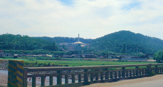
However, I did take one picture a few miles down the road toward Seoul of what I had thought on previous trips was some sort of commercial facility, or perhaps some kind of modernistic religious building. I remember that I asked our Korean accountant, Sammy Ko, what the building was, and he told me a bit about death in Korea.
Burial is not common in most parts of Korea. Here in the northern area, any land suitable for a US-style graveyard is needed much more as farmland, and in any even the burial practice was never widespread (except for notables). Cremation is the normal practice, and in most houses one will find one or more ancestors sitting on a shelf in a kind of small, makeshift shrine. That building is one of the largest crematoria in this part of Korea.
It certainly is situated in a pretty area, but even the facility itself is located up a rocky hillside that is itself unsuitable for agriculture. Anyway, I rode the bus into the city, and at one of the first stops it made, a stop I knew to be about three miles (as the crow flies) from Yongsan Army Post.
|
Note from the present:
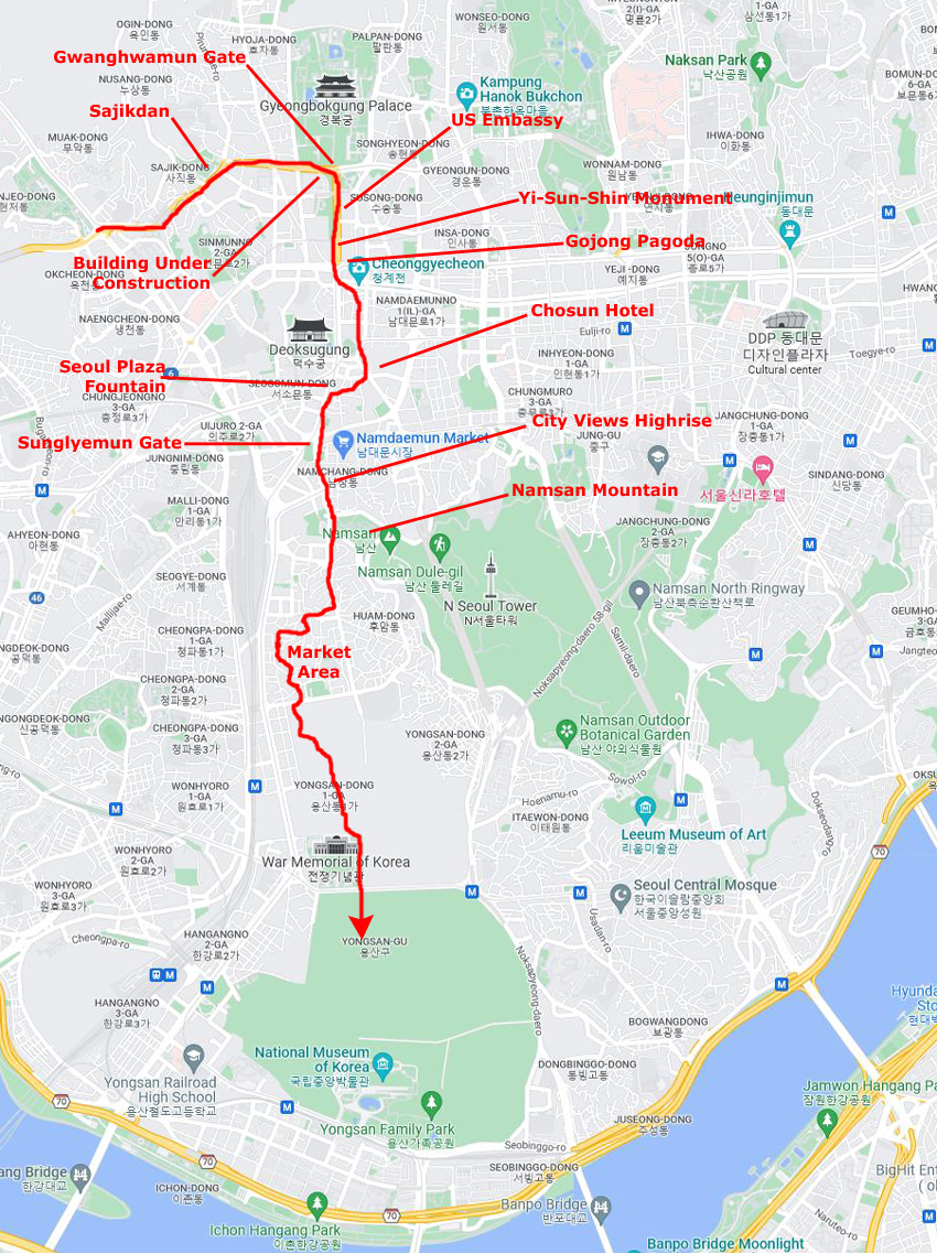
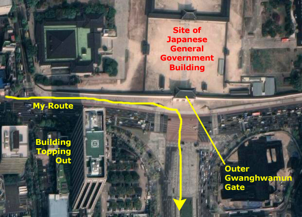
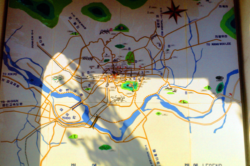
At left I have put a map I created that covers the entire length of my walk today. Since the map is much taller north to south than it is wide (east to west), I have put it in a scrollable window. If you have just gotten to this page, the map is positioned at the northernmost part of my walk.
You will see a red line wandering through the map; that was my route today. I can pretty accurately draw the route now, a half century later, because of the still-existing structures and locations that I can identify and the order in which the pictures were taken. When I was wandering through typical side streets and back streets, I can only approximate my route, as there are no identifying landmarks that still exist. (Most of the small streets and alleyways I traversed are totally gone, replaced with the new, modern, glitzy, downtown Seoul.)
On the map I have marked the stops (and pictures) I can identify so you can follow along on my route. You can use the vertical scroll bar at the right side of the map to move it up or down as we go, so you can see the entirety of my route today.
As we go, I am also going to supplement the narrative with another resource available in the present- the aerial view. Some things I photographed in 1970 still exist today, and I think it may be interesting for you (as it was for me) to see how they have changed- or not.
I hope you enjoy this walk through Seoul; it will turn out to be one of the longer weekend excursions that I had in this amazing city. Everywhere around me I saw photo opportunities, and I can say now, from the vantage point of 2022, that had digital photography been available to me then, there wouldn't just be 30-40 pictures from today- there would have been many hundreds.
|
|
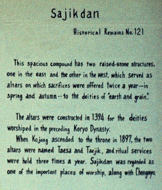
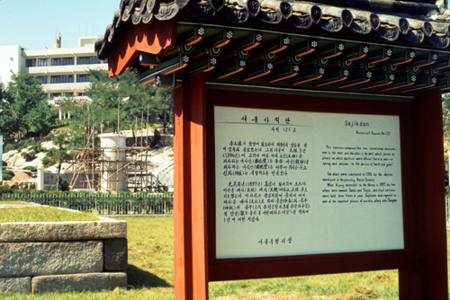
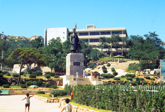
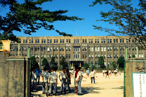
Here is the entrance sign as I saw it, and as you can see the sign is in both Korean and English. I have enlarged the English translation and put it at left for you to read. Looking beyond the sign, it appeared that they were either renovating or adding onto the park. The building in the far background is, I discovered, a school.
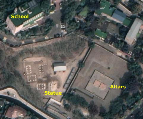
Along with the royal palace (Gyeongbokgung) and the Jongmyo shrine, the Sajik shrine is a fundamental symbol of the new capital city created during its first year. This site is located west of the palace (which we will go by a bit later on), at the feet of Inwangsan Mountain.
|
|
Inwangsan is famous for its views, the mountain is entirely within the ancient Fortress Wall of Seoul. I would have liked to climb up there to experience those views, but US Military are told that unless there is a marked trail or something like that, soldiers should avoid climbing random peaks anywhere around as it is hard to tell what areas are regularly patrolled by the South Korean Army.
In my picture, which looks up towards the school, you can see one of the large statues on this site; this one represents Lee Yulgok, one of the most prominent scholars and philosophers during the Joseon Dynasty who lived from 1536 to 1584.
When the 1st king of Joseon dynasty established the country, he built up the main palace in the center of Seoul. Then, he built up Jongmyo shrine on the left of the palace and Sajikdan on the right of the palace. Everyone who passes in front of the statue stops briefly and bows, especially the older people.
|
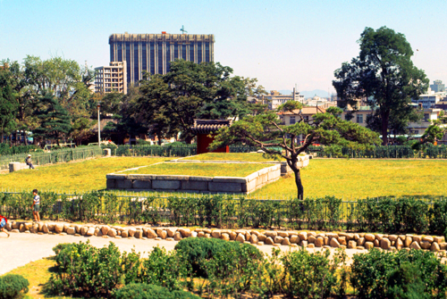
The park was named in 1395 by Taejo Lee Sung-gye who made the first Sajik altar, as well as built Gyeongbokgung and Jongmyo Shrine. Rites were held here regularly dating back to the Three Kingdom Period in Korea from the 4th to the 7th centuries. Under Japanese colonial rule, these rites were abolished in 1908; they have not yet been formally reintroduced. Offerings to the gods included slaughtered cattle, pig and lamb as well as grains, followed by ceremonies offering silk, welcoming the deities, offering three wines, sharing the food, and finally lighting the written prayers on fire.
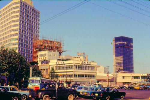
There is something you should note in the picture above, right. It is that new high-rise building that you can see in the distance. It was one of the clues enabling me to trace today's route, as I took another picture of it a little later on my walk. From Sajikdan, I followed the main street, which had turned east. In the next few blocks, I took a few interesting pictures.
|
|
In that second picture, you can also see the dome of another building in the distance. As I walk down the street, I will get closer to it and eventually get a picture of it.
|
|
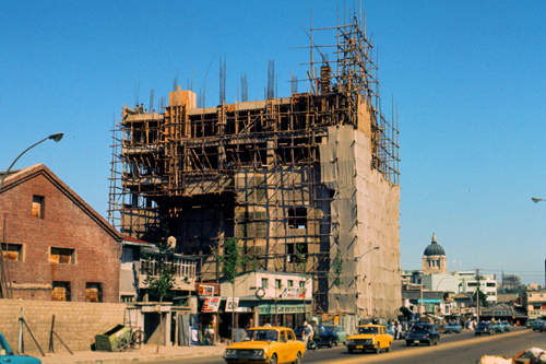
Shortly after I passed that new building, I came to what looked like an old oriental gate on the north side of the street, and through the gate was the building with the domed tower that I had seen a few minutes earlier in the distance. Now things get a bit interesting. First, let's have a look at the gate itself.
|
|
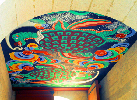
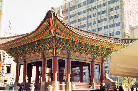
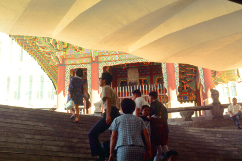
"This is a decorative building in front of the Government Center in Seoul, Korea. It is a pagoda that stands in front of the large government building and although it is very old, it has been restored. The wooden roof is ornately carved and painted."
For a reason I will explain in a moment, I actually walked through one of the three openings; a couple of them were roped off, but you could go through one, and the image at right shows the beautiful and colorful ceiling decoration inside. At the time, this is what I wrote:
"This is the decorative painting on the inner roof of the arch in fron tof the Government Center. Later, you will relate the location of this arch to a broad avenue which leads into the center of the city; the arch commands a position much as our Capitol does in relation to the Mall."
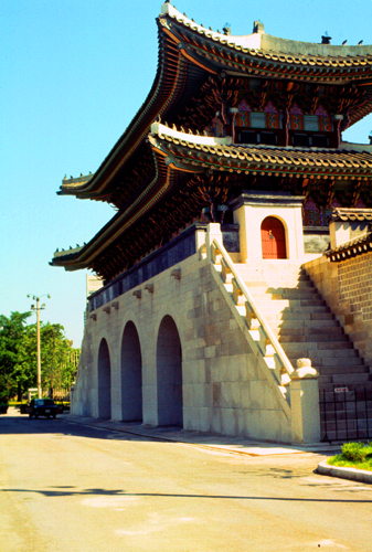
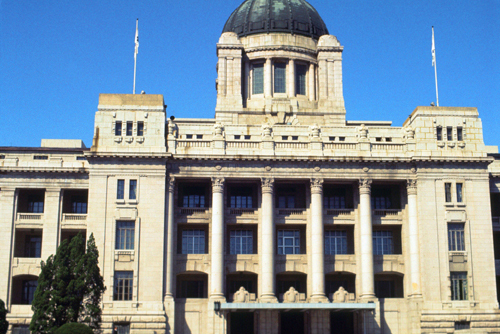
Let me continue with the gate's history. Gwanghwamun was first constructed in 1395 as the main gate to Gyeongbokgung Palace, the main and most important royal palace during the Joseon Dynasty. During the 1592 Japanese invasion, it was destroyed by fire and left in ruins for over 250 years.
Gwanghwamun was reconstructed in 1867 along with the rest of Gyeongbokgung Palace by the order of regent Daewongun during the reign of Emperor Gojong. The gate stood until 1926, when the Japanese government had it deconstructed and moved it some distance away, to make way for the massive Japanese Governor General Building, which is what I walked through the gate to see.
The Korean War completely destroyed the wooden structure of Gwanghwamun, and its stone base lay in complete disrepair and neglect. In 1968, during Park Chung-hee's administration, the stone base was again relocated in front of the Japanese Governor General Building, and the wooden superstructure was also rebuilt- but in concrete (although it looked like wood to me). This was the gate as I am seeing it today.
|
|
Now for the interesting thing. I returned to Seoul in 2018, and my partner and I visited Geunjeongmun Palace. We entered the grounds through the same gate you see in the right-hand photograph above. Once inside the gate, we walked north for a ways until I turned around and took the picture below.
|
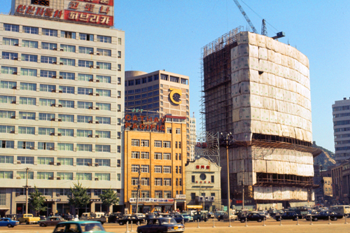
When I took the photo at left, I was standing in the footprint of that huge building. As it turns out, in the 1980s there was a growing movement that said the building was a reminder of the time when Korea was ruled by a foreign power, and that the building should be demolished. It was- the year after the picture showing the gate and the building.
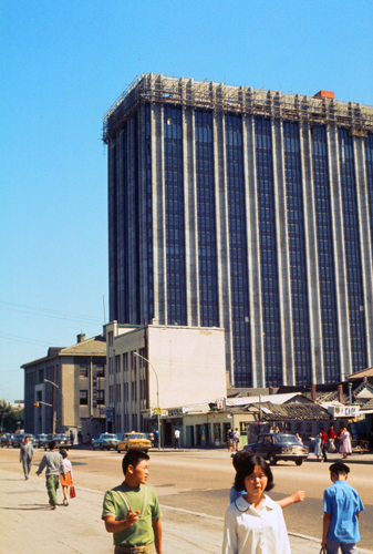
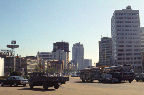
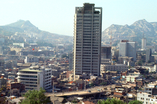
But there is something else interesting. The photo at left looks south and a bit west, which was the direction from which I came in 1970. Remember that skyscraper that you saw a picture of above? The one that had some remaining scaffolding right at the top? If you don't remember it, just click on the skyscraper in the photo at left. That skyscraper is the same one that was just being completed in September, 1970! (Although the old picture looks at it from the opposite side.) So we know its lasted for 48 years, and it looks like it's still in very good shape.
From the Gwanghwamun Gate, I turned and headed south along one of Seoul's major thorofares- Sejong-daero. This broad avenue points directly south towards Yongsan Army Post, between two and three miles away.
|
|
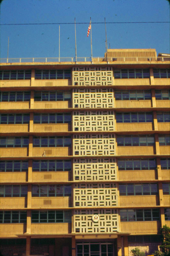
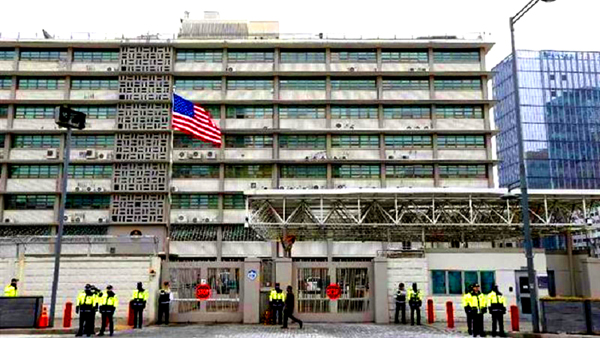
The US Embassy has operated in Seoul continuously since the end of the Korean War. The current chancery building was built in 1962 for USAID, but became the Embassy in 1964. The Chancery is located in the heart of downtown Seoul, in the Jongno-gu district. It is on the main street leading to the Kyongbok palace, and directly next to several major Korean government agency buildings. At the time of its construction the building was one of the tallest in Seoul and comparatively modern. The U.S. Embassy in Seoul has traditionally played a key and prominent role in South Korea politics. Issues such as the ever-present danger from North Korea, the presence of U.S. troops in South Korea, and the deference of South Korea to the U.S. have been factors that lead to such importance.
|
|
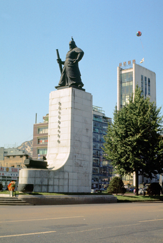
Continuing south, I passed an impressive statue in the middle of the avenue, just north of a major intersection.
|
The statue is 17 meters tall and made from bronze depicting the standing figure of the admiral, who is holding a sword in his right hand. A miniature turtle ship, a type of contemporary Korean war vessel commanded by Yi Sun-sin, is also located in front of the statue. Two models of war drums are also present near the statue.
This statue was erected in 1968 in the presence of the South Korean President. It was designed by Kim Se-jung, a sculptor and professor of art at Seoul National University, aided by the historians from the National Institute of Korean History. It was the first statue built by the Statue Establishing Committee led by Kim Jong-pil who was asked by President Park Chung Hee: “Build a statue of a person most feared and admired by the Japanese in the Sejong-no intersection.” The raising of the statue, also a part of a renovation of the Gwanghwamun Plaza, was one of the symbols of modernization and rebuilding of Korea. The armored figure of the war hero has also been considered a symbol of the then-military government of South Korea. At the time of its unveiling it was the tallest standing statue in Asia.
Next to the statue there is also a water fountain in honor of the Admiral's achievements. It is named the 12.23 Fountain, to commemorate the 23 battles he fought with 12 warships, when he led Koreans to victory during the Japanese invasions of Korea. The water jets rises to a height of 18 meters along with 300 smaller jets, which symbolize the battles he fought on the sea. A small museum is located underneath the statue.
Note from the present:
Mostly because I can, I want to show you the 2020 view of this avenue, looking north back the way I have come. You can pick out the Sun-Sin statue, and you may be able to see the Gwanghwamun Gate in the distance. At right, you can also see the next item of interest that I photographed.
|
At right is an oriental structure, more in the Korean style than the Japanese, that is a tribute to the 40th Anniversary Monument of Gojong’s Enthronement.
|
In 1895, the wife of Gojong, known as Queen Min and Empress Myeongseong, was assassinated by the Japanese. After the assassination, Gojong, along with the Crown Prince fled from Gyeongbokgung Palace to the Russian legation for protection and for his fear of a coup d’état.
Gojong ruled the Korean government from the Russian legation for one year which outraged citizens of Korea. In 1897, Gojong left the Russian legation under rising pressure and relocated to Gyeongungung, known today as Deoksugung Palace. It was here where he proclaimed the founding of the Korean Empire, also known as the Great Han Empire. Gojong became the first Emperor of the Korean Empire.
Letters on the front of the monument were carved by Sunjong, who was Crown Prince at the time. The inscription tells how the monument honors Gojong as king and later as the first emperor of the Korean Empire.
The monument is protected by a square house that is three kan by three kan. A kan is an interval between pillars. Stone columns and a rainbow shaped gate, known as Mansemun Gate, can be found on the southern wall. The building is a reminder of the traditional architectural style of the early 20th century. During the occupation of Korea, the monument, the building, and the gate were sold to the Japanese. In 1954, the monument was returned and put back into place. It sits adjacent to the underground passage at this interesection.
|
|
I went down into the underground passage and walked to the other side of the street- just to see what I could see. Then I returned to the Gojong monument and continued wandering generally southward.
|
Below is a building that had some interesting signage, as if it were the headquarters of the Tic-Tac-Toe Association of Korea. I never did find out what it was for. (But I can tell you as I create this page that the structure no longer in existence.)
|
As you saw on the map above, I continued wandering southward, going down whatever streets I found interesting. I also photographed what I thought interesting, and here are some of those pictures.
|
|
|
|
From this point I was generally walking south, but I wandered off down side streets, following my nose and heading towards Namsan Mountain. There was a lot to see.
|
|
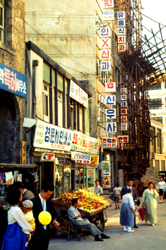
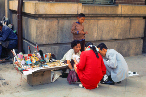
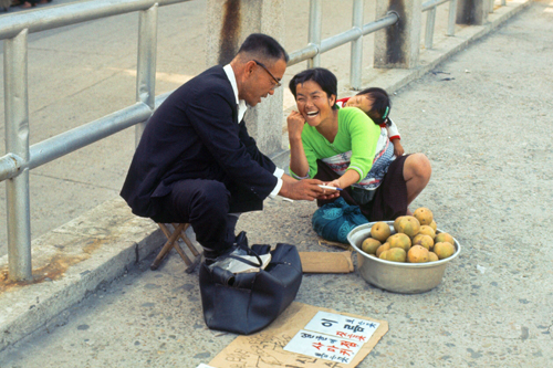
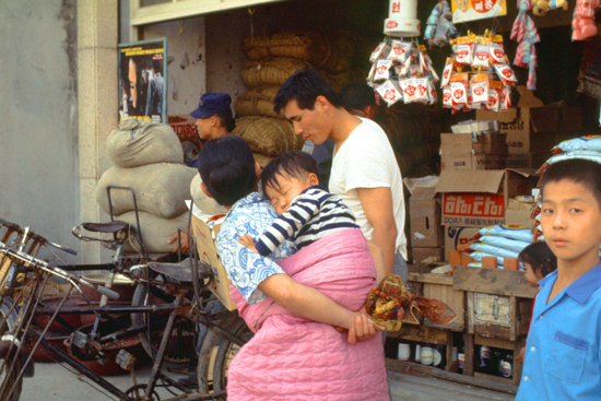
Some of you who live in large cities (New York comes immediately to mind) are familiar with "pushcart" vendors who sell one thing or another out of movable carts. In Korea, they seem to be an institution. On almost every street one finds these kinds of vendors selling everything under the sun.
|
Now, in some cases, these operations might be classified as being part of the "black market". I have seen some of these vendors selling things that were fairly obviously part of US Army supplies- from paper and pencils to food. I can only suppose that someone diverted the goods at some point, and then sold them to the vendors for them to sell in turn.
But I guess that many of the vendors were just reselling some goods they were able to purchase wholesale or get on consignment. None of these items were very expensive. I suppose they were all items that passersby might prefer to pick up quickly from a vendor rather than go into a store to try to find them.
But there is something else very interesting here. If this were a pushcart vendor, the goods would be in the cart, which would usually be at waist level. If someone were to stop to look over the goods, they could conveniently do so standing up, and the entire transaction would be done that way, as the vendor would also be standing up or maybe sitting on a stool or something. Not here.
Any time a Korean, man or woman, wants to stop and do something where it is not convenient to stand, they drop quickly into a full squat, like the woman and her two customers are doing here. People in Korea do this all the time, and they do it for extended periods. It is not a position we are used to being in, and it is something of a curiosity how Koreans can get into and hold this position for as long as they do. I tried it, and it's not easy, and I'm fairly young.
|
It also requires a lot of practice to keep your balance- particularly if one was chubby. Of course, I hardly ever saw overweight Koreans, and I have no idea how hard it might be for big people to sit in this position. Do they squat because they're thin, or are they thin because they don't sit in chairs very much at all? No idea.
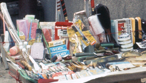
I thought the goods themselves were interesting, so I have expanded the image to focus in on them. On the woman's small "tray" she has both Korean and assorted American goods. You can see the Ivory soap, and there are such things as gum, ribbons, and other little sundries.
Anyone who can get his hands on some of this merchandise just sets up a little stand and goes into business. People stop and haggle over a price as a matter of course, as this couple are doing. It is most incongruous to see a well-dressed couple like this stopping to buy from one of these vendors.
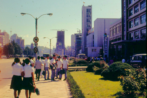
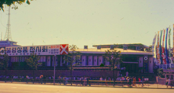
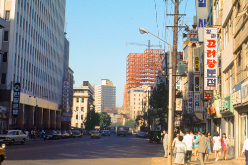
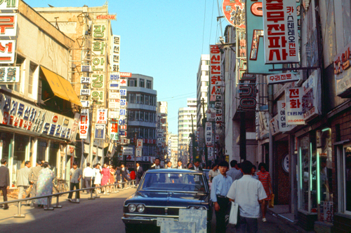
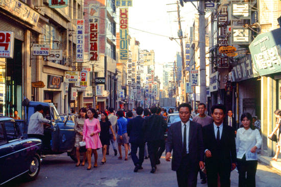
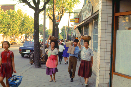
It is hard to express how interesting it was to simply walk the streets of this, the most foreign city I had ever visited. Perhaps if I had previously visited the "Chinatowns" of San Francisco or Los Angeles I might not have found Seoul so exotic, but it was, and I did. Take a look at these city scenes:
|
|
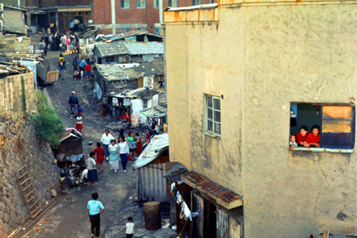
This section of the city is a good one, and you will see the population well-dressed, and the shops, though small, neat and clean. There is a great difference between this, and the poorer sections, where shops are smaller, the people poorer, and the city dirtier and shabbier. But I suppose that's true everywhere.
|
|
In case you are interested, I investigated a good many of the shops, using a phrase Dr. Kim showed me to indicate I was just looking around, not ready to buy anything. A good piano costs 210,000 Won, or about $700. A stereo I paid $228 for in the PX can be bought here for a little over $400 (even so, the same thing in a stereo store at home would be much more). On this particular day I wandered around for hours, and have been back many times since with friends.
|
|
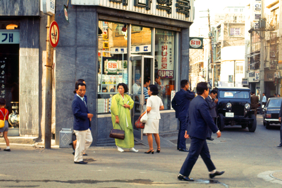
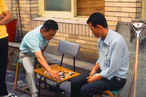
The two men in the picture above are interesting for another reason- their dress. You can tell, from the fact that they aren't wearing dark suits, that they are not "office workers". (In Japan, these workers are called "salarymen".) They might have been store proprietors taking a break, or perhaps just on their day off, or something. But they illustrate casual dress for adult men- trousers and an open dress shirt without tie.
|
|
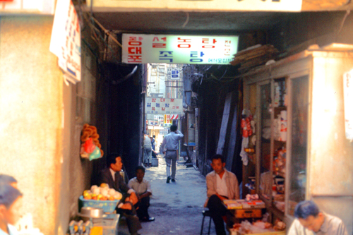
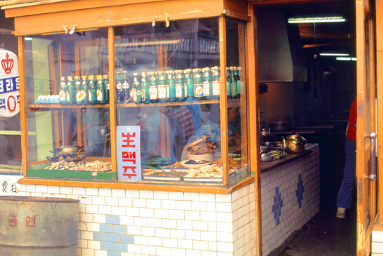
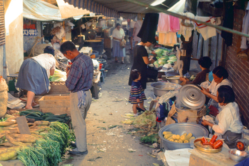
On the topic of eating "street food", it is not advised that US personnel patronize these little places because of possible contamination of the water and questionable sanitary practices. However, when walking down the narrow streets, the smells are most enticing, and one is tempted to take a chance. (Note: I can report here that on some of my walks I did indeed try some of the impromptu "restaurants", but I took care to only eat food that I'd seen actually cooked in front of me, shying away from uncooked vegetables and such. To my knowledge, I never had an adverse reaction to food I ate on my walks.)
|
|
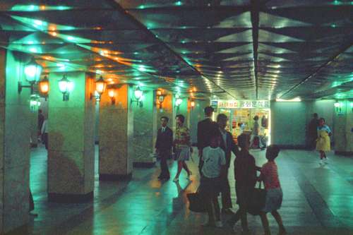
On this page, I want to repeat a picture I took on a previous visit to Namsan Mountain, because it shows you just where I am at the moment.
|
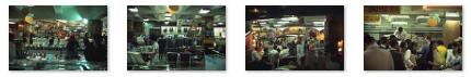
I decided to go inside the store just to see what it was like, and I ended up taking some pictures you might be interested in. To get the most out of them, I need to show them in a large size. To do that, I've provided below a set of four small images for these four pictures. To see the large version of each of them, just click on one of the little images. The large picture will pop up for you to look at. Just close each of those windows when you're done.
(Note that in many of the pictures, you can see the same orange globes hanging from the ceiling!)
|
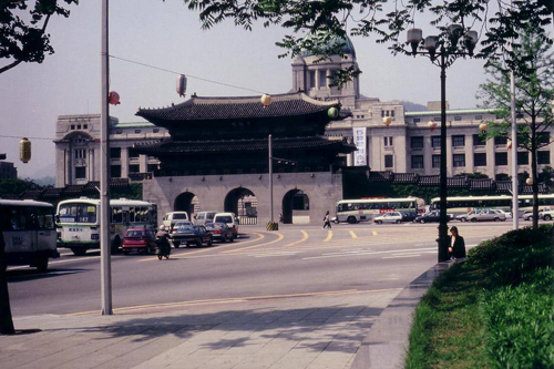
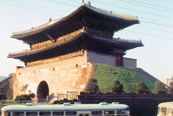
The department store was interesting, but inside looked much like any other department store I'd been in, with the typical departments selling the typical things. One unusual scene, though, was the white-shirted man handing out bags of rice to shoppers who wanted to buy them. I could only imagine the bags were fairly heavy. Coming out of the store, I saw just down the street another of the gates that Seoul is famous for and which are sprinkled around the city. Like others, this one was in the middle of a large intersection.
|
Namdaemun (English, "Southern Great Gate") is commonly believed to have been the name imposed forcibly under the Japanese Empire, and therefore should not be used. However, Joseon dynasty annals indicate that naming the eight gates of Seoul after their respective directions was common colloquial usage before the Japanese arrived.
Namdaemun is indeed the oldest wooden structure in Seoul. The city gate, made of wood and stone with a two-tiered, pagoda-shaped tiled roof, was completed in 1398 and originally used to greet foreign emissaries, control access to the capital city, and keep out Siberian tigers, which have long been gone from the area. Construction began in 1395 during the fourth year of the reign of King Taejo of Joseon and was finished in 1398. The structure was rebuilt in 1447, during the 29th year of King Sejong the Great's reign, and has been renovated several times since. It was originally one of three main gates, the others being the East Gate (Dongdaemun) and the West Gate (Seodaemun).
In the early part of the 20th century, the city walls that surrounded Seoul were demolished to make the traffic system more efficient. A visit to Seoul by the Crown Prince of Japan prompted the demolition of the walls around Namdaemun, as the prince was deemed to be too exalted to pass through the gateway. The gate was closed to the public in 1907 after the authority constructed an electric tramway nearby. Namdaemun was extensively damaged during the Korean War and was given its last major repair in 1961, with a completion ceremony held on 14 May 1963. It was given the status of "National Treasure No. 1" on 20 December 1962.
|
|
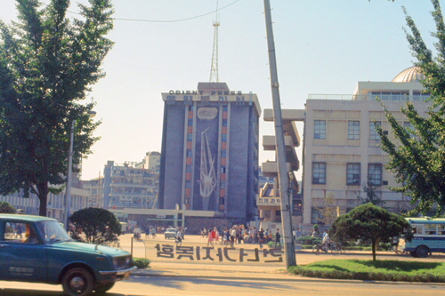
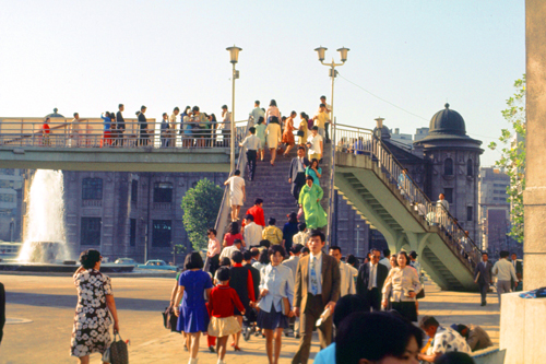
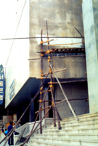
You have also seen this building in an earlier picture on this same page. It sits just north of the street I am walking on, which is the one in the picture that turns into a bridge near the base of the skyscraper. My route will be taking me across this bridge presently.
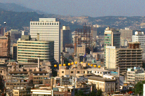
Anyway, when I got inside, I found that the building was actually already open, and there were lots of people going up in the new, modern elevators. Oddly, there was a sign in the lobby advertising "Cafe Floor 17", and so I got the idea to take the elevator up to that floor. Perhaps, I thought, there will be some windows where I could look out and get some pictures of the nearby cityscape.
As it turned out, that was exactly what I was able to do. The cafe, presumably for the building's workers, was quite busy, and so I was able to walk around unobtrusively to look out the windows and take some pictures. (I also saw a delicious-looking pastry being served, so I bought one and sat down to have a snack.) Here are a couple of the pictures I took (a little dark because the glass was tinted.
|
|
I headed back down to the lobby and left the building, which looked to me inside to be just like any office building in the States. Then I started walking across the street bridge as I continued south.
|
|
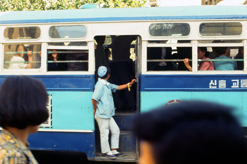
If you'd like to get a better view of the three people in the window, just click on them.
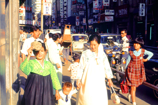
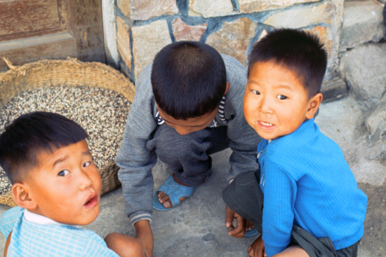
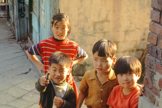
What made my walks even more interesting was, as I said above, the curiosity that Americans seemed to engender on the part of the Koreans- most particularly the children, who would gather around at every opportunity.
|
|
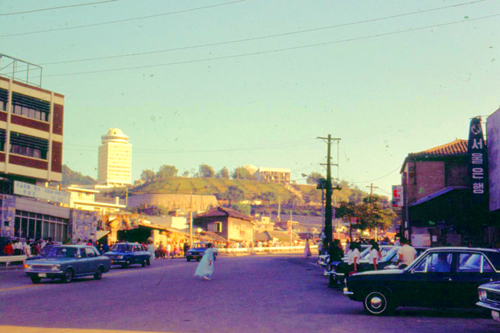
It was getting late, and I wanted to have dinner at Yongsan's Officer's Open Mess, so I continued past Namsan Mountain heading south towards the Eighth Army compound. I got some additional interesting (or quirky) pictures on the way:
|
|
|
|
Today's walk was one of the most enjoyable so far. But what I really need to do is to get further off the beaten path, and perhaps go up some of the hillsides to see how many people live.
You can use the links below to continue to another photo album page.
|
October 3, 1970: A Football Game at Camp Red Cloud |
|
September 19, 1970: At Dr. Kim's/Namsan Mountain |
|
Return to Index for 1970 |