|
October 20, 1973: My Move to Eugenie Square |
|
September 1-3, 1973: A Weekend in Traverse City, MI |
|
Return to Index for 1973 |
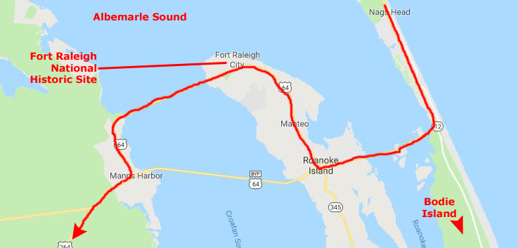
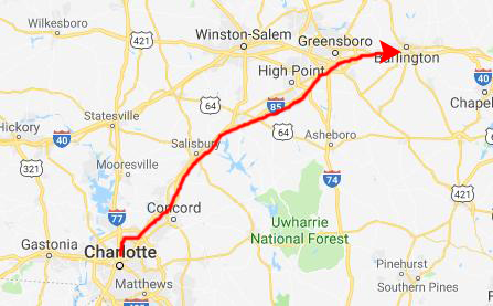
The Bank gives me two weeks of vacation each year, and I decided to take one of them towards the end of September. It will be mostly a driving trip, although I will be flying to Charlotte and back, and then using my Mom's car to go off on my own for a while. I'll end up back in Charlotte, and my Mom and I will go visit my sister and her family in their new house outside of Elon, North Carolina.
|
We spent the evening together and played down at the Charlotte Bridge Club before I borrowed her car and headed out on my "grand cirle" around North and South Carolina.
Later on in this photo album, whenever I can remember, I will mark my route on maps like this. But I confess that I didn't think to keep track of my route in 1973, didn't try to add it when I wrote my slide narratives years later, and now, in 2019, can't remember it precisely at all. I could make a guess, but why bother?
What I can say is where I went, because I have the pictures themselves to guide me.
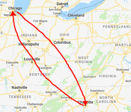
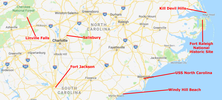
So where all did I go? Well, before just launching into the pictures and one destination after another, here is a map of the area with the stops that I made marked on it.
|
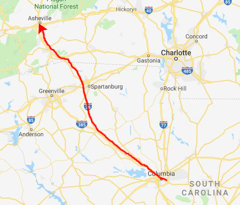
I am a sucker for revisiting placs I've been, so I next wanted to spend a night in Windy Hill Beach, where Art, Peter, Chuck, and I spent a few days during college (in the same motel if I could find it). Getting there had me drive south along the coast through Wilmington, where I stopped to see the USS North Carolina. After Windy Hill, I headed up through Columbia, South Carolina, so I could stop to see Peter, who was currently stationed at Fort Jackson.
After a night there, I drove up towards Asheville and the Blue Ridge Parkway. I wanted to see Montreat again (where I had spent a memorable summer at the Presbyterian retreat center), and I also wanted to see Linville Falls, about which I had always heard so much. Finally, on my way back to Charlotte, I stopped off in Salisbury, North Carolina, to see one of my best college friends, Steve Lee, whose degree in Sacred Music from SMU had landed him a position as the music director at a large Methodist church there.
Returning to Charlotte, I spent another night with Mom, and then the two of us drove up to my sister's new house outside Elon, North Carolina, before returning to Charlotte and my flight home.
So, not worrying overmuch about how I got from one place to the next, or where I spent each particular night, let's just look at the stops I made.
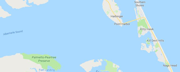
Kill Devil Hills
|
As I said, the signage said that the town was home to the site of the Wright brothers' first controlled, powered airplane flights in 1903. But I had always thought that the flights had taken place at Kitty Hawk, North Carolina, which my map told me was still another four miles north. So had I been misinformed (wrong) all these years? Well, yes and no.
At the time of the flight, the town of Kill Devil Hills did not exist; it did not receive its municipal charter until 1953. As the nearest settlement at the time of the famous flights, Kitty Hawk became popularly noted as the site of those flights, I guess because it was easier to be imprecise than to say "the flights occurred on some open hills approximately four miles south of the town of Kitty Hawk, NC". Or perhaps it was because the right after their four flights in their Wright Flyer, the brothers walked back to Kitty Hawk, where they sent a telegram from the Weather Bureau office to their father informing him of their success. The Wrights chose the area because its frequent winds and soft sandy surfaces were suitable for their glider experiments, which they conducted over a three-year period prior to making the powered flights. But now you know.
|
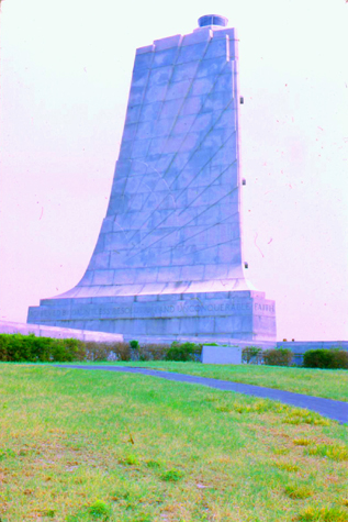
The doors of the tower are stainless steel over nickel, with a price of $3,000 in 1928. The the three relief panels on each door represent the conquest of the air, mentioning, among other figures, the French locksmith Besnier (who had the concept of a flat wing), the German Otto Lilienthal (who died conducting gliding experiments), Icarus (the Greek mythological figure who flew by attaching feathers to his arms with wax), and the kites of the Wright Brothers and others.
The Art Deco design was selected in 1930, but it took a year to prepare and stabilize the site. Construction began in October 1931 and with a budget of $213,000, the memorial was completed in November 1932. In the end, 1,200 tons of granite, more than 2,000 tons of gravel, more than 800 tons of sand and almost 400 tons of cement were used to build the structure, along with numerous other materials. It is constructed of granite mined at the North Carolina Granite Corporation Quarry Complex.
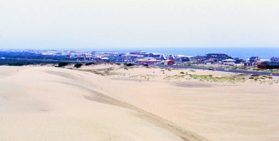
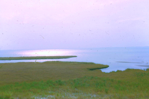
The Wright Brothers chose the site both for its steady winds and for its remoteness, preferring to conduct their tests away from the media of the time. It struck me as a bit odd to see a shoreline that hasn't been developed; the lakes and oceansides I've seen before an in pictures all seemed to be full of hotels or vacation home. But here, there wasn't much of anything.
|
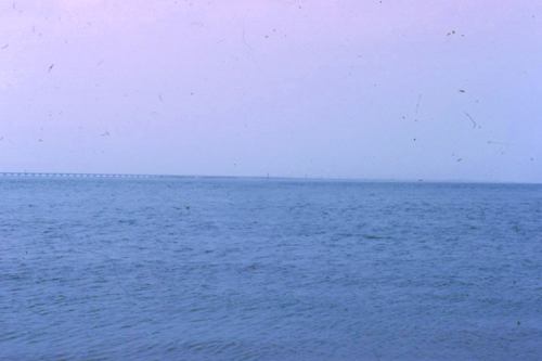
But of course we aren't on the mainland here, just a barrier island. The Atlantic's east of us, but another huge body of water, Albemarle Sound, is west of us. Only beyond that do you reach the mainland. So the views to the east are expansive:
|
|
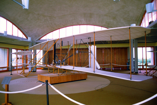
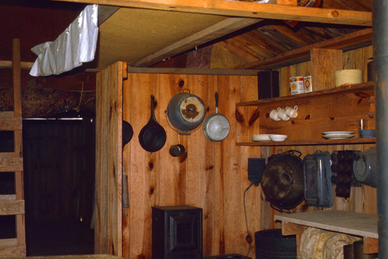
But I digress. Coming back to the Wright Brothers Historic Site, there was a Visitor Center, which is home to a museum featuring models and actual tools and machines used by the Wright brothers during their flight experiments including a reproduction of the wind tunnel used to test wing shapes and a portion of the engine used in the first flight.
|
|
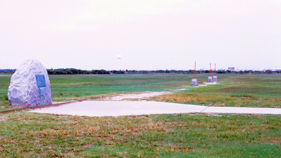
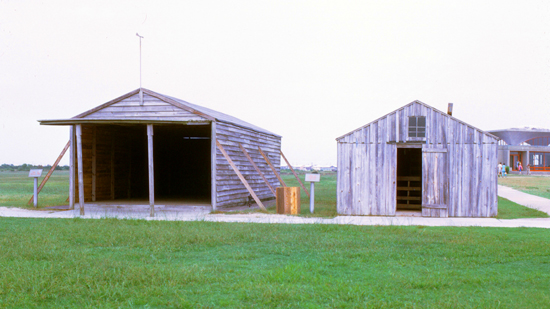
The Wrights made four flights from level ground near the base of the hill on December 17, 1903, in the Wright Flyer, following three years of gliding experiments from atop this and other nearby sand dunes. It is possible to walk along the actual routes of the four flights, with small monuments marking their starts and finishes. Two wooden sheds, based on historic photographs, recreate the world's first airplane hangar and the brothers' living quarters.
|
|
I found it really interesting to wander around the area, and I thought the Park Service had done a good job of recreating the feeling of what it must have been like for the Wright Brothers to have been here.
|
Authorized as Kill Devil Hill Monument in 1927, the site was transferred from the War Department to the National Park Service in 1933. Congress renamed it and designated it a national memorial in 1953 and the national memorial was listed on the National Register of Historic Places in 1966. The memorial is co-managed with two other Outer Banks parks, Fort Raleigh National Historic Site and Cape Hatteras National Seashore.
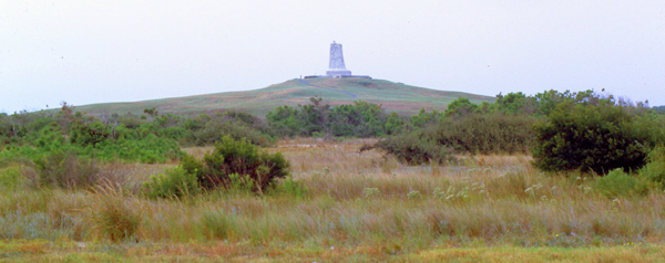
Leaving the Historic Site, I got a very nice view of the memorial, and that view is at right. I drove south to where US Highway 64 heads over to Roanoke Island so I could visit Fort Raleigh.
Fort Raleigh National Historic Site
|
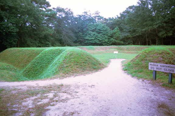
The historic site is off U.S. Highway 64 on the north end of Roanoke Island, about 3 miles north of the town of Manteo. The visitor center's museum contains exhibits about the history of the English expeditions and colonies, the Roanoke Colony, and the island's Civil War history and Freedmen's Colony (1863-1867).
|
To determine why there was a small earthen fort with no evidence of a nearby settlement, we need to understand its function. What was its purpose? To mount cannon to control the waters off the north end of Roanoke island? To protect Thomas Harriot�s 1585-6 industrial and scientific activities taking place west of the fort? To protect a now-lost landing spot east of the fort? To house and defend the eighteen men who made up the military �holding party� that came, fought, and fled in 1586? Or was it to serve the new, civilian settlers of 1587, who later became the Lost Colony? No one really knows.
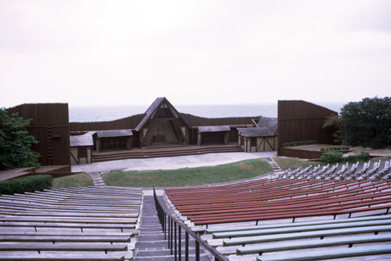
There were a number of trails you could follow, and I did some walking along them. I also stopped by the amphitheatre where the "Lost Colony" play is put on in the summer.
|
|
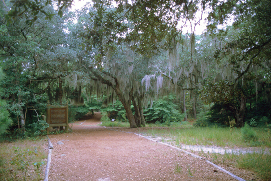
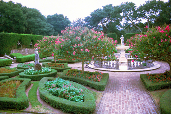
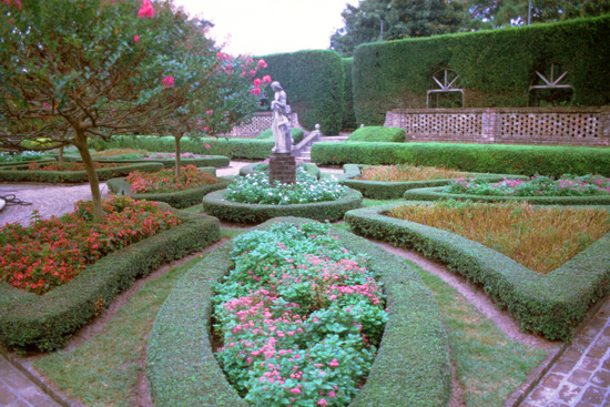
The Elizabethan Gardens are located adjacent to The Lost Colony's Waterside Theatre, and although things have changed a lot since my visit, the gardens were still nice to walk through. When I was here, there were two or three rather small pocket gardens and a space between them, but I note that now the area is quite extensive and the gardens much larger.
|
|
The Bodie Island Lighthouse
|
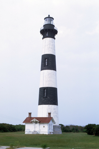
Driving south, I went past the turnoff to Roanoke Island; the drive along the ocean was quite pretty, and I saw signs for a famous old lighthouse about five miles further on. I saw the lighthouse way before I got to the small parking area for it and got out to take a look and a picture (shown at left).
The current Bodie Island Lighthouse is the third that has stood in this vicinity of Bodie Island on the Outer Banks in North Carolina and was built in 1872. It stands 170 feet tall and is located on the Roanoke Sound side of the first island that is part of the Cape Hatteras National Seashore. The lighthouse is just south of Nags Head, a few miles before Oregon Inlet. I'd hoped I might climb to the top, but the stairs were closed off. (Actually, a four-year renovation that began in 2009 once again made the 214 steps that spiral to the top climbable by the public.It was renovated from August 2009 to March 2013, and was made climbable by the public. There are 214 steps that spiral to the top. The structure is one of only a dozen remaining tall, brick tower lighthouses in the United States, and one of the few with an original first-order Fresnel lens to cast its light.
Leaving the lighthouse, I continued south on NC 12. The road was in the middle of the thin barrier island with the ocean on one side and the sound on the other. Eventually, I crossed the Bonner Bridge- a two-lane automobile bridge spanning the Oregon Inlet, between Bodie Island and Pea Island (both part of North Carolina's "Outer Banks"). The bridge carries NC 12 and is utilized by local and seasonal tourist traffic. The 2.7-mile bridge was built in 1963 and was dedicated to Herbert C. Bonner- a 12-term Congressman from North Carolina.
The Trip to Wilmington and the USS North Carolina
|
|
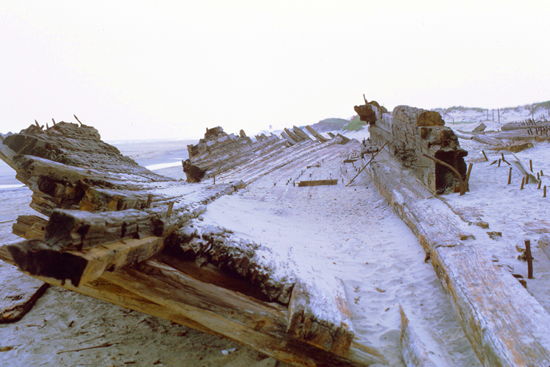
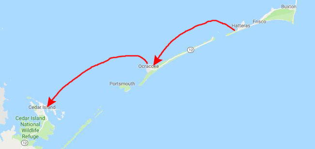
I continued down the highway, taking my time and enjoying the afternoon. Perhaps, as it turned out, I should have investigated ferry schedules sometime earlier. But you have to remember that this trip was way before the Internet and smartphones that could access it. Or even cell phones, for that matter. Eventually I reached Hatteras, North Carolina, and found, right where the road deadended- the ferry terminal. When I pulled into it, there were no other cars there waiting, and when I went over to the ticket office I found out why. The office was closed as the last ferry had left some 45 minutes earlier.
|
|
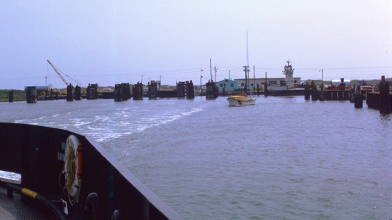
The ferry trip was in two legs. The first leg was the ferry from Hatteras to Ocracoke Island. The only way on and off this particular part of North Carolina's Outer Banks is indeed by ferry. From Ocracoke, the ferry continues on to Cedar Island, North Carolina. While Cedar Island is also an island, there is a bridge from it to the mainland, so I could drive my car off the ferry and on south along the coast. I did take a couple of pictures from the ferry:
|
|
Riding on the ferry was really neat. This wasn't the first time I'd been on a car ferry; I recall a couple of times when I was a kid traveling with my family when dad took our car on one. But this was the first time I'd driven my own car (actually, my mother's) on and off a car ferry. All throughout the trip, there were lots of local denizens keeping us company.
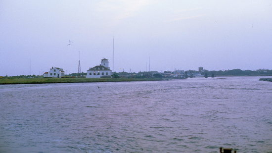
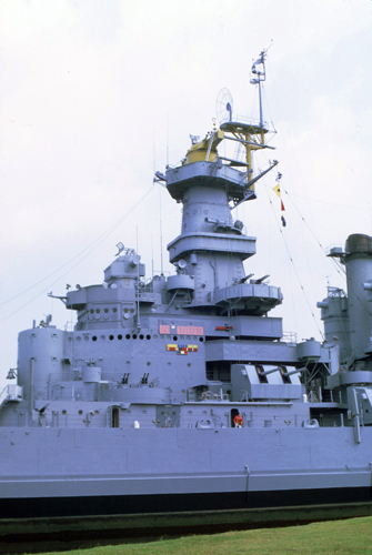
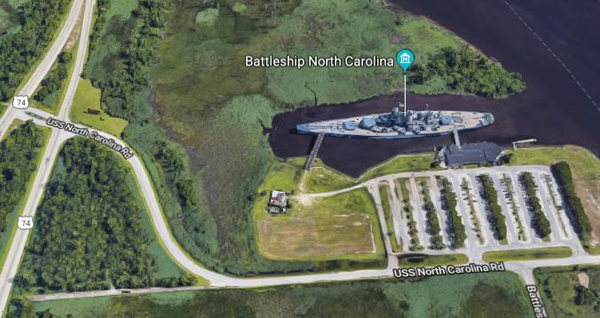
From Cedar Island, I picked up US 70 to Morehead City, and then took NC 24 over to Jacksonille, NC. From Jacksonville, I took US 17 southwest down the coast to Wilmington NC, and then right through the city. As I crossed the Cape Fear River, I could see the USS North Carolina just north of me, so I decided to stop and have a look at it.
|
|
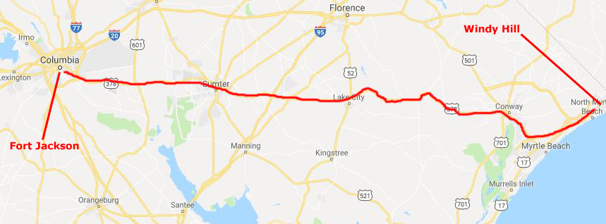
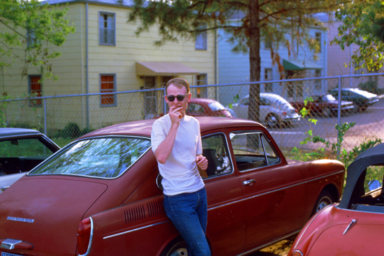
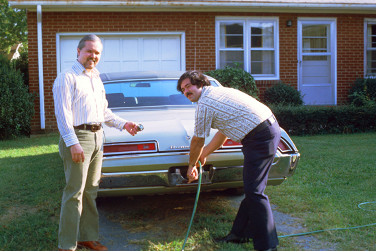
Windy Hill and Fort Jackson
After an hour of checking IDs and having the car searched, we were on our way, only to be stopped twice more (although not so violently) on our way home. Even coming into Charlotte, we were shadowed for a time by another police car, but he must have phoned us in and gotten the word that we weren't the perps he was looking for. I found the same motel we'd stayed in that summer, and stayed there for a night by myself, enjoying the beach and a dinner out.
|
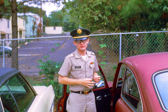
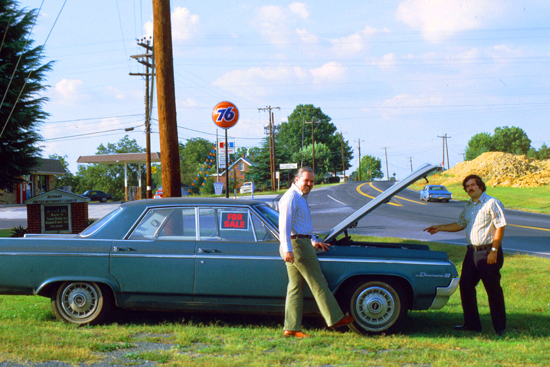
The next day, I headed inland towards Columbia, South Carolina, and Fort Jackson where my college roommate, Peter Gurerrant, was stationed. He was still in the Service in the Adjutant Generals Corps (the Army's administrative service). I took a couple of pictures during my stop in Fort Jackson- both of Peter outside his BOQ:
|
|
After Davidson, Peter had attended law school for a while in California, but then entered the Army when he began to think that it wasn't the career for him. Peter served in Vietnam for his overseas tour in 1971; he's been in the Army for almost four years now, and will probably make it a career.
The Blue Ridge Mountains and Linville Falls
|
|
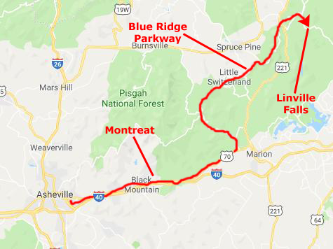
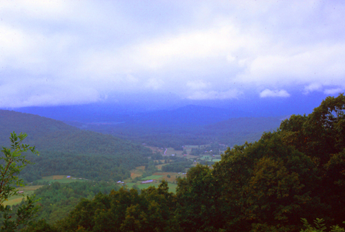
Instead, I headed east a bit to find US 70 which would take me to a road I could take up into the Blue Ridge and to the Blue Ridge Parkway. The parkway is, I think, one of the country's most beautiful drives. Indeed, until I started traveling for a living and had the opportunity to drive along the Pacific Coast and in the Rocky Mountains, the Blue Ridge Parkway was the most beautiful, relaxing driving experience I'd ever had. I wanted to experience that relaxation again, and so thought I would drive a few hours north and see how far I could get.
The Blue Ridge Parkway is a United States National Parkway and All-American Road noted for its scenic beauty. The parkway, which is America's longest linear park, runs for 469 miles through 29 Virginia and North Carolina counties, linking Shenandoah National Park to Great Smoky Mountains National Park.
|
Begun during Franklin D. Roosevelt's administration, most construction was carried out by private contractors under federal contracts issued as public works projects- part of Roosevelt's efforts to put Americans back to work and ameliorate the effects of the Great Depression. Work began on September 11, 1935, near Cumberland Knob in North Carolina; construction in Virginia began the following February. On June 30, 1936, Congress formally authorized the project as the Blue Ridge Parkway and placed it under the jurisdiction of the National Park Service.
|
The parkway's construction created jobs in the region, but also displaced many residents and created new rules and regulations for landowners, including requirements related to how farmers could transport crops. Residents could no longer build on their lands without permission, or develop land except for agricultural use. They were not permitted to use the parkway for any commercial travel but were required to transport equipment and materials on side roads.
The Eastern Band of Cherokee Indians were also affected by the parkway, which was built partially through their lands. Numerous negotiations were held, and agreements were reached. Cherokee leaders participated in the dedications when the Cherokee sections opened in the 1950s. Construction of the parkway was complete by the end of 1966 with one notable exception- the 7.7-mile stretch including the Linn Cove Viaduct around Grandfather Mountain. I didn't drive that stretch this time as I entered the parkway north of it, but I can write now that this stretch did not open until 1987. All in all, the project took over 52 years to complete.
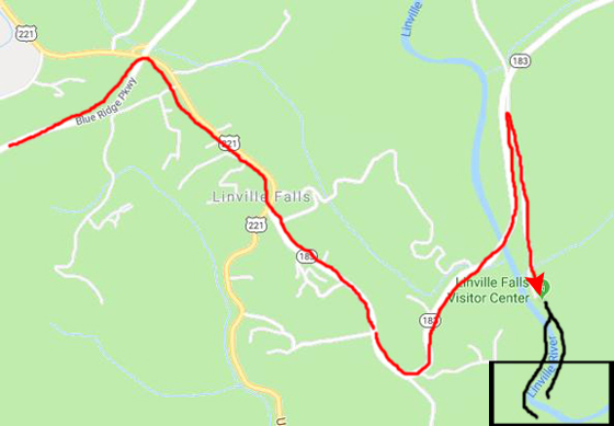
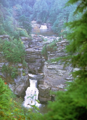
As it turned out, I got as far as the turnoff for Linville Falls. Here, I could see the falls and then be in good position to head back down out of the mountains and back towards Charlotte. So I left the Parkway at the exit for US 221, and followed the signs to the Linville Falls Visitor Center.
|
|
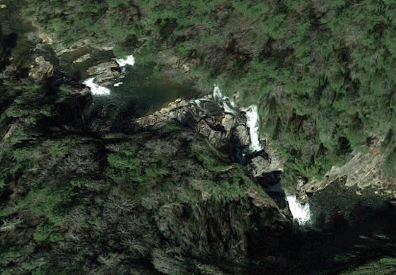
The map above, left, shows my route from the Parkway to the Visitor Center. I have also marked the general location of the falls, and the forked hike that I took to see the falls both up close and from a distance. And at right, above, is an aerial view of the falls, and you'll be able to match what you see to the pictures I took. The aerial view approximates the area inside the black rectangle.(Fortunately, physical earth features don't change much even after 40 years, which is why my photos still match up with the aerial view!)
|
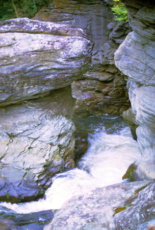
Linville Falls marks the beginning of the Linville Gorge, which is formed by the Linville River, which continues on after the falls before finally ending near Lake James.
The falls were donated to the National Park Service in 1952 by John D. Rockefeller, Jr. He provided about $100,000 for purchase of the land, including a 1,100-acre area surrounding the falls and a part of Linville Gorge, from Giulia Luginbuhl of Des Moines, IA, whose father, F. W. Hossfeld of Morganton, NC, had purchased the property about 1900.
At one time, the upper section of the main plunge was the same height as the lower section, however, flooding caused the upper section to collapse on top of the lower falls, making the lower falls a considerably longer plunge.
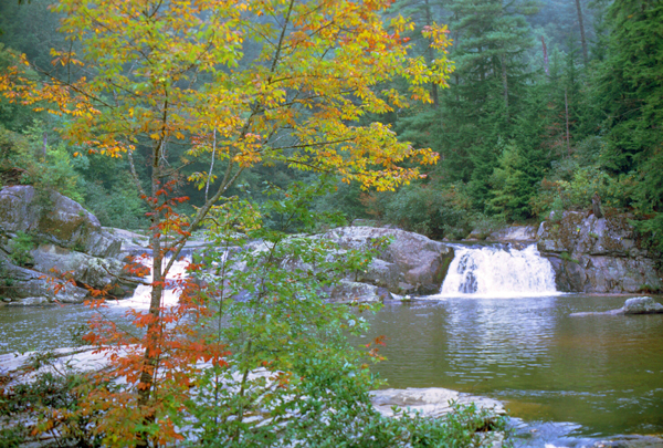
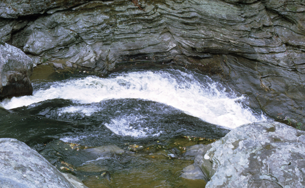
The falls is owned by the National Park Service, which operates the visitor center and several miles of non-handicapped accessible trails with 4 overlooks for the falls. The half-mile Upper Falls trail led me to the top of the falls, where I could see the small twin upper falls and the water spiraling through a small canyon on its way to the main falls.
|
|
Another trail, the Erwin's View trail leads to 2 overlooks, the Chimney View overlook and the Erwin's View overlook each of which provided nice views of the river and the canyon. I also walked the three-quarter-mile Plunge Basin Overlook Trail, which provides a view of the falls from the other side of the river.
|
Finally, I walked along the 0.7-mile Gorge Trail, which branched off from the Plunge Basin trail and led to an area near the foot of the falls. Swimming is prohibited at all areas of Linville Falls, as many deaths have occurred. Acording to personnel at the Visitor Center, the falls were used by local Native Americans to execute prisoners. No one is known to have survived a fall over the final plunge. The following is from the CARNEGIE Hero Fund Commission:
| "Charles W. Davis, 23, beekeeper, saved Hallie L. Hartman, 20, from drowning, Linville Falls, North Carolina, August 30, 1928. Miss Hartman fell into the Linville River and was carried 300 feet through swift water and dropped 30 feet over a fall into a pool in which the water was 45 feet deep and very cold. The banks of the pool were high and precipitous. Davis descended high rock ledges with difficulty to a low ledge at the pool, becoming winded. Fully clothed, he swam 40 feet through rough water to Miss Hartman, who was unconscious. Grasping her, he swam 15 feet with great exertion against a strong undercurrent that pulled toward the falls and then swam 65 feet farther to a low point at the bank. As he tried to push Miss Hartman upon the bank, he fell to his knees from fatigue but got to his feet quickly and placed Miss Hartman upon the bank. After prolonged efforts, Miss Hartman was revived." |
I really enjoyed seeing Linville Falls for, I think, the first time. I know that as a kid we came to the mountains a few times and drove along the Parkway, and perhaps my family stopped here. But if they did, I was too young to remember much.
My Trip Concludes Back in Charlotte
|
|
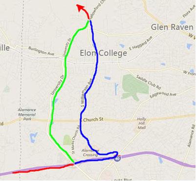
When I reached Charlotte, I went back to Mom's house and we played bridge that evening, and the next day drove up to my sister's new house outside Elon, North Carolina. I want to show a bit about where my sister is, but the difficulty I have is that between my visit this Fall and the time at which I am writing this online narrative (mid-2019), a lot has changed, physically, in Elon, Burlington, and North Carolina, with the result that the way one gets to my sister's farm today is much different than it was on this visit.
|
|
So just off the exit from the Interstate, you almost immediately have to double back on Garden Road which goes back along the north side of the Interstate and dead ends into South Williamson Avenue. Here, you turn right and head north, go across US Highway 70, continue north and eventually through the center of Elon, and finally, as you continue north/northwest, you will come onto Elon-Ossippie Road (where you reach a red line again) that leads to my sister's farm.
|
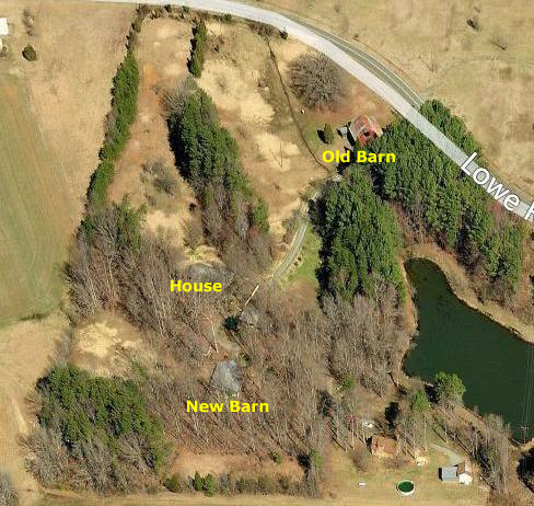
My sister has a really nice farm a quarter mile west of Elon-Ossipee Road. She's been in Burlington since college, and when she married Bob they bought a piece of land and built a house on it. That was just last year. Their two kids, live at home of course; Ted is 4 and Jennifer ("Jeffie") is 3.
Judy and Bob bought the land and then built a house on it; the only structure they kept when they bought the property was the old red country barn down by the road. That's where the other residents of the Barbour ranch reside; those would be my sister's horses. (There are also other four-legged residents, but those are dogs and cats.)
There's an aerial view of my sister's property at left, but of course it doesn't show the farm as it looked this year. The biggest change between then and now (as I write this) has been the construction of a new, modern, cement-floored barn up near the house, to take the place of the vintage dirt-floored old one. (I will visit here during its construction years from now, and I created an album page for the pictures we took of it under construction.)
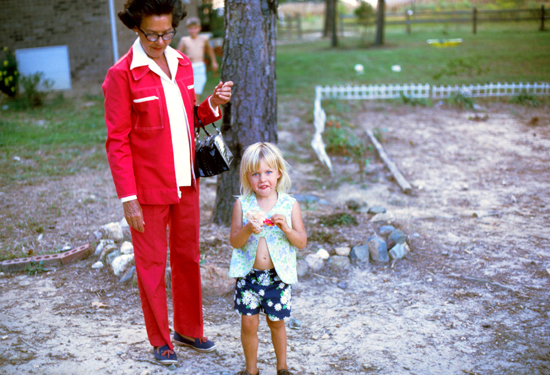
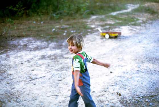
I always like visiting my sister and Bob (and the kids, of course), not least because it is a chance for me to get out of my city environment and into a more pastoral one. It's good for the soul. Mom and I spent the day here with the family; Bob works at his family's drug store, so he didn't get home until the afternoon. The two pictures I came away with were of my niece and nephew.
|
|
After a nice visit, Mom and I returned to Charlotte late that night, because my flight back to Chicago was the next day.
|
A lot would happen to that house in the ensuing years, and my Mom would eventually sell it to move into a condominium elsewhere in Charlotte. Years after that, she would move again- to Dallas, Texas, this time. I would be living there at the time, and could do a better job of looking after her if she were nearby.
But all these developments and more are well into the future, and so if you are going through this album linearly, you can look forward to learning about them.
I caught my mid-afternoon flight home, and by the following Monday was back at work at the Bank.
You can use the links below to continue to another photo album page.
|
October 20, 1973: My Move to Eugenie Square |
|
September 1-3, 1973: A Weekend in Traverse City, MI |
|
Return to Index for 1973 |