|
July 12-15, 1985: My Sister Judy Visits Dallas |
|
January 18-21, 1985: We Move from Chicago to Dallas |
|
Return to the Index for 1985 |
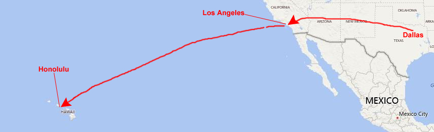
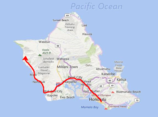
By the end of April, I had traveled so much that I was worn out, and Grant had certainly been putting in a lot of hours getting the house in order and was starting to look for a job. I thought that we should go ahead and take a vacation before Grant found a job, since any new job he found was probably not going to give him much time off in the first year. So after getting settled in at 7011 and the rigors of moving, I suggested to Grant that he cash in his Christmas gift- a ticket on American Airlines to anywhere he would like to go in the United States. After due consultation, we picked Hawaii.
Getting to Hawaii
 |
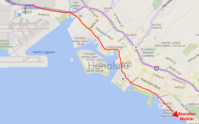
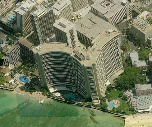
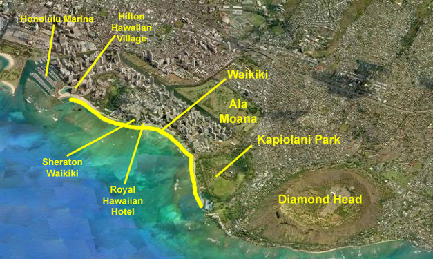
We took a limousine (actually a glorified to the Sheraton Waikiki (my favorite hotel in Honolulu) and got a very nice room with a view.
|
|
I have been staying at the Sheraton Waikiki on all my Hawaii trips save for my first stop here on the way back from Korea in 1970; on that trip I stayed in a military barracks at Fort DeRussy, a now decomissioned military post. When Tony Hirsch and I came to Hawaii for our first work with Cullinane Corp., and when I returned there a couple of times later on, I always stayed at the Sheraton. We stayed in the tower once, where Grant and I are on this trip, but we usually stayed in a low-rise building at the front left of the main tower called "The Garden Rooms" because it was a lot less expensive for our clients. But the Sheraton is a great hotel with a huge, open-air lobby through which the winds blow in all four directions.
Honolulu and Waikiki
|
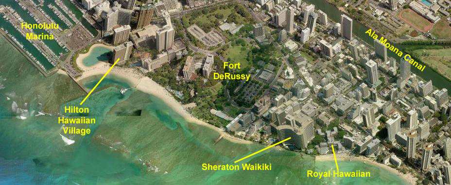
I have marked the location of both the Sheraton Waikiki and one of Honolulu's oldest (and classiest) hotels, the Royal Hawaiian. I remember when I was a kid home sick and I watched afternoon game shows, whenever a contestant won a Hawaii trip it was always the Royal Hawaiian where they stayed.
Ala Moana is a large park on the other side of the Ali Wai Canal from Waikiki; most people use "Ala Moana" to refer not only to the park, but also the canal and the area of the city beyond up the hills. Kapiolani Park is another large park just across Kapiolani Boulevard from Waikiki Beach.
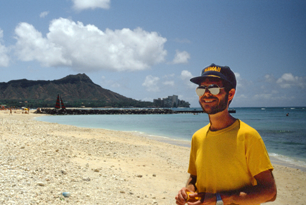
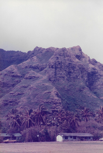
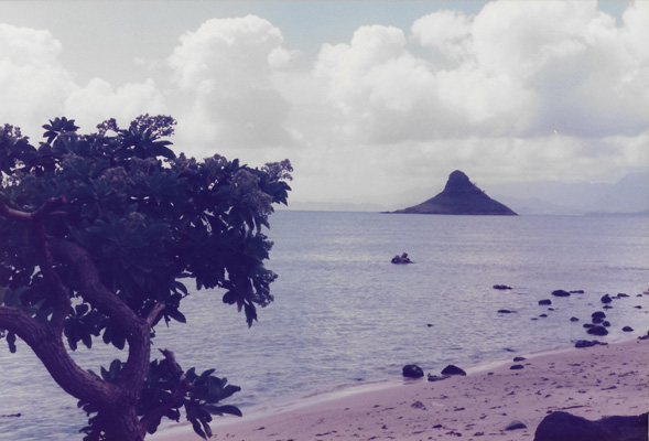
The last marked location on the view above is the southern tip of Oahu- marked by the extinct volcano Diamond Head. You will see Diamond Head in a few of our pictures; it is another of those iconic Hawaiian views, and is recognizable to most people. From the beach, it looks like a mountain headland, but from the air, you can clearly see the crater inside. There are hikes you can make up the north side of the mountain and then down into the crater itself; maybe we can do that on this trip.
|
We went to the marina two or three times as I recall, as Grant was enthused with all the boats that he found here. (Actually, this turned out to be the only place with lots of boats that I didn't get the impression Grant would have wished he could move to. He would have been way too far away from his family and he would have missed having any winter season at all.) We also spent a lot of time walking along the beach.
From the Sheraton, I could do my jogging in the evening, on a route that took me around Kapiolani Park. There was plenty for Grant to do while I was doing that; right across from the Sheraton on Kalakaua Street was the Hawaiian Market and a host of shops and other attractions. We ended up walking around the area almost every night, just to see what we could see.
So with our centrally-located hotel we were well-situated to do a lot of stuff by just walking, and there were only rare times when we just hung around the hotel. When you come this far, you want to see as much as you can. With all that introduction (overkill for those of you who have been to Hawaii), we can have a look at the pictures from this trip.
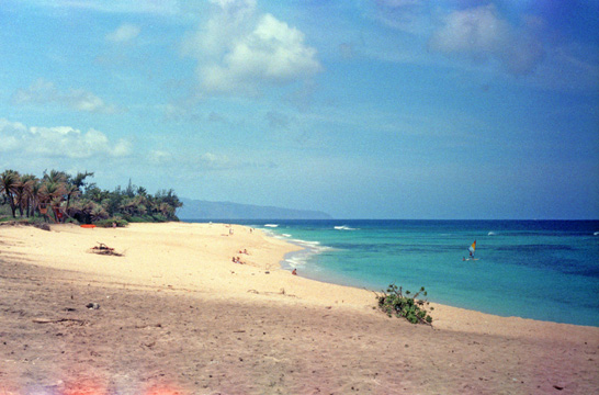
In Waikiki and on Waikiki Beach
|
Waikiki is actually the name given to is a beachfront neighborhood of Honolulu, on the south shore of the island of Oahu. The neighborhood is most famous for Waikiki Beach, but the famous stretch of sand is just one of five beaches in the district, the other four being Kuhio Beach and Gray's Beach to its south, and Fort DeRussy Beach and Kahanamoku Beach to the north. The neighborhood is also home to public places such as Kapiolani Park, Fort DeRussy, Kahanamoku Lagoon, Kuhio Beach Park, and Ala Wai Harbor.
The name Waikiki means "spouting fresh water" in the Hawaiian language, for the springs and streams that fed wetlands that once separated Waikiki from the interior.
The area was originally a retreat for Hawaiian royalty in the 1800s who enjoyed surfing there on early forms of longboards. A few small hotels opened in the 1880s. In 1893, Greek-American George Lycurgus leased the guest house of Allen Herbert and renamed it the "Sans Souci" (French for "without worries") creating one of the first beach resorts. Later that year Robert Louis Stevenson stayed at the resort; subsequently it became a popular destination for tourists from the mainland. There is still a short stretch of beach that locals call "Sans Souci Beach"
|
I should say that if you are a season Honolulu visitor, that the view looks Pearl; as the view in my picture above looks "Diamond Head". These two terms refer to directions from Waikiki and Honolulu (Pearl being the major harbor west of the city of Honolulu). For the other two directions, we have "mauka" which means "mountain" and makai, which means "ocean". Since a visitor can usually see at least three of these features anywhere in Honolulu, it is hard to get lost.
I have been in two buildings in Honolulu (one and office building and one a hotel) where when you get off the elevator you are facing signs with arrows pointing each way, and these labels used. In the hotel, one might say that "Our room is makai from the elevator", and so you would turn towards the ocean when you step off the lift. An office worker might say "I am the third cubicle Pearl from the elevator", and so on. (This does mean you have to be cognizant of which way the building is oriented and which way you were facing when you got in the elevator, but it is kind of charming.)
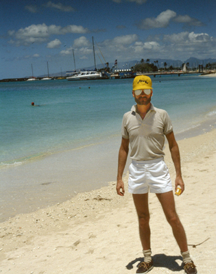
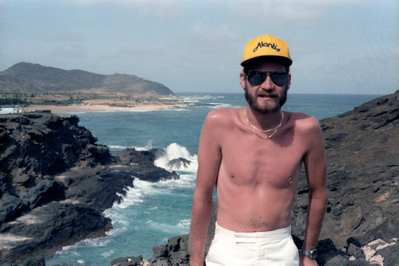
This was Grant's first trip to Hawaii (it seems as if every place we go together is his first trip, since he and his family never traveled outside the general Chicago area while he was growing up), but my tenth or twelfth. So while it was old hat for me, I was able to enjoy Grant's reaction to all the new scenery. He was real impressed when we flew First Class (using some free upgrades I had earned, of course), and when we stayed in the Sheraton right on the beach at Waikiki. He liked everything about Hawaii, particularly the multitude of boats.
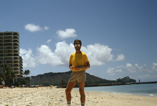 Here I am on Waikiki Beach with Diamond Head in the Background. |
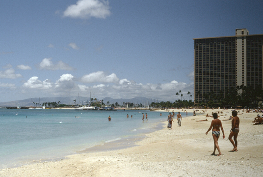 This view looks Pearl from the beach in front of the Sheraton Waikiki. That's the Hilton Hawaiian Village at right; what's left of Fort DeRussy is between me and the Hilton; the the land is being developed now. |
While the weather in Hawaii is excellent more often than not, it can also be brilliantly sunny, and today was one of those days. It was not oppressively hot, but it was quite warm. Being in the middle of the Pacific Ocean, the temperatures here are fairly constant year round (highs around 85° and lows around 65°).
 Looking Pearl from the Sheraton |
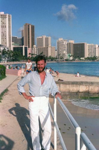
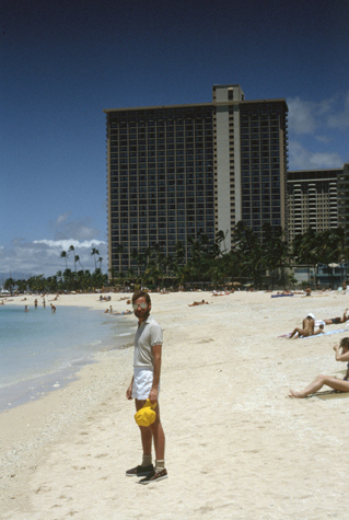
(Picture at left) Grant, again, with the Hilton in the background. I worried about Grant and the sun, because his skin is fairer than mine, so I made him wear a shirt and his hat most of the time. He just loved the whole area, and loved to walk along the beach down to the marinas.
(Picture at right)
|
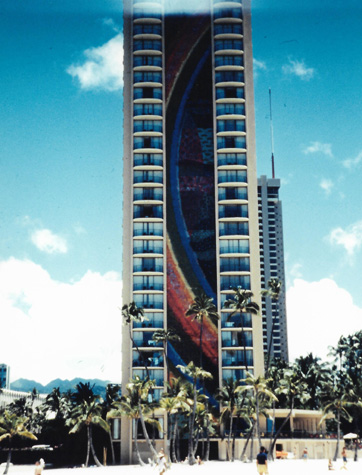 The Hilton Hawaiian Village Hotel |
Honolulu is, of course, Hawaii's capital and largest city (one of the very few states where this is true). Honolulu is the most remote city of its size in the world and is both the westernmost and the southernmost major U.S. city (population: about 300,000). The name of the city means "sheltered harbor" or "calm port", and the city has been the capital of the Hawaiian Islands since 1845.
|
We sat on the mesh webbing right up at the front of the boat, and we had the ride of our lives. If we hadn't put our glasses and sunglasses back in the area where most of the tourists rode, we surely would have lost them as the nose of the catamaran dived through the waves. Grant was laughing and screaming and having a great time, and both of us got soaked in the first few seconds. But it was fun!
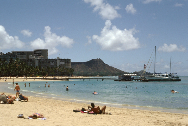
The catamaran ride turned out to be an excellent way to get a good look at the Waikiki skyline which, in recent years and certainly since my first visit, has become dotted with an abundance of both high-rises and resort hotels. The beach is actually fairly short, with half of it marked off for surfers. For some distance into the ocean the water is quite shallow, although there are numerous rocks on the bottom. As with most ocean beaches the waves can have some force, particularly on windy days. The surf at Waikiki is known for its long rolling break, making it ideal for long boarding, tandem surfing and beginners. It was this same surf condition that led the catamaran to buck and dive as it sped through the waves on our 60-minute ride.
I have two more pictures of Honolulu and Waikiki that we took later in the week, and I will include them here in the section with Waikiki Beach.
|
|
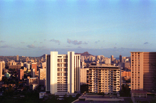
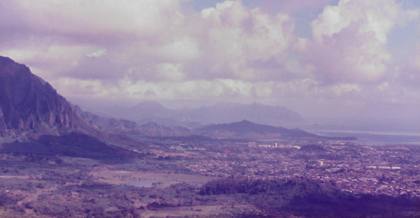
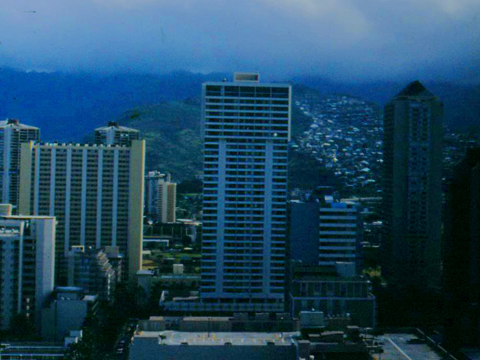
Eventually, the houses thinned out that that's where we found the overlook, which offered this view of the western part of downtown Honolulu in the nearground, with the central financial district behind it, the hotels and resorts of Waikiki and Ala Moana beyond that and then Diamond Head in the far background. In the background, left, you can see the area north of Diamond Head and the town of Waialae. As advertised, the view was just tremendous.
Here are the last two pictures that I took in downtown Honolulu:
 I took this picture from one of the upper floors in the Hilton Hawaiian Village; each floor had hallways with windows at both ends. |
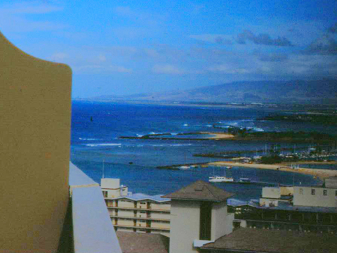 This picture, looking towards Pearl Harbor, was taken from our hotel room balcony. |
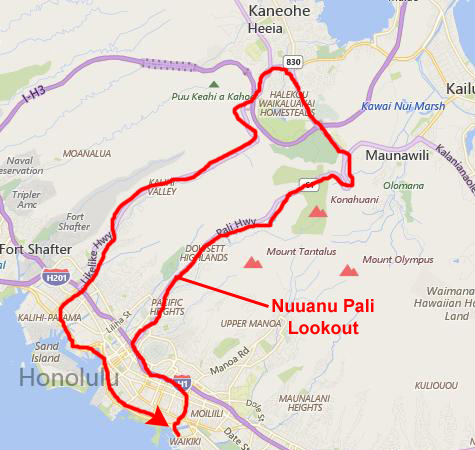
A Circuit of the Pali Highway and the Likelike Highway
|
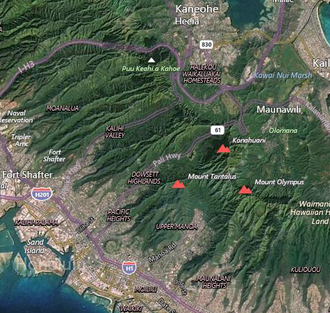
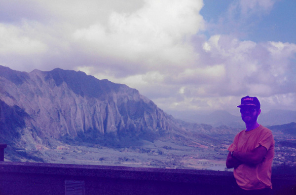
Driving up the mountains North of the city on Route 61 (the Pali Highway), we arrived at the Nuuanu Pali Lookout, which offered us views along the Koolau Range, which stretches from the Southeastern tip of the island, up the Eastern side of the island to a point midway along the Northern shore.
Nuuanu Pali is a section of the windward cliff ("pali", in Hawaiian) of the Koolau mountain located at the head of Nuuanu Valley. It has a panoramic view of the windward (northeast) coast of Oahu. The Pali Highway (Hawaii State Highway 61) connecting Kailua/Kaneohe with downtown Honolulu runs through the Nuuanu Pali Tunnels bored into the cliffside. The area is also the location of the Nuuanu Freshwater Fish Refuge and the Nuuanu Reservoir. The Nuuanu Pali State Wayside is a lookout above the tunnels where there is a panoramic view of the Oahu's windward side with views of Kaneohe, Kaneohe Bay, and Kailua. It is also well known for strong trade winds that blow through the pass (now bypassed by the Nuuanu Pali Tunnels).
|
Oahu is basically a rectangular island, but it is tilted so that one of the corners of the rectangle points due North. So the eastern shore of the island is also on the northern side. Most people ignore that, and just call it the eastern shore.
The Nuuanu Pali has been a vital pass from ancient times to the present because it is a low, traversable section of the Koolau mountain range that connects the leeward side of the mountains and the city of Honolulu to the windward side and the cities of Kailua and Kaneohe. The route drew settlers who formed villages in the area and populated Nuuanu Valley for a thousand years.
The Nuuanu Pali was the site of the Battle of Nuuanu, one of the bloodiest battles in Hawaiian history, in which Kamehameha I conquered the island of Oahu, bringing it under his rule. In 1795 Kamehameha I sailed from his home island of Hawaii (known today locally as "the Big Island") with an army of 10,000 warriors, including a handful of non-Hawaiian foreigners. After conquering the islands of Maui and Molokai, he moved on to Oahu. The pivotal battle for the island occurred in Nuuanu Valley, where the defenders of Oahu, led by Kalanikupule, were driven back up into the valley where they were trapped above the cliff. More than 400 of Kalanikupule's soldiers were driven off the edge of the 1,000-foot cliff to their deaths.
|
On an average day, most of the clouds stay inland, on top of the mountains, and so here it is very shady, while down at the beach it is bright and sunny (of course, you can see from the pictures that the sun is pretty sparse today). This pattern reverses itself in the early evening, as the clouds move down the mountains and out to sea. This happens because of the relative temperature differences between the land and the water.
This means that the beach is only likely to get rain in the early evening or early morning, unless there is a storm system present. Although it is shady here, it is still quite warm, though not so warm as at the beach, of course.
In 1845 the first road was built over the Nuuanu Pali, to connect Windward Oahu with Honolulu. In 1898, as this road was developed into a highway, workers found 800 human skulls� believed to be the remains of the warriors who fell to their deaths from the cliff above. This road was later replaced by the Pali Highway and the Nuuanu Pali Tunnels in 1959, which is the route used today. The now extinct bird, the Oahu nukupuu, was last collected in this valley.
|
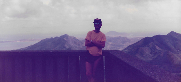
This view was taken from part way down the mountains to Kaneohe from the overlook. I had not intended for the mountains to be so dark, but just as I was taking the picture the sun was coming out and the light meter acted to keep the clouds in moderate light. We spent some time driving around this area, stopping for ice cream at Baskin-Robbins, and then returned to Honolulu via a different highway over the mountains- the Likelike Highway.
Back at the hotel it was sunny, so we went to the pool and the beach. After lying with me at the pool for a while, and walking along the beach that afternoon, Grant walked back down to the marina to look at some more boats while I snoozed in the sunshine. Late in the day, I went to do my jogging, following the normal route around Kapiolani Park that I have always taken all the times I have come to Hawaii. It is a nice run, about three or four miles, and brings me back along Ala Moana where I can stop and watch the bridge and chess players at the beach side pavilion, before heading back to the hotel for dinner with Grant. We ate at a number of different places while in Honolulu, but nothing terribly adventurous.
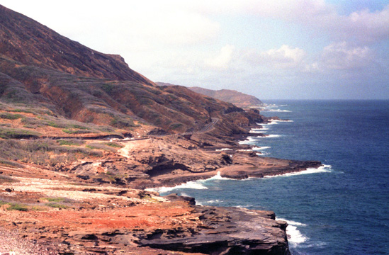
A Drive Up the Eastern Shore
|
 |
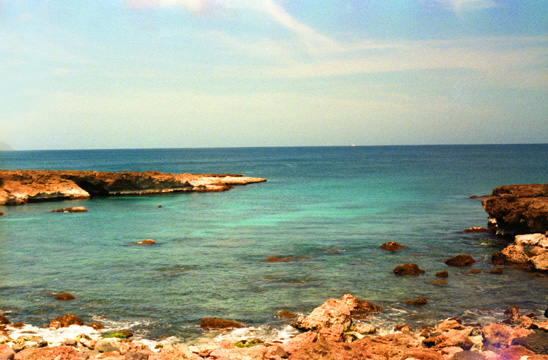
There is no swimming or surfing here, and the waters are too treacherous for sailing either. This part of the island, still showing the volcanic origin of Hawaii, is very scenic but not used for much. We continued east along the southern shore to reach one of Oahu's most famous natural attractions- the Blowhole.
|
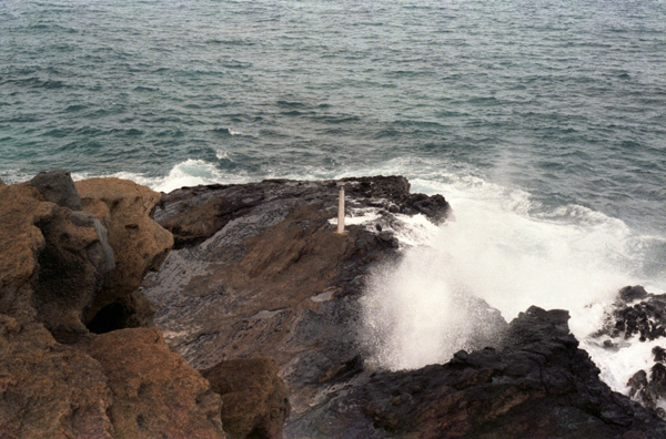
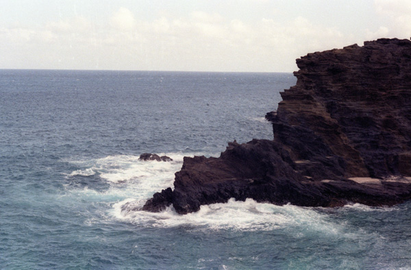
The Halona Blowhole formed thousands of years ago when numerous volcano vents were active on Oahu. Here, the Koko Volcano's lava flowed into the ocean at this point through a lava tube. The tube remained open underwater and over time part of it on land either wore away or collapsed. So, as underwater ocean waves enter the open tube, the water is forced in and then up through the landside hole forming a geyser. When the currents are aligned with the tube opening, the geyser can spray over thirty feet into the air.
In the picture at left, I have captured the water coming up through the blowhole. Further out on the rock is a USGS marker.
Sadly, but as you would expect, a number of tourists and locals have been injured here at the blowhole, and at least four deaths have occurred. There are numerous signs around and in the parking area warning visitors not to go out onto the rocks or get close to the geyser, but these are often not heeded.
|
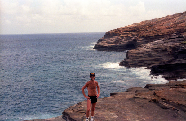
I walked around on the rock for a bit, and Grant came down to join me. We were, I think, about forty feet from the blowhole itself, and while we were there, almost all of the wave-caused geysers were only ten or fifteen feet high.
|
|
Whenever the highway got close to the mountains, the clouds that hung on them darkened the sky, but nearer the shore the day was bright and sunny. It was so bright that I was a little worried about Grant as he was already beginning to get quite a good bit of sun. I didn't want him to burn, as he is not used to locations like this.
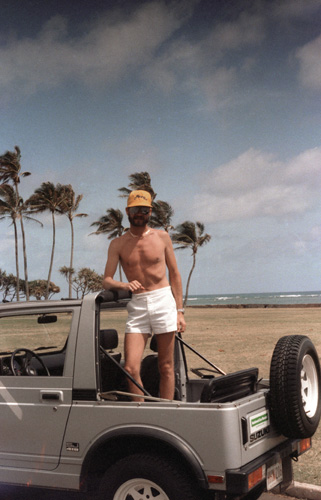
The drive up the highway was really neat, and riding in the open jeep gave us better views all around. The only other time I have driven a vehicle like this was in Korea, fifteen years ago, when I violated regulations and drove my own jeep out on payment runs to outlying bases along the DMZ.
|
|
As we continued along the Eastern side of the island, there were nice beaches alternating with rocky shores, although the island gives way to continuous beach about halfway up. It was particularly interesting to be standing on a nice beach and see these rock outcroppings offshore; they are remnants of the original lava flows.
The weather was uniformly good once we reached Punaluu Beach; from that point until we got back to Honolulu, we were never close enough to the mountains to come under the cloud cover surrounding them. I did also notice that as the day wore on, those clouds seemed to evaporate and the tops of the mountains in the Koolau Range became visible.
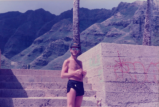 Here I am on the stairs leading down to the beach from the parking area at Punaluu Beach Park. |
 Taken at Punaluu Park, this view looks north towards Kahuku point. Kahuku point is the Northern tip of Oahu. |
This was a wonderful beach, and there were a number of other tourists and natives here, and the views looking towards Kahuku point were quite beautiful. We continued our drive all the way around the northern tip of Oahu and then southwest to the town of Haleiwa where we stopped for lunch. We turned South at Haleiwa to go down through the center of the island and back to Waikiki. The road does continue around the island, but there is a stretch at the northwestern corner of the island where the road is not paved, and we didn't want to chance getting in over our heads.
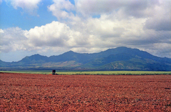 Here are some of the extensive pineapple fields in the center of Oahu. This picture looks West towards the Waianae Mountains, the other major mountain chain on Oahu; the pineapple plantations occupy the lush valley between the two. Here, the soil and rainfall are ideal for growing both pineapple and sugar cane. |
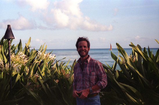 We got back late in the day, and I went to go jogging while Grant went to look at boats. We met back at the hotel, got cleaned up, and then went off to eat dinner. On the way I stopped in the small garden that separates the pool at the Sheraton from the public walkways along the beach. |
We didn't actually get onto a pineapple plantation, although we stopped at a roadside stand that was selling pineapple fresh from the fields. The taste of it is hard to describe; anything else seems watered down after you taste pineapple that has just been harvested. Just about every place you go to eat in Honolulu, and particularly the buffets (and there are a lot of them), fresh cut pineapple is available. It is really delicious- much, much different from what you get in cans or even what you get in supermarkets when you buy a whole pineapple.
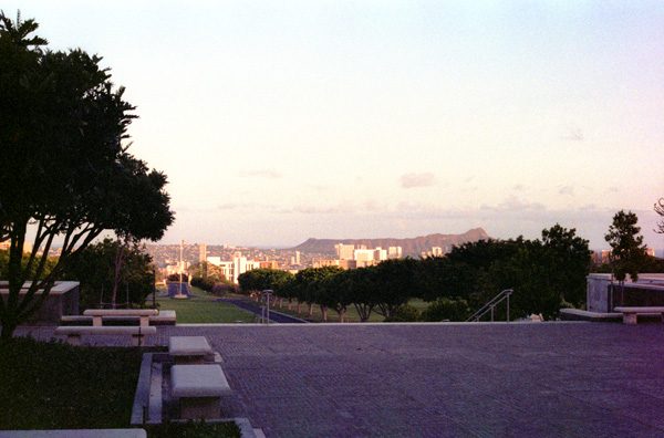
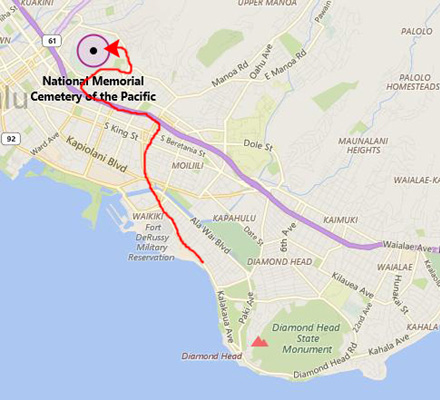
A Visit to the National Memorial Cemetery of the Pacific
 |
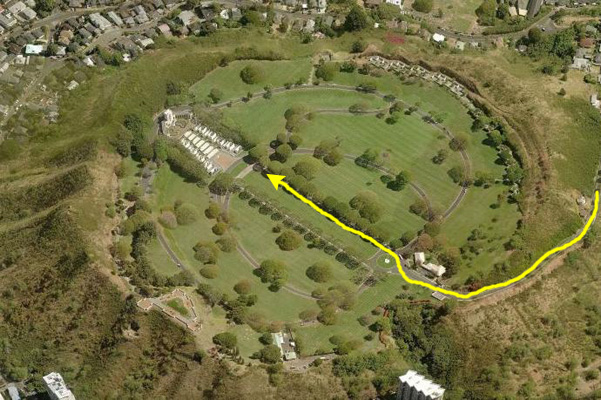 |
The Punchbowl is actually not far from Waikiki or from downtown Honolulu; it is just on the north side of the east-west expressway, up above some nice Honolulu neighborhoods, and reach via a circuitous route up through those neighborhoods. It is located in the crater of an extinct volcano.
|
The view of Honolulu at left was taken from the steps of the memorial itself. You can see part of the city of Honolulu and, although the picture is dark, if you look closely you can see the rows of graves here.
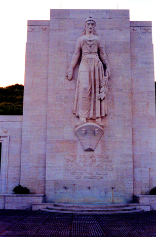
In February 1948, Congress approved funding and construction began on the national cemetery. In the years since the cemetery was dedicated in September, 1949, approximately 53,000 World War I, World War II, Korean War, and Vietnam War veterans and their dependents have been interred. Prior to the cemetery's opening, the remains of soldiers from locations around the Pacific Theater�including Guam, Wake Island, and Japanese POW camps� were transported to Hawaii and held for interment. The first interment was made January 4, 1949. The cemetery opened to the public on July 19, 1949, with services for five war dead: an unknown serviceman, two Marines, an Army lieutenant and one noted civilian war correspondent Ernie Pyle.
Initially, the graves at National Memorial Cemetery of the Pacific were marked with white wooden crosses and Stars of David� like the American cemeteries abroad� in preparation for the dedication ceremony on the fourth anniversary of V-J Day. Eventually, over 13,000 soldiers and sailors who died during World War II would be laid to rest in the Punchbowl. Despite the Army's extensive efforts to inform the public that the star- and cross-shaped grave markers were only temporary, an outcry arose in 1951 when permanent flat granite markers replaced them. The National Memorial Cemetery of the Pacific was the first such cemetery to install Bicentennial Medal of Honor headstones, the medal insignia being defined in gold leaf. On May 11, 1976, a total of 23 of these were placed on the graves of medal recipients, all but one of whom were killed in action.
|
The dedication stone at the base of staircase is engraved with the following words:
|
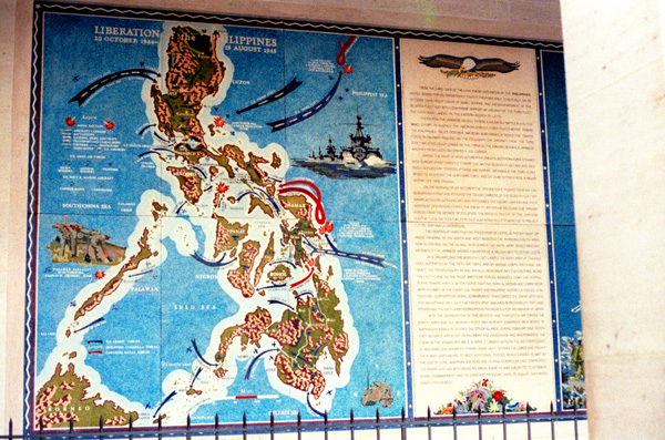
Therepun the Japanese decided to rish a major sea battle in a determined effort to destroy the American forces. Three fleets moved toward the Philippines. On 23 October American submarines attacked the center force in Palawan Passage. On the following day, aircraft from the Third Fleet inflicted heavy losses on this force in the Sibuyan Sea while Japanese aircraft from Luzon destroyed a U.S. carrier.
During the night of 24-25 October the enemy's southern force steamed into Surigao Strait directly toward the waiting Seventh Fleet and was decisively defeated by torpedo attacks and gunfire. Meanwhile, the third fleet moved to intercept the northern force and on 25-26 october won a major victory off Cape Engano. On the morning of 26 October the center force pushed through San Bernardino Strait and attacked the escort carriers of the Seventh Fleet off Samar. Although outnumbered and outgunned, the escort carriers and their screen of destroyers forced the enemy to withdraw, relieving our ground forces from the menace of isolation. The decisive defeat of the Japanese Fleet at these battles for Leyte Gulf also rendered it powerless to prevent future amphibious operations.
Two months of hard fighting freed most of Leyte, although many Japanese escaping to the north and west resisted the pursuing Eighth Army. Now in control on the island, in December the Sixth Army seized Mindoro. Meanwhile, the Japanese massed a quarter of a million men to defend Luzon.
On 9 January 1945, the Seventh Fleet landed the Sixth Army at Lingayen Gulf. Supported by the Fifth Air Force and by Marine Corps and naval aircraft, the troops pushed inland. Initially, resistance was encountered along the left flank; on the right American forces advanced down the central plains toward Manila. After fierce fighting, Manila, Bataan, and Corregidor were cleared of the enemy. U.S. Troops and Philippine guerrilla forces, continuously supported by aerial bombardment, then forced the enemy deep into the mountains. On 1 July, the Eighth Army assumed responsibility for land operations; the Sixth Army regrouped in preparation for an invasion of Japan.
With the cooperation of the Seventh and Thirteenth Air Forces, the Eighth Army and the Seventh Fleet had already embarked on a series of amphibious assaults to free the other islands. During February and March they secured airfields in Palawan and Zamoanga and overpowered the enemy in the Visayan Sea area. In April, they landed units on the southern coast of Mindanao and advanced toward Davao Gulf; others followed and fought their way northward to meet additional forces which landed in May. By the end of June, American soldiers and Filipino guerrillas had compressed the enemy into isolated mountain areas. There he was subjected to intensive aerial bombardment and to constant pressure until 15 August 1945 when hostilities ceased."
After the Punchbowl Cemetery, I took Grant over to Pearl Harbor to the Arizona Memorial. We took the boat out to the Memorial and Grant was able to see the ship just below the surface of the water. I have been here twice before, but it was Grant's first time, and I think he was impressed and moved.
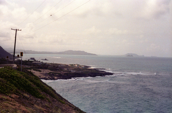
The West Coast of Oahu
 |
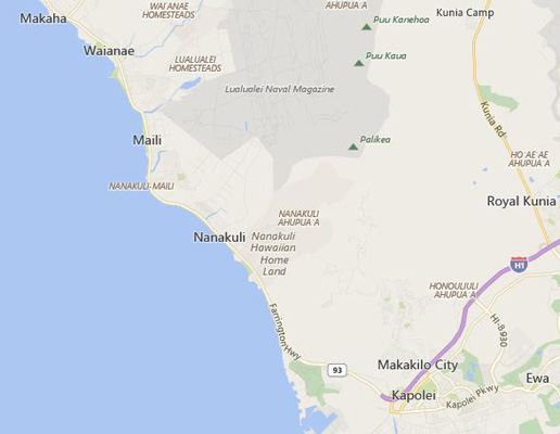 |
Today we just enjoyed the drive, and took only a few pictures. The drive here is shorter than on the east coast, and we could not go all the way around the northwest corner of the island for the road is not paved there. We drove over to Waianae, which is the last major town going North on the road along that side of the island, and then we drove back along the coast, stopping frequently to look at the coastline.
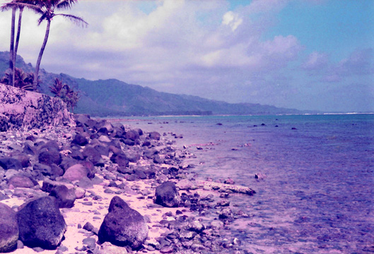 This is the northwest coast of Oahu; Grant had never seen any coastline like this before. He was as impressed with the color of the water as I was the first time I came to Hawaii on my way back from Korea. You can see how the winds are keeping the clouds up over the mountain peaks during the daytime. |
 Here is one of the many inlets along the northwest coast. We are near the small town of Nanakali as we move down the coast. We stopped at a number of little coves and bays just like this one. At a few of them, we found either tourists or locals having picnics or swimming in the water, which was nice and warm. |
 Further back along the highway this vista was particularly striking. The Northwest coast of Oahu. I find it interesting that the island can have so many kinds of coastline, but I suppose that is due to the vagaries of the ancient lava flows that built the island. |
 This was taken just at the point where the road turns inland to meet up with the expressway to Waipahu. Again, there are many little islands just off the coast here. |
The Honolulu Marina at Ali Wai Harbor
 |
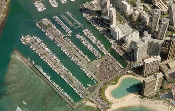 |
I know very little about boats, so I can't give really good descriptions and explanations of the ones we photographed, but I will do my best.
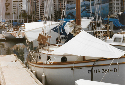
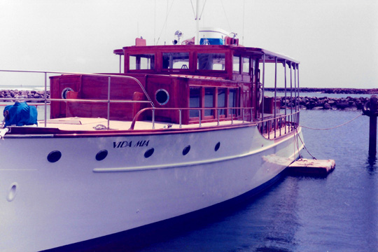 This is an old cabin cruiser in the marina; Grant and I had walked down here at midday before hitting the pool. This was the first day we found this marina, to which Grant would return a few times. |
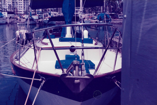 Obviously a large sailboat at the marina. I don't need to mention yet again how much Grant likes to walk around marinas on all of our trips. |
Grant just loves to look at the boats, meet some of the owners, and talk about the various points about each boat. With my limited knowledge, it is good that he finds someone occasionally who is willing to chat with him. I guess that is the way that sailors are. Of course, as soon as Grant saw the boats here, he wanted to move to Hawaii, but he always wants to move where boats are.
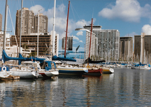
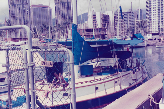 A sailboat at the Honolulu city marina. As I have mentioned before, the city of Honolulu is separated from the vacation area around Waikiki by about a mile or so. That is the actual business district of the city in the background. The hotel area is about a mile to the right out of the picture. |
 A liveaboard at the Honolulu marina. Walking from the hotels to the marina is easy, and you can basically walk along the shore to get there, which is lots nicer than walking along city streets. There is always a lot of construction in Hawaii, and there are a few new buildings since my last visit. |
It seemed as if there were quite a few larger sailboats that were being used as residences; they had all kinds of canopies and other attachments that Grant said meant that either someone lived aboard them or they were often taken on extended voyages- perhaps even across the ocean.
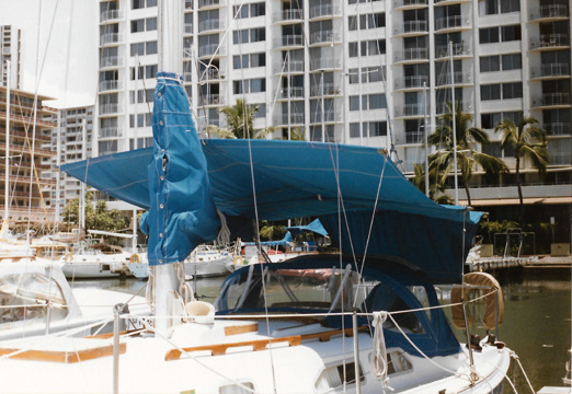 Here is another live-aboard sailboat with a new condominium in the background. |
 In this picture of the marina, the boats, and some of the new buildings in Honolulu you can also see the large "trompe d'oeil" mural painted on the side of another building. It makes it look as if a building beyond it is floating in the air. |
There seemed to be many more sailboats here than there were powerboats, but I am not exactly sure why that should be true. It might be that there would be little use for smaller power boats as they would have to go immediately out into the ocean; there were some larger yachts, though, but not as many as I thought there might be.
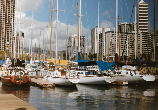 On this beautiful day, here are more sailboats at the marina and the ity for a backdrop. |
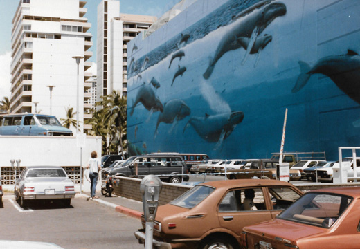 On our way back to the hotel, we passed by the painted building seen earlier. This is a close-up of the painting, which if of whales, the sea and the sky. |
Our Return to Dallas
You can use the links below to continue to another photo album page.
|
July 12-15, 1985: My Sister Judy Visits Dallas |
|
January 18-21, 1985: We Move from Chicago to Dallas |
|
Return to the Index for 1985 |