|
June 30 - July 5, 1995: Summer Trip to New Mexico and Colorado |
|
April 23, 1995: Easter Party at Lowery and Ron's |
|
Return to the Index for 1995 |
For some time, Fred has been wanting to take me hiking at the Wichita Mountains. We have done a number of trips together already, and the hiking is something that Fred introduced me to that I very much enjoy. We have considered taking some of the other guys, off and on, and we had considered going with Mike Racke as well, but nothing seemed to work out, so we decided to just do it ourselves. The Wichita Mountains seems to be a "special place" for Fred, and I was looking forward to having him introduce me to it. The area, near Lawton, Oklahoma, is actually a National Wildlife Refuge, not a National Park.
Getting to the Wichita Mountains National Wildlife Refuge
|
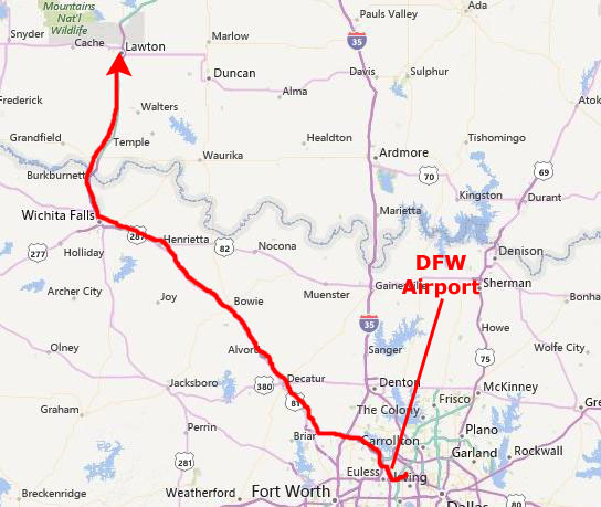
From the airport we took Texas highway 114 across the top of Ft. Worth to where it intersected with US Highway 287 to Wichita Falls. I had never taken Texas highway 114 that far before, but US Highway 287 was very familiar to us, we having used that route many times on our trips out west.
We had dinner, as usual, at the El Chico in Wichita Falls, and then headed up Interstate Highway 44 to Lawton.
We got there relatively early, it being only about fifty miles up the highway from Wichita Falls. We did not plan to camp on this trip, but we checked into a Holiday Inn in Lawton.
|
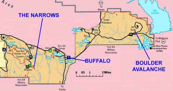
At right is a map of this area. You can see that Fort Sill and its accompanying military reservation occupies most of the land area north and northwest of Lawton. The National Wildlife Refuge is northwest of Fort Sill.
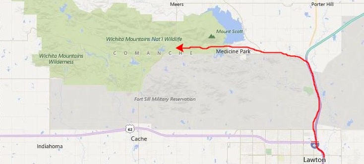
To get to the Refuge, you take I-44 north through Fort Sill and then, once you leave the military reservation you take Oklahoma Highway 49 to the west towards the town of Medicine Park. Just past that town you reach the boundary for the Refuge, although the actual visitor center (a small affair) is some miles into the park past Mt. Scott.
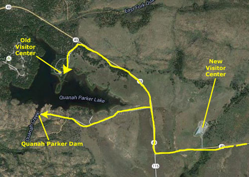
We passed Mt. Scott, which Fred said we should save for Sunday, and headed into the center of the Refuge. There is a major intersection there where Highway 49 turns north, and turning left will take you south down highway 115, out of the Refuge to the town of Cache, Oklahoma and another way back to Lawton. We turned north to make our first stop at the Refuge's Visitor Center. The center is (actually, was, as I write this in 2015) on the north shore of Lake Quanah Parker, which is close to the center of the tourist area of the Refuge.
|
 |
After spending some time in the Visitor Center getting current hiking information, we came back down Highway 49 and took the park road west along the south shore of the lake to the parking area for Quanah Parker Dam.
The Baldy Trail
|
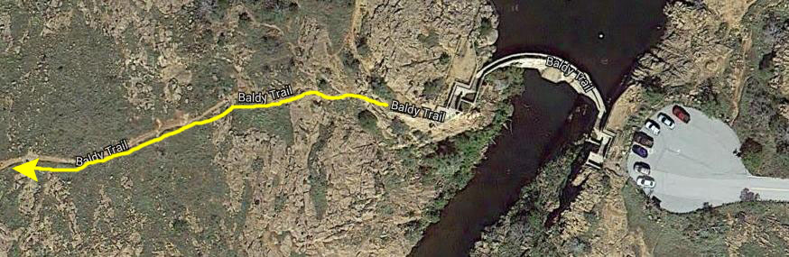
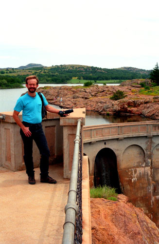
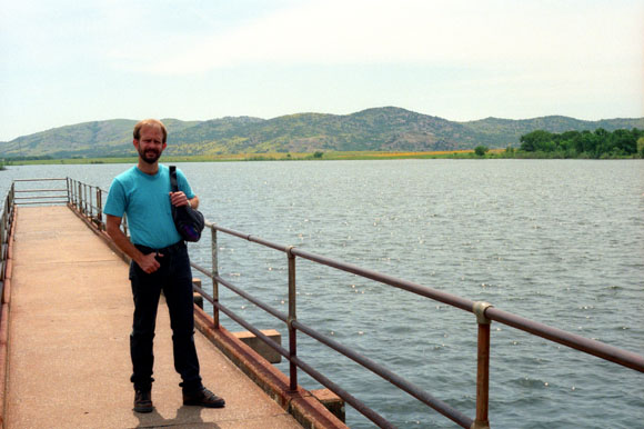
We are planning to do the one-mile hike to the top of Mt. Baldy (only about a 400-foot elevation gain from the parking area), but to get to the trail itself you have to go to the other side of the creek, and the best way to do that is to simply walk across the top of the dam.
So we walked down the short trail and stairs from the parking area and walked out onto and across the dam.
|
 |
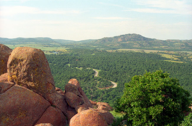
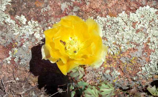
The countryside is typical of the area. There are some medium-size trees, but relatively few of them. Most of the ground is bare rock, except for the stands of trees and grass at the lower elevations where there is sufficient water to keep them going. We headed west from the dam, following the Baldy Trail. The trail wasn't always easy to find, but at least our objective was always in view. But if you focus only on the mountain west of you, you will miss what's right under your feet:
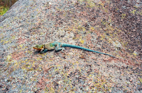 This lizard was very colorful, and with some care I was able to get fairly close to it. Note that it is shedding its skin- that is the light brown stuff that you can see around its neck and upper body. He is sitting on a big hunk of granite, and I am actually about three feet away. |
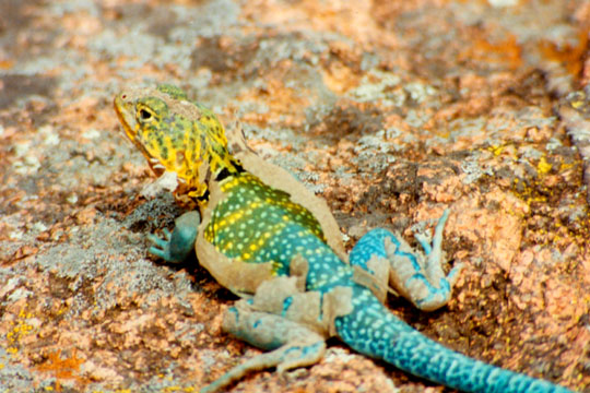 I took the camera, got a bit closer, and got this very good shot showing both the coloring on the lizard and also the skin he was shedding. Notice how the dots on the lizard's back are in straight lines of yellow. I wonder why it is colored the way it is. |
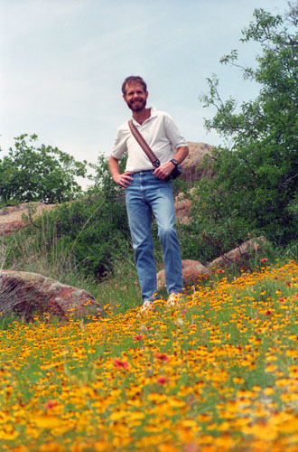
The hike was basically over bare earth and rock, with low grasses and flowers everywhere. Actually the trail was hard to find in spots, but being only 3/4 mile long, and with Mt. Baldy clearly in view, we couldn't really get lost.
|
 |
We enjoyed the trail up here; it is heavily used but well-cared for and there was no litter at all. With the flowers and cacti and the many colored lizards that we saw, it was an interesting half-hour walk to the top.
|
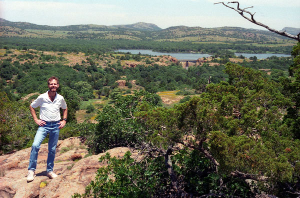
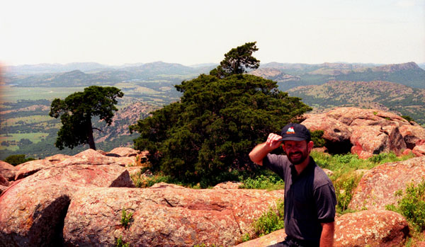
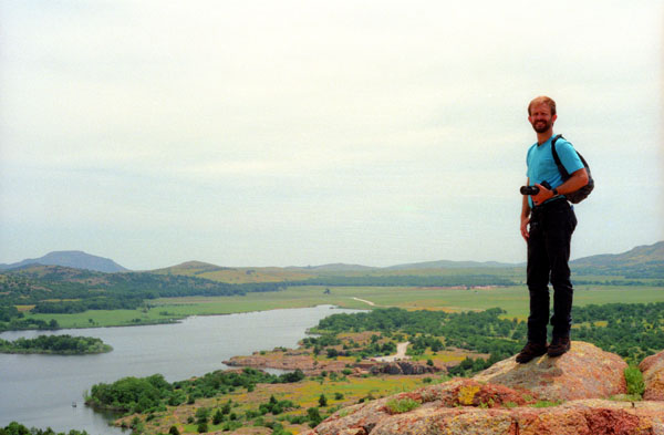
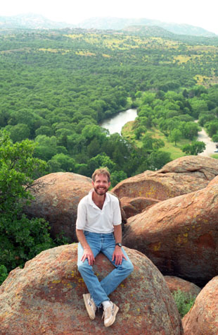
We planned on making a large circle around through the hills and back to the parking area, crossing the small stream considerably downstream from the dam, where it appeared that it was much shallower and drier. When you are on top of one of the hills, as we were in the last picture, it is easy to plot your route, but when you get down into the valleys, it is much harder to keep in the direction you want to go.
We didn't quite follow the route we planned, but the hiking was lots of fun nevertheless. We have left the first hill where we stopped (just over my head in this picture) and reached the top of another one (having basically followed a straight line between where we are now and the first stop we made). Quanah Parker Lake and the dam can be seen right in the center of the picture. And here, again, you can see the typical countryside within the park.
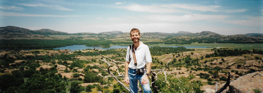
In addition to the normal picture above, left, Fred took a panoramic picture from this same spot:
 |
We continued on our cross-country hike, eventually making the big circle back to the parking area. It was fun to just light out cross-country, scrambling up and down the low hills.
|
 |
As we traversed the countryside, kind of following our noses back to the parking area, we went up and down a number of small hills, many of which consisted of bare boulders. We could only get our bearings when we were on top of one of these hills, so I'm sure that someone watching from above would think that we weren't following a very straight path back. We got a little off track at one point, and just had to follow our noses to get back to where the truck was parked, but after about three hours of hiking, we finally reached it.
|
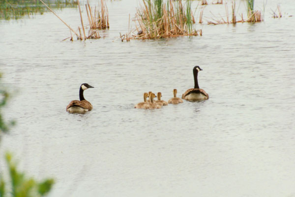
On the way out from the dam, you go right by the lake, and Fred thought this shot of the duck family was interesting. I don't know much about duck coloring, but I think I can tell who mom is.
We set our next objective a hike to a waterfall and deep pool that Fred knew about, this hike beginning from a picnic area beyond the visitor center to the northwest.
The Wichita Mountains Buffalo Herd
|
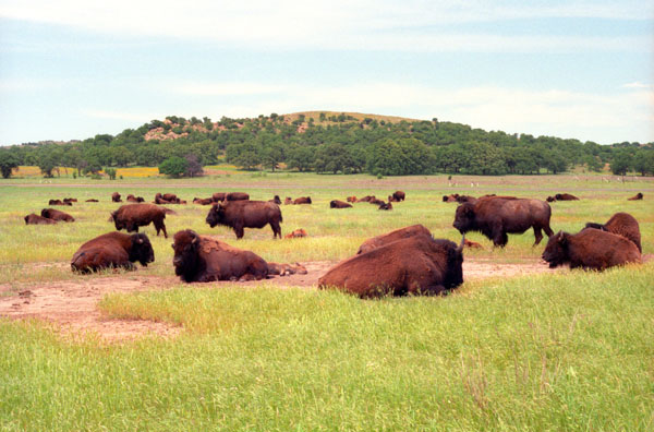
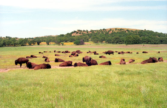
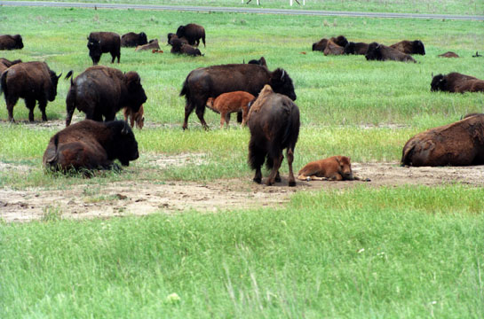
As you may already know, Fred is very interested in all things having to do with buffalo, and has quite a collection of buffalo-themed items- pictures, books, and all manner of other items with images of buffalo on them. I suppose that part of Fred's attraction to them is a sympathetic reaction to the way they were treated in the 1800s. From a distance, they are handsome animals. Fred took the picture at left from the road.
Seeing the buffalo so close was an unexpected treat. They must have wandered to this area after we went out to the dam three or four hours previously, because I am sure we would have noticed them as we passed. We took quite a few pictures of them, and the best of these are below:
 As Fred took this picture and we were going to try to get some other pictures from as close as possible. |
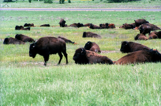 The buffalo are apparently putting on their summer coats, and shedding the long winter hair. |
The largest existing North American land mammal, American bison are members of the mammalian order Artiodactyla, family Bovidae. Bison bulls can weigh as much as 2,000 lbs and have heavy horns and a large hump of muscle which supports their enormous head and thick skull. They have a thick mass of fur on their heads and a heavy cape of fur even in the summer. This enhances their size and protects them when fighting.
 A Closer View |
 A Closer View |
I wanted to get closer to the herd to get some better pictures, so I did so very carefully. At the visitor center, we were cautioned to keep our distance, but I thought getting a bit closer would be safe enough. They seemed more concerned with eating, resting, and taking care of the newborn young calves that you can see sprinkled through the herd.
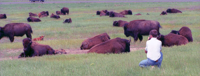 Me While Taking the Previous Shots |
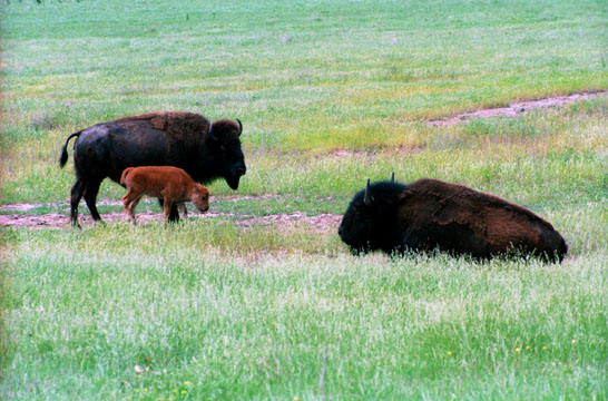
Cows weigh about half as much as bulls. Their horns are narrower and are slightly curved. They have smaller humps and a smoother summer coat. Both sexes possess true horns which are not shed. Mating occurs in June and July, with females giving birth to a single calf after a nine-and-one-half month gestation period. Calves are born from late March through May and are a bright rust red color for the first month or so. Cows are very protective of their young and can be even more dangerous than a bull when they have a calf at their side.
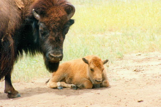 Female Buffalo and Calf This is what the Refuge is trying to do- repopulate the buffalo. There will never be millions of them again, but we found out that the herd here is prolific enough so that the herd can be culled periodically, and some animals sent elsewhere to begin building up a different herd. |
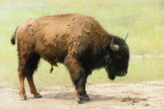 Male Buffalo I wanted to get at least one classic shot of a buffalo for Fred's collection of buffalo memorabilia, and I think this one fits the bill. It might have been better had the buffalo had his winter coat still on, for that is how most of use visualize them, but this will do. |
Bison calves change color, and, as they grow older, become dark brown like their parents. Normal bison life span is 10 to 20 years, but a few live to be older. Two bison cows are known to have had calves at 28 years of age. In most cases, the older bulls become solitary at about 12 years of age due to their inability to compete with younger animals.
If you are interested in buffalo, I can recommend that you read Chapter Three of James Michener's "Centennial", and specifically the section written from the point of view of the buffalo. It will almost be as if you are inside the mind of one of these magnificent animals.
After our encounter with the buffalo, we got in the truck and headed off northwest along the park road to our second hike- The Narrows. We got to the parking area for the hike to the forty foot pool and waterfall, and at that point we had some lunch before we started out.
Hiking Along the Narrows Trail
|
From a parking area, you can walk either along the rim of the canyon to the lake, or you can get down into the canyon itself, and walk or climb up along the watercourse to the lake. We did a bit of both.
We left Fred's truck in the parking area, and began the hike which first took us through a wooded area and some open grassland that led over and up to the rim of the small canyon.
|
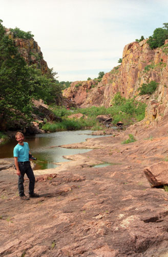
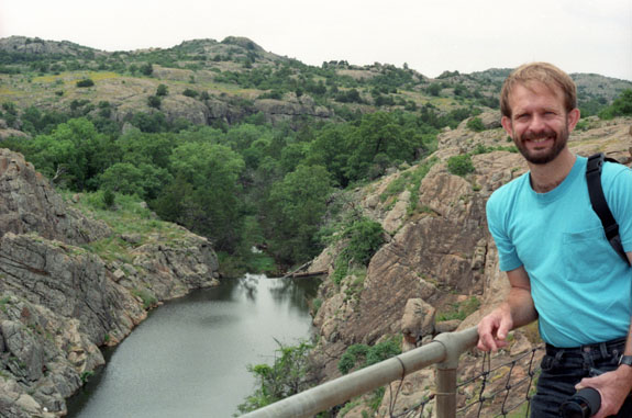
But after a short ways, the lake comes to an end and the canyon turns into a rocky affair with the small stream running down and over the rocks at the bottom. Here it is easy to hike along, and the first chance we got we scrambled down the hillside to the bottom and walked along there, on the easily walkable rocky floor of the small canyon. The picture at right is the view looking up the narrow canyon.
Although this is a popular hike, it seemed as if we had the area all to ourselves this afternoon, which was, of course, very nice, and it was very pleasant walking up the rocky canyon to the waterfall that Fred said was up ahead.
Being down here in the canyon was certainly a lot more fun that being up on the cliff. It was warmer up there, and the hike is basically just a dusty trail across open meadow until you come to a view of the Narrows Falls.
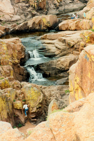 Narrows Falls |
(Picture at left) I was pleasantly surprised by the falls. Having been here before, Fred took a trail that led a good ways up the cliff wall so he could get pictures looking down. I am not actually climbing vertically, as it may appear, but just manoeuvering over a big boulder rather rather than going around, a way that was blocked by the water. The waterfalls are ahead of me, not above me as it may appear. The places where the water is falling give you a good indication of how high the drop really is. I think the people at the upper right (the only other hikers we saw) were actually only about twenty or thirty feet above the level where I was.
(Picture at right)
|
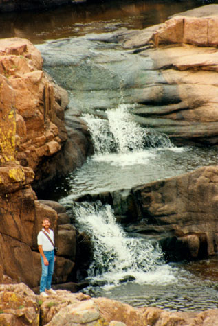 Narrows Falls |
After we finished looking around the waterfalls and the water pool, we did some further hiking up above that, and then went to the top of the cliffs and hiked along the trails that led back to where the truck was parked.
On Boulder Mountain
Clambering around and up the boulders, through stands of short trees and occasionally through underbrush was a great deal of fun, and the views were just spectacular on the way up. Here are some of them:
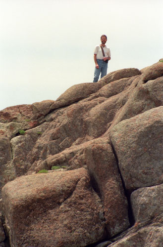
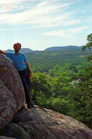
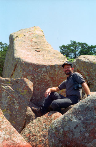
 Me on Boulder Mountain |
(Picture at left) The hiking was pretty easy, and the scenery was great. I liked the easy-to-climb boulders and rocks. We spent the better part of two hours having fun climbing the rocks and getting as high as we could. This is me near the top of this pile of large boulders and rocks. In the background is the road into the parking area from the highway.
(Picture at right)
|
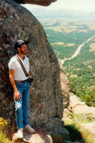
 Fred on Boulder Mountain |
 On Top of the World |
(Picture at left) In the background, you can see the lower portion of the river that flows through the canyon we were hiking in earlier, and just at the right you can see the parking area where the truck is. I was just having a great time, with all the easy hiking and stuff, and it was good exercise too, and I like that.
(Picture at right)
|
 An Unusual Rock Formation |
What a great experience Boulder Mountain turned out to be. Actually, everything we'd done today was really neat, and Fred tells me that there is lots more to do here, so a return trip is already in the cards.
|
This was the last view we took before we started down to the parking area. In that view, you can see the road back to the highway in the distance.
This had been a really great afternoon, but I was getting hungry and looking forward to dinner. We hiked back down to the truck, and then decided to take the back way out of the park, through Cache and back to Lawton.
The Longhorns
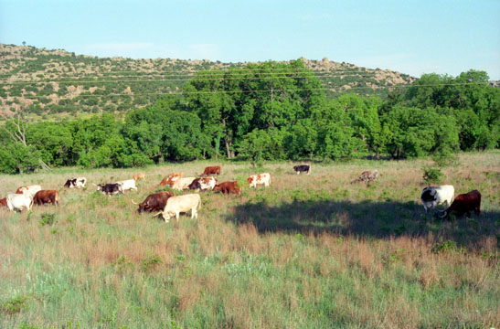 I had actually never seen Longhorn cattle up close; they were just moving along slowly, grazing on the grass. |
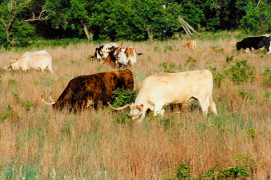 Fred had his zoom lens handy, so he took a closer picture of the two longhorns near the center of the wider-view picture that I took. |
Shortly after passing the Longhorns, we left the Refuge and returned to Lawton. We cleaned up and had dinner at a Chinese buffet, which was quite good and then went to the movies down the road from the hotel. We saw "While You Were Sleeping," which was just the right movie for the evening.
The Incredible Boulder Avalanche on Mt. Scott
|
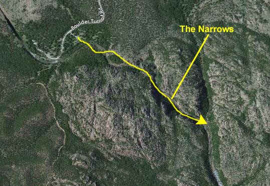
I have marked the Narrows Trail area where we were yesterday afternoon, as well as the spot where the buffalo were located when we photographed them.
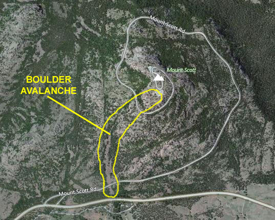
As you can see, Mt. Scott is at the eastern side of the Refuge, just off highway 49 west of Medicine Park and overlooking Lake Lawtonka.
On Sunday morning we got up and refilled the cooler, checked out of the hotel, had breakfast at the IHOP down the street, and headed off for Mt. Scott. Once again, we took I-44 north from Lawton and then turned of on Highway 49 towards the Refuge. We passed through Medicine Park, entered the Refuge and shortly were at the base of Mt. Scott.
|
The weather was quite good today, even a bit better than yesterday, and so it was ideal for ascending Mt. Scott. Hiking is allowed all over the mountain although there are no formal trails and the paved road is closed to pedestrians. Mount Scott was named in honor of General Winfield Scott. The most fun way to the top is found on the south side of the mountain. Just a few hundred yards from the beginning of the spiral road to the top is the lower portion of what is locally known as The Boulder Avalanche.
I suppose the most folks take the spiral auto road from Highway 49 to the top of Mt. Scott, but Fred told me that there was a much better way (and by "better" he meant "more strenuous and more fun") to get to the top. When we parked the car in a small parking area off Highway 49 and walked a hundred feet up the spiral road to come to the base of the Boulder Avalanche, I understood exactly what he meant.
|
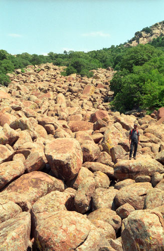
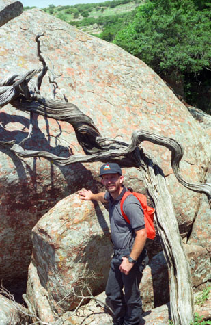
The avalanche may well have followed the course of a small stream flowing down from the top of the mountain; as you climb up, you can sometimes hear water way beneath your feet. Boulder-hopping up and down Mt. Scott is one of our favorite things to do; this will be the second or third time we've been here and done this. Hopping from one to another requires a bit of care, but is not particularly dangerous (although people have lost their footing and fallen into spaces between the boulders).
I learned quickly that you don't want to be carrying something; both hands are sometimes needed to climb up the rocks. So Fred had his backpack and I slung my camera around behind me. Even so, there was one time when it swung and hit a boulder (but fortunately not hard). You need both hands for balance and to block a possible fall should you lose that balance).
The boulder field heads straight up for quite a ways, and then curves around to the east to continue all the way to the top. At two points, it crosses the spiral road. It takes about ninety minutes to get to the top, and perhaps a little more to get down (since hopping DOWN onto boulders has to be done a bit more carefully so your forward momentum doesn't cause you to pitch forward and go further than you intended).
This was probably the most incredible hiking experience of the last few years with Fred. Certainly there have been more awesome views and more interesting trails, but for sheer enjoyment clambering up the boulder avalanche was in a class by itself. I could tell just ten minutes into our ascent that this would be one thing I would like to do again and again.
 Fred on the Boulder Avalanche |
(Picture at left) Climbing up the boulders was just as much fun, if not more, that the hikes of the previous day. Interesting enough so that you had to watch what you were doing, but not so strenuous that you got exhausted. There were innumerable nooks and crannies and tunnels that you could go through, and there was some sort of small underground stream running beneath the boulders that we could see occasionally and hear most of the time. This shot was taken about halfway up the boulder avalanche.
(Picture at right)
|
 Fred on the Boulder Avalanche |
We took our time and had a lot of fun. It took about 90 minutes to get all the way to the top of Mt. Scott.
|
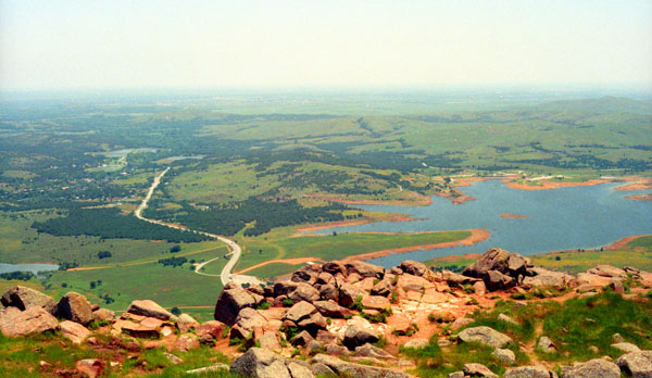
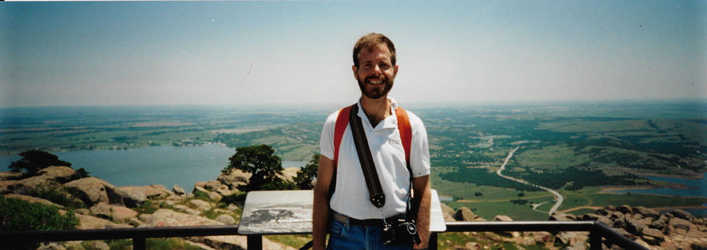
To reach the top you have to cross the road one time, and we did that, and then came out on the observation area at the top. There were about thirty people and twenty cars up there, and we spent a few minutes getting some pictures from the top. Here is a shot looking west out across the park. The lake is hidden, but you can see the mountain we hiked up yesterday in the background.
I suspect, since we did not see any other vehicles down at the base of the mountain where we left ours, that we were the only people here at the top who actually came up the avalanche. There were some older folks here for whom the hike up might have been inadvisable, but there were also quite a few people our age who missed out on an incredible experience.
|
That's not the lake from yesterday, but rather a new lake that has been created and is filling up. There seems to be new housing being built along its shores. And you can see Highway 49 that leads east to Interstate 44- the road back to Wichita Falls.
We thought about trying to hitch a ride down the mountain, but since we had plenty of time, we finally decided to hike down, which is just as much fun as coming up but a lot easier.
Before we headed down the mountain, though, Fred got out his panoramic camera to take a couple of pictures; he and I each took one and they are below:
 |
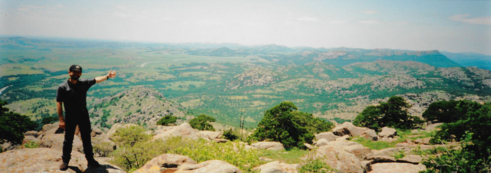 |
And on the way back down, Fred took another:
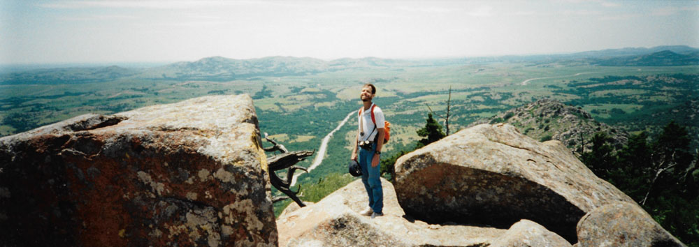 |
When we got back to the truck, we had something to drink and a snack and then headed off for home. I will remember the ascent and descent on the boulder avalanche permanently, and will look forward to coming back and doing it again.
The trip up to the Wichita Mountains makes a perfect weekend getaway, and I assume I will get another chance to come back here with Fred. I am already thinking about which of our friends might also enjoy it. Our return trip to DFW Airport was simply the trip up here in reverse. After dropping me at the airport, Fred headed directly to Prudence's house where I understand he got cleaned up and then went to dinner with her. I was actually at the airport so early that I got my car, drove home, took a shower, and then drove back to the airport.
NOTE:
While this paragraph has nothing to do with the trip to the Wichita Mountains, I just wanted to mention that the class in Cleveland was OK, although I didn't do any teaching but just observed the people who were. I've provided some input on the course materials, and progress has been made, but the two women developing it haven't done this sort of thing before, and it shows. We talk so much about excellence at E&Y that it puzzles me why the firm doesn't get more experienced people to do this kind of work. If I were in Cleveland, I certainly would have volunteered.
You can use the links below to continue to another photo album page.
|
June 30 - July 5, 1995: Summer Trip to New Mexico and Colorado |
|
April 23, 1995: Easter Party at Lowery and Ron's |
|
Return to the Index for 1995 |