|
July 3, 1995: Riding the Durango-Silverton Narrow Gauge Railway |
|
Return to the Index for Our Western Trip |
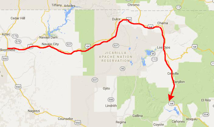
When we got up in the morning, the weather was beautiful. We checked out of the motel, put some gas in the truck, had a donut for breakfast, and then drove back east along US Highway 64 towards Chama, New Mexico.
|
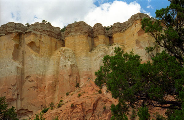
About 40 miles south of Chama, we came to Echo Amphitheatre, one of the places on our list of potential stops today.
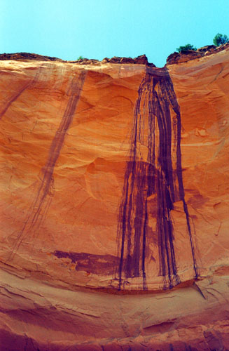
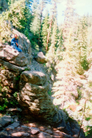
Echo Amphitheatre
|
Three years later, when the Navajo were being forced on the "Long Walk" to Bosque Redondo by the U.S. Army, ten Navajo men were killed at the top of the amphitheater in retribution for the earlier deaths. Once again, blood spilled down the walls of the amphitheater. The blood seeped into the pores of the rock and dried and supposedly is still visible today. It is said that in the echoes returned from the cliff's walls one can hear the anguished cries of the dead.
We turned off US Highway 84 right into the parking area for the Echo Amphitheatre campground, picnic area and hike. We parked and then walked the short trail to the Amphitheatre.
|
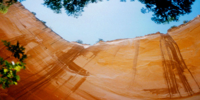 |
Fred took the picture above of the actual echoing rocks with his wider-angle lens, and this gives a better idea of the actual arc of the rocks that causes the echoes.
This area wasn't very big; there were perhaps four campsites and about the same number of little picnic areas. The trail to the amphitheatre was only a few hundred feet, and there was an explanatory sign just before we reached the cliffs.
|
|
All of the features we have seen in the West- the Grand Canyon, Zion, Bryce Canyon, Chaco Canyon, Sunset Crater, Arches, Bridges, and now Echo Amphitheatre- are tied into this grand story.
When we got back to the entrance to Echo Amphitheatre, we stopped to take a picture of ourselves. The picture was a bit fuzzy when we took it, and scanning it didn't help matters much. But you can have a look at anyway. The campground here had enough trees that camping would be OK, but there is not a lot to do, so I don't think we'll ever actually camp here. We did stop at one of the picnic areas for one of the campsites to have some lunch.
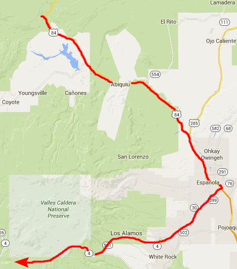
Los Alamos and Valle Grande
|
 |
In Los Alamos, we stopped at the Bradbury museum to look at the memorabilia left from the work done here on the Manhattan Project before and during World War II. We also stopped at the local Baskin-Robbins, before continuing along the highway to Valle Grande and the Santa Fe National Forest and Jemez Mountains. We had been along this road before, about two years ago, with Greg, the time we stayed in Santa Fe.
|
Spear points dating to 11,000 years ago have been discovered in the caldera, and several Native American tribes frequented the area, hunting and gathering obsidian. Spanish and later Mexican settlers as well as the Navajo and other tribes clashed here in the caldera, and it was one backdrop for the Indian Wars after the United States acquired New Mexico as part of the Treaty of Guadalupe Hidalgo in 1848. Around the same time, the commercial use of the caldera for ranching and logging began.
The caldera became part of the Baca Ranch in 1876, and later went through a series of owners. Frank Bond, a businessman from Espańola, ran up to 30,000 sheep in the calderas in the 1930s, significantly overgrazing the land and causing damage from which the watersheds of the property are still recovering.
The Valles Caldera National Preserve was created as a result of legislation signed by President Clinton in 2000. The then current owners sold the entire surface estate of 95,000 acres and seven-eighths of the geothermal mineral estate to the federal government for $101 million. 5,000 acres, including the headwaters of Santa Clara Creek, were obtained by the Santa Clara Pueblo, which borders the property to the northeast. Finally, 300 southwest corner acres were ceded to Bandelier National Monument.
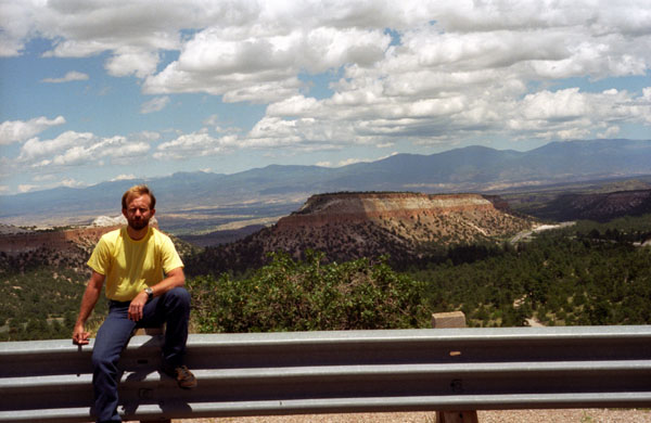
In addition to the picture I took of Valle Grande, Fred got out his panoramic camera, set it up on the tripod, and took a picture of the two of us will Valle Grande in the background:
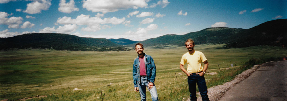 |
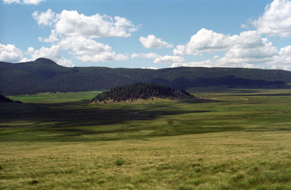
We've been here before, but it's worth a second look. The huge crater of an extinct volcano is about ten miles wide, and perspective can only be gained by realizing that the narrow white line just this side of the central peak is a road, and that there are buildings off to the right in that cleared area. The entire valley seems to be one gigantic meadow, and it is certainly beautiful.
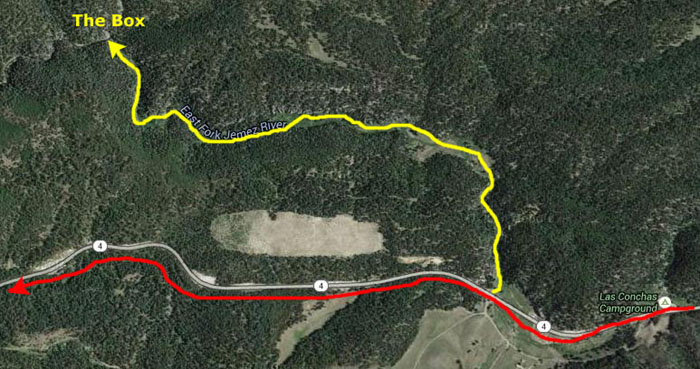
Hiking the East Fork of the Jemez River
|
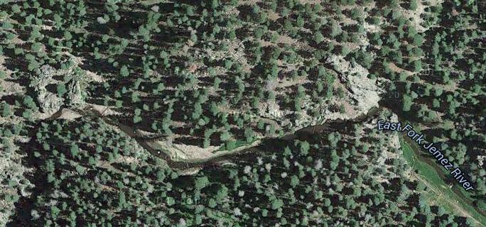
The actual trail is over five miles long just in this section of the Forest; the other end of it goes to the McCauley Hot Springs, but we are going to visit them later. Our little hiking guide suggested that for an out an back hike, one should start at the trailhead here and go about 1.5 miles to a place known as The Box.
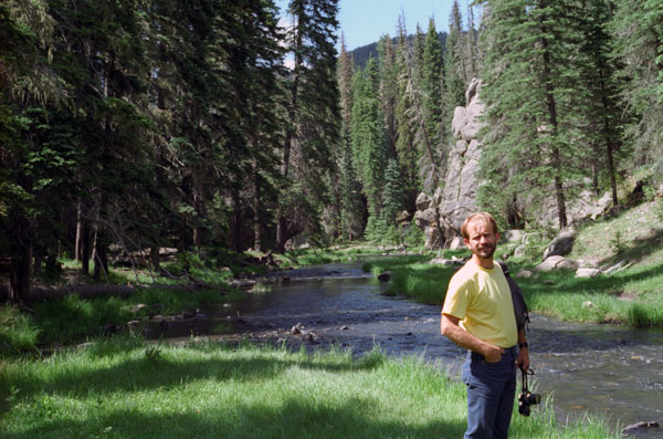
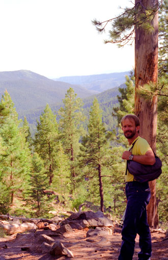
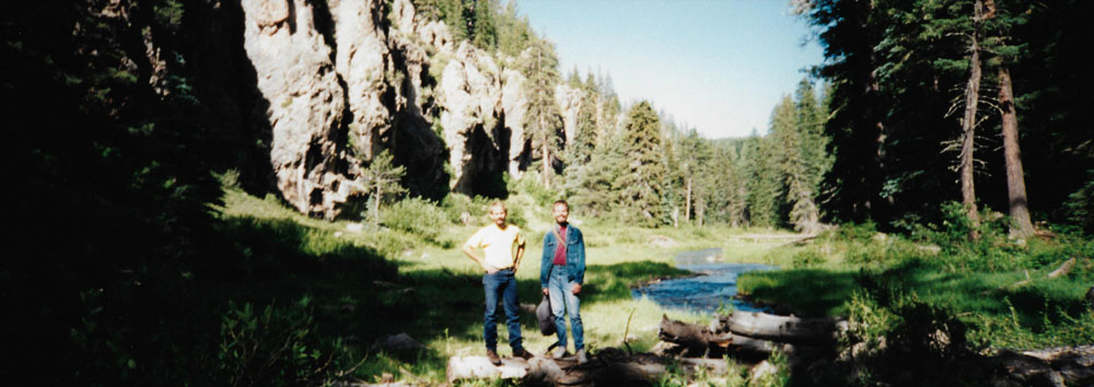
When we parked and started hiking, there were lots of people, and it was much like other trails we had followed in the past. But soon, the people disappeared, except for occasional hikers, and we were pretty much to ourselves. The road and the cars disappeared, as did the noises caused by them, and the scenery turned into the idyllic, pastoral landscape that you see here.
Right away, we realized that this was something special. If Walt Disney had poured billions into an effort to recreate the most beautiful, untouched mountain scenery he could, supplied just the right amount of water and just the right amount of meadow and forest, and put a path through it all that looked as if only you had been there, he could not have equaled this.
Shortly after we started out, we were out of sight of the road and parking area, and all we could hear was the low murmuring of the water and the sounds of the wind and the birds in the trees. Since we were temporarily by ourselves, Fred set up his tripod to take this panoramic picture:
 |
Of all the places Fred and I have been hiking in the last few years, I was struck by the thought that this was quite possibly the most beautiful, most idyllic walks we have taken. (I should point out that from my vantage point twenty years hence, I can look back and say that this hike, which we have repeated with other folks since, certainly ranks high for the kind of hike it is, but did not turn out to be the most beautiful that we have taken. That said, I should also say that almost all of the places we have been have had their own unique characteristics that make it hard to compare them- they are all so different. So perhaps I shouldn't try to inject a superlative here, but just say that if you ever have a chance to take this easy walk, you should do so.)
|
This picture gives you an excellent idea of the pastoral nature of this particular hike, although I am just sorry that I wasn't able to do a better job of scanning the print for inclusion here online. In any event, I suppose that part of the reason I was so enamored of this hike was due to the extreme contrast between the first hiking we did at Chaco Canyon and now this.
Here, everything is lush and green and there is plenty of water and lots of trees, while in Chaco, everything was stark and dry. It always makes me wonder why the Anasazi chose areas like Chaco to live when there were areas like this just a hundred miles or so away.
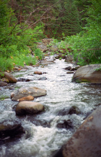
For the most part, the trail skirted the edge of the forest on either side of the East Fork which typically ran right through the middle of a meadow.
|
 |
The trail climbed slowly as we proceeded, but the going was very easy. It was just wonderful, being there essentially by ourselves, walking along in the cool morning with the sound of the water always accompanying us.
|
There wasn't anything about this trail or this hike that wasn't just perfect. We were having a wonderful time, just hiking along and talking quietly. I wish that everyone could know that such beautiful places exist, although if everyone experienced them, they would be destroyed utterly.
In our travels, we have found a hierarchy of tourists. For example, everyone goes to the Grand Canyon South Rim and, while beautiful, it is very commercialized. Fewer people go to the North Rim, or to Zion or Bryce, and, while there are lots of people there, they are more dedicated to the hiking and the natural beauty. Then you have places like Arches or Bridges National Parks. They are less traveled, and uncommercialized. You also see relatively few people there, compared to other attractions.
Then, there are places like this, that might only see a few hundred people a day, instead of thousands. These are the places that really rejuvenate the spirit, and we have had a chance to go to many of them.
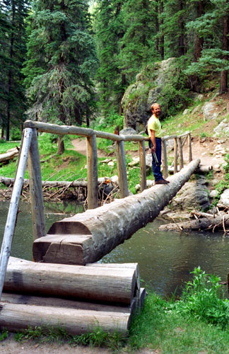
Our hike in to The Box was about a mile and a half and took more than an hour because we were walking slowly, crossing log bridge after log bridge and thoroughly enjoying the views and the day.
|
We spent maybe a half hour here at The Box simply reveling in the location. We climbed on the rocks and took pictures of this special place.
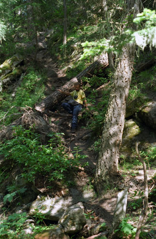 Fred Coming Down the Trail |
(Picture at left) We went a bit beyond the actual pool and waterfall to get a good view up the stream. Fred is taking it slowly to avoid losing his footing and falling down into the creek. I think his fear of heights was playing some small role here, too. I have come down to creekside, and am actually standing on a large rock out in the water to get this picture. I am continually impressed at the beauty of the forest land here, with the dappled afternoon sunshine.
(Picture at right)
|
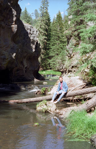 Me at The Box |
Here are the other two pictures that we took while relaxing at The Box this afternoon:
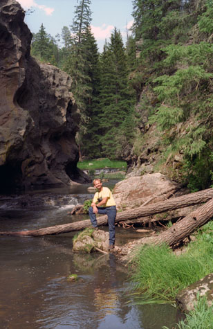 Fred by the East Fork of the Jemez River |
(Picture at left) Here, I have changed the exposure again, and, as a result, this picture of Fred is much better. I think this will turn out to be one of my favorite pictures of this trip. It's the kind of picture that you can enlarge and frame, and I might just do that for Fred as a gift. We spent some more time back here at the end of the trail, and Fred took some pictures as well.
(Picture at right)
|
 On the Hillside Above The Box |
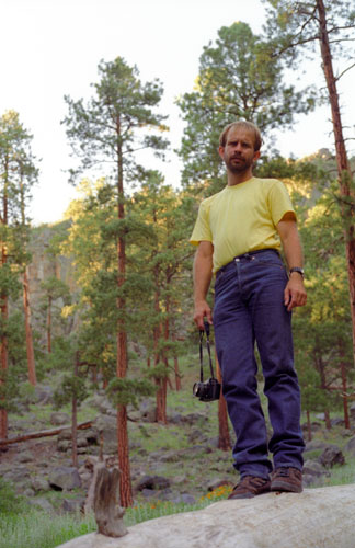
When we had enough time at The Box, we turned around and started hiking back to the roadway. The hike back was just as pleasant and just as restful. When we got back to the parking area, we stopped for a few minutes and watched some of the amateur rock climbers practicing their skills on a fairly sheer rock face near the highway before getting back in the truck and continuing on down New Mexico Highway 4 to Jemez Springs.
Our Hike to McCauley Warm Springs
|
|
As with some hikes that go through open forest, it was sometimes tricky to tell the trail from just bare areas under the tree canopy, and we occasionally wondered if we'd lost it. We did pass two groups of hikers returning from the springs who assured us that we were on the right trail. There are a number of trails that criss-cross this area, one of which leads back to the first hike we did today, and we didn't want to go off in the wrong direction.
The hike to the warm springs was about two and a half miles one way, and it took us about ninety minutes to make the trip, and were rewarded with a neat group of warm springs when we got there.
|
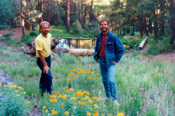
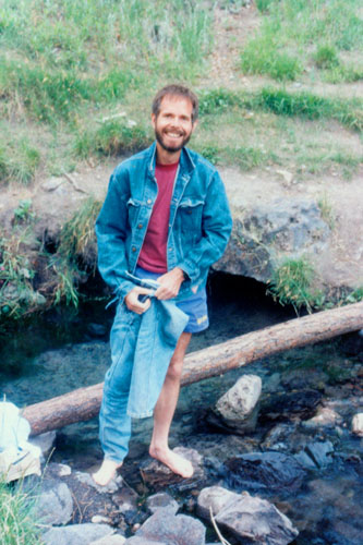
At left are Fred and I at the MacCauley Warm Springs. I may have called them "hot" springs earlier in the pages for this trip, but they actually weren't. They were just warm.
While we were getting this picture set up, Fred was walking around the area just above the springs and he found an actual pottery shard with painting on it and everything. It certainly looked authentic, and we are sure it is. I know you aren't supposed to remove anything from the area, but if we didn't, we were sure someone else would, and it wasn't like there was a whole field of artifacts that should remain undisturbed, so Fred is now in possession of an actual ancient Indian artifact. We looked for others, but were able to only find the one.
This was a neat area, made all the more interesting an restful as we were the only two hikers here. (Unusual, since this is the height of the summer, but perhaps people are doing other things on the Fourth of July.
|
We had planned to go swimming (and had brought bathing suits), expecting the water to be hot, but it was only warm, and the air was so chilly that I for one didn't relish the thought of getting out of the water and drying off in the cold air. So we settled to changing into shorts and going wading in the pool.
The water was coming up very gently, and the only indication that water was coming up at all were the small fountains of loose sand at the bottom of the pool where the water seeps were.
We walked around the area for a while, dipping out feet into the pools, and at one point just sat on rocks and dangled them in the water. This is a relatively popular hiking destination, and there were a good many old campfire sites around the pool. Actually, there were three or four pools, each on a different level, and all of them fed by the one set of springs.
We took some pictures around the warm springs, and I have put them below:
 At McCauley Warm Springs |
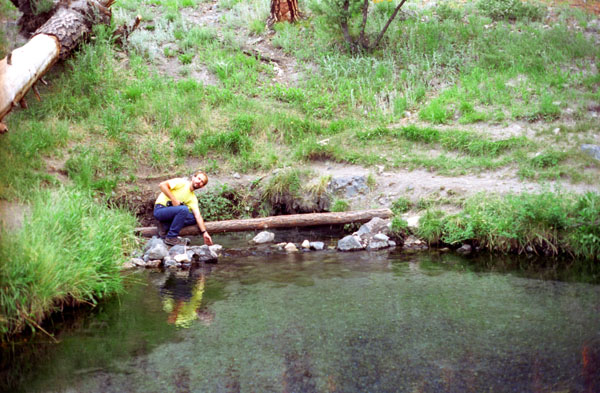
(Picture at left) Even though the water wasn't as warm as we had hoped (actually, Fred thought the springs would be more appropriately called, "tepid"), we decided to at least go wading, and for that we had brought our bathing suits. We sat on the log you see here, and dangled our feet in the water, and waded in that area behind me which is where the warm water is coming up through the rocks. Afterwards, we both had to put our jeans on again, and I am just in the process of doing that. It would have been fun to go swimming, but the water would have to have been warmer for that to be pleasant.
(Picture at right)
|
 Fred at McCauley Warm Springs |
 The Large Upper Pool |
(Picture at left) Someone has dammed up the outlet from the hot springs to form a pool about the size of one side of a tennis court. Below this, or behind me in this picture, the water flows down a short rocky hillside to another pool that has been created. By this time, the water is barely warm. There are lots of little fish, tetras, I think, that have been introduced into the pools by persons unknown.
(Picture at right)
|
 The Upper End of the Upper Pool |
Wandering around at the McCauley Warm Springs, particularly since we had it all to ourselves. But, eventually, we had to start out on the hour-long hike back.
|
We returned to the truck and continued down the highway to New Mexico Highway 44, and took that into Bernalillo, just north of Albuquerque. Along the way, we went through Jemez Pueblo, and it seemed as if everyone for miles around had gathered for the July 4th fireworks display.
We had hoped to get back to Albuquerque in time to go to some fireworks ourselves, but we were a bit late. We could see the displays in the distance as we entered Albuquerque. We had some trouble locating the La Quinta where we had reservations, so we just picked one on the north side of town. Since it was getting late, we went right out to eat. Lots of places had closed early for the holiday, and the only place we could find was an Olive Garden, where we had quite a good meal.
We returned to the hotel, got cleaned up, and then went to the local country/western-levi/leather bar (oddly enough, listed in the Yellow Pages). There was not much there to look at, although we did find the section of town where all the bars and bookstores are. We stayed for a while and then returned to the hotel for a good night's sleep.
The next day, we got up early and headed off for home. Most of the trip was on Interstate Highway 40, just retracing our steps through Amarillo and on through Wichita Falls and over to Sherman. We reached Sherman about eight o'clock, and so we stopped and had dinner at the El Chico's there. We did some shopping at the Albertson's, and then headed back to Fred's place in Van Alstyne. I spent the night, of course, and then headed home when Fred went to work the next morning.
This trip was just as much fun as all our previous trips have been, even counting the uncooperative weather on the train ride. At least that happened while we were riding the train rather than while we were hiking. We both had a lot of fun, and most of that was due to Fred's excellent planning. Even though I did most of the work making reservations and such, the ideas for what to do and where to stop were Fred's. We seem to work well that way, with Fred providing, from his experience and from reading his books, the ideas on what we could do, us talking about the various options and picking some, and then me making the arrangements. We plan on taking a trip to Arkansas again in the fall, so that will be the next thing we do together.
You can use the links below to continue to another photo album page.
|
July 3, 1995: Riding the Durango-Silverton Narrow Gauge Railway |
|
Return to the Index for Our Western Trip |