|
March 9, 1997: Lowery Evans' Birthday Party |
|
Return to the Index for 1996 |
During January, Fred and I talked about going back to Florida again in February. I think he really enjoyed it the last time, and so again he planned to take three vacation days and the weekend. I made airline reservations for a late flight on the 20th. Fred came down after work, we had a quick supper at home and then left for the airport, making our flight in plenty of time. I had booked a rental car with Value, the first time I had used them; getting the car was something of a hassle that late at night, but we finally got to the condo about one in the morning.
At Dania Beach State Park
|
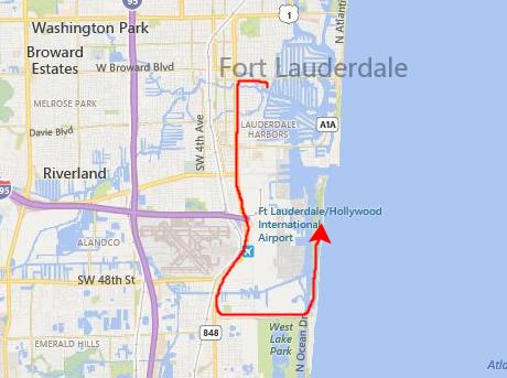
But to get there, we have to go north to Broward Boulevard, then west to Federal Highway (US 1) and then south- through the Kinney Tunnel and all the way past the airport. Down in the town of Dania, there is finally a road that leads back over to the beach and the continuation of A1A south to Miami.
The entrance to the State Park is just north of the point where the road east to the beach meets A1A. There was a small entrance fee, and then we drove a quarter mile or so north to find one of the parking lots for the beach.
As there is on Fort Lauderdale Beach, there is a section of Dania Beach where by tacit agreement gays tend to congregate. The section of beach is not "clothing optional," however; there is an actual "clothing optional" beach called Haulover Beach a mile or two further south in Hollywood.
|
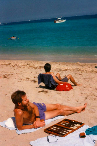
After a bit, I took out the backgammon game and continued the lessons I've been giving Fred.
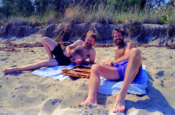 |
I have played for years, and I guess I would call myself a pretty good amateur (kind of the same ranking I give myself in Bridge). But there is a lot that is instinctive in both games once you have played them for a while, and trying to get that across to someone else who only plays for an hour or so a few times a year is difficult. I get into teaching mode, but Fred, sad to say, doesn't get into student mode, and we just move the men around the board. But still and all it is something to do.
|
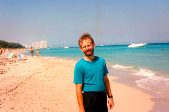
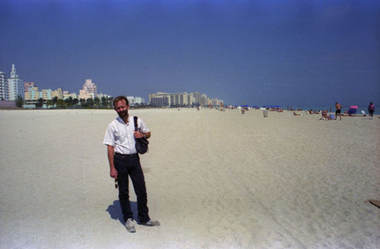
We also just walked around on the beach for a while, which is when I took the picture at left. The view looks north back towards Fort Lauderdale. Those tall buildings in the background are the condominiums that are on the north side of Everglades Inlet; near to them are the rocks that you can go sit on to watch the cruise ships go out of port on Saturdays for their week-long Caribbean cruises.
After a couple of hours at the beach, we returned to the car to head home. Fred had got quite a few pictures here last time, and you may already have seen them. That's one reason why there were so few today.
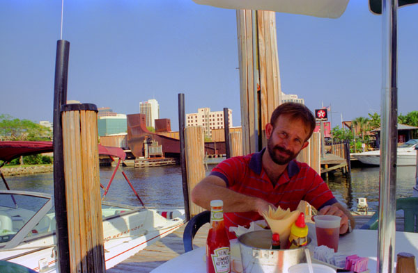
After we got back to the condo, we went and had some lunch, and after that, we went up to see Ty and Scott at their workroom. We returned to the condo through an area known as Victoria Park. This is the area south of Sunrise Blvd. and north of Broward, east of Federal Highway and west of the Las Olas Isles and the Intracoastal. We had our first dinner with Ty and Scott at Acapulco Lindo, the Mexican restaurant up in Wilton Manors.
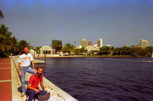
On the Riverwalk at Esplanade Park
|
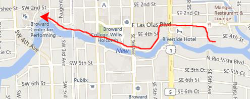 |
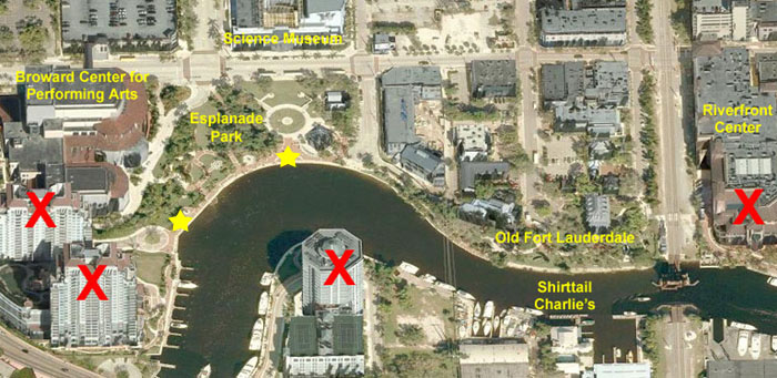
I have put a current aerial view of the performing arts center and the park above, left, and a little map showing our route from the condo to Esplanade Park above, right.
|
The interesting thing about this picture isn't what's in it, but rather what's not. Ten years after this picture was taken, the skyline behind Fred had changed radically. The new Riverfront Center shopping complex opened in 1998, and in the ensuing years a whole row of high-rise condos- some of the 40 stories tall- were built along the river on both sides of it. In addition, downtown added five or six tall office buildings. As you go through this photo album, you will see pictures of these new additions on the various pages devoted to our trips down here.
The City has also added a Riverwalk right along the north side of the river; it is a broad bricked walkway with nice plantings, benches, docks on the river, and entrances to and from the new buildings that have been built. If you have ever been to San Antonio, you can compare it to the Riverwalk there. As of this trip down there, the first section of it, in front of the performing arts center and across from the Science Museum is complete, and there are already plans for the two new condos that will be called The Symphony and built just south of the center. You can see them now on the aerial view, but I have put big red "X"s on them on the aerial view, since they haven't been built yet in 1996. I have also X'd out Riverfront Center, since it won't be built for another two or three years, and yet another high-rise condo building that will be built on the south side of the river across from the park.
|
As we came around by the Science Museum, we noticed that the IMAX theatre there was currently showing "The Living Sea", an IMAX film that we had not seen. The next showing would be in a little under an hour, so we bought tickets and then went back out to the Riverwalk and went down the walk to the little yellow star that I've put on the aerial view above. There, we took a picture looking back towards Esplanade Park.
This picture gives you a good idea of what the construction of the Riverwalk is like. It is mostly brick with borders (and we noticed that the City seems to be selling some of the bricks to individuals, for many of them are inscribed with various tributes to other people- from birthday wishes to wedding dates to dates of death to a great many that simply said "I Heart So-and-So". I guess it was a good way to raise at least some of the funds for the project.
We always enjoy IMAX presentations, and this one was no exception. Narrated by Meryl Streep, this one was quite good and, as usual, the photography was excellent. After the movie, we went back out to Esplanade Park and the New River. Using a tripod and the new 35mm lens that Fred got me for Christmas, I took two good pictures, and they are below:
 The Science Museum and Esplanade Park |
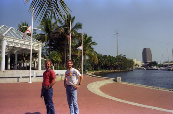 The View Along the River Towards Downtown |
Particularly in the right-hand picture above, you would not recognize the background were that same picture from 2015; there at least seven high-rise buildings now that were not built when that picture was taken.
|
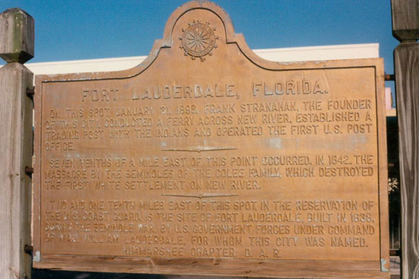
The marker reads:
|
On this spot, January 31, 1888, Frank Stranahan, the founder of this city, conducted a ferry across New River, established a trading post with the Indians and operated the first U.S. Post Office. Seven tenths of a mile east of this point occurred, in 1842, the massacre by the Seminoles of the Colee family, which destroyed the first white settlement on New River. Two and one tenth miles east of this spot, in the reservation of the U.S. Coast Guard, is the site of Fort Lauderdale, built in 1838, during the Seminole War, by U.S. Government forces under command of Jaf. William Lauderdale, for whom this city was named.
|
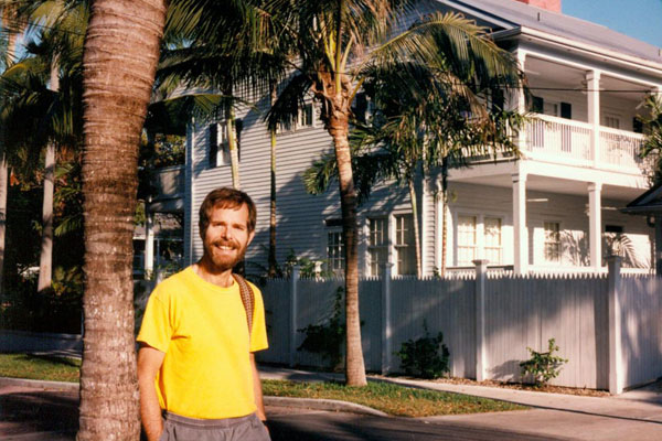
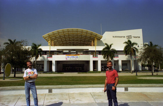
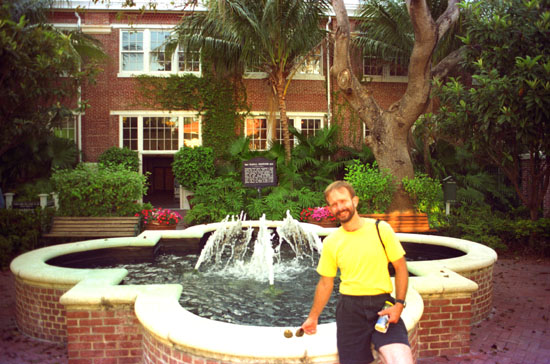
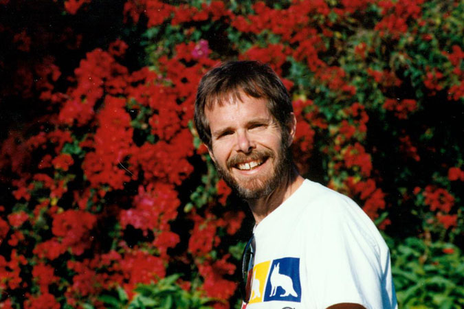
We came back to the condo to relax for a bit, and then went out to walk along Las Olas Boulevard and window-shop. There are lots of neat places along the street, many of them new, and it seems that each season there are quite a few different ones (although there are many that have remained unchanged since Grant and I first visited here). Fred was intrigued, as usual, by all the beautiful foliage that grows easily outside here, and had me take this particular shot of him and some of it. This is the building that was the original headquarters of Blockbuster Entertainment.
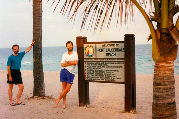
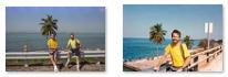
On the Fort Lauderdale Beach
|
Since I'd brought my camera and tripod along, I thought that I should take at least one picture while we were at the beach, so we posed next to one of the signs along the beach that list the various rules and regulations for its use.
That evening, I had Ty and Scott over for dinner, fixing a chicken dish that Grant had showed me how to make; it is pretty easy and it always get good reviews from those that we share it with. After dinner, the four of us played some Spades.
Tomorrow, we plan on driving down to Key West, a trip that Ty and Scott have made a number of times, so we discussed the route and the time it would take. They actually suggested going down as far as the first few of the keys, looking around, and then returning- all in the same day. Instead, though, we planned to get an early start and go all the way to Key West, walk around the town for a while, and then return- all in the same day.
After Ty and Scott left for home, we headed over to the Eagle for a drink, but it wasn't very crowded on Thursday night.
A Day Trip to Key West
|
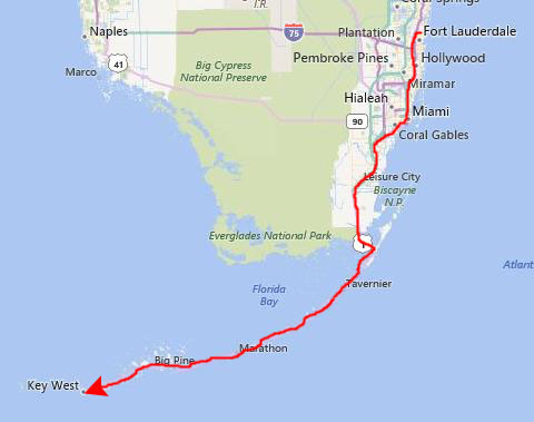
The part of US 1 that takes you from Miami, past Coral Gables and on south towards the Keys is a divided street, and although there are quite a few traffic lights, we were able to move fairly steadily, and by 945AM we were driving through the southern Everglades towards the first bridge out onto the Florida Keys.
That first bridge takes one onto the northernmost of the Florida Keys- Key Largo. Being the closest to the mainland and to Miami, it is also the most heavily populated (not counting Key West itself, of course). Key Largo is the beginning of what is called the Overseas Highway, an improved two-lane road that leapfrogs from key to key as it heads south/southwest. This drive is thought to be one of the most scenic in the country on every survey of such things, and I was pleased to be able to introduce Fred to it.
I have created a composite map of the Overseas Highway. To get it to fit into some reasonable space, I have rotated it and adjusted it so that I can put it in a scrollable window, and that scrollable window is below. Scroll all the way to the right and you will see US 1 as it comes off the mainland and onto Key Largo.
|
As you can see from the perspective, I have had to rotate sections of the map to level it out and fit it into a relatively thin window. Because of this it will appear as if we are driving pretty much east to west, but I think you can see from the high-level map of the Keys above that we were actually going as much south as we were west; generally, the Overseas Highway goes southwest from Key Largo to Key West.
|
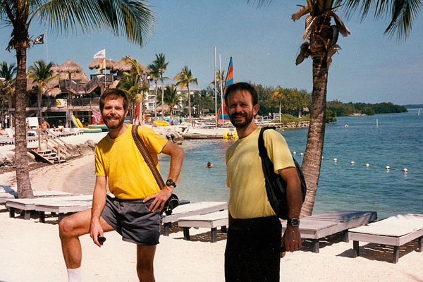
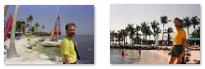
We were in the area between the hotel and the Atlantic side, where the is a beach and space for various other activities. The day was just beautiful- very pleasant for walking around. We took a couple more pictures here, and there are clickable thumbnails below for them:
 |
The Keys are quite long; it's about a hundred miles from where US Highway 1 crosses onto Key Largo from the mainland all the way down to Key West. So when you see pictures like the ones above, you aren't looking at any appreciable amount of the real estate of the Keys. But the area where we stopped on Plantation Key seemed very nice, and if I didn't have a place of my own in Ft. Lauderdale, this would be a nice place to vacation.
|
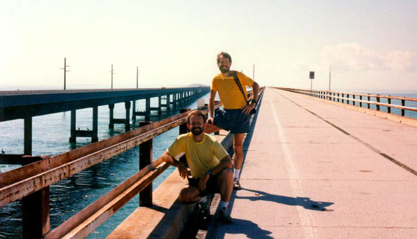
Islamorada is a major inlet through the keys for small boats wanting to go between the Atlantic Ocean and the Gulf of Mexico. The bridge is not high enough, though, for large ships, but then the water isn't very deep, either. There are some marked ship channels further down the Keys, and of course there is always the route around Key west. Here are clickable thumbnails for two more pictures we took by this stretch of the highway:
 |
At this point, we knew we would have enough time to make it all the way down to Key West; we hadn't been sure about the timing until we got down past Miami and to the less-populated area of the Keys. I was pleased about that because Fred had never been there and there was lots to do and see. So we headed on down US Highway 1, marveling at the scenery.
|
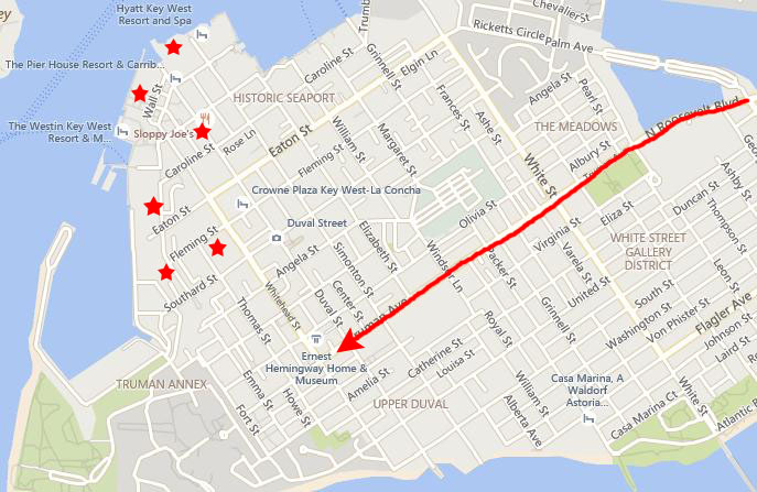
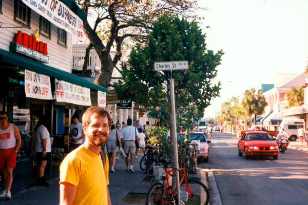
We found some street parking near that intersection and then walked down Duval Street to the Historic Seaport area. We had no real itinerary of places to go, although had we known, we might have visited the Hemingway House, the Southernmost Point in the United States and the Key West Lighthouse. All these were in the opposite direction from the way we walked.
I can point out from my vantage point in 2015 that in the ensuing years Fred and I would visit Key West a number of times by ourselves and with other friends, and would get to see all of those attractions more than once. Our visits would include a stop here on one of the first cruises that we took.
|
We headed down Duval Street toward the waterfront and the large hotels. When Fred saw this building, he wanted me to use the wide-angle lens to try to get it all in. I showed Fred where a couple of the bars were, and we also found two stores like the ones on Cedar Springs to go into. At one of them, we attracted some appreciative comments from a couple of guys running the store, and of course that always feels good.
The island of Key West began to appear on European maps and charts of the Caribbean about a century after Ponce de Leon discovered "La Florida" in 1513, although its name was Cayo Hueso, or Bone Key. Legend has it that Indian tribes forced south by European colonists and other Indians made a last stand on the key, a bloody battle that left sun-bleached bones on the beach there. England held the Keys until the end of the Revolutionary War, after which they were returned to Spain. During this time, until the first Americans settled there, Cubans fished there and Bahamians cut mahogany and other hardwoods, hunted turtles, and salvaged wrecks from the reefs.
In 1815, Spain deeded the island to Juan Pablo Salas, and when, in 1819, all of Florida was ceded to the United States, Salas sold it to John Simonton, an American businessman who understood the potential of Cayo Hueso's natural deep-water. By this time, the island had been renamed Key West, probably as a result of an English language distortion of the original Spanish name.
|
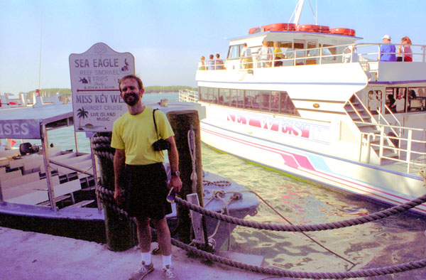
We continued walking around the waterfront looking at the people and the scenery. While we were walking around, I snapped a picture of some pelicans sitting on the pilings and floating in the water. We rounded the point at the southern end of the dock area, and Fred took a picture looking northwest of me at the Key West waterfront.
There were lots of restaurants, hotels, and shops along this stretch of restored waterfront, and in one broad area near Caroline Street there were even some street performers. I was trying to remember what this area had looked like eight years ago when I was here with Grant, and I am pretty sure that quite a bit of the restoration hadn't been done then.
|
 Fred at the Customs House (click on the sign behind Fred to read it) |
In 1823, Captain David Porter was sent to Key West to deal with the pirate problem and establish a naval base. He did so, but also had to deal with mosquitoes, yellow fever and a lack of fresh water. But Porter had the idea that the island and everyone on it were second to the needs of the Navy, so he decided that he was the supreme and only ruler. In effect, he declared martial law. Porter's reign lasted until a few wealthy citizens with connections in the nation's new capital manoeuvred to have him "recalled", and replaced with someone less tyrannical.
One problem with Key West was the reefs just seven miles offshore, reefs that caught many an inexperienced sea captain. As a result, wrecking and salvaging soon became the island's primary business and its citizenry became wealthy on the proceeds. Storehouses and chandleries abounded, and people came from all over to bid on the valuable salvaged items. Between 1828 and the 1850s, Key West was considered the richest city, per capita, in the United States. Other Key West industries included fishing, turtling and salt manufacturing, although the demand for Key West salt quickly diminished when plentiful salt mines were discovered on the mainland.
|
"Sin" was good for Key West. With Prohibition in the 1920s, smuggling of contraband beer and rum from Cuba and whiskey, rye and scotch from the British Isles via Nassau was easy and many Key West citizens became wealthy from the profits. In much the same way, marijuana smuggling in the 1960s through the early 1980s made many a Key West fortune, and when that trade declined, citizens used that money to buy land, build homes and start legitimate businesses.
Early on, Key West was a "destination". Being so far down the Keys, it was so isolated that it sometimes seemed as if it were a separate island nation. Harry Truman traveled to Key West before he ascended to the Presidency; when he did become President, he established what was called the "Winter White House" here, in an old home near the Customs House. In doing so he continued the tradition of Presidential retreats, like Warm Springs, Martha's Vineyard and the LBJ Ranch.
But with all that, Key West's primary industry turned out to be, as you might expect, tourism- today by far its biggest business. Millions of visitors from around the world travel here each year by plane, by cruise ship, or by car down the Overseas Highway to find paradise at the end of US 1; Fred and I were no exception. Just down the street from the Winter White House we ran across this large banyan tree with an incredible, above-ground root system. I suppose the tree has been here for ages, as the fence has been built around it. Fred was intrigued with it, and very much wanted a picture.
It was getting late in the afternoon, so we slowly walked back to the car and then headed back up US Highway 1 towards home. We stopped at one of the shell stores we'd passed on the way down so that Fred could get some souvenirs for the folks back home. We found a nice restaurant that had a rather good salad bar/buffet, so we stopped there for dinner. On the way back, we went through downtown Miami again so Fred could see the city at night. We connected up with Interstate 95 and were home by ten.
It being Friday night, we went out for a while before returning to the condo. On Saturday, we did some stuff with Ty and Scott, and just relaxed and had dinner at Peter Pan. We went out again in the evening, first with Ty and Scott and then later by ourselves.
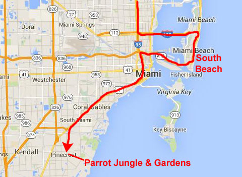
Miami's South Beach
|
South Beach, also nicknamed "SoBe", is located due east of Miami city proper between Biscayne Bay and the Atlantic Ocean. This area was the first section of Miami Beach to be developed, starting in the 1910s, thanks to the development efforts of Carl G. Fisher (for whom the exclusive Fisher Island is named) and John S. Collins, whose Collins Bridge provided the first vital land link between mainland Miami and the beaches (and for whom Collins Avenue, the main street of South Beach, is named). The area has gone through numerous artificial and natural changes over the years, including a booming regional economy, increased tourism, and the 1926 hurricane, which destroyed much of the area. In 1990, 35,000 people lived in South Beach.
South Beach started as farmland. In 1870, Henry and Charles Lum purchased 165 acres on the barrier island for coconut farming. Charles Lum built the first house on the beach in 1886. In 1894, the Lum brothers left the island, leaving control of the plantation to John Collins, who came to South Beach in 1888 to survey the land. He used the land for farming purposes, discovering fresh water and extending his parcel from the current 14th Street to today's 67th Street in 1907.
|
In 1912, the Lummus Brothers acquired 400 acres of Collins' land in an effort to build an oceanfront city of modest single family residences. In 1913, Collins started construction of a bridge from Miami to Miami Beach, but although some local residents invested in the bridge, he ran short of money before he could complete it. (You might notice the similarity between the last names of Henry and Charles Lum and the Lummus Brothers. I can't find any connection between the two, but it is interesting to also note that the Lum's Restaurant chain was also founded here in Miami Beach in 1956- by someone whose last name was NOT Lum. Whether the name was somehow an homage to any of these people is unknown. You may have eaten at a Lum's in your lifetime; the hot-dogs-steamed-in-beer chain was popular in the 1970s, and had 400 outlets at its height. Most locations were closed by 1985; only one is still in operation in Omaha.)
Millionaire entrepreneur Carl G. Fisher arrived in 1913; his vision was to establish South Beach as a successful city independent of Miami. Fisher loaned $50,000 to Collins for his bridge, which was completed in June, 1913. In 1915, the Town of Miami Beach was incorporated, and in 1920 the County Causeway (renamed MacArthur Causeway in 1942) was completed. The Lummus brothers sold their oceanfront property to the new city; that area is still known as Lummus Park.
|
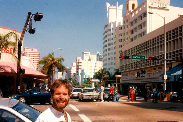
The land boom in Miami Beach began in 1920; the main streets of South Beach were quickly adapted to automobile traffic, and the population grew quickly. Millionaires like Harvey Firestone, J.C. Penney, and Harry C. Stutz built homes here, and even President Warren G. Harding stayed at the Flamingo Hotel during this time. The arcitectural revolution arrived in South beach in the 1930s. It brought Art Deco, Streamline Moderne, and Nautical Moderne architecture to the Beach. South Beach claims to be the world's largest collection of Streamline Moderne Art Deco architecture.
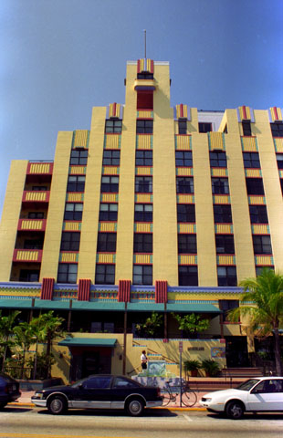
The Netherland was built in 1936 as an upscale apartment building, and it was a popular residence well into the 1950s. Like many areas of Miami Beach and South Beach, it suffered a decline for many years before being completely renovated in the early 1990s. It is nine stories tall and today offers 33 condominium residences with 1-3 bedrooms sized between 400-3,758 square feet. In 1996, larger units were selling for $750,000, although I can report that as of 2015, one 2800-square-foot unit was on the market for $3.2 million. We got closer to the building to photograph some of the neat outside decoration.
By 1940, the beach had a population of 28,000, and in the year before WWII, almost two million people visited South Beach. After the war, South Beach continued to be a popular tourist destination, and the 1950s saw the construction of new beachfront hotels and apartment buildings.
Beginning in the mid 1960s and continuing through the 1980s, South Beach became a retirement community and its hotels and apartment buildings filled with elderly people living on small, fixed incomes. Drug dealers moved in and used the area as a base for their illicit activities. Even so, the television show Miami Vice used South Beach as a backdrop for much of its filming because of the area's raw and unique visual beauty. The show had many scenes set in utterly run-down, almost ruin-like empty buildings. Sadly, not much set decoration had to be done because many buildings in South Beach really were in such poor condition at the time.
|
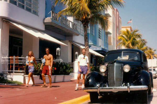
Walking along Ocean Boulevard, we walked in front of a number of colorful, Art Deco buildings, and seeing this old automobile parked at the curb made a very interesting picture. One might imagine it having been taken in the 1940s, were it not for me and the couple walking by on their way to the beach.
Fred is always interested in pictures of decorative elements, and in this one he focused on some wrought-iron gatework in front of an Ocean Boulevard building. Fred thought the pineapple motif (or pine cone motif, depending on your point of view) was interesting here, and I know he is looking for a ceramic sun face for his greenhouse- something like the gold leaf one shown here. The gated area led to a garden with lots of interesting foliage; we could see inside, but the gate was locked.
We enjoyed walking through South Beach. The morning was quite warm, almost hot, and there was not much of a breeze. I think Fred knew he was overdressed, but he really doesn't like to wear shorts. We did walk over to the beach at Lummus Park, just to see what it was like.
|
In both daytime and at nightfall, the South Beach section of Miami Beach is a major entertainment destination with hundreds of nightclubs, restaurants, boutiques and hotels. The area is popular with tourists from Europe, and this fact has resulted in South Beach's tolerance of topless sunbathing. Residents are from all around the world. Spanish has overtaken English as the most prevalent "first language"- the two accounting for 88% of residents. Portuguese, French and German bring the total to 95%.
After decades of economic and social decline, an influx of gay men and women moving to South Beach in the late-1980s to mid-1990s helped contribute to the area's revitalization. The newcomers purchased and restored dilapidated Art Deco hotels and clubs, started numerous businesses, and built political power in city and county government.
But as South Beach has become more popular as a national and international tourist destination, there have been occasional clashes between cultures and disputes about whether South Beach is as "gay friendly" as it once was.
Parrot Jungle and Gardens
|
Originally founded in 1936 by Franz & Louise Scherr, Parrot Jungle was one of the first tourist attractions established in the Miami area. The idea for Parrot Jungle began after Scherr, who owned and operated a feed and supply store in Homestead, Florida, another Miami suburb, became intrigued with the idea of building an attraction where birds would "fly free".
Scherr leased 22 acres of hammock land for an annual fee of $25 and began the development of his dream. Parrot Jungle was built as a winding nature trail dug through the coral rock and hammock land, indigenous to the area. All the natural plants were left undisturbed. The entrance was built on Red Road.
The attraction opened on December 20, 1936, to about 100 visitors. Each paid 25 cents admission to see and hear Scherr talk about his birds, trees and flowers. Since 1936, over a million people visited Parrot Jungle. Among its many famous visitors was Sir Winston Churchill, film director Steven Spielberg, and former US President Jimmy Carter.
The park evolved over the years under the direction of its current owners who purchased the park from the Scherr family in 1988. After Hurricane Andrew, devastated much of the park, the owners set their sights on continuing to develop the park in a more spacious location on Watson Island between Downtown Miami and South Beach. After construction was completed in 2003, the Watson Island location opened for business as Parrot Jungle Island.
When the Village of Pinecrest became aware of the plans underway to move the park to Watson Island, they decided to purchase the land on which the park was then located. They did so, and after the animals were moved to Watson Island, the Village began renovating the site to become a public park. In 2003 the Pinecrest Village Council dedicated Pinecrest Gardens and officially opened it to the public as the Village's newest municipal park, but without the animals that had made the park famous.
|
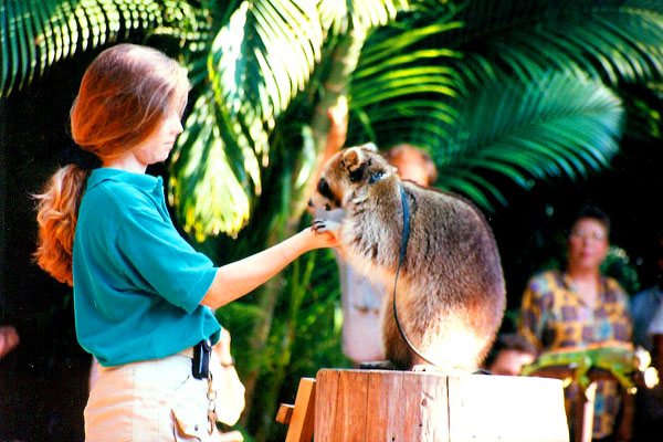
The theme park's landmark continues to be the Jungle Theater, an arena where visitors encounter wildlife from all over the world. We made an early stop at that enclosure where a program was going on about Florida mammals, and this trained raccoon was one of the stars of the show. After the show, you could get up close for pictures- if the animals were obliging. After getting back the picture at right, I was intrigued by the expression on the handler's face- as if her attentions were far, far away.
Near the entrance to the theater there was a small artificial pond stocked with colorful goldfish. I know he'd like to have something like this at home!
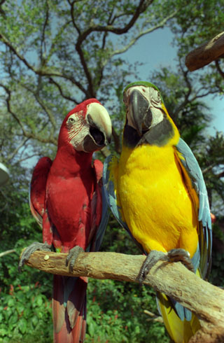
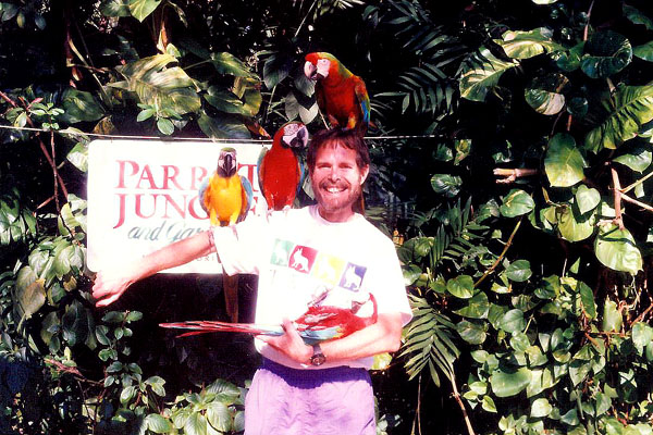
After the show, we went back to the main entrance to start a tour through the grounds. There are lots of parrots and other birds on perches here, and you can buy sunflower seeds to feed them. They'll peck at your fingers even if you aren't holding food, though. I thought this blue and yellow parrot was particularly pretty.
|
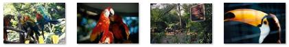
There were, of course, lots of birds, and there are some clickable thumbnails below for some of the other pictures we took of them:
 |
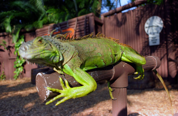
In addition to walking around, we watched a short program featuring trained birds and visited a small reptile house. Parrot Jungle seemed very much a small affair, with that family-run feel. I understand, though, that in the years after our visit, and particularly after the attraction moved over to Biscayne Bay, that the park expanded a great deal. They now have a 900-pound liger, a cross between a lion and a tiger, and an expanded exhibit of reptiles, penguins, flamingos and other animals at a new Serpentarium. They have more birds, too, including the Andean condor, cassowary (the only trained cassowary in the world), and king vulture, as well as a show featuring large cats and wildlife. We should visit the new location sometime.
|
What's sauce for the goose is sauce for the gander, I guess, so it was my turn next. The attendant did something a little different with me. After putting a couple of parrots on my shoulder and head, he asked me to crook my arm, and then he tapped one of the parrots on the head and put him in my arms as if he were a sleeping baby. I am sure the parrot had to be trained to do that. That's me at right cradling the "sleeping" parrot.
There were a couple of areas in the small park just for kids- including a little "petting zoo" where a few very tame animals subjected themselves to the tender ministrations of small children (under the watchful eye of the attendants and their parents, of course). There were also animal feedings, keeper talks and casual presentations are conducted throughout the park.
|
You can see both of those pictures at left.
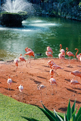
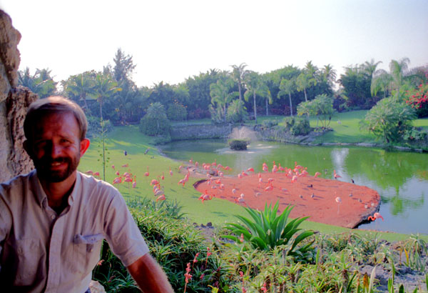
I also took one more picture of the flamingos from a different point on the observation perch, and you can have a look at that picture here.
Back at the entrance, we stopped to admire the colorful foliage and take a couple of pictures. You can have a look at them below:
 |
 |
We could have stayed longer, but since Fred's flight home was to leave at seven in the evening, so we headed back to Ft. Lauderdale. Back at the condo, we got Fred all packed (I was staying on until the following Friday) and we drove down to the Everglades Bar, which is on the way to the airport, where Ty and Scott had asked to meet us to say goodbye to Fred. After that short stop, I took Fred to the airport and put him on his flight. We had another good time, but trips with him are always enjoyable. I spent the next week working on my home page, using my laptop and Netscape, did my jogging, bummed around with Ty and Scott, and so on. I enjoy being in Ft. Lauderdale very much, and I enjoy being with Ty and Scott, too. I hope I am able to go back there frequently. I returned to Dallas on Friday, March 1st. Fred met me at the airport and we went to the Alamo for dinner. Another great trip was over.
You can use the links below to continue to another photo album page.
|
March 9, 1997: Lowery Evans' Birthday Party |
|
Return to the Index for 1996 |