|
July 6, 1996: Visiting Hoover Dam |
|
July 4, 1996: An Afternoon in Las Vegas |
|
Return to the Index for Our Las Vegas Trip |
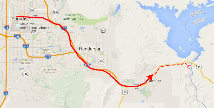
Today, our main activity will be to take a rafting trip down the Colorado River. This won't be whitewater rafting, but more of a touristy thing, as there are no rapids on the section of the Colorado that we'll be traversing.
Getting to the Colorado River
We chose a company called Black Canyon Adventures. The name comes from the name of the canyon below Hoover Dam. Most people think the Grand Canyon begins there, but in actuality it begins many miles downstream.
|
Right at 930AM, all the folks doing this particular tour boarded some buses and headed towards Hoover Dam. A few miles before the dam itself, the buses turned off onto an access road that led us down to the edge of the Colorado River, just below Hoover Dam.
|
In the upper corner of the aerial view, you can see a small portion of the new Mike O'Callaghan-Pat Tillman Memorial Bridge. It was not even on the drawing boards in 1996; planning for it will not begin until next year, and the bridge won't open to traffic until 2010. In 1996, the shortest route for auto traffic from Las Vegas to Phoenix was via a US Highway 93 that crossed the top of Hoover Dam. That route had several hairpin turns, was tricky to drive at night, and, because it crossed the top of Hoover Dam, cars slowed to view the dam and also avoid all the tourists walking on top of it. Traffic often came to a standstill in gridlock. The Hoover Dam Bypass Project envisioned rerouting that highway away from the dam entirely, straightening out the roadway and having it sweep over Black Canyon on an arched bridge some 1500 feet below the dam itself.
Planning began in 1997, and construction started on the approaches to the bridge in 2003, and construction of the bridge itself began in 2005. It opened five years later, and is credited with cutting between an hour and three hours off the trip from Vegas to Phoenix, depending on the season and time of day.
|
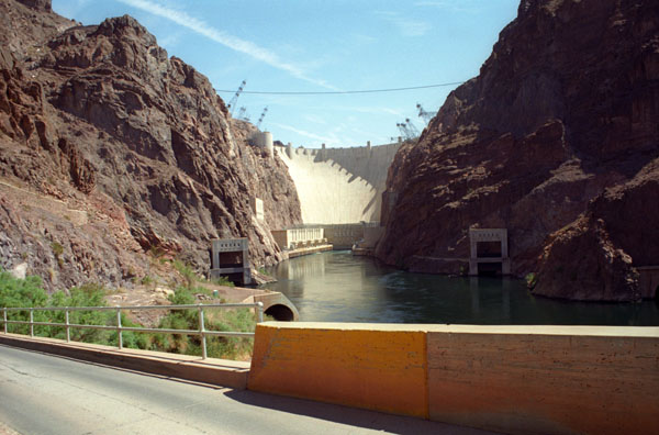
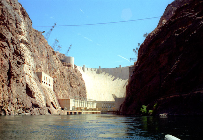
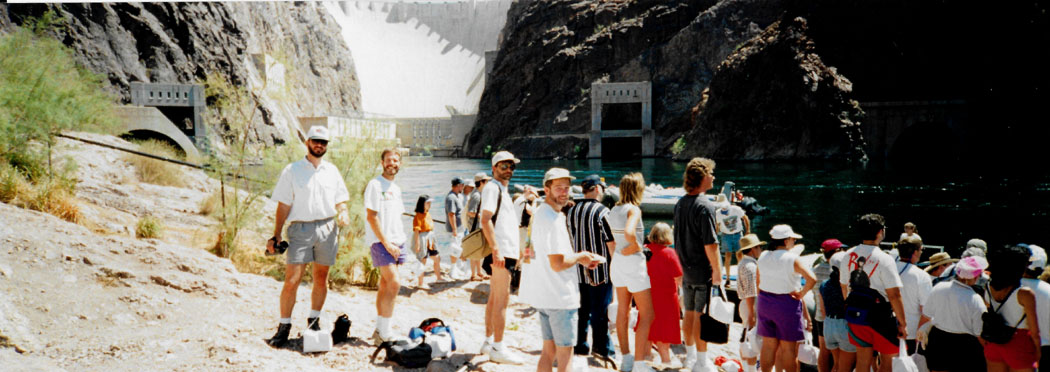
A much better view opened up when the bus made the final sharp turn to descend to the shore of the river. Here, the dam was ahead of us and we were only twenty or thirty feet above the river, and so we were looking at the dam straight on. The driver must have known that this was a good viewpoint, for he stopped the bus and allowed those who wanted a picture to get out and take one, which many people did. Our picture is at left.
The only way to get better views is to be on the water.
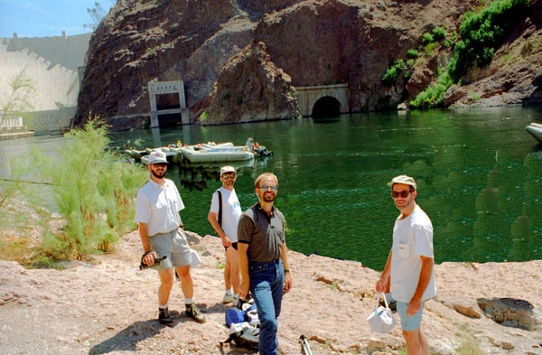
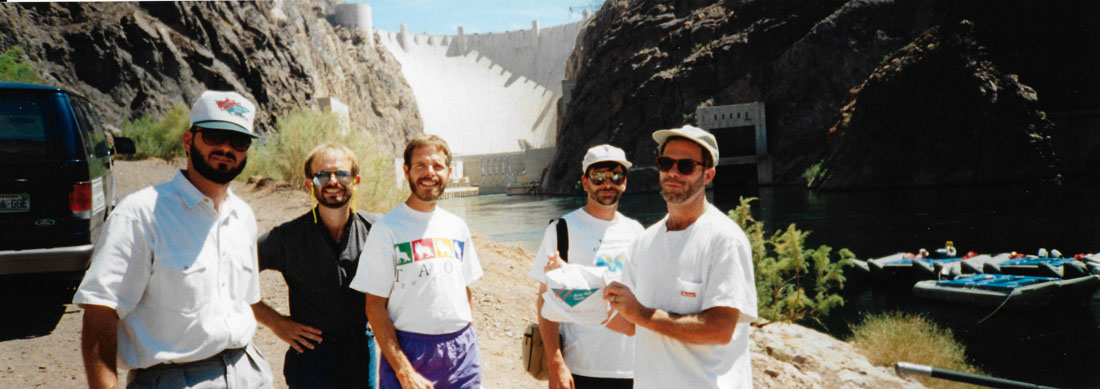
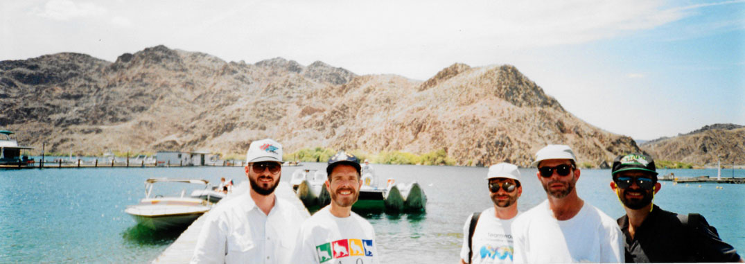
We hopped back on the bus and it took us the last quarter mile to a turnaround point. There, we disembarked and our guide had us all troop down the hill to the shore and the boats. As we were behind the crowd at that point, I prevailed on Fred to set up the tripod so we could take a panoramic picture of just the five of us:
 |
Then we, also, made our way down the hill, following our guide, to the raft we were to take.
|
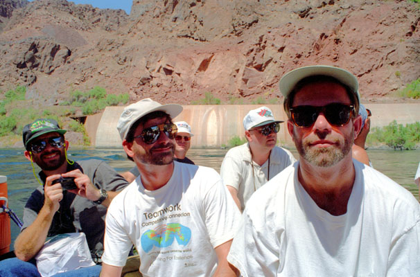
I took a picture of the reest of our group here, but of course we were just four guys in the middle of a large crowd- even though there was no one between Mike, Ron, Fred and Chris and I. There were, however, lots of people in the background, and most of them had their backs to me as they were listening to their guides or getting on their rafts. So many rear ends spoiled the shot then, but I can use techniques available now to do a quick and dirty job of taking them out, which is what I did for the picture at right. (I am actually pleased with the job of editing I did; you can see the unedited picture here.)
The Colorado River is in the background, and you can see two of the outlets below the dam. One of them was only used during construction, and is now only usable in emergencies. The one at the left is an active spillway, used when water must be let through the dam without running through the turbines. This was very infrequent in 1996, we learned the next day, for the lake seemed to fill about as fast as the water was used by the thirsty city of Las Vegas nearby.
Now, in 2015, it is a different matter. The overflow spillways have not been used in over 15 years, as the level of Lake Mead has declined steadily. Today, it is almost a hundred feet lower than its maximum level; rather than too much water, now the danger is too little- not just too little for the city of Las Vegas, but too little for the structure of the dam, as silt is building up against the dam at an alarming rate. The day was warm, but not too hot.
Down here at the bottom of the hill by the boats, we took the pictures above, and also another panoramic of the dam and the crowd of folks milling about waiting to board their respective rafts:
 |
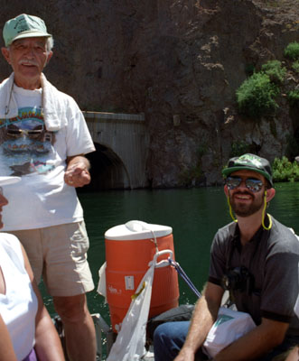
It was actually quite a production to get everyone into the proper raft. There were actually tours from three different outfitters here today, and so that made it critical that the right folks got into the right boats, and it took some time to accomplish this.
|
|
It took maybe thirty minutes for us all to get settled, go through a little safety talk, and push away from the "dock". We first idled out in the middle of the river while our guide talked about Hoover Dam itself. (I won't bother including some of that information today, because we will be taking an actual tour of the dam tomorrow.)
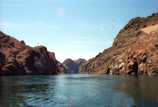
As you could see above, there were some pretty good views of Hoover dam from our vantage point down here on the shore of the Colorado River below the dam, but it wasn't until we got out on the water that the views got really good.
|
Hoover Dam is a power generation facility, of course, so I really can’t say that the electric wires spoil the view of the dam; that’s its purpose. It’s interesting, though, how the towers are set into concrete slabs, which are themselves at an angle. I understand that this reduces the tension on the towers themselves. The structures at the base of the dam are the generator houses; only the turbines and their associated equipment are actually inside the dam. We are still looking upriver, to the North.
We did take two more pictures of the dam, and in the second one you can see the other raft from our outfitter, and so you'll know what ours looked like. Click on the thumbnail images below to see these pictures:
 |
The rafts were pretty sturdy and fairly large, although we were a bit crowded in. There was sometimes a tendency for water to slosh into the raft, so the only precaution to take was to keep your feet and shoes out of the water. I preferred sitting astride one of the outside pontoons, as you could see people doing in our other raft, above.
|
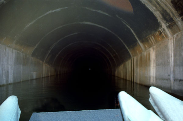
Next, the pilot of the raft took us partway inside one of the construction spillways at the dam so that our guides (a talkative bunch, as you would expect) could point out the peculiarities of its construction and tell us how it was used (to carry water around the construction site while the dam was being built). The far end of this tunnel terminates in a kind of natural cistern near the eastern end of the dam. When the dam was under construction, water flowed around the site into this cistern where this tunnel allowed it to continue downstream. The cistern is closed off, now, and only used in emergencies, when much water has to be released quickly. I think this tunnel, all by itself, would rank as an engineering marvel almost anyplace else.
We continued to circle around at idle so everyone could get all the pictures they wanted of Hoover Dam, and so the guides could continue to talk about it. We actually nosed into the bypass tunnel a couple of times so people at the back of the raft could get a good view inside.
|
To the right of that picture is a good one of Fred, Ron and Chris, and one of the water outlet tunnels that are part of the dam complex.
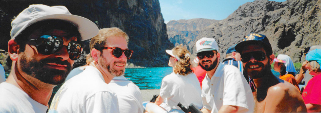
Fred took a picture of Mike Racke and myself looking at something up on the cliff. Mike uses a video camera, and he was busily filming whatever it was the guide was talking about. You can have a look at that picture here. From Hoover Dam, the rafts headed down the Colorado through the Black Canyon of the Colorado.
As we were going to head downstream now, I thought I would get Fred to take a panoramic picture looking in the direction we were going, so he obliged:
 |
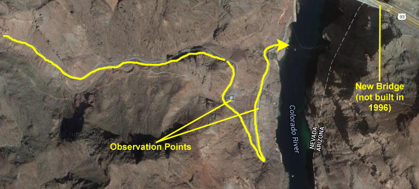
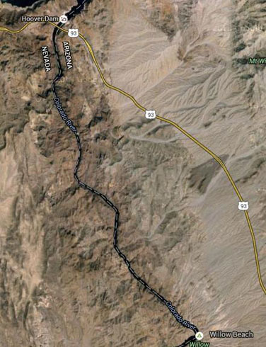
Before we get into the downstream trip and pictures, let's take a look at our route.
|
 |
From our docking there, the same buses that took us to the embarkation point will be waiting for us to take us back to US Highway 83, back north and across Hoover Dam, and back to Boulder City and the meeting point from this morning.
|
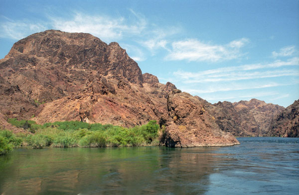
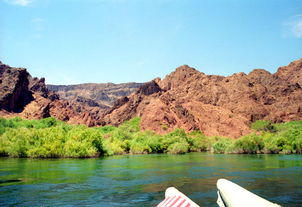
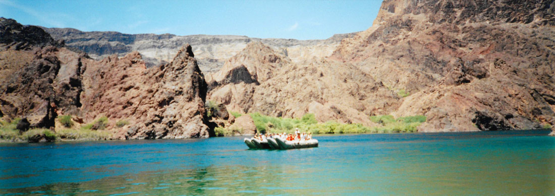
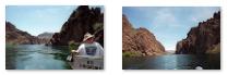
As we leisurely floated downstream, there were many opportunities to view the harsh vistas along the banks and ahead of us. There are clickable thumbnails below for two such vistas:
 |
The Black Canyon of the Colorado is the name given to the canyon on the Colorado River where Hoover Dam was built. The canyon is located on the river at the state line between Nevada and Arizona. The western wall of the gorge is in the El Dorado Mountains, and the eastern wall is in the Black Mountains of Arizona.
Of course, it was impossible to get a picture of our own raft from a distance, but there were two rafts from our outfitter that made their way downstream together, and here is what the other one looked like:
 |
The canyon was formed about 15 million years ago during the Miocene Basin and Range uplift. The Black Canyon gets its name from the black volcanic rocks that are found throughout the area. This was far from a whitewater rafting trip, although in some places, there were some gentle “rapids” that served to provide a small bit of excitement to an otherwise smooth trip.
|
One small canyon that splits from this canyon south of the Hoover Dam is Boy Scout Canyon; it has a geothermal spring in the back of it:
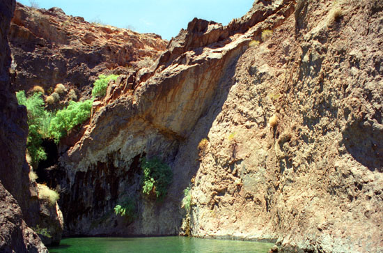 |
On the Arizona side of the river, there are several large hot springs that can be found by taking a trail north from a larger bay about 4 to 5 miles south of the Hoover Dam, but of course thatt's not part of the excursion.
|
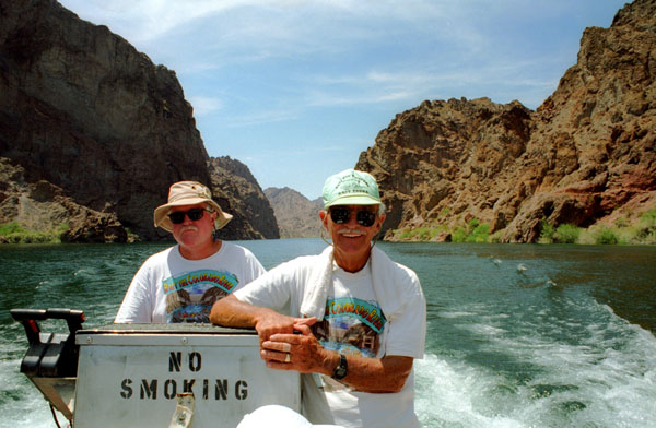
"Scotty" spent most of his time guiding the raft and sometimes bantering with the other; the taller man was the one who did most of the talking. Both of them seemed to be in their sixties; I can imagine that they are either retired or have done this for a long, long time. The river is certainly beautiful, but is certainly different from rivers back east, in that there is so little vegetation on either side.
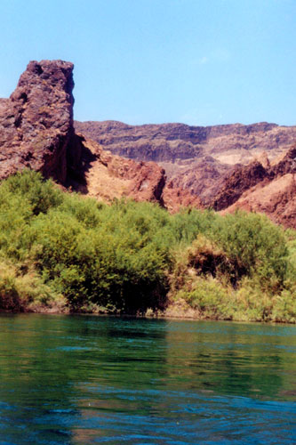
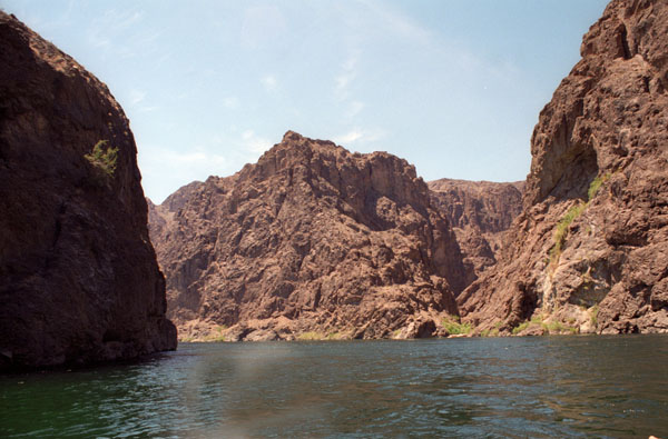
The river wound through stretches where the canyon walls came right down to the water, and at some points the rafts would nose over to them to give us a closer look. At other places, the landscape was much lower along the river, and at places like that there was often some greenery indicating a separate water source.
|
There was one point where the guides took our raft over to the cliff wall to see some birds nests built under the cliff wall. I am not sure that kind of birds they were, but you can see what look like mud dauber nests on the underside of the rock cliff just in front of the raft. The nests are obviously secure from most predators (except, perhaps, other birds) since there is no way to get to the nests themselves except by flying. Even an animal swimming up to the rock face would not be able to get to the nests as they wouldn’t get a foothold on the smooth rock.
This scenery was typical of the river where the cliffs came down to the water. The land is basically desert all around here, and it was incongruous to see the cold, blue water flowing past these barren cliffs, and no greenery on either side. Occasionally, there was some scrub grass and low trees, but I don’t think this vegetation gets its sustenance from the river.
|
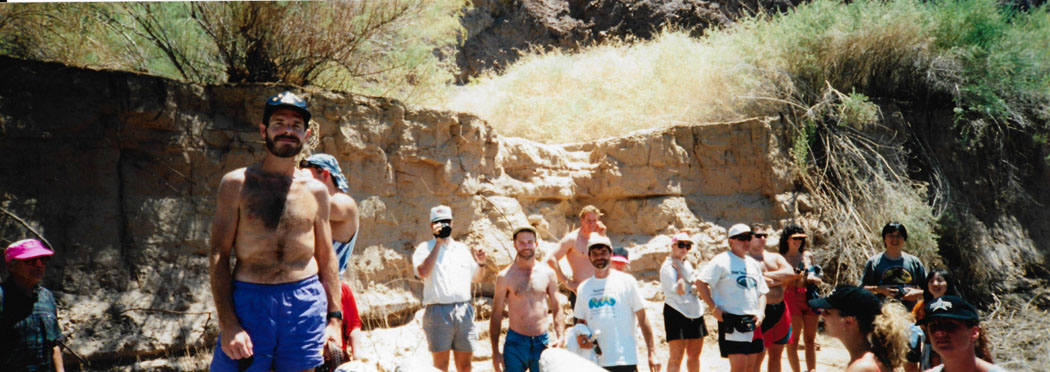
A while after lunch, the raft pulled to the side of the river to allow those who wanted to go in swimming; Chris was the only member of our group to do so. There’s Chris and Ron and some others from our raft. Chris likes the sun, but Ron hates it. I, myself, like going without my shirt, although I wish I looked better with it off.
While we were on shore, we spotted a duck on the river This was the first wildlife that I saw, and I believe there was a story behind the ducks, but sadly I have forgotten what it was.
Again, while we were on shore, Fred took another panoramic shot of the rest of us and some of our raftmates:
 |
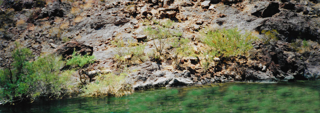
We got back in our raft and continued downstream, and at one point our guide took the raft close to the western side of the river to let us all get a better look at some of the local wildlife:
 |
As I mentioned before, we came to a number of places where there was greenery along the water's edge. I tend to think that in places like this, seeds blew in or were washed ashore, and there is enough water from the river flowing past to cause the vegetation to thrive. I doubt that there could be so many springs that they could support all of this vegetation.
|
We also passed this small cave. The guide told us that the cave had been explored but didn't go back very far. He confessed he had never been given a good explanation as to what formed it, but that there is, supposedly, a small spring towards the back. Perhaps the action of this spring, over time, wore away the rock. It would have been interesting had the raft been able to stop and let us explore the cave.
As we neared Willow Beach, I thought the canyon was exceptionally pretty, and Fred and I took multiple pictures. There are clickable thumbnails below for the best of them:
 |
When we got to Willow Beach and had disembarked and thanked our guides, I asked an obliging raftmate to use Fred's panoramic camera to take a picture of the five of us:
 |
Our trip came to an end about three in the afternoon. Our guides did an excellent job and we all had a good time. At the termination, buses were waiting to take us back upriver, across the top of Hoover Dam, and back to the outfitters. We reached there late in the afternoon, and headed back to town.
Back at the hotel, we lay around at the pool for a while, hooked up with Lowery and Ron, and then made some dinner plans. Actually, Ron and Chris wanted to see Cirque de Soliel and then go gambling (well, Ron, anyway). Lowery and Ron wanted Italian and Mike wanted to strike off on his own. So for this evening, we went with Lowery and Ron to an Italian restaurant down the street from our hotel. Later on, we all met up again and went out walking along the Strip.
You can use the links below to continue to another photo album page.
|
July 6, 1996: Visiting Hoover Dam |
|
July 4, 1996: An Afternoon in Las Vegas |
|
Return to the Index for Our Las Vegas Trip |