|
November 16-17, 2001: A Visit to San Antonio and Leakey |
|
September 1-4, 2001: Southern Decadence in New Orleans |
|
Return to the Index for 2001 |
Fred has some additional vacation days that he can take from the greenhouses this year, and so we've planned a hiking trip over to Arkansas for the weekend of the 6th and 7th. Fred will also take Friday the 5th and Monday the 8th (Columbus Day this year) off as well. We'll be making a route north into Oklahoma to the Billy Creek Recreation Area (which actually goes into northwest Arkansas, and then spend three days in Arkansas- mostly near the Albert Pike Recreation Area. Here is a high-level map of the area that we'll cover:
|
On Sunday, there were two hikes in the Albert Pike Recreation Area to streams and waterfalls- all on the Little Missouri River. At the end of the day, we drove north out of the Ouachita National Forest and up past Fort Smith to the White Rock Mountain Recreation Area where we camped for our third night. On Monday, we hiked the White Rock Rim Loop before leaving for home.
It was a really pleasant long weekend, and the weather was pretty much perfect.
So let's take a look at the hikes we did, beginning with our first afternoon at the Billy Creek Recreation Area in Oklahoma.
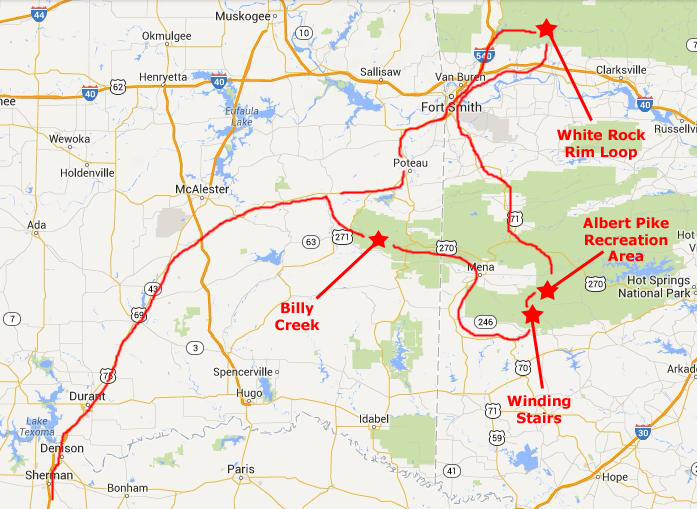
The Billy Creek Recreation Area (Oklahoma and Arkansas) (11/5)
|
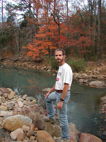
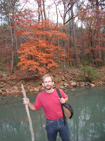
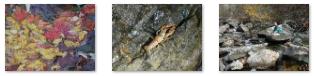
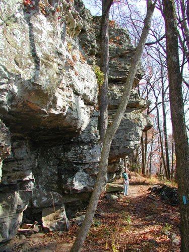
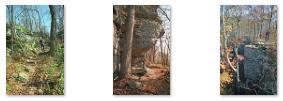
The trail we hiked this afternoon is a long, winding one, and trails intersecting with it lead on into Arkansas. The marked trail we were on forms a six-mile loop, winding up and down the hillsides (gaining and losing some 600 feet elevation) and down into small valleys, one of which has Billy Creek running through it. It was a neat hike through the forest, and we even got to see some Fall color. Click on the thumbnails below for a couple of other pictures from the hike:
|
When we got down in the valley to Billy Creek itself, we found a rock-strewn riverbed with not all that much water going through it.
|
|
Our hike took about three hours altogether, and when we returned to the campground, it was getting quite dark. While Fred fixed supper, I inflated the air mattresses and got the inside of the tent in shape. We had the campground pretty much to ourselves, and we got a good night's sleep.
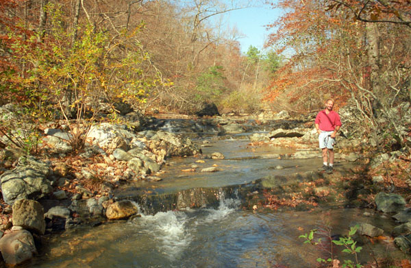
The Winding Stairs Hike (Arkansas) (11/6)
|
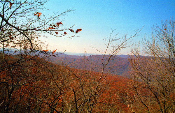
We found the Little Missouri trailhead in Camp Area B, although we could have driven to another trailhead for the Winding Stairs trail about a mile and a half west on a forest road. But we decided to take the longer hike; it was a nice afternoon and there was a lot of fall color to see on the first part of the hike through the forest.
From the trailhead, we walked through the forest to come alongside the Little Missouri River, and we followed the river downstream to the National Forest boundary.
The walk, especially along the river, was through an area known for its scenic beauty, popular swimming holes and challenging fishing opportunities. There were small cascading waterfalls, abundant wildflowers and impressive fall colors- all of which contribute to the popularity of this trail.
|
|
Below are clickable thumbnails for some of the pictures we took as we were hiking along- and crisscrossing- the river and some of its little tributaries:
 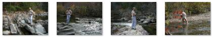 |
The trail provides several spectacular overlooks of the river. The most scenic spot on the trail is where Raven Branch flows into it. The afternoon was perfect for the hike, although when we had to wade the river, we found the water to be darn cold.
|
  |
Although we didn't encounter anyone else on the trail this afternoon, we have come to understand that it is a popular one with both day and overnight hikers; the trail, combined with the Little Missouri Trail, provides about 16 miles of trail along the Little Missouri River- quite enough to satisfy the needs of hikers who want to backpack and camp overnight.
We went ahead and stayed in the campground that was back at the beginning of the trailhead; by the late evening the campground was only about half full, which is one reason why we take our fall trips in October, when the kids are all back in school.
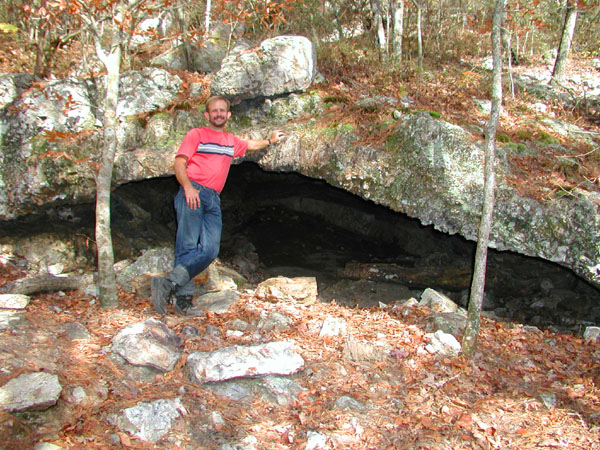
Tributaries of the Little Missouri River (Arkansas) (11/7)
|
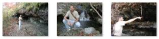
The Little Missouri flows in a generally north-to-south direction through Pike, Clark, and Montgomery counties in northwestern and north centrak Arkansas. There are numerous tributaries, each of which has its own charm. The Little Missouri River is dammed by Narrows Dam and forms Lake Greeson; the stretch above lake is wide and has an average drop of 35 feet per mile, making it an excellent canoeing river. Down below the dam, however, the river is much more placid, and it turns out that its various tributaries, many of which run through the Albert Pike Recreation area, where we are this morning, are more picturesque and interesting.
The watershed of the Little Missouri River is quite small, which means that its upper reaches ordinarily contain little water during the dry summer months, and there is relatively little water in the tributaries as well, since we are here after the dry summer and before the fall rains and snows.
|
Use the clickable thumbnails below to see some of the pictures we took along the hike and at the various small waterfalls we found:
|
Portions of the Little Missouri River flow through the Ouachita National Forest, and the lower segment flows past the Crater of Diamonds State Park. The Albert Pike Campground provides camping facilities for visitors to the area.
Fred took some movies this morning while we were at some of the small waterfalls; they are short and mostly show me walking around the rocks or the waterfalls themselves. You can watch them with the three players below.
|
|
|
|
|
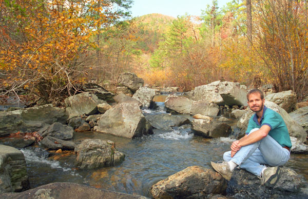
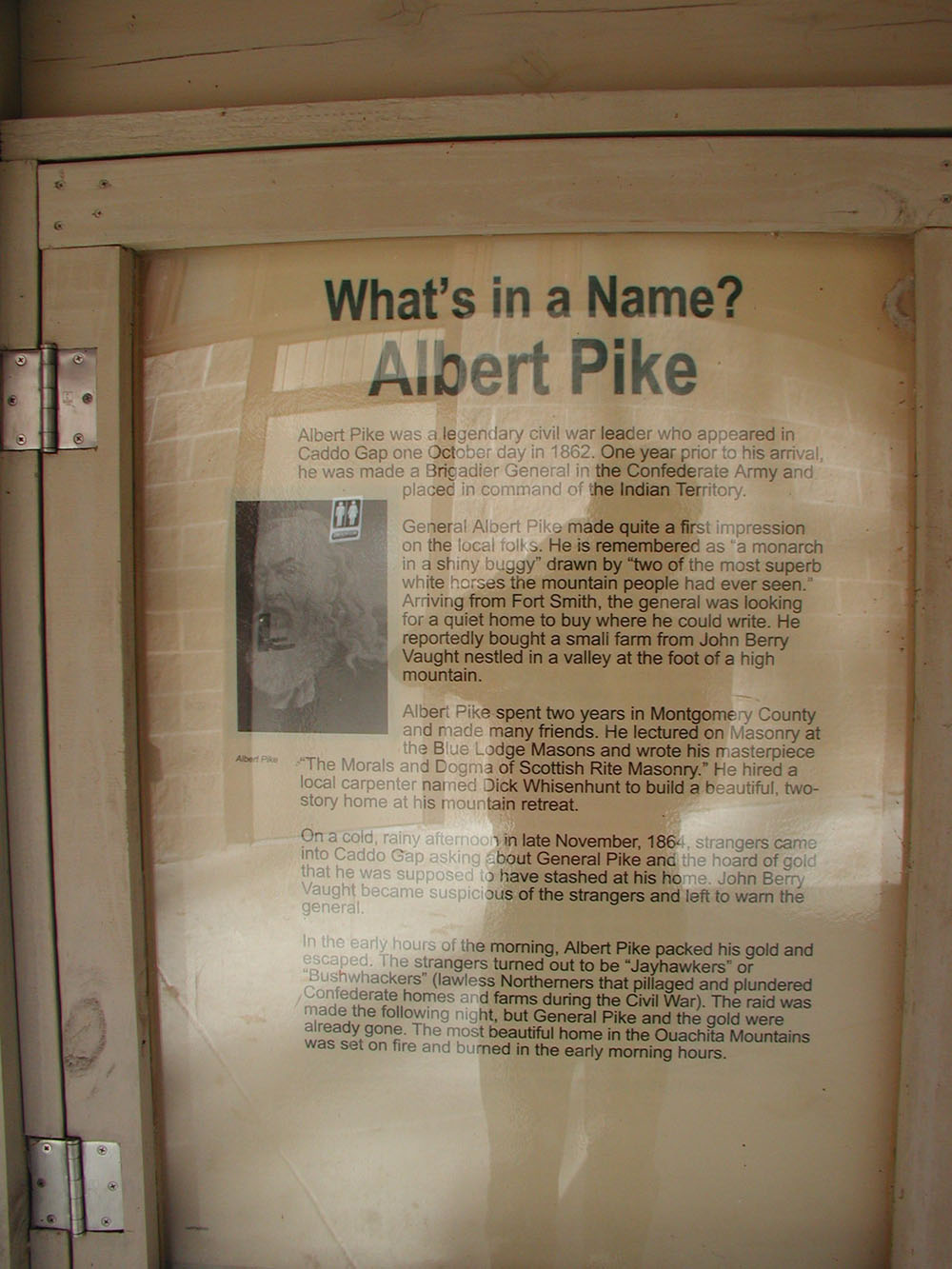
Hiking in the Albert Pike Recreation Area (Arkansas) (11/7)
|
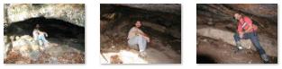
So after getting a little background on who Albert Pike was, we headed off along a different trail that would lead to a different stream.
|
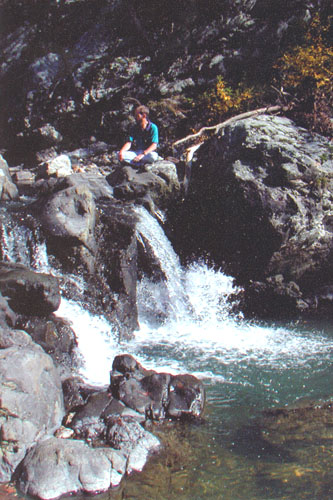
We hiked upstream for a ways, walking on the rocks in the streambed, until we came to a pretty nice waterfall. It consisted of a couple of different cascades over the same rock outcropping, and it was easy to get up on top of the ten-foot falls to sit and enjoy them.
Below are clickable thumbnails for some of the pictures that we took on this peaceful afternoon hike:
 |
You may not have looked closely at the last picture of those above; if you didn't, you should click here. The insect you are looking at is a Phasmatodea, or, more commonly, the "stick insect." As its name suggests, the creature looks like a twig on a branch, bush or tree, and is thus difficult for predators to spot. Stick insects are found in the forests, rainforests and jungles around the world where they live a peaceful lifestyle, expertly camouflaged into their surroundings.
There are more than 3,000 different species of stick insect in the world, with more being thought to have not yet been discovered. Stick insects can range in size from just over an inch to almost a foot long; if you can't tell from the picture, this one was about six inches long. This species had a long, cylindrical body- stick-like in both shape and color. Others have flattened bodies that make them look more like leaves than sticks. Stick insects are herbivorous, feeding on leaves and other green plants, along with the odd berries or fruit.
Stick insects have numerous predators in their tree-surrounded environment, if they can be seen that is. Birds, small reptiles, and rodents all feed on the stick insect if they are able to find one. After mating, the female stick insect lays up to 1,500 eggs which are cleverly camouflaged to look like plant seeds. The eggs of the stick insect are able to lay dormant for months before the larvae begin to hatch out of the eggs- already closely resembling their adult form.
After our hike here, we returned to the truck and headed further north through the recreation area, leaving it and continuing north through Fort Smith and into the White Rock Mountain Recreation Area. There, we found a campsite and settled in for the night.
The White Rock Rim Loop Trail (Arkansas) (11/8)
|
To optimize the views, the trail runs close to the edge of the tall bluff most of the way, and so folks are admonished not to take small children with them- the risk of a fatal fall is just too great. It's also not a good idea to hike after dark (in fact, much of the trail is closed after sunset) or while intoxicated. There have been a number of deaths related to these factors in the past few years.
|
From the campground, we went to the end for a trailhead marked for the Ozark Highlands Trail, headed down that road, following blue blazes, until we passed the last cabin and came to the beginning of the actual Loop Trail.
|
|
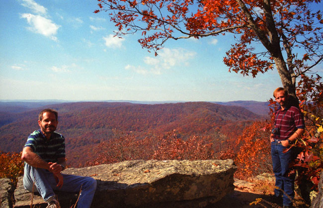
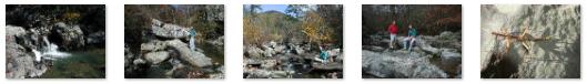
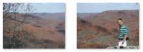
As the trail headed on around on top of the bluff, we got some great views down onto the bluff itself- lots of lichen and moss and even a few ferns growing on the sandstone rock.
The drainage out in front of us is called the Salt Fork Creek valley. The trail continued to hug the bluff, going past several large hardwoods. Looking out across Salt Fork, the first mountain beyond was Potato Knob, and we could see six or seven ridges beyond that.
About a mile into the hike, we passed a trail off to our left; it turned out to be a shortcut back to the campground for folks who didn't want to do the whole loop. We next passed one of the four rock pavilions along the trail- all built by the Civilian Conservation Corps back in the 1930s. Just beyond, we passed lots of rocks both above and below the trail that wee covered with a thick carpet of moss.
|
The views were just tremendous. Below are clickable thumbnails so you can see some of them:
|
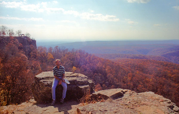
When the trail returned to the bluffline around the mountain, not only were the views really great, but walking along the bluffline was also a lot of fun. At one point, I let Fred get out ahead of me so he could look back and get a picture of me on top of the bluff, and you can see once again why this trail isn't recommended for small kids- particularly rambunctious ones!
|
You can see our view of this iconic scene at right, and you can see a second, closer view (taken from a bit further along the bluffline) here.
Below are clickable thumbnails for two more pictures we took along this portion of the hike:
 |
And this whole part of the hike would be the spectacular spot from which to view the fall colors in late October; even now, early in the month, they are beautiful.
The trail made its way on over to the third pavilion, which is perhaps the most scenic, and popular, spot on the mountain (although this morning we had it pretty much to ourselves). The trail wrapped around the point, swung back to the left and headed to the fourth pavilion. The last stretch of trail led back below the lodge and cabins and back to our starting point.
Before we headed off for home, we took a few more pictures around the trailhead, and you can have a look at them here, here and here. On the way back to the highway, we passed a deer camp, along with its humorous sign.
After we had some lunch at the campground, we went back to Van Alstyne via I-40 and Fort Smith, and we were going through Sherman-Denison at dinnertime. We stopped at El Chico (one of our favorite "after-trip" places) and got back to Downhill Run Acres (Fred's house) about eight-thirty. After unloading our stuff and relaxing for a bit, I got back in my Honda Civic and headed back into Dallas.
A great trip with lots of nice hikes.
|
November 16-17, 2001: A Visit to San Antonio and Leakey |
|
September 1-4, 2001: Southern Decadence in New Orleans |
|
Return to the Index for 2001 |