|
June 28-30, 2002: At the San Antonio Folk Life Festival |
|
April 19-21, 2002: A Trip to San Antonio |
|
Return to the Index for 2002 |
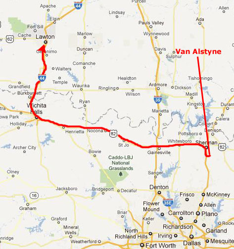
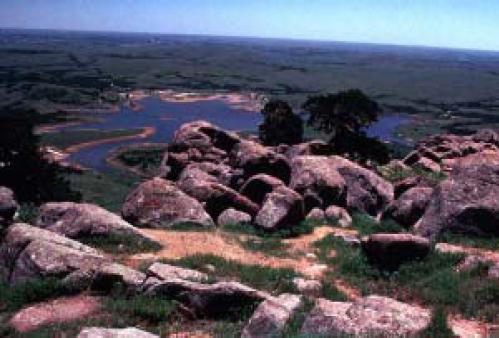
Every few years, Fred likes to visit the Wichita Mountains up in Oklahoma. He introduced them to me shortly after we met, and we have been there a number of times since. We like to do many of the same things repeatedly, but every hike is a bit different each time we do it. My favorite thing is the boulder avalanche on Mt. Scott, but I don't like carrying a camera when I hike it because I need both hands for balance as we jump from rock to rock. (Later in this album, after both Fred and I start using digital cameras, I will have one small enough to fit in my pocket, and I will take pictures of the avalanche then.)
Getting to the Wichita Mountains
|
|
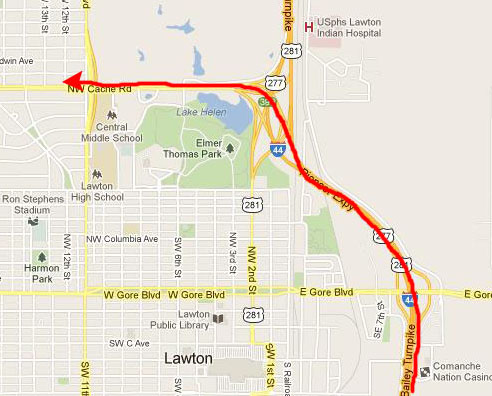
The Super 8 Motel where we were going to stay was on the north side of town, so we just continued past downtown on I-44 to get off at Cache Road; the Super 8 was less than a mile on our right. We got there just about midnight.
|
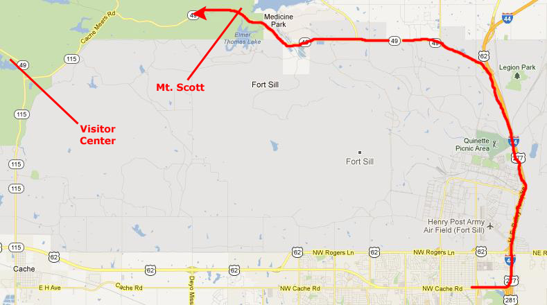
The actual Visitor Center is a good ways inside the park by Quanah Parker Lake, although we understand that a new one is going to be built a couple of miles southeast of the lake, east of the intersection of Highway 49 to the northwest and Highway 115 that heads south into west Lawton.
Saturday in the Wichita Mountains Wildlife Refuge
|
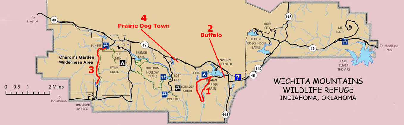
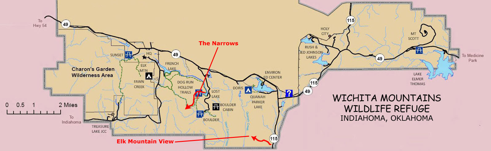
We're going to make a number of stops and do a number of hikes in the next two days, and so it might be helpful if you have a park map to look at.
|
I have put one at left in a scrollable window. If you will use the horizontal scroll bar to go all the way to the right, you will see our first stop, Mt. Scott, just north of the highway into the Refuge. The other hikes and stops today will be in the western part of the Refuge, so you'll have to scroll to the left to see them.
Today, we
(1) Hiked the Baldy Trail
(2) Stopped to see the buffalo
(3) Hiked to Charon's Garden
and
(4) Stopped to visit at the prairie dog town.
Each of these are marked on the map.
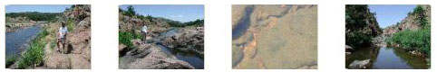
Hiking Along the Baldy Trail
|
To see the rest of the pictures we took along this hike, just click on the thumbnail images below:
|
|
Observing the Buffalo
|
On October 11, 1907, the first 15 bison to leave that breeding program boarded a train to cross the country to Oklahoma. When the train pulled into Cache, Oklahoma, seven days later, the bison were greeted with much fanfare by a party including Comanche Chief Quanah Parker. The huge crates were loaded onto wagons and the bison then traveled 13 miles to the Wichita Mountains where they went went on to flourish, so much so that there were even annual auctions to keep the herd�s number in check. By the 1930s, the American bison count was up to 20,000. Thanks in no small part to the American Bison Society, there are now around half a million bison in North America.
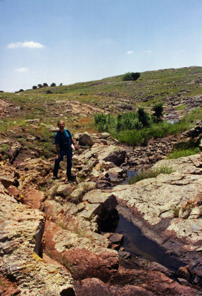
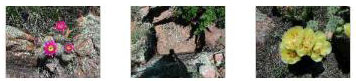
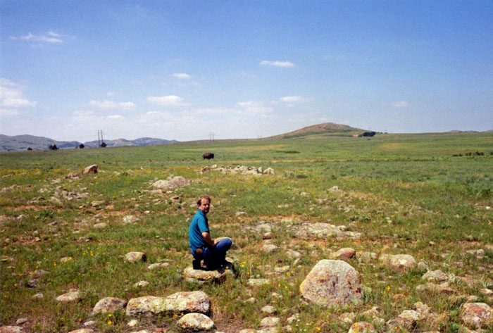
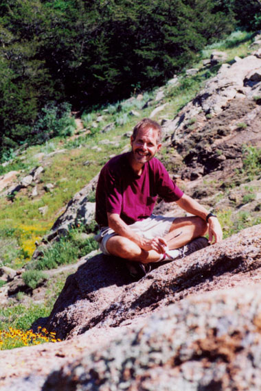
I took the picture of Fred at left just as he was getting ready to use his zoom lens to capture an image of the buffalo in the distance, which he did shortly after my picture was taken. You can have a look at his image here. Sometimes we see lots of buffalo here by Quanah Lake, but today there was just the one that we could see. While we were in this area, Fred took a picture of me with Mt. Scott in the background, and he also got a very nice picture of a cactus in bloom.
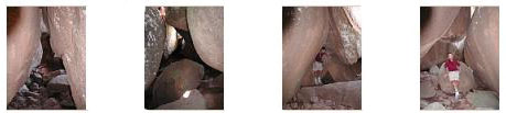
The Hike to Charon's Garden
|
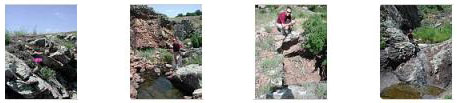
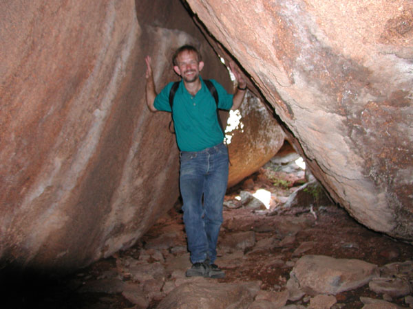
Just before the trail descended into the canyon between the two hills, I noticed a little peak off to the right, and I had Fred take my picture sitting on top of that little peak with the mountain above Charon's Garden in the background; you can have a look at that picture here. While we were standing here, Fred also used his zoom lens to get a shot at some of the balanced rocks above Charon's Garden. Then we got back on the trail, descended into the canyon, and shortly found ourselves in the midst of the rock formations known as Charon's Garden.
I suppose that the reason this series of rock formations is known as "Charon's Garden" is...well, I guess I really don't know.
|
Below are thumbnails for some of the other great pictures that Fred took while we were here climbing around; click on them to view the full-size images:
|
|
From Charon's Garden, we went back on the trail a short ways and then followed a side trail that led almost due west from the valley we were in, climbing up and over a couple of high hills until we were a good half mile from Charon's Garden, where we were able to look back at the same balanced rocks we'd seen earlier off in the distance. Have a look at that view here.
|
We took a number of pictures here at the tank and also nearby, and you can click on the thumbnails below to have a look at them:
|
|
The hike to Charon's Garden was really neat, but we had one more stop to make today before returning to Lawton and our hotel.
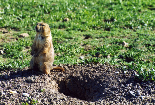
A Stop at the Prairie Dog Town
|
That's what we did for a while. We saw some of the little animals acting as sentries while others came and went. It was interesting and funny, and Fred took one other close-up of one of the prairie dogs that you can see here.
When we were done watching the prairie dogs, we took Highway 115 south and back to west Lawton, and then east to our motel on Cache Road. We had a good meal that evening and got ready for our second day in the refuge.
Sunday in the Wichita Mountains Wildlife Refuge
|
At left is a scrollable window containing another copy of the park map, and you can see the two stops we made marked on it. Just scroll left and right to view.
Actually, we did one short walk before going up to the Narrows hike. Just after we entered the park from the south on Highway 115, we stopped to take a walk we'd read about that led to an overlook from which you were supposed to get good views of Elk Mountain. We did take the walk, and we did get some views of Elk Mountain, but it turned out not to be as interesting as what we'd read had indicated.
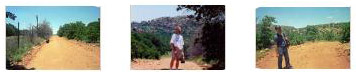
We did take a few pictures at the start of the hike, and you can have a look at them by clicking on the thumbnails below:
|
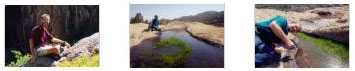
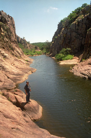
We returned to the car and then headed off to the north to find the access road to Lost Lake and the hike through the Narrows.
|
We walked along the "shore" of the narrow lake as we headed upstream, and if you will click on the thumbnail images below, you can see some of the pictures we took along this part of the hike:
|
|
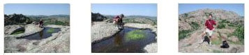
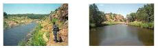
As we hiked upstream, the lake got very thin and then basically disappeared and turned into a stream flowing gently across a rocky streambed. I took a picture of Fred at the point where the lake ended and the stream began, and you can have a look at that picture here. Eventually, all the vegetation that had been bordering the lake pretty much disappeared, and we found ourselves in a winding, rocky canyon. The walking had gotten a bit more challenging, in that the sides of the canyon were steep in spots, so we sometimes had to climb back up almost to the top of the cliff to find a way forward that didn't involve getting our feet wet.
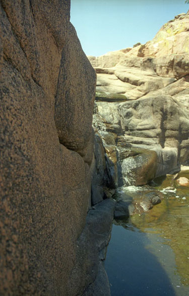
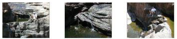
Eventually, we reached the "head" of the canyon- a rocky amphitheatre with a waterfall at the upstream end.
|
It was very pleasant just to sit in the shade (the day had gotten quite warm) and watch and listen to the cool water coming over the falls. Fred took some pictures of the falls and of me, and you can have a look at them by clicking on the thumbnails below:
|
Fred also made some movies here at the end of the canyon; his new digital camera gives him that capability. (One of these days, I will have to get a digital camera, too. Film is getting expensive and the digital quality is actually better. And I fancy myself something of a film auteur, and would like to be able to supplement pictures with action movies.) In any event, you can use the movie players below to watch the three movies Fred made here:
|
|
|
|
Our hike up the Narrows completed our visit to the Wichita Mountains this weekend, and we had a really good time. But we had to get back to Van Alstyne before too late so Fred could get some sleep before having to go back to work in the morning. It was a good trip, and I am sure we will be back again.
You can use the links below to continue to another photo album page.
|
June 28-30, 2002: At the San Antonio Folk Life Festival |
|
April 19-21, 2002: A Trip to San Antonio |
|
Return to the Index for 2002 |