|
July 8, 2006: Devil's Tower, WY and Mt. Rushmore, SD | |
Return to Glacier National Park Trip Index |
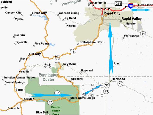
Custer State Park
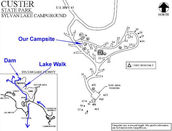 |
After arising and breaking camp (for the last time on this trip), we headed off the short distance to Sylvan Lake to walk around and see what we could see. A short walk (our route is marked on the map) along the lake brings you to some really neat rock formations. The rocks seem to just jut up out of the lake and alongside it. One of the short side trails led through a maze of rocks to a stairway on the trail that led up to and through a rock hallway and another one led to a cul-de-sac where we found a shallow cave.
Another trail branches off from the main trail along the lake, and follows stepping stones along the boulder face and up a couple of stone steps to bring you out onto the small boulders that are at the beginning of the walkway across the dam that holds back the water that forms Sylvan Lake. The walkway across the dam doesn't continue around the other side of the lake, but just ends at a boulder, and that's as far as you can go. Coming back to the parking area from the trails, Fred got a good picture of me and the Sylvan Lake Dam.
We also stopped in the camp store and, not so oddly, found quite a few buffalo‑themed items.
Custer, South Dakota
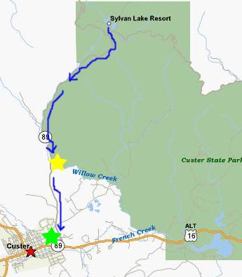 |
Our intention had been to make a visit to Jewel Cave, which is west of Custer, SD on US16 (the highway going east-west through the map), so when we left the rock shop we headed west and immediately entered the town of Custer, South Dakota.
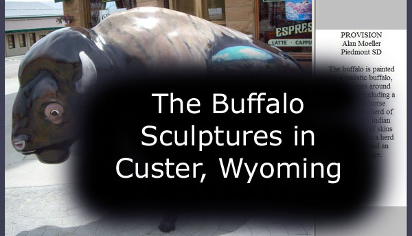
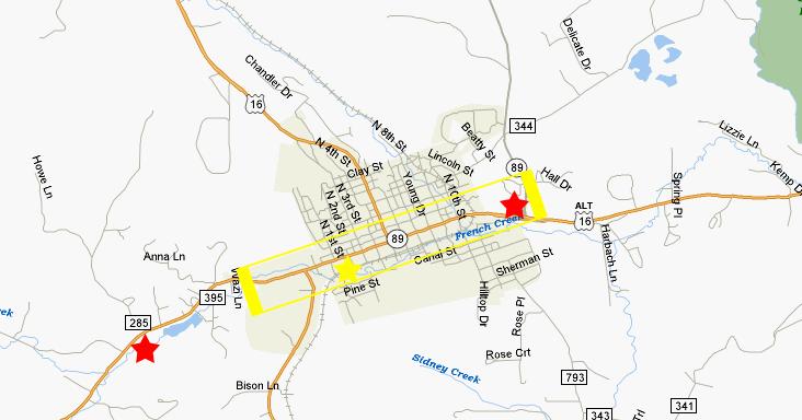
From the fossil shop (rightmost red star on the map below), we headed west through the town of Custer. It was a picturesque town, with lots of small shops, a few motels and restaurants and quite a few older buildings. As we passed through town, we noticed various buffalo sculptures along the main street and on some of the side streets, most within the yellow box I've drawn on the map. It looked like they had been done by artists and such. We thought we'd like to stop and look at them, but we had a lot to do today and didn't think we could spend the time to do so.
 |
Returning to downtown Custer, we began taking pictures of the buffalo and their accompanying descriptions- Fred on one side of the street and me on the other. The painted buffalo are part of the Custer Stampede, a town festival held in late September each year. For a description of the festival, or to see pictures of the buffalo we might have missed, you can visit www.custerstampede.com. There were supposed to be 30 buffalo scattered about town, and I think we found most of them. There were some blue painted footsteps that were supposed to lead you from one to the next, but some of the footprints had worn away.
All these buffalo sculptures were really, really interesting. Some were extremely colorful, some were less embellished. But all had interesting stories supplied by their artists.
|
To view the slideshow, just click on the image at right and I will open the slideshow in a new window. In the slideshow, you can use the little arrows in the lower corners of each image to move from one to the next, and the index numbers in the upper left of each image will tell you where you are in the series. When you are finished looking at the pictures, just close the popup window.
Taking pictures of all those buffalo was giving us an appetite for lunch, and partway through the town we were fortunate to run across a restaurant that fit in perfectly with our theme of the day- buffalo. Finally, just when we were about finished with all the buffalo we could find (and we only missed three or four of them), Fred ran across this interesting historical sign on one of the buildings in town.
 |
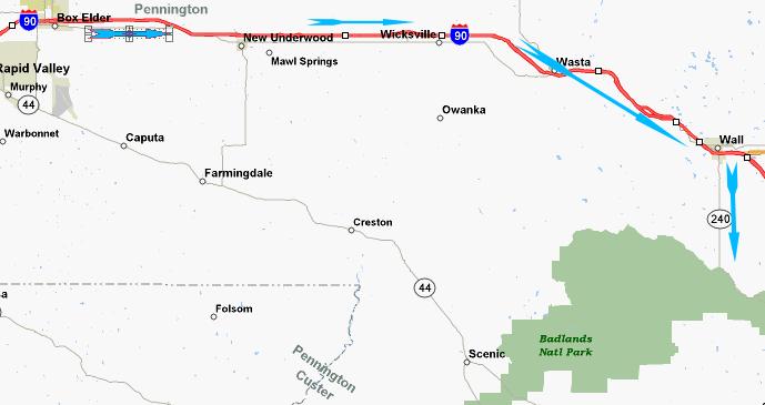 |
There was also plenty of time for me to explain to Fred the significance of all the signs he kept pointing out referring to "Wall Drug." I thought he had heard of Wall Drug before, but apparently it was new to him, but it wasn't until he'd noticed five or ten signs that I undertook to explain the whole story to him. Actually, I had forgotten some of it, and I had to dig out one of our South Dakota brochures where there was an explanation.
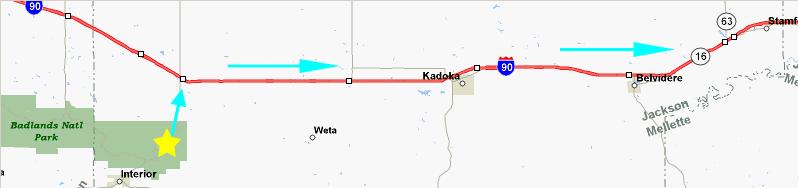
We arrived at the exit for the town of Wall (which was the same exit we needed to take for Badlands National Park), so we took a very short side trip into town to see the famous Wall Drug. As I remembered when Tony and I came through here years ago, it was a tourist mecca, and it seemed as if every non-local vehicle traveling along I-90 in either direction had stopped here. Not surprising, since signs for the destination appear 500 miles in either direction along the Interstate.
|
|
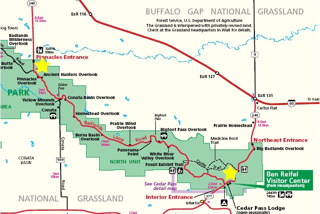
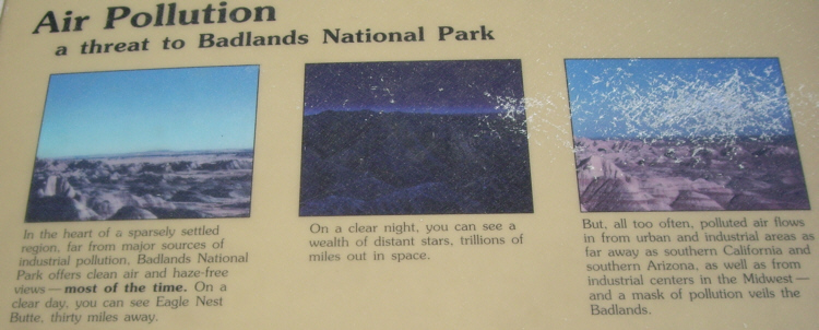
Badlands National Park
Note:
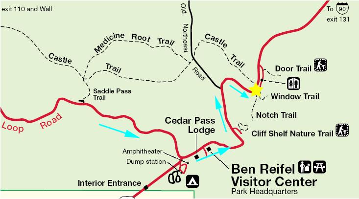
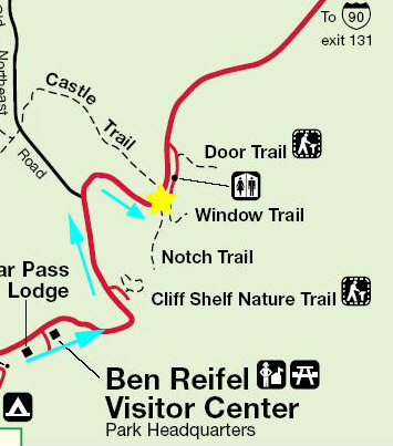
On many of the maps you've seen thus far, I've made notations (either with little yellow or colored stars, or with numbers or both) to tell you exactly where some of the pictures were taken. For this drive, I think that is going to be overkill, especially since all the points of interest are labeled on the park map used here. So, I'll just refer to the name of the overlook or feature, and simply say that the first section of pictures from Badlands National Park were all taken between the Pinnacles Entrance (yellow star on the left) and the Ben Reifel Visitor Center (yellow star on the right). I'll repeat the map as needed so it is never far away as you read the narrative.
Driving the Badlands Loop Road
|
|
At the overlook, we found some information about the Sage Creek Wilderness, which we might of traversed had we visited Jewel Cave. From Jewel Cave, over by Custer, the most direct route to Badlands National Park isn't along I-90, but rather a more southern route, making use of a number of South Dakota highways as well as some BIA roads. Coming that way might have been more scenic, but it would also have taken more time.
 |
|
|
At the Ancient Hunters Overlook there wasn't much to see except a deep gully and more of the Badlands landscape, but, according to the sign, this had been a place where Native Americans drove buffalo to a fall. From the Ancient Hunters Overlook, the Badlands Loop Road leads through a section of the Park that is almost a continuous vista of starkly beautiful craggy peaks, formed by the action of both water, what little there is of it, and wind. In the valleys below the peaks, the low hills that have been softly rounded have colored strata at the base and grey strata on top, and the result is that they look like formations lit from below. The combination of the colored ravines and colorless peaks was certainly interesting and, in its own way, quite impressive.
|
|
The next feature along the Badlands Loop Road are the yellow mounds, so named, of course, from the contrasting color of these mounded hills that cover only a small, defined area along the highway. From a good ways further along the highway, at the Conata Basin Overlook, we could see the entire Conata Basin and get also use the telephoto to get a good picture of the Yellow Mounds Overlook.
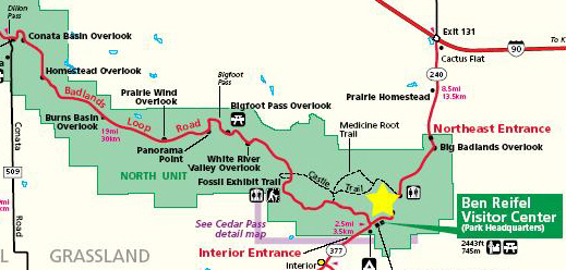 |
For the next 15 miles or so, from Conata Basin to the visitor center, the highway wound through one spectacular area after another. At one stop on the highway, we could look to the southeast at the very edge of The Badlands, and it was extremely interesting how the formations just end abruptly and turn into flat grassland to the south. From approximately the same point, here is Fred and The Badlands boundary looking back west. From a bit further on, the contrast between the scenery on the south side of the highway- exquisitely layered formations with prairie beyond- and on the north side of the highway- barren rock formations stretching to the horizon- was very dramatic. The same layered stone formations continued for miles and miles, and you can see excellent views of them here, here and here.
|
|
Next, at the White River Valley Overlook, there were particularly nice views of the banded rock formations where you can see that the various layers extend, at exactly the same level for mile after mile. It loks for all the world as if you are looking at a television picture of some mountains and there is an interference pattern on the screen so that there are static lines drawn straight through everything. From this viewpoint, the Badlands seem to go on forever.
The rest of the way to and past the visitor center offered views of the Badlands that after a time became remarkably consistent. I could certainly understand how someone trying to cross this area could easily get lost- there are no landmarks to speak of. Even looking at the road itself, as in the views here and here, everything is so similar that it would be impossible, save for mile markers, to describe to anyone just where you were. We rarely saw very many cars until we got close to the visitor center, at a point where I stopped to get a picture of an unusual balanced rock formation near the roadside. At that point, when I was walking back from where we pulled off, there happened to be a spate of traffic, more than we had seen all day.
 |
Hiking in Badlands National Park
 |
It didn't scare us off, though, so from the Notch Trail trailhead we headed off across the open area to the south, following the (for the moment) clearly-marked Notch Trail.
|
|
One of the first interesting things we came across, and this as we got up to the cliff face, were these bird's nests that had been meticulously built by the birds that we saw flying around nearby. In this closeup of the bird's nests you can see the way the walls of the nest were constructed out of pebbles and such (although how they were held together, in the absence of much water, seems to be a mystery) and how the openings face downward to keep out whatever rain there is. Quite amazing.
A short ways into the hike, we came upon The Ladder, constructed by the Park Service as a way of getting you up onto the ledges along the peaks. On the way back, before coming down the ladder, I tried to find a way down without it, but kept running into sheer dead ends, so I guess it was necessary. I climbed the ladder, and here is the view back down the ladder to where Fred was waiting to climb up.
|
|
Here is a picture of me at the top of the ladder, looking back along the ledges towards the parking area. It is the area behind me that I explored to try to find a way down without using the ladder.
From the top of the ladder, there is a pathway marked by steel poles that led off along the cliff ledges. Hiking a ways along this trail brought us to a point where we could look back along the trail to see the ladder and trail back to the parking area. Here is another picture of the trail leading up to the ladder base. From the same spot, here is the trail ahead following the ledges along the cliff face. You can see the steel poles that mark the trail; they were pretty easy to follow, although at one point it was easy to go wrong (and I did, temporarily). As you can see here, some of the signs were very confusing and it would have been very easy for me to head right and miss the sheer cliff that I had to edge along carefully before I met back up with Fred.
A ways further along the trail, we noticed that across the ravine there was what seemed to be a notch "doorway" into what appeared to be an enclosed area behind the rock wall. I walked over through the doorway into this enclosed room, and found a number of connecting "rooms," about three or four of them, almost like rooms in a house with the ceiling missing. I climbed up the outer wall of the first room to where I could see Fred waiting for me on the main trail. To get back to him, I decided not to use the doorway, but to climb up and over the rock wall in a direct line to where he was waiting. He took this picture of me climbing down the rock wall.
 |
|
|
|
|
I made a movie during our return trek along the Notch Trail, and you can watch that movie with the player at right.
For posterity, is yet another picture of me going where I'm not supposed to. We both made it back, so I guess that things could be said to have worked out.
Back at the parking area, we decided to also take a walk along the very short Window Trail, which starts at the parking area and leads across some raised walkways (presumably there to keep the area near the parking lot from being all torn up by people walking whichever way across it) to another window that offered a pretty spectacular view of The Badlands.
And, finally, we returned to the parking area. We took a short way along the Door Trail, but it was more of a nature trail that led to one more view of The Badlands, but maybe you've seen enough already. We knew that it was time to head home, hence this one last picture from The Badlands.
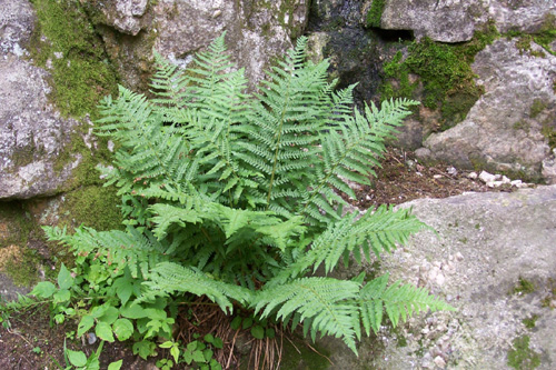
Today's Flora
 |
Leaving The Badlands
 |
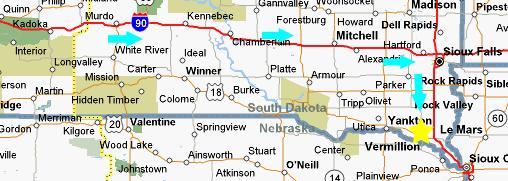
A spectacular trip. We hated for it to be over. But it's always good to get home, whether you've been gone a day or a week. The route home was easy, and began this day with a drive up to I-90 and then a run east towards Sioux Falls, SD.
 |
The Drive Home
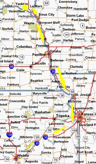 |
At Kansas City, we left I-29 for I-435, the belt road around the city. In many places, the road is cut through native limestone and is quite pretty. From the belt road, we took the I-35 exit and headed off southwest towards Wichita. It was here that we would rejoin the route we traveled 9 days earlier.
You might also notice on the map the towns of Atchison, MO and Topeka, KS. These two towns were the origination points for one of the most famous railroads in history- immortalized in writings and song- the Atchison, Topeka and Santa Fe.
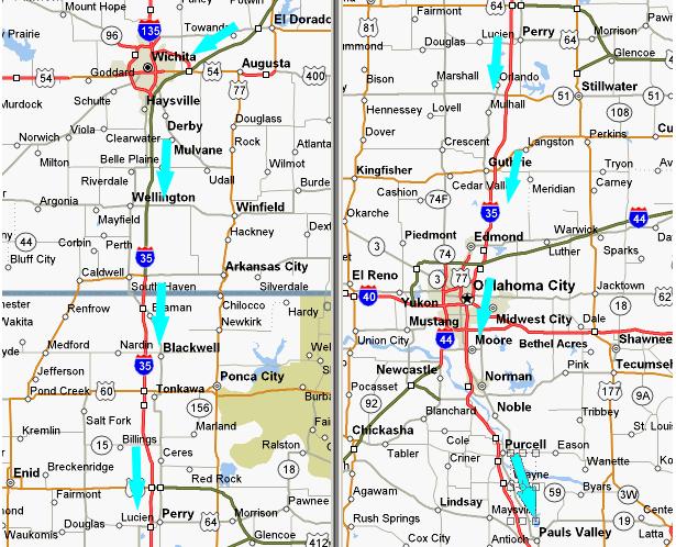
I-35 becomes a toll road in Kansas, and took us through and around Wichita.
 |
 |
This is probably not the place for a valedictory on this particular trip, but as far as the trip itself goes, as far as doing what we intended is concerned, we achieved all our objectives- and a good deal more. We replaced one or two things we'd planned to do with three or four we hadn't. All in all, and particularly considering the fine weather, the trip was an unqualified success.
How did this trip compare with others of the same length we've taken? We can't say for sure just yet, but we suspect it'll be in the top five or six:
Bryce Canyon/Zion/Cedar Breaks/Grand Canyon
Yosemite and Northern California
Yellowstone and Grand Teton
Mt. Rainier and the Canadian National Parks
Rocky Mountain National Park
Glacier National Park- MT/WY/SD
It was good to be home. We are constantly amazed that, no sooner do we tell ourselves that we've experienced the most beautiful natural wonders there are, that another trip comes along with something entirely different but exactly the same. How much beauty is out there? More, we suspect, than we will have time to see.
You can use the links below to continue to another photo album page.
|
July 8, 2006: Devil's Tower, WY and Mt. Rushmore, SD | |
Return to Glacier National Park Trip Index |