


|
February 13-23, 2009: Relaxing in Fort Lauderdale |
|
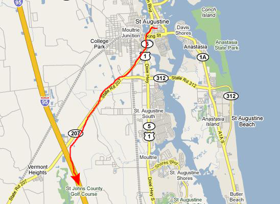
February 11, 2009: Driving to St. Augustine |
|
Return to the Index for Our Florida Trip |
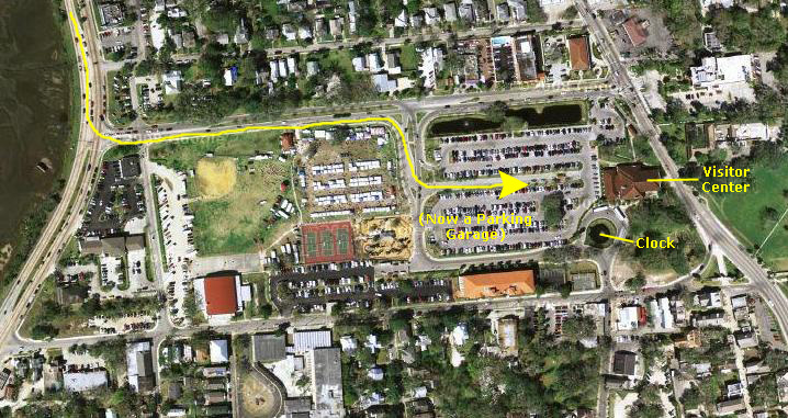
Arrival and Visitor Center
 |
Embedded in the terrazzo of the plaza is the commemorative plaque for the renovation project that presumably added the garage and plaza. As you can see, the project was completed just three years ago.
Also inlaid into the floor of the plaza was a very large mosaic that was actually a map of old St. Augustine. All around its border were various scenes and items relating to the city and its surroundings and history. The mosaic was way too large for either of us to get a picture that could show you any detail at all, so Fred decided to take a series of pictures of some of the items in the large border surrounding the map. If you will click on the thumbnail images below, you can have a look at the elements of this very inricate mosaic:

|
Inside the Vistor Information Center, we picked up a guidebook and took a look at some of the exhibits. The main one was a replica of an old schooner. It was interesting enough that I also wanted to get a picture of Fred and the ship model. There were some other exhibits as well, including a few of the archaeology of the area that particularly interested Fred. It was lunchtime, so we also asked for a couple of recommendations for local places we might eat. What we got was the advice that if we just walked down into the old city south of the Center we'd find a number of places to try- all local and all good.
We walked out the south entrance to the Visitor Center and found ourselves in a nicely-kept garden with various sculptures and fountains. In the aerial view above, this garden has not yet been constructed. One of the centerpieces of the garden was this fountain. It was interesting not only because it was a fountain (Fred finds all fountains interesting) but because of the mask waterspouts. There were six of them, and nearby there was an explanatory sign about them. Turns out they are significant because they were a gift from St. Augustine's "sister city" in Spain. You can read all about them if you take a look at the fountain marker.
We left the garden and walked across the visitor center's circular drive (various tour buses and such stop here) with its old‑time clock and down into the old part of St. Augustine.
A Short Walk Before Lunch
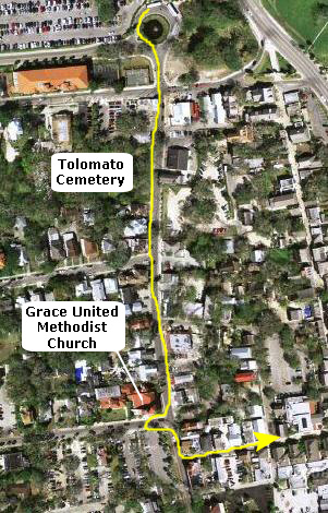 |
During the first Spanish period, prior to 1763, this site ws occupied by the Christian Indian village of Tolomato, with its chapel and burying ground served by Franciscan missionaries. The village was abandoned when Great Britain scquired Florida. In 1777, Father Pedro Camps, pastor of the Minorcan colonists, who had come to St. Augustine after the failure of Andrew Turnbull's settlement at New Smyrna, obtained permission from Governor Patrick Tonyn to establish this cemetery for his parishioners. Father Camps was buried here in 1790; ten years later his remains wer re-interred in the "new church"- the present Cathedral. The first bishop of St. Augustine, Augustin Verot (d. 1876), is buried in the mortuary chapel at the rear of the cemetery. The last burial here took place in 1892.
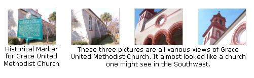
We continued down Cordova until we came to the corner of Cordova and Carrera streets. Here we found the Grace United Methodist Church. It was a very interesting building, and so we took a number of pictures of it. We've put thumbnail images for four of the best of them below; the first image is the historical marker for the church. Click on the images and you can both read the marker and also look at some views of this interesting church:
|
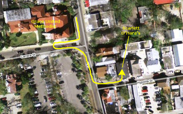
Lunch at Scarlett O'Hara's
 |
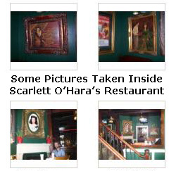
|
We had a nice lunch and then headed out to see more of the old city of St. Augustine.
Walking Around Old St. Augustine
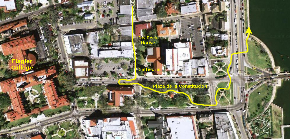 |
As we walked south along St. George Street, we passed a number of interesting shops in old buildings- most of them tourist-oriented. Just before reaching the Plaza, we passed the "Dr. Peck House," one of the oldest homes in the city which was restored with funds donated by Henry Flagler. Then we reached the northwest corner of the Plaza at the intersection of St. George and Cathedral.
St. Augustine Cathedral is located on the northeast corner of this intersection. It is now the major cathedral in the city, although there are others as would be expected from the Spanish influence in the city's history. As befitting the climate, the church is mostly white- which seems unusual for other cathedrals we've seen, but the Spanish tile roof and other reddish accents add interest, particularly to the cathedral's main entrance. And right next to the cathedral (and done in appropriately the same style as its neighbor) was an architecturally interesting branch of Wachovia Bank.
Before walking through the park, we crossed the street to the southwest corner of the intersection and I took a picture of Fred alongside one of the buildings of Flagler College. This view looks westward along Cathedral Street and you can see the main buildings of Flagler College in the background. Henry Flagler was, of course, the railroad magnate whose Florida East Coast Railway figured so prominently in opening up the Atlantic Coast of Florida to development. His name appears in towns and cities all up and down the coast, and he even took his railway all the way to Key West (although service there has long since been discontinued).
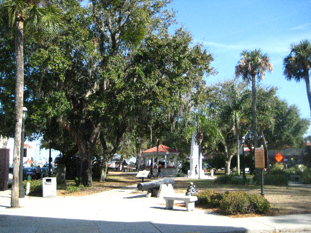 |
The Ordinances specified that the plaza was to be laid to the compass points, and in "good proportion"- a prolonged square, the length equal to one and one-half times the width. Lengths and widths based on proportional ratios were believed to be imbued with harmony and spiritual meaning.
The first system of weights and measures was established with a market here in 1598. You can read the marker giving the history of the market here, and you can see the rebuilt market structure referenced on the marker here. Here in the plaza there are markers about Florida's 67 counties, memorials to Felix Varela, prisoners of the American Revolution, the Confederacy, and soldiers killed in WWII and the Korean and Vietnam wars. A pre‑18th century well has been designated an American Water Landmark. The Town Plan and plaza were designated a National Historic Landmark in 1970. Immediately adjacent to the plaza at the east end is the Juan Ponce de Leon memorial commemorating his discovery of Florida in 1513.
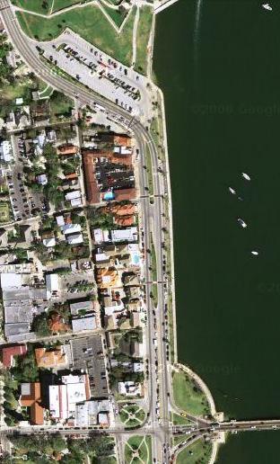
We walked through the plaza to its south side so we could look down some of the old city streets, now mainly residential, that continued south from the plaza such as Aviles Street, shown here. Finally, we reached the waterfront at the eastern end of the park, and walked a bit north so we could cross A1A to walk along the seawall. At this point I took a picture at the intersection to record the close junction of A1A and US‑1. These two routes figure prominently in many of my descriptions of our Florida trips as you have undoubtedly already noticed. US-1 was the original route that anyone living on the East Coast would have taken to get into Florida and get to any point south along the Atlantic Coast. When I was young, that is the route that we took when we came down to Ormond Beach for our summer vacations. US-1 was a good road, but it went through innumerable towns and cities and by today's standards you could not make very good time.
A1A was actually an artificial route designation- not a continuous highway like US-1. Loosely an abbreviation of "Alternate Route 1- Atlantic," A1A hugs the coast much more closely than US-1, in many places going right along the seashore. It twists and turns and follows residential streets at times, and it is even harder to travel quickly along it than on US-1, since residential driveways open onto it and it often follows circuitous routes through towns and built-up areas (which is just about the entire coast, now). But it was not intended as a road to make time on, but rather a road to offer the maximum in scenic driving along Florida's Atlantic Coast. When we got to Jacksonville, where A1A begins, my Dad would always follow it rather than US-1, just so we could see stuff. You may remember that I have ridden my bike more than 100 miles along A1A from Fort Pierce to Fort Lauderdale (although not all at once!).
In the early 1960s, of course, work was well-along on Interstate 95 which became the highway of choice for travel along Florida's East Coast. It is quick, but far from scenic. Jacksonville to Miami on I-95 is a six-hour trek. On US-1 it would be an all-day journey, and on A1A you'd have to allow two days or more. Even so, one of these days, I'd like to drive A1A again from here to Fort Lauderdale and see how much I can remember and how much has changed.
Walking Along the Waterfront
 |
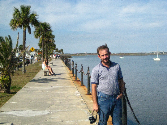
As we walked north towards the Castillo, we could look back to see the Bridge of Lions where A1A heads back out to the barrier island for its route south along the coast. This particular bridge is an unusual one- it is a lift bridge, rather than a drawbridge. The mechanism lifts a whole section of the roadway up, like an elevator. I would be curious to know why such a bridge was chosen rather than a drawbridge, the kind of bridge that is common in Fort Lauderdale. Ahead of us, we could see some of the many pleasure craft anchored in the waterway. These boats have to be anchored a ways out because of the tides. Indeed, looking ahead to the Castillo, you can see that the tide is quite low, and if the boats had been anchored right along the seawall, they'd be sitting on the bottom about now.
Walking along the seawall, we passed a long line of carriages waiting to take tourists around the city. We had seen a couple of them earlier in the day when we were wandering around town. Just before we reached the Castillo, we could look back south along the length of the seawall, and you can look at that view here.
Castillo de San Marcos
 |
The first group of pictures was taken as we walked on top of the fortification along the Intracoastal from the southeast corner of the Castillo to the northeast. On the north side of the structure, we took some stairs down into the outer courtyard, and walked back south at the base of the actual Castillo wall. This is part #1 of our walk.
The next group of pictures was taken as we walked up to the entry pavillion, paid our fee, and then went into the area outside the Castillo at the south end of the bridge into the Castillo itself. This group includes some pictures I took as we went through the actual entry to emerge in the inner courtyard. This is part #2 of our walk.
Next, we worked our way clockwise through the interior of the Castillo, looking in each of the various rooms in turn, and spending time at the various exhibits. All the rooms opened onto the center courtyard, and so we just went from the courtyard into each of them, one after the other. This path, #3, ended back at the entry archway at the base of the stairs that led up onto the parapets.
Our fourth and final section of pictures was taken on our way up the stairs to the parapets and as we made another large clockwise circle around the top of the structure (path #4).
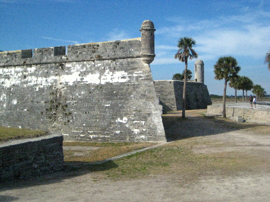
The Outside of the Castillo de San Marcos (Path 1)
 |
|
|
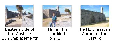
We walked a short distance north on top of the seawall, and I was struck by how precise and sharp the angles at the corners of the fortification actually were, and I took a picture of the southeast corner of the fortification so that you could see, too. We continued walking on top of the wall along the water until we got to the stairs down into the outer moat. Along the way we took some good pictures, and you can take a look at them if you click on the thumbnails below:
|
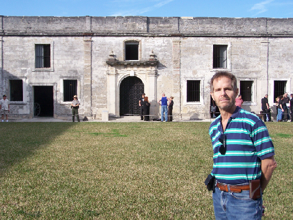
When we reached the end of the fortified seawall, we could look across the north side of the Castillo. The fortification was much like the eastern side, but without the water access, of course. At the top of the stairs down into the outer moat area, we could look back south along the eastern side of the Castillo to the city of St. Augustine in the background. Then we descended the stairs and walked right over to the side of the Castillo where I got a picture of Fred right beside the Castillo.
We walked back south right alongside the wall of the Castillo until we came to the U. S. Shot Furnace. This structure is a hot shot furnace for heating cannon balls to be shot at wooden vessels and to set them on fire. It is part of the water battery built by the U.S. (1842-44) when this side of the moat was filled and guns were mounted on the stone arcs behind the seawall. (You can see some of these arcs in the aerial view above). Then we were back to our starting point where Fred noticed a Spanish coat of arms high up on the Castillo wall.
Entering the Castillo de San Marcos (Path 2)
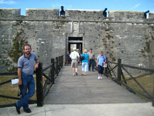 |
There was a raised platform off to our left as we entered, and we walked up the stairs to it. From there, we could look along the southeast wall of the Castillo towards the Intracoastal, and we could also look over and down at the the entrance bridge to the Castillo proper. We came back down from that platform and crossed the bridge entrance to the Castillo. Just outside the entryway to the fortress we encountered a Castillo guard- or at least a reasonable facsimile of one. We listened to some folks talking with him for a few minutes, and then moved inside the entryway, where Fred got a picture of me with a view back outside and across the entry bridge. You can have a look at that picture here.
The Spanish soldier had also moved inside to give some explanations to a few people who were asking questions. As he did so, he was standing behind the information desk, and the whole scene struck me as a bit funny- what with the anachronism of the modern desk and brochures and the "soldier" in seventeenth-century attire. He looked for all the world like a seventeenth‑century concierge!
Before we start actually touring the Fort, a few words about its history. Castillo de San Marcos is a United States National Monument. This fortification, the oldest in the continental United States, anchored the St. Augustine defense system (city wall, supplementary lines, and outposts at Matanzas Inlet near Jacksonville, the St. Johns River, which flows west of here, and St. Marks). The Castillo replaced the last of nine successive wooden forts which, since 1565, had affirmed Spanish dominion and protected Spanish shipping returning to Spain. (You can see a diagram of the approximate shipping routes that the Spanish used, taken from an exhibit inside the Castillo, if you will click here.)
Touring the Ground-Floor Rooms and Exhibits (Path 3)
 |
|
|
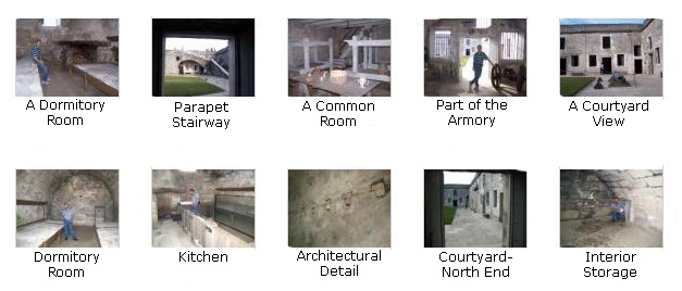
Now we began to tour the various rooms here on the ground floor of the Castillo, sticking our heads in just about everywhere we could. Most of the rooms were either labeled very well or their function was fairly obvious- such as the chapel. Many of them contained interesting exhibits; one explained the picture that Fred had taken earlier of the royal coat of arms while another had an interesting bronze model of the Castillo. Another was being used as a small theatre that showed short movies. One of the interesting ones was a re-enactment of the formal cannon-firing procedure (I hadn't realized the procedure was so structured) that coincidentally starred our Spanish concierge. Yet another detailed how the Castillo had been built and expanded in stages over many years and still another displayed the various flags that had flown over the Castillo at one time or another. (You can take a look at those flags here.
As we toured through the various rooms and looked at the exhibits, we took a great many photographs, but we've selected only some of them for this album. If you will click on the labeled thumbnail images below, you can look at these pictures:
|
Walking Around the Top of the Castillo (Path 4)
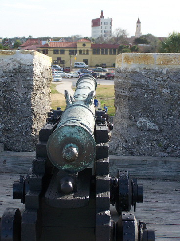 |
There was a lot see from up here. One of the first things you notice is the total view that you have of the inner portion of the fortress, and we took pictures all around. Click on the thumbnail images below to look at them:
|
At each corner of the fortress are the circular lookout posts that are so familiar in pictures of Spanish colonial forts in the New World. I'd never been on top of one of these fortresses before, so I did not know that there were walkways or anything like that to allow access; they almost look decorative. But this picture of Fred at one of the accesses shows what they are actually like. The last time I saw these for real was in San Juan on the cruise Grant and I took in 1991, but they are iconic (and have appeared on U.S. postage stamps.
|
I made a pretty good panoramic movie from the top of the Castillo to show you the view in all directions. |
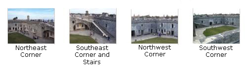
We walked entirely around the top of the Castillo, taking pictures of the cannon emplacements, the fortress itself and the views in all directions. These pictures don't need much narrative, so we've just put thumbnail images for them below. If you will click on these thumbnails you can look at the full-size images:
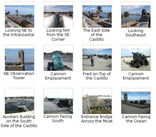
|
Well, that was it for the Castillo de San Marcos. It was very interesting, but it is getting late and we need to get on the road to Fort Lauderdale.
Returning to the Visitor Center
|
|
To get back to the Visitor Center we just crossed the street and walked a block north. We happened to notice a nice little shopping area because the sound of the fountain in the middle of it attracted us. There was a shop selling all kinds of cat and dog items that were breed-specific, and I found a neat set of salt and pepper shakers in the form of little daschunds for my sister. I also made a movie of Fred at the fountain, and you can watch that movie by clicking on the thumbnail image at left.
We then walked across the street to an old gate that provided entry to the grounds of the Visitor Center. We passed the fountain with six faces once again so Fred could get another picture from a different angle. Then we walked past the tower clock to the parking garage where we collected the car and headed on to Fort Lauderdale.
I do not remember ever spending so much time in St. Augustine, although I am sure my family did when I was young. It was certainly interesting and well worth going a little out of our way to get to.
Driving to Fort Lauderdale
 |
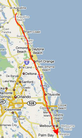 |
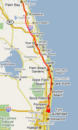 |
When we got into town, we got off at Oakland Park Blvd. so we could have dinner at Peter Pan, the diner we frequent when in town, and then we headed home to the condo. We found everything in order there, and it wasn't long before we retired for the night.
You can use the links below to continue to another album page.
|
February 13-23, 2009: Relaxing in Fort Lauderdale |
|
February 11, 2009: Driving to St. Augustine |
|
Return to the Index for Our Florida Trip |