|
February 13-23, 2009: Vacationing in Fort Lauderdale |
 |
Return to the Index for Our Florida Trip |
February 24-25, 2009
Driving Home to Dallas
It's the morning of the 24th, and time for us to head home. A few days ago, Ron and Jay surprised us with a portable GPS for the car. Ron says that it's in thanks for allowing him to use the condo at lunchtime for his naps and snack, and it was very nice of them to think that anything at all was required. But since we have it now, we've decided to let it show us the way home. I suspect that it will send us a different way than usual, because when I ask Mapquest or Google Maps for directions, I get a different route than the one I usually take. So we shall see.
February 24: Our Trip Home (First Day)
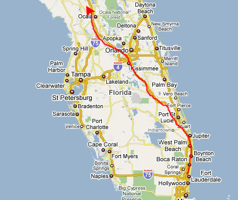
We started out the way we would normally go- following the GPS instructions. It took us out Broward Blvd. to I-95 and then north. Near Jupiter, it routed us over to Florida's Turnpike- again, the way I would normally have gone. We took the turnpike northwest and by early afternoon we were north of Orlando.
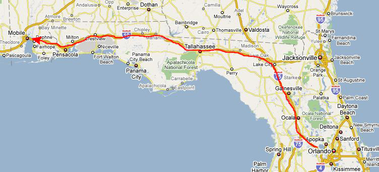
From north of Orlando, the GPS routed us up I-75, our usual route, and we stopped at a BBQ restaurant in Gainesville for lunch. Then we continued up to I-10, taking that west past Tallahassee and Pensacola towards Mobile, Alabama. As we neared Pensacola, Fred was able to get some good sunset pictures through the windshield, and if you will click on the two thumbnail images below, you can have a look at them:
We continued on west towards Mobile- still following the instructions from
the GPS.
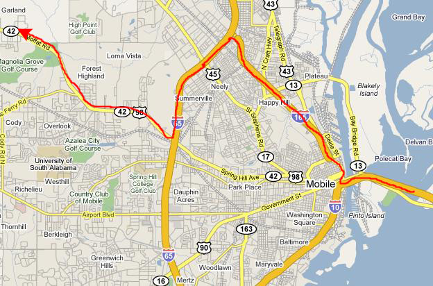
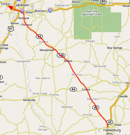
At Mobile, the directions issued by the GPS deviated for the first time from the route I would normally have taken (which would be to continue west on I-10 to I-49 and then take I-49 north to Shreveport). Apparently, the GPS was going to route us directly northwest towards Jackson, Mississippi. I could see on the map where this would be more of a diagonal than my usual route, but the segment from Mobile to Jackson was not Interstate highway, and I was concerned about losing time on non-Interstate highways. However, even when I asked Google Maps to give me the fastest route, it still chose this, so we decided to go ahead and see what it was like.
Our first problem occurred just as we got off of I-10 at Mobile. There was no direct connection to I-165 north, so we had to go a mile or two on downtown streets. This might have been fine, but there had apparently been some kind of street celebration going on and downtown was jammed. Traffic just crawled for those two miles, and it probably took us twenty minutes just to go that distance.
Then we followed the GPS as it sent us north on I-165 and then back south on I-65 to the exit for US 98 west. As it turned out, we would have made better time across a slightly longer distance if we'd taken I-10 to I-65 and then gone north to our exit. We could have avoided the twenty-minute delay downtown.
But, anyway, we found our exit and headed northwest.
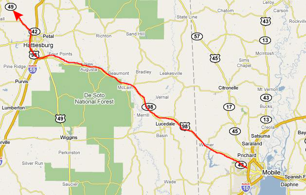
We immediately found ourselves wishing that we'd gone the way we always did, for the highway was only two lanes wide in places, and was all built up. For about the first fifteen miles as we headed away from Mobile, the road was congested with lots of traffic lights, and with the trucks and all the traffic, we were lucky to do 45 miles an hour. We were kicking ourselves (I was kicking myself, actually) for trying this route.
After about fifteen miles, however, the complexion of the highway changed. We left the city behind and the highway opened out into a four-lane divided highway (although not an Interstate). At least there were two lanes in each direction and relatively few lights (maybe one every five or ten miles), and we were able to move along quickly, keeping up with the few other cars who were doing 70 or so. We made good time all the way to Hattiesburg, where the GPS put us onto I-59 north. We took a city exit to find a restaurant (Shoney's) to get something to eat, and then got back on I-59 to the exit for the continuation of US 98/Mississippi 49 northwest.
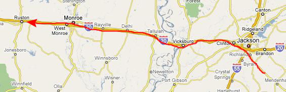
We continued to make good time all the way to Jackson. We weren't, perhaps, going quite as fast as we might have on the Interstate, but the difference was not much. There was some traffic and congestion as we went through the southern part of Jackson to hit I-20, but it wasn't much at this time of night (ten o'clock or so).
All in all, I can't help but think that the different route was pretty much a wash, time-wise. I think that next time we drive to Florida, we might try going down this way, if only to bypass the usual congestion in Baton Rouge (that we've gotten caught in twice now).
Well, we'd had dinner and it was ten-thirty or so and we were on I-20 heading west. From here, it is all Interstate all the way to Dallas, and we started debating whether we should just drive right on through, which would put us into Dallas sometime around five in the morning. We went back and forth about that, but finally decided to go ahead and stop for the night and do the rest tomorrow. We ended up stopping about one in the morning in Ruston, Louisiana at the Super 8 Motel there.
February 25: Our Trip Home (Second Day)
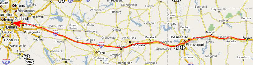
Understandably, we slept a bit late in Ruston, but then got back on I-20 for the final shot to Dallas.
We passed through Shreveport just after lunch, and so we stopped at a BBQ restaurant that we knew about from our last trip to have some lunch. Then it was a 3-hour trip back to the city, where we arrived about 4 in the afternoon. Fred had been gone quite a long time, so after relaxing at the house for a while, we went and had some supper and he left for Van Alstyne.
You can use the links below to continue to another album page.
|
February 13-23, 2009: Vacationing in Fort Lauderdale |
|
Return to the Index for Our Florida Trip |