


|
October 5, 2009: Green Bay, Wisconsin |
|
October 3, 2009: Chicago, Illinois/The Field Museum |
|
Return to the Index for Our Midwest Trip |
Walking from Our Hotel to the Parkview (My Old Condo)
|
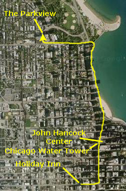
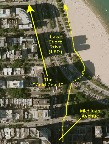
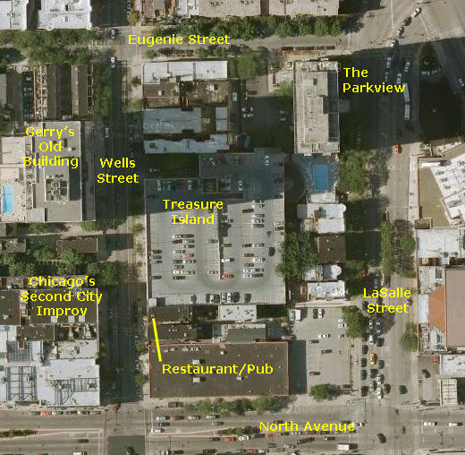
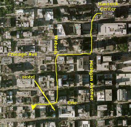
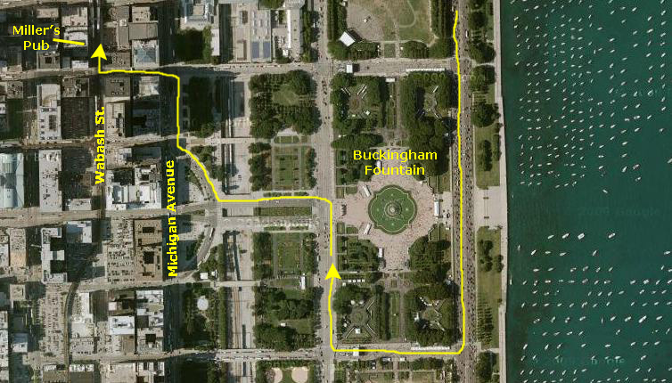
The walk to the Parkview, which is about two miles, will take us from our hotel east to Michigan Avenue via Ontario Street. At Michigan Avenue, we'll head north, going under Lake Shore Drive and then walking up the lake shore to North Avenue. At North Avenue, we'll head west to LaSalle Street and then north a block to The Parkview.
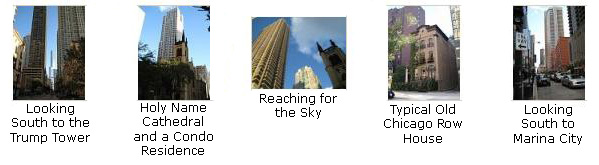
The first segment of our walk was from our hotel at Wabash and Ontario east along Ontario to Michigan Avenue. We took a few good pictures along the way, and you can look at them if you click on the thumbnail images below:
|
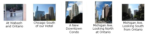
One of the Chicago landmarks along Michigan Avenue is the Chicago Water Tower. The Chicago Water Tower is a contributing property in the Old Chicago Water Tower District landmark district. It currently houses a Chicago Office of Tourism's Official Visitor Center. The Chicago Water Tower is the second-oldest water tower in the United States, after the Louisville Water Tower in Louisville, Kentucky. The tower, built in 1869 by architect William W. Boyington from yellowing Lemont limestone, is 154 feet tall. Inside was a 138 foot high standpipe to hold water. In addition to being used for firefighting, the pressure in the pipe could be regulated to control water surges in the area.
The tower gained prominence after the Great Chicago Fire of 1871. While some incorrectly believe that the tower was the only building to survive the fire, a few other buildings in the burned district survived along with it. But the water tower was the only public building in the burned zone to survive, and is the only one of the surviving structures still standing. In the years since the fire, the tower has become a symbol of old Chicago and of the city's recovery from the fire.
If you will click on the thumbnail images below, you can look at some of the pictures we took of the Water Tower as we approached and passed it:
|
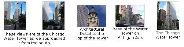
And of course, Chicago is all about the tall buildings and the architecture. It used to be that many of the country's modern architectural landmarks were in Chicago- more, even, than in New York City. Those landmarks are mostly still here, but they've been overshadowed by all the new construction. The new buildings have their own distinctive beauty, I think, and they mostly seem to be different one from the other. Chicago is more open than Manhattan, so it's easier to admire the individual buildings. If you click on the thumbnail images below, you can see some of the new construction along Michigan Avenue:
|
|
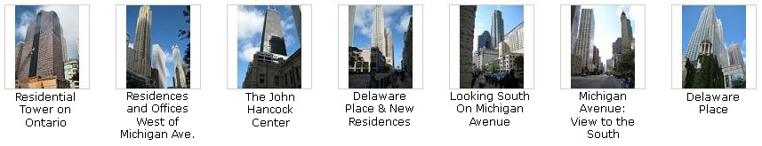
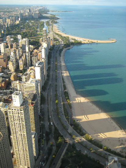
This area, home to much of Chicago's "old money," has, for at least a century, been known as "The Gold Coast." This row of residences began as two- and three-storey brick and stone mansions, but after World War II, the lake side of the first block in converted over to some of Chicago's first residential high-rise buildings. They were immediately a success, and the apartments in them were legendary for their size and opulence. Some of the newer buildings have wrested the attention away from the Gold Coast, but this stretch from the top of Michigan Avenue to North Avenue remains one of Chicago's most desirable (and expensive) residential areas.
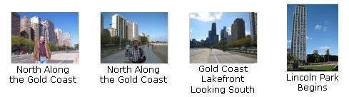
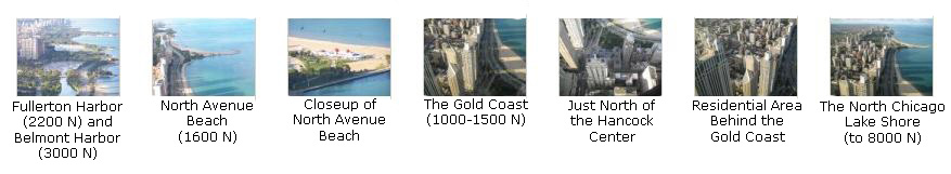
Most of the buildings have residences that run entirely through the building from east to west, so that every apartment/condo has at least one lake-facing view, and these views are pretty spectacular (at least in the Fall, Spring and Summer). In warm weather, the walkway along the lake shore is very busy with joggers, bicyclists, sun bathers and swimmers. The area is also a popular place for boaters to congregate. In some of the pictures below, you can see this Gold Coast area as Fred and I walked along the lake from the top of Michigan Avenue to the pedestrian underpass at North Avenue. Click on the thumbnail images below and you can take a look at some of the pictures we took:
|
|
|
When we got to the upper end of the Gold Coast at North Avenue, we took the pedestrian tunnel under LSD to walk along North Avenue heading west. North Avenue is the southern boundary of Lincoln Park, one of the nation's largest urban parks- larger than Central Park in New York City. Depending on how you define an urban park, Lincoln Park, at a little over 1,200 acres, either the second largest city park or at least in the top 5. It is certainly the longest urban park, stretching some six miles along the Chicago lakefront. It is one of the things that makes Chicago such a livable city, that so much of the lakefront has been set aside from development.
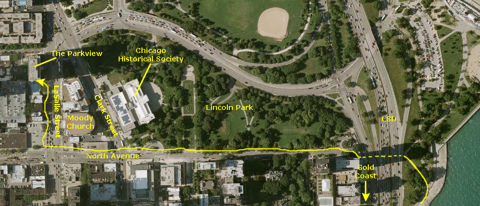
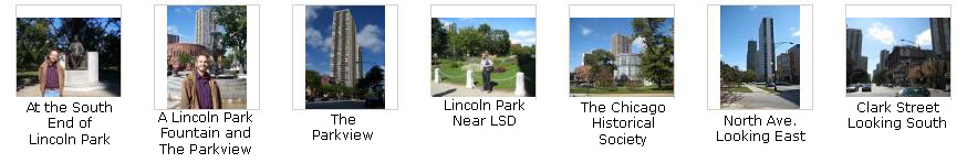
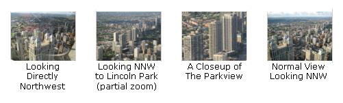
We walked west along North Avenue, crossing Clark Street to LaSalle Street. LaSalle Street is one of Chicago's most notable streets; downtown, it is Chicago's Wall Street. It dead ends into the Chicago Board of Trade; the Federal Reserve Bank of Chicago and the former Continental Illinois Bank and Trust are on either sides of LaSalle. LaSalle Street actually begins right in front of The Parkview, the building I last lived in in Chicago. Before reaching The Parkview, Fred and I took some pictures along North Avenue, and you can look at them by clicking on the thumbnail images below:
|
At The Parkview
|
|
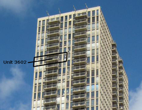
If you can count, you'll see that the building was 42-floors high. I had certainly never lived in such a place before, but I knew the first afternoon I walked in to see the apartment for rent that I just had to. The views alone sold the apartment. The living room and kitchen had views to the south and downtown; the living room and both bedrooms had views to the west. And these views were expansive. Between The Parkview and downtown there were no other tall buildings to block the view; in fact, the only tall building nearby was my friend Gerry's old building across Wells Street, but it was shorter than my building and I could see over it as far west as the air quality would allow.
Perhaps by the time you read this, I will have worked backward in my photo album to the mid-1970s where you will see some of the photos that I took from my condo while I lived there. If not, just trust me- the views, especially at night, were just incredible. Perhaps one of these days, I'll be in another highrise like it; certainly, there are some here in Dallas. But Dallas isn't Chicago, as I am sure some of the pictures from this trip have already indicated. I wish now that I hadn't sold the condo a few years after I left Chicago, and had continued to rent it out. It would have made a wonderful getaway "pied a terre" in the country's most beautiful city.
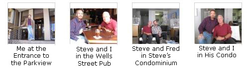
Anyway, today we've come to the Parkview not only so that I can see it again and Fred can see it for the first time, but so that we can hook up with one of my oldest friends- Steve Goldberg. When I started traveling for a living in 1974, Steve became my travel agent, and over the years he must certainly have booked hundreds and hundreds of thousands of dollars of airline tickets, hotels and rental cars. Back then, there was no Internet, and no way for individuals to compare deals except through exhaustive telephoning. It was much, much easier just to let Steve handle everything. Steve, and some of my other Chicago friends (Diane Glickman, Sheila Pasen and Linda Rappin) all lived in the building, and Gerry lived across the street. I had not seen Steve since sometime in the late 1980s when he came down to Dallas for a visit with Grant and myself, so I was looking forward to the reunion.
|
Meeting Up with Gerry Vitale
|
|
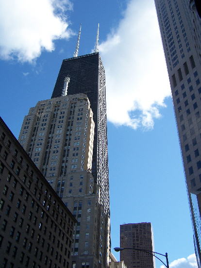
When we got together, we thought that one thing Fred should do would be to go up in one of the Chicago skyscrapers, and the nearby John Hancock Center seemed the logical choice. So we walked from Gerry's condo east to Lake Shore Drive and then south to the Hancock Center. When we got to Lake Shore Drive and turned south, there were good views of the Hancock Center, so we took a couple of pictures. The two best were of Gerry and I and Gerry and Fred.
Visiting the John Hancock Building
94th Floor Observation Deck
|
The building is home to offices and restaurants, as well as about 700 condominiums and contains the highest-up residences in the world. The building was named for John Hancock Mutual Life Insurance Company, a developer and original tenant of the building.
One of the most famous buildings of the structural expressionist style, the skyscraper's distinctive X‑bracing exterior is actually a hint that the structure's skin is indeed part of its 'tubular system'. This idea is one of the architectural techniques the building used to climb to record heights (the tubular system is essentially the spine that helps the building stand upright during wind and earthquake loads). This X-bracing allows for both higher performance from tall structures and the ability to open up the inside floorplan (and usable floor space) if the architect desires. Original features such as the skin have made the John Hancock Center an architectural icon. It was pioneered by Bangladeshi-American structural civil engineer Fazlur Khan and chief architect Bruce Graham. Unlike the Sears Tower, the building's antenna masts are the same height, which gives the building a much more symmetrical appearance, despite several similarities in the design of the two buildings.
The interior was remodeled in 1995, adding to the lobby travertine and textured limestone surfaces. The elliptical-shaped plaza outside the building serves as a public oasis with seasonal plantings and a 12-foot (3.7 m) waterfall. Here is a picture of Gerry and I in the plaza. A band of white lights at the top of the building is visible all over Chicago at night and changes colors for different events. For example, at Christmas time the colors are green and red. When a sports team goes far in the playoffs, the colors change, too. When the Chicago Bears made the Super Bowl the colors were blue and orange. You may be interested to know that there is a swimming pool for residents inside the building on the 44th floor. It is America's highest indoor swimming pool! The building is a member of the World Federation of Great Towers. It also has won various awards for its distinctive style, including the Distinguished Architects 25 Year Award from the American Institute of Architects in May 1999.
|
|
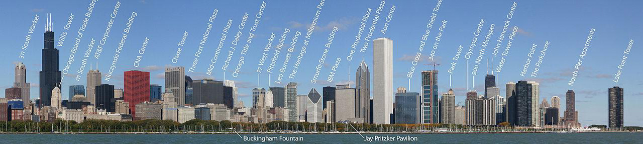
If you want to compare John Hancock Center to other Chicago skyscrapers, and position it in Chicago's skyline, you can use the scrolling window below, which presents a panoramic view of downtown Chicago as seen from a mile or so out into Lake Michigan from Grant Park and Harbor. Just use the scroll bar to go back and forth if the entire skyline is not visible to you all at once:
 |
The entry to the observation deck is from the lower level, so we went inside, bought our tickets and then queued up for the elevator. The elevator takes only about 45 seconds to ascend the 95 floors to the observation level, so we were there before we knew it. The observation deck itself is one open floor with windows all the way around. At the elevator/stair core, there is a cafe and some gift shops and a number of exhibits about the city of Chicago.
|
At a couple of spots in front of the windows in each direction there are maps that explain the view, labeling the other buildings and points of interest. There are no buildings blocking the view in any direction, so all the views are impressive.
On the south side of the floor is a special outdoor area where the windows have been replaced by steel mesh. In this area you are indeed outside, and can experience the winds over 1000 feet above ground level.
Included in the admission is an audio guide system keyed to the maps and other labels on the windows. With this system you can learn a great deal about the city of Chicago, and it was the first time I had used it. Explanations of the views and the narration of the interesting items about Chicago history and the current city was done by David Schwimmer, the actor most noted for his role on the TV show "Friends."
|
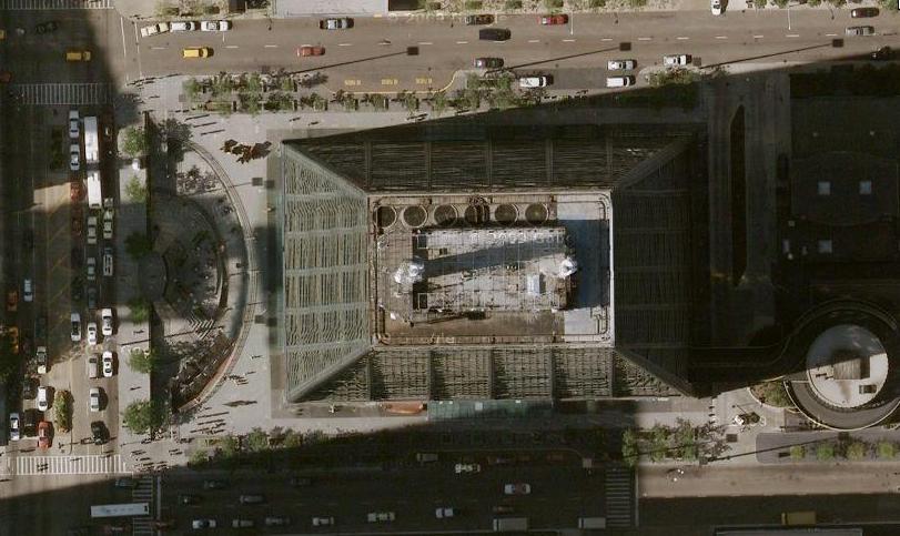
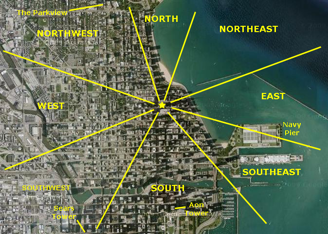
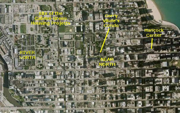
To help orient you, at right is a higher-level aerial view of downtown Chicago. I have marked the general directional groupings that I'll use to organize the pictures. I've also marked four major landmarks that I'll refer to when I label the picture thumbnails. Let's begin our tour with the views to the east.
Views to the East: Streeterville and Lake Michigan
The local press became enamored with the story of Streeter's brash personality and his self-proclaimed district. Mayor William Hale Thompson tried to evict the Streeters for selling liquor, and after several eviction attempts and gun battles, Streeter landed in jail. In 1918, the courts invalidated his claim of sovereignty. Today, the district is home to some of the most expensive real estate in Chicago but, in a throwback to the past, the entire area is still called Streeterville.
 (Click on Image to Expand) |
Although there is general agreement that Streeterville is bounded on the west by the Magnificent Mile, some claim the boundary extends to one block further to the west to Rush Street. The southern boundary is close to the Chicago River and the northern boundary is at the top of Michigan Avenue. Streeterville includes Navy Pier, the most visited attraction in Chicago, and, of course, the John Hancock Observatory, the eighth-most visited attraction in Chicago. In 2007, construction started on Chicago's new tallest skyscraper, the Chicago Spire. It will be located in the southeastern corner of the neighborhood, next to Lake Shore Drive, and is scheduled to be completed in late 2010.
The neighborhood hosts a National Historic Landmark, the Jean Baptiste Point Du Sable Homesite, the home of the first settler in Chicago. Properties in the neighborhood listed in the National Register of Historic Places include 257 East Delaware, the 860-880 Lake Shore Drive Apartments, the Drake Hotel, the Fourth Presbyterian Church of Chicago, the Navy Pier and the Palmolive Building. Other Chicago Landmarks in the neighborhood include Allerton Hotel, Farwell Building, McGraw-Hill Building, Perkins, Fellows & Hamilton Office and Studio, Tribune Tower, and the Woman's Athletic Club.
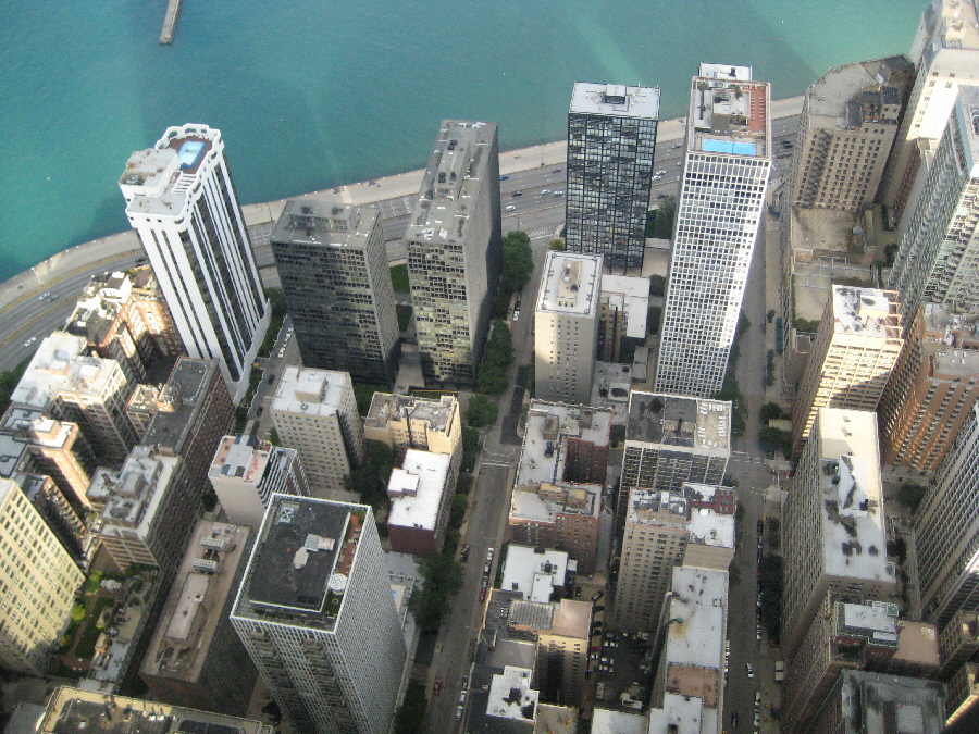
The east views from the Observatory look out across the northern portion of Streeterville to the lake. We took the photo at left when we first arrived at the Observatory. Fred also took a zoom picture of boats at the offshore breakwater. Late in the afternoon, when we'd returned to our starting point after a walk around the entire floor, the buildings of Streeterville, including the Hancock Center, were casting shadows into the lake.
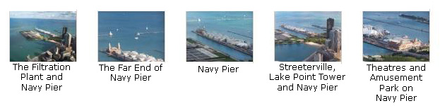
Views to the Southeast: Streeterville and Navy Pier
South of the filtration plant is Navy Pier. Navy Pier is 3,300 feet long and was actually constructed beginning in 1914 as a pier. The pier was completed in 1916 at a cost of $4.5 million, equivalent to $87.8 million today. It was a part of the Plan of Chicago developed by architect and city planner Daniel Burnham and his associates. As Municipal Pier #2 (Municipal Pier #1 was never built), Navy Pier was planned and built to serve as a mixed-purpose piece of public infrastructure. Its primary purpose was as a cargo facility for lake freighters, and warehouses were built up and down the pier. However, the pier was also designed to provide docking space for passenger excursion steamers, and in the pre-air conditioning era parts of the pier, especially its outermost tip, were designed to serve as cool places for public gathering and entertainment. The pier even had its own streetcar.
With the decline of lake shipping, one purpose for the pier evaporated, and the "public gathering place" purpose became most important. During WWII, the pier was leased to the Navy, and some 40,000 Navy personnel trained there (including the first President Bush). In honor of this service, the city renamed the pier "Navy Pier" during that time. Today, Navy Pier is Chicago's number one tourist attraction; it has theatres, an amusement park, restaurants and a wealth of other attractions.
Below are thumbnails for some of the best pictures we took in this direction; you can click on them to view the full-size images:
|
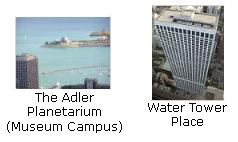
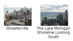
Views to the South:
Streeterville & the Museum Campus
Grant Park & the South Shore
Eastern Portion of Downtown
|
|
Below are thumbnail images for some of the photos we took in this direction; click on them to view the full-size images:
|
|
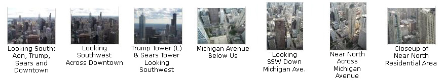
Views to the Southwest: Near North and Downtown Chicago
In this direction, we can see the Aon Tower and the Sears Tower (I guess I'll never get used to calling it the Willis Tower, which is its new name) and between the two the new Trump Tower. (This is the building that was, at least theoretically, managed during its construction phase by the winner of the first installment of Donald Trump's "The Apprentice" television show.) These three buildings that you can see in the first couple of views below are each taller than the John Hancock Center.
Below us we can see Michigan Avenue and the residential areas of Near North- a profusion of beautiful highrises. Having lived in a highrise building before, I can only imagine how much more modern they are now than The Parkview, which was built in the early 1970s. One of these days I'd like to see some of these apartments and condos, so I guess I'll have to pose as a prospective purchaser.
Anyway, I've put thumbnail images below for the best of the pictures we took looking southeast. Click on them to view the full-size images:
|
|
|
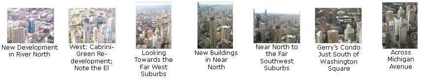
Views to the West: Near North, River North and Suburban Chicago
|
Cabrini-Green was a Chicago Housing Authority project and, at its peak, was home to 15,000 people, living in mid- and high-rise apartment buildings. Over the years, gang violence and neglect created terrible conditions for the residents, and the name "Cabrini-Green" became synonymous with the problems associated with public housing in the United States, and this was the condition it was in when I lived in Chicago.
As of 2008, around 4,700 residents remained in Cabrini-Green. Most of the buildings have been razed and the entire neighborhood is being redeveloped into a combination of high-rise buildings and row houses, with the stated goal of creating a mixed-income neighborhood, with some units reserved for public housing tenants. The audacious project is not without its controversy, and plans are still in flux.
In our views from the Hancock Center, we can see many miles beyond River North; on clear days, you can see 40 and 50 miles, out to the far west suburbs like Lombard, Wheaton and West Chicago. Below are thumbnail images for some of the western-looking pictures that we took from the Hancock Center; click on them to view the full-size images:
|
Views to the Northwest
|
|
|
Views to the North
|
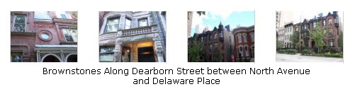
The most exclusive residences were just north of where the Hancock Center is now, and where the Gold Coast later grew up. The brownstones and mansions on the streets between LaSalle and the lake were legendary in their opulence. As the city grew, development continued north, bordering Lincoln Park and, as with the Gold Coast, a wall of medium-rise apartment buildings grew up. Over the years, many of these were replaced with taller and taller structures- like The Parkview.
The open green space of Lincoln Park, with its zoo, conservatory, gardens, playing fields, bike and equestrian paths and, of course, the beach, made residences close to it premium places to live. This development continued up to the end of Lake Shore Drive (which ends at Hollywood Blvd.). Lincoln Park also ends at Hollywood; Sheridan Road continues up the lake shore, usually hugging it closely. From Hollywood north, an entirely new set of high-rise buildings grew up along the lake shore, all the way to Highland Park, Park Forest and Evanston.
So, from my building north, and from the edge of Lincoln Park inland, was solid residential. And the rule always was that the closer to the lake you were, the more expensive the accommodations. And, at any given spot, the higher you were, the more exclusive your residence was. I was fortunate to be in the right place at the right time, and end up with a residence that was not only as close to the lake as possible but almost as high in my building as possible.
So, the views to the north are among the most iconic in Chicago, and we have put thumbnails for seven of the best ones below. Click on them to view the full-size images:
|
|
|
Northeast Views and Inside the Observatory
|
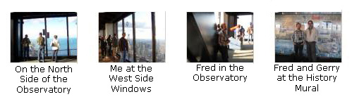
To finish off our tour here in the Observatory, I thought I would include a few pictures that Fred and I took inside the Observatory as we were wandering around. Thumbnails for them are at left; click on them to see the full-size images.
It was about five o'clock when we finished at the Observatory, and there was still daylight left, so I thought that it would be a nice idea to take Fred for a ride up Lake Shore Drive and show him the side of the city where I had lived.
Walking Through Near North Chicago
|
Then we jogged west on Chicago Avenue, south on Wabash (the street our hotel was on) and then west on Erie to the parking lot where the car was. At Wabash and Erie, right around the corner from our hotel, we again passed the Ransom R. Cable House that we'd seen briefly yesterday when we checked in to the hotel. The house is now a Chicago Landmark. It was designed in something called the "Richardsonian Romanesque" style for the president of the Chicago, rock Island and Pacific Railway Company. It is, apparently, one of the few remaining structures that illustrate the original elite residential character of the area just west of North Michigan Avenue.
As we made our way to the parking lot, we had a number of opportunities to take interesting pictures in and around the Near North neighborhood. If you want to see some of these pictures, just click on the thumbnail images below:
|
|
|
A Ride on Lake Shore Drive
|
Then we merged onto LSD and headed north. Not many of Fred's pictures out the moving car's window turned out, but he did get one acceptable one as we exited the expressway temporarily at Belmont Harbor. I wanted to show Fred the kind of building where I lived when I first moved to Chicago, so when we got off at Belmont I drove two blocks south to Barry St., where my first Chicago apartment was located. I won't go into detail about it on this album page; I hope one day to have worked my way backwards to the actual time I lived in the city, and I'll show it to you then.
Just north of Belmont Harbor, I made a movie while I was driving (totally safe, I assure you) of the stretch of LSD just north of that harbor. You can watch it with the player below.
|
|
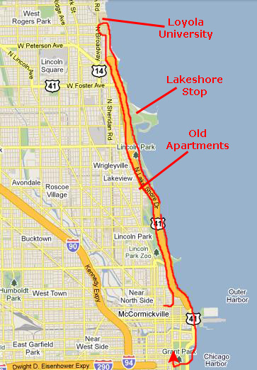
A bit north of Irving Park Blvd., I got off the expressway temporarily and we drove through Lincoln Park over to the lake shore to get a view of the lake and beach. (This wasn't a particularly good example of the beach, as it seemed to be a dog park.) Then we continued north on LSD until it ended at Hollywood, and then we drove north on Sheridan Road. We ended our northward trek at Loyola University where Gerry went to school.
|
|
Riding on LSD is something that I used to do frequently, and I always thought that the scenery, particularly heading south, was pretty amazing. But I'd never really had the opportunity to take pictures of it before. Now, with my little camera, I could- even while I was driving. So, beginning at about Irving Park Blvd., I filmed a movie as we headed south, and filmed almost all the way to the Hancock Center. I think the movie turned out well, and I hope you'll have a look at it using the player at left.
We followed Lake Shore Drive around the east side of Streeterville, past Navy Pier and some of the newer buildings at Illinois Center. Then we continued south a half-mile until we could turn west into Grant Park.
Grant Park and Dinner
|
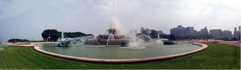
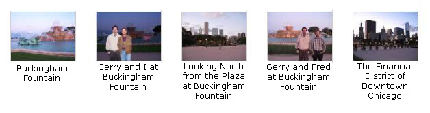
The fountain is considered to be Chicago's front door, since it resides in Grant Park, the city's front yard. The fountain, located at Columbus Drive and Congress Parkway, was designed with sculptures by Jacques Lambert. It was donated to the city by Kate Buckingham in memory of her brother, Clarence Buckingham. The fountain itself represents Lake Michigan, while each sea horse symbolizes a state bordering the lake. The statues were created by the French sculptor Marcel F. Loyau. The design of the fountain was based on the Bassin de Latome and modeled after Latona Fountain at Versailles. The fountain used to be known as the Clarence Buckingham Memorial Fountain. Kate Buckingham also established the Buckingham Fountain Endowment Fund with an initial investment of $300,000 to pay for maintenance on the fountain. Buckingham Fountain was dedicated on August 26, 1927.
(You may also be interesting to know that the fountain is considered the starting point for US Route 66. Perhaps in honor of that, it was also the starting point for the TV reality show The Amazing Race 6.)
If you will click on the thumbnail images below, you can see some of the pictures we took here in Grant Park at Buckingham Fountain:
|
|
|
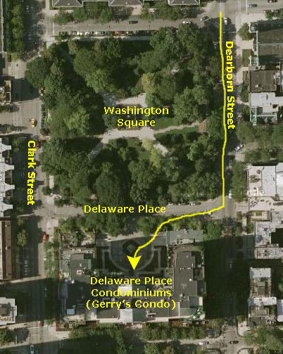
It was getting dark and late, so we decided to eat downtown. Gerry knew of a place over on Wabash- a Chicago institution called Miller's Pub, so that's where we went. Being late on Sunday, we found a parking space on Wabash with no problem, crossed the street, passed under the Chicago "L" and found ourselves right outside Miller's Pub. We had a wait of about thirty minutes, but we had a nice meal after that. We'd enjoyed all the conversation with Gerry today, right up through dinner. Since tomorrow was a workday for the investment guru, we took him back to his condo at Delaware Place and bid him good evening.
After we dropped Gerry off and had taken the car back to the parking lot, Fred and walked around the area of Near North south of our hotel. I didn't get any good nighttime pictures, even though we crossed the Chicago River a couple of times, passed by the new Trump Tower, and saw a number of other views that are familiar to most Chicagoans. After our short walk, we went back to the hotel to get ready for our trip to Green Bay tomorrow.
You can use the links below to continue to the album page for different day.
|
October 5, 2009: Green Bay, Wisconsin |
|
October 3, 2009: Chicago, Illinois/The Field Museum |
|
Return to the Index for Our Midwest Trip |