|
May 10, 2012: A Sea Day |
|
May 3-8, 2012: Crossing the Atlantic |
|
Return to the Index for Our Cruise to Europe |
|
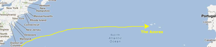
We have been steaming across the Atlantic for six full days; actually, the ship could do the distance in a bit over three, but then the point of a cruise is to relax, and the summer schedule for the Noordam was planned out a long time ago, and only requires that it be in Rome on the 18th. So we took our time.
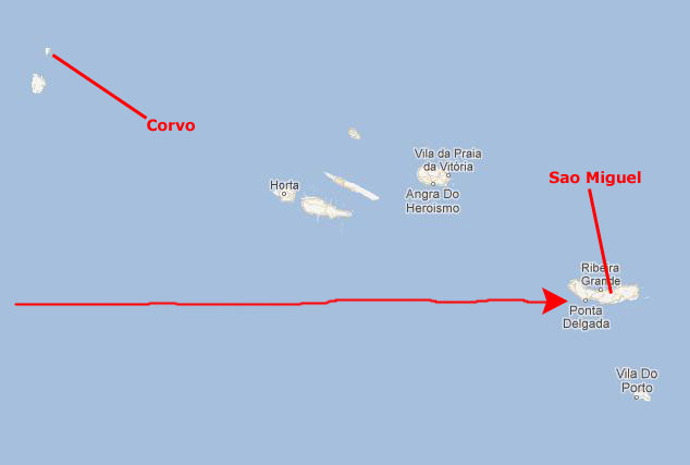
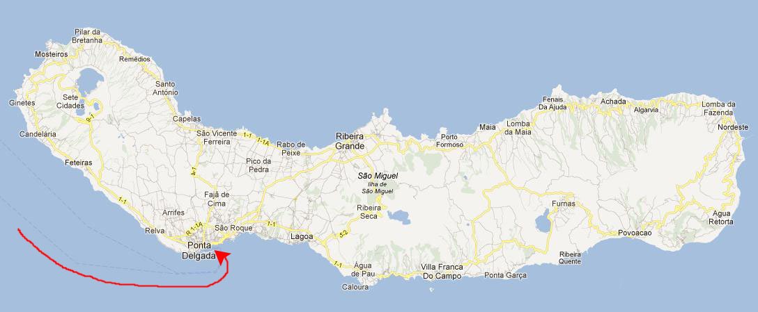
Arriving in Ponta Delgada
|
The Azores played an important role in Portuguese national history when Terceira islanders defeated Absolutists under dom Miguel de Braganca. The (UNESCO World Heritage) city of Angra is known in Portugal as Angra do Heroismo.
|
The weather is temperate and the hills lush and green. The water is sparkling clean and the Azorean people can only be described as warm and friendly. Azorean pioneers represented an unusual mix of Bretons, Jews, Moors and Portuguese people. the multi-ethnic heritage is evident in island architecture, although most homes represent traditional Portuguese style.
The largest and most populated island is the one at which our cruise ship will dock- Sao Miguel. It has the Azores' largest city and best port- Ponta Delgado.
|
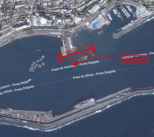
I got up fairly early so that I could be up on deck to watch our arrival into the Azores, but the ship turned out to be a bit early, and by the time I got on deck, there were a goodly number of other folks there and we were a lot closer to docking that I had thought we would be.
|
|
But the ship seemed to be going backward, and when I went over to the other side of the ship, I realized what was going on. First, watch the movie I made from the starboard side of the ship with the player below (I have eliminated the audio because of the wind noise):
|
|
We had actually come into the Porto Delgada harbor from the east, and the captain was backing into the dock. (Presumably, there is a good reason for doing so, not just so he can make a quicker getaway at the end of the day.)
|
I took a few pictures as we were coming into the dock, and if you will click on the thumbnail images below you can have a look at them:
|
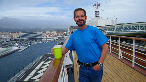
Fred joined me on deck after the ship had docked, and you can see some of his pictures if you click on the thumbnails below:
|
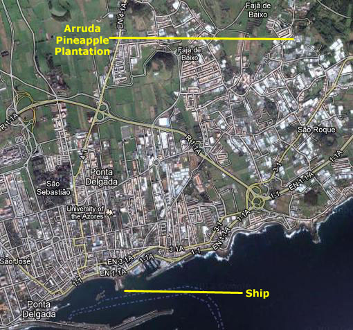
Visiting the Arruda Pineapple Plantation
|
The weather had been cloudy and a little rainy when we came into the harbor, but when the bus left the rain had stopped but the sun was trying to break through (which it did while we were at the plantation). Fred took a number of pictures out the window of the bus as we drove the few miles northeast to the plantation, but many of them didn't turn out well. You can see two that did if you click on the thumbnail images below:
|
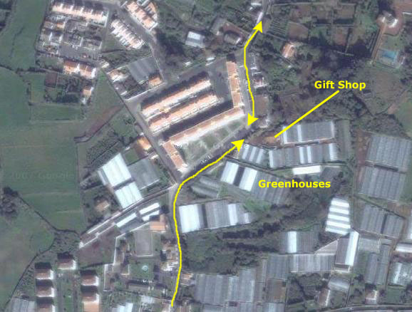
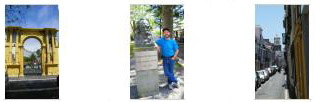
It took about twenty minutes to get to the plantation, which was actually in a separate little town northeast of the main part of Ponta Delgada. The bus parked in the street outside and we got off, at which point I got a picture of Fred and Greg. When everyone was off the bus, our guide took us in to the plantation through the entry gate.
|
Pineapple grown on S�o Miguel originally came from Cantral and South America and it was introduced to the island around the mid 19th century as a decorative plant. When folks realized how delicious the fruit of the plant was, though, a great many more were imported, and a number of entrepreneurs, like Mr. Aaruda, began growing them commercially. This is quite an undertaking here. Unlike Hawaii, whose weather is perfect for pineapples, neither the soil nor the weather here is conducive to open-air, large-scale production.
The soil had to be modified somewhat to encourage the plant to set fruit reliably, and greenhouses had to be built to shelter the plants from cold weather. Here at the Aaruda plantation, they also built a holding pool for water that they used to irrigate the plants in the houses. The complete growing period from planting to picking takes 18-24 months. Although in the Azores pineapples are available all year round, the sweetest are from May through August.
There is also a shop selling pineapples, pineapple liqueur and pineapple jam, and part of the tour was to sample the pineapple liqueur, an island speciality, which is very sweet.
|
|
Fred took some good pictures here at the pineapple plantation, and you can click on the thumbnails below to have a look at them:
|
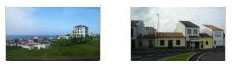
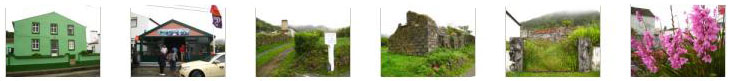
I also took some pictures here at the greenhouses, but I also went for a short walk up the street just to see what I could, and I snapped some pictures of some of the properties along the street near the plantation. You can have a look at my pictures by clicking on the thumbnails below:
|
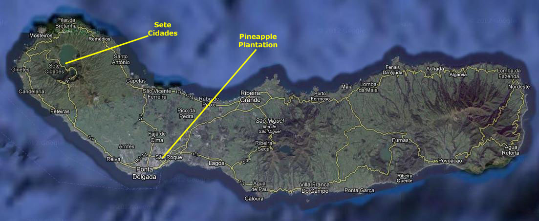
When we were done at the greenhouses, we piled back into the bus for our trip to Sete Cidades.
The Caldera and Sete Cidades
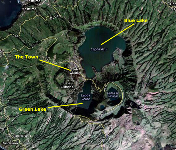
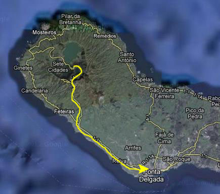
As you can see from the aerial view of Sao Miguel below, we will be heading up and into the largest caldera on the island.
|
The region received its name from Latin: "Island of the Seven Tribes/Peoples/Cities." The first European document to refer to Sete Cidades was a Latin chronicle written in 750 A.D. by a Christian cleric. It told the story of the Visigoth archbishop who, fearing an assault by Muslim forces, sailed to the unknown lands in the western sea- accompanied by six other bishops, their prelates and approximately 5000 faithful in a fleet of twenty ships. The chronicle indicated that the fleet arrived at their destination, burned their ships and established seven Christian communities under the reign of the seven religious leaders. Although many prepared to follow, in truth, the archbishop (if he existed) was never heard from again, nor was the route to the mythical lands established.
|
The district became the fiefdom of a local property owner for many years rented tracts to farmers and other colleagues, who then cultivated the limited areas and paid monthly stipends for their use. More recently, the lands were sold to the municipal government and residents can now obtain title to their lands. this has increased settlement in the caldera.
Our guide related this information as we were riding across the top of Porto Delgada to head northwest to the caldera.
|
|
As we neared the caldera, our guide also gave us a great deal of geological background on the area. The Sete Cidades caldera is the remnant of three phases of volcanic eruption. The first phase occurred 36,000 years ago, and ceased with the collapse of the principal volcano. A secondary phase began around 29,000 years ago and was responsible for the collapse of the northwest portion of the primitive caldera. Around 16,000 years ago the last phase, marked by the collapse of the northern and northeastern portions of the crater occurred.
The Sete Cidades Volcano has experienced 17 intra-caldera eruptions within the last 5000 years, which makes it the most active in the archipelago.
|
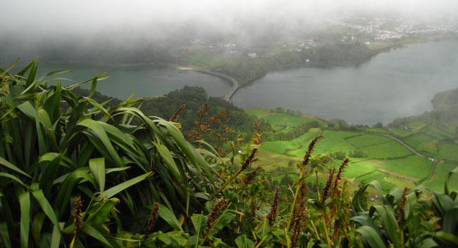
You can't really see the difference today; our guide said that only when the sun is shining is the difference apparent, and even that depends on the angle from which the two lakes are viewed. We did stop at an overlook, where we could get some really pretty views of the houses and farms down at the shore of the lakes.
Before heading down into the town of Sete Cidades, I want to show you a panorama, made on a day clearer than ours, of the view into the caldera; you can use the horizontal scroll bar to see the entire image:
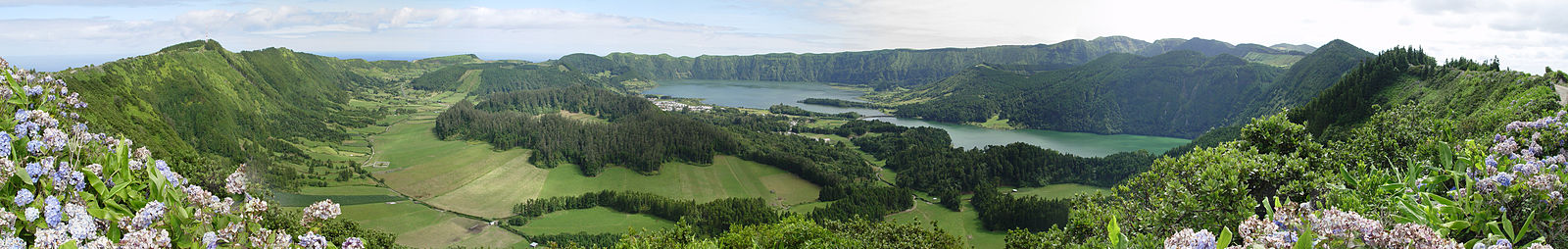
The urbanized portion of the parish, the village of Sete Cidades, is located in the southwest portion of the crater within the Cumierias da Bretanha and extends from the Blue Lake north to south. Farmland, mostly pastures, are located around the village, and confined to the portions south of the Blue Lake. The remainder of the crater is forested, although the southeastern portion also has some grasslands. On the far side of Sete Cidades, a new road and bridge link to Ponta Delgada; we will come into the town from the southeast, across the bridge that divides the two lakes. In the western end of the crater, in an area of open parklands, a tunnel has been constructed that links the crater to the village of Mosteiros. Sete Cidades has a school, a church and a small square.
|
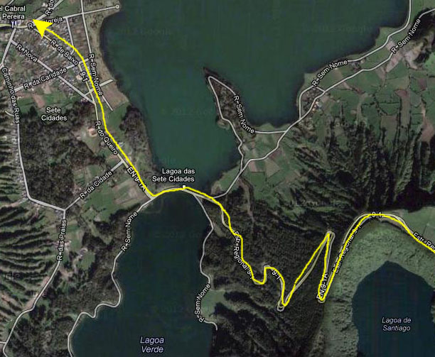
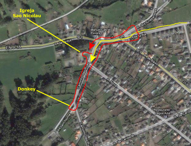
The three of us pretty much wandered around independently, but we saw basically the same things. I've marked in red the route that I took; Fred joined me for most of it. I'll organized the pictures that both of us took based on that route. The first stop we made was at the Igreja Sao Nicolau.
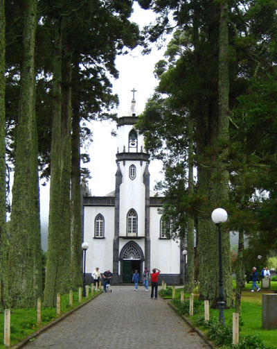
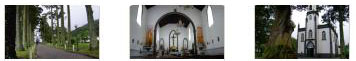
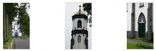
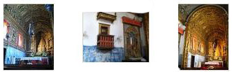
The small country church of Igreja Sao Nicolau was not Sete Cidades only church, but it was by far the largest, and we spent some time exploring the church and grounds.
|
The church was erected in fulfillment of a vow made in 1849 by Colonel Nicholas Maria Raposo Amaral (1770-1865) and his wife. The invocation chosen was Saint Nicholas, Bishop of Myra. The site chosen was 250,000 square feet in the district of Sete Cidades; it had been acquired earlier in 1834 and had become part of a primogeniture established by a deed since 1821. The project, in neo-Gothic style, was done by Manuel Monteiro Lambert, who was also responsible for directing the work begun in 1849 with the help of 60 workers. A water source was nearby, which made the church stay relatively isolated; that water source now feeds a decorative pool a short distance from the chapel. To facilitate its access, a mall of cryptomeria was planted, now headed by two towering pines.
By a deed recorded in 1857, the church was endowed with a budget of $500 per year for its upkeep. Subsequently, in 1859, the church received a separate dowry for the oil lamp of the Blessed Sacrament.
The church was consecrated amid great festivity in 1857, with a solemn Mass celebrated by the then Bishop of hte Diocese of Angra- Friar Stephen of Jesus Maria. The founders kept a chaplain, who had built the Passal, allowing the population of the valley to attend Mass, which until then was only possible in the neighboring parishes. At the time, the place of the Seven Cities belonged to parishes and monasteries of the Riders, separated by the bed of the "Ribeira da Praia," which is now called Church Street.
In 1863, a new law extinguished the morgadios in Portugal, and put the church back into the possession of its founders. In the 20th century, his heirs, no longer wishing to keep it, donated it to the people (1969), so it became the seat of the curate in the parish, which is the designation that the Seven Cities were elevated to in 1971.
The church was a plain one, and fitted well into its surroundings. This was the first church we had seen or entered on this cruise, but given the locations we'd be going to, it certainly would only be the first of many. Looking back on it, though, this was probably the simplest, plainest church we would encounter; a large number of the pictures you'll see in this cruise album will be of churches and cathedrals.
|
|
|
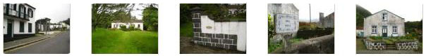
Leaving the church, we walked back towards where the bus was parked along Caminho das Ruas, passed the bandshell/gazebo, which I presume is used for town functions, and then southwest along Caminho das Ruas, passing Rua Nova on the way.
|
|
He also took some pictures while walking along the street; have a look at them by clicking on the thumbnails below:
|
I took some pictures, too, and you can see them by clicking on the thumbnails below:
|
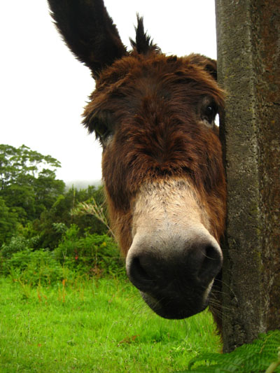
Up at the top of Caminho das Ruas we seemed to have run out of "town" and gotten into "farm." And here's where I found a friend.
|
|
The three of us walked back down towards the church, and then Greg went off somewhere on his own for a while while Fred and I walked east on Church Street, back the way the bus had come into town. It was just a pleasant walk, with appropriately rustic Azorean rural scenery to look at. We turned around at the intersection where the road we came in on meets the road to the tunnel to Mosteiros. Here, we also found an interesting fountain- it was working, but I wasn't sure if it was for people or animals.
You can click on the thumbnails below to see some of the pictures we took along Church Street as we headed out and then back to the square to reboard our bus:
|
We did get back to the square at the right time to board our bus that was going to take us back to Porta Delgada. On the way, we stopped at an overlook up on the caldera rim where we could get a good view of Lake Santiago, which was actually inside the large caldera but in a smaller caldera of its own. While it wasn't good for picture-taking that there was so much mist, it made the thick pine forest seem even more lush that it actually was. At the overlook, I discovered a trail down through the forest that led all the way to Lake Santiago. I walked down it a hundred feet or so; it was very pleasant, and it would have been nice to have the time to hike down and back but I had to return to the bus pretty quickly. After that, it was a pleasant bus ride back to Porto Delgada- during which time we found that the mist was mostly up in the mountains, for it got more and more clear and sunny as we got closer to town.
Walking Around Ponta Delgada
|
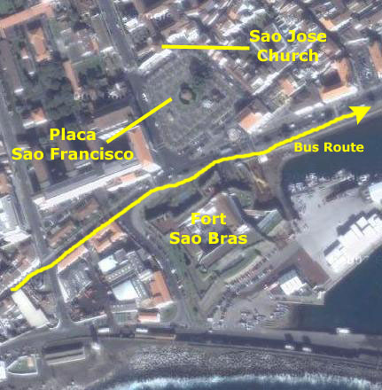
Fort Sao Bras
|
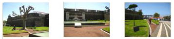
The three thumbnails below will take you to a series of pictures spanning the front of the fortress, looking at it from our view from the street:
|
You can see the War Memorial close-up here, and an even closer view of one of the sculptures here.
Across the street from Fort Sao Bras was Plaza Sao Francisco, which seemed to be being prepared for some sort of festival, and on the other side of the plaza was the Sao Jose Church. Before we cross the plaza, have a look at the 360° panorama I tried to make of the forte, the Plaza Sao Francisco and the buindings around it. Just scroll back and forth to see the entire view:
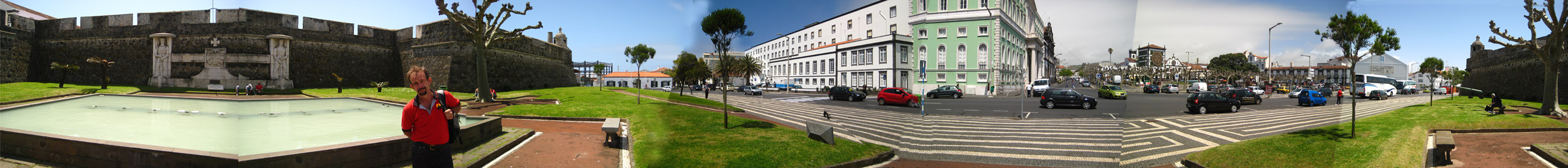
On the other side of Placa Sao Francisco we could see the Sao Jose church, and that's where we would be heading next, so we walked out into the plaza.
|
|
Fred took some pictures in the plaza, and you can have a look at them if you click on the thumbnail images below:
|
We walked across the plaza to take a closer look at the church.
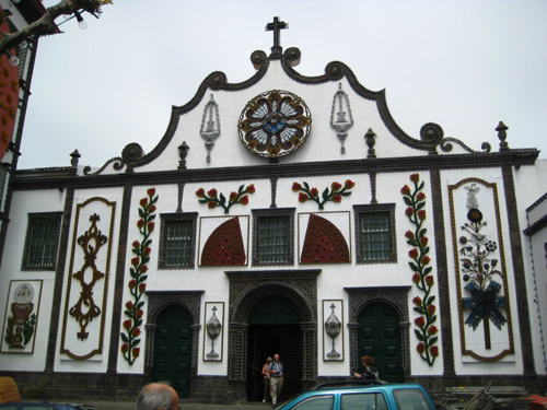
Sao Jose Church
|
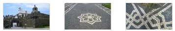
Click on the thumbnail images below to see some of the beautiful interior of this church:
|
Walking Through Ponta Delgada
|
|
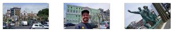
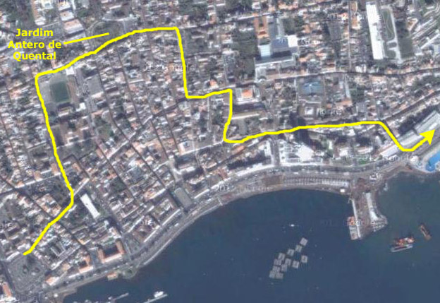
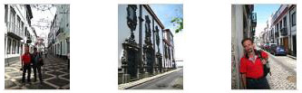
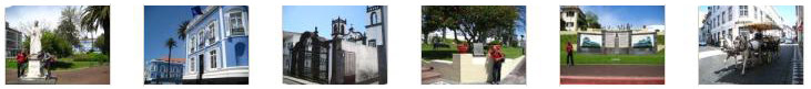
As we were walking around Ponta Delgada, we saw interesting buildings, parks and street scenes, and if you will click on the thumbnails below, you can have a look at some of what we saw:
|
|
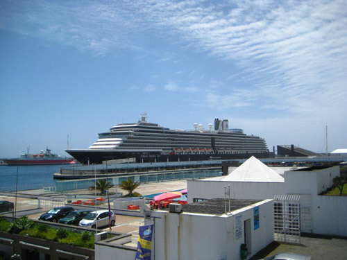
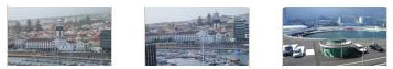
We walked back generally in the direction of the harbor, and eventually came out on the main road that goes along the harbor and the shore eastward from here- the same road we'd taken earlier on the bus going to the pineapple plantation. The weather had cleared completely, and when we got to the harbor we found that our sense of direction was pretty good- the ship was right in front of us.
|
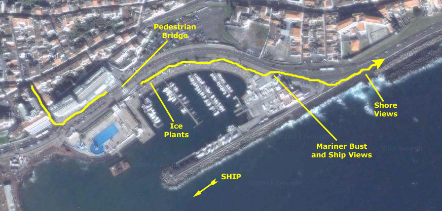
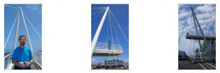
We turned eastward when we got to the harbor road, and walked along in front of some commercial buildings towards a pedestrian overpass that we could see a few blocks down.
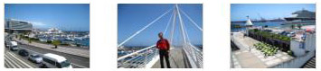
It looked like a miniature Calatrava bridge, and when we got to it, I had Fred go on ahead up the stairs to it so you could get an idea of the scale when I took a picture of him on the bridge.
We both got up on the bridge and headed across. The bridge carried us over the wide boulevard, and there were some very nice views looking in both directions.
|
|
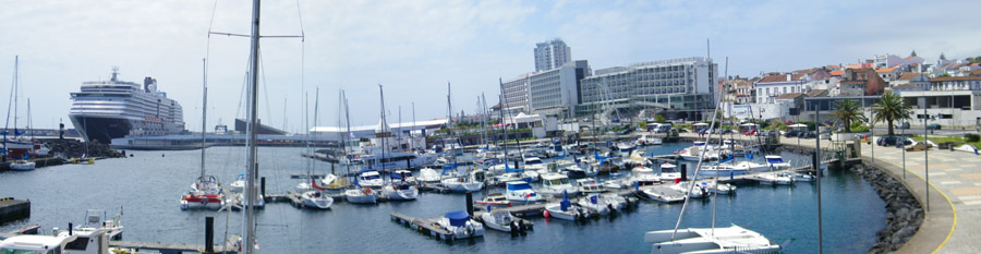
When we came down off the bridge, we continued walking eastward around the marina. Down by the marina parking area, Fred noticed that the large planters were filled with ice plants in some colors he hadn't seen before. He was able to pull up a couple of very small shoots to take home and try to grow in his greenhouse. As we came around the eastern end of the marina and followed the road past the yacht club building, Fred used his camera's stitching capability to put together a panoramic view of the Noordam, the yacht harbor and the waterfront of Porta Delgada. The result is below:
|
When we came around by the yacht club, there was a bust of a mariner outside, but with no inscription as to what it signified. We continued around to the shore to get some good pictures looking east along the southern coast of Sao Miguel- and you can see some more of those "jacks-shaped" concrete forms that are used to construct breakwaters. There's also a view of the ship from here, and what appeared to be a prison. Just click on the thumbnails below to look at these pictures:
|
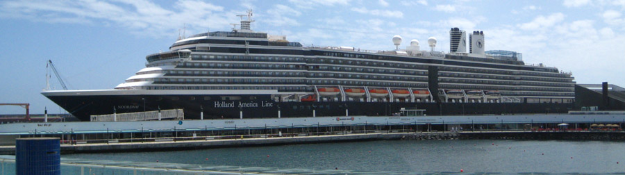
I don't know how to make my camera stitch multiple exposure together, so I do it manually with Photoshop. As we walked back towards the ship and came alongside it on the harbor road, I took two exposures- one of the front of the ship and one of the back- from approximately the midpoint of the ship. When I stitched them together, this was the result:
|
Also, if you compare this picture to the aerial view of the harbor towards the top of this page, you can see that indeed the pier is much larger now than it was when the aerial view was taken. We walked back onto the pier to re-board the ship. Usually, the X-ray machine is on the ship itself, but at this port, it was just inside the building that was connected to the ship via the enclosed gangway. When we got through security, I noticed that there were some duty-free shops- one of which seemed to sell wine and spirits. Now, you aren't really supposed to take liquor on board with you (although wine is allowed), I guess because that cuts into their bar profits. And I'd been told that if the X-ray detected bottles, they checked them to see whether they were wine or not, and if they weren't, they would hold the liquor for you until the end of the cruise. At least that's what I'd been told. It occurred to me that here I was, inside the secure area, with the ability to buy liquor to take on board; I assumed there would not be yet another X-ray when we boarded. Since I'd been a little jealous of Fred and Greg who were sharing the wine from Merrill‑Lynch (our financial advisers had sent the bottle to our suite), I went into the duty-free shop to see if they would have something I could drink. They had rum, but nothing to mix it with, so I settled on a large bottle of Bailey's Irish Cream. It was reasonably-priced, so I got it and, sure enough, there was not another X-ray check before we got back on board. That seemed to solve that problem, so I thought that if I finished that bottle, we'd encounter the same situation again somewhere, and I could replenish it. I was later to discover that perhaps what I'd been told hadn't been correct.
Back Aboard the Noordam
|
|
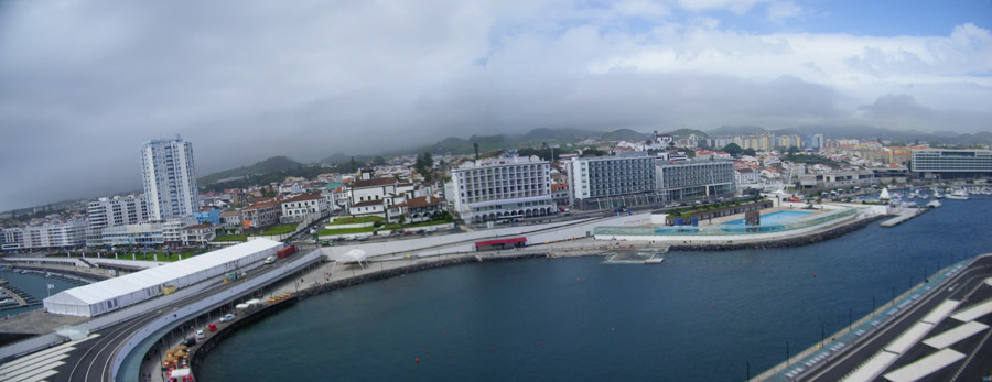
We also tried our hand at some more panoramic shots. Fred stitched together a couple of pictures in his camera to achieve this:
|
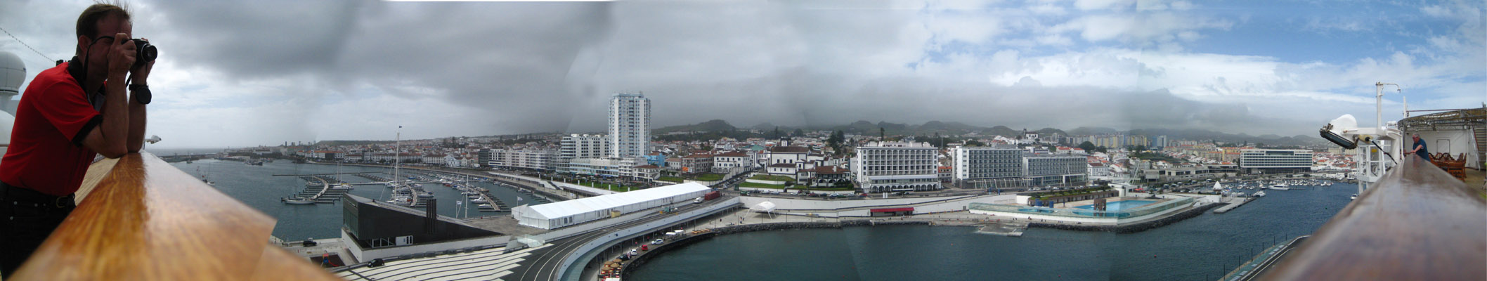
I, on the other hand, tried the first super-panorama on this cruise. I tried to carefully position my little camera to take five pictures, beginning with a shot along the rail to my left, and ending with a shot along the rail to my right. Then, I later tried to stitch the pictures together with Photoshop. This works well, so long as I can keep the camera level. Here, I had the rail to help me, but later in the cruise I'll use the little steadying device that Greg found for us. The biggest problem is the lighting, though. Even if the pictures are taken in rapid succession so that the sun is in the same place all the time, the fact that it is in the same place causes the camera to adjust the lighting in the picture depending on how much light is reaching the sensor from the sun. So pictures taken more in the direction of the sun will tend to be a bit darker than those not. And just the objects in the photo will also fool the sensor into automatically adjusting the light. I think now that there is a setting where I can turn off all this automatic stuff, and I should try to find it. But for this cruise, I just tried to ameliorate the problem when I combined the pictures by fuzzing any boundaries between one lighting setting and another. I could not always do this well, so you'll have to forgive my impreciseness. The problem usually only shows up on more monochromatic areas- like sky and water- so that's where you will notice where I have stitched the pictures together. Anyway, here is my first attempt at putting more than a couple of pictures together; use the horizontal scroll bar to see the entire result:
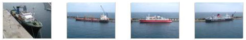
There were three large ships and another medium-sized boat docked here in the harbor with us, and I took pictures of each of them. You can have a look if you click on the thumbnails below:
|
The Noordam Leaves Ponta Delgada
Both Fred and I took a series of pictures as we pulled away from the dock and headed out of the harbor. Click on the thumbnails below to see the pictures Fred took:
|
And click on the thumbnails below to see some of mine:
|
Evening Activities On Board the Noordam
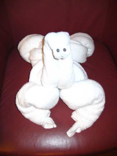
This Evening's Towel Animal
|
We thought it might be a swan, but then the front legs threw us a bit. Got a better idea? If so, send me an email at "ron" at "rondougherty" dot com.
You can use the links below to continue to the album page for different day.
|
May 10, 2012: A Sea Day |
|
May 3-8, 2012: Crossing the Atlantic |
|
Return to the Index for Our Cruise to Europe |