|
May 12, 2012: Lisbon, Portugal (Day 2) |
|
May 10, 2012: A Sea Day |
|
Return to the Index for Our Cruise to Europe |
|
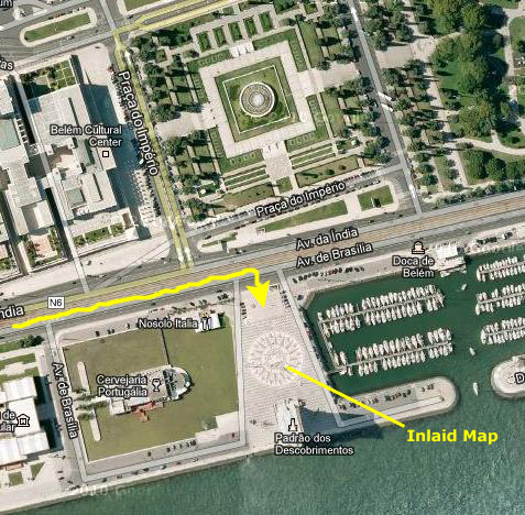
Unlike most other ports, the ship will not arrive at the dock until noontime; one reason is that it takes the ship a good while to go up the Tagus River estuary to the dock at the city of Lisbon; the dock is a good fifteen miles from the open ocean, and the ship goes quite slowly up the estuary.
This afternoon, we'll take a bus tour that will introduce us to the city of Lisbon, take us out to the beach resort town of Estoril, and then bring us back to the harbor with a stop at the famous monument to Prince Henry the Navigator. We think that the introduction to Lisbon will enable us to be on our own tomorrow as we explore the city by ourselves, figuring out the local transportation as we go.
Arriving in Lisbon
|
I wanted to see us arrive in Lisbon, and especially see the trip up the Tagus River estuary, as we were supposed to go under a large suspension bridge, but since we weren't supposed to start up the estuary until well after nine in the morning, I had time to sleep in just a while. Still, I got up before the other guys, and went up on deck to see where we were.
|
The next point of interest that we passed was Belém Tower (in Portuguese "Torre de Belém," or the Tower of St Vincent). It is a fortified tower and a UNESCO World Heritage Site (along with the nearby Jerónimos Monastery) because of the significant role it played in the Portuguese maritime discoveries of the era of the Age of Discoveries. The tower was commissioned by King John II to be part of a defense system at the mouth of the Tagus River and a ceremonial gateway to Lisbon. The tower was built in the early 16th century and is a prominent example of the Portuguese Manueline style. The structure was built from lioz limestone and is composed of a bastion and the 100 foot, four story tower. It has incorrectly been stated that the tower was built in the middle of the Tagus and now sits near the shore because the river was redirected after the 1755 Lisbon earthquake. In fact, the tower was built on a small island in the Tagus River near the Lisbon shore.
|
Next, we passed the former Palace Santa Catarina, which is now an art museum and popular viewing spot right on the estuary. From a distance, we could view one of the modern sculptures outside the museum.
And shortly after that, we passed the Discoveries Monument. I won't go into detail here, as we stopped at that monument at the end of our bus tour this afternoon. In this view of the monument, you can see the ornate Archaeology Museum in the background. And a bit further on, we passed the huge Museum of Electricity. By this time, MaryEllen and Jim and Greg had also joined Fred and I here on the bow of the Noordam, and Fred snapped a picture of the rest of us.
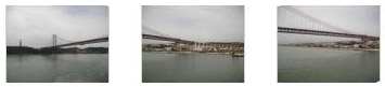
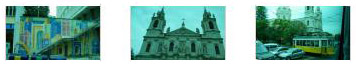
Fred took some interesting pictures of the shoreline as we passed along, and you can have a look at them by clicking on the thumbnails below:
|
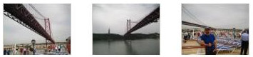
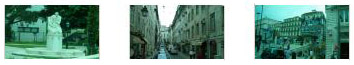
I didn't take as many individual pictures, but you can also look at a few of mine:
|
I also tried my hand at another panorama, this time stitching four pictures together. Because the boat was moving and the light was changing, the transitions are not very subtle, but you can have a look at it below:

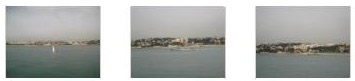
The last landmark we'd pass before docking is the "April 25th Bridge."
|
I hope you'll pardon my use of a stock shot here; there was no vantage point from the ship or from our tours of Lisbon that could have afforded a picture of the bridge in its entirety (although below you'll see an attempt to stitch one together). Fred did get one picture of almost the entire bridge but it was from a long ways away and the morning weather wasn't very good.
From the late 19th century there had been proposals to build a bridge for Lisbon, but none was constructed- at least not at this point. But in 1958 a new Government commission recommended building the bridge, choosing the southern anchor point adjacent to the recently built monument to Christ the King (Cristo-Rei). In 1960, a United States consortium won the bidding competition, and construction began on 5 November 1962. Forty-five months later (six months ahead of schedule) the bridge was inaugurated on 6 August 1966. Presiding at the ceremony was the President of Portugal, and the bridge was named in honor of a former Prime Minister.
The bridge cost four lives (out of 3,000 workers), 2,185,000 man-hours of work and $225 million in current dollars. In 1974, Portugal saw the "Carnation Revolution," and the bridge was renamed the 25 de Abril Bridge, the day the revolution had occurred. (Some people call it "the bridge of the angry bees" for the sound you can hear when you are near it- tires going across the bridge's open gratings.)
Both Fred and I made movies and took pictures as we passed under the bridge. It's impossible to say which one's I should include here, so because pixels are cheap, I'll include both. We'll start with Fred's movie and pictures (be patient while his movie shows you some of the Lisbon shoreline along the Tagus):
|
|
|
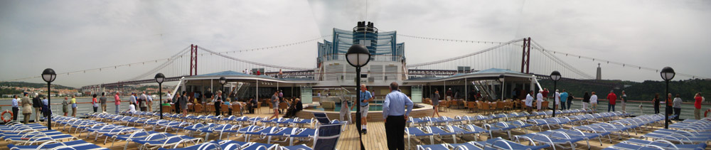
I stitched together four pictures taken from the exact center of the stern try to get the whole ship and the entire bridge into one picture. I had to take the pictures quickly, because the ship was moving and the proportions were changing every second. The end result wasn't too bad:
|
Now for my movie and pictures:
|
|
|
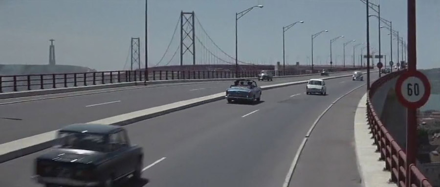
Quite often, landmarks like this one are used in television shows and movies; think how many times you've seen the Colosseum in Rome, or the San Francisco cable cars in movies. But I can only find one movie in which the April 25th Bridge was used. Here is a still from that movie (you know it's this bridge because you can see the monument to Christ the King on the hill in the background):
|
I am sure you won't guess the movie from the still; there are no identifying characters or objects- other than the bridge. You might not even guess the movie from the clip (Please excuse the first eight seconds of the clip- I have no idea what happened. And if the aspect ratio seems wrong, please excuse that, too!):
|
|
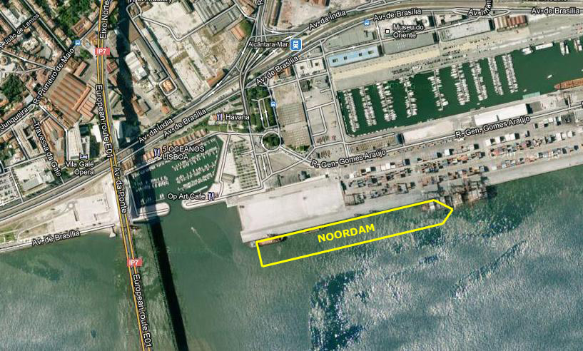
As we came under the bridge, I could tell that the ship was moving slower and slower. The reason becomes apparent when you look at where we docked:
|
By a quarter of one we were all docked, and the three of us had some lunch in preparation for the 1:30PM departure of our bus tour to Lisbon and Estoril.
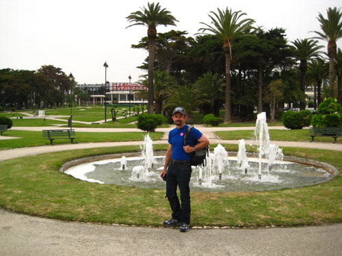
A Stop at Parque Eduardo VII
|
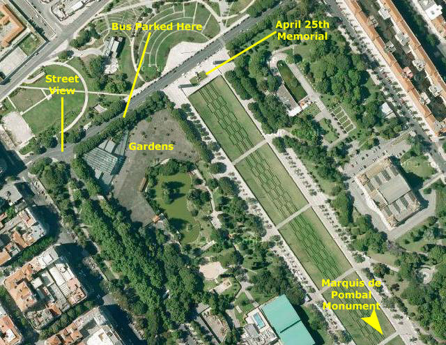
|
The trip to the park took about twenty minutes, and on the way we saw lots of places we'd like to visit tomorrow. Eventually, the bus turned onto Alameda Cardeal Cerejeira, parked and let us get out for a short stop in the park. (I think its interesting that in the aerial view below, you can easily see the portion of alameda Cardeal Cerejeira that appears in my photograph.)
|
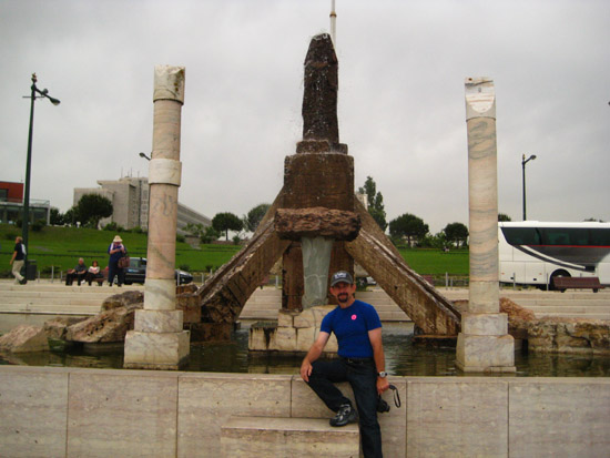
In the square, you can see the monument to the Marquis of Pombal, the prime minister responsible for the rebuilding of Lisbon following the Great Earthquake in 1755, showing him standing on a column with his hand on a lion (symbol of power) and his eyes directed to the downtown area that he rebuilt.
The big attractions within the park are the two estufas, the hothouse (with the more exotic plants) and the greenhouse ("Estufa Fria") filled with tropical plants, ponds, and endless varieties of palms and cacti.
|
I made a movie from our vantage point near the 1974 Revolution monument, and you can watch it with the player below:
|
|
|
A Visit to Estoril
|
In the hilltop enclave of Monte Estoril is the Verdades-Faria Museum, built in 1917. In 1942, the building was dedicated to the support of the arts and artists, and was the beginning of a lively artistic community- to which many artists gravitated.
During the Second World War, the region was the centre of spies and diplomatic secrecy, situations that provided the region with a cosmopolitan atmosphere and sophistication. It became an international tourist destination both during and after the Second World War; during that time, several dignitaries and exiles came to Estoril: the regent of Hungary lived and died in exile here after the Second World War; the Infante Juan, Count of Barcelona (father of Juan Carlos I of Spain) and the King resided in the territory, as did Umberto II of Italy and Carol II of Romania. It was also in this location that former Portuguese dictator António de Oliveira Salazar had a summer house. It was he who ordered the construction of the E.N.6 motorway, in order for him to quickly travel by car between Cascais and Lisbon with fewer stops- and less chance he would be easily recognized in transit (as many were murderously unhappy with him).
|
Again, Fred found that the tinting on the bus windows ruined most of the pictures he tried to take, but if you can ignore the green cast to the picture, he got a very good one of an ancient aqueduct- still functioning, we are told.
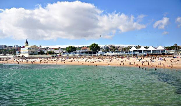
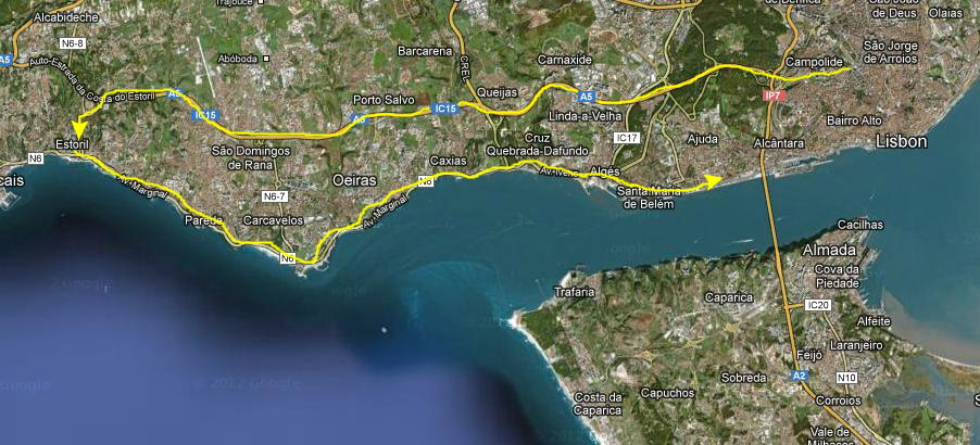
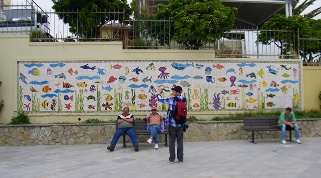
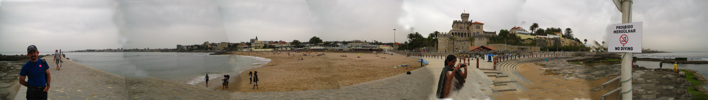
We got to Estoril in about an hour, and the bus parked alongside the Gardens of Casino Estoril. The Casino is the largest casino in Europe, and during World War II was reputed to be a gathering spot for espionage agents, dispossessed royals, and wartime adventurers. It was the inspiration for Ian Fleming's 007 novel Casino Royale. We would be exploring on our own for a couple of hours; from the bus, our tour guide led us south to the corner of Avenida Aida and Marginal de Cascais- a busy, four-lane street. There, she showed us the underground passageway to the beach and gave us a time to be back at the bus. The three of us took the passageway, and soon found ourselves at Tamariz beach.
|
|
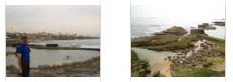
We were on a walkway just above the actual beach and below a row of buildings that might have been either shops or summer rentals. Towards the west, we could see the city of Cascais off in the distance. Looking east, Fred could see a breakwater behind me that looked as if it might offer good views back this way, so we planned to go out there. I guess the thatch umbrellas on the beach have been there a good while; you can even see them on the aerial view.
We could see, at the eastern end of the beach, a building that looked like a castle. We didn't know what it was, but we are going to walk in that direction anyway, so maybe we'll find out. We headed east and at the end of the beach, turned for another look west towards Cascais.
|
The breakwater began in front of Forte da Cruz, and we started walking out. As we began to get out on the concrete walkway, we began to get good views of most of Tamariz beach. Click on the thumbnails below to see a couple more shots I took from out on the breakwater:
|
Fred took a number of good pictures while we were out on the breakwater, and you can have a look at some of them if you click on the thumbnails below:
|
I tried another of my massive panoramas, stitching seven pictures together this time to get a 180° view around from the breakwater. Again, the sky is difficult to smooth, but you can look at the result in the scrollable window below:
We walked back in to the shore from the breakwater, and then continued walking eastward. We wanted to find another way up from the beach to the Marginal de Cascais so we wouldn't have to go back the way we came. At one point, Fred took a picture looking back west of Greg and I, and immediately after I returned the favor with a picture of Fred and the view eastward. At one point, we passed a very interesting residence, which was up above the beach atop an interesting retaining wall made of boulders.
|
We got back up to the Marginal de Cascais and began walking westward to get back to the place the tour bus was parked.
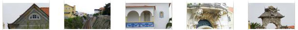
Along the way back, Fred was snapping lots of pictures, and I picked a few of them to include here. They are views of the architectural detail on some of the buildings we passed, and one picture of the rail line that links Estoril and the city of Lisbon. Click on the thumbnails below to look at these pictures:
|
It took us only a few minutes to get back to the gardens on the ocean side of the Casino Estoril.
|
We were back on the bus in plenty of time, and it headed off back to Lisbon, this time following the coast road. Fred took a number of pictures through the bus window, but sad to say the tinting made everything green again. So we'll skip over those candid shots.
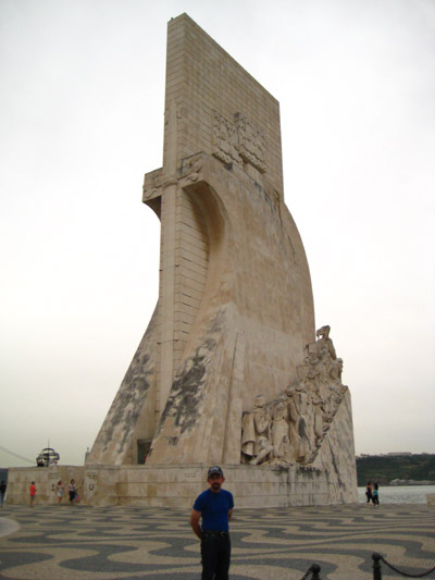
The Monument to the Discoveries
|
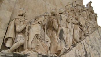
The monument was conceived in 1939 by Portuguese architect José Angelo Cottinelli Telmo and sculptor Leopoldo de Almeida as a temporary beacon during the Portuguese World Fair opening in June 1940. It represented a romanticized idealization of Portuguese exploration. It was originally intended to be temporary and indeed, in 1943, it was demolished. In 1958, the government promoted the construction of a permanent monument, and it was completed in 1960. It was formed in cement and rose-tinted stone, and the statues were sculpted from limestone excavated from the region of Sintra. The new monument was an enlarged version of the original to celebrate the fifth centennial of the death of Infante Henry the Navigator.
There is a large plaza with an inlaid map of the Portuguese voyages of discovery (more details below) and, opposite the square and across the Avenida de Brasilia motorway, is the Square of the Empire and behind that the Jeronimos Monastery, Belem Cultural Center and the green-spaces of the Garden Vasca da Gama (you can see a picture of these features, taken through the green-tinted bus window here).
|
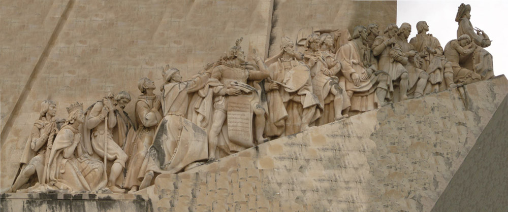
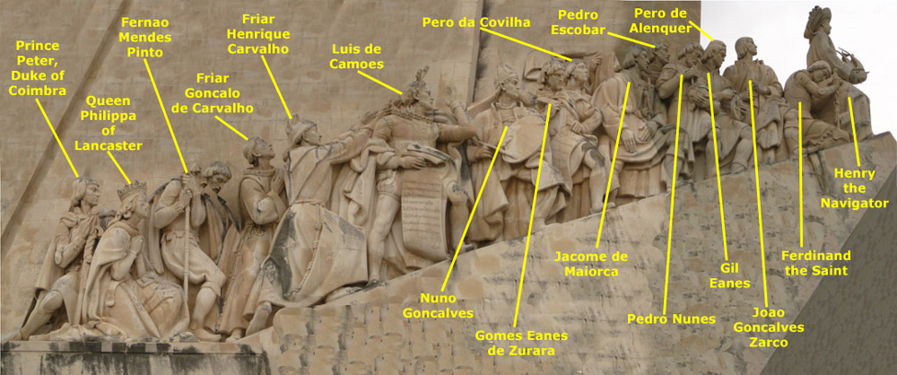
On either side of Henry, and behind him on each ramp, are 16 figures (different on each side) representing figures from the Portuguese Age of Discovery. These great people of the era included monarchs, explorers, cartographers, artists, scientists and missionaries. Each idealized figure is designed to show movement towards the front (the unknown sea), projecting a direct or indirect synthesis of their participation in the events after Henry.
|
The two aspects of the Monument that are of the most interest are the carved figures on the Monument itself, and the "compass rose" in the square in front of it.
|
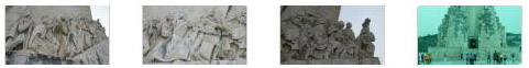
Fred took some additional pictures of the sculpted figures in closeup, and one from the bus of the entry to the inside of the Monument. Click on the thumbnails below to have a look at these pictures:
|
So what I thought I'd try to do would be to photograph the frieze in sections, and then put the sections together later. The result was quite acceptable, although it would have been better had I been able to get closer to the frieze and take more pictures. Anyway, you can have a look at the result below:
|
Of course, you probably know who all these folks are, but just in case you don't, here they are, all nicely identified:
|
In case you are interested in who these folks are, here is a brief description of each:
| Prince Peter, Duke of Coimbra | Henry the Navigator's brother, and the most well-travelled prince of his time |
| Queen Philippa of Lancaster | Mother of Henry the Navigator |
| Fernăo Mendes Pinto | Explorer and writer |
| Friar Gonçalo de Carvalho | Spiritual advisor |
| Friar Henrique Carvalho | Spiritual advisor |
| Luís de Camőes | Renaissance poet who celebrated the navigations in the epic Lusiads |
| Nuno Gonçalves | Painter |
| Gomes Eanes de Zurara | Chronicler |
| Pęro da Covilhă | Traveller |
| Jácome de Maiorca | Cosmographer |
| Pedro Escobar | Navigator |
| Pedro Nunes | Mathematician |
| Pęro de Alenquer | Navigator |
| Gil Eanes | Navigator |
| Joăo Gonçalves Zarco | Navigator |
| Fernando, the Saint Prince | Henry the Navigator's brother |
| Prince Henry, the Navigator |
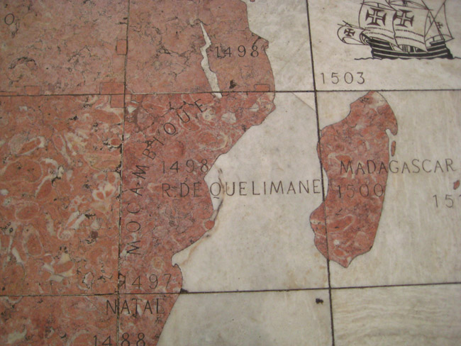
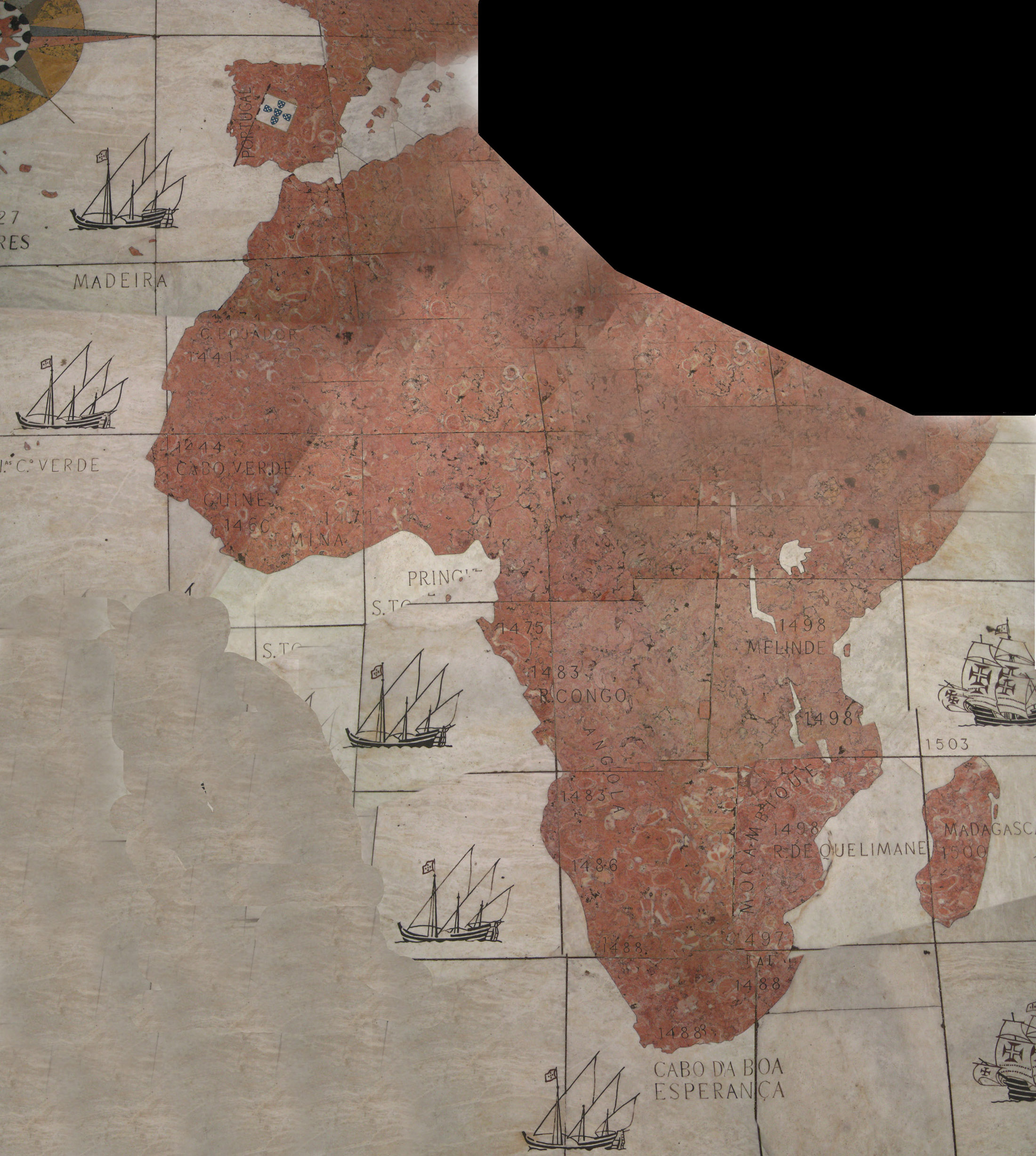
The other interesting aspect of the monument plaza was the inlaid map of Portuguese discovery.
|
I guess I have gone a bit overboard in my efforts to put lots of pictures together (although you'll see a good many more panoramas later on for this cruise) because what I thought I might try was standing over the mosaic section by section, taking pictures of each, and then stitching them all together so I would have a composite picture of the whole thing- as if I had been able to float over it and get it all in.
I ran into two problems. First, it was tough to get enough of the mosaic in without my feet as well to keep the number of pictures to some reasonable number. I might have overcome that given enough time, but time was the other problem. I got this idea just a few minutes before we were called back to the bus, so I ended up hurriedly taking a series of pictures working my way from Portugal and Spain down the coast of Africa and around the Cape of Good Hope to Madagascar. But I did end up stitching these pictures together, and trying to fill in the areas I didn't cover.
The result wasn't nearly what I had hoped, but if you want to look at it, use the scrollable window below:
Well, the bus was calling, so we all reboarded and headed back to the ship. This brought our first day in Lisbon to a close, but we will be here again tomorrow, and look forward to walking through Lisbon at our own speed.
You can use the links below to continue to the album page for different day.
|
May 12, 2012: Lisbon, Portugal (Day 2) |
|
May 10, 2012: A Sea Day |
|
Return to the Index for Our Cruise to Europe |