|
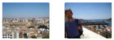
May 16, 2012: Barcelona, Spain (Montserrat) |
|
May 14, 2012: Malaga, Spain (The Alhambra) |
|
Return to the Index for Our Cruise to Europe |
|
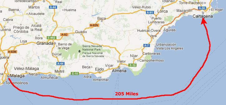
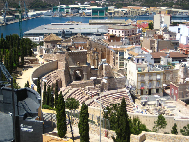
Arriving and Docking in Cartagena
|
|
We assume that the harbor pilot who boarded the ship about seven knew the route intimately, and our slow, hour-long progress to the dock was interesting to watch. Fred and Greg joined me up on deck for breakfast about seven-thirty, and together we watched through the Lido Pool area windows as the hills and harbor slowly slid by and we came into the dock. We'd been to Cartagena before- in 2008 when we did a repositioning cruise from Barcelona back to Fort Lauderdale, so we already had a lot of pictures of the route in to the dock, and didn't repeat them here.
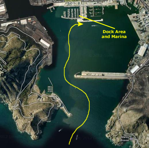
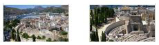
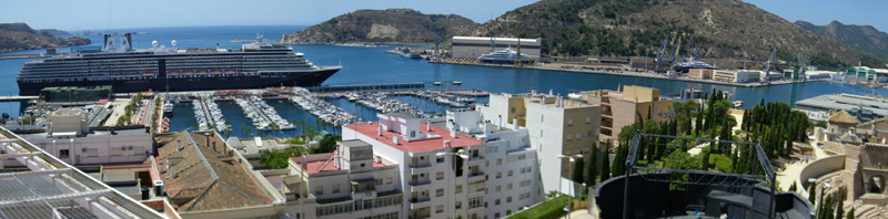
Our Walking Tour of Cartagena - Aerial Map
 |
When we get to the end of our walk and back on board the Noordam, you can just close that window.
We were off the ship before nine o'clock to begin our leisurely walk through Cartagena.
Our Walking Tour of Cartagena - Harbor Area
|
|
As you might be able to see on the aerial view (if you are following along), there is an old submarine in front of the museum, and a street that parallels the marina just north of it. Across the street are the walls of the old fortification, and there is a set of stairs leading up to what was the old city. We didn't go up that way just now, but when we return to the ship we'll be descending those stairs.
We thought that since we had no particular destination in mind today, that we might see if we could locate a coin laundry and come back and do some; laundry on the ship is pretty expensive. Rather than walk around aimlessly looking for one, we turned to the west along the boulevard and walked a block down to the building that we remembered housed the tourist office. This building is adjacent to a small park that has, as its centerpiece, a monument to the Spanish Navy.
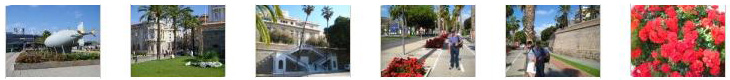
This part of the city, built outside the old walls, is also fifteen feet lower that the buildings up on the old fortification- which now comprise only a small fraction of the modern city. You can see many of the things mentioned in the narrative above in the pictures we took between the ship and the tourist center. Click on the thumbnails below to have a look at the best of these pictures:
|
We went inside the tourist office to get a lead on a coin laundry, and were directed to a street north and a bit east through town, so we headed off.
Our Walking Tour of Cartagena - Looking For the Laundry
|
|
|
|
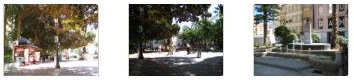
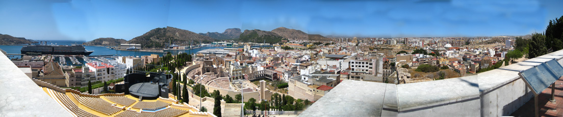
As you can see if you are following along on the aerial view, after we got a ways up the street leading from the harbor, we angled off to the northeast, following our directions. Eventually, we came to a kind of a park that had an interesting fountain, but we went by it to see if we could find the coin laundry where it was supposed to be at the end of a building bordering one of the main streets through town. This might be a good place to point out that in the central part of town- certainly in the area near the port, most of the streets were pedestrian streets only (although a few small cars came through them occasionally). Further out, more of the streets were for automobiles. We found this to be the case in many of the city/ports we visited, although some, like Lisbon and Rome, were almost all given over to automobile streets. But even there, in most of the older sections of the cities, the streets were for people- not cars. Quite unlike most American cities. But this made walking around them a lot more enjoyable (and a lot safer).
When we finally found the laundry, we realized that something had gotten lost in translation, for the shop did not have any self-service machines; you had to drop off your laundry and pick it up later. There wouldn't be time for that today, so we gave up on the quest. Greg decided that he would go do some shopping and head back towards the Noordam, but we decided just to walk around until the ship sailed later in the afternoon. We were going to visit the Parque Torres once more, and the Roman Theatre. (I might mention that a bit later on in the afternoon, as we were passing through the Plaza de la Merced, we did run across exactly the kind of laundry we'd been looking for. Sadly, however, we discovered that it was closed- permanently.)
|
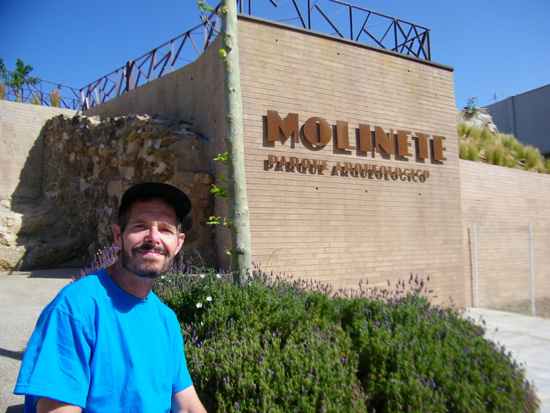
Just following our noses, we headed down southeast along the side of the plaza and down a street that I thought looked familiar. I thought it was one of the streets through an intersection we'd visited the last time we were here, just northeast of the Parque Torres. It wasn't, as it turned out, but we weren't far from the ship and weren't worried about getting lost. Then we came to a church that also looked familiar. It had been near an open area which had seemed, the last time we were here, as an area set aside for eventual excavation of some of the ruined walls and towers that we'd seen there. I recalled that area as having some abandoned modern buildings on it as well; all that had been left of them were some walls and stairs. When we went down the street by the church, we found that it was indeed the same area, but that in the last four years it had been turned into an archeaological park. We decided to explore it.
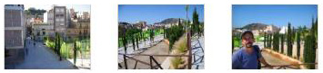
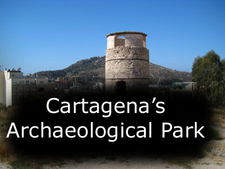
Our Walking Tour of Cartagena - The Molinete Parque Arqueologico
|
|
I made a movie as we walked up the street to the park entry and fountain, and you can watch it with the player at left. You can also use the clickable thumbnails below to see some of the neat views from the park entry:
|
|
If you will look at the aerial view map of our walk, you will see that, apparently, the satellite picture of the area was taken before the park was completed- or even started, it seems- for you can't pick out any of the walkways or landscaping or most of the structures that are there now. I think, however, that I can pick out the two circular structures (including the one at the top of the hill) that the park's website indicates were ancient mills (assuming the translation of the page is accurate).
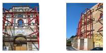
The park opened to the public in October 2011. On the lower southern slope, the ruins of the old Roman Forum, which are still slowly being excavated, began having visitors in March of this year. The excavation site requires an entry fee, and you can watch archaeologists at work while you walk through the site (which is covered by a large, tent‑like affair to protect it from the elements.
|
To view the slideshow, just click on the image at left and I will open the slideshow in a new window. In the slideshow, you can use the little arrows in the lower corners of each image to move from one to the next, and the index numbers in the upper left of each image will tell you where you are in the series. When you are finished looking at the pictures, just close the popup window.
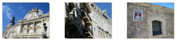
The project was intended to beautify the space while giving priority to the implementation of new archaeological excavations and the preservation and enhancement of existing ones- and both objectives had to be achieved simultaneously. One goal of the project was to maximize accessibility to all people, so a thorough analysis of the location of the archaeological remains was conducted, and, guided by the topography of the hill, viewpoints, multiple terraces, views and spaces were all planned out beforehand. This was to be a major viewpoint for the interesting sights of the city of Cartagena (including some monumental graffiti/artwork on some buildings below the park). Click on the thumbnails below to see some views of Cartagena from our walk around the hilltop park:
|
|
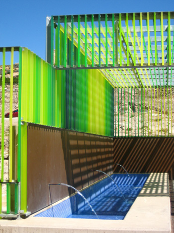
Around the perimeter of the hill, there is a very interesting fence made of transparent, colored panels (which appear to be some kind of thick plastic like lucite). All these panels are in various shades of green, and they protect the area while at the same time allowing views from the street to the top of the hill and to the various excavations going on. Each panel seemed to be about five inches wide by a couple of inches thick; the effect was quite striking.
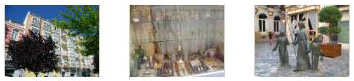
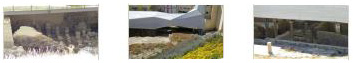
The active excavation site is underneath a translucent cover designed especially for this site; it has to protect the site while allowing as much daylight as possible for the archaeologists who are working there; provision was also made for artificial lighting at night. The improvements at the excavation site alone cost about $1.5 million. From the top of the hill, Fred was able to use his zoom to peek underneath that cover and see some of the work going on at the excavation site; click on the thumbnails below to see a few of these pictures:
|
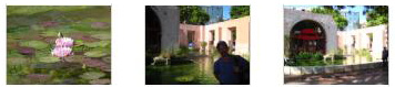
More than just an archaeological site, the area is a park as well, and there are now landscaped spaces where native species, both evergreen and deciduous, have been reintroduced- allowing the creation of spaces for rest and relaxation with shade in summer and sun in winter. One novelty is the playground at the top of the hill that makes the area ideal for the families that live nearby or who will come to visit.
|
|
I made a movie while we were on the top of the hill, and you can watch it with the player at right.
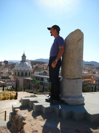
One of the views we had from the hilltop was of the fortification ruins about a mile distant from where we were this afternoon; we had walked over to these ruins in 2008 and explored them.
We spent quite some time wandering around the top of the hill, but then made our way back to the entrance.
|
|
|
We turned at the corner of the fence and began to walk back west. This side of the park seems still to be under construction. There is the excavation site, of course, but there was an open area currently used for ad hoc parking, and our view was of the backs of the buildings along the street south of us (where the graffiti was). I suspect that this area will be redone at some point as it detracts from the otherwise very well-landscaped area. We continued walking along the green panel fence and eventually found the entrance to the excavation site.
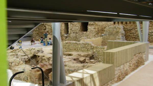
The excavation site at the base of the hill, under the tent cover, is "Ancient Carthago Nova." This is a Roman district in the immediate surroundings of the colony's forum, dating from the first century BC. Within the site is the thermal bath complex, including a colonnaded courtyard and the atrium building which was used for religious banquets. The walls still standing are up to 12 feet high, and some of the original murals can still be seen. The baths are a succession of cold rooms, warm and hot, heated by furnaces.
|
|
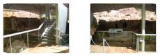
We finished our walk around the archaeological park area by going across the street from the active excavation site to take a look at some other ruins we hadn't seen years ago. These ruins, part of the forum and baths complex, were apparently excavated some time ago; they are covered by a glass roof, enabling you to look down into them. You can see a couple of views of these ruins here and here.
Our Walking Tour of Cartagena - Our Walk to Parque Torres
You can follow us along on our walk if you have the aerial view open. We took a different street to head eastward, and we found that the buildings south of the archaeological park were not complete at all, but just facades that had been stabilized from the far side that we could now see. I imagine that the facades have some historical or architectural significance, and that perhaps the buildings behind them will be rebuilt. We've seen the same thing in lots of cities we've been to- cities as diverse as Barcelona and Albany.
|
|
We also took a few pictures here, and you can use the clickable thumbnails below to view them:
|
As you can see from our path on the aerial view, we went through Plaza de la Merced from west to east, and then continued to follow the streets east, following our noses as we went. I was looking for the intersection we'd been to before that lay just northeast of Parque Torres. We didn't find that, but we came to another, smaller park or square from which we could just see Parque Torres to our south. To get there, we turned south and ascended a broad walkway that looked very new. There were new buildings on either side of it, and interesting stone walls and plantings all the way along. This being spring, most everything was in bloom, so I had Fred take a seat on one of the walls so I could get a picture of him and some of what looked like azaleas behind him; you can see that picture here.
|
|
|
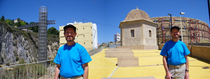
We walked around the bullring to the south intending to cross the street to get to Parque Torres. There seemed to be a new, small plaza there; it had not been there four years ago. There was a kind of balcony with a small round building from which you could look all around and see the harbor, Parque Torres, the bullring and some partially excavated ruins that I recalled having seen before. Instead of some individual pictures, let me include one here that Fred made by stitching together two images, enabling him to get Parque Torres, the elevator/stairs, the new little round building and plaza and the bullring all in one shot. He had me stand in both pictures, so that is why I am in the panorama twice:
|
|
|
From this little plaza, we could see quite a lot. We could see the harbor, of course, and we had excellent views across the street to the roadway entrance to Parque Torres. It came up from the street in front of the harbor through a couple of switchbacks and then up to the top. Click on the thumbnails below for some nice views from here:
|
We thought that we would climb the stairs to get up to Parque Torres, so we descended the stairs from this plaza to the bottom and then crossed the street, heading for the elevator structure. I stopped to get a picture of Fred with the plaza behind him and then we headed over to the elevator structure. Four years ago, going up or down was free, but this time, there was a $5 charge. Since we'd done it before, we nixed the idea of doing it again and just walked back to the other side of the street, up the sidewalk and onto the street leading to the Parque Torres motor entrance. We could see that there were also pedestrian walkways and stairs so you didn't have to actually walk up the road.
From the street, we had a nice view back to The Noordam, and from the road up, nice views back to the plaza and bullring. Going up the sidewalk, we took the pedestrian stairs directly up; these crossed the road twice, and once I had a very nice view of the road and the elevator structure. You can see that view here.
Our Walking Tour of Cartagena - Parque Torres
|
|
From the fountain, we walked west again up the very pretty trellis‑covered walkway towards the observation platform. We could see the platform ahead of us and just before we came out onto it, Fred got a good picture of the end of the walkway and one of the hilltop ruins to the west of the city. You can see that view here.
Then we were out in the open on the platform, and it offered the same amazing views we recalled from four years ago.
|
|
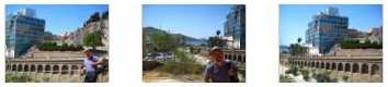
Fred took a nice picture of the Noordam docked at the pier, and one of me with Cartagena in the background. In return, I got a nice picture of Fred with the Noordam in the background and also one looking back at the Molinete Parque Archeologie where we'd been an hour ago. There are clickable thumbnails for both of these pictures below:
|
From here on the observation platform we both tried our hands at creating panoramic views. Fred used the abilities of his camera to stitch together this view:
|
I got rather more ambitious, and took a series of eight pictures, stitching them together later to form my own panorama. As usual, the different lighting can be easily seen when looking at a solid background, like the sky, but after a bit of work the end result wasn't too bad:
|
We spent a few minutes enjoying the views and the sunshine, and then took the stairs down from the platform to get to the Roman Theatre. The walkway took us through an old watchtower via a tunnel, where we both took pictures of each other. You can see my picture of Fred here and Fred's picture of me here.
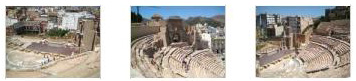
Our Walking Tour of Cartagena - The Roman Theatre
|
|
Then we took the walkway down, through the tunnel, and around to the back of the theatre where we had excellent views looking down into it. (There are tours you can take to go inside it, but we didn't take the time to sign up for one- we may have missed some commentary and the chance to take pictures from the proscenium, but we got good views nevertheless.)
|
Our Walking Tour of Cartagena - Returning to the Ship
|
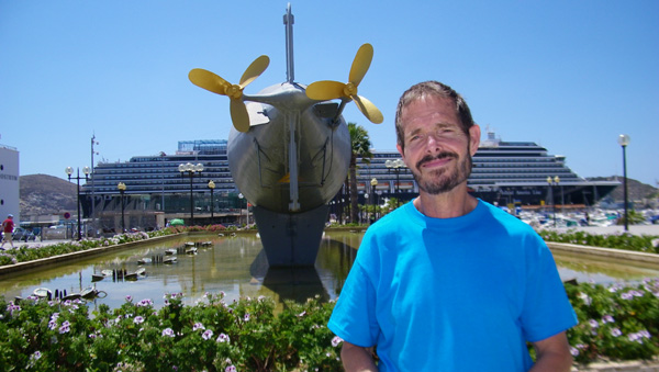
A short while later, after stopping for an additional photo opportunity at the submarine dockside, we were back on board the Noordam and off to the Lido Pool for a snack. It was an enjoyable walk through Cartagena; a lot has changed in four years and we got to see some areas we hadn't seen before.
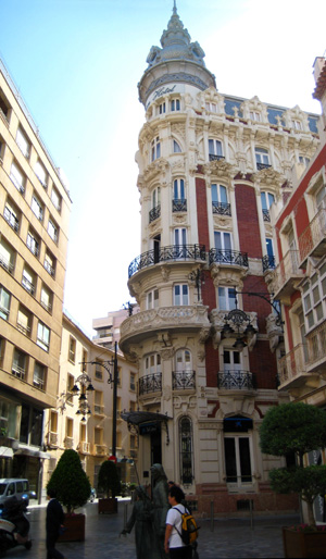
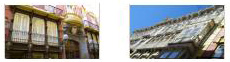
Cartagena - Architectural Detail
|
To view the slideshow, just click on the image at left and I will open the slideshow in a new window. In the slideshow, you can use the little arrows in the lower corners of each image to move from one to the next, and the index numbers in the upper left of each image will tell you where you are in the series. When you are finished looking at the pictures, just close the popup window.
Departure from Cartagena
|
|
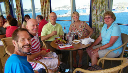
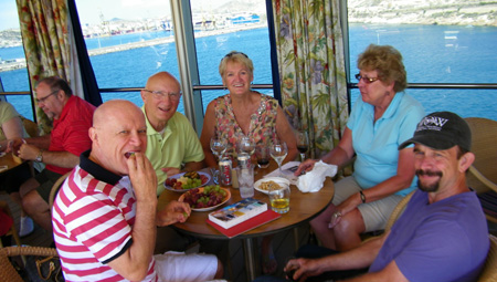
We hung out with them for a while, and then just before the ship sailed we went up on deck to watch the scenery as we sailed out of the harbor. We got some pretty good pictures looking to the west, and a little later got to see another cruise liner passing us- the first we'd seen on this trip that wasn't coming into or leaving one of our ports. Click on the thumbnails below to have a look at these pictures:
|
Evening Activities
|
This Evening's Towel Animal
|
You can use the links below to continue to the album page for different day.
|
May 16, 2012: Barcelona, Spain (Montserrat) |
|
May 14, 2012: Malaga, Spain (The Alhambra) |
|
Return to the Index for Our Cruise to Europe |