|
January 22 - February 4, 2013: Our Winter Trip to Florida |
|
January 18-20, 2013: Brookgreen Gardens (Day One) |
|
Return to the Index for 2013 |
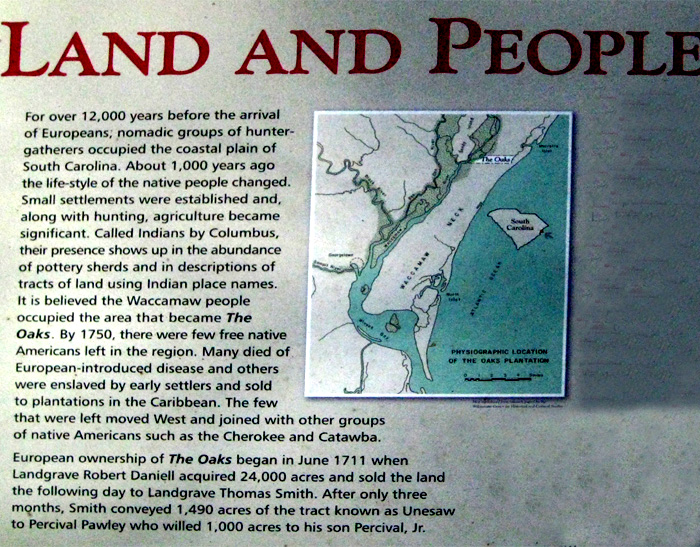
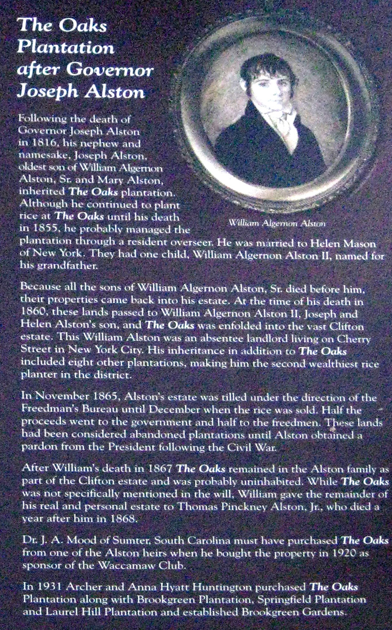
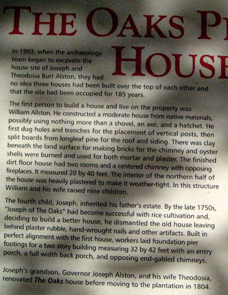
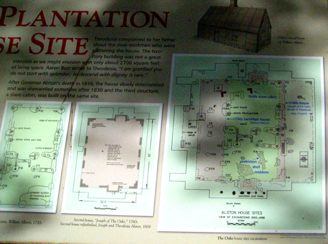
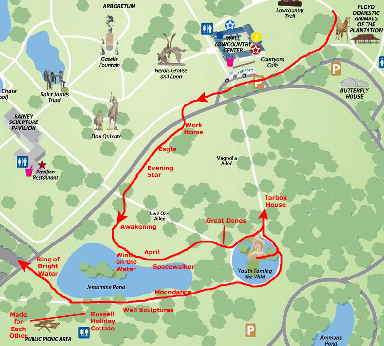
Today, we're going to take advantage of our multi-day tickets to Brookgreen Gardens to return there to see the areas of the Gardens we hadn't had a chance to see the day before, as well as the area of the property where the original Alston plantation house and the slave houses stood.
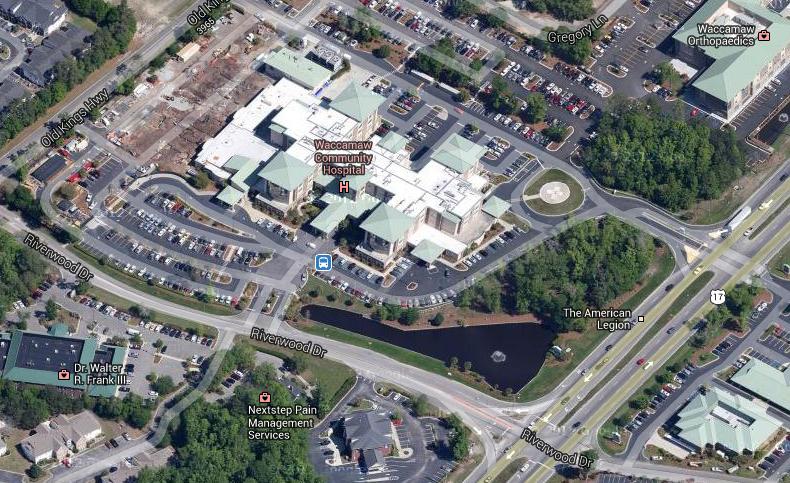
Waccamaw Medical Center
|
This album is not the place for much information about that, but after the accident his father had that broke one of his shoulders put him in the hospital there were other complications and there might be more surgery involved. Decisions would have to be made, and so Guy would need to stay at the hospital most of the day to ensure that those decisions were the right ones.
He suggested that Fred and I couldn't do much there with him, so we should go on to Brookgreen Gardens for another day, and give him a call when we were done. By then he should know more about what would be happening and we could make afternoon or evening plans. So with our best wishes that everything work out right, we got back in the car and drove back down to the Gardens.
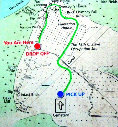
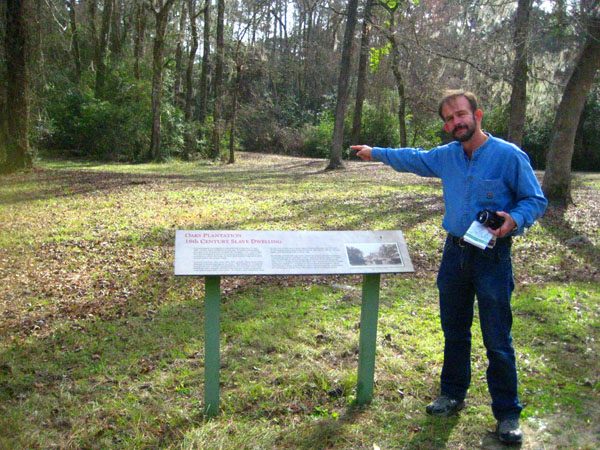
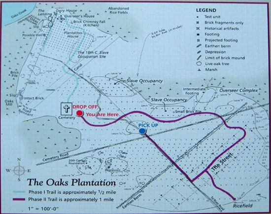
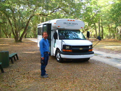
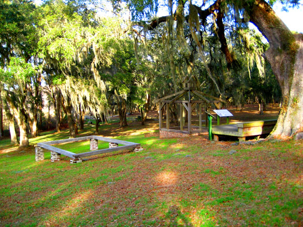
Guy had mentioned to us that there was a walk we could take through an area south of the actual Gardens that was the site of the original Oaks Plantation. In the Gift Shop, we enquired about the trail. We found that it was a self-guided trail that brought to life the historical elements of the South Carolina Lowcountry. We would have a chance to see the archeological site of the former plantation buildings, the Alston family cemetery, and the slave village. Through interpretive panels along the path, we would learn about the history of the individuals who lived at The Oaks Plantation during the rice-producing years. We had to ride a Garden vehicle to the drop-off point of the trail, and we'd be returned the same way at a pre-arranged time. The cost was nominal, and by noon we were being dropped off at the beginning of the trail.
NOTE:
I would have snipped an aerial view of the area we walked, but the entire area is heavily wooded, and from the air you can't see much of anything. So, just be aware that the area we covered, about a square mile, was itself about a mile and a half southwest of the Visitor Center.
The Oaks Plantation Trail
|
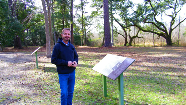
We began out walk at the dropoff point, and followed the directions from sign to sign, looking at all the various sites. The walk was immensely interesting, and I'd like for you to experience as much of it as possible. The interesting information was on the informational signs at each of the sites the trail passed, but there was so much information that copying it into narrative here was simply too great a task. So instead, I am going to include here the pictures we took of those signs, increasing them to a size so that you can read them yourself.
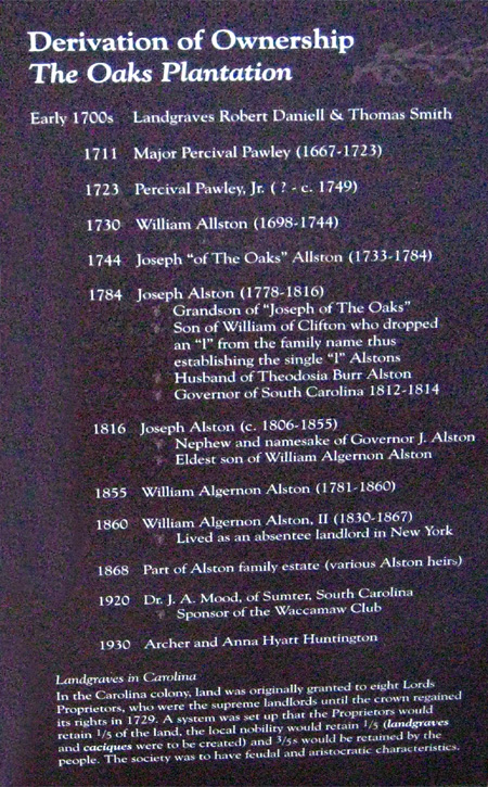
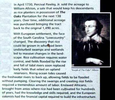
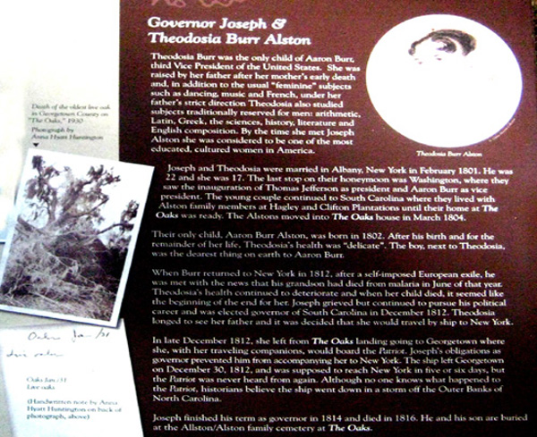
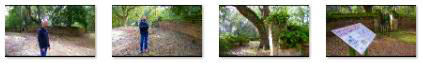
You can begin by reading about Joseph Allston himself:
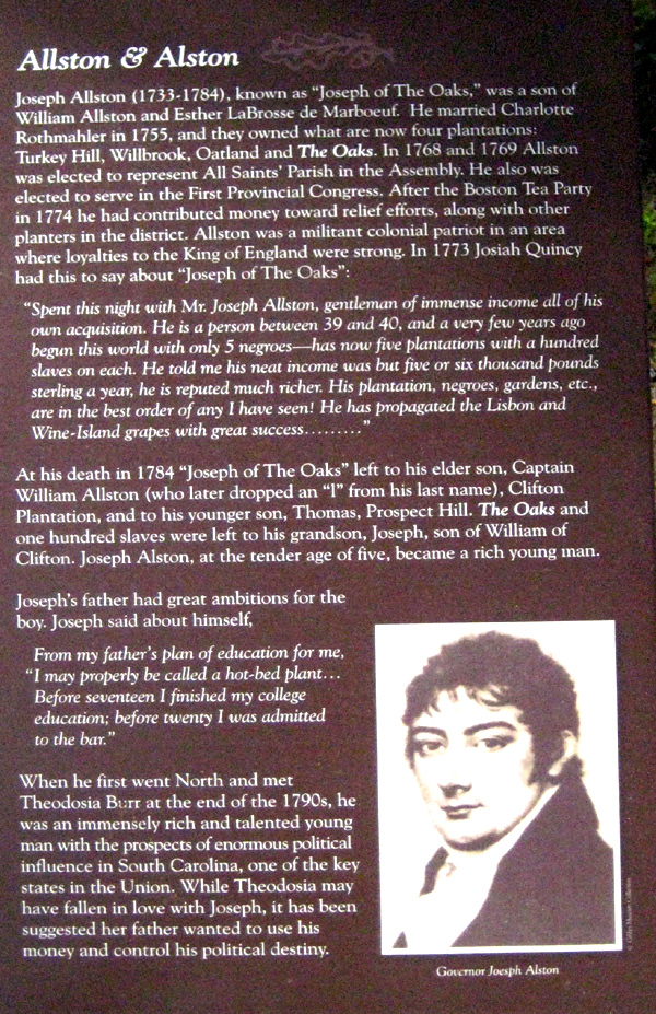
The beginning of the trail had a couple of signs, including the one from which the information on Joseph Allston was taken, that set the stage for our walk.
|
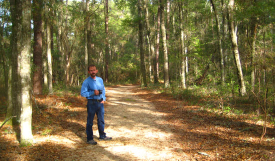
You can read the other two sections of this sign below after you look at me and an old tree nearby:
 |
 |
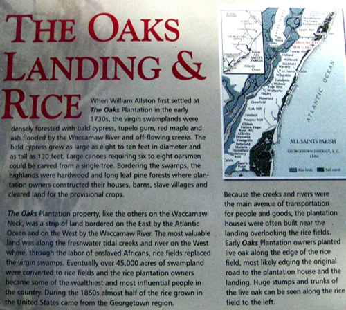
The Landing
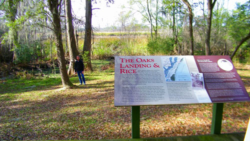 The Dock Area |
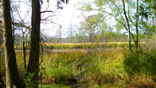 Rice Cultivation |
If you'd like to read the sign about this area, you can use the scrollable windows below:
 |
 |
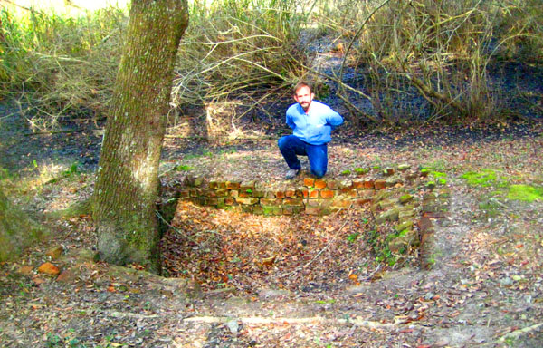
The Dairy House
|
You can see a close-up of the depression that is all that remains of the structure here, and you can use the clickable thumbnails below to see some other views of the house and the surrounding area:
 |
The description of the dairy house on the sign nearby was interesting, and you can read the sign with the link below:
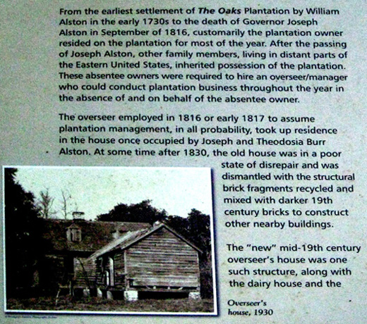
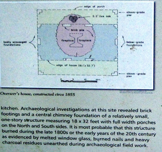
The Overseer's House
 |
 |
 |
The Kitchen
The Plantation House
|
The Site of the Oaks Plantation House |
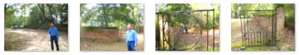
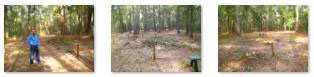
I also took a couple of pictures of Fred here at the site of the plantation house, and you can use the clickable thumbnails below tto have a look at them:
 |
There was, of course, a sign describing the site, and you can read it in two sections using the scrollable windows below:
 |
 |
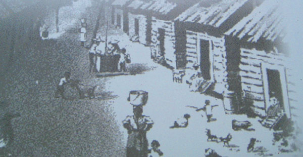
The Slave Dwellings
|
At one end, there was usually an open fireplace (exterior to the wall of the house) commonly made of lath or split sticks, laid up like log work, and plastered with mud or clay.
Remnants of their African roots, these structures would frequently measure ten feet by ten feet or less, typical of those found in West and Central Africa (pictures of which were shown on the sign here). These freestanding houses have no openings other than a single doorway. This dark, tight enclosure would provide adequate shelter in a tropical or sub-tropical environment where most living is done out-of-doors and a house would be used mainly for sleeping or shelter from the rain or extreme temperatures.
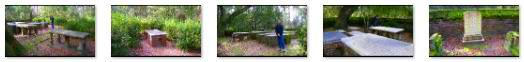
The Alston Family Cemetery
|
The Alston Family Cemetery is a rectangular enclosure perhaps 80 by 60 feet, with the entrance and an old wrought‑iron gate in the middle of one of the long sides. When Archer and Anna Hyatt Huntington purchased the Oaks Plantation in 1930, the cemetery was in a state of disrepair; the last recorded burial had been in 1905. Storms had broken tree limbs which had fallen on the stones and crypts and even the gate and brick wall were damaged. The Hyatts had workment repair the damage, and a brick walkway was added within the enclosure. Today, Brookgreen Gardens performs constant maintenance on the Alston Family Cemetery.
Use the clickable thumbnails below to see some of the various pictures we took outside the cemetery:
|
There were some interesting and informative signs in front of the cemetery, and I thought you might want to read them. There are three links below for these signs. Click on the first, and you can read about the preservations efforts that have been conducted to maintain the cemetery. Click on the second, and you can peruse the Alston family tree. Finally, click on the third and you can survey a diagram of the cemetery and see who is buried where. As always, when you are done with any of the new windows that will open, just close them to continue on.
|
Preservation Efforts at the Alston Family Cemetery |
The Alston Family Tree |
A Diagram of the Alston Family Cemetery |
We spent a fair amount of time here at the cemetery; it was immensely interesting, looking at the graves and markers and comparing them to the schematic that you may have looked at above.
|
A Tour of the Alston Family Cemetery |
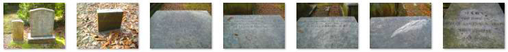
We took a lot of pictures here; You can use the clickable thumbnails below to have a look at some of Fred's:
 |
I took a few general pictures here in the cemetery as well, and you can use the clickable thumbnails below to see some of them:
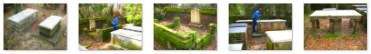 |
Actually, I concentrated on taking pictures of the grave markers, intending to compare them to the schematic that had been posted outside. I never did that, but the markings were an interesting record, and you might want to read some of them as well. You can use the clickable thumbnails below to do so:
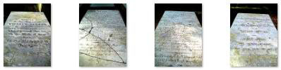
Gravestones and Markers in the Alston Family Cemetery |
Although my movie looked around most of the cemetery, I wanted to try my hand at taking enough pictures to be able to stitch them together into a 360° panorama of the entire site. I did that, and you can use the scrollable window below to see the result:

The Alston Family Cemetery was the end point of the first of the two walking tours that we took in this area of the gardens.
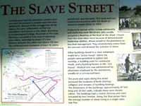
The Slave Street Trail
|
The archaeological map of The Oaks Plantation clearly delineates these areas. Phase I of the Trail, about a half mile, travels through the plantation owner's complex ending at the Alston family cemetery.
|
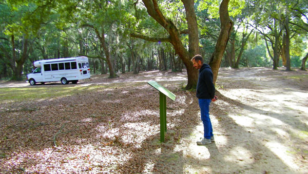
From the sign and dropoff point, we followed the road through the trees for a short distance when it turned into a very pleasant trail that eventually crossed the road we came in on and headed southeast to the area of slave dwellings.
 |
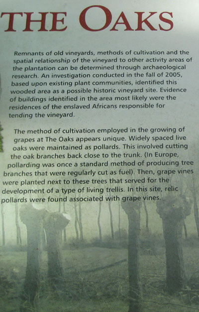
Just after leaving the cemetery, we did come upon an informational sign talking about the fact that wine grapes were also grown here at The Oaks Plantation. On that sign, there was also an interesting comment by a visitor to The Oaks Plantation that was extremely complimentary to Mr. Alston. You might like to read that sign, and you can do so with the two scrollable windows below.
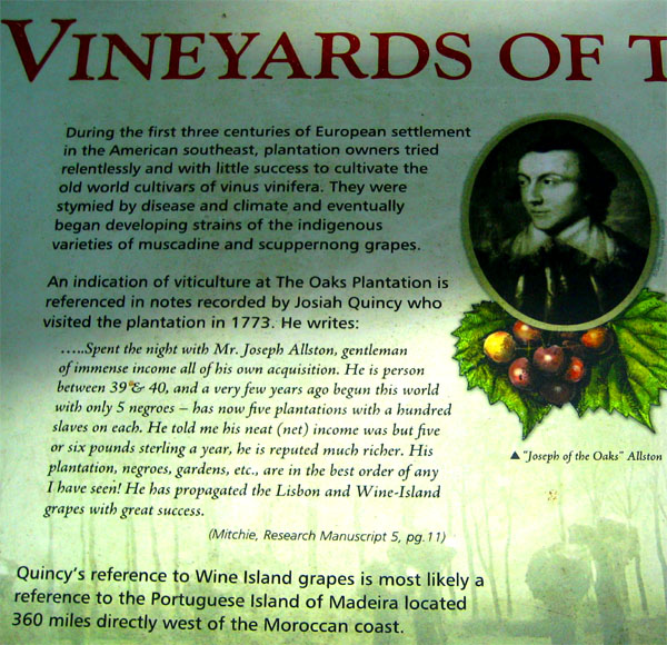 |
 |
As I said, our trail turned southeast, crossed the road and then came to the Slave Street. Aside from a large relatively open area, there was hardly anything left of what was once here.
|
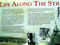
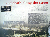
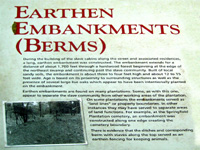
  Remains of Buildings Along the Slave Street |
While there was not much to see, physically, there were a number of very, very interesting signs along our path through this area. First, as you would expect, these signs described what the buildings and life must have been like along the street. This information was very interesting, and I think you'll want to read the signs for yourself. Below are a series of little icons that you can click on that will open a new window with that particular sign in it. Scroll through the window and read the sign, and then close the window to return to the photograph album:
|
|
|
|
|
|
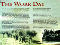
As I said, these informational signs were very interesting, and we stopped to read all of them. But there was another component to each of the signs. From 1936 to 1938, over 2,300 former slaves were interviewed by writers and journalists as one of the many activities of the WPA- the Works Projects Administration- one of the "alphabet agencies" that was created as part of The New Deal to put people to work. Fred and I have been the beneficiaries of other efforts of these agencies, notably the CCC- Civilian Conservation Corps- that built much of the infrastructure we still take advantage of today in America's National Parks. Each of the signs we saw here on the Slave Street had one of these "slave stories", and they were also immensely interesting. I thought you might want to read them, too, so I have photographed each one and have put each one in a separate window. You can click on any or all of the links below to read these extremely interesting and often poignant stories. When you've finished with each one, just close its window:
I hope you enjoyed reading these recollections and recountings by the former slaves. All are long dead now, of course, but through the efforts of this WPA project, at least their stories and countless others have been preserved.
|
As luck would have it, one was waiting there when we arrived; we learned that the driver had just brought one other group out to begin the Oaks Plantation trail but that since no other groups were coming out here at the moment, he thought that until he was alled back to the Visitor Center, he would just wait for us.
Ten minutes later he was dropping us off by the Gift Shop, and we were heading off to see the part of the Gardens we hadn't had time to see yesterday.
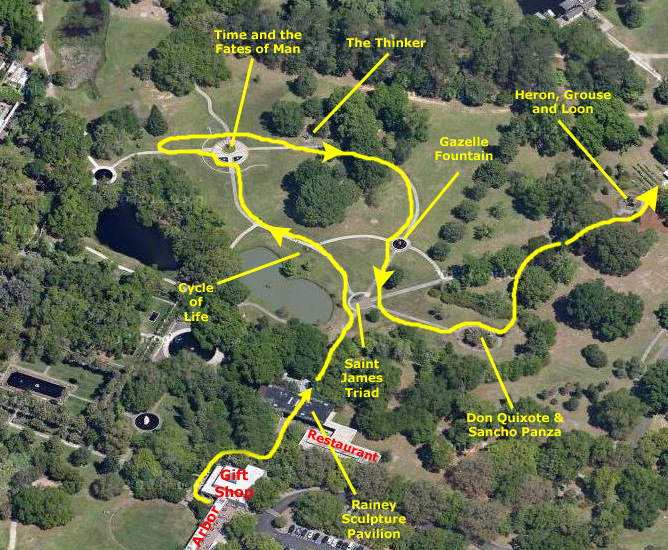
The Arboretum Area
|
We stopped at the Visitor Center for short break, and Fred noticed a display outside of some of the plants currently blooming in the Gardens. He took a couple of pictures of the display, and if you want to see them, use the clickable thumbnails below:
 |
Then we headed past the Gift Shop and out into the area called the Arboretum.
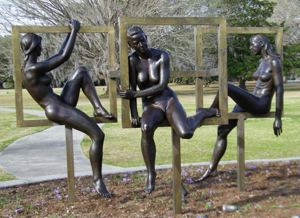
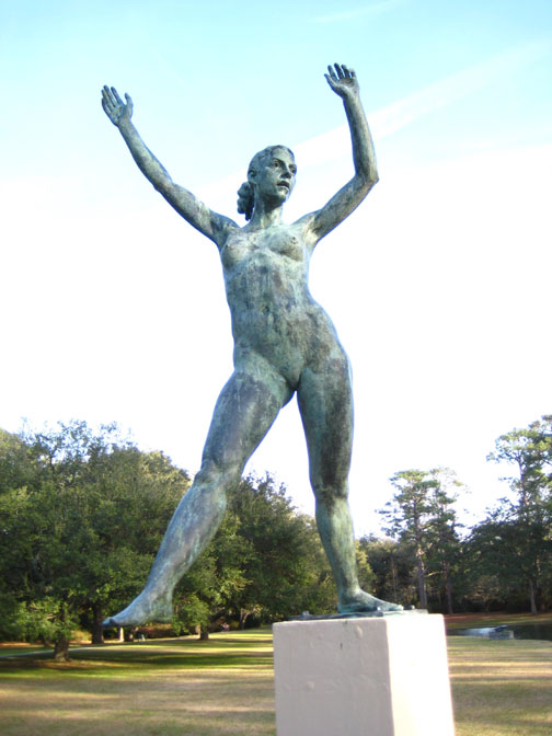
The first major sculpture we came to was beside the walkway out into the Arboretum.
|
This over-life-size sculpture was actually the subject of a book, Voices in Bronze, describing its inspiration, creation and challenges. Miller placed three figures within box-like frames to contrast soft curves with hard geometric lines, a device he had used in other works.
The frames provide support and visual interest without confining the contemplative figures. The title of the piece is derived from Saint James, New York, the hometown of the individual who commissioned the work.
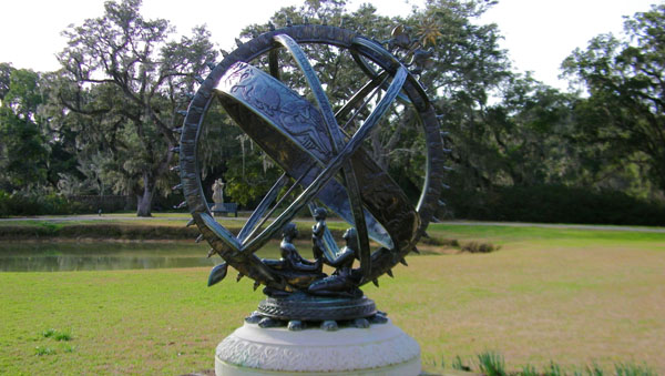
|
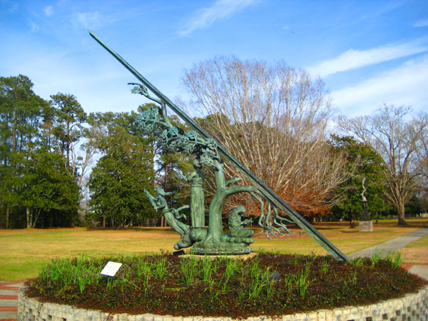
A penchant for astrological and mythological symbolism comes across clearly in Manship's work. This sundial symbolizes the cycle of life encompassed by the cycle of eternity. It is patterned after an armillary sphere, an ancient astronomical device composed of rings representing the great circles of the heavens. On the rings and base are depicted the elements, seasons, hours of the day and signs of the zodiac.
This cycle is also emphasized by the bronze figures of man, woman and child that form part of the base of the piece.
Out in the middle of the garden lawn as we passed was a very large tree with a great deal of Spanish moss hanging from its branches. This was not unusual in itself, but I don't recall ever seeing such a large tree with that moss in the winter- when it had no leaves. You can have a look at that tree here.
|
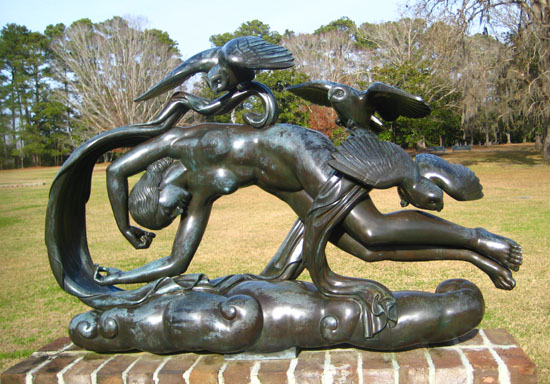
Evening is the study model for one of four sculptures known as The Moods of Time that Paul Manship created for the 1939 New York World's Fair. The sculpture was placed along with its companions- Morning, Day and Night- in a pool adjacent to his monumental sundial, Time and the Fates of Man. Together, these sculptures created a focal point near the Fair's signature structures, the Trylon and Perisphere.
Manship repeated the use of figures in a floating, horizontal design in many of his most successful works. This piece, along with the monumental sundial, were acquired by Brookgreen gardens after the fair closed.
|
By accommodating the taste for elegance and streamlining, Manship's work stretched the bridge between the academic tradition and modernism. Symbolic of the passage of time, the sundial presents the three Fates: Clotho, who spun the thread of life; Lachesis, who measured the thread and determined life direction; and Atropos, who cut the thread of life, causing death.
The entire group is sheltered by the Tree of Life, its branches lush and green over the living and barren at the moment of death.
You can see those symbolic figures here, in the wonderful closeup view that Fred obtained.
Just northwest of this sculpture, out in the lawn, we noticed a huge fir tree that had a sign at its base, so I sent Fred out to stand by it for a picture (which you can see here; the sign gave the genus and species and also noted that it is this tree that is decorated for Christmas at Brookgreen Gardens.
We walked back east past Time and the Fates of Man to find yet another major piece.
|
Clews's satirical artistic commentary dealt with aspects of American society: religion, education, government, military, family, love, and even art. His fascination with evil and its reflection in his sculpture was not well-received by the public or critics.
On this piece, one of the base panels shows a blowfish attacked by a group of needlefish. Certainly an odd representation. Clews said, however, that the scene represents the perennial struggle between the artist, puffed up with creative ideas, and the public's stabbing criticism of his work. Another panel on the base shows two alligators biting each other's tails; I can't even guess at the symbolism of that.
|
As a final example, look closely at the tortured human form atop the sculpture here. What the meaning of the skull might be I have no clue. I rarely see a piece of artwork that I detest but this was one of those times.
I don't want to overstate the case, but it was something of a relief to leave The Thinker behind and continue on to The Gazelle Fountain.
|
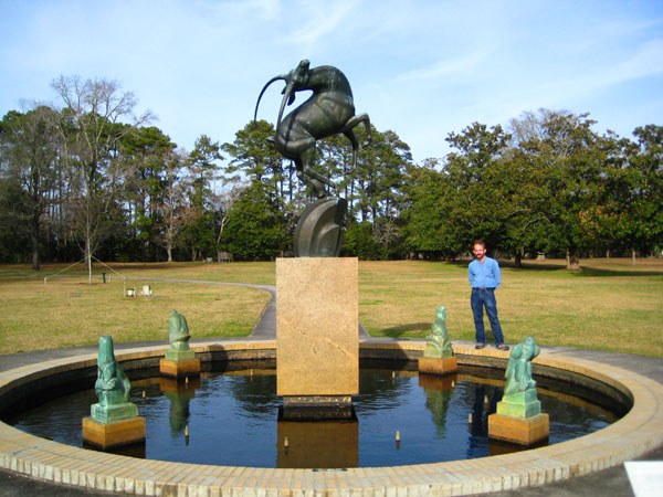
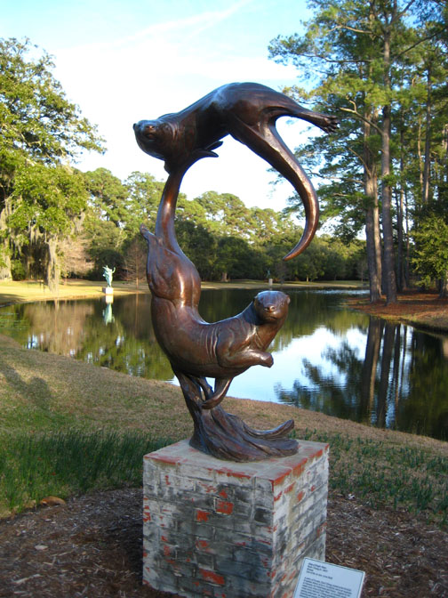
In the sculpture, a sleek gazelle is presented in a characteristic movement known as "wheeling." The sculpture was adapted from the central figure of the Levi L. Barbour Memorial Fountain on Belle Isle in the Detroit River (home of the Detroit Zoo). Placed around the fountain basin are a hawk, rabbit, grouse and otter, representing animals native to the region.
In 1936, this design won first place in a national competition, and in 1972, it won the Purchase Prize in a competition sponsored by Brookgreen Gardens.
A short distance further on, near the eastern edge of the Arboretum area, we came to another major installation.
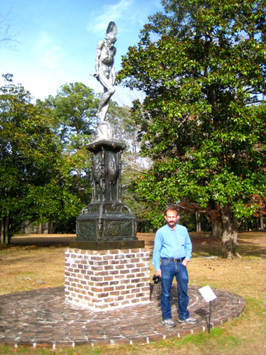
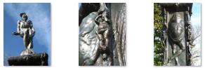
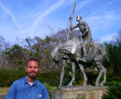
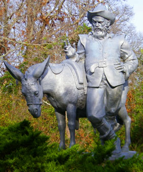
|
Huntington envisioned Cervantes' famous subject as a pitiful character, rather than a comic one. She depicted him dazed and confused at the moment after he has lost his joust with the windmills. His dispirited horse, Rocinante, was first modeled in 1937 from local horses at the studio in Atalaya, the Huntington's winter home at Brookgreen. After becoming the first sculptor to use aluminum as the medium for a major piece, it became her material of choice.
Sancho Panza was also sculpted in aluminum, but by a different artist at a different time. In 1968, Anna Hyatt Huntington asked Paul Jennewein (1890-1978) to create this compannion piece after years of requests for a suitable companion to her Don Quixote. The figure of the paunchy sidekick is a perfect foil to the gaunt, wrinkled figure of the misguided knight.
Jennewein studied literary references to the character in order to present th eproper attitude and asked The Hispanic Society of America to provide the accurate period costume. The sculpture was completed in 1971 and only one example was cast.
|
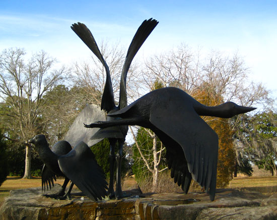
Elliot Offner (1931-2010) is known for his sculpture's meticulous surface treatments and for compositions that launch his subjects into flight or emphasize points of tension and balance.
The first casting of Heron, Grouse and Loon was created in 1992 for a location in downtown Minneapolis. There, the birds are perched on granite boulders in a fountain, encircled by a seat wall. Here, they are displayed in an environment of gently flowing water surrounded by native plants.
This casting was a gift to Brookgreen Gardens by the family of Austin P. Kelley.
The Lowcountry Center and Interpretive Trail
|
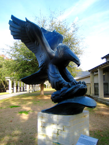
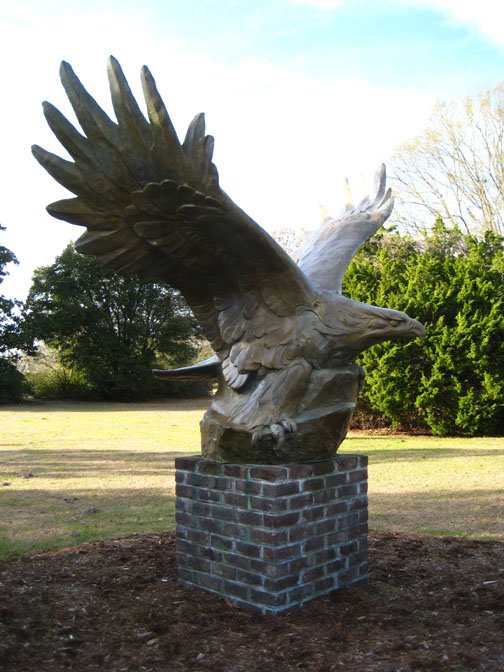
Outside the Center we found another beautiful sculpture- Diving Eagle- sculpted in bronze in 1963 by Albino Manca (1976-1973).
Diving Eagle is the half-size model of the United States monument to whose who died in the Atlantic Ocean during World War II. The large monument is located in New York City's Battery Park near the former site of the World Trade Center. The eagle symbolically places a wreath upon the crest of a wave. Since its completion, this sculpture has won many awards, including the Henry Hering Memorial Medal of the National Sculpture Society, given in 1972.
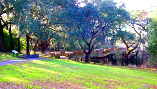
We did not actually go into the Lowcountry Center, but opted instead to walk along the Lowcountry Trail.
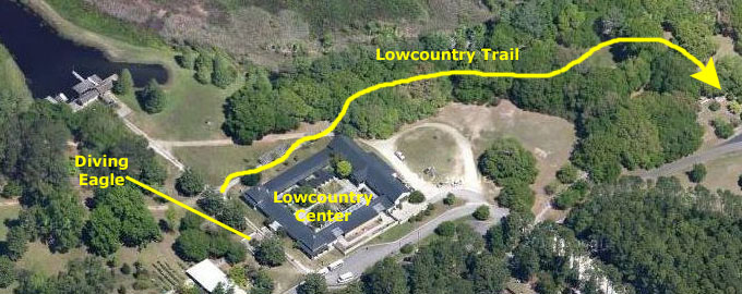 |
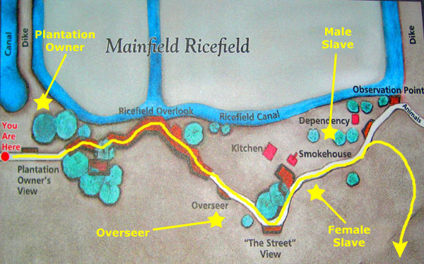
Winner of the South Carolina Heritage Tourism Award, the Lowcountry Trail consists of a beautiful boardwalk that crosses the hillside overlooking Mainfield, a restored rice field of the former Brookgreen Plantation.
|
Archaeological projects have revealed the remains of four structures on the hillside: the site of the overseer's residence at the apex of the hill, and its kitchen, smokehouse and dependency closer to the edge of the rice field.
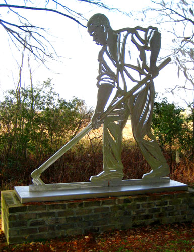
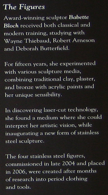
Along the trail, interpretive panels that describe life on a rice plantation and four stainless steel figures have been placed to represent the Plantation Owner, the Overseer, and an Enslaved African Male and an Enslaved African Female. These figures, created in stainless steel by Babette Bloch, an award- winning artist known for her site-specific works, serve as visually compelling landmarks to draw visitors along the trail and to interpret a revealing story about each one's role in the economic and social system of a Lowcountry plantation.
Of course we walked the trail, beginning in front of the Lowcountry Center, and took a number of pictures along the way. We'll divide up the narrative and pictures here around the four huge figures that we saw.
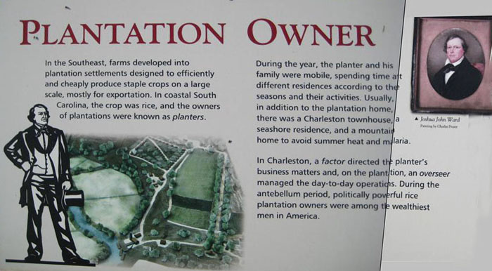
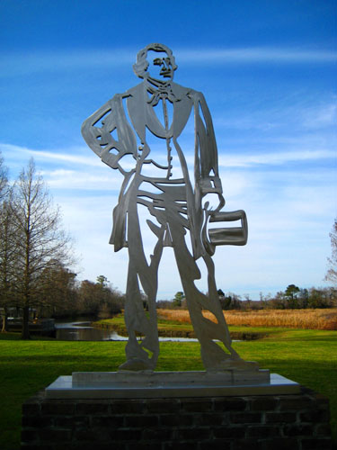
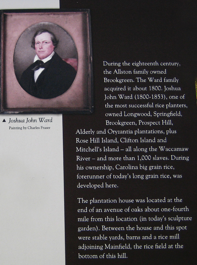
The Plantation Owner
|
The stainless steel figure of the plantation owner, modeled on Joshua Ward, was on on the lawn by the ricefield and canal, although the way the sun was it was hard to get a good view of it from the walkway up by the Lowcountry Center.
|
Rice Cultivation
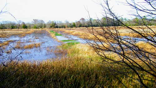 The Ricefield |
 The Boardwalk |
|
|
|
The previous sign, about the land and the river, was accompanied by two interesting pictures, and you can see them below:
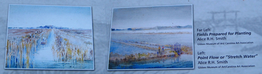 |
|
I thought all the signs were pretty interesting, just as much as those we encountered on the Oaks Plantation trail earlier, so I hope you took the opportunity to read some of them.
|
|
The Overseer
Brookgreen Slave Village/Female Slave
|
Another interesting sign described a building that is no longer standing- the Overseer's Kitchen. By the end of the eighteenth century, it was customary to confine cooking tasks to buildings located away from residences, and this kitchen building was one of them. If you would like to read the sign about it, just click on the link below, and I'll open another window so you can do so. Just close the window when you're done.
The smokehouse has been partially reconstructed so the visitor can see where it was and about how large it was. You can read the sign about it using the link below; just close the window when you are done:
The third of the four large stainless steel outline figures was located nearby; it was the figure of a female African slave dressed in a typical work dress. You can see it here.
Domestic Slave Dependency/Male Slave
|
If I back up from the sign and take another picture, you can see the rectangular plan of the buildings that the sign above talked about; you can see that view here.
There were two other interesting signs here, and rather than transcribe them, you can read them yourself using the links below. Just close each window when you're done with it:
|
Read the Sign at the Rice Field Observation Point |
Read the Sign about Swamps, Rice Culture and Natural History |
From here, there were good views out into the rice fields. And just up the hill, by the road, we found the cypress tree log. According to the sign, this log, taken from the Waccamaw River and on permanent loan to Brookgreen Gardens, was cut in the 1700s or 1800s, and was already 500 years old when it was cut to make room for the rice fields. You can open a new window to read the sign describing the log and its history (don't forget to close the window when done) if you click HERE.
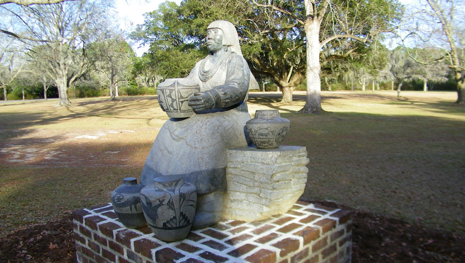
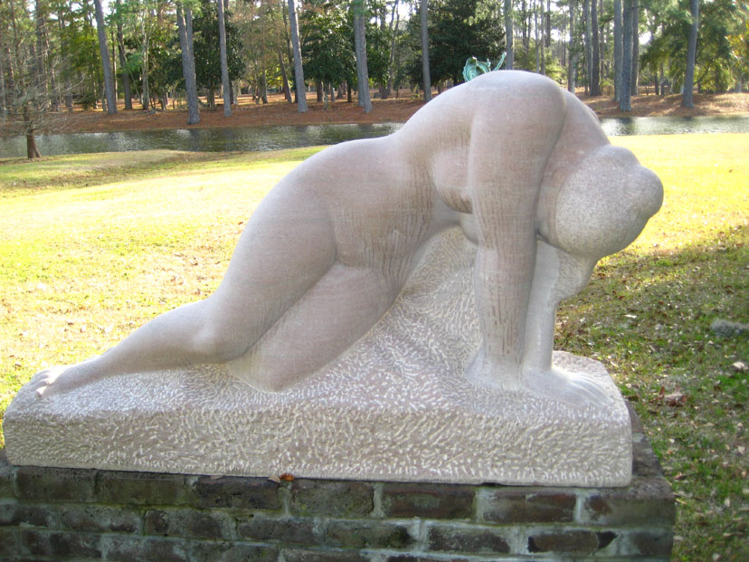
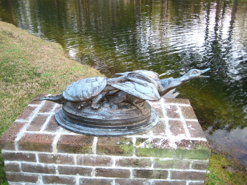
The Ponds, Allees and Other Sculptures
 |
I think the easiest thing to do here is just show you the sculptures and let you follow along on the garden diagram; or just have a look at the diagram and then go right on to the sculptures below. Our route wasn't all that complicated. So, anyway, just scroll on down and start the walk with us.
We crossed the road to get to our first sculpture. You can click on the sculpture's thumbnail to have a look at a full-size picture of it and, as usual, where there was a sign describing the sculpture you can read it by clicking on the "SIGN" link.
|
|
|
|
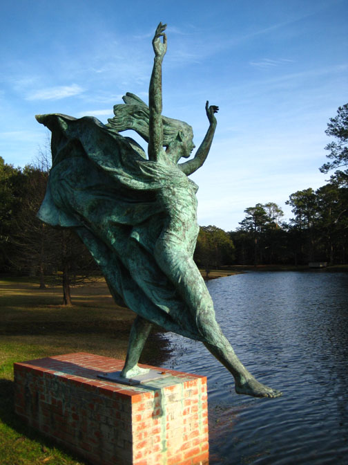
This brought us down to the shore of Jessamine Pond, and we turned east to walk along that shore to the center of the gardens.
|
|
|
|
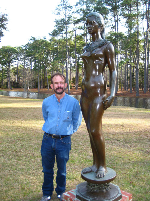
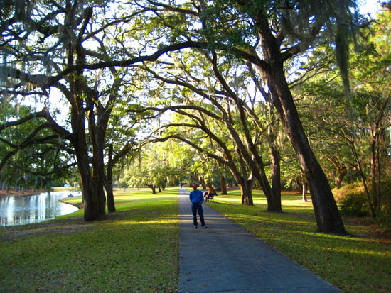
From the last sculpture, we came back up to a walkway that had been paralleling the pond; it led through a continuation of the Live Oak All�e that had extended on the other side of the Rainey Sculpture Center. It actually begins at the circular pond in the center of the garden. Below are two pictures of the All�e looking back the way we'd come and ahead toward the gates at the end:
 |
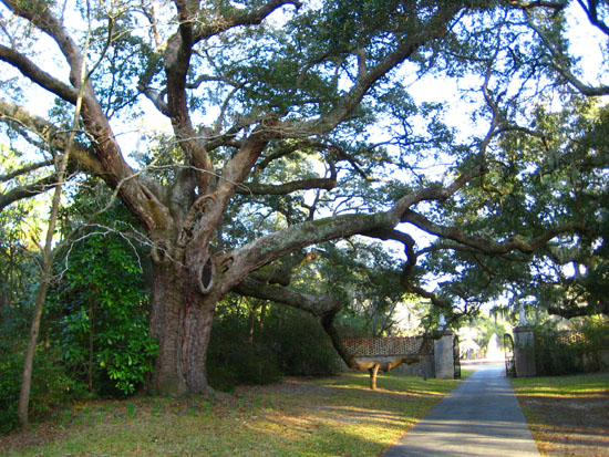 |
The Live Oaks were very large and, presumably, very old. I got a nice picture of Fred standing by a gnarled, low branch of one of these magnificent trees, and you can have a look at it here. The gates at the end of the All�e were originally part of the main garden entrance; they are wrought iron, and have animals incorporated into the wrought iron. Atop the gate's pedestals are two sculptures together entitled Great Danes. The dogs are different, and you can see a closeup of one of them here. There was also a sign describing this sculpture by Anna Hyatt Huntington, and you can read that sign here.
|
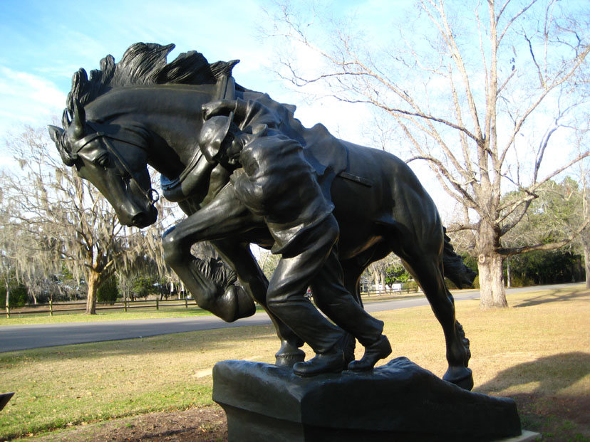
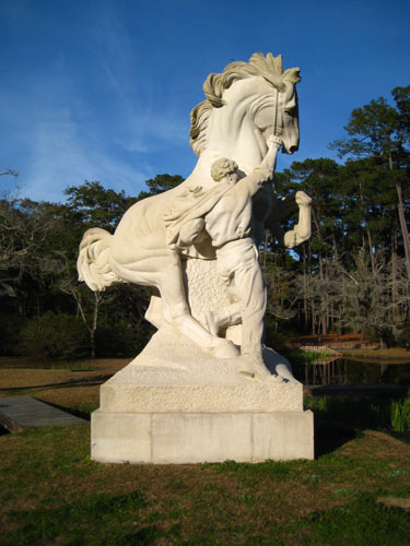
The founders of Brookgreen Gardens, Anna and Archer Huntington, created a haven for native plants, animals and American sculpture. One of the first pieces of sculpture to be placed here, it's theme was adapted as a memorial to Archer's father, Collis P. Huntington, one of the "Big Four" who built the transcontinental railroad. The idea of a burgeoning America, represented by a vital young man, taming the rearing horse of the Wild West, had great appeal at the time.
I went out to the island to see the sculpture and make the movie that you can watch with the player below:
|
|
I went out to the island to stand beside the sculpture to take my picture, while Fred stayed on the walkway and took his own pictures of the installation. You can have a look at them here and here.
|
The Tarbox house sits on the north side at the east end of another tree-lined walkway through the gardens- the Magnolia All�e.
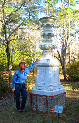
In a small garden between the Tarbox House and the island pool, we found another sculpture, this one entitled Barberini Candelabrum. It was the work of Furio Piccirilli (1868-1949) and his brother Horatio (1872-1954), done in white marble in 1900. It was Horatio's gift to Brookgreen Gardens. This example of architectural sculpture was modeled at the request of the brothers' father.
The four side panels on the base represent the Roman mythological deities: Zeus, Athena, Aphrodite and Ares. The Piccirilli family included six brothers and their father, all stone carvers, who immigrated to New York City from the carrara region of Italy in 1888. Among their many commissions were public monuments and architectural ornamentation for buildings.
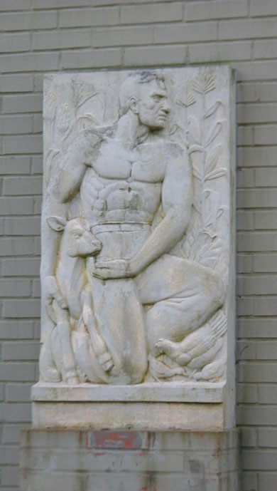
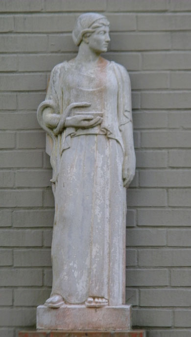
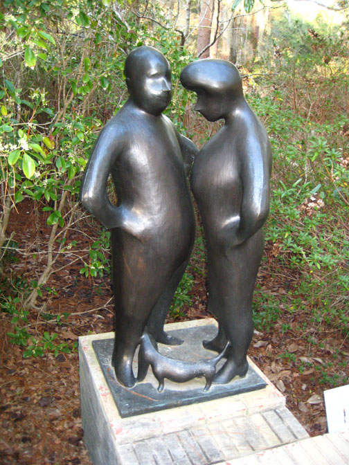
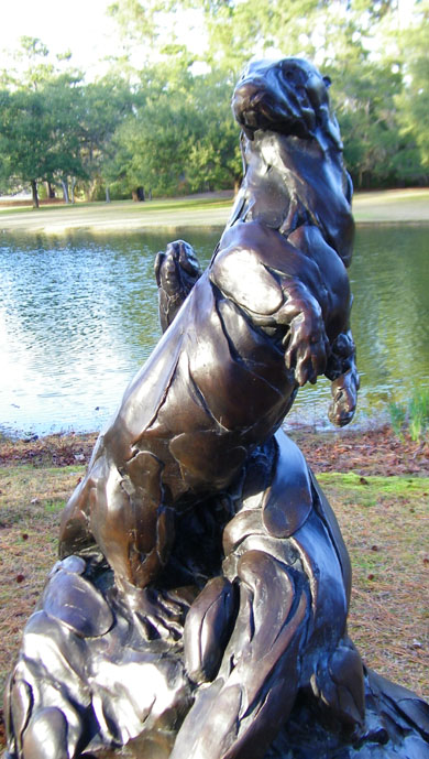
We went back and circled around the island pond and found another walkway that led along the southwest side of the Jessamine Pond, back towards the Visitor Center. Along the way, there were a number of sculptures between us and the pond, and on the side of one of the Garden's sculpture buildings we found four interesting figures.
|
Along this walkway, which led by the Russell Holliday Cottage, we found a number of other interesting sculptures.
|
|
|
|
That was the last sculpture that we saw on our visit to the gardens today- and I think that between yesterday and today, we saw just about all of them, aside from the ones inside the exhibit buildings. On the way back to the parking area, Fred did find an interesting flower to smell and back in the parking area, he took a picture of me that I was kind of partial to.
We left the gardens and went back by the Waccamaw Medical Center to talk with Guy again; he was still there overseeing his father's care. We waited until he was ready to leave, and the three of us returned to his father's house. We spent a final evening with him, watching a movie we'd brought and talking about his father's situation. Guy would remain in Murrell's Inlet for another week to take care of his father and arrange for where he would go from the hospital, and Fred and I would take Zack and head on down to Florida.
You can use the links below to continue to another photo album page.
|
January 22 - February 4, 2013: Our Winter Trip to Florida |
|
January 18-20, 2013: Brookgreen Gardens (Day One) |
|
Return to the Index for 2013 |