|
September 25, 2013: Galway to Dublin, Ireland |
|
September 23, 2013: Kylemore Castle near Galway, Ireland |
|
Return to the Index for Our British Isles Trip |
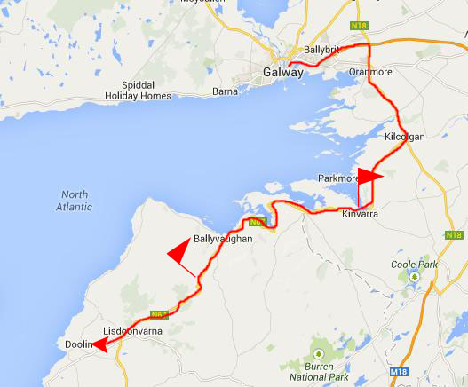
Early this morning, at breakfast, we asked Maire what she might recommend for a day trip today. Karl had laid out a driving route that would take us a good ways south, but we would be driving most of the time and it would take us the entire day. Maire recommended driving a shorter distance down to the coast to catch an excursion boat to see the Cliffs of Moher, which are quite famous. She helped me call the boat operator to make the booking, which would include a trip to one of the string of three islands- the Aran Islands- just off the western Irish coast.
Driving to Doolin, Ireland
|
|
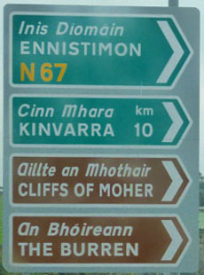
Along the N67, which we took all the way to the Doolin vicinity, we stopped three times.
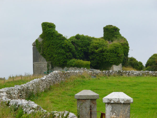
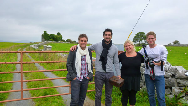
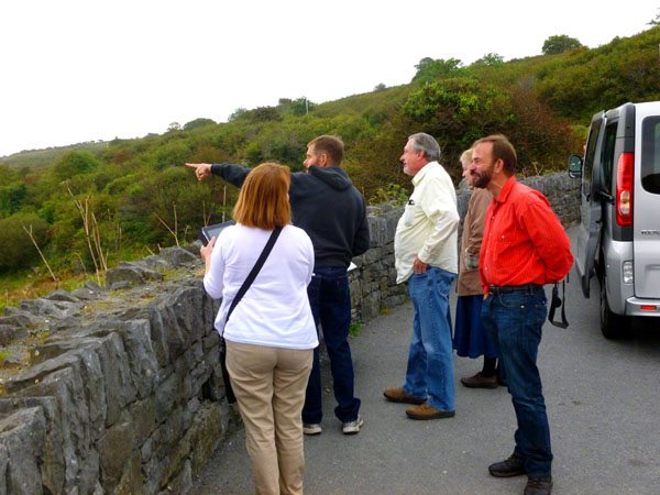
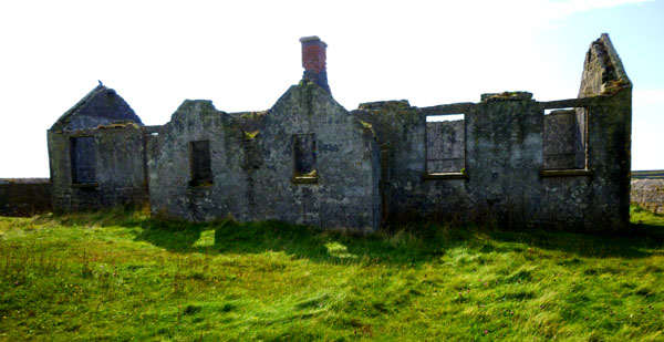
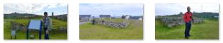
The first time we stopped we did so because we saw a bunch of other cars stopped and some people looking at an old building off to our right. So, we stopped too, just to see what it was. The turnout was just a short ways past the building; walking back along the rock wall, Fred was intrigued by the wild blackberries he found growing on the wall.
|
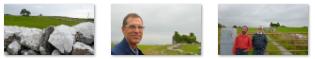
We stood around snapping pictures of the house and of each other for a little while, and I think just about everybody got photographed. There are clickable thumbnails below for some of the pictures we took:
|
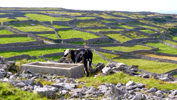
The first picture in the second row is interesting; it shows one of the rock walls in closeup with many more in the background. We were to see such low rock walls all day long, uncountable miles of them. They seemed to delineate both pastures and property lines, and sometimes a single wall would run for a mile or more up to the top of a hill. We had a number of discussions amongst ourselves as to where the rocks all came from. Perhaps they were unearthed in the process of clearing and tilling the land, but it seems unimaginable that there could have been so many. So it is something of a mystery.
|
Back near where we'd parked the van, Fred noticed something in the trees just off the road; it looked like a grave marker. I have no idea whether it was actually a marker and, if so, whether it was for someone who lived on the property or perhaps, as is the custom here, a marker for someone who died at that particular spot along the road.
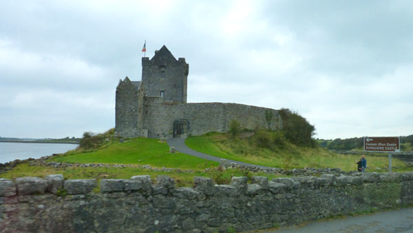
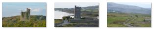
The seven of us piled back into our van and headed off to our next stop, in the picturesque seaside village of Kinvarra. About two miles before we entered Kinvarra, we passed a seaside castle- Dunguaire Castle.
|
The castle was built by the Hynes clan around 1520, a family who had been in the area since the mid-600s. Currently, archeologists believe the original dun (castle) was most likely a ring fort; there are remains of such a structure just northeast of the current castle. Dunguaire Castle was transferred in the 17th century to Oliver Martin, although the main seat of the Martin family was in Tullira Castle some distance away. Because of this, Dunguaire fell into disrepair.
The Martyn family died out in 1922, and the surgeon and poet Oliver St. John Gogarty purchased Dunguaire. Gogarty began restoring the castle and established it as the meeting place for the leading figures of the Celtic Revival, such as W.B. Yeats, George Bernard Shaw, Augusta, Lady Gregory, and John Millington Synge.
The castle was acquired in 1954 by Christobel Lady Ampthill, who completed the restoration work started by Gogarty. It was later purchased by Shannon Development, an Irish corporation that manages numerous historic tourist attractions in Ireland. During the summer months when Dunguaire Castle is open to the public, a Medieval Banquet is held every night with costumed performers who recite Irish literature and play traditional Irish music.
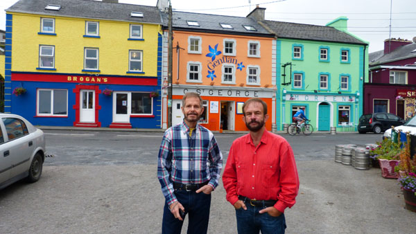
We continued on past the castle, and another few minutes brought us to the seaside village of Kinvarra, where we stopped to have a look around.
|
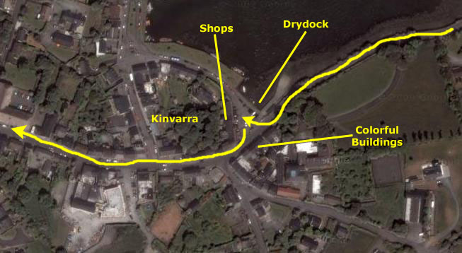
Kinvara developed around a towerhouse (now completely demolished) close to the main pier and the medieval church of St. Colm�n or St.Caim�n (now in ruins) which is situated between the main road through the village and the oldest part of the quay. The church of St. Caim�n dates to the early 13th century and was built on the site of Saint Caim�n's original early medieval church.
In the aerial view at right you can see the bay and the quay that runs along it. It was low tide when we arrived, and so some of the boats were sitting on the bottom (and some were being worked on). We parked in a triangular area between the main road, the quay and a row of shops, where Nancy and Prudence went souvenir hunting. Fred and I walked around the area taking pictures of the charming little town.
|
  Scenes in the Town of Kinvarra, Ireland |
After about 45 minutes in Kinvarra, the girls were done and we continued on our way down to Doolin. I was watching the clock as we had a 1PM sailing, and I was measuring our progress. We were on schedule, but with little wiggle room. Along the way to our next stop, which was a vista point up in the hills, Fred snapped picture after picture as we drove along. It is remarkable that with so little time to compose his shots or steady his camera, that any of them turned out well. But some did, and I have put clickable thumbnails for those pictures of the Irish countryside below:
 |
After a time, the road began to ascend into the hills via a series of switchbacks- sharp curves that Ron Ruckman handled like a pro. Eventually, near the crest of the hills, we came to the overlook.
|
Of course, we took pictures here at the overlook. Most of them were of our party, and I have put clickable thumbnails below for some of these:
  Scenes from the Corkscrew Hill Overlook |
As for the scenery, Fred did get one nice view of a towerhouse way down below us in the valley, and you can see that view here. And I put together a picture of the descriptive sign that showed the features in the distance, and you can see it below:
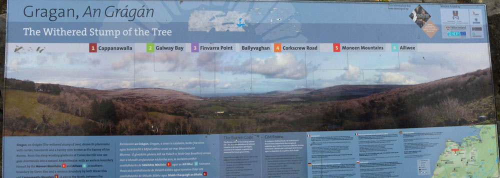 |
Both Fred and I took panoramic shots as well. Fred did his within his camera, and you can see it below:
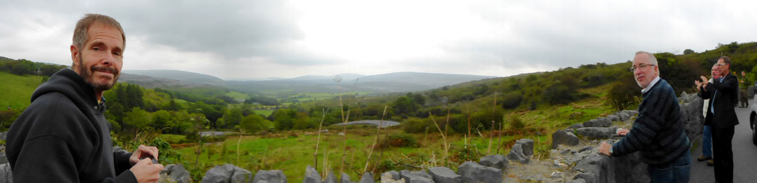 Fred's Panoramic View from Corkscrew Hill |
I put mine together out of three separate pictures, and you can see it below:
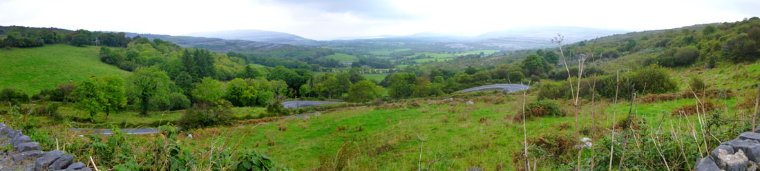 Ron's Composite Panoramic View from Corkscrew Hill |
We continued on the last few miles on the N67 before we turned off on a local road. Another few miles, and we could see Doolin ahead of us.
Taking the Ferry to Inisheer Island
|
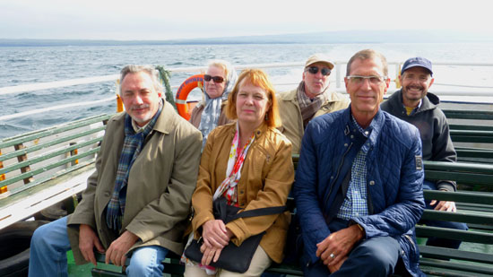
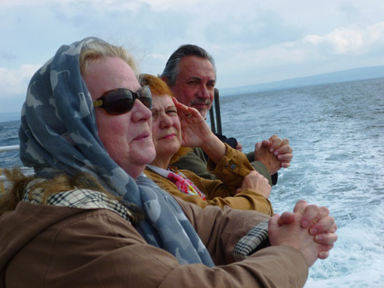
As we were getting situated on board, we took a few candid pictures- pictures of us on board, of the rocky shore south of us, of the island in the middle of Doolin harbor and, as we moved out into the harbor, of the pier behind us. There are clickable thumbnails below for a few of these pictures:
 |
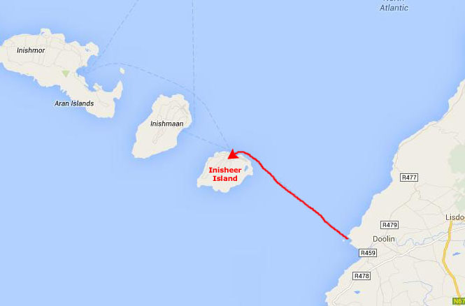
Our destination first will be the island of Inisheer, one of the three Aran Islands off the coast. Inisheer is the closest- about ten miles from Doolin.
|
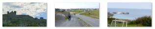
As we left Doolin, we could begin to see the view down the coast; there was a rock promontory just south of the Doolin harbor, and we could see people walking out on it. At one point, Fred saw a surfer and his board heading out across the rocks, and he could also see the Cliffs of Moher shrouded in a light fog behind the surfer. It made for a nice picture, and you can see it here.
The topograph of the mainland at this point along the coast is that of a high ridge of rounded hills that taper down to the sea near Doolin. As you move south this changes as the shoreline rises abruptly, culminating in the Cliffs of Moher a few miles south of Doolin. We'll be taking the ferry to see them late this afternoon.
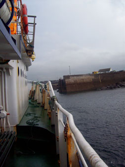
Just a few hundred yards from shore in the Doolin Harbor, there was a small island with what looked like the remains of a fortification on it. Fred got a good picture as we passed, and you can see it here.
|
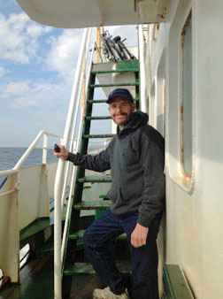
Getting Settled Aboard the Happy Hooker |
That is what amused me as I made a movie of our group and of the boat just after we got underway; you can watch that movie with the player at right.
I thought the forty-minute crossing was very enjoyable, but then I like small boats. It was quite cool; I was glad I'd brought my pullover (although towards the end of the stay on Inisheer, the weather warmed considerably).
|
|
From Doolin, we could see Inisheer way ahead of us; when we approched the island, we could look back towards Doolin. As we came around to the Inisheer harbor from the east, we could see what appeared to be a rusted ship sitting high and dry on the rocky shore. I didn't know it at the time, but I'd get a chance to see the wreck up close and personal.
|
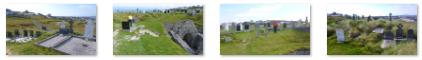
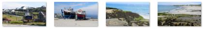
There were other interesting-looking views of the island as we came around its north side to dock at the town of Inisheer, and as we docked there were views of this small-village harbor as well. We would see all of these features later on, much closer up, so there's no need to include a lot of these pictures now. But there are clickable thumbnails below for a representative selection of the photos we took from the boat as it came in to dock (including one of an interesting hilltop cemetery that we would indeed visit later):
 |
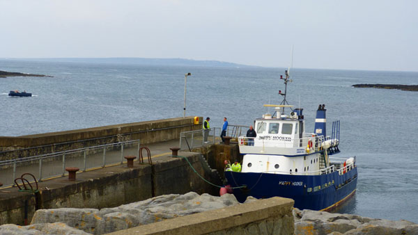
The boat docked at the concrete pier and the fifteen or twenty of us on board got off to see what we could see.
Walking Around Inisheer Island
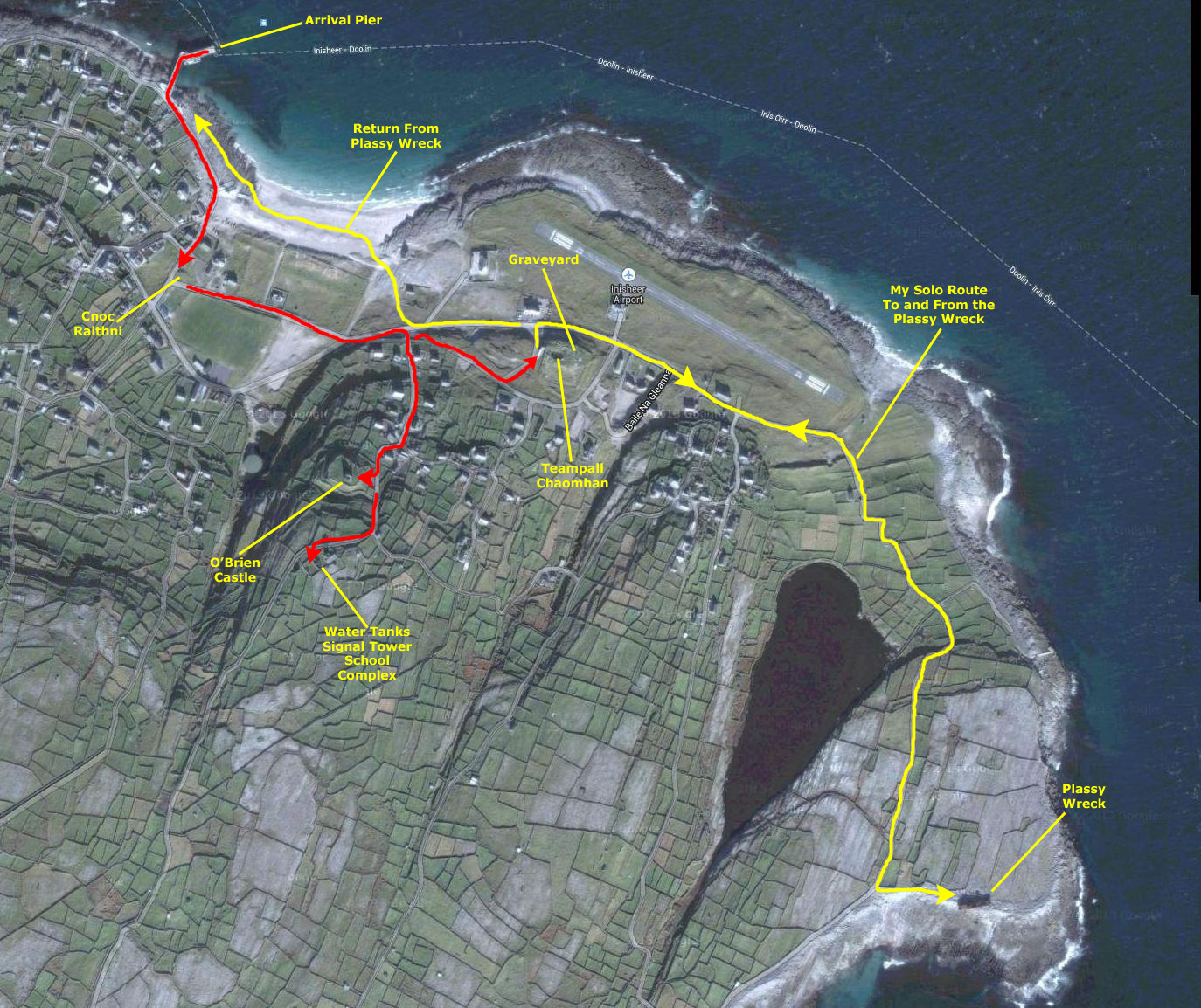
While this meant that we wouldn't all be together, it was the most reasonable solution (especially considering that six persons was the limit for one of these carriages. So we bid the other five temporary farewell, agreed to meet back at the pier at the appointed time for our return trip, and headed off in our different directions.
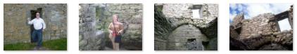
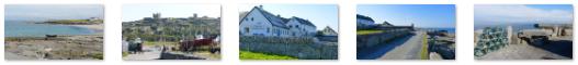
Below are clickable thumbnails for some of the pictures that Fred and I took on our arrival on the island and just after we started off on our own:
 |
Throughout this trip, I've been integrating some of the pictures taken by Nancy, Prudence and Guy into those taken by Fred and myself since, for the most part, we were together, seeing the same things at the same time. Here on Inisheer, though, this was not the case. So what I have done is simply organize the pictures we all took into the sections that correspond to the sequence in which Fred and I walked to the various spots of interest on the island. And, since we took so many pictures of so many different things here, I am also going to organize this portion of the page into a section for each of the points of interest. And at the end, there will be a section for miscellaneous views around the island that aren't directly related to one of the points of interest.
|
Just an an example, one of the previous group of thumbnails above is for a picture that Fred took of the beach as we were walking to the beginning of the pier. In the aerial view, you can see this beach clearly. I think that later on, when I visit the shipwreck that we saw from the ferry, you'll appreciate having the aerial view to supplement the pictures.
I might comment, however, that in working on this photo album, I have discovered that not all Google Maps aerial views are of the same resolution; those made of very populated areas are quite good, enabling you to easily see objects as small as a person. But in other areas, like Inisheer and even the mainland nearby, the resolution is not so good. The aerial view is zoomed in about as much as is reasonable; any closer, and it just gets fuzzy. (You might compare the aerial view at left to a section of the aerial view of Manhattan Island shown here, and you will see what I mean.)
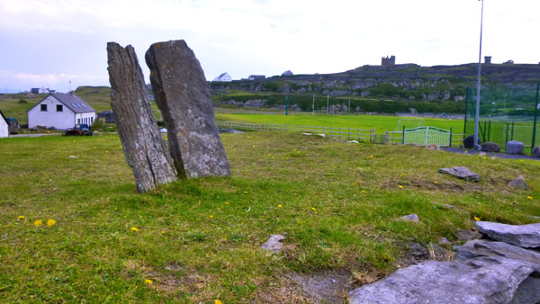
So, with all that introduction, let's walk to the first point of interest- the Cnoc Raithni monument.
The Cnoc Raithni Monument
|
 |
Following gales in 1885, inhabitants discovered a dry-stone wall encircling a low mound. In the lowest level, towards the southeast, two pottery urns were found inverted over cremated human bones, together with a small bronze pin or awl. Thirty yards away some fragments of smaller highly-decorated urns were found, also ontaining burnt bones. The urns were deposited in the National Museum in Dublin.
At a higher level in the north-west quadrant, enclosed by a dry-built wall, upwards of twenty-four stone-lined graves were discovered, each lying east-west and covered by a stone slab. These, perhaps, denote a re-use of a pagan burial place in the Early Christian Period.
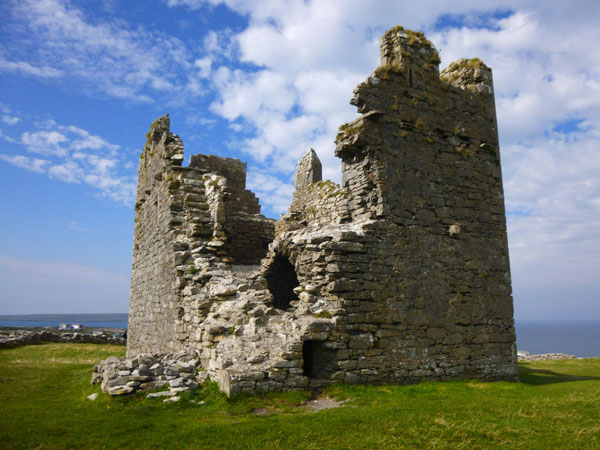
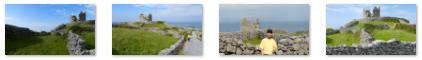
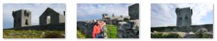
The O'Brien Castle
|
  Views from the Walk Up to the O'Brien Castle |
It was about a half mile from the base of the hill up to the top and the O'Brien Castle as the narrow road wound through the ubquitous stone walls.
|
Views of the ruined castle from outside it were impressive. We took a lot of pictures from the outside, many of them quite good. But I couldn't include them all (well, I could, but I won't). Here are clickable thumbnails for some of the best:
 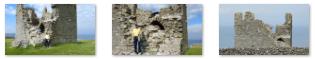 Views of O'Brien's Castle |
In many of the pictures, you can see the stone walls that ring the castle; the rocks used in these walls (and some of the walls themselves) are the remains of an even older stone fort known as D�n Formna. The Iron Age fort differs significantly to most of the other ancient forts on the Aran Islands in that it has a rectilinear grid of walls rather than the empty strict circular/rounded shape of the other Aran forts.
I liked the fact that the ruins were quite open, and that visitors are free to clamber around on them. I suppose this is only possible because the castle is in such an out-of-the-way location; I can't imagine being allowed into the ruin if it were located just outside Dublin, for instance.
|
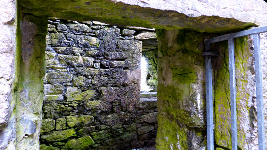
  Views from Inside O'Brien's Castle |
Because the Aran Islands were the key to controlling Galway Bay, they were contested, fortified and garrisoned by various competing powers. During the Medieval period until 1582, the Aran Islands were controlled by a branch of the O'Brien Clan from County Clare. From as early as the 13th century, there are records of payments of large amounts of wine by Galway City to the O'Brien Clan to keep the shipping routes in the area free from piracy.
Before we left O'Brien's Castle, we walked out onto the hilltop to admire the expansive views in all directions. Although the hill is only a couple hundred feet high, almost everything else nearby was lower, so the views were unobstructed. Individual pictures are fine, and some of them are in a later section devoted to miscellaneous views around the island. But panoramas are better, and we each constructed one. Fred allowed his camera to create one, and his view looks to the south and west, capturing the signal tower and water tanks. His view is below:
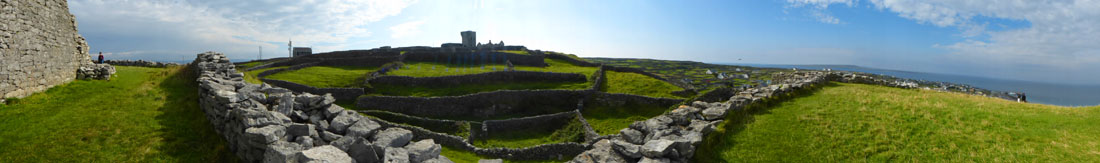 Fred's Vista Shot from the O'Brien Castle |
I wanted to do something a bit different- attempt to get in the entire sweep of the view from the Castle, past the Signal Tower and then all of the view from southwest to northeast until the castle came back into view. This required eight separate pictures and a good bit of manipulation. The impressive result is in the scrollable window below:

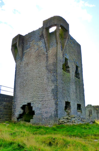
The Signal Tower, Water Tank and School
|
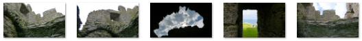
When we first got to the tower, the gate we passed had a "Keep Out" sign on it, so we thought that further on we might find an open entrance. Along the way alongside the tower, we passed it and the school building, and got some good photos looking into the ruins complex. There are clickable thumbnails below for a few of these:
 |
Oddly, since the O'Brien Castle had been totally open, we did not find another entrance. I didn't want to not get some good photos inside the complex, so while Fred waited by the road, I ducked in through the gate to have a look around. There were actually three elements to this area of ruins. Of course, the most prominent was the Signal Tower, and you can see an excellent view of it, taken looking north, here. Walking around the tower was immensely interesting, as was going inside it. It was tough taking pictures inside; it was quite dark, yet using the flash didn't give great results either. Here is the best of my inside shots. Just after taking that last picture, I turned to take a picture looking out the two windows on the northwest side of the tower, and you can see that view here.
Outside, I walked around to the north side of the tower to photograph the gaping hole in the tower's side. For some reason, I thought the hole was interesting; it almost looked as if a cannonball had torn through it. Walking around the south side, where I could see the ruins of the school on the other side of a rock wall. I could also see that there was a gap between the tower and the water tanks that are situated next to it on the east side, so I climbed partway up the stairstepped side of the tanks and walked north so I could see Fred waiting for me down by the road. The picture I took looking down at him was unremarkable, so I haven't included it here.
At the same time, though, Fred was taking pictures of the tower, including this interesting one of the tower with a bird in flight. He had just done that when I appeared and called to him, at which point he took a picture of me between the tower and water tank. The water tank turned out to be just a larged, walled enclosure that was now pretty much filled with dirt and grass inside.
|
There were side windows on both sides of the room, such as this one that looks south, and one on the north side that offered a framed view of the Signal tower.
Life on the islands has always been hard but the Islanders worked hard to provide services and facilities taken for granted on the mainland. The education of the island�s children has always been important, from the early hedge schools to a National School that was built close to the Signal Tower in 1889. This school house served the educational needs of the Island�s young population until 1941, when it was demolished; some of its materials were used when a newer school was built close the beach. (That school, incidentally, offers its instruction in Irish, not English, although English is taught as a subject.)
We left the ruins of the Signal Tower to walk back down the road towards the shore to visit the island graveyard that we had seen earlier. A ways down the road, I got a nice view looking back at Fred and the Signal Tower.
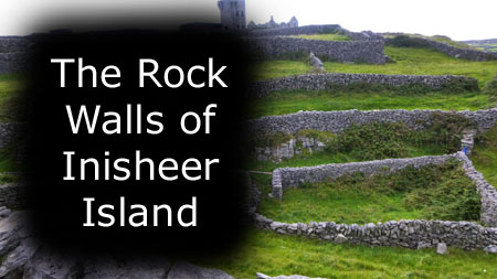
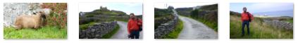
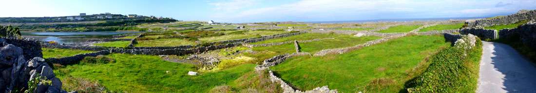
Inisheer's Rock Walls
|
The walls themselves seemed to be simply piled up rocks. I didn't notice any mortar, although I'll admit I didn't examine the walls really closely. Perhaps the most mindboggling aspect of the walls is the tiny �fields� that they mark out. Some of the fields are barely big enough for one cow! (Oddly, while some of the enclosures had gates, it seemed as if a lot of them had no way in or out- for either animals or people.
The best place to gain a real perspective on the extent of the stone walls is by walking/cycling to the southern end of the island where you see nothing BUT stone walls. We didn't do that, but still got great overhead views from the areas around the O'Brien Castle and the Signal Tower.
|
To view the slideshow, just click on the image at left and I will open the slideshow in a new window. In the slideshow, you can use the little arrows in the lower corners of each image to move from one to the next, and the index numbers in the upper left of each image will tell you where you are in the series. When you are finished looking at the pictures, just close the popup window.
And before you ask, I have no idea, nor did I find any definitive answer on the Internet to the question "Where did all the rocks come from?" A rough calculation, based on just the mileage of the walls on Inisheer, is that there are at least 50,000 cubic yards of stone in the walls on this island alone. It is hard to believe that the rocks might all have been dug up as the land was tilled and planted, nor does it seem likely that the rocky coasts could have provided so much material (although based on the composition of the shore near the Plassy Shipwreck, it is possible that they were continually washed up by the ocean). I am just speculating, of course; I would give quite a lot to know just where the rocks and boulders came from.
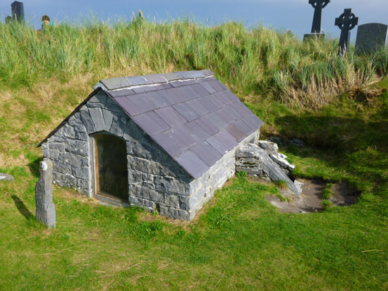
The Graveyard
|
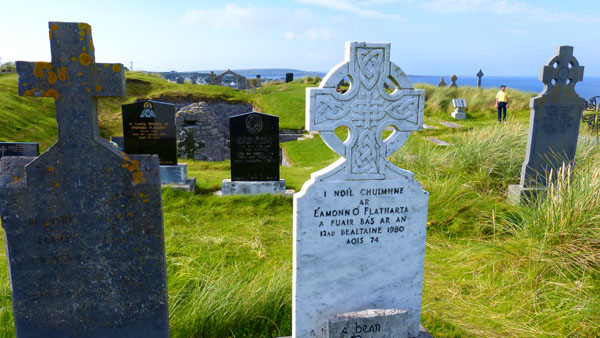
The headstones seemed quite plain, but that fitted the site, I think. There seems to be no ornateness anywhere on Inisheer, and the graveyard reflected that. The Celtic Cross was much in evidence, although a few of the headstones had the familiar Christian cross on top of them. Below are clickable thumbnails for some pictures of the island graveyard:
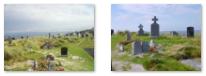 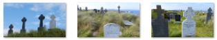 In the Inisheer Island Graveyard |
The graveyard had an odd quality about it. Most such places I have been are either huge affairs near populated areas, or smaller plots tucked away near churches. We are all familiar with iconic graveyards such as The Punchbowl, Arlington, Boston Churchyard and Forest Lawn, but this one was different. Sited as it was on a windswept headland overlooking the ocean, it brought to mind and emphasized the many centuries during which the islanders and the sea have been intimately connected. Most graveyards are tied to history; this one was tied to the sea.
|
On the floor of that depression were carved Celtic symbols, now almost worn away. I noticed some votive candles at the head of the grave, right underneath the west-facing window opening. Below are clickable thumbnails for the best of the pictures we all took adjacent to and inside the tomb of St. Chaomh�in:
 |
I know that Fred and I spent a good deal of time wandering around the graveyard, and especially visiting the Teampall Chaomhan, a small church that is inside the graveyard and which we'll talk about in the next section, and I can only assume that the others did too.
|
The Inisheer Island Graveyard |
And I want to include some more pictures that Fred and I took here in the graveyard; we each found graves and scenes that we thought worth recording, and you can use the clickable thumbnails below to have a look:
 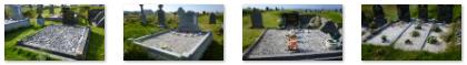 In the Graveyard on Inisheer Island |
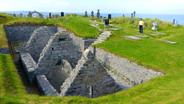
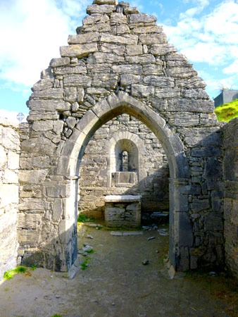
Now for the graveyard church.
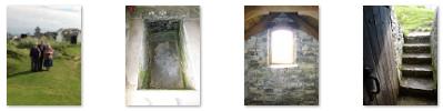
Teampall Chaomhan
|
St. Keevaun is believed to have been a brother of St. Kevin (the founder of the magnificent monastery complex of Glendalough in County Wicklow) and a disciple of St. Enda of Inis Mor. St. Keevaun is the patron saint of Inis Oirr and his feast day �L� an Ph�truin� is celebrated on the 14th of July, a day when the islanders come to the small church for Mass. It is also tradition for the islanders to pray at the grave of the Saint (located close to the church) the night before. We just saw that tomb in the previous section of this page.
There was some additional information about the church on the sign in front of it; rather than copy it, I'll just let you read the sign here.
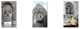
We went down into the church to look around, first descending some steps on the north side of the church to a pathway that runs all around the ruin. I couldn't quite figure out whether the stone walls through which the steps are cut were actually part of the church structure, but I think they were added later as a kind of retaining wall to keep the pathway (and the ruin) from being entirely covered. Anyway, if you walk around to the south side of the ruin, you'll another set of steps that lead through an arched door in the church wall to bring you into the church. The doorway was quite small, and my first thought was that the church was built for Munchkins; you can see how small it is if you look at my picture of Fred crouching in the doorway.
|
We took a number of other good pictures while we were down here in the tiny church (and one other good view of the church from above). If you would like to have a look at some of these, just use the clickable thumbnails below:
 |
|
 |
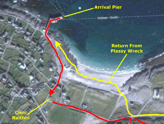
The graveyard was immensely interesting, but eventually we had seen all of it and went back to exit through the gate. Below the graveyard is Port na Cille (harbor of the church) and of course there were good views back up to the castle. Outside the graveyard, Fred and I debated what to do next. He wanted to walk around the town and the harbor area, but I had my mind set on walking the mile-plus to the Plassy shipwreck. We reached a compromise. Fred went off to the harbor to see what he could see, and I turned right on the north road to head east to the shipwreck. I had over an hour, so I thought that would be plenty of time.
The Shipwreck of the Plassy
|
On the Road to the Plassy Shipwreck |
As I was walking along the open road, I made a movie of the scenery on either side, and you can watch it with the player at left.
After the road curved around and went through some of the low walls, I stopped, took five pictures, and stitched them together into this panorama:
 Loch Mor and the Northeastern Corner of Inisheer |
It took me about twenty minutes to get down to where the wreck was. By the time I got to it, I could even see the lighthouse in the distance. There was a bike here, but I don't know who it belonged to as I didn't see anyone else.
|
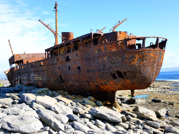
The wreck was immensely interesting because I had never been so close to the hull of such a large ship before. It wasn't the Titanic, but it was impressive nevertheless. There are clickable thumbnails below for some other pictures I took of the rusting hulk:
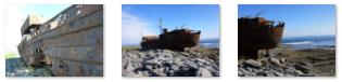 |
Although it was interesting to stand so close to the ship, that made it impossible to get the whole thing into a single picture- except from a distance. So I steppedd back far enough from the midpoint of the ship to get it all in three overlapping pictures, which I later put together into a panorama. On looking at the panoramic result, I realized I should have taken my three pictures the same distance from the ship but one-quarter, one-half and three-quarters of the way along the hull:
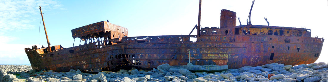 The Wreck of the Plassy |
Pretty impressive. I assume that the proximate cause of the sinking was the hole ripped in the hull a third of the way back from the bow. I wonder what the wreck will look like in another fifty years.
|
At the Wreck of the Plassy |
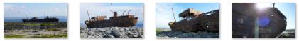
And I want to include a few more pictures of the wreck, even though they may be repetitive. You can use the clickable thumbnails below to have a look at them:
 |
When I saw that I had a little less than an hour before sailing, I headed back to the harbor, passing back by the Inisheer Graveyard with more than a half hour to spare.
Inisheer Island Scenes
Below are clickable thumbnails for some of these miscellaneous pictures, all but the last one of which were taken by Guy and Nancy:
 |
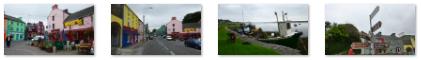
We only saw the main Inisheer village- Baile an Lurg�in- which is the one surrounding the harbor. It has most of the islands facilities- shops, pubs, B&Bs, a hotel and restaurants., But there are, in fact, many different communities, most of them scattered around the northern side of the island. The community near O'Brien's Castle is Baile an Chaisle�in, while these two ladies Live in Baile an S�ip�l near the beach. We didn't visit Baile Thiar; it is the furthest village away from the pier. Locals living in these villages are very friendly (as were the two ladies of whom I asked directions). The folks we talked to spoke pretty good English, one heck of a lot better than my Irish.
From up near Castle O'Brien, I made a panoramic picture of Baile an Lurg�in, and you can see it below:
 The Village of Baile an Lurg�in as Seen from O'Brien's Castle |
You can use the clickable thumbnails below to have a look a selection of the island pictures that Fred and I took:
 |
I Meet Up With Fred at the Harbor
|
  Fred's Pictures at the Harbor |
Eventually, Fred spotted me on the beach. I had stopped to take a picture looking towards the harbor (a picture that you can see here) and as you can easily see, I hadn't yet spotted Fred. Fred continued to watch as I walked across the beach towards him. Eventually I did spot him, and headed over to join him on the seawall. About thirty minutes before we were due to embark for our return trip, Fred spotted the ferry coming back.
We were getting a trifle worried in that we had not yet seen everyone else. We doubted that they might have returned early and taken an earlier ferry back to the mainland, so we just kept an eye out and waited. While we were sitting on the seawall, I made a couple of movies, and you can watch them with the players below:
|
Island Transportation |
Caution: Vehicle in Tow |
I took one last picture of the beach, and Fred took a nice picture of the clear waters of the North Atlantic. He also got one last view of O'Brien's Castle and the Signal Tower before we spotted our group, headed over to meet them and walk out onto the pier. The boat wasn't ready to board, so we sat down to wait. After a few minutes, our ferry was called and we boarded for our return trip. Inisheer had been a great way to spend an afternoon, but I was looking forward to seeing the Cliffs of Moher.
Our Return Ferry Ride to Doolin
|
 |
I hadn't expected it, but as the boat pulled in to the pier at Doolin, the fellow I'd talked to on the phone and bought our tickets from, Danny, was there; he is the man in the yellow life jacket here. He had come down to make sure that since we had bought a combination ticket that included a cruise down to the cliffs, that we stayed on the boat, as it would be the same one making that trip.
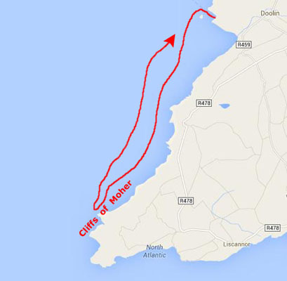
On the way back, Prudence, Nancy and Karl had decided they'd had enough boat travel for the day, and so would disembark in Doolin and wait for us to return. I'm not exactly sure why that made that decision, but that's what they wanted to do. So after the ferry passengers had disembarked, and some other, new passengers for the cliffs cruise had boarded, we headed back out of the harbor and down the coast to the Cliffs of Moher.
Our Cruise Down to the Cliffs of Moher
|
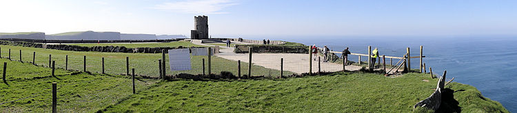
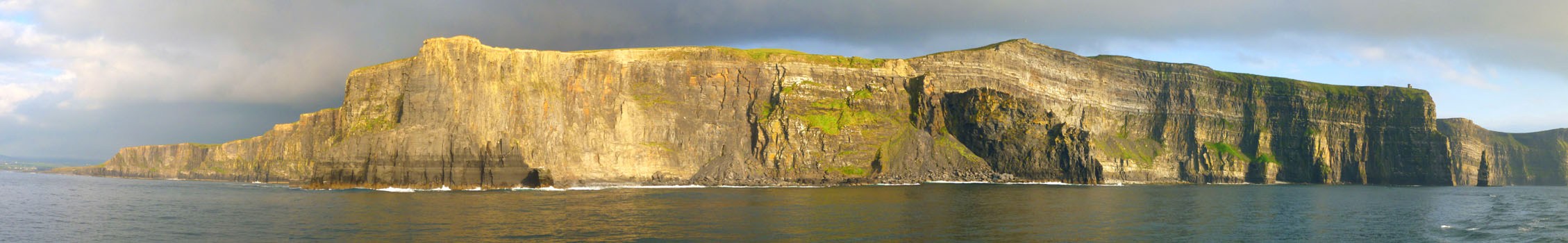
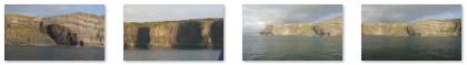
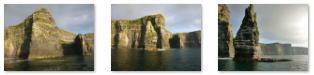
The Cliffs of Moher (in Irish "Aillte an Mhothair") are located at the southwestern edge of the Burren region in County Clare. They rise 390 feet above the Atlantic Ocean at Hag's Head, about eight miles south of Doolin, and reach their maximum height of 700 feet just north of O'Brien's Tower, which is about three miles south of the harbor. The Cliffs of Moher are perhaps the biggest attraction (no pun intended) in western Ireland, and by car, on foot and by boat they receive almost a million visitors a year.
O'Brien's tower was built on the cliffs in 1835 by local landlord Sir Cornellius O'Brien as an observation tower for the hundreds of Victorian tourists that frequented the cliffs at the time. (A more popular and more circulated version of this history is that O'Brien built the tower specifically to impress women he was courting.) On a clear day the view can extend as far as Loop Head at the southern tip of Clare and beyond to the mountains of Kerry. Looking north from O'Brien's Tower on clear days, the Twelve Bens in Connemara (also known as the Twelve Pins) beyond Galway Bay can be seen (which means that with a telescope you would be able to pick out the mountain on whose southern slope Kylemore Castle is situated), and typically the Aran Islands to the west.
|
The cliffs take their name from an old fort called Moher that once stood on Hag's Head, the southernmost point of the cliffs. The writer Thomas Johnson Westropp referred to it in 1905 as "Moher U� Ruis" or "Moher U� Ruidhin." The fort still stood in 1780 and is mentioned in an account from John Lloyd's a Short Tour Of Clare (1780). It was demolished in 1808 to provide material for a new telegraph tower. (The present tower near that site was built as a lookout tower during the Napoleonic wars.)
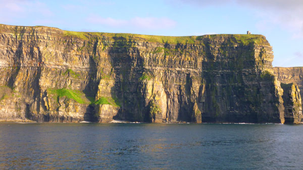
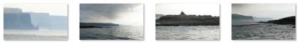
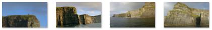
As for the cliffs themselves, they were, in a word, amazing, and I think that looking back on it, while the view from the top might have been wonderful, the only way to really appreciate the grandeur of the cliffs is by looking at them from below- and the only way to do that is by boat. When the boat had reached the halfway point down to the pinnacle island you'll see in a moment, I took advantage of the craft's slowing to take five pictures covering the length of the cliffs, and I put them together into your first panoramic view of the Cliffs of Moher. Too big to show all at once, you can use the scrollable window below to have a look at this natural wonder:
|
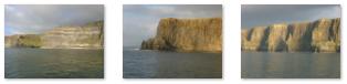   The Cliffs of Moher |
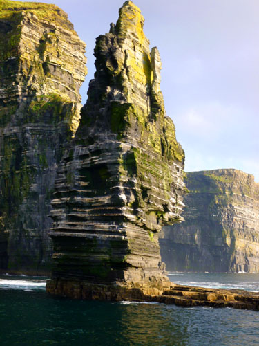
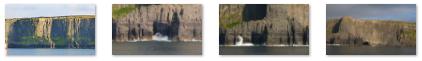
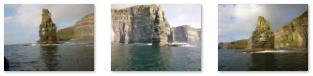
The most prominent sea stack along the Cliffs of Moher is just below O'Brien's tower, and that is where the cruise headed. Once there, the boat slowly turned this way and that to allow everyone, no matter what side of the boat they were on, to get good views of the cliffs and of the sea stack itself. A stack or seastack is a geological landform consisting of a steep and often vertical column or columns of rock in the sea near a coast, formed by erosion. Stacks are formed over time by wind and water, processes of coastal geomorphology. They are formed when part of a headland is eroded by hydraulic action, which is the force of the sea or water crashing against the rock.
|
 |
And you can use the player below to watch one of the movies I made that features the stack:
|
The Cliffs of Moher Sea Stack |
There are an estimated 30,000 birds living on the cliffs, representing more than 20 species. These include Atlantic Puffins, which live in large colonies at isolated parts of the cliffs, as well as hawks, gulls, guillemots, shags, ravens and choughs.
|
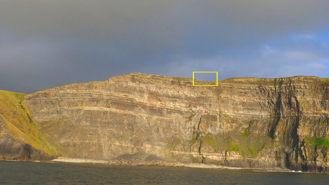
Click anywhere in the yellow rectangle to see Fred's closeup view, and you'll see what we mean about the trail. And you can use the clickable thumbnails below for some of our last pictures of the cliffs:
  |
And to complete our visit to the Cliffs of Moher, you might want to watch the two movies I made while the boat was circling around by the sea stack at the highest point of the cliffs. You can watch these movies with the players below:
|
The Sea Stack and Highest Cliff Point |
We Begin Our Journey Back to Doolin |
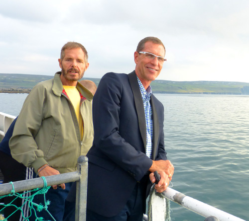
We left the Cliffs of Moher behind us and headed back to Doolin. On the way, we took a couple more snapshots- one of Fred and Ruckman and another of Guy and myself. The boat came in to the dock at Doolin and thanking Danny (who again met the boat) as we did so, we disembarked. As we walked back to the van to rendezvous with Nancy, Karl and Prudence, Fred looked back to take one last view looking out from Doolin to the Aran Islands in the melancholy afternoon light. The picture turned out quite well, and you can see it here.
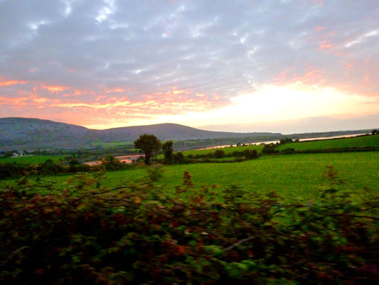
Returning to Galway
|
|
It was evening, and I guess that cows have to be moved from one pasture to another, but I always supposed that was done overland, through farm gates and across the countryside. I had no idea that in Ireland the roads are sometimes used for this purpose. I guess it wasn't any worse than the proliferation of school zones in Dallas in the afternoon, though. You should use the player at left to watch the movie I made while we were following them, and you can also use the clickable thumbnails below to see some of the pictures I took of the operation from my front seat perch:
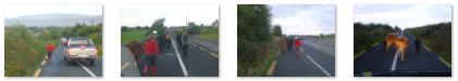 |
Once the cows had been driven off the road and into a pasture, we were able to be on our way, and we made pretty good time on the road back.
|
 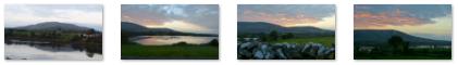 On the Return Trip to Galway |
We were lucky in that we did not have to drive in the dark; as it turned out, much of the gloominess during the first half of our return was due to the cloudy skies, and we had good light all the way back to Galway.
We got back to the Nile Lodge safe and sound and a little while later headed out for some supper at a local pub.
You can use the links below to continue to another photo album page.
|
September 25, 2013: Galway to Dublin, Ireland |
|
September 23, 2013: Kylemore Castle near Galway, Ireland |
|
Return to the Index for Our British Isles Trip |