|
November 20-22, 2014: A Visit to Lima, Peru |
|
November 17 and 19, 2014: Our Stay in Cuzco, Peru |
|
Return to the Index for 2014 |
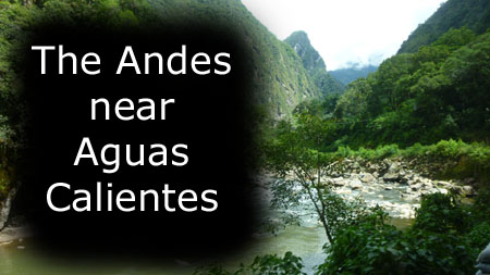
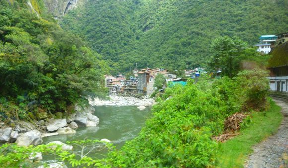
Today will be what we expect to be the second highlight of our trip to South America. We will travel by train from Cuzco to the isolated mountain town (it can only be reached by train) of Aguas Calientes and then take local transportation up to Machu Picchu. We will spend almost the entire day there, with just a bit of time left before our return train to explore the town itself.
Getting to Machu Picchu
|
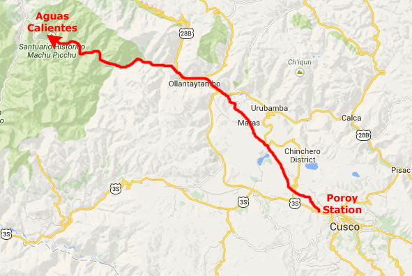
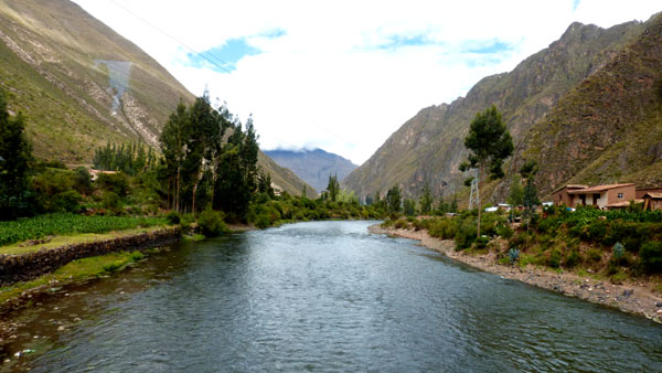
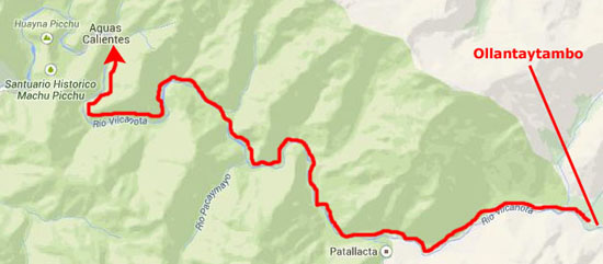
From the Poroy station, we took a special Peru Rail train that traversed the relatively level farmland on the way to the town of Ollantaytambo, about halfway on our 60-mile trip from Cuzco to Aguas Calientes. From there, it was more scenic as we traveled through the mountains along Rio Vilcanota all the way to Aguas Calientes.
From that mountain town, we'd take a local bus up to Machu Picchu for our day there, and in the evening we would return by train to Poroy where we had arranged for the same taxi driver to meet the train about eight in the evening to take us back to the apartment.
That's the general route, so let's start out by being picked up by our taxi right about 5:30 in the morning.
Getting to the Poroy Station
|
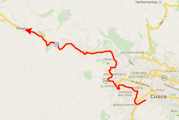
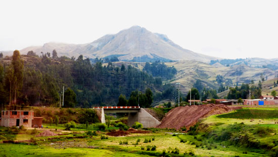
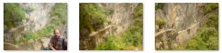
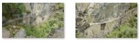
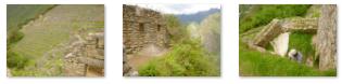
While parts of Cuzco seem modern and well-kept, the areas we drove through on our winding trek up the side of the valley and out into the farmland beyond were not. Houses and shacks were ramshackle and crept up the hillsides. There were little construction projects everywhere; streets and sidewalks and little buildings. The road was narrow and our taxi had to dodge oncoming traffic, so steadying our cameras was hard to do.
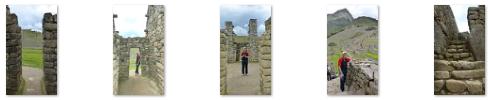
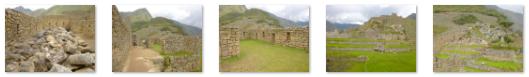
Click on the thumbnails below for some of the least fuzzy of our pictures:
 |
At the Peru Rail Station in Poroy
|
 |
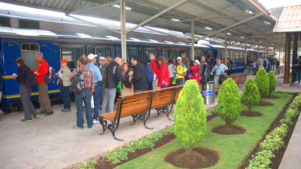
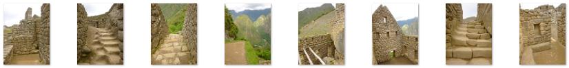
The train has three classes of service- first (which we had), second and "Hiram Bingham" (an outrageously expensive affair with its own private car, waiter service and little sleeping compartments). When we boarded the train (you can see Fred boarding the train in the picture I took), we found our seats easily. We were in a little section of two-by-two facing seats with a table. Yoost snapped a picture of Greg and I while the rest of us photographed each other. There are thumbnails below for some of these pictures taken inside the train:
 |
It wasn't long after we boarded that the train began to pull out of the Poroy station on our way to Aguas Calientes via Ollantaytambo.
The Train Ride to Ollantaytambo
|
The trip to Ollantaytambo took about two hours. Even though the entire trip is only about sixty miles, the train only goes about twenty miles an hour at its fastest. Plus, there is much time taken up with the switchback process near Ollantaytambo as the train has to descend two thousand feet in less than five miles. About an hour into the trip we were served breakfast; there are thumbnails below for some pictures of us enjoying it:
 |
One thing was odd about the breakfast service. The little cart they were using seemed awfully familiar. We realized where Peru Rail got them, and we got quite a chuckle, when we read the cautionary metal sign affixed to the side of one of them.
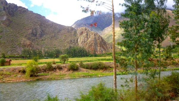
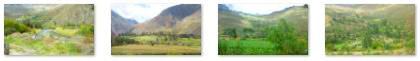
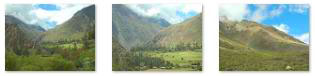
While we were traveling through farmland, there were, of course, hills and mountains on either side of us; this area of Peru is a series of very high mountain valleys (which actually look deceptively low). The terrain reminded me very much of South Korea, with the same kind of mountainous terrain where maximum use is made of the flat areas to grow crops.
|
|
To view the slideshow, just click on the image at left and I will open the slideshow in a new window. In the slideshow, you can use the little arrows in the lower corners of each image to move from one to the next, and the index numbers in the upper left of each image will tell you where you are in the series. When you are finished looking at the pictures, just close the popup window.
While our train waited at the Ollantaytambo station I looked up out of one of the ceiling windows in our car at the cliffs that towered above us over the Sacred Valley, and I saw, hanging on the cliff face, three of what seemed to be glass capsules. I had no idea what they might have been, and we had a good deal of discussion about it. They looked like habitations, but we couldn't figure out how people would get in and out of them. It was not until I was creating this page that I made an effort to find out what they were. As it turns out, the three transparent capsules are the Skylodge Adventure Suites, and they are part of a two-day adventure that people can take that involves hiking, rock climbing and ziplining- and which includes a night in one of the pods. Each one can sleep four and, if you are asking the obvious question, each has a little porta-potty for those calls of nature that occur at inopportune moments.
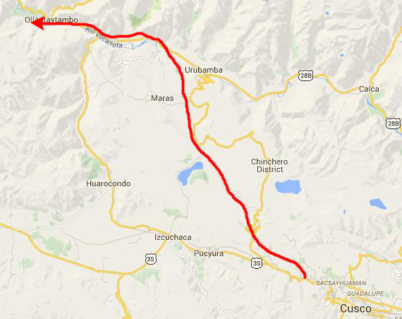
The Journey from Ollantaytambo to Aguas Calientes
|
 |
West of Ollantaytambo, the high mountains were to the right of the train; we could see them constantly through the ceiling windows of our railroad car. Incidentally, if you are curious as to what the inside of the car looked like, you can see it here. (Yoost took that picture, and our seats are on the left at the end of the car.)
|
We took a large number of good pictures as we moved along through the valley, and there are thumbnails below for the best of them:
|
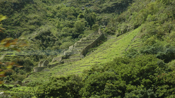
Soon, we could see the end of the valley ahead of the train, and once we got there, the farmland pretty much disappeared and it was all terraces, as the land rose steeply on the other side of the river. The river itself was still relatively slow, but soon it would become much quicker. Farming would pretty much come to an end as we entered the narrow portion of the Rio Vilcanota canyon on the way to Aguas Calientes. Below are thumbnails for some of the pictures we took as we left the wide part of the valley behind:
 |
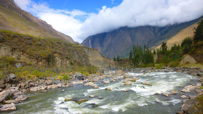
As we entered the mountain passes, the whole complexion of the landscape changed- and the complexion of the river changed along with it. Mountains now rose steeply on either side of the river. There were still some inhabited areas, but only in a few spots where a wide area had been created by the river and some small amount of terraced farming was undertaken.
|
The terrace farming was very interesting; the idea is an ancient one, but still used today. (My first exposure to it was in South Korea, where the rice farmers built an amazing number of little walled ponds that crept up the hillsides, making maximum use of the land.) At one point, a field had been created by the construction of a series of low, sturdy walls right along the river. Here are some thumbnails for some more pictures of the intricate terracing:
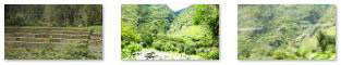 |
Soon, this part of the Andes became reminiscent of someplace in Colorado- a wild mountain river flowing between steep green mountains. The railroad curved to follow the river all the way to Aguas Calientes. And the beautiful scenery was just non-stop. I made two movies that you might like to watch, and in one of them you can see our train as it wound its way through the canyon; use the players below to watch:
|
|
|
I just can't say enough about how beautiful the scenery was. The day had cleared and when the blue sky appeared, everything got even more beautiful.
|
|
Just before 10AM, we came around a final curve and our excursion train began to slow as it came into the station at Aguas Calientes.
|
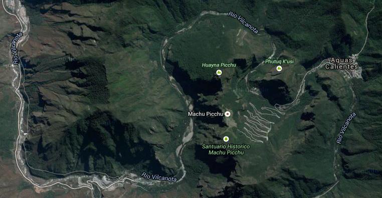
We came up into Aguas Calientes from the south. At that point, the Vilcanota turns west and curves around between two mountains- Huayna Picchu and another mountain that is a favorite of experienced hikers. It continues to flow north, then west then south again around the base of Huayna Picchu and south below the Machu Picchu site. South of the site it turns almost due west and flows into another large valley, eventually turning north again on its way to the Amazon.
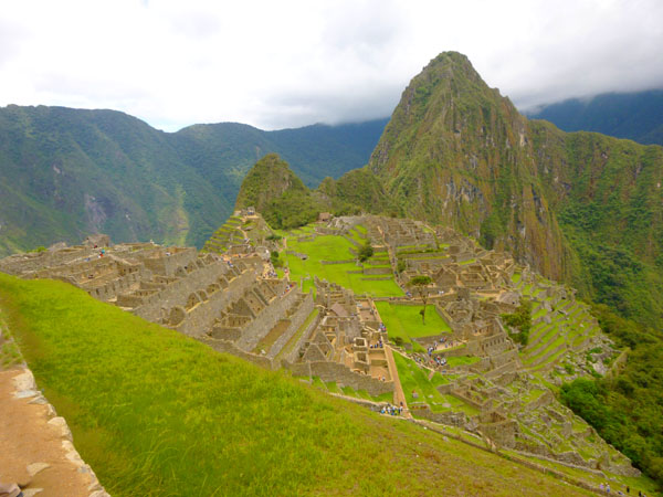
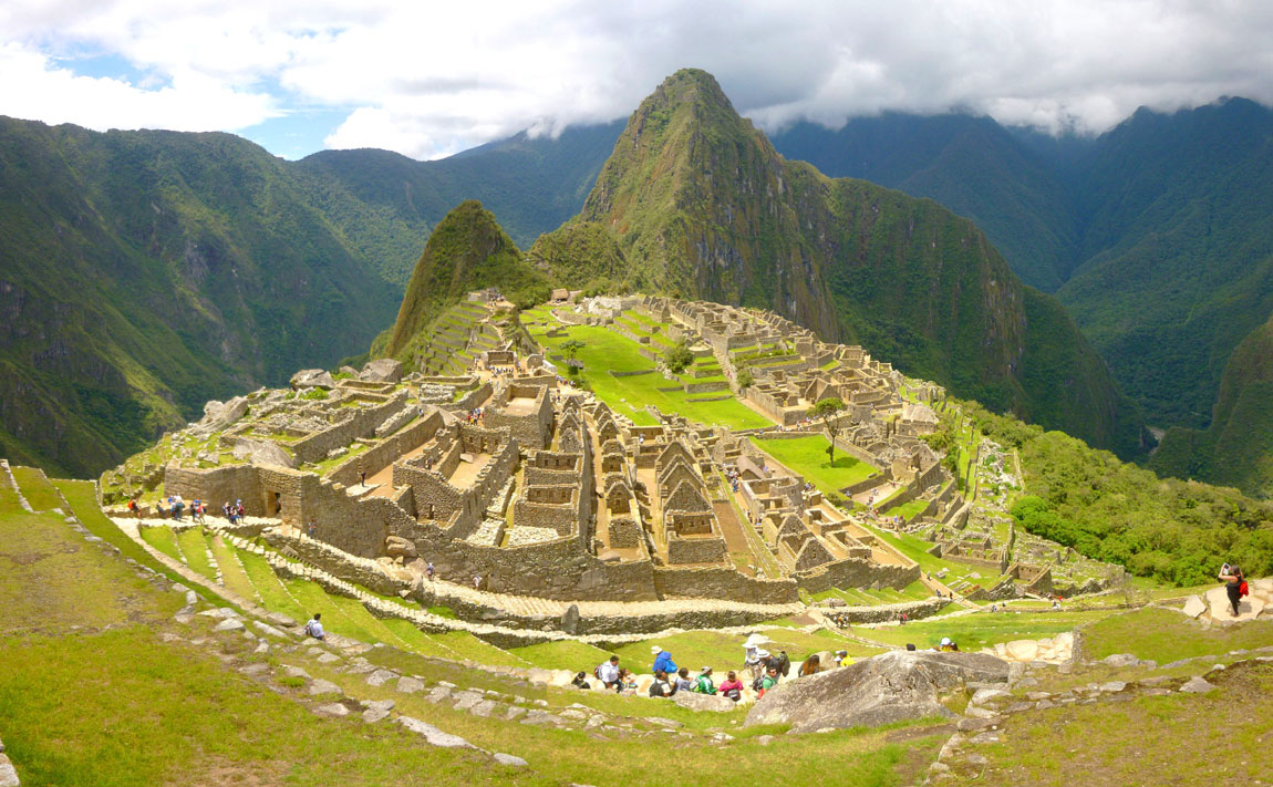
If you will keep this general orientation in mind, then you can ignore the different orientation of the Machu Picchu diagrams and the sequence and direction of our pictures. And the occasional references in my narrative to actual directions will make more sense. One rule of thumb: whenever you see one of the iconic pictures we took of Machu Picchu, with the ruins in the foreground and Huayna Picchu towering in the background, you are looking north.
From Aguas Calientes to Machu Picchu
|
|
|
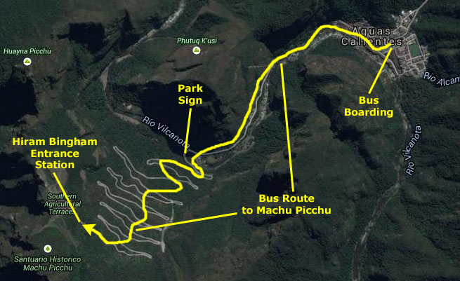
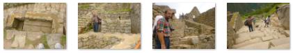
We had to wait about ten minutes for the next bus to leave but that wasn't long. Then we were off to Machu Pichu itself. Our bus followed a dirt road along the north side of the Vilcanota as you can see in the aerial view, and then we crossed the river, passed the entrance sign and then began one of the most nerve-wracking vehicle ascents I have taken in my life.
|
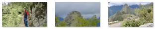
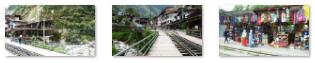
I took lots of pictures, and tried to take a few movies, but there was so much foliage going by that it obscured most of the pictures and ruined the focus on all the movies. But trust me when I tell you that few amusement park rides have much on this bus ride. It wasn't until we disembarked at the entrance station that we were able to get some decent pictures, and there are thumbnails below for some of them. (You can see the bridge we crossed over the Vilcanota in the first of those pictures.)
 |
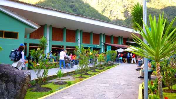
With our arrival at the entrance station, our actual day visit to Machu Picchu began.
Our Day at Machu Picchu
|
The Incas built the estate around 1450, but abandoned it a century later at the time of the Spanish Conquest. It was unknown to the outside world until 1911, when the American historian Hiram Bingham was led to it by a local guide. Reconstruction of the site began almost immediately thereafter and continues today. Some 70% of the site has been restored (not completely rebuilt, but restored so that visitors can see what the buildings would likely have looked like when the site was in use). Machu Picchu is a UNESCO World Heritage Site, and is the most famous and largest tourist attraction in South America, visited by almost a million people a year.
Since the site was not known to the Spanish during the colonial period, it is highly significant as a relatively intact cultural site. Machu Picchu was declared a Peruvian Historical Sanctuary in 1981 and a UNESCO World Heritage Site in 1983. Machu Picchu was built in the classical Inca style, with polished dry-stone walls.
It is the popularity of Machu Picchu that makes it vulnerable to the threat of overuse. The heavy rains of January, 2010, trapped 4000 locals and tourists at the site and in Aguas Calientes; the tourists had to be airlifted back to Cuzco. In July 2011, the Direcci�n Regional de Cultura Cusco (DRC) introduced new entrance rules aimed at reducing the impact of tourism on the site. Entrance was limited to 2,500 visitors per day, and entrance to Huayna Picchu (within the citadel) was further restricted to 400 visitors per day, in two allocated time slots at 7am and 10am. (We would have liked to climb Huayna Picchu, but there was no way we could meet either of the entrance times unless we stayed the night before in Aguas Calientes and spent two days at the site.)
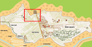
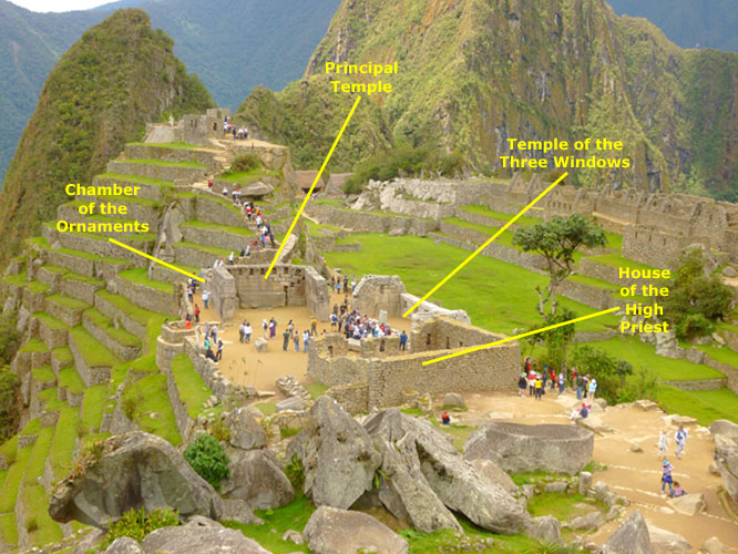
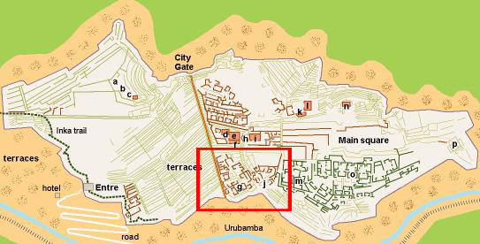
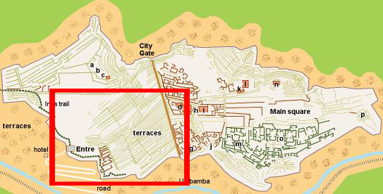
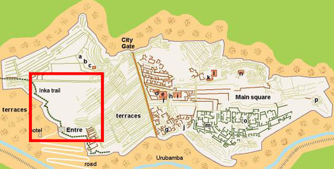
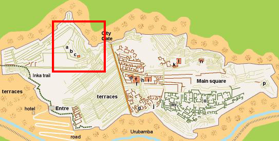
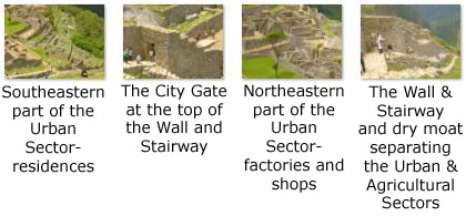
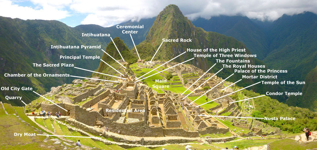
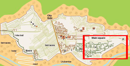
We spent all day at the site, walking through almost all of the ruins and photographing and filming as much as we could. Organizing even a fraction of all the pictures we took is a daunting task. I will do so by dividing our visit into segments keyed to a map of the Machu Picchu site. The entire map, with the various segments marked on it, is in the scrollable window below.
Each of the segments will have its own section of narrative, pictures, thumbnails and movies below. Also, for each segment I will repeat a smaller version of the map with the area covered by that section marked on it. I hope that in this way, the hundreds of pictures and movies will make more sense to you.
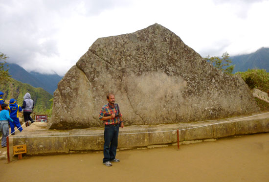
From the Entrance to the Main Viewpoint (1)
 |
 |
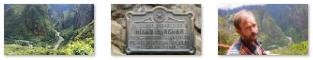
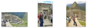
The entry was right by the Machu Pichu Lodge, where I suppose some people stay if they want to climb Huayna Picchu early in the morning. We showed our tickets (which we had bought months ago online) and entered the site via a walkway past some plaques and markers (one of them commemorating Hiram Bingham).
|
|
At this point, I stopped to make my first movie of the day, which will show you that vista down the mountain as well as our path ahead into Machu Picchu itself. Use the player at left to watch this movie if you wish.
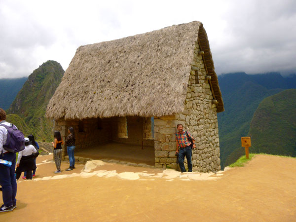
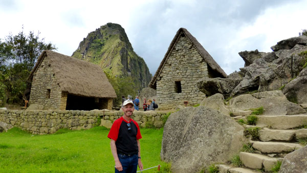
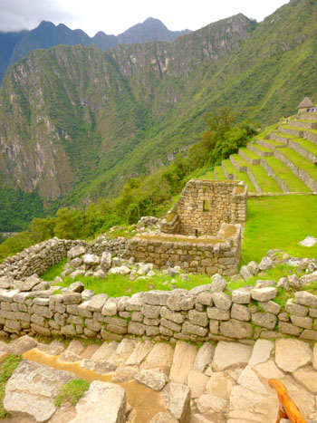
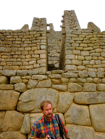
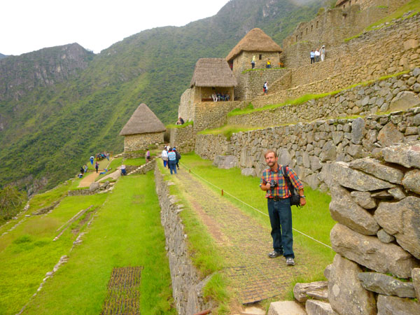
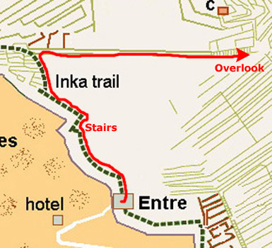
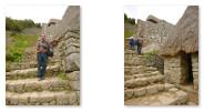
At the end of this walk, we found ourselves at the base of the Inca Trail, the stairs of which led to our left, and an area ahead and below us to our right known as the Houses of the Guardians. We stopped to look at our guide map and reconnoiter. We decided to make a broad circle through the site, by first ascending the stairs to our left to the top of the agricultural section of Machu Picchu. From there, we'd descend into the residential and commercial area, make a circle around it and finally return to our starting point by coming up the stairs we could see to our left that passed these restored houses (the ones with the thatched roofs).
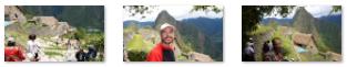
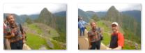
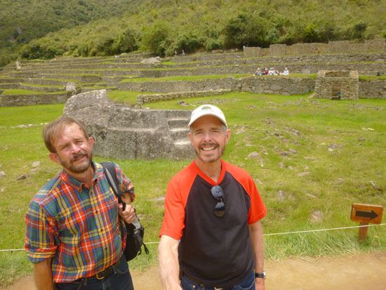
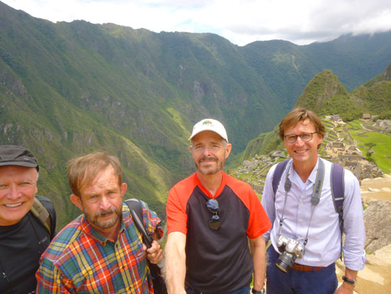
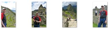
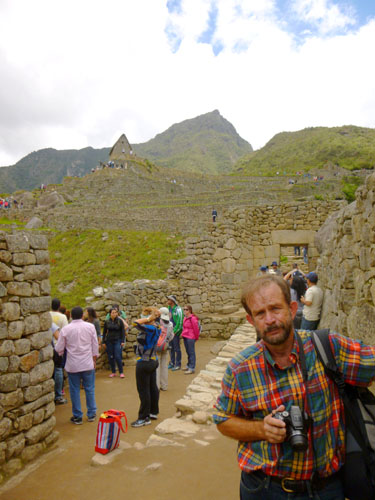
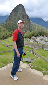
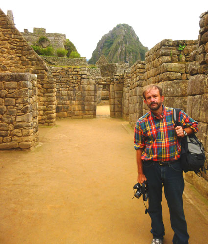
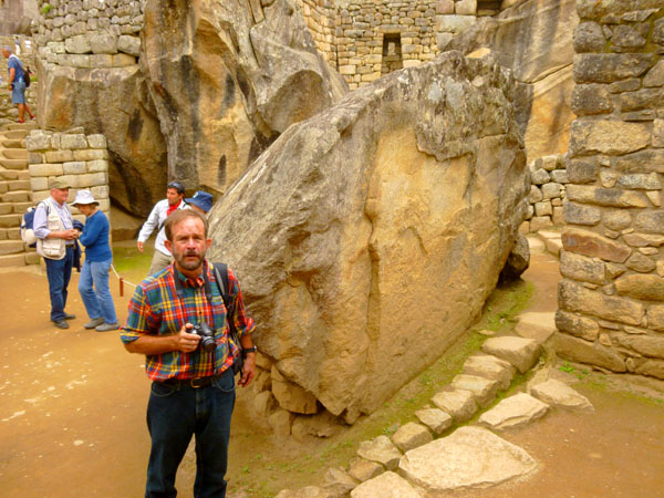
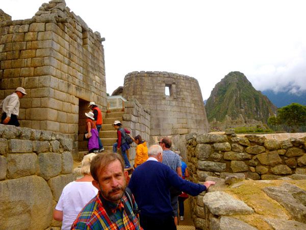
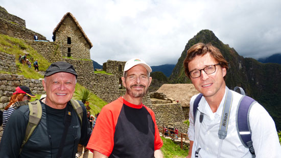
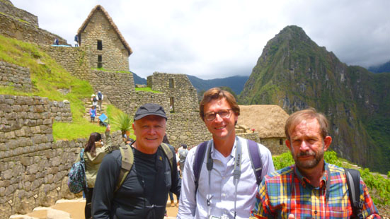
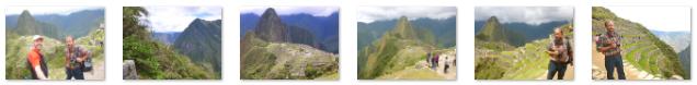
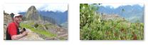
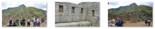
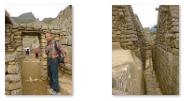
Before we began ascending the stairs Fred and I each took a picture of the rest of the group as our "introduction to Machu Picchu". These pictures are below:
 |
 |
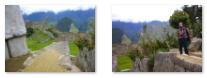
With our general plan in mind, we turned to our left and headed up the stairs to our left. These quickly turned into a series of switchbacked walkways that snaked up the hillside. As we ascended, the restored houses dropped below us and the view out across Machu Picchu got better. Yoost stopped at one point to capture one of these views; you can see that picture here.
|
|
As we climbed, both Fred and I took a number of pictures. I've eliminated some of the duplications, and chosen some of the best to include here. Use the thumbnails below to have a look at them:
|
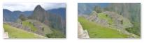
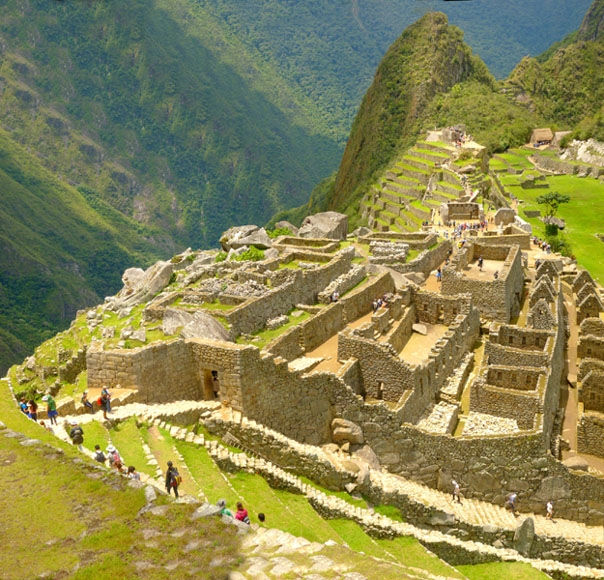
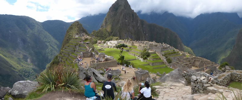
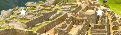
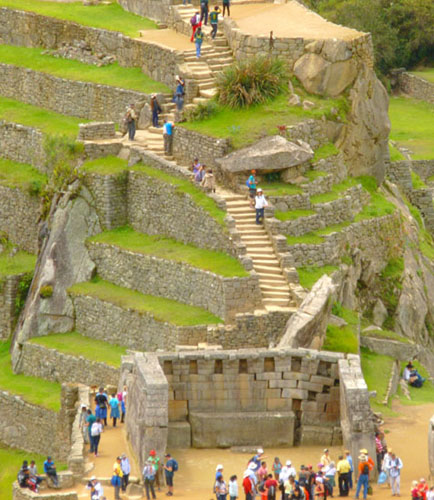
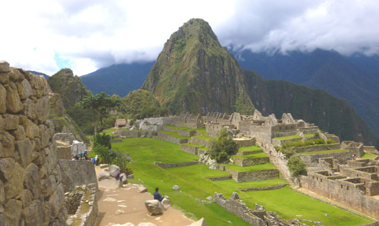
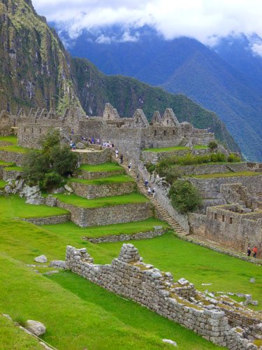
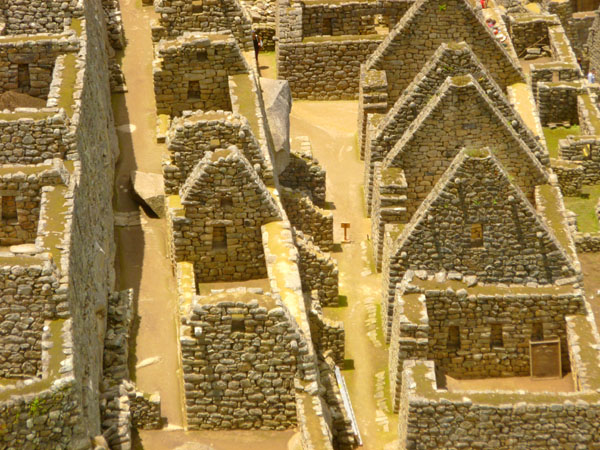
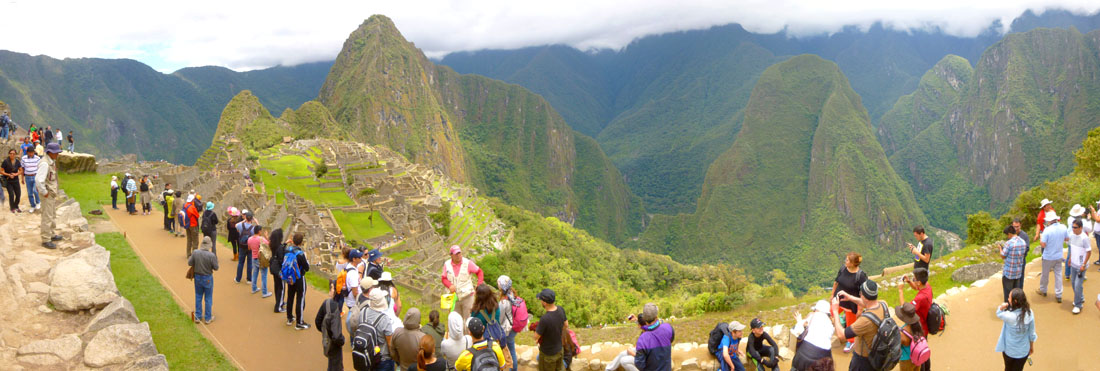
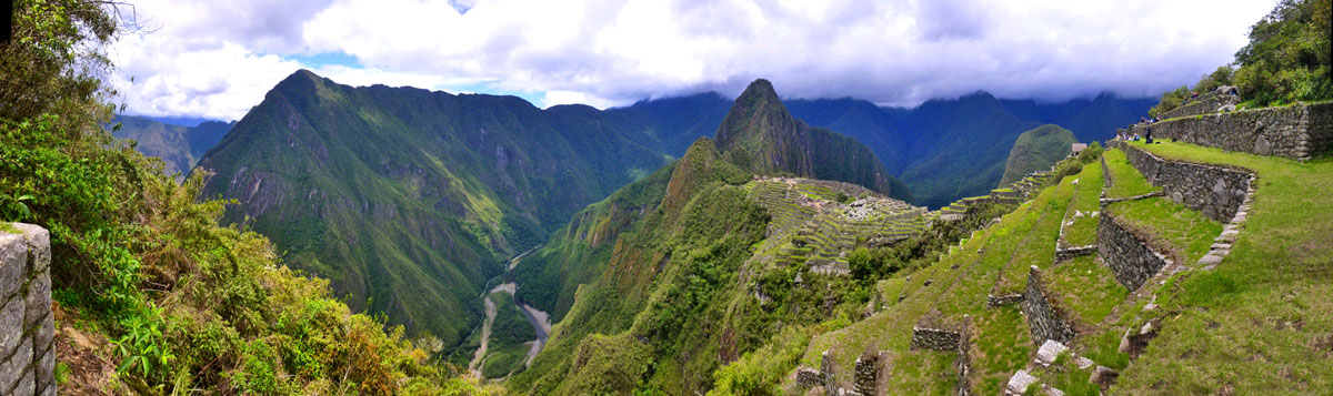
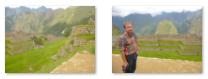
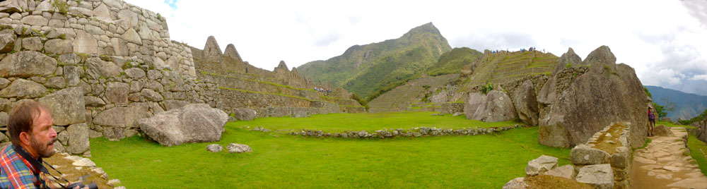
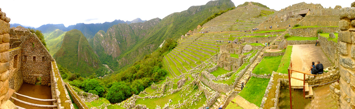
When we got to the top of the stairs and switchbacks, there was a long walkway that headed out west to the overlook. As we knew they would be, the views from here were just incredible, and we all took scads of pictures. Let's whittle it down. First, I took a series of nine pictures, combining them into one large image. It is in the scrollable window below:
I know the image is quite large, but I wanted to show as much detail as I could but still have a picture of pretty much the whole site of Machu Picchu. I encourage you to scroll around and look at the extent of the area; remember that those are all people wandering around various areas.
|
|
|
Machu Picchu was built around 1450, at the height of the Inca Empire, but it was abandoned just over 100 years later, in 1572, as a belated result of the Spanish Conquest. It is possible that most of its inhabitants died from smallpox introduced by travelers; but there is no record of Spanish having visited the remote city. The types of sacred rocks defaced by the conquistadors in other locations are untouched at Machu Picchu. Over the centuries, the surrounding jungle grew over the site, and few knew of its existence.
Hiram Bingham was an American historian employed as a lecturer at Yale University; he was not a trained archaeologist. In 1909, returning from a conference in Santiago, he traveled through Peru and was invited to explore some Inca ruins, and he developed an interest in them. He returned with a Yale expedition in 1911 to search for the lost city of Vitcos, the last capital of the Incas. His expedition examined ruins throughout the Sacred Valley, but none matched the descriptions available. By the time they camped near present-day Aguas Calientes, they had examined ten different sites.
At their camp, a local farmer told the party of some excellent ruins at the top of Huayna Picchu. On 24 July 1911, the farmer led Bingham and his party across the river and up the mountain. At the top, they came across a couple of men who were farming some of the original Machu Picchu agricultural terraces; the 11-year-old son of one of them led the party along the ridge to the main ruins. These were mostly covered with vegetation, and so Bingham's party did not immediately realize the extent of the site, and spent their time examining just a few buildings. They concluded that the ruins didn't match the description of the city of Vitcos.
The next segment of our walk through Machu Pichu will take us to our highest point and give us access to the Watchman's Hut, Funerary Rock and the cemetery.
The Watchman's Hut and Cemetery Area (2)
 |
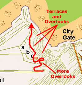 |
There is no aerial view or site diagram that can show exactly where the ledge overlooks were, but I suppose that is not really important. We were in the area of the site just below the Watchman's Hut, making our way up towards its level.
|
Here are clickable thumbnails for more of the great pictures we took of the site from our vantage point below the Watchman's Hut:
 |
Bingham�s focus on Machu Picchu was because of the fine Inca stonework and the well preserved nature of the ruins that had not been disturbed since it was abandoned. Although Bingham put forward various hypotheses to explain the existence of Machu Picchu, none of them has stood the test of further examination and study. Bingham�s lasting contribution is in publicizing Machu Picchu to the world and undertaking a rigorous and thorough study of the site.
Bingham wrote a number of books and articles about the discovery of Machu Picchu, the most popular of which today is "Lost City of the Incas", a retrospective account of his 1911 Yale expedition and his discovery of Machu Picchu, written in 1948 near the end of his life.
Huayna Picchu, or Young Peak, is the mountain rising several hundred meters above the Machu Picchu citadel, and you can see it in many of our pictures. It provides a stunning outlook over Machu Picchu and the surrounding area, it has become a very popular hiking destination, so much so that access is now fee-based and limited to 400 daily permits � 200 at 7am and 200 at 10am. It would have been quite an adventure to climb it; good hikers can reach the top in about an hour. It is not an easy climb though, as there are steep steps built right at the edge of the cliff, hand-over-hand cables and railings. There is even a squeeze through a narrow tunnel that limits the size of folks who attempt the climb.
|
|
While we were going from viewpoint to viewpoint, I thought I would make a movie, since most of the site was spread out below us. You can use the player at right to watch that movie. And below are clickable thumbnails for three more of the best of our pictures taken from the various viewpoints:
 |
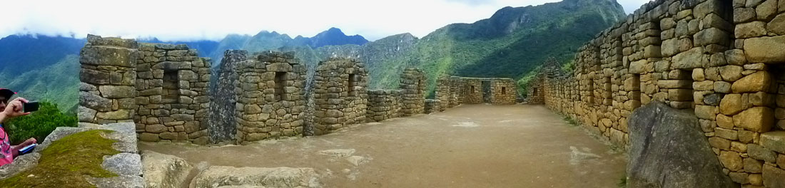
Before we reach the Watchman's Hut, there is one more picture I want to include here- a panoramic view of Machu Picchu taken from the terrace just below the hut:
 |
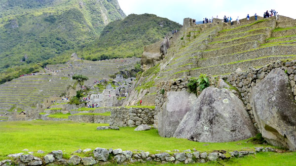
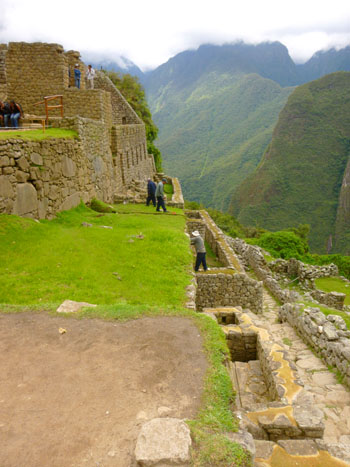
The Watchman's Hut and the cemetery area are at the top of what is called the "Agricultural Sector" of Machu Picchu. It is an area of some 40 terraces constructed up the east side of the site in its southern area. These terraces served two major purposes. First, they provided level, arable land for farming. It may be hard to believe, but these terraces, and others elsewhere in the complex, were capable of providing much more food that would have been necessary for the maximum number of people who ever occupied the site. They also provided grazing area for animals.
|
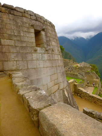
The Casa del Vigilante (Watchman's House) is the most prominent construction in the agricultural sector, and it is strategically located on the highest point in the complex. From here, one could observe the entire Urban Sector as well as almost all of the agricultural sector. Here, for example, is the view from just a few feet outside the hut of the terraces on the west side of the complex.
Of course, the view would be reversed for anyone attempting to scale the terraces; they would have to look up at the defenders. Being at the highest point in the complex, the views out over Machu Picchu and the surrounding mountains were quite beautiful, and you can use the clickable thumbnails below to see some of them:
 |
There is another theory involving the use of the Watchman's Hut. It involves the Funeral Rock that was located nearby, on the flat, open area near the top of the southern mountain in the Machu Picchu complex. (Huayna Picchu is the northern mountain, and the site itself occupies the saddle between them.)
|
Some stones found nearby contain grooves, which could mean that they were used in sacrifices. Some specialists say that certain carvings in rocks were made for blood drainage or for placing human or animal body in it. Though, there is no concrete evidence that the Incas made human sacrifices in Machu Picchu, we know that animal sacrifices were very frequent and considered requirements by the gods in Inca religion. Bingham himself believed that it may have been used as a mortuary slab where the deceased were laid out in the sun before mummification. In the Upper Cemetery just above this rock, Bingham found a significant number of skeletons.
The views from here were much the same as from the Watchman's Hut, although we were just a bit higher, and could not see down the east terraces. Here are clickable thumbnails for some of these views (and another one of the Funeral Rock):
 |
The area west and south of the Watchman's Hut was given over mostly to terraces. As I mentioned, the Funeral Rock is just fifty feet or so due south of the hut; there are terraces south and east of that, and also terraces running along the mountainside to the southwest of the hut.
|
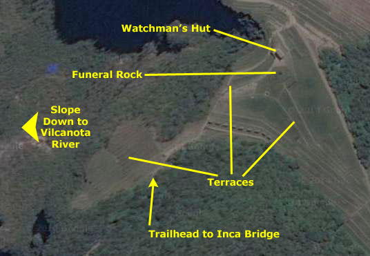
At left is a little portion of the big aerial view you saw when we arrived in Aguas Calientes, much expanded to show just the Watchman's Hut and the area south and west of it. The urban area ruins extend out of the picture to the top. The diagrams you've seen so far are "flipped," in that south is at the top. (Maybe this is some sort of convention south of the equator, I don't know). But since the next group of pictures and movies detail our wanderings around this area, I thought it might be useful to repeat the aerial view.
On this aerial view I have marked the Hut, the Funeral Rock, the terraces southeast and southwest of the Hut and also trailhead for our hike to the Inca Bridge, coming up in the next section.
Now, the four of us walked along the various levels of terrace south and west of the Watchman's Hut. I, particularly, wanted to go as far west along these terraces as I could, so I could see into the valley to the west. The views from these terraces were just incredible, and we took lots of pictures. In a different take on the iconic Machu Picchu view, I segmented it into four pictures, and then put them together into the large picture below:
 |
All four of us walked out beyond the Watchman's Hut, but it became apparent that Greg and Yoost wanted to walk through Machu Picchu at a faster pace than Fred and I, and weren't as concerned with snapping pictures every five seconds.
|
Then Fred and I walked all the way to the end of the terraces that go west from the Watchman's Hut; from there, we got interesting views looking back towards the Watchman's Hut.
Not too many folks came out this far, so they missed the excellent view of the Vilcanota River as it came south on the west side of Machu Picchu.
From the end of the terraces, we also got different views of the Machu Pichu complex, so I took a series of pictures from each of four different locations and stitched each series together into a panoramic view. The views were similar, but two of them stood out as being the best of the bunch. Have a look at them below:
 |
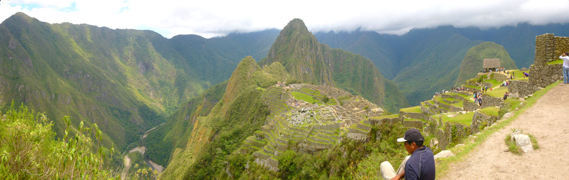 |
I liked the perspective of the site from my position just behind the young man in the panorama above, and so I also took one still shot from that location; you can see it here.
|
|
To wrap up our time out here on the terraces, I want to include six more out of some 25 other pictures we took from out here. Each, I think, shows something different, and you can click on the thumbnails below to have a look at them:
 |
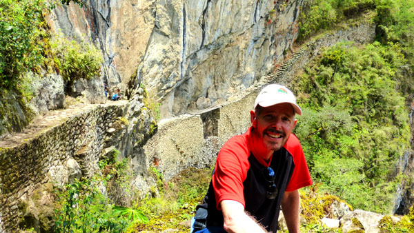
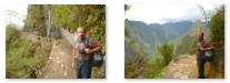
I went a bit further out to the end than Fred did, and I happened to notice a couple of young people walk past a little sign and off onto a trail that led further up the mountain. I went to read the sign, and found it pointed the way to the Inca Bridge. I consulted my guide brochure, found out about the hike, and went to see if Fred would want to do it.
The Trail to the Inca Bridge (3)
|
From that entry station, the path went along the side of the cliff- although the path seemed quite safe- walled on the outside along most of its length. Here is a picture of Fred on the path. The views off to the side were beautiful; we could see the point where the westward course of the Vilcanota turned directly north (as you saw on a map view earlier). The valley through which it flowed had some buildings, and we understood later that there were mining operations there. Use the clickable thumbnails below to see a couple of these views:
 |
Our 30-minute walk along the pleasant path brought us to a clearing an the overlook for the Inca Bridge. When we arrived here, we could see that the path continued right to the end just above the bridge itself.
Some believe that the path of the Inca Bridge was a secret back entrance to Machu Picchu. Like a drawbridge, the bridge itself could even be made impassable across its 20-foot gap in the narrow mountain trail right where it clings to the face of a 1,900-foot cliff.
|
Movie Title |
|
As I said, we could have continued on from the clearing to where the trail narrows to a stone track seemingly carved out of the mountain and perched above a sheer vertical drop; there are metal and rope hand holds along the way. But we thought the views we'd already gotten were sufficient, and wanted to head back to the main part of Machu Picchu.
|
|
Then we headed back to the trailhead, taking pictures along the way, and a number of these are good enough to include here. There are clickable thumbnails below for them:
|
When we got back to the terraces, we headed to the path just below the Watchman's Hut that led down to the urban sector.
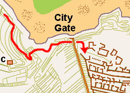
Entering the Urban Sector Through the City Gate (4)
|
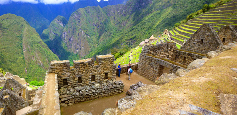
When we came back from the Inca Bridge, we went down a few terraces from the top, but still west of the Watchman's hut. From here, there were excellent views out across the complex, such as this one of Fred and Machu Picchu.
You have seen a number of pictures of the over 100 terraces in the complex, and you might wonder how one got from one terrace to another; the answer is that there are rock stairs in the terrace walls. You can see that they are not regular stairs as elsewhere in the complex, but just stones that stick out from the terrace walls. At other places in the complex, there will be a continuous stairway at one end or the other of the terraces. But little steps like these would be a shortcut up or down.
|
|
|
We are getting ready, now to descend from the terraces down into the urban sector of Machu Picchu, so these will be the last of the expansive view of the complex.
|
Click on the thumbnails below to see some pictures I took from our vantage point here of these various features of the Urban Sector:
 |
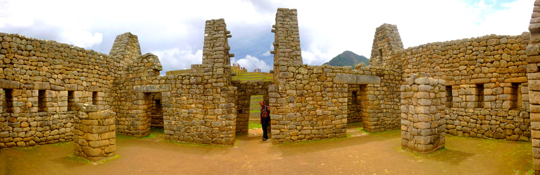
The City Gate will lead us into the upper-class residential area, and you can see that area (and the City Gate) in the photograph at left (which was actually a composite of six different pictures).
It is hard to overstate how wonderful were the views of this amazing place from high up on these terraces. I suppose that's why almost every picture you usually see of Machu Picchu was taken from here.
|
|
So we finally descended from the Watchman's Hut down the zig-zagging walkways to the City Gate. As we approached it, we took a number of pictures, and there are clickable thumbnails below for three of the best of them:
 |
The Royal District Residences (5)
 |
When we passed through the City Gate, we toured through the residential area, wandering back and forth to see the various buildings, but continually working our way to the Sacred Plaza. From there, we climbed the Intihuatana Pyramid and worked our way around past the Ceremonial Center and Sacred Rock. We then came back through the commercial area, stopped at the Condor Temple, and then finished in the area of the Royal Houses and palaces.
So we will begin by touring the west side of the Royal District, between the City Gate and the Sacred Plaza. You can see the area that we will be walking through on the marked picture above, and if you are interested, you will also be able to pick out exactly where many of the pictures were taken or the subject of those pictures. I will try to let you know where we are as we tour the residential area so that you can make these connections.
|
|
|
I also took two still pictures of the wall on the other side of that room; there are clickable thumbnails below for them:
 |
We walked a little further north along the main pathway until we were just past the north wall of the large room and there we found some stairs down to our right; these led down towards the royal houses that we would visit later on in the day. There was a sign partway down the stairs indicating that restoration work was going on towards the bottom. Fred went down to that sign and took a great picture looking southeast back towards the terraces and the mountains beyond; you can have a look at that picture here.
|
|
The views from this highest point were pretty incredible. They weren't the most expansive views of Machu Picchu (those were available from the level of the Watchman's Hut), but they offered a different perspective.
|
Fred took a couple of other pictures from up here on the hill; use the clickable thumbnails below to have a look:
 |
After a few minutes, I joined Fred up here at the top of the hill.
|
|
I also took some good pictures of the complex from here, and there are clickable thumbnails below for them:
 |
We were going to continue on to the Sacred Plaza, but first we wanted to go down a few levels in the residential area to take a look at a row of restored structures one level below the large room we'd stopped in earlier.
|
So we walked to the eastern edge of that top area and then some of the stairs until we came back to the main pathway we'd entered onto through the City Gate. Then we continued down one more level until we came to the level where there was a row of restored house walls.
|
|
From this point, we returned to the main pathway, and went down some additional stairs and came to the Sacred Plaza.
The Sacred Plaza (6)
|
 |
We continued into the center of the plaza, and from there, Fred got an excellent view of the House of the High Priest with the terraces, the Watchman's Hut and the mountain of Machu Picchu; you can see that view here.
Also from here, there were nice views looking back up to the terraces from which we had come. Over by the west edge of the flat plaza, we could also look down into the valley of the Vilcanota River, at the point where it turns from its southward course and flows to the west.
Now we are going to have a look at the three major sites here in the Sacred Plaza, and you can see them marked on the view we took earlier from up above the residential sector- the House of the High Priest, the Temple of the Three Windows and the Main Temple. As we leave the plaza, we will also pass by the Chamber of the ornaments.
|
Fred got an interesting picture through one of the south windows in the high priest's house- framing the Watchman's Hut in that window. You can have a look at that picture here.
And here are some clickable thumbnails for other views we got of the House of the High Prients here in the Sacred Plaza:
 |
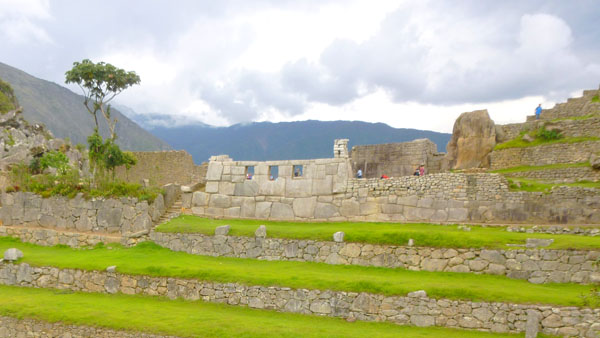
The city of Machu Picchu was never really "lost". The work or archeaologists and anthropologists has shown that the locaion was well-known locally long before Hiram Bingham arrived. Bingham believed that he had found "Tamputoco" or "Hill of the Three Windows"- the origin of the Inca civilization. The Temple of the Three Windows shows engravings made by visitors- the most recent before Bingham having been in 1902. Anthropologists don't doubt that the Temple figured prominently in the history of the city.
|
The Temple is located on the east side of the Sacred Plaza, just above the main square; views from here look over to the commercial side of Machu Picchu. The rectangular Temple consisted of three walls with an upright stone in the middle of the line where a fourth wall would have been; on the vertical stone are engravings that represent the three levels where the Inca civilization divided the Andean world: the sky spirituality (Hanan-Pacha), the Earth's surface or the mundane (Kay-Pacha) and subsoil or inner life (Ukju-Pacha).
The building probably had a roof, since the end walls were shaped so as to support one, and there are a rounded rock protrustions that may have been involved in the roof structure. The walls themselves were constructed from large blocks of solid rock carved in polygonal shape forming a conglomerate of perfectly matched stones each other.
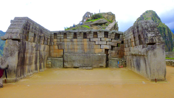
The east wall may originally have had five windows (there is space for that many), but today there are only three windows, and they are oriented to the exact location of the sunrise. In one of the niches that may have been an additional window, Fred spotted little squatter- actually one of the few animals we saw today. Fred took one other picture of this temple, this one from below and just north of it; you can see that picture here. I also stepped back a ways from the upright stone and put a couple of pictures together into a small panorama; you can see it below.
 The Temple of the Three Windows |
The third structure of note in the Sacred Plaza is simply known as the principal temple. This structure has suffered from ground settling, a major problem here, partially due to the masses that tramp all over the mountain. However, because of the actual architecture and construction of the building it is considered one of Machu Picchu's greatest.
|
The walls of this temple are, for the most part, intact, although that you can see that fissures have opened up and stones have moved out of place. Some of the walls have niches in them; the Incas placed sacred objects into them. This temple is another example of a "Wayrana-type"- one with three walls and built out of rectangular stones. (Some anthropologists think that the absence of the fourth wall was not intentional, and might simply be an indicator that the building might not have been finished or perhaps a sign of the fact that the population had left, abandoning the city.)
We took a few minutes to go around the east side of the temple to see the large vertical rock that we could glimpse behind it. I asked Fred to have a seat at the base of this rock so I could get a picture, and you can see it here.
The Intiwuatana Pyramid (7)
|
As we climbed the stairs that you can see in the picture at right, I made a movie; in it, you can see our surroundings and get a feel for what the climb was like. Use the player below to watch it.
|
|
It took only a few minutes for us to get to the top of Intiwuatana. The site was built on a small hill that existed; the builders reconstructed the hill to take on a pyramidal shape. They turned the sides of the hill into level embankments forming a structuring of terraces and runners.
|
 |
The Intiwuatana can, again, really only be appreciated from a distance. You have already seen it in some of our pictures taken from the south, but it is much more impressive seen from the east.
The Intiwuatana Pyramid is surrounded by the most valued buildings for the citizens of Machu Picchu because of their religious and spiritual meaning, something essential for the Incan civilization; this is one of the reasons that clearly explains why so much effort went into creating the staircases, which were of course sculpted by hand out of the huge granite rock hill.
At the top of the pyramid there was an "outdoor chamber"- a walled area that probably was never roofed. It was more like an enclosed patio.
|
 |
Right in the middle of the walled area was, what archaeologists theorize was an astronomical device- made of stone. The structure could have been used by the Inca civilization as measuring instrument for scientific purposes such as astronomy, astrology, mathematics, physics, meteorology and many other doctrines. The tool seems to be based on light phenomena and provided the civilization with a way to analyze the light and shadows from the sun, thus identifying the different seasonal periods by pinpointing the solstices and equinoxes.
The device is quadrangular, with a 40-centimeter-high prismatic shape. Two of the sides of the gadget would provide measurements to create a calendar based on the apparent solar time or sundial time- absolutely essential to the life of the city. It has four vertices indicating the cardinal directions, which means that the Incan civilization had been using a Cartesian coordinate system.
It is interesting that "Intiwuatana" could translate to �observatory� (in Quechua, "Inti" refers to the biggest star in the sky and "wata" means "year"). This explains why this site was the astronomical observatory, but it probably also had a religious connotation because of its sacred location. It may well have been an altar used in all sorts of ceremonies. This double meaning, time device and sacred altar, reflects the tight relationship between the Inca deities and astronomical phenomena.
|
|
From the top of the pyramid we could see our next objective- the Ceremonial Center. It is an area nestled at the base of Huayna Picchu.
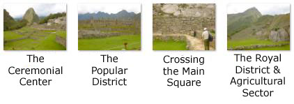
The Ceremonial Center and Sacred Rock (8)
|
|
At the bottom of the stairs, we turned to the east to clamber over the large rocks at the base of Intiwuatana and head towards the grassy main square.
As we walked eastward towards the square, we came out from behind the Intiwuatana Pyramid and could again look out across the complex- a view hidden from us when we were around the northwest base of the pyramid. And the views that opened up were really neat. As soon as we cleared the base of the hill, we could look down the wall of the lowest terrace back towards the Agricultural Sector and its many terraces leading up to the Watchman's Hut.
So we descended the north end of the Intiwuatana Pyramid and began to follow the pathway across the grassy central area of Machu Picchu, crossing from the Royal and Religious sectors over to the Popular Sector. As we crossed, we got some great views.
|
There were great views from out here in the middle of the complex, and you can click on the thumbnails below to see some of them:
 |
From out in the middle of the Square, I put together a panorama of the complex, and it is below.
 |
Reaching the east side of the complex, we turned to the north to follow the path towards the Ceremonial Center, which was only a hundred feet or so north of where we crossed the square.
|
Standing in the middle of the area, one has excellent views looking towards the Pyramid and beyond it in the direction of the path leading to the Inca Bridge, and also the terminus of the Inca Trail in the Agricultural Sector. You can see that view here. There were two three-sided, thatched-roof buildings here; of course, the ones you see in our pictures have been restored based on the wall fragments that Bingham found. You can see some of the detail of the construction of these buildings in one of the closeups Fred took. An explanatory sign said that this wall was intact up two feet above the lintel, while the rest was a reconstruction (as was, of course, the roof).
There was another low building here (which may not have been roofed). It had windows in its east and west walls, and when you look through and line them up, you are looking pretty exactly east or west (east in the case of Fred's picture).
|
The monolith (some have speculated that a visit to Machu Picchu inspired Stanley Kubrick's "monolith" in 2001: A Space Oddyssey) is about nine feet high and located in an area formed by a rectangular perimeter with the two adjoining three-walled houses called "huayranas". The Sacred Rock sits on a base 21 feet wide, adopting a form that comes to remind the profile of a feline animal on a podium of solid rock that was carved by the construction tools referred to as "Ollantaytambo" ("rocky rolling stones" and a name used for the town we stopped at on our trip up here). Anthropology experts the shape as being a representation of the sacred puma of the Cerro Pumasillo of Machu Picchu. This has lead to a popular theory that the Sacred Rock and the other buildings of the Ceremonial Center are a sort of "map", showing the various geophysical elements of the mountain systems of Machu Picchu and Huayna Picchu.
The Sacred Rock was placed at the northernmost point of the city, right at the point where the access to Huayna Picchu is found. This spot also offered entry to the Main Square of Machu Picchu and the Popular District nearby. For all these reasons, the experts agree that the Sacred Rock represents a geographical landmark which marked the portal of Machu Picchu to Huayna Picchu. This was an interesting spot, and just before we left to explore the Popular District, I stopped to take a selfie of ourselves with the Intiwuatana Pyramid in the background.
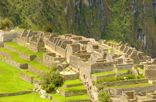
The Popular District: Factory Houses
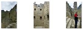
|
 |
According to our brochure, the area outlined in red consists of the "factory houses", which we took to mean the dwellings of the many Incas who worked here in agriculture and manufacturing and other commercial endeavors. The buildings were much smaller than those back in the Royal District, and there were many more of them.
|
We took lots of pictures as we wandered through the buildings; there are clickable thumbnails below for the first set of the best of these:
|
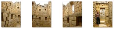
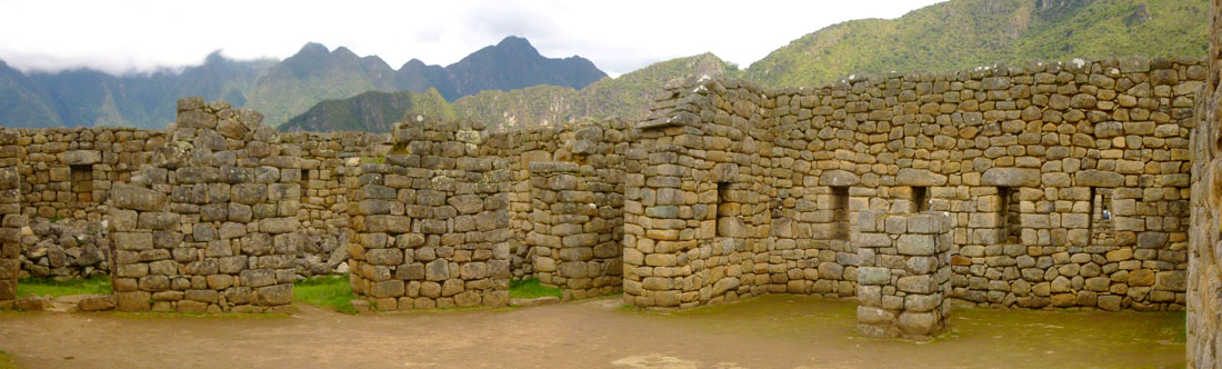
The buildings in this area of Machu Picchu are thought to be the dwellings of factory workers, craftsmen and perhaps military personnel. The buildings were mostly simple rectangular structures, used for living and storage.
|
|
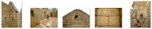
Inca walls had numerous design details that helped protect them against collapsing in an earthquake. Doors and windows are trapezoidal and tilt inward from bottom to top. You can click on the thumbnails below to see some other examples of windows and doors in the restored walls here at Machu Picchu:
 |
In the construction here, corners usually are rounded; inside corners often incline slightly into the rooms; and "L"-shaped blocks often were used to tie outside corners of the structures together. These walls do not rise straight from bottom to top, but are offset slightly from row to row.
|
|
We took a great many pictures here among the factory houses, and there are thumbnails below you can click on to see some of the best of these pictures:
 |
Certainly these structures are not on the scale of the pyramids, which make one wonder how the huge blocks of stone could have been placed without modern technology. Nor are these buildings on the scale of Mayan ruins like Chichen Itza. But while the individual stones could easily have been placed manually, it is still an architectural wonder.
Below are some of the excellent panoramic pictures we took either within our cameras or by stitching pictures together. In them, you can see the intricacy of the Incan construction:
 |
 |
 |
Here is a very good panoramic shot of Fred standing in the middle of one of the largest buildings here in this area of Machu Picchu:
 |
One still wonders how all the rocks and boulders were hauled here. Some were quarried up on the hill we visited earlier, but certainly not all. They would not have been transported in any kind of cart, for the Incas never used the wheel in any practical manner. Its use in toys demonstrates that the principle was well-known to them, although it was not applied in their engineering. The lack of strong draft animals, as well as steep terrain and dense vegetation issues, may have rendered the wheel impractical. So how they moved and placed the enormous blocks of stones remains a mystery, although the general belief is that they used hundreds of men to push the stones up inclined planes.
However the factory houses (and other buildings were constructed) there were good views from the buildings that bordered the main square:
 |
We worked our way through the factory houses to the southwest corner of the area where we found one of the longest staircases at Machu Picchu that led down to the next area we visited. Here is Fred at the top of these stairs.
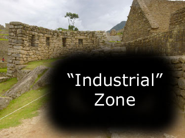
The Popular District: Industrial Zone
|
 |
To get down to the industrial zone, we had to descend that stairway, of course. From the top of the stairs, I stopped to take some pictures looking straight down it- and with Fred at the top of them for scale, you can get an idea of how steep they are.
|
|
It is hypothesized that these buildings that are located below the Main Plaza were used by workers to make weavings and pottery. At least one of them has a pedestal in the middle, the purpose of which is unknown. For example, some mortars were found in this area and some archaeologists believe these mortars were used to grind plants to make dyes used during the manufacture of weavings and pottery. However, other scientists believe that these so-called mortars were actually "cradles" for holding pointed base jars that contained "chicha" (a fermented drink). Others have suggested that the mortars were made to be water basins which served as mirrors for making astronomical observations of the moon.
Like any archaeological ruins, the true purpose of many artifacts is obscure and was lost with departure of original habitants of the site.
|
|
To view the slideshow, just click on the image at right and I will open the slideshow in a new window. In the slideshow, you can use the little arrows in the lower corners of each image to move from one to the next, and the index numbers in the upper left of each image will tell you where you are in the series. When you are finished looking at the pictures, just close the popup window.
The industrial sector seemed to wrap around the hillside down below both the factor houses and the main square (the open grassy area in the middle of the complex), and as we walked through the buildings we found ourselves right at the east edge of the complex.
At the eastern end there was a little open area that had good views back towards the agricultural sector. A path continued through that area down below the east wall of the industrial buildings and then down the slope to more agricultural terraces- terraces that extended across the hillside until it got too steep to build them. Here, we found breathtaking views east, right along the east edge of the complex. And of course, there were great views down into the valley cut by the Vilcanota River.
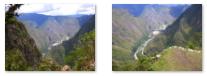
From the edge here, I took a selfie and then made two movies. The first surveys the east side of the Machu Picchu complex and then out across the valley of the Vilcanota, looking down to the railway by which we arrived. We found that we also had a good view of the bus road up the mountainside from the river to the entry pavilion for Machu Picchu, and the second movie zeroes in on that road. You can watch both movies with the players below:
|
The Valley of the Vilcanota |
The Bus Road Up to Machu Picchu |
The Royal District: Noble Houses and The Temple of the Condor
|
 |
The extraordinary beauty of Machu Picchu can be seen both in its ruins and in the Machu Picchu and Huayna Picchu mountain systems. The iconic views of the ruins always include Huayna Picchu, but what is harder to show is another of the indigenous wonders of the area, the bird granted the status of "King of the Andes"- the condor.
|
In addition to the rock resembling a bird with spread wings, excavations carried out nearby discovered another representation in stone that resembles the animal; in this case, a rock just below the actual outcrop was delicately carved to create the bust of the bird, in a curious beak form on the temple floor. Why this was done is unclear, although it seems obvious that the Incas used the representation of the condor to conduct their sacred rituals. To the Incas, the figure of the Condor was the representation of fertility; contemporary accounts tell stories that when condors were present, the clouds would gather and rain would result. This temple is extremely popular with Machu Picchu's visitors.
Fred and I of course took our own pictures, some of which you've already seen. Fred stepped back into some of the nearby structures to take a couple of pictures of the temple with the terraces as a backdrop, and you can see those here and here. Meanwhile, I got up close to the rock outcrop to see if I could capture the wing shape of the rocks a bit better, and you can see a couple of my views here and here.
|
There was quite a lot of restoration work going on in this area- particularly on the slopes that led down into the river valley. Below are clickable thumbnails for some our pictures of the noble houses and the restoration work going on:
|
As a matter of fact, from one of these courtyards, we got our best view looking down to the river where you can clearly see the railroad and the Vilcanota River bridge that we crossed on our way up here. Oddly, another area nearby seems to be where prisoners were kept (there is evidence of dungeons underneath the Temple of the Condor). It was odd that this area might be right beside the area where nobles lived; I guess the NIMBY movement had yet to take hold.
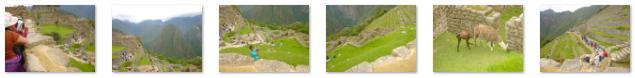
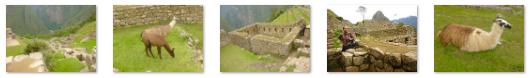
Wandering around this area was immensely interesting, going up and down the steps, and stopping at one of only two curved walls in the entire complex. From here, we could look out to the terraces (where we would eventually go) and see the llamas grazing there (brought in from outside, we found out later). Click on the thumbnails below for more pictures taken here in the area of the noble houses and the Temple of the Condor:
 |
The view from here was so good that I took a series of five pictures and stitched them together into the panorama below:
 |
The views we got of the noble houses up close were certainly interesting, but a little later on, when we climbed up to the Royal Houses above, we could look back down on this entire area, and so we were able to show the entire area as well as close-up detail of many of the structures through which we wandered.
|
You can click on the thumbnails below to see some of the best of the many pictures we took of the noble houses from our vantage point higher up:
|
The Royal District: Royal Houses and The Temple of the Sun
|
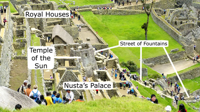
As it turns out, Fred took a good picture earlier, when we were up above the city gate, of the area we will walk through now, and so I think it might be useful for you to have a look at it. In this picture, you can see the royal houses, the Temple of the Sun, a set of buildings called "The Palace of the Princess" (Nusta's Palace) and the Street of Fountains. I have marked these features on this picture, which you can see at left.
We actually came up the stairs just out of the picture to the right of that open area at the right of the picture. It was from there that we took the picture looking up at the Watchman's Hut, and it was there that I took a picture of Fred that you saw earlier as he was going down the short set of wooden stairs towards the Street of Fountains.
I think it serves as a good introduction to the features of this area of the city and may help you relate together the pictures that are upcoming.
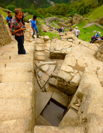
The Staircase of the Fountains
|
I sat down near the top of one fountain right between the Temple of the Sun and the Royal Palace. Click on the thumbnails below to see some views of the fountains near where I was sitting:
 |
The stairway and its pools show incredibly fine work using high skills and construction techniques that created the various channels and sinks that constitute this water collector system- the Incan version of a Roman aqueduct. The construction also shows a number of polygonal rocky ridges and their meaning could have been also religious.
There is a main fountain located in the Wayrana, one of the most significant buildings here, that was probably some sort of spiritual center. Today, the water found by the Incas has a more prosaic use- it is used by the lodge and entrance center as well as the town of Aguas Calientes. So, sadly, the beautiful fountains no longer run.
The Royal Houses and the Royal Tomb
|
One of the houses we went into had more of the same circular depressions in the floor. As noted earlier, the purpose of these is unknown, although theories abound. In any case, the stonework involved in the construction of these houses was pretty amazing (particularly for the time and particularly since there is no evidence that the Incas used the wheel as anything other than a toy or novelty. Click on the thumbnails below for some pictures taken in the royal houses:
|
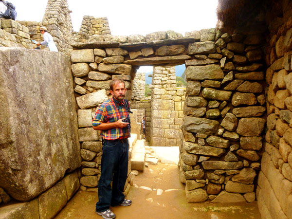
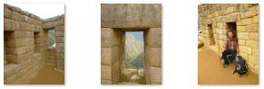
One of the royal houses seemed to have been more completely restored than many of the others, and we saw one of the tour guides taking a group into it, so we followed along. The building that we entered and walked through had multiple rooms; the first such building we'd been in. (Most of the other buildings we had walked through seemed to be only a single room, although it may be that there had been interior partitions built of material that has long since decayed.)
|
|
We also took a number of pictures inside the Casa del Inka, and you can use the thumbnails below to have a look at them:
 |
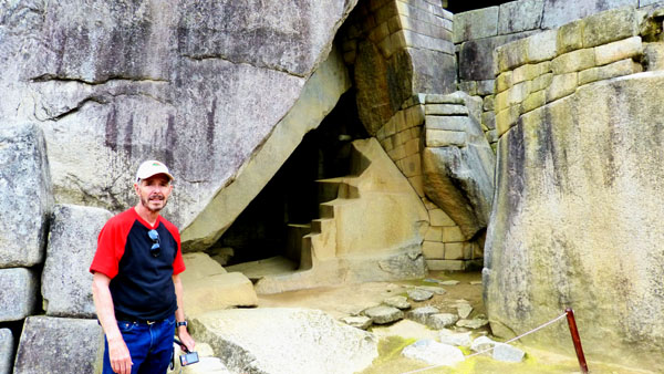
As we walked south from the royal houses towards the Temple of the Sun, we came upon what we found out was the Royal Tomb. The Royal Tomb of the Machu Picchu has a character similar to the buildings of the Sacred Plaza, although it appears to have been carved out of solid rock.
|
We could not enter the Royal Tomb but there are engravings carved all over the inside walls; these are quite intricate, with all kinds of sacred symbols. The "stair-stepped" construction was supposed to give the idea of a House with three tiers- one of the city's symbols. Studies have revealed that the Royal Tomb and the Temple of the Sun are perfectly aligned. This was very characteristic of this civilization, which based their architectural work on the spiritual symbolism and religious buildings attributed to the city.
|
The architecture inside the tomb is a symmetrical arrangement of carved rocks, and these form different small spaces; presumably, each person buried here would have his own space in one of the niches embedded in the walls, or in one of the tiny room-like enclosures. Though we could not see them, there are also inside a series of stone cylinders built into the interior wall; these may have been the support for some ornamentation or perhaps part of some necessary equipment used in the burial process.
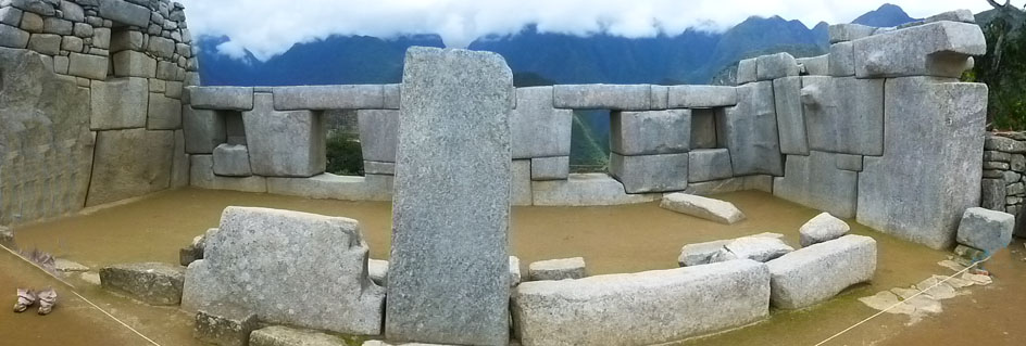
The Temple of the Sun
|
The tower of this temple, known as the Torreon, was the most important part of this most important building in Machu Picchu. Not counting the agricultural terraces or the pyramid, the top of the tower was the city's highest point. It was the center of civic life, where the most important and meaningful events were held. These events- astrological occurrences, sacred rituals, etc.- have left behind a large number of archaeological remains, like the gnomic device or sundial that was used for the civilization to indicate the daylight hours and therefore, to create the Inca calendar. Actually, entry into the temple proper is blocked off; one can only look at the inside of the temple from a platform at the top of the wooden stairs.
We could, however walk through some of the ancillary rooms of the temple, and view the tower itself from not only that platform but also from walkways down below.
|
There are other areas of the temple we could not enter. Underneath the Tower, there is a small underground cavern with excellent masonry works. The theory is that this room was a crypt to accommodate the mummified corpses of the highest members of the Inca aristocracy. In the western side of the temple, a rectangular courtyard shows nine hollows that could have been intended as graves. There is another room that has a drainage/sewage system, and it is thought that this was once a barn or stable for domesticated alpacas and llamas. This animal barn leads to an adjacent room that gives access to another private chamber that has a balcony facing east and providing views out over the city.
It would have been interesting to explore this underground area, but we had to content ourselves with wandering around abovegorund. From all around the temple there were great views out across the city and the agricultural terraces, and you can use the clickable thumbnails below to look at some of them:
 |
We left the Temple of the Sun to go a few feet further south to the palace of the princesses.
The Palace of the Princess (Nusta's Palace)
|
The �usta Palace came to be considered part of the Temple of the Sun; the palace was not only an annex to the Temple of the Sun, but displayed the same laborious and refined methods of construction reserved only for the most important buildings of the city. You can see some of this construction in the pictures we took in and around the palace; click on the thumbnails below to have a look:
|
The building clearly had a very special place in Incan civilization; the house was planned to house the most important members of the aristocracy of the city, including, anthropologists believe, the Priestess- the highest social status woman. But the house is large enough that it probably also housed the princesses who would form part in the rituals of the Inca culture. The building occupied two floors with very fine construction. Although there appears now to be a door leading to the Temple of the Sun, archaeologists believe that this was actually a window (based on construction similarities elsewhere on the site). There were, of course, the same wonderful views from the outside of the structure.
Our visit to the Palace of the Princesses completed our tour through all of Machu Picchu's urban sector. What remained was to see the terraces up close and make our way back to the entrance pavilion.
The Terraces of the Agricultural Sector
|
Just after that, we came to a wooden walkway that led out onto the terraces. Before we cross them, you can take a look at some of the pictures we took getting to this point; just click on the thumbnails below:
 |
Apparently, the park did not want tourists walking across all the terraces willy-nilly, so one of them was marked as the crossing point and the wooden bridge led to it. So that was the level that we took across to the far side.
|
When we got to the bottom one, our path led around below it, and on the far side we found a long stairway up the hill that ran right beside these buildings. So as we climbed the stairs, I could photograph the buildings and even look inside them. Use the thumbnails below to see some of the pictures we took as we climbed the stairway:
|
This stairway turned out to be the same one that we'd seen when we first entered the Machu Picchu site. At the top of the stairway, we found ourselves on the same paved walkway that led into the site originally, and from which we had turned up the hill to the viewpoints and the Watchman's Hut hours and hours ago. So all we had to do was follow the walkway back to the entrance station and lodge.
We did not see Greg and Yoost at the bus stop, so I took a look inside the restaurant and, sure enough, they were there having a buffet lunch. They were not done, so we told them we would go on back down to Aguas Calientes, tour the town on our own, and meet them at the train station ahead of our departure for Cuzco. That's what we did, bringing our amazing day at Machu Picchu to and end.
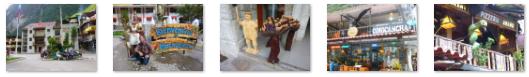
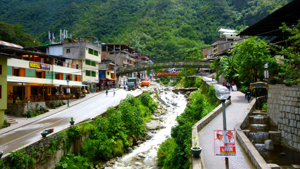
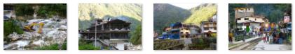
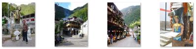
The Town of Aguas Calientes
The town we know as Aguas Calientes is officially named Machupicchu, and is the seat of the Peruvian district of the same name. There are many hotels and restaurants for tourists, as well as natural hot baths which gave the town its colloquial Spanish name. The baths were destroyed by floods several years ago, but have been rebuilt.
|
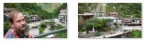
Suffice it to say that we spent all our available time wandering around this quirky mountain town, realizing all the while that everything we saw was either built right here or brought in by train from outside. As I said before, there is no road that leads out of Aguas Calientes to the rest of Peru; although it doesn't seem apparent when you walk around (since there are cars and truck son the narrow streets), the town is completely isolated save for its rail link to Cuzco.
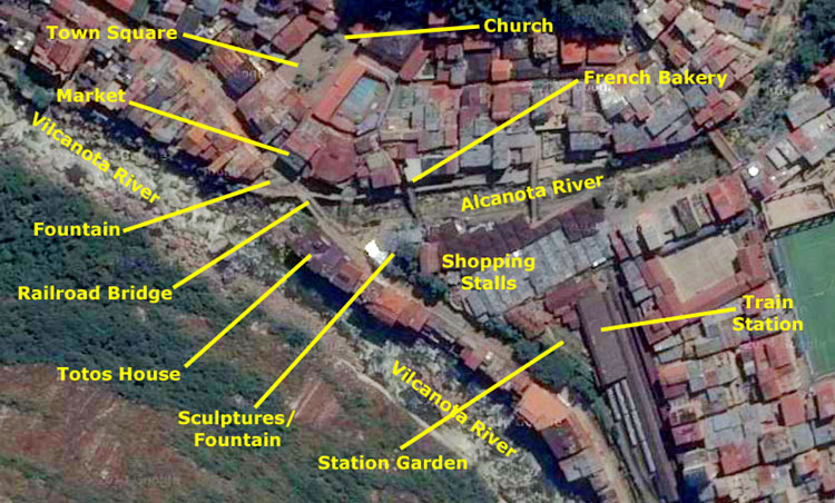
On the aerial view at left, I have marked the location of some of the places we stopped where we took pictures. I hope this will help you get a feel for what wandering around the picturesque town was like.
One of the first items on our agenda was to get some sort of snack; after all, we had not eaten since the small breakfast on the train six or seven hours ago, and there wouldn't be anything else until the train ride back a couple of hours hence.
|
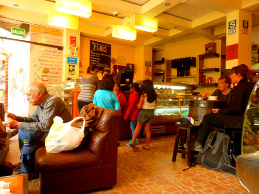
Right where the bridge came into town from the station we found the Boulangerie de la Paris- basically, a little bakery with sandwiches and baked goods. We settled for one of the largest cream puff pastries I'd ever seen and some bottled water. We got a little table and sat down to relax and have our snack. It was a very good pastry, and also good to be sitting down after five hours of walking around Machu Picchu. We also had an excellent view of the bridge over the Alcanota that led over to the shopping stalls by the station (the ones we'd had to work our way through after we'd gotten off the train).
After we'd finished, we went off to just wander around the town to see what we could see. The first thing we did was to walk back out on that pedestrian bridge so I could get a couple of pictures; you can use the thumbnails below to have a look at a couple of them:
 |
Earlier today, just before we boarded our bus, I'd noticed an interesting fountain just ahead of where the buses (which you can see at right in the first of the two picture above that I took from the pedestrian bridge); it is obscured by the parked buses in that picture. So, we next walked down to the railroad bridge to have a look at it. The three‑tiered fountain had an Incan warrior and a condor as its centerpiece. This fountain was located right at the corner of the road we took to Machu Picchu and the "street" down which the railroad tracks led northwest out of town to the rail yards that we could see from up at Machu Picchu. You can see the fountain and that street here, and, after we'd walked a bit down that street, another view of it here.
|
And while we were walking along here, we were serenaded by an impromptu musical group; I made a movie of them, and you can use the player below to watch it:
|
|
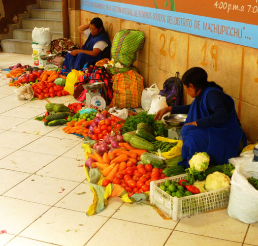
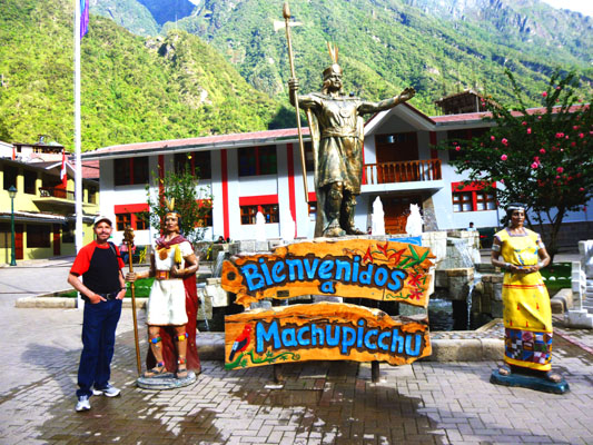
We walked through the market and then down a narrow street to what seemed to be the town square of Aguas Calientes.
|
It was fun to wander around the square, and we took a number of interesting photographs. You can use the clickable thumbnails below to have a look at some of them:
|
Machupicchu was settled by a few farm families in 1901, and remained a sleepy mountain hamlet almost unknown- until the arrival of Hiram Bingham in 1910. Shortly after Bingham made the existence of Machu Picchu public, tourists began arriving- although in very small numbers because there was no way to the town save an exhausting trek along the Inca Trail. In the mid-1920s, the tiny settlement was transformed into a busy railway worker's camp called Makinachayuq (a Spanish name that literally translates as "the one with a little machine") during the construction of the railroad to the town. The town was the central hub for worker lodging and their equipment up until the railway was finished in 1931; after that, tourists began arriving in droves, and the town became the tourist town that it is today.
|
I took a picture of a young woman doing needlework and we took a few more around the area that you might enjoy seeing. Click on the thumbnails below to have a look:
|
About a half-hour before we were supposed to board our train for the return trip, Fred and I went into the railway station to wait for the train- and for Greg and Yoost to show up.
|
Actually, we were getting a bit concerned about Greg and Yoost, particularly when the announcement was made for train boarding and we had not yet seen them. Fortunately, they'd been having a drink somewhere nearby, and showed up just at the time we decided we'd better go ahead and board.
We boarded the train about 4:45 ahead of an on-time departure back to Cuzco right at five.
The Train Ride Back to Cuzco
We had dinner instead of breakfast on the train and, after the meal, to keep people occupied (since there wasn't any visible scenery to look at) the crew put on a kind of fashion show (with the inevitable spate of items available for sale afterwards) and also a bit of entertainment, in which a couple of crew dressed up in colorful costumes and there was much music and dancing in the aisle.
For the final movies of the day, use the players below if you want to watch two short movies of one of the most colorful of the crew:
|
|
|
And for the final pictures of the day, there are thumbnails below for four of the best of the many pictures we took of the crew performance:
 |
Our taxi driver was at the station as he had promised to pick us up when the train arrived about 10PM, and by 11PM we were back in the apartment.
You can use the links below to continue to another album page.
|
November 20-22, 2014: A Visit to Lima, Peru |
|
November 17 and 19, 2014: Our Stay in Cuzco, Peru |
|
Return to the Index for 2014 |