|
July 23, 2016: A Visit to The Modern & Kimbell Museums in Fort Worth |
|
June 13-15, 2016: A Visit with Jeffie in North Carolina |
|
Return to the Index for 2016 |
This is the second of four pages describing my all-day excursion on DART. If for any reason you want to skip this segment, then you can go to the next by clicking on the link below:
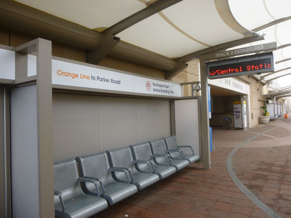
The Orange Line: Bachman Station
|
If I did that, then I wouldn't be repeating station stops that more properly belong on the end-to-end ride on the Green Line. So to start on the trip to the airport, I first had to ride two stops north and change over to the Orange Line.
I did change trains at the Bachman Station (since the first train that came through the Inwood Station was a Green Line train), and I settled in for my ride out to DFW Airport.
|
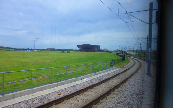
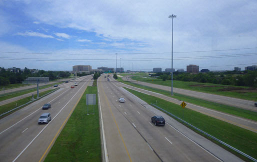
The Orange Line trains, on the other hand, curve around just south of Northwest Highway, and then follow Storey Lane (Spur 482) out past the site where Texas Stadium used to be. This brings it close to Texas Highway 183, which goes west to the south entrance to DFW Airport.
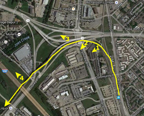
You can see this curve in the track in the aerial view at right. The Green Line heads north about at Point 1, while the Orange Line makes a turn to the west, going over Harry Hines Boulevard and then over I-35E.
Along the way to the first station that is solely on the Orange Line, I took four pictures- at the spots and looking in the directions marked on the aerial view at right. They were:
| Beginning the Turn to the West (1) Crossing Over Harry Hines (2) Looking Out Northwest Highway (3) Looking North at I-35E (4) |
To see these pictures, just click on the numbers and arrows on the aerial view.
|
Before the new stadium in Arlington, the Cowboys used to play here, in a large stadium situated in an otherwise unused triangle of land between three expressways. (One complaint people used to have was that despite the fact that the old stadium was bounded on all sides by expressways, getting in and out was always a problem.)
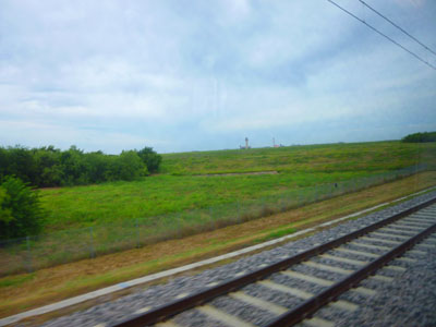
This was the iconic stadium with the retractable roof that you may remember most vividly from the opening montage on the 1980s TV Show "Dallas". That stadium was imploded perhaps five or six years ago, and I don't know what might go on that land now. The Orange Line then heads northeast for a mile or so, paralleling the Airport Freeway to come to the first new station.
The Orange Line: University of Dallas Station
|
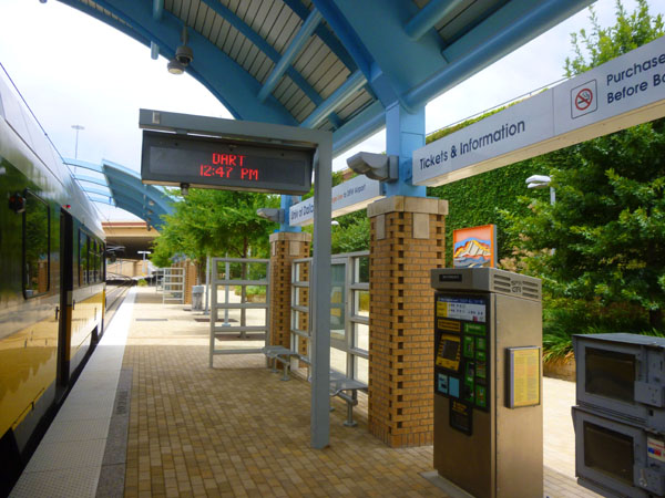
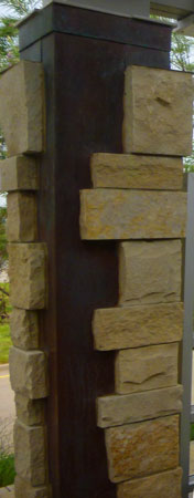
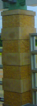
I said earlier that I found out before my trip today that each DART Light Rail Station was unique. While many used the same canopy style and the same signage, it was the decoration on and around each station that made them different.
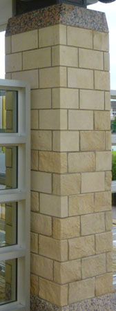
It didn't take me long to figure out that one difference that was always present was the style of the column bases for the canopy structure. For example, here at the University of Dallas Station, the style was a basket-weave in ochre brick. You can see that in the picture I took of the station when I hopped off the train momentarily, but I have also gotten a picture of the column itself, and you can see it to the right of the station picture.
I tried to do this for all the stations, so I'll adopt this same style here on this album page. Right beside a picture of the station itself, I will put an enlarged picture or a separate picture of the column style in use at that station.
As far as this station is concerned, we can say that a purposeful connection exists between the station's design and the University of Dallas, much of which was designed by O'Neil Ford, a leading architect of the American Southwest. "The general forms of the station arise from the architectural components, design, form and materials found on the university campus," said Lyle Novinski, station artist and UD professor emeritus of art. "The column design, for instance, echoes the university's most prominent feature � the Braniff Memorial Tower � by recreating the bricks and the construction detailing."
The Orange Line: Las Colinas Urban Center Station
|
Columns feature both limestone and Texas pink granite, transitioning from a rough-hewn base to a smooth block � a subtle visual reference to the ongoing transformation from open natural landscape to refined urban community. At the top of the columns, the cap alludes to the rooflines of Williams Square. Landscaping provides seasonal color and blends with the neighboring environment.
The Las Colinas Urban Center Station is located near the shores of Lake Carolyn, the artificial lake that has been at the center of the Las Colinas planned development since its inception. Las Colinas also has its own elevated tram connecting many of the buildings.
Originally called El Ranchito de Las Colinas ("the Little Ranch of the Hills"), Las Colinas was developed in 1972 by cattle ranching millionaire Ben H. Carpenter. It was one of the first planned communities in the United States and was once the largest mixed-use development in the South, with a land area of more than 12,000 acres (49 km2). Urban planners were consulted to lay out the entire town, an undertaking that predated later projects in Plano, Allen and other suburbs.
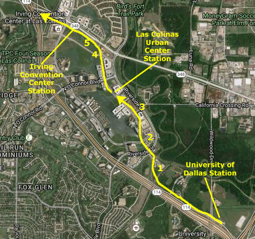
As we came around the southeast side of the huge Las Colinas development, I took some pictures of the area where I worked in the mid-1990s; it has certainly changed a great deal. These pictures are below, keyed to the numbers on the aerial view below, right.
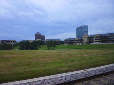 Las Colinas (1) |
 On Lake Carolyn Avenue (2) |
 Lake Carolyn (3) |
|
In 1985, the first sign of financial trouble appeared at Las Colinas due to a real estate market crash, but the community recovered by the end of that decade. Another 6.5 million square feet of office space was built in the late 1990s boom. After a lull in construction that lasted until 2010, new office and residential construction sped up again, and most of the original tract of land is now fully built-out. In addition to 3500 single-family homes and some 15,000 apartments and condominiums, Las Colinas has 25 million square feet of office space.
In the aerial view at right, Las Colinas encompasses all of what you see west of the dark green flood plain (where no building is allowed as the area is prone to flooding), but it also extends north, northwest and west far out of the picture. Las Colinas has three private country clubs and four championship golf courses surrounded by gated communities.
It also contains high-rise office towers, retail centers, upscale residences, apartment complexes, and leisure facilities. Notable attractions include the Mustangs at Las Colinas sculpture and fountain and Las Colinas Flower Clock. The Mustangs of Las Colinas are featured in the courtyard of the Towers at Williams Square. The complex also features a River Walk-styled canal offering gondola cruises, as well as the above-ground Las Colinas APT (elevated tram) System.
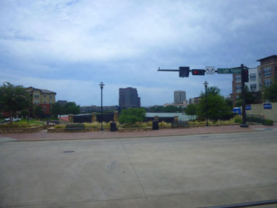
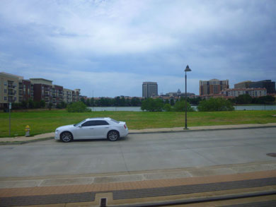
The ride to the next station was very short, and I only took a couple of pictures worth including here (the numbers are keyed to the aerial view above, right):
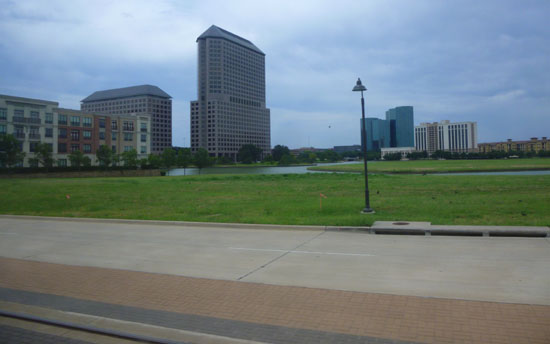 Williams Center (4) |
 Looking towards the Convention Center (5) |
As I said above, the part of the route that went down the middle of Lake Carolyn Avenue was pretty neat, and on the way back, I made a couple of movies looking out the front of the front car of the train. The first began just past the Irving Convention Center Station as we headed into the Las Colinas Urban Center. The second continued the first, taking us to the point where the light rail left Lake Carolyn Avenue to continue around the southeast part of Las Colinas. I did not realize that I should have set my little camera on "Through Glass"; I was up against the window between the passenger area of the leat car and the operator's compartment, so the camera's autofocus had to take into account that pane of glass, the space of the operator compartment and then the glass front window of the train itself. Complicating the focus was the operator's microphone, the long flexible neck of which was in my field of view, fooling the camera sometimes to focus on it rather that the buildings and other objects outside. So If you think the outside scenery is a bit fuzzy, or if it goes in and out of focus, these are some of the reasons. Anyway, here are those two movies:
|
Going Through Las Colinas Urban Center (Mouseover Image Above for Video Controls) |
Going Along Lake Carolyn Avenue (Mouseover Image Above for Video Controls) |
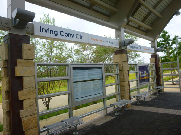
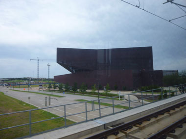
The Orange Line: Irving Convention Center Station
|
The columns are in an interlocking pattern of oxidized red-brown copper � alluding to the exterior cladding of the Irving Convention Center itself � and split-faced limestone. The patterns of the two materials signify a "coming together," such as what happens at conventions.
Windscreens are conceptually similar to the ones at Las Colinas Urban Center Station, with a translucence that allows the viewer to superimpose the artistic images on the surrounding scene. Landscaping picks up on this cue, with abundant natural prairie grasses.
I can't imagine that this station is very busy- at least not yet. Although there are probably a couple thousand people that live across Northwest Highway. There is a tunnel they can use to walk to the station, so these new apartments can bill themselves as being commuter-friendly.
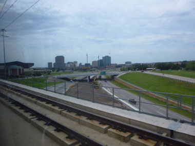
As the train pulled out of the station heading west, it crosses over the interchange between Northwest Highway and Highway 114. It will stay south of Highway 114 all the way to DFW Airport. I took a few pictures as we crossed over that interchange.
 Looking Back at the Convention Center |
 Looking South Along Highway 114 |
 Looking North Across the Interchange |
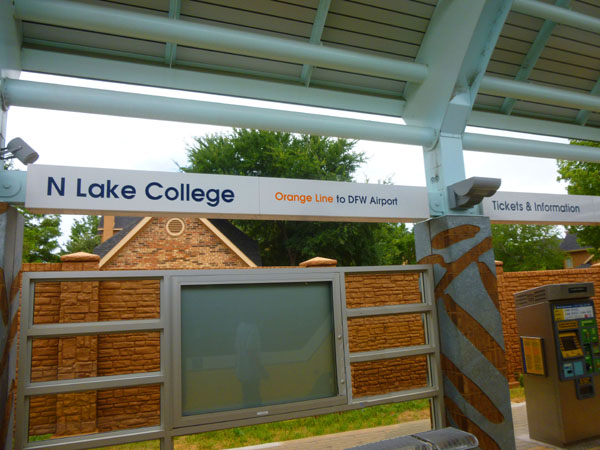
The Orange Line: North Lake College Station
|
North Lake College is a two-year public community college serving Irving, Texas and northern Dallas County. North Lake opened in the fall of 1977, becoming the sixth of seven colleges in the DCCCD. The college's central campus sits on 276 acres in the Las Colinas area of Irving, at 5001 N. MacArthur Boulevard.
In addition, North Lake operates three community campuses: North Campus in Coppell, South Campus in South Irving, and West Campus adjacent to DFW Airport. The college�s signature programs include logistics, the sciences, construction technology, and our unique pairing of arts and technology.
I would think that the North Lake College Station is pretty busy; I could see that people in Mandalay Place could walk to the station, there was a commuter parking lot and of course there is the college.
|
"The mesquite leaf naturally droops from its twig, so the motif is also a nod to the ancient hanging gardens - which inspired North Lake College's original architecture," station artist Chris Fulmer said.
A plaza between the station and parking lot features a philosopher's garden inspired by Plato, the great thinker who challenged and shaped young minds. Its spiraling pathway of decomposed granite, representing intellectual growth, coils outward through the greenery.
Additionally, the design reflects the architecture of the campus by using dark brick and metal accents that complement the materials of the adjacent library and other buildings nearby.
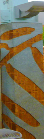
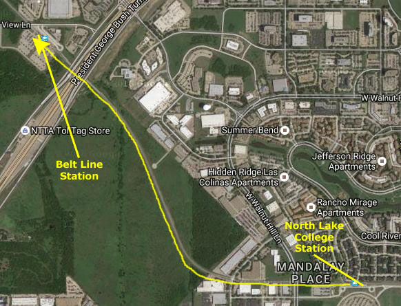
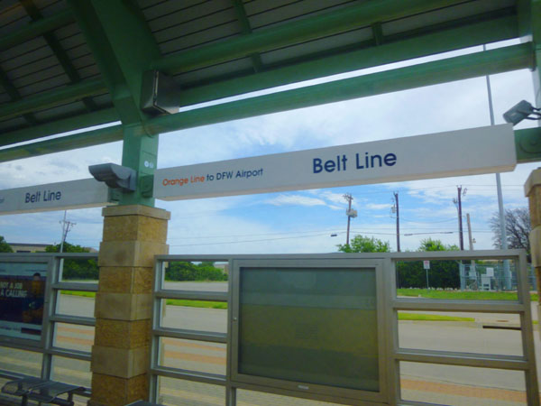
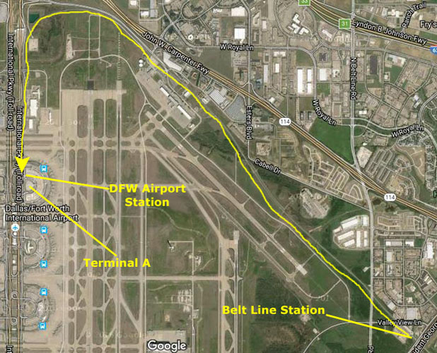
The Orange Line: Belt Line Station
|
 |
Just on the northwest side of the turnpike, the light rail comes into the Belt Line Station. This is major transfer station for the DART System, and there is also a very large Park-and-Ride lot (and even four "Kiss-and-Ride" spaces, whatever those are).
|
Goldberg and the neighborhood advisory committee chose to enhance the natural setting at Belt Line Station. Landscaping emphasizes native grasses, as well as mesquite and cedar trees. A gradually ascending, mesquite-lined all�e - a walkway shaded by uniformly planted trees - links the parking lot to the platform in a way that is at once understated and dramatic.
At the platform itself, columns feature alternating bands of polished and rough native Texas limestone. The 250 million-year-old stone, with its irregular texture and relief, is inherently sculptural. The windscreens feature bear grass laminated between translucent sheets. The simple, rustic materials combine to create what Goldberg calls a "Texas vernacular style."
It was just after we pulled out of this last station before the terminus at DFW Airport, I got my first view of the end of the line:
 |
The Orange Line: DFW Airport Station
|
I understand that way back when there was some discussion whether the light rail should go to the southernmost terminal instead, but there were a number of reasons why this route was chosen: (1) it was shorter, (2) it allowed stations that would serve more people, (3) it could serve the Convention Center and North Lake College, and (4) there was right-of-way that could be purchased relatively cheaply. The alternative, along Highway 183, was impractical as both sides of that freeway were totally built out.
Here are some of the airport views I got as we worked our way around the north side of it:
|
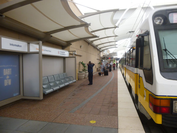
Probably the most interesting part of my entire excursion today was the arrival at and departure from the DFW Airport Station. The interesting part began when the light rail made the final turn to head down into the DFW Airport Station. The best way to show you what it was like is via the movie I made of our arrival at the DFW Airport Station. The player for that movie is at right, below, and to its left is an aerial view of the station itself.
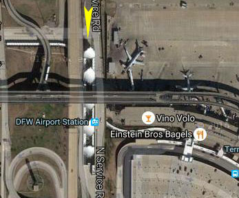 DFW Airport Station |
Arrival at the DFW Airport Station (Mouseover Image Above for Video Controls) |
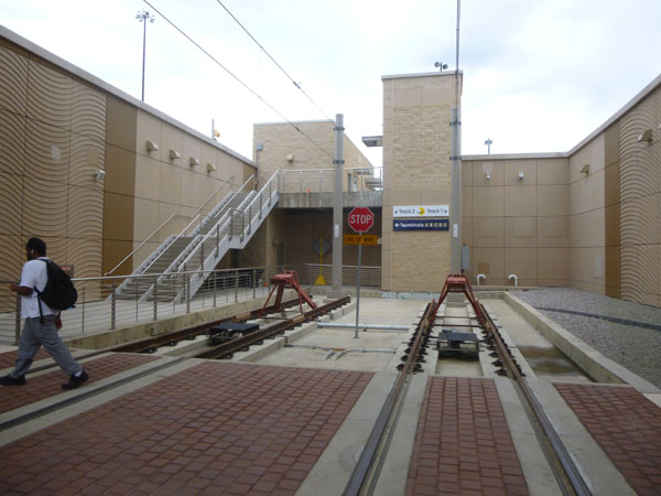
Here at the end of the line, the DART light rail does what is typically when a rail line ends and the trains return the way they came. One way is to have a "lasso". This is a mechanism by which a train can be turned around without having to actually back up (so named because there is a loop of track at the end of the line. This technique is most often used when the actual train line has a single track, but it can also be used when it is difficult to actually back the train up.
|
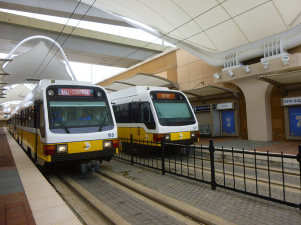
In the picture below, you can see that there are two trains in the station. The one on the right is the one I arrived on (it still has its destination label set to "DFW"); the one on the left is the train I will leave on. Of course, by the time we get out of the station we have to be on the right-hand of the two tracks back into town. This will be accomplished by an "X-crossing" just up the track from here. It won't matter for the train I'll be taking back, but when the train I arrived on departs, it will have to use it to cross over to the right-hand track.
Sometime after my train leaves, another will arrive, and it will use that crossing to come into the vacant platform. I guess a long explanation wasn't really necessary; anyone whose ridden a commuter train to the end of its line has seen the same technique in operation.
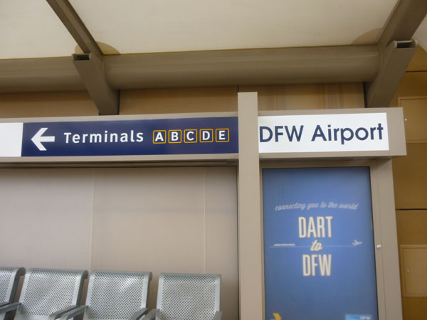
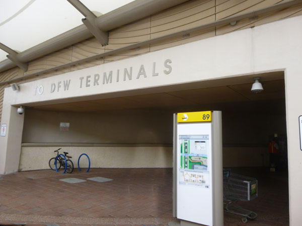
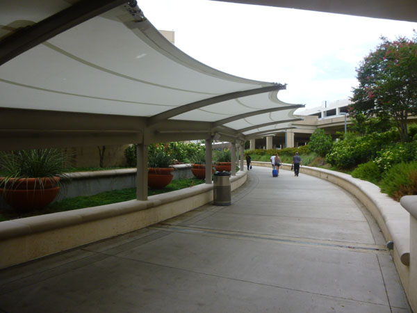
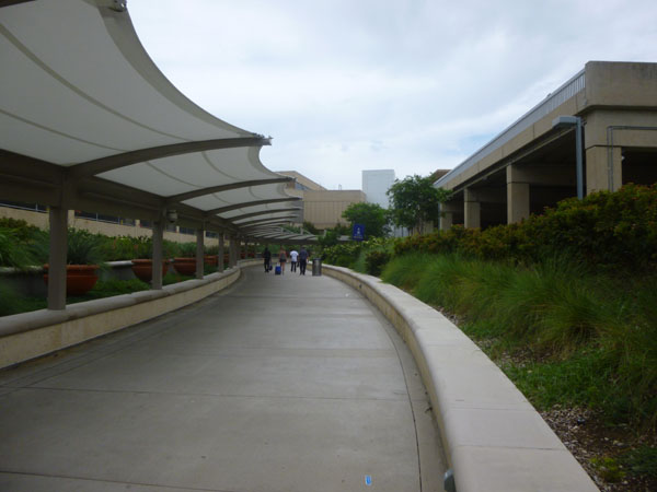
This station is only a couple of hundred feet from an entrance to Terminal A, so it is very convenient to take your luggage along the covered walkway into that terminal.
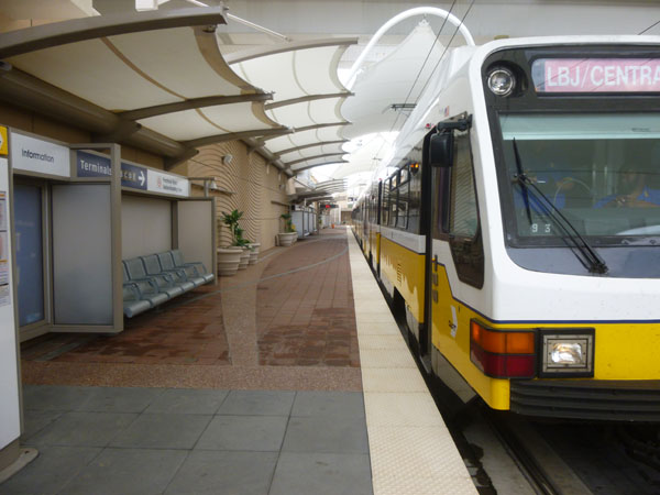
This was my first time at the light rail station here at DFW, and I have to admit that it was done in a very pleasant, if utilitarian way. This was the only station today that didn't have a signature column treatment, so that's why you don't see one here. I wandered around taking pictures for maybe ten minutes until I hopped back on the train that was ready to depart.
|
|
Finally, I made a very good movie of our departure from the station, and you can watch it with the player below:
Departing from the DFW Airport Station (Mouseover Image Above for Video Controls) |
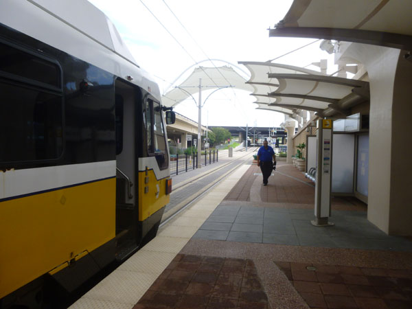
The ride back was comfortable, and I struck up a conversation with a Southwest Airlines pilot who had deadheaded to DFW and was now headed to Love Field to captain a flight. He actually lives in Oklahoma City. When I got back to the Bachman Station, I began my ride on the Green Line.
To continue with the next segment of my all-day excursion on DART, just click on the link below:
|
July 23, 2016: A Visit to The Modern & Kimbell Museums in Fort Worth |
|
June 13-15, 2016: A Visit with Jeffie in North Carolina |
|
Return to the Index for 2016 |