|
May 2, 2018: A Day in Jerusalem (Israel) |
|
April 29, 2018: Aqaba (Jordan): A Day in Petra- The Red Rose City |
|
Return to the Index for 2018 |
We left Aqaba about 9PM on Sunday, April 29, spent a day at sea, and then, on the morning of Tuesday, May 1, found ourselves at the southern end of the Suez Canal, ready to begin our transit. It will take all day to go through the canal; all the pictures and movies we took during the transit will be on this page.
From Aqaba to the Suez Canal
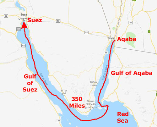
We steamed away from the cruise ship dock in Aqaba about 9PM. It was dark, so we have no pictures of our departure. Ahead lay a 350-mile trip to the Suez Canal.
|
First, we have to head south a hundred miles through the Gulf of Aqaba to reach the Red Sea. But we aren't in the Sea long- just the few hours it took to round the bottom of the Sinai Peninsula and Sharm El-Sheikh and enter the Gulf of Suez.
Then we cruised north through that Gulf to come to the south entrance to the canal.
We could have gotten here in 25 or 26 hours, but we had a transit "appointment" for the morning of May 1, and I guess there is not a lot of area to circle around in waiting for our turn through the canal. It's not like it's first-come, first-served. So the captain cruised well under his top speed and we spent April 30th "at sea". But early on the morning of May 1, we came up on deck to find ourselves looking at the canal ahead of us.
The Canal- and a Bit of History
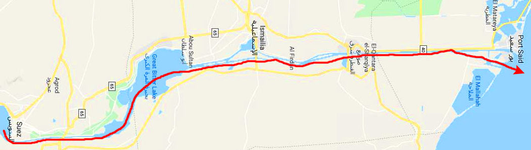
The Suez Canal is an artificial sea-level waterway in Egypt, connecting the Red Sea (actually, the Gulf of Suez) to the Mediterranean Sea through the Isthmus of Suez (between Egypt proper and the Sinai Peninsula). Constructed by the Suez Canal Company between 1859 and 1869, it was officially opened on 17 November 1869. The canal offers watercraft a shorter journey between the North Atlantic and northern Indian Oceans via the Mediterranean and Red Seas by avoiding the South Atlantic and southern Indian Oceans, reducing the journey by approximately 4,300 miles. It extends from the southern terminus of Port Tewfik at the city of Suez to the northern terminus of Port Said. The canal is, essentially, a 120-mile ditch; since it is all at sea level, there are no locks as in the Panama Canal.Its length is 193.30 km (120.11 mi), including its northern and southern access channels. In 2012, 17,225 vessels traversed the canal; for comparison, the Panama Canal handled 15,000 ships the same year.
Below is a map of the canal, turned, for space reasons, so north is to the right:
|
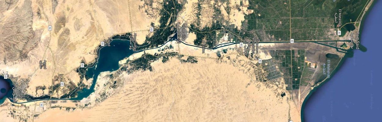
The original canal was a single-lane waterway with passing locations in the Ballah Bypass and the Great Bitter Lake. It contains no locks system, with seawater flowing freely through it. In general, the canal north of the Bitter Lakes flows north in winter and south in summer. South of the lakes, the current changes with the tide at Suez. The canal is owned and maintained by the Suez Canal Authority of Egypt. Under the Convention of Constantinople, it may be used "in time of war as in time of peace, by every vessel of commerce or of war, without distinction of flag".
So that you can see what the topography of the area looks like, here is an aerial view of it, again rotated so that north is to the right:
|
In August 2014, construction was launched to expand and widen the Ballah Bypass for 22 miles to speed the canal's transit time. The expansion was planned to double the capacity of the Suez Canal from 49 to 97 ships a day. At a cost of $8.4 billion, the "New Suez Canal", as the expansion was dubbed, opened with great fanfare in August 2015. In 2016, the Suez Canal Authority officially opened a new side channel, located at the northern side of the east extension of the Suez Canal; this allowed berthing and unberthing of vessels in the northern terminal while other ships were transiting the Canal serving the East Terminal for berthing and unberthing vessels from the terminal. As the East Container Terminal is located on the Canal itself, before the construction of the new side channel it was not possible to berth or unberth vessels at the terminal while the convoy was running.
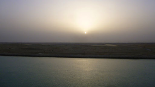
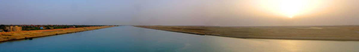
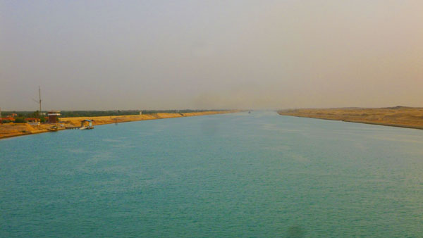
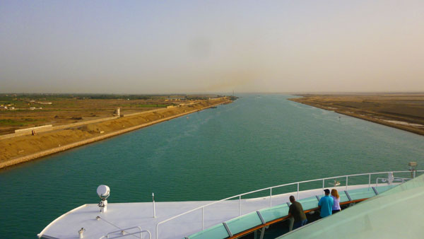
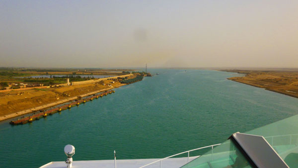
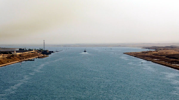
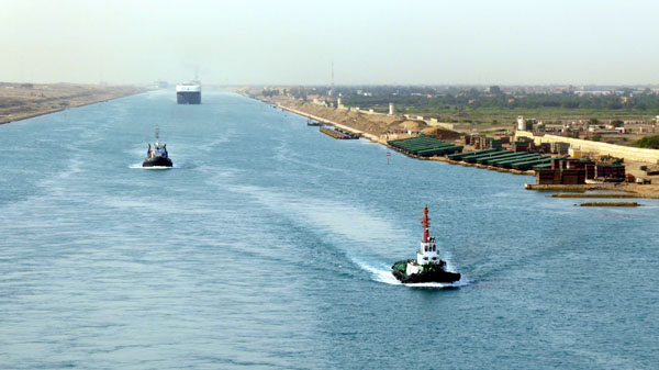
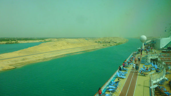
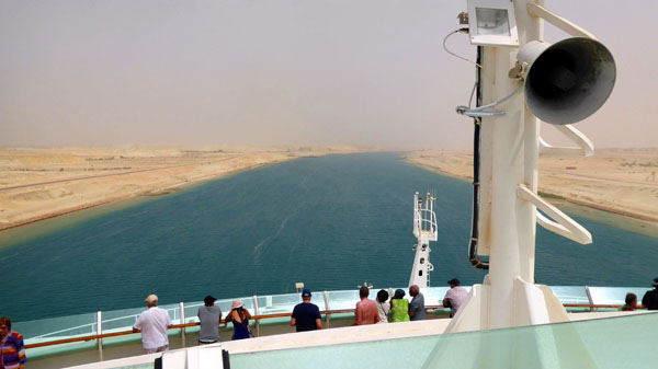
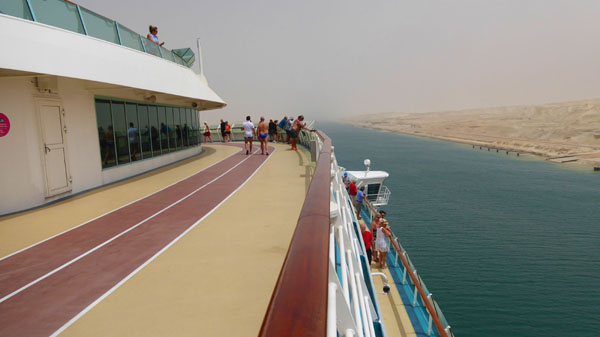
Beginning Our Transit (Way Before Breakfast)
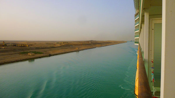
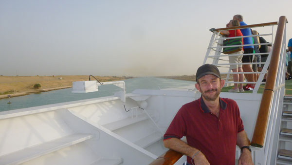
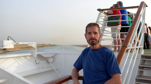
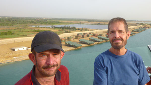
I was up at first light, and I could see land outside the balcony window, so I grabbed my camera and headed up on deck. Fred followed along in a little while, and together we recorded the scene at the south end of the canal- which, as it turned out, we'd already entered just as the day was beginning.
|
|
Before Fred came up on deck, I discovred that he'd made a movie of the passing shoreline here at the very south end of the canal- from the vantage point of our balcony. There was an inexplicable few seconds in the middle of the movie where all you can see is the deck railing, but other than that, the movie gives a decent idea of what our entry into the canal was like. At the same time, I was up on deck, and one of my first pictures is also worth including here:
|
(Mouseover Image Above for Video Controls) |
(Just Past Six-Thirty in the Morning) |
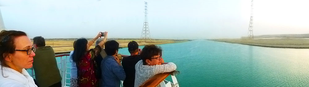
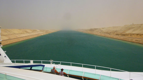
Here is a composite panorama, made just as the sun was coming up:
|
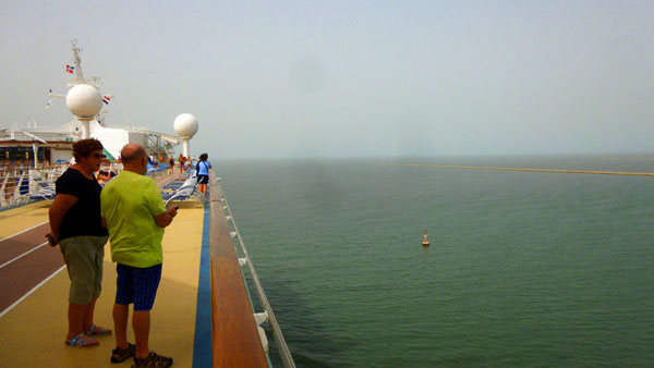
And, as the sun was breaking over the low clouds and we were getting some actual light, the crowd at the bow of the Mariner of the Seas:
|
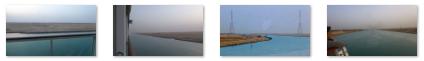
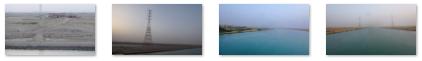
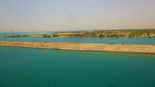
Sites of Interest During the Transit
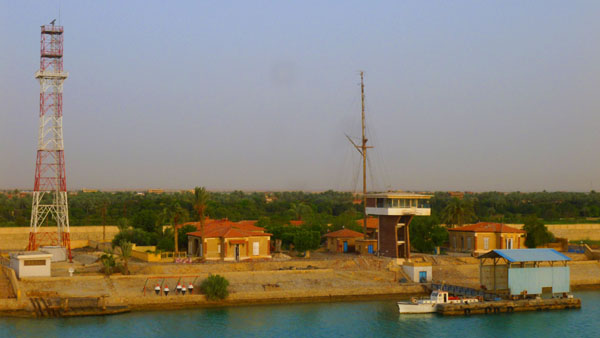
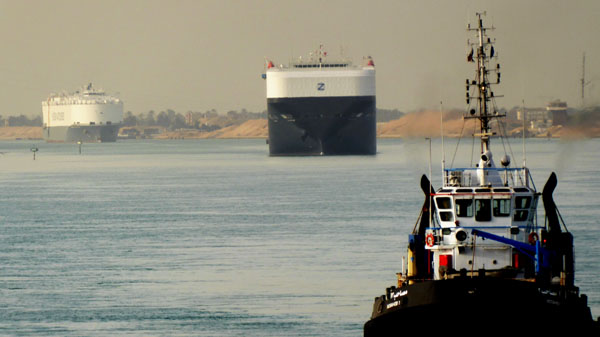
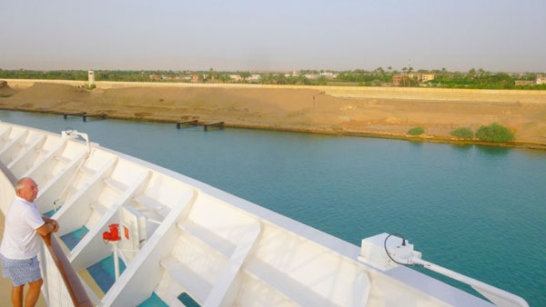
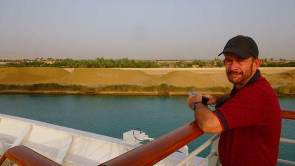
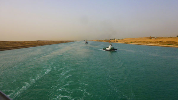
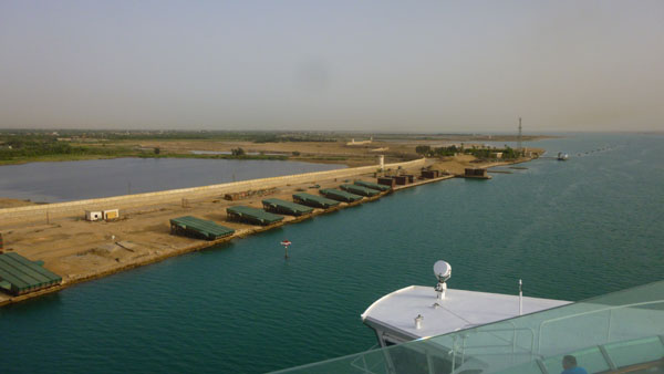
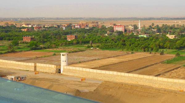
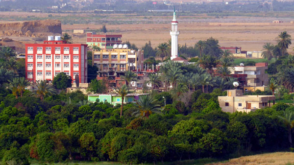
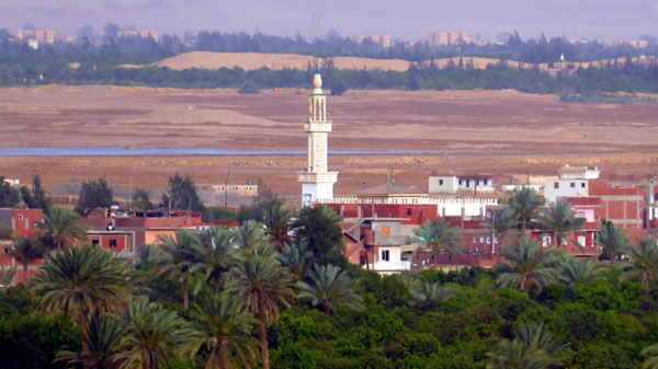
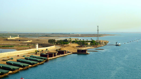
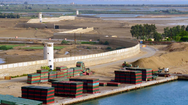
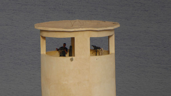
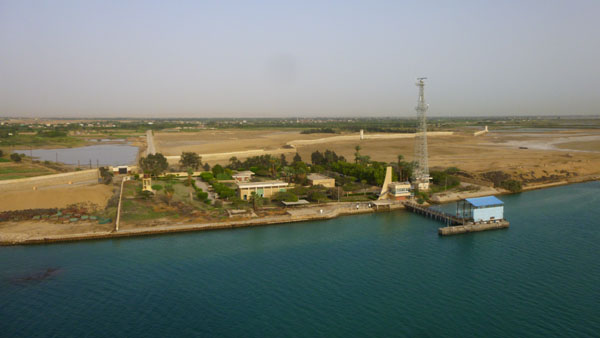
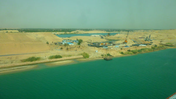
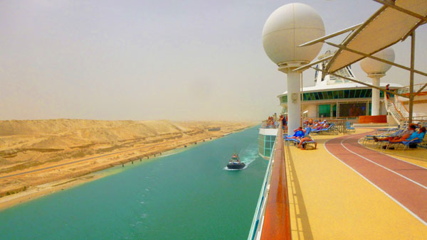
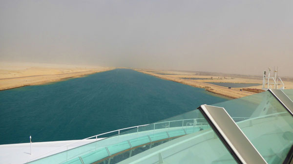
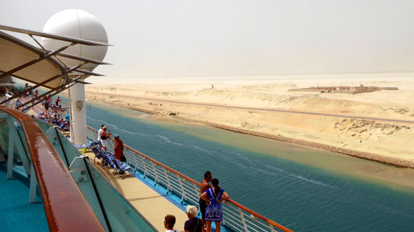
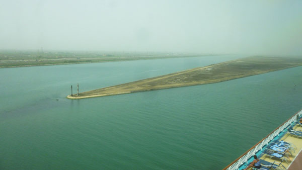
Most of the pictures we took during the transit of the canal were just of interesting landscape features or structures on either side of the waterway. We certainly don't have explanations for what each one shows; since we weren't on shore, there was no one to ask and no signage to read. So what I want to do in this section is describe some of the sights we saw that I can identify and gather some information about. Later on, we will take a look at some of those more random pictures of scenery along the canal.
When I can specify, I will tell you where along the canal the sight was, using the Mile marker system along the canal; miles are numbered from north to south from 1 to 121. So, in no particular order, here are some of those interesting sights.
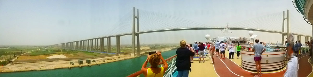
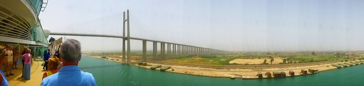
The Mubarak Peace Bridge/Egyptian-Japanese Friendship Bridge
|
The bridge was built with assistance from the Japanese government, assistance that was offered during the visit of then-President Hosni Mubarak to Japan in March, 1995. The bridge cost $200 million to build, and the Japanese assisted with 60% of that total.
|
(Mouseover Image Above for Video Controls) |
One such bridge was the Centennial Bridge over the Panama Canal near Panama City, and another was the older bridge near the same spot that this new bridge was built to supplement. Another bridge was the bridge from the California mainland to Coronado Island; we passed under this bridge when that same Panama Canal cruise entered San Diego Harbor. Finally, we passed under a bridge like this one when one of our transatlantic cruises came up the Tagus River to dock in Lisbon, Portugal. This was the 25th of April Bridge.
I made movies similar to this one when we passed under those bridges; you can use the player at left to watch my movie made as the Mariner of the Seas passed under the Mubarak Peace Bridge.
The construction of this bridge was part of a larger project to develop the northern part of the Sinai Peninsula. Construction began in 1996, and the bridge was opened in 2001. The Suez Canal Bridge was part of a major drive to develop the areas surrounding the Suez Canal, including other projects such as the Hamdi Tunnel under the Suez Canal (completed in 1981), the El Ferdan Railway Bridge, and the Suez Canal overhead powerline crossing.
|
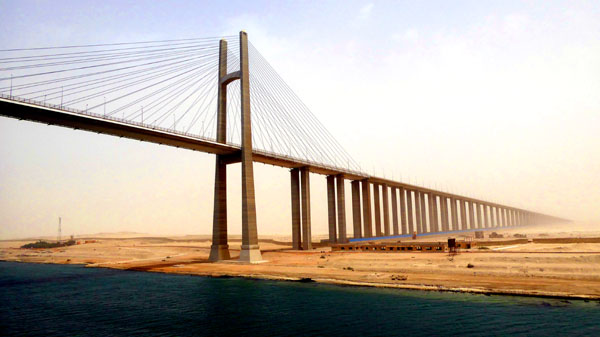
The bridge was quite beautiful- not because of ornamentation (it was, in fact, extremely plain)- but because of the long, straight approaches that seemed to rise gradually right out of the desert. Of course we took lots of pictures of the bridge; here are some of them:
|
We've passed under the bridge now, and here is a view looking back at the eastern approach:
|
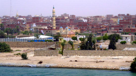
The bridge crosses the canal at the town of El Qantara, which lies on both sides of the canal. Kantara, as it was then known, played an important role in World War I, as it was the Headquarters of the Suez Canal Campaign. It also had a massive distribution warehouse and hospital center that supported and supplied all British, Australian and New Zealand operations in the Sinai from 1916 until final demobilization in 1919.
|
The Commonwealth War Graves Commission Cemetery and Memorial is located outside of town. It was begun in February, 1916 and after the war was doubled in size to accommodate the remains of soldiers from makeshift cemeteries and desert battlefields. The cemetery contains 1,562 Commonwealth burials from World War I and 110 from World War II, along with some 350 war graves of other nationalities. Various national monuments are located at the cemetery, including the Kantara Indian Cemetery Memorial.
The town's importance as a hospital center was renewed during World War II when General Hospital No. 1 (and three others) were located there from July 1941 to December 1945. During the 1967 Six Days War, Israel captured the town. Egypt recaptured it at the start of the 1973 Yom Kippur War during The Crossing, and held it until the ceasefire was negotiated. Egypt regained formal control over the town in 1974.
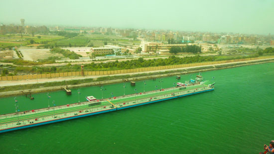
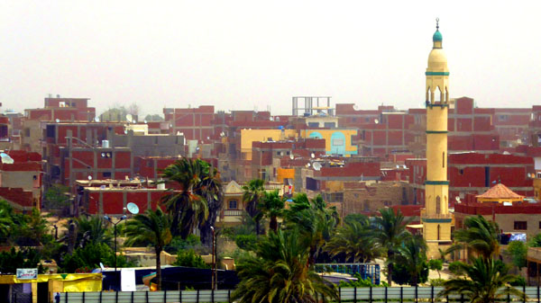
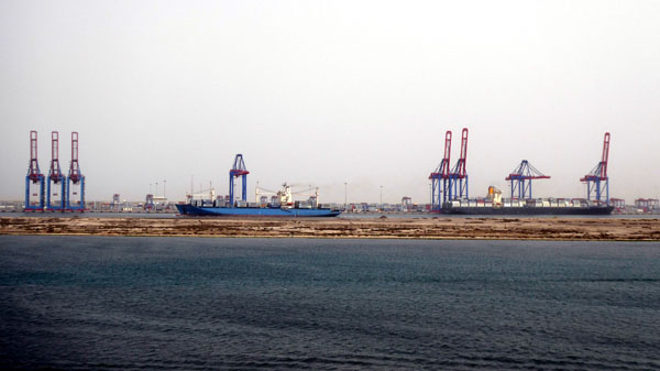
Port Said
|
Port Said has acted as a global city since its establishment and flourished particularly during the nineteenth century and the first half of the twentieth when it was inhabited by various nationalities and religions. Most of them were from Mediterranean countries, and they coexisted in tolerance, forming a cosmopolitan community. Referring to this fact Rudyard Kipling once said "If you truly wish to find someone you have known and who travels, there are two points on the globe you have but to sit and wait, sooner or later your man will come there: the docks of London and Port Said".
The name of Port Said first appeared in 1855. It was chosen by an International committee composed of Great Britain, France, the Russian Empire, Austria, Spain and Piedmont (and not, tellingly, Egypt). It is a compound name; the "Port" part is obvious, while "Said" comes from the name of the ruler of Egypt at the time the town was laid out. It was that ruler who granted Ferdinand de Lesseps the concession to dig the canal.
|
There were no local resources; everything Port Said needed had to be imported: wood, stone, supplies, machinery, equipment, housing, food and even water. Giant water storage containers were erected to supply fresh water until the Sweet Water Canal could be completed. One of the most pressing problems was the lack of stone. The city became a testing ground for the new technique called "conglomerate concrete", which worked well. That same concrete was used to construct the lighthouse of Port Said, the only original building still standing in the city.
In 1859 the first 150 laborers camped in tents around a wooden shed. A year later, the number of inhabitants had risen to 2000 � with the European contingent housed in wooden bungalows imported from northern Europe. By 1869, when the canal opened, the permanent population of the city had reached 10,000. The European district, clustered around the waterfront, was separated from the Arab district by a wide strip of sandy beach where a tongue of Lake Manzala reached towards the sea. This inlet soon dried out and was replaced by buildings, over time there was no division between the European and Arab quarters.
|
|
When we reached Port Said, I'd gone back inside the card room to rejoin the ongoing game of bridge, but I continued to watch the port city go by out the windows. Fred was still out on deck taking pictures, and I could see him snapping away
|
(Mouseover Image Above for Video Controls) |
Later, reviewing Fred's pictures, I found he had taken some interesting ones, so here are some more views of Port Said, taken as we passed very close to it in the canal (which at this point was one-way and fairly narrow) and headed out into the Mediterranean:
|
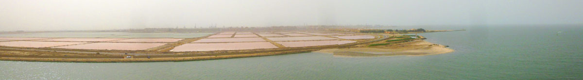
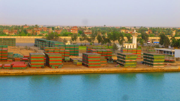
One of the large businesses here in Port Said is fish farming- mostly mullet. The fish are farmed in huge ponds that lay between the two lanes of the canal here at its north end. Here's a panoramic view of some of these fish farms, which, as you can see, are placed right next to the Mediterranean Sea:
|
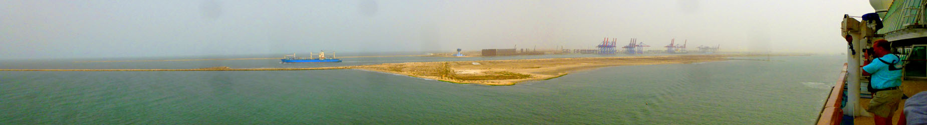
Shipping, of course, is another main activity here, and the entire industry grew up around the original dock area- which is now a bit out into the Mediterranean. As we passed by the actual port, I took four pictures and put them together into a panoramic view; it is in the scrollable window below:
 |
You will find a few more pictures of Port Said and its harbor area in the slideshow of Suez Canal pictures towards the bottom of this page.
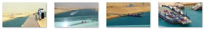
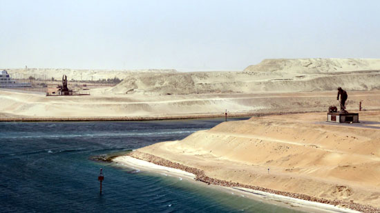
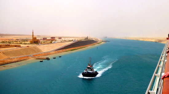
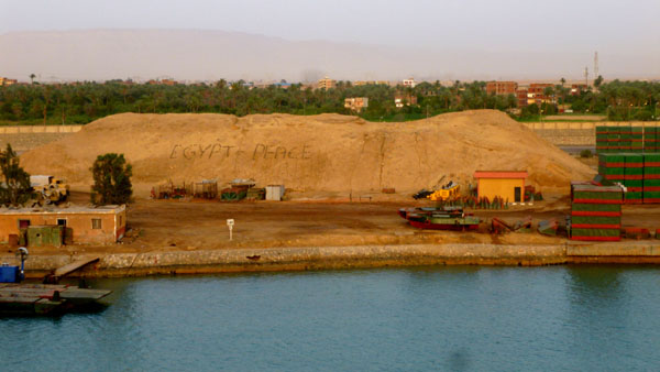
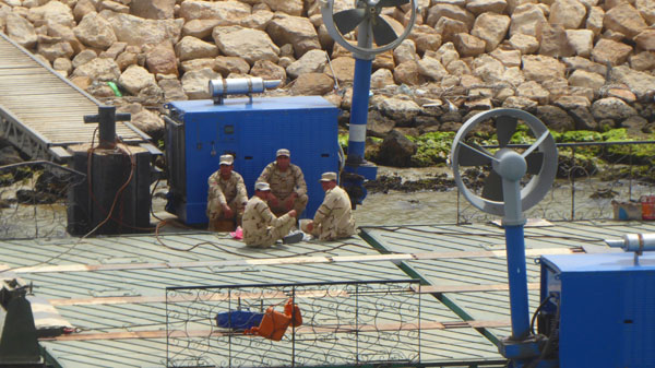
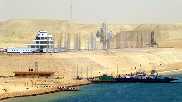
Suez Expansion Canal and Administration Building
|
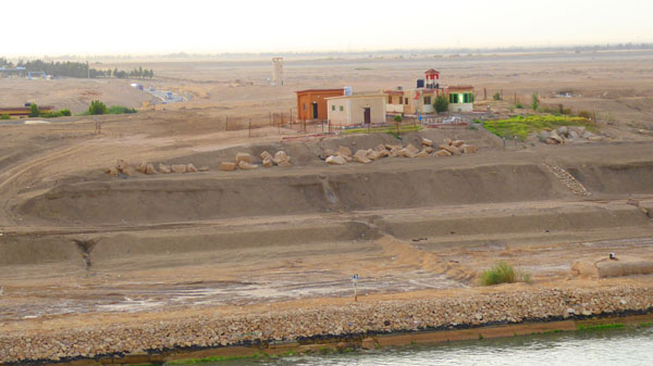
The facilities, and some of the statues, monuments, and other development going on around them were pretty interesting (although the area is still very new and, consequently, very desolate. I don't know if at some point in the future vegetation will take a foothold here, but right now the land on both sides of the eastern canal extension seems to be just sand- and lots of it- with a few trees around some of the buildings.
Coming north, we first came to a new ferry that crosses this eastern canal extension. I suppose there was a ferry here when it was just one channel, but I'm not sure. In any event, there is a new road across the "median" between the channels that comes to the ferry crossing here:
|
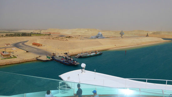
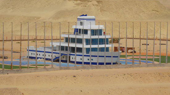
Continuing north, we could see new buildings on both sides of the canal. On our left, just before what was apparently a "cut-through" in the median to allow small craft to pass from one channel to the other, was a new building and a couple of monuments.
|
|
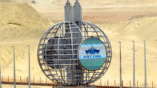
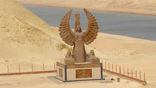
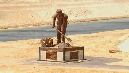
There were three items of interest around the new administration building- two statues just north of it and on either side of a cross canal, and a kind of symbolic globe out in front of it.
|
|
|
|
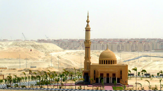
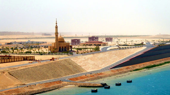
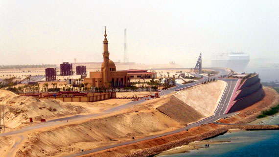
On the other side of the canal we saw some of the new development that is beginning to take hold here now that the canal expansion project is finished. There was a new mosque, another low building that will serve as Canal HQ, and much other development as well. Here are four good pictures of the mosque and the other buildings we passed:
|
|
|
|
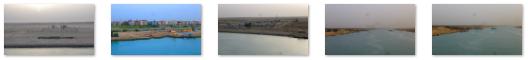
A Selection of Suez Canal Pictures and Movies
|
(Mouseover Image Above for Video Controls) |
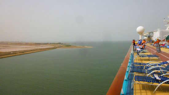
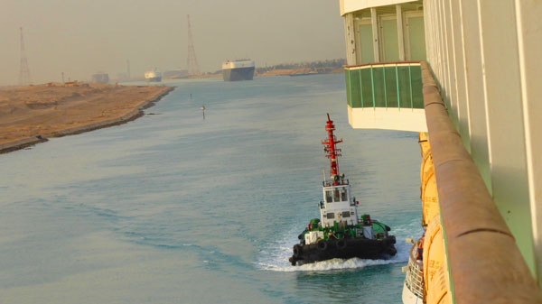
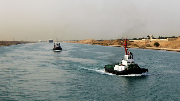
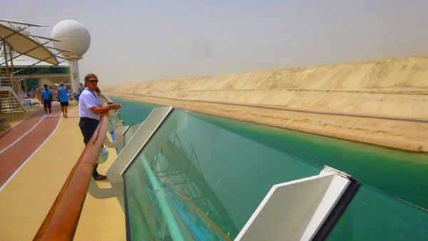
Here, not to take away from the engineering feat of the Suez Canal, we were essentially moving slowly through a deep, wide ditch, with mostly barren landscape or desert on either side. Not much to add to the pictures to simply watch that landscape slide by. But Fred did make one interesting movie early in the morning; it was made soon after we got into the canal, and it will show you what most of our trip was like. Please use the player at left to have a look at it.
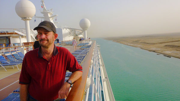
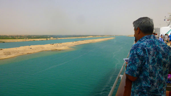
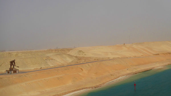
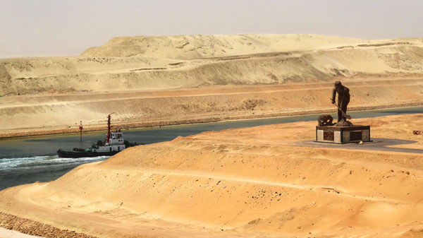
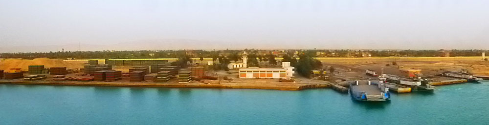
I did attempt a number of panoramic shots, too. Only a few of them turned out well enough to include here; even though the ship was not moving very fast, the panoramic function of the camera didn't work well, nor did putting together a series of still pictures. But some turned out well- like this image of a long stretch of the western shore of the canal:
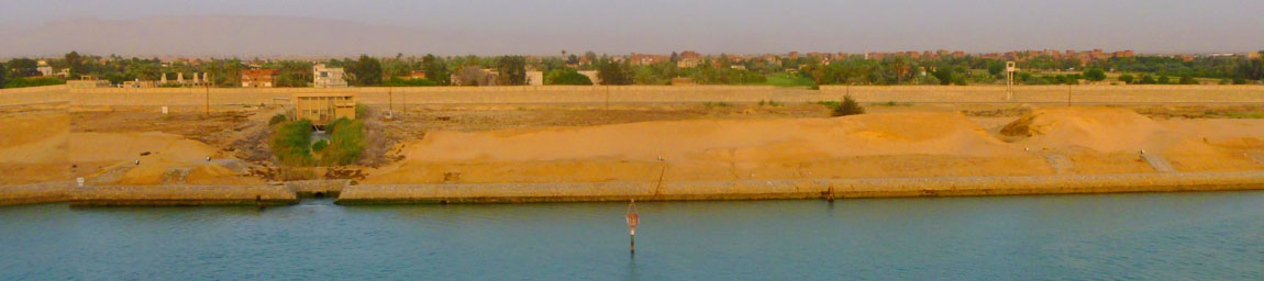
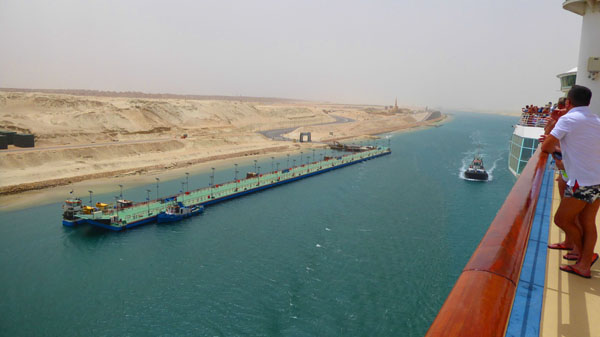
So did this image of one of the ferries that cross the canal:
 |
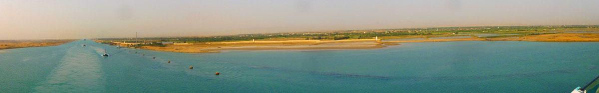
But I think the best one was a combination of four images taken from the stern of the Mariner of the Seas just after it entered the Great Bitter Lake. The view looks at the south shore of that lake, and the canal exit heading south:
 |
But of course, we took a great many more still pictures in the nine hours that it took for us to get through the Canal. They begin with our entry into the canal at Suez and continue through the day until our ship entered the eastern canal extension at Port Said and slowly made our way north to exit into the international waters of the Mediterranean.
|
|
We saw much commercial activity, including a plethora of green-and-gray containers (at least that's what we thought they were). But we mostly saw barren desert slide by, not the green jungles of Panama.
So have a look at some of our pictures that are in the slideshow at left. As always, use the little arrows in the lower corners to move through the show, and track your progress using the index numbers in the upper left.
Late in the afternoon, we emerged from the Suez Canal into the southeastern corner of the Mediterranean, and began to make our way up the coast towards Israel, and tomorrow's visit to Jerusalem.
You can use the links below to continue to another photo album page.
|
May 2, 2018: A Day in Jerusalem (Israel) |
|
April 29, 2018: Aqaba (Jordan): A Day in Petra- The Red Rose City |
|
Return to the Index for 2018 |