|
June 8 - July 2, 2024: A Trip to Fort Lauderdale |
|
April 13-16, 2024: A Museum Trip to Houston |
|
Return to the Index for 2024 |
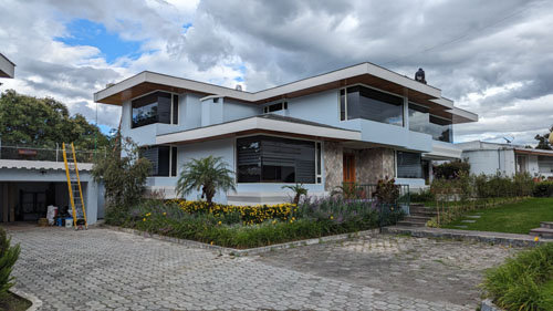
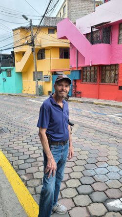
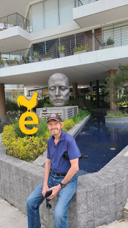
Our second trip to Ecuador this year will be on our own. In February, we had both my niece Jeffie and our friend Brad come to visit, but this time we will be on our own. Because we are on our own, there won't be nearly as many pictures as on our last trip. There are some other things we want to do in Quito and around the area, but on this trip we postponed them to take care of some additional work on the house itself.
Getting to Our House in Ecuador
|
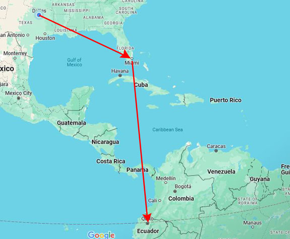
So for this trip, we flew American Airlines all the way from Dallas to Quito. There is no non-stop flight, only flights that go first to Miami, involve a plane change, and then go on to Quito. But the times are pretty convenient. The Miami flight leaves about one in the afternoon, and we get into Quito around 10:45 in the evening.
And of course since both flights are on American, we can pick good seats and also check bags without any extra fees. The flight to Miami is on a big plane, and the entertainment options, which Fred likes, are extensive. But the bad part is that the flight to Quito is on an older 737, and that plane doesn't have a seat-back entertainment system. But it's only a 4-hour flight, so I hope that Fred won't be bored.
There were no significant delays today, and the transfer between flights in Miami wasn't too bad. Neither of us like the Miami airport, because it is so large and usually requires long walks between flights- particularly between domestic and international. But we had time, so we were OK.
We landed in Quito, got an Uber through the app, and the driver took us right to the gate of Urbanizacion Santa Lucia Baja at Paseo San Francisco in Cumbaya. This is one nice thing about where we live: almost all Uber and taxi drivers know of our community and of course where Paseo San Francisco is located. So, even if we aren't using an Uber (where you specify the destination right in the app), there is no problem getting to where we live.
This visit was very low-key. We did a lot of walking to familiar locations around the valley and, as you will see, we put a new roof on the house. So what I'll do here is just group the pictures around an activity or destination.
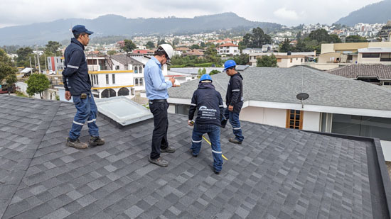
The New Roof
When we arrived, we also noticed that the ceiling in the stairway had also shown that water was leaking in, and small bits of the plaster had fallen onto the stairs. We had Felipe bring his roof expert around and they did a thorough inspection, and we all decided that the 30-year-old roof needed to be replaced. (We had seen that late last year, our neighbor Nicholas had done some work on his own roof; the three houses were all built at the same time.)
So the roof project (which, incidentally, turned out to be one of those things that is a good deal cheaper here in Ecuador than it would be in the States, even though the Owens-Corning shingles were imported from Toledo, OH) began during our second week here. The project took about eleven days.
|
The project began with the removal of the old shingles, of course, and then an entirely new base sealant material was put down over the whole roof. Where the roof came down to its edge, new drains were put in to carry water down into the underground drains. Our three houses don't use gutters and downspouts, but instead this kind of drain system- which is not the usual practice in the United States. Then the new shingles were put down and then capped and sealed with a kind of heat treatment; that's the purpose of the tanks that the workmen took up onto the roof.
We also asked Matias, one of our architectural firm's employees and liaison on this project, to have Andres (the roofing company representative), have his workers remove the old satellite dishes that we of course don't use anymore. (Our Internet and streaming TV come to us via a fiber-optic cable that begins at a phone pole on the far side of Veronica's house across from us. Typical of Ecuador and many other old countries and cities, our cable was just laid on top of Veronica's roof and then slung across to ours where it attaches at the back of our house. You'll see that cable in a number of my pictures.
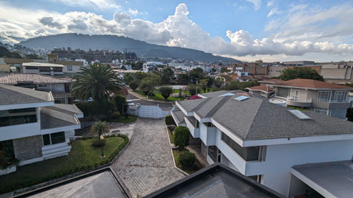
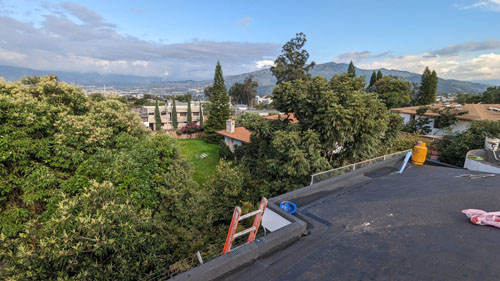
It was all very interesting to me, and I put aside my mild fear of heights to go up onto both the outbuilding and the rooftop to watch how they did things and, of course, take lots of pictures of the process. Now, I will freely admit that the pictures and movies I took of the process of putting on the new roof, from start to finish, are undoubtedly not of interest to most of you. That's why I have separated out all the pictures and movies I took of the actual workers putting on the new roof from not only all the other pictures from this trip, but even from pictures I took from the top of the house at the area around us. Those you might actually find interesting, and they will be in a separate section below.
|
To view the slideshow, just click on the image at left and I will open the slideshow in a new window. In the slideshow, you can use the little arrows in the lower corners of each image to move from one to the next, and the index numbers in the upper left of each image or movie will tell you where you are in the series. When you are finished looking at the pictures, just close the popup window.
So, after eleven days, the roof project was complete, and both Andres and Matias were on site to do a final inspection.
|
 |
When everything was done, I asked Andres and Matias to pose for a picture, and you can see that picture at left. Our thanks to both of them for a job well done.
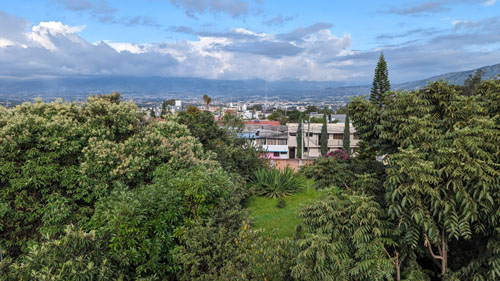
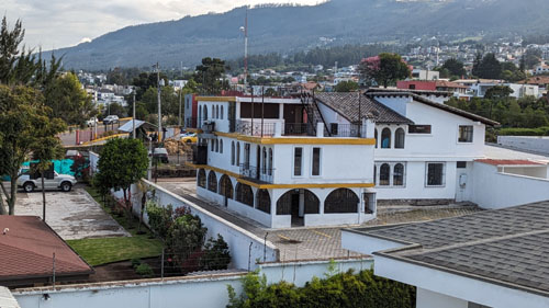
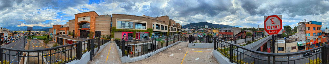
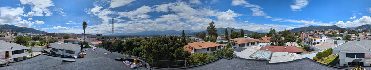
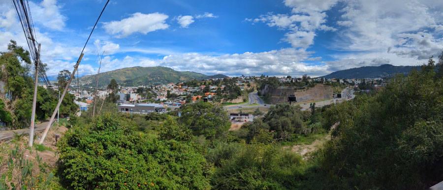
The View from the Top
Probably the best picture is this 360° panorama of the view around our house. Look carefully at the picture below and you'll see Dario's house across the way both at the extreme right and extreme left of the picture.
 |
|
|
|
|
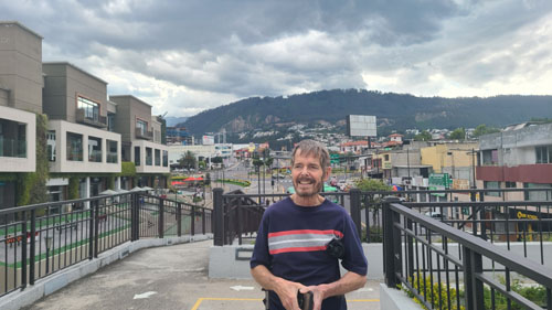
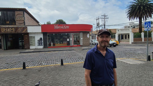
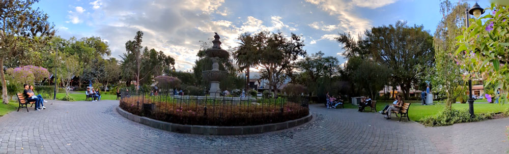
Cumbaya and the Square
|
The view covers the area from our community and the Paseo San Francisco down to the Parque Cumbaya- the old town square with the big fountain in the center and the Catholic church on its east side. We walk back and forth in this area frequently. Down by the square are restaurants we favor, bakeries and other stores, and the art gallery we've patronized (more on that in a section below).
Our usual route takes us around the Paseo San Francisco and the large traffic circle northwest of it, across the pedestrian bridge from the Paseo to the University, and then down the street to old Cumbaya (where there are a couple of different routes we can take to the square).
I won't try to locate each of the pictures below on that aerial view; just from the descriptions and the labels on the aerial view you can figure out where it was taken.
So let's just look at some pictures taken in this area of Cumbaya.
|
|
On this particular day, we came out of the house to find Veronica's cat Magdalena sunning herself on the walk between our two houses. We see the cat every few days; she likes to hide out in the new plantings in front of our house.
We leave through our compound's private gate and then head up the street, which is where I began my movie. You can use the player at left to watch it.
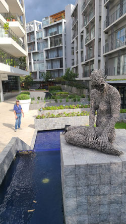
Heading out through our guard gate, we come around by the Paseo, and we can always see the sculptures in the traffic circle. I've taken closeup pictures of these sculptures before; they are always interesting to see.
We then usually cross the pedestrian bridge from the Paseo to the University, and from that bridge we took the next few pictures:
|
|
|
|
|
|
Just west of the square is a row of restaurants, one of which we patronized- an Italian restaurant called Fatto a Mano.
|
|
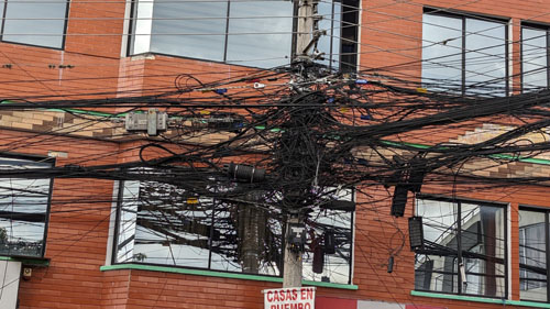
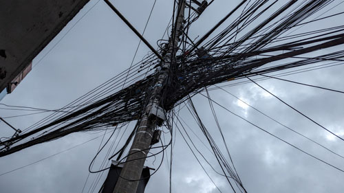
One thing I always find amusing walking around Cumbaya, the older sections of Quito, and numerous other places around the world is how electricity, Internet, and phone service are delivered- all by wire. But it seems, sometimes, that there are so many wires, that if something goes wrong with a customer, it's easier to run them a new wire than it is to find the wire that is the problem. I can't find any other reason why these nests of wires are found all over town:
|
|
Our destination on most of our walks is the old town square- Parque Cumbaya. It is a great place to sit and have an ice cream, or people-watch, or just relax.
 |
On one particular trip, the vendors who sell the little apparatus that creates large bubbles from soapy water were out and about, and I made a couple of movies of them.
|
|
|
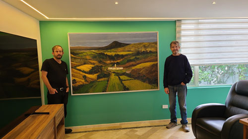
The Budding Art Collectors
|
|
One work, by Ecuadorian artist Jorge Vintimilla, shows a landscape from the Chimborazo province with the volcano of the same name in the background.
|
|
The second work, by surrealists Peruvian artist Jose Luis Alfaro de la Cruz, features a woman in traditional garb, a basket full of odd items, and a cat behind her in the trees:
|
|
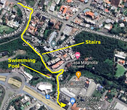
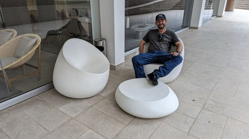
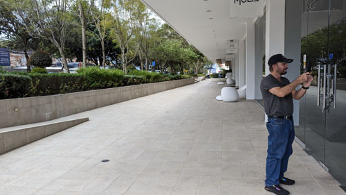
A New Route to Scala Mall
|
So we decided to explore. We began by heading southeast down Ave. Maria Angelica Idrovo from Paseo San Francisco:
 |
A ways down this street, it begins to wind down a steep hillside to Avenue Oswaldo Guayasamin. That would take us to Scala Mall, but not only is it out of the way, but there are no sidewalks. But just beyond that intersection there is a street that leads down the hill to the right, and that was the street I thought might go all the way through.
|
 |
The walkway was actually fairly steep; thinking about it as we walked, we thought that while we might walk down to Scala Mall along this route, but coming back up this way would be extremely arduous (maybe not for younger folks, but certainly for us).
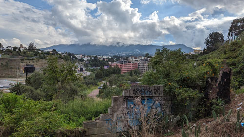
I have to admit, though, there were nice views out across the ravine below us to the west:
|
|
 |
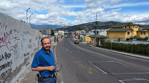
We continued down the walkway and stairs, and, after just a short ways, the pathway turned into a street again- a street where we could see new apartments being constructed on the hillside. (Cars could get to these only from Avenue Oswaldo Guayasamin, of course.) The street continued to wind down the hill for a block until it made a sharp right turn. Fred took a picture of me just at this corner, and you can see that picture here.
We turned right, and noticed that to our left the street led to a B&B called Casa Magnolia. We continued on to Avenue Oswaldo Guayasamin and passed, oddly-enough, a swimming pool (for which, we noted, a $1 entry fee was charged). Then we came out on the main street and turned left to walk two more blocks to Scala Mall. So this route turned out to be a good way to get to Scala Mall, but probably not the best way to return home; the walkway was very, very steep.
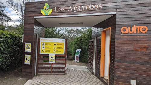
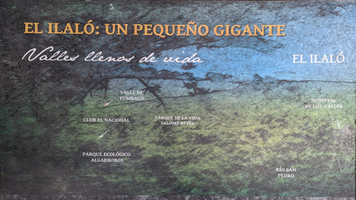
Los Algarrobos (The Carob Trees)
|
Fred had seen mention of the area online, and so when we left Scala Mall one day we turned east to check out this small park area.
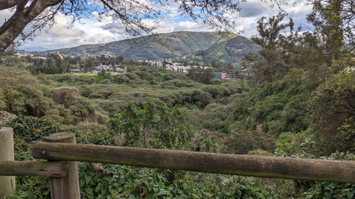
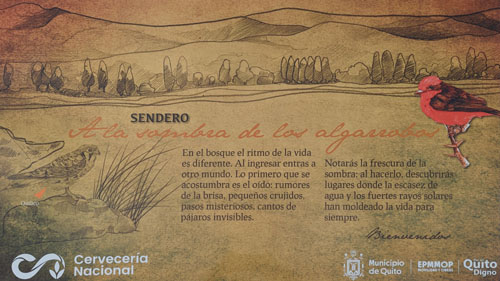
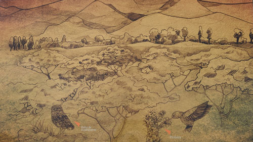
Los Algarrobos translates to "the carob trees", and indeed there are supposedly a number of them in the forested park area. This area of approximately ten acres has paths that wind through the forested areas all the way down to the Rio San Pedro- a small river (or large creek) that winds its way through the Tumbaco Valley.
|
|
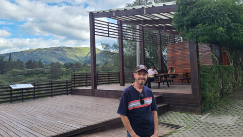
Here is a panoramic view I made here at the entry plaza for Los Algarrobos:
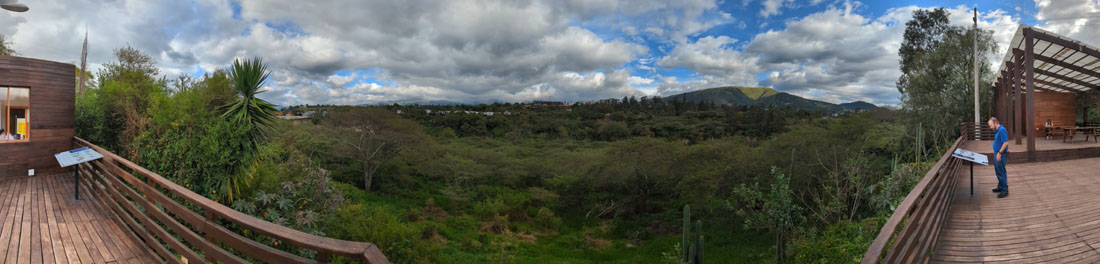 |
And here are two more views looking out over the park:
|
|
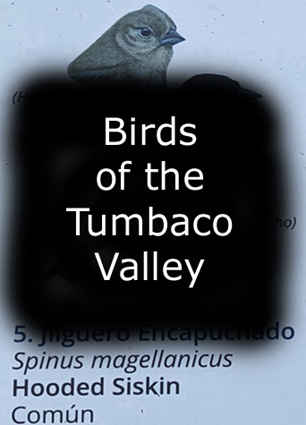
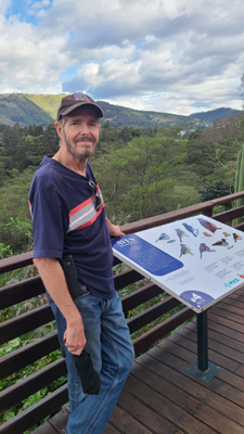
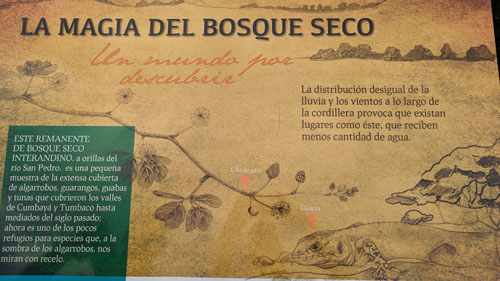
The entry plaza had a little cafe and also numerous signs describing the ecological area, the surrounding landscape, and especially the birds that call this area of the Tumbaco Valley home.
to View the Slideshow |
|
Chaquinan is located in the inter-Andean valley, between the western and eastern mountain ranges of the Andes, which is why it registers low rainfall and a warm temperate climate. This valley is made up of a dry forest dominated by bushes, cacti and small thorny trees such as the Algarrobos, the protagonists of the landscape.
Fortunately, our parks, gardens and every corner of our city still have the best neighbors, birds. Some help us control the abundance of insects and rodents by actively hunting them, others allow the arrival of new plants through seeds that they release in their feces. In addition, local hummingbirds are very important in the reproduction of plants by carrying pollen from one flower to another, forming seeds.
To view the slideshow, just click on the image at left and I will open the slideshow in a new window. In the slideshow, you can use the little arrows in the lower corners of each image to move from one to the next, and the index numbers in the upper left of each image will tell you where you are in the series. When you are finished looking at the pictures, just close the popup window.
There was other interesting signage around this area, and I'll let you have a look at those explanatory signs, providing translations below each one as necessary:
|
|
|
|
|
|
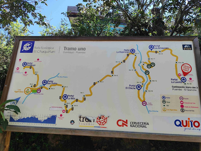
On the Chaquinan Ecological Trail
|
|
 |
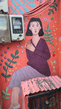
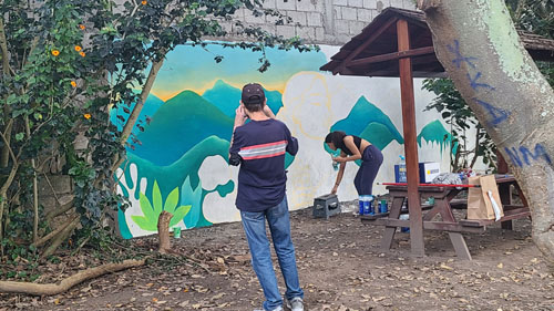
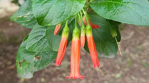
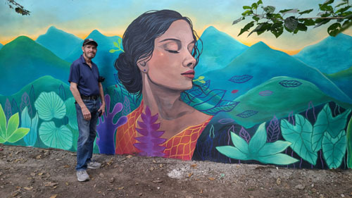
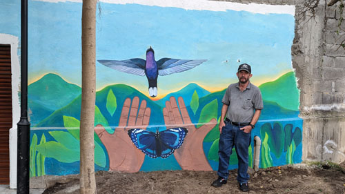
All along this segment of the trail, there are occasionally walls made of concrete or cinderblock, and almost every square inch of these surfaces has been painted with everything from simple graffiti "tags" to elaborate images and scenes. On one of our walks this time, we actually came across someone working on a wall mural. Here are some pictures we took of this wall art (and one picture of a floral interloper):
|
|
|
|
|
|
Today, we happened across an artist creating one of these wall murals- something novel, I thought. Have a look at the artist at work:
|
|
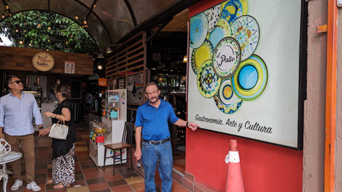
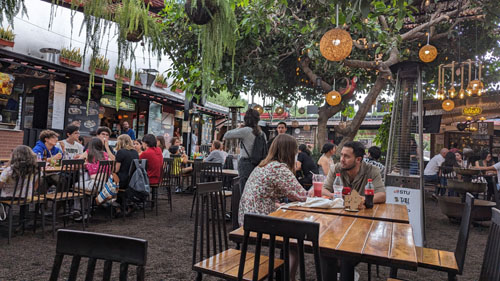
The Feria Gastronomica El Patio
|
On this trip, we wanted to visit the outdoor food court again (although not on the day the expat community meets) to have some lunch. So we walked down to Scala Mall following the new route I talked about above, and then we walked east along the street to a crosswalk that would take us to the foot of the street that led up the hill to El Patio. The hill is steep, so we had to take it a bit slow.
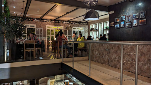
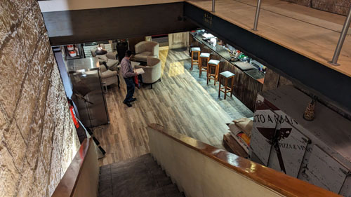
El Patio has a couple of entrances from the street, and at first you might think you are walking into a typical restaurant, but as soon as you come through the entrance you find yourself at an open courtyard with tables and chairs. There are a couple of trees in the patio, and a "roof" that is more like some shade fabric that covers part of the area.
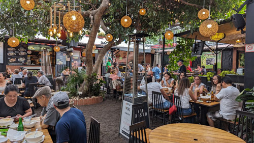
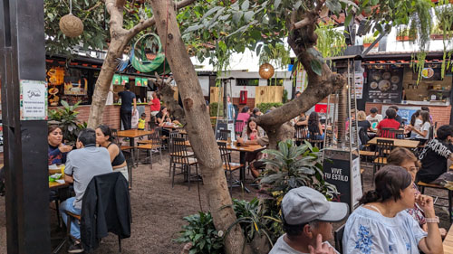
Surrounding this courtyard are some fifteen food establishments- everything from South American to Asian to hamburgers to Indian- that you can patronize. You basically pick what you want to eat, order and pay for it at the individual establishment, and then go find a place to sit in the patio. Eventually, your order is brought to you.
The first time we were here, there were only a few tables occupied aside from the expat community members, but today El Patio was quite busy. One of the reasons was that there was another large party occupying a long string of tables; it turned out to be someone's birthday party. Fred picked some Indian dishes, and we had a really good lunch. While we were eating, I took some photos of the area:
|
|
|
|
As is often the case, still pictures only tell part of the story; sometimes a short movie or two can give a better flavor to what is being photographed, and I thought that a short movie of El Patio would be interesting:
|
|
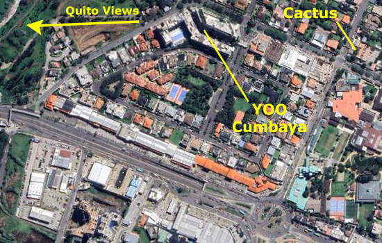
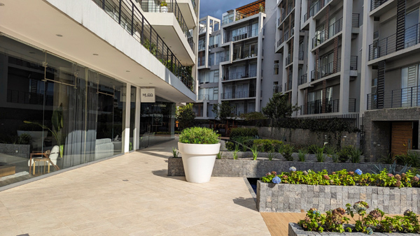
The Block of Plaza Cumbaya
|
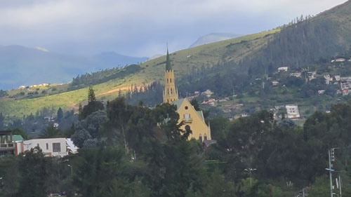
We often walk around this block just for exercise, or after having a meal; walking counterclockwise around it from the traffic circle brings us by YOO Cumbaya, a really beautiful residential complex, a place across the street from it that offers views up towards Quito itself, and, at the extreme west corner of the block, Baguette, a bakery and restaurant that is an excellent spot for some lunch. In the interior of the block, hidden away, is a gated residential community.
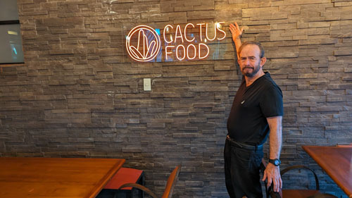
On this trip, we took pictures when we had a dinner at Cactus Food, when we walked by YOO Cumbaya, and when we stopped to have a look way up the side of the valley to the crest of the hills that separate the Tumbaco Valley from Quito proper.
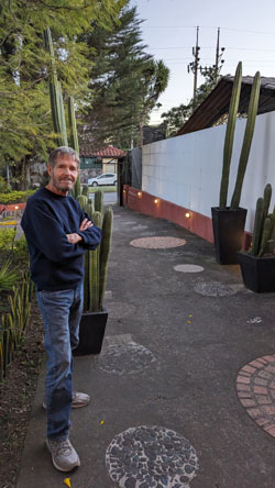
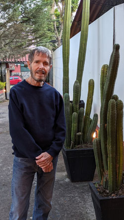
Cactus Food
|
 |
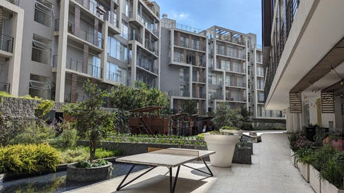
YOO Cumbaya
|
|
Let me borrow a description from YOO's website:
| "Yoo Cumbayá marks the entrance to contemporary Cumbayá. The combination of businesses and residences marks a milestone in responsible sustainable development. The office built faces the bustling avenue with pedestrian and business activity. The building forms a parallelogram suspended on a glass base. Linear volume is defined at a corporate and technological scale. The points of the parallelogram become monumental frames that mark the importance of the corners and public space. Framed inside are various terraces that create double-height spaces. The terraces contribute to creating an informal and pleasant component in the similar workplace to what defines the creative environment of Silicon Valley." |
Here are some of the pictures we took of the complex:
|
|
|
|
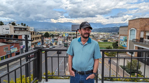
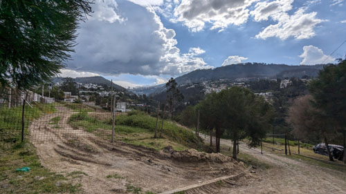
Views of Quito
|
|
The Trip Home
But none of that we evident as we got on our American Airlines flight and began the process of taxiing out to the runway. We took some pictures before the takeoff and once we were in the air. Mariscal Sucre Airport is certainly scenic, as you can see in the pictures below. Have a look at as many as you wish.
|
Fred and I were sitting on opposite sides of the plane, and both of us made movies of our takeoff. Both are interesting and show off to good effect the beautiful landscape of the Ecuadorian highlands:
|
Fred's Movie |
My Movie |
The flight to Miami, and our progress through customs were uneventful. In fact, using the new Mobile Passport Control app, we breezed through Miami customs in record time. It was only after we got to the gate that things took a darker turn. We were late boarding (never a good sign) and after we'd pulled away from the gate, we just stopped on the tarmac. The captain came on the PA to announce that due to storms in Dallas, DFW Airport had initiated a "ground stop", which means that no flights to DFW can take off from whatever airports they are coming from.
The captain went on to say that he was working to see if we could get an exception and go ahead and begin our trip, but a helf hour later he came back to announce two things. First, he'd been unable to get permission to take off. And second, we couldn't take off anyway as the entire crew would knowingly become "illegal" (worked more hours in a day than is allowed) during the flight. If we were to take off at all, a new crew would be needed. So back to the gate we went to see if (1) we could take off and (2) we could get a new crew. Neither, after about an hour, turned out to be possible, so our flight (and two other earlier flights that were similarly delayed and then stuck) was cancelled.
At about midnight we found ourselves back at the American ticket counter to see about rebooking. The lines were long and the numerous gate agents that had been called back in to handle the situation were as frazzled as we were. We witnessed numerous loud, complaining passengers. When our turn came, the very first thing out of my mouth was to thank the agent for coming back in to help. The second thing was a suggestion. I suggested that since they had so very many passengers to try to rebook out of Miami, we could be flexible and let him rebook us out of Fort Lauderdale the coming Sunday afternoon. We said we would find our own way there and eschew a lodging or meal voucher.
|
|
We reached the condo about 1:30 in the morning on Friday, dropped our stuff, and headed down to the Floridian for some supper. We slept in on Friday, saw Ron Drew for lunch, and spent the weekend vegetating.
Our flight home was in the early afternoon on Sunday, and Ron Drew graciously offered to give us a lift to the airport. We got there in plenty of time for the flight which was, itself, uneventful, as the storms in Dallas had passed a day earlier.
I did make a movie of our takeoff from Fort Lauderdale, and you can use the movie player at left to watch it.
A late afternoon Uber ride home from DFW and our trip to Ecuador came to an end.
You can use the links below to continue to another photo album page.
|
June 8 - July 2, 2024: A Trip to Fort Lauderdale |
|
April 13-16, 2024: A Museum Trip to Houston |
|
Return to the Index for 2024 |