|
January 27, 1971: The Golden Course |
|
Return to the Index for the Japan Trip |
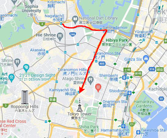
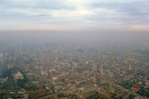
The next morning, the 15th, we got up early and packed our stuff, mailed slides, and such. Film and processing for this trip ran about $70. We checked out of the Sanno in preparation for an 1800 flight from Yokota air base back to Kimpo, and checked our bags there in the hotel. Then we decided to make another trip over to Tokyo Tower to go up to the higher observation area that we were not able to visit earlier in the trip. Unfortunately, the day was hazy, and so the pictures are not outstanding.
At Tokyo Tower
|
|
The Tokyo Tower (officially called the Japan Radio Tower) is a communications and observation tower in the Shiba-koen district of Minato, Tokyo. At 1,092 ft, it is the tallest structure in Japan. The structure is an Eiffel Tower-inspired lattice tower that is painted white and international orange to comply with air safety regulations.
Built in 1958, the tower's main sources of income are tourism and antenna leasing. The tower gets close to a million visitors a year; there is a four-story building directly under the tower that houses museums, restaurants, and shops. Departing from there, guests can visit two observation decks. The two-story Main Observatory is at 490 ft, while the smaller Special Observatory is at a height of 819 ft. The tower is repainted every five years, taking a year to complete the process. Since its completion in 1958, Tokyo Tower has become a prominent landmark in the city, and frequently appears in media set in Tokyo.
|
A large broadcasting tower was needed for the Tokyo region after NHK, Japan's public broadcasting station, began television broadcasting in 1953. Private broadcasting companies began operating in the months following the construction of NHK's own transmission tower. This communications boom led the Japanese government to believe that transmission towers would soon be built all over Tokyo, eventually overrunning the city.
The proposed solution was the construction of one large tower capable of transmitting to the entire region. Furthermore, because of the country's postwar boom in the 1950s, Japan was searching for a monument to symbolize its ascendancy as a global economic powerhouse.
Originally planned to be taller than the Empire State Building, a lack of both funds and materials kept the tower to a height just sufficient for the region's TV stations broadcast range- about 90 miles. The structure's designer, Tachū Naitō, based his design on the Eiffel Tower in Paris, but engineered the structure to withstand a 140-mph typhoon and twice the intensity of the 1923 Great Kantō earthquake.
The project attracted hundreds of the traditional Japanese construction workers who specialized in the construction of high-rise structures. Construction began in June, 1957; a third of the steel used was scrap metal taken from US tanks damaged in the Korean War. On its completion in October, 1958, Tokyo Tower was the tallest freestanding tower in the world, taking the title from the Eiffel Tower by nine meters. Its final cost was $8.4 million and it remained Japan's tallest structure until 2010.
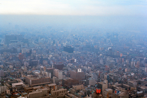
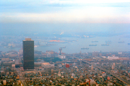
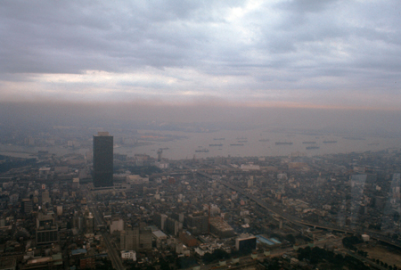
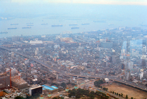
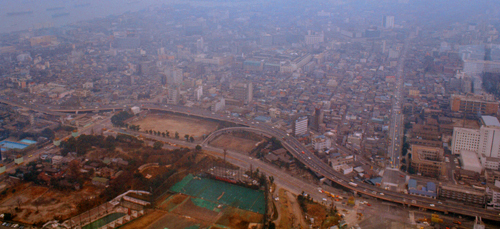
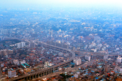
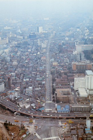
We again went all the way up to the Special Observatory (which required a change of elevators at the lower observation deck). It was only noontime, but the weather was very cloudy and threatening, and it seemed as if it were late afternoon, as you will see from the pictures we took. As with Mt. Fuji, the weather was not cooperating to allow us to get the kind of pictures we wanted. A good many of the pictures just recorded the sprawl of urban Tokyo:
|
|
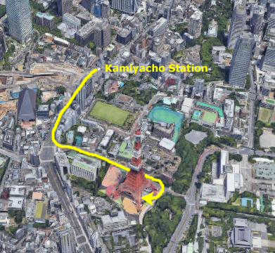
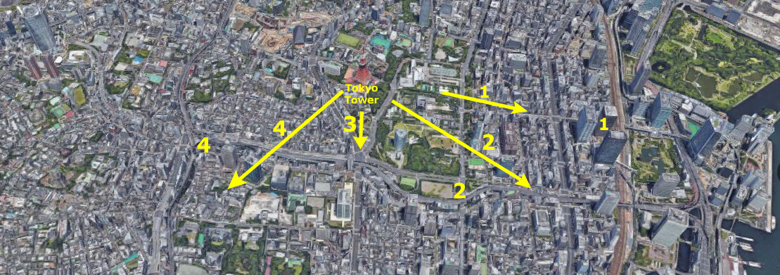
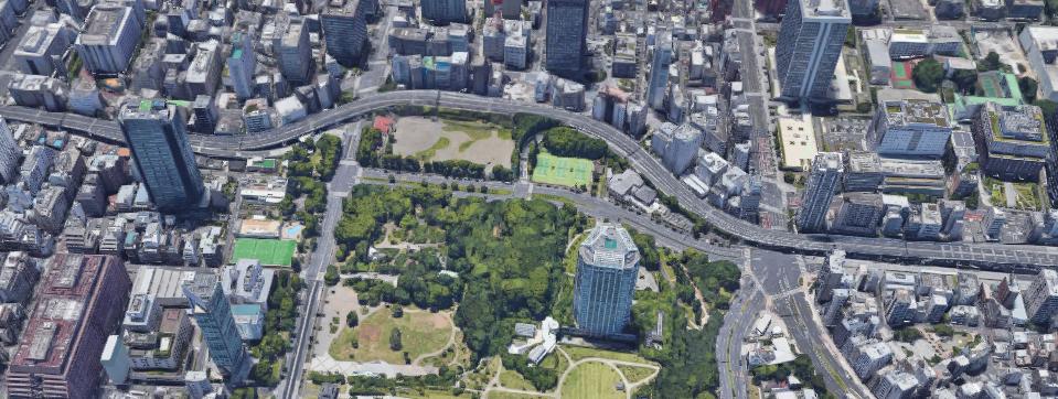
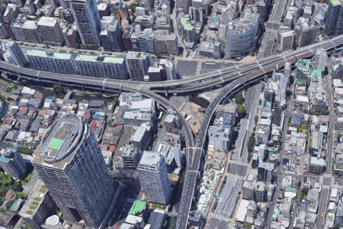
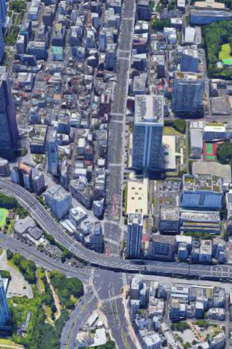
For the rest of the pictures, I'd like to do something interesting since I am creating this page in 2021. I have looked at the aerial view of the area around the Tower that is available to me now. That view is below:
|
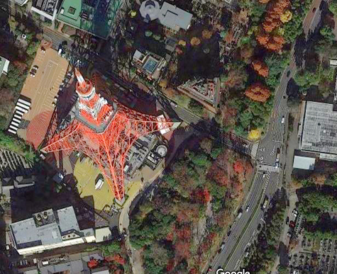
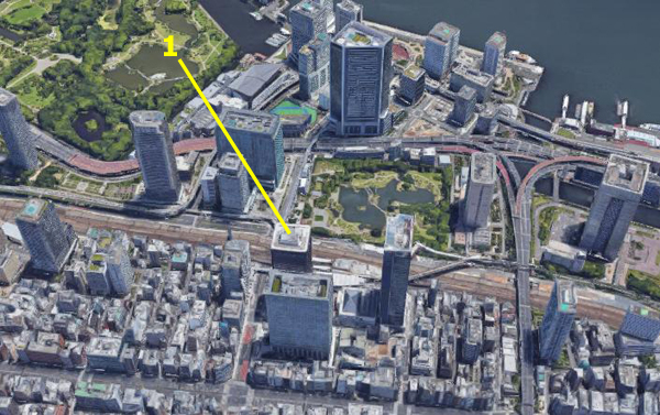
On this view I have been able to pick out many of the features that have not changed in the half-century since these pictures were taken, and what I've done is to relate some of the pictures that I took in 1971 to the aerial view of the same area from fifty years ago.
|
|
Take a look at the pictures above. You will see a lone new skyscraper, basically square, at the left side of the picture. Using that building as a focal point, I started to compare the picture I took to the lay of the land today.
|
At left, I have zoomed in on today's aerial view and then rotated it so that the perspective is generally the same as the one looking from the tower, and I have again marked the square building in the picture with the same number in the more expansive view earlier.
Now you can see clearly that while building (1) was a lone development fifty years ago, it is now dwarfed by the many, many highrises that have been built in the same general area. My guess would be, of course, that in addition to the new highrises, most of the lowrise buildings, shops, and stores may well have been replaced or renovated in the half-century since my visit to the tower.
In the smaller, darker view above, you can just make out the open land left of the tall building; it appears as a very nice park in today's aerial views. It looks as if a good deal of renovation happened there, too. It also looks as if some land has been reclaimed from the bay; and perhaps commercial shipping has been moved further out to allow for residential development closer in to the city center.
Anyway, as you may have discovered throughout this album (or will see much more of, if you happen to be going through this album chronologically), I have a penchant for relating places I visited many years apart together, using my pictures on one hand and current views on the other. I have already done this for my first partial year in Korea and now for my trip to Japan, but you will see this again and again as I relate places I visited over the next decade to those same places that I may have visited again after the turn of the millennium. One particularly interesting comparison that related to my time here in Korea will come on the album page for my visit to Seoul in 2018.
On that page, you will find some more juxtapositions between pictures I took in the city during my various visits last year and this, and pictures I took in 2018 when Fred and I visited the city ahead of a cruise from Singapore to Barcelona. I find it immensely interesting to see how long some landmarks last (and how some thing change dramatically), and so I find these comparisons intriguing.
|
|
In 1971, I thought that perhaps this was going to be an area to be developed into some sort of commerical complex, or maybe a park or something like that. When I looked at approximately the same view in 2021, though, I found the open space still there, and no development having been done (you'll notice the swimming pools in the lower left of my picture are gone, too):
|
 |
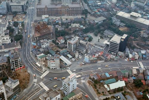
Now here is another example. The view at left, taken from the tower today, looks almost due south down a major street; there is an intersection right below the tower, and it is crossed left to right by the same expressway that goes around the open area southeast of here. At right is the aerial view from 2021. You can see that the intersection is basically the same, with the same expressway crossing over the south portion of it. The differences seem only to be the appearance of a few highrise towers sticking up from the various low buildings that may or may not have been updated. |
 |
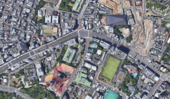
For the next example, refer to the big aerial view up this page and find the #4 view from the tower. I have marked the location of a highway interchange at #4 on that view as well. What we were looking at was essentially a T-intersection between two major highways. To keep the interchange from taking up too much space, as each of the three highways approach the interchange point, the two directions get onto two different levels, directly on top of each other. My picture is on the left, and the current aerial view is on the right:
|
|
This method of stacking the roadways, which is a little difficult to describe, keeps the space required for the interchange down to the minimum. I was intrigued enough to take out my new telephoto and take a closeup picture of the center of the interchange so you can see more closely what is going on. One thing of note is the row of midrise buildings just north of the highway and just left of the interchange. They appear in my picture AND in the aerial view, and so at least these buildings have stood the test of time.
|
|
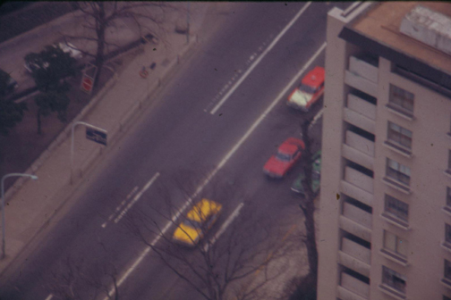
Finally, with my telephoto still on the camera, here are a couple more views of areas on the ground quite close to the tower:
|
|
We ran out of time at the tower, and about 2PM we left to head back to the hotel to retrieve our belongings and then take the train back out to the airfield for our flight home.
Returning to Korea
We signed in at the air terminal (which also brought our usage of leave time to a close), and then took a quick walk back to downtown Fussa to the bakery. Our flight was posted for a 1935 departure, so we settled down to wait, eating dinner in the base cafeteria right in the terminal. We found a couple waiting for space-available flights, and played hearts for an hour until our flight left.
The flight back on the 727 was uneventful, and we landed at Kimpo about nine, and shared a taxi with two other people back to Camp Howze, where we signed in about ten-thirty, stopped by the Officer's Club for a drink, and then headed up the hill to the BOQ and sleep.
Thus endeth the first trip to Japan. It was, in retrospect, an amazing experience.
Postscript
When I return I would like to see some of the rural areas in Japan that are not tourist attractions, and I would like perhaps to see Hiroshima, the Southern Islands, Osaka, Kyoto and/or Sapporo. I know now how to get around and plan these things, and the next time I won't have to take up time shopping for myself or for others.
You can use the links below to continue to another photo album page.
|
January 27, 1971: The Golden Course |
|
Return to the Index for the Japan Trip |