|
April 28, 1971 (approximate): A Money Run to Seoul |
|
April 1 & 17, 1971: Second Division Moves to Camp Casey |
|
Return to the Index for 1971 |
As I have done frequently since I have been in-country, I am taking advantage of another Saturday afternoon to make a trip into Seoul. With the move of the Second Division HQ to Casey, I am some distance from the flagpole, and so am more in control of my own time. Still, I can't just take off on a weekday; that would surely be the one time that MAJ Henderson would try to get hold of me.
|
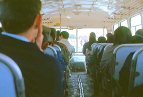
The inside of a modern Korean bus is pretty similar to the inside of any other bus, and so the picture at left is probably unnecessary. Still and all, the bus is comfortable and runs on time. The term "kimchi bus" refers to the older buses that run on rural routes (and many routes into Seoul). These buses are less modern, and seem to spew an inordinate amount of smoke and exhaust. It is a crapshoot as to which bus you'll get at any particular time. This morning I was fortunate to get a newer one.
|
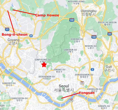
Whichever route the bus follows, it always enters central Seoul through the West Gate (Donuimun), one of the Eight Gates of Seoul in the Fortress Wall that surrounded the city in the Joseon Dynasty. I did not photograph that gate today, as I have previously done so on some of the money runs into town that I made to pick up or drop off cash at Yongsan.
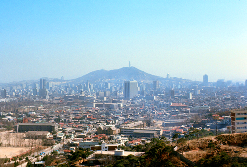
The city, of course, no longer ends at the Fortress Wall; indeed, most of the Fortress Wall no longer exists (and a few of the gates don't, either). The actual gates, now some 500 years old, typically stand in the middle of wide boulevards now, and are considered historical monuments.
I usually take the bus through (or by) the gate and then about a mile down the road we come to a major bus stop. Although the bus I am on continues almost to Yongsan, I always get off at this major stop (marked on the map with a red star) and then walk the rest of the way to the Yongsan Compound. I do this because it gives me a chance to take a different route each time, wandering through this neighborhood and that, across hillsides, and past major historical and cultural sites. I can usually see Namsan Mountain in the center of Seoul from just about anywhere I am, and I know that Yongsan is not far from it. So getting lost is not an issue.
Note from 2021:
I would like to be able to show you maps or aerial views with the actual routes I have taken through the city, but at this point the resources that are available to me now show Seoul as it is today, not as it was fifty years ago. Save for the historical or cultural sites I have already shown you in this album that still exist today (and a few other buildings and streets that are also still in existence) however, trying to do so has been relatively unsuccessful. But not knowing exactly where my pictures were taken will not, I hope, keep you from finding them interesting.
|
|
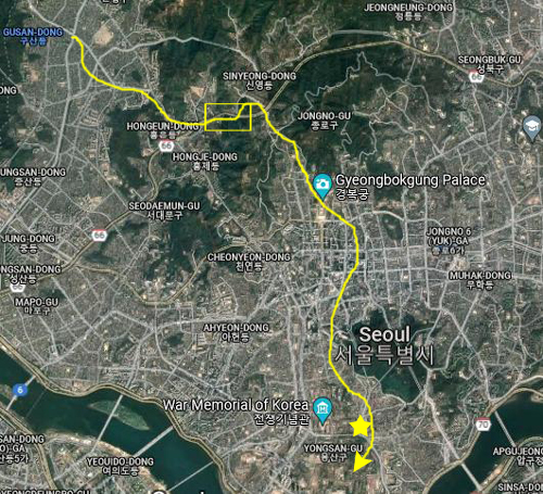
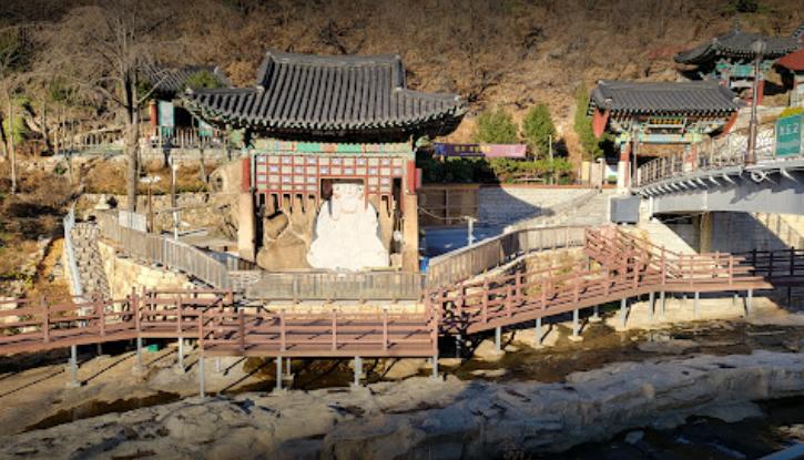
So in creating this page, I looked at the aerial view on Google Maps and worked my way along the hillside that I thought I might have traversed. Lo and behold, I found that when I zoomed in enough, the exact spot I had photographed was actually labeled on the aerial view.
You can see what I found if you click on the small yellow square on the aerial view above, left. When the closer-up image pops up, note that I have marked the Okcheonam itself, and have located on the aerial view the spot where the women were washing clothes in my image.
|
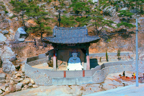
The image is a realistic depiction of the characteristic features of a bodhisattva, including the graceful lines of the hands displaying the dharmacakra mudra and the heavenly robe draped across both shoulders and falling to the chest where it forms X-shaped folds. It nicely preserves the typical features of Buddhist sculpture of late Goryeo, making it a good source of knowledge on Korean Buddhist sculpture of that period.
I think it interesting to note the changes that have been made around the sculpture and the building that houses it in the last 50 years. But it is also interesting to note what has NOT changed, and that is MOST of what I photographed in 1971. Of course, Seoul has modernized enough so that I expect that none of its residents need to bring their clothes to the small creek that runs along Okcheonam to wash them.
So, I can place at least the first part of my walk using the location of Okcheonam. The next waypoint, however, was mundane enough so that I needed some help to locate it.
|
As I have done before, I decided to send a copy of this picture to a couple of organizations in Seoul that deal with the history of the city- one museum that seems to have an extensive image collection, and one historical society. Fortunately, both organizations had email addresses.
It took a few days, but the museum emailed back that the building, which is no longer there, was actually a Seoul City office building that was indeed in the district near Yongsan. The museum told me that according to their records, the building and the surrounding area has been completely redeveloped and is now right in the middle of the new, modern downtown Seoul core.
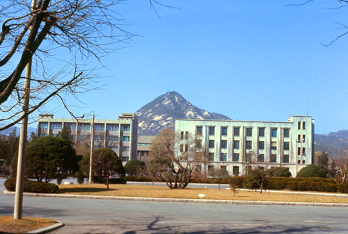
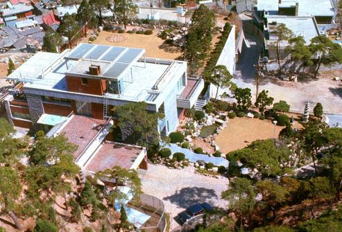
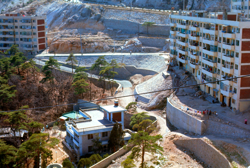
So these two waypoints enabled me to "connect the dots" on today's walk through Seoul down to Yongsan. I did take some other pictures today, but none of them are identifiable. I suspect that much of what you will see in them either no longer exists or has been modified out of easy recognition or comparison to my photos. So I will just include these other photos with the exact narrative that I sent home to accompany them:
|
|
|
|
You can use the links below to continue to another photo album page.
|
April 28, 1971 (approximate): A Money Run to Seoul |
|
April 1 & 17, 1971: Second Division Moves to Camp Casey |
|
Return to the Index for 1971 |