|
June 16, 1971: Hiroshima, Japan |
|
Return to the Index for the Japan Trip |
The last stop on my tour of southern Japan was Itsukushima, also known as Miyajima, a small island in Hiroshima Bay. It is known for its forests and ancient temples. Just offshore, the giant, orange Great Torii Gate is partially submerged at high tide. It marks the entrance to the Itsukushima Shrine, which was first built in the 12th century. Nearby, the Museum of History and Folklore has cultural artifacts in a 19th-century merchant's home.
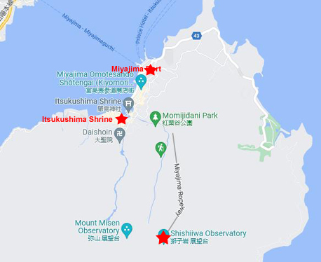
Getting to Miyajima
|
|
I took pictures in three general areas. First, I took some pictures in and around the port area which (at the time I visited) was also most of the town itself. (Not so today, as the entire area between the port and the shrine has been developed.) I also visited the Itsukushima Shrine, and you will see a number of pictures of it. Finally, I took the ropeway (cable car) to the top of Mt. Misen and the Shishiiwa Station and Observatory.
The Port and Town of Miyajima
|
Itsukushima (popularly known as "Miyajima", Japanese for "Shrine Island") is located in the western part of the Inland Sea of Japan, located in the northwest part of Hiroshima Bay. Itsukushima is mountainous and sparsely settled. It has an elementary school and a middle school. There are no traffic signals. It is rural and mountainous, only 11 square miles, with a population of around 750 full-time residents, most of whom live around the actual shrine in Miyajima town. The island is part of a large national park/nature preserve; it has no cities, only small towns with simple houses and privately owned shops. The islanders work hard to preserve the forests and respect nature. The only way on or off the island is via one of the scheduled ferries.
The island contains the Miyajima Natural Botanical Garden on its north coast. As it turned out, the photo I took of the north end of the island is actually a photo of most of the area covered by the Botanical Garden.
|
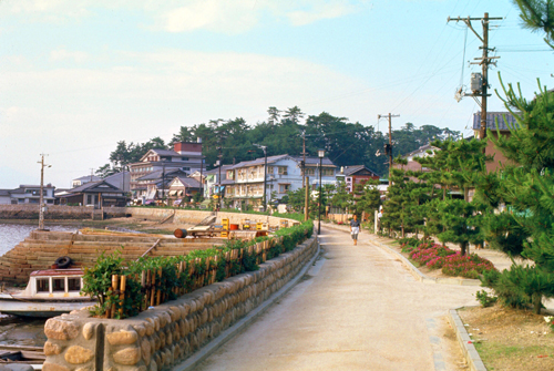
My guidebook described the main street (in fact the only street) leading up from the ferry dock very accurately. It was indeed lined with garish souvenir stands, almost all selling the same postcards, dolls, gaily-wrapped rice candles, and towels whose nude illustrations become visible only when wet.
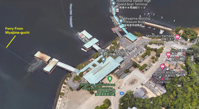
The buildings were almost all small wooden structures. I think that the relatively new bank and post office were the only stone/concrete buildings in the entire town. And the small area by the port was quite crowded, as the ferry I came over on is one of three or four ferries that come here from various places- one from the port of Hiroshima itself.
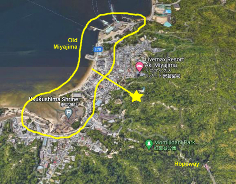
In placing the pictures I took here in Miyajima town, I tried to investigate to see where some of them might have been taken, and perhaps find aerial views or maps that would match. This proved fruitless, however, as in 2020 Miyajima is over five times as large as it was when I visited.
|
|
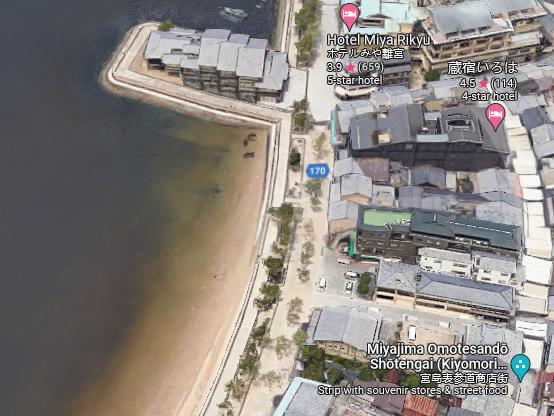
But I want to point out here that my photo showed just about all the buildings that existed in Miyajima when I visited. Behind the row of buildings along the shore (to the right in my photo) there were a few houses and such, but little else. In the aerial view above right, however, you can see that the entire area has been built up. I've circled the area of buildings that were there in 1971, and you can see how much the area has grown.
|
But in the closeup aerial view at left (again circa 2020), you can see that that whole area has been renovated, and the boats moved elsewhere. I suppose this is due to the population growth in the area, but today the waterfront at Miyajima is much different.
Looking at the structures in today's aerial view, and comparing them to the photo I took of this same area, it seems as if most of them have been either dramatically enlarged or rebuilt altogether. This is not surprising at all, as it has been more than a half-century since my visit.
But I always think it is interesting when I compare many of my old photographs to the way places are today. Locations like the Miyajima waterfront have usually changed dramatically, but in a bit, when we get to the Itsukushima Shrine, you will find that these historic buildings and their locale have changed very, very little.
So the town of Miyajima was very small and very picturesque- kind of a sleepy backwater when compared to the bustling cities of Tokyo, Kyoto, Osaka, and Hiroshima. I continued walking down towards Itsukushima Shrine, and along the way took a couple of additional pictures:
|
|
The Shrines
|
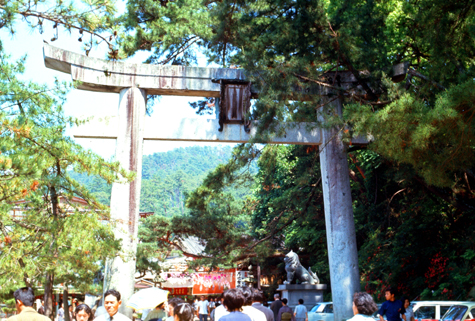
Entrance to the shrines complex was through a large torii gate, and you can see my picture of it below:
|
Toyokuni Shrine
|
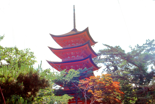
Daimyo Toyotomi Hideyoshi (1537-1598) gave the order to build Senjokaku in 1587. He wanted a place for chanting Buddhist sutras for fallen soldiers. He died in 1598 before the shrine was completed. Actually to this day the shrine is still unfinished. Senjokaku was designated as a Specially Preserved Building in 1910. In 1963 the Japanese Government gave it the status as an National Important Cultural Property.
Originally, Amitabha Buddha and two Buddhist saints, Ānanda and Mahākāśyapa, were enshrined in the structure. But at the time of the Meiji reformation, the structure was converted into a Shinto shrine dedicated to Toyotomi Hideyoshi. Numerous votive picture tablets that had been hanging in the Itsukushima Shrine buildings until the Meiji era, have been hung on the walls inside the hall.
Not every shrine here is Shinto; one that I did not visit (as it is only for Japanese) is Daiganji Temple, dedicated to the Goddess Benzaiten as well as three Buddhas important to Shingon Buddhism. This Japanese Goddess is thought to be the same as the Goddess Saraswati in Hinduism; she is the Goddess of eloquence, music, arts, wealth and knowledge.
|
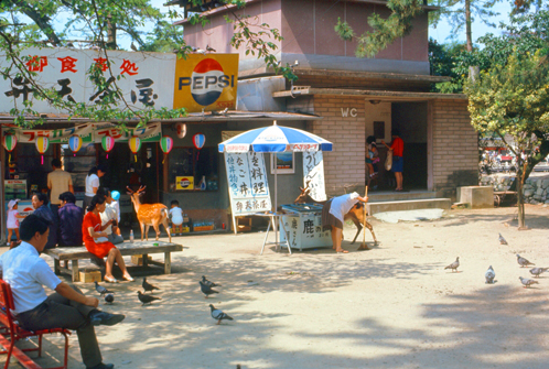
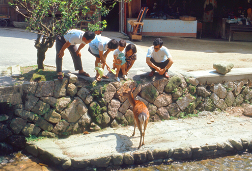
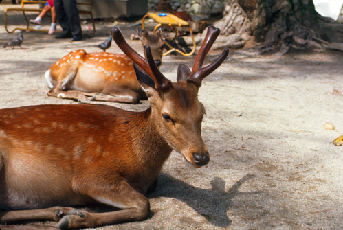
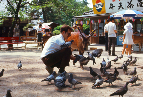
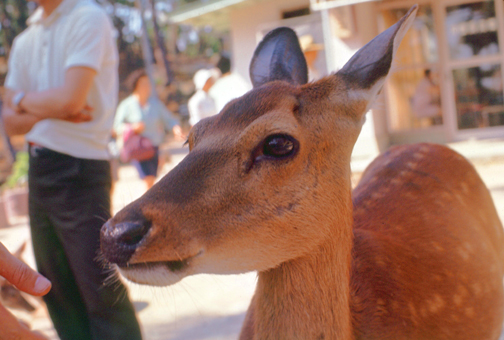
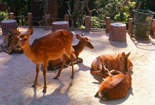
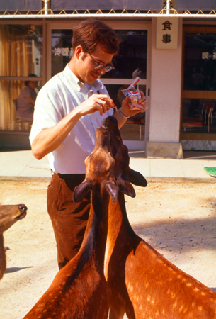
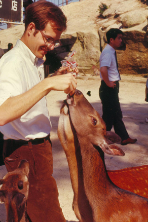
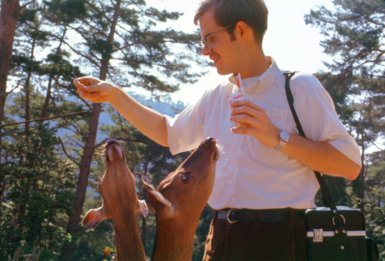
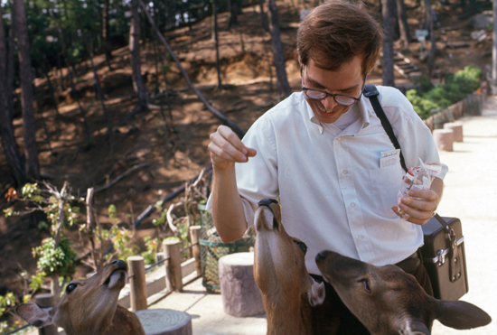
Between the Toyotomi Shrine and Itsukushima there is a little park with tame animals, deer and birds, for whom you can buy food for and feed out of your hand. There were lots of kids around as it seems like a popular place for families.
Deer roam freely in the little park. Deer are thought of as sacred in the native Shinto religion because they are considered messengers of the gods. They walk the streets of the city, not afraid of the tourists.
|
|
I took some time to buy food and feed the animals. The birds weren't timid, and it was startling when ten or twenty descended on your outstretched hand to eat the food you could hold.
|
|
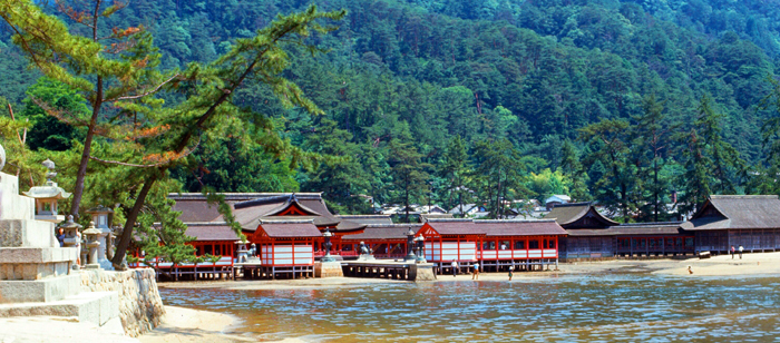
Itsukushima Shrine
|
It was not uncommon during the 16th century for daimyo to build shrines or take on other architectural projects in order to "reflect their power and splendor." The daimyo Kiyomori was at the height of his power when he established the Taira dominion over the island. He ordered construction of the main hall of Itsukushima shrine as a display of reverence for the god of navigation and to serve as a base for maritime activities. Miyajima soon became the Taira family shrine. Supposedly, Kiyomori chose the location also for the reason to further establish himself in the aristocracy as one who deviated from the social norms of Shinto pilgrimage. He lavished great wealth upon Itsukushima, and he enjoyed showing the place to his friends and colleagues, or even to royal personages.
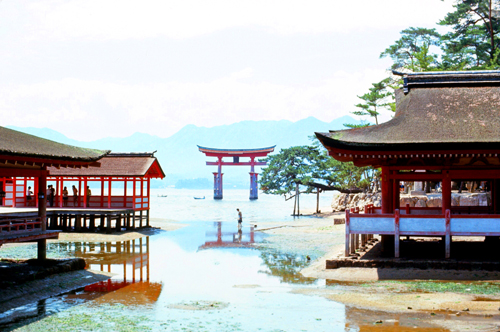
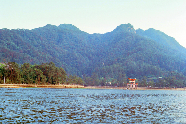
It is also said that Kiyomori rebuilt the shrine on account of a dream he had of an old monk who promised him dominion over Japan if he constructed a shrine on the island of Miyajima, and pay homage to its kami who are enshrined there for his success in life. The renovations funded by the Taira allowed for Itsukushima to grow into an important religious complex. My first view of this complex came when I walked out to the end of the point of land opposite the Torii Gate out in the water, and was able to look to my southwest to see the shrine spread out along the shore.
|
In reading this information in my guidebook, I was struck by the similarity of these architectural principles to the rise of the "form follows function" school of architecture in the United States, and particularly the architecture of Frank Lloyd Wright, who was famous, in part, for incorporating the landscape into his structures- particularly those in rural settings such as Miyajima.
much of it donated by patrons. |
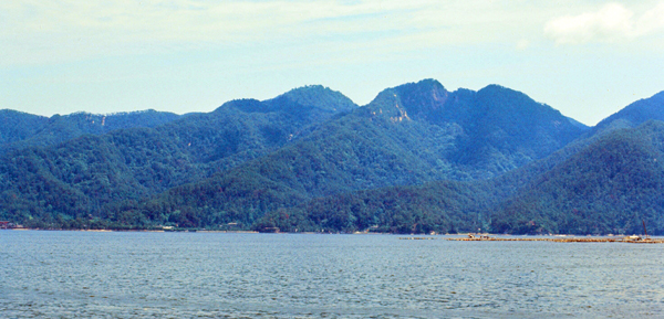
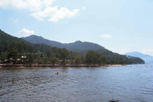
The Itsukushima shrine is dedicated to the three daughters of the Goddess Susano-o no Mikoto, known as the sanjoshin or "three female deities". These Shinto deities are the goddesses of seas and storms. Kiyomori believed the goddesses to be manifestations of Kannon, and therefore the island was understood as the home of the bodhisattva. In Japanese, Itsukushima translates to mean "island dedicated to the gods". In fact, the island itself is also considered to be a god, which is why the shrine was built on the outskirts of the island. Adding to the sanctity of the site is Mount Misen- and 1,800-foot peak.
The shrine complex itself consists of two main buildings: the Honsha shrine and the Sessha Marodo-jinja, as well as 17 other different buildings and structures that help to distinguish it.
in this part of Japan in the very early Summer. |
Originally Itsukushima was a pure Shinto shrine where no births or deaths were allowed to cause pollution. Because the island itself has been considered sacred, commoners were not allowed to set foot on it throughout much of its history to maintain its purity. Retaining the purity of the shrine is so important that since 1878, no deaths or births have been permitted near it. To this day, pregnant women are supposed to retreat to the mainland as the day of delivery approaches, as are the terminally ill or the very elderly whose passing has become imminent. Burials on the island are forbidden.
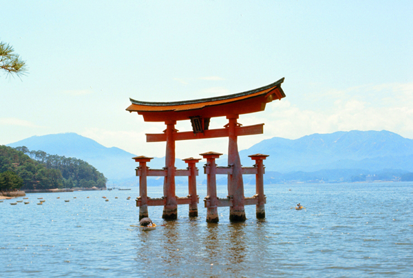
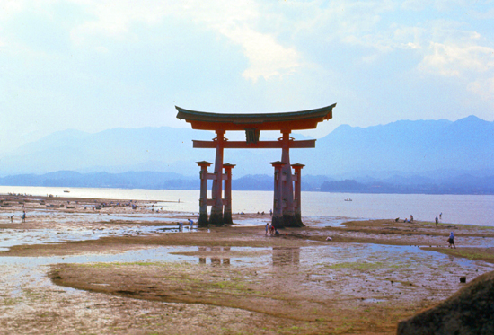
To allow pilgrims to approach, the shrine was built like a pier over the water, so that it appeared to float, separate from the land. The red entrance gate, or torii, was built over the water for much the same reason. Commoners had to steer their boats through the torii before approaching the shrine.
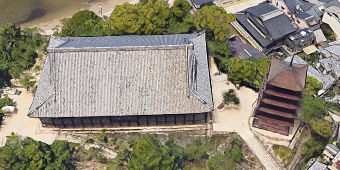
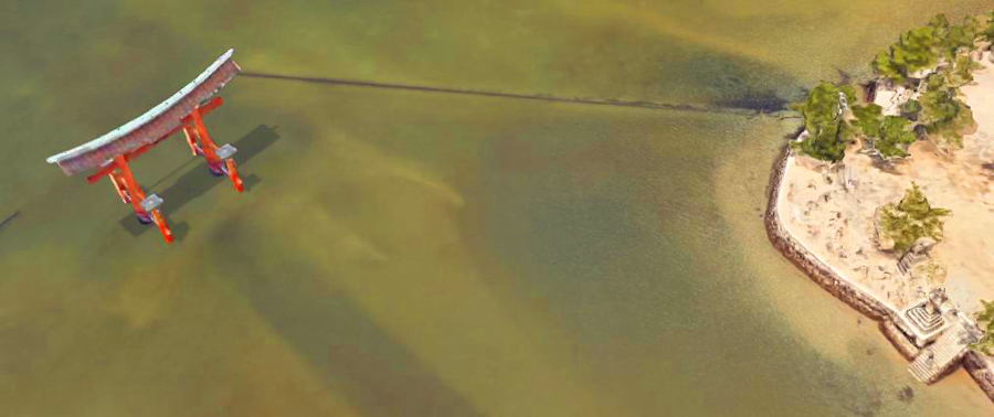
The most recognizable and celebrated feature of the Itsukushima shrine is its fifty-foot tall vermilion otorii gate ("great gate"), built of decay-resistant camphor wood. It stands some 400 feet out from the shrine itself, and on the aerial view you can see that there is a pathway constructed to it, although that pathway is only visible (or usable) at low tide.
|
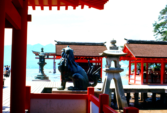
Of course it is interesting to see the gate from this angle, and we'll talk more about the gate itself in a moment. But also interesting in this picture is the stonework in the lower right. It looks like a multi-tiered "cake" or someting, right there at the edge of the water.
Why is this stonework interesting? If you go back up the page and look at my picture of the shrine itself, the one taken looking across the water, you will see that same stonework in the lower left corner of my picture! So that stone structure has stood the test of time, appearing both in my 1971 picture and in a 2021 aerial view.
When I took that picture earlier on this page, I was standing just northwest of that stone pyramid, and you can just see some of the levels of it in my picture. I also want to point out that I have some pictures of the torii gate and of the shrine when the tide was in and when it was out. That's because I took some pictures before my ascent of Mount Misen and others after I came back down. The gate was surrounded by water when I first arrived on the island, but by the time I came back down from the peak it had pretty much gone out.
|
In fact, this is one of the largest Torii gates in Japan, and sits in the water a short distance from the Shrine. At night, powerful lights on the shore illuminate the torii. Although the gate has been in place since 1168, the current gate dates back only to 1875.
|
When I visited Miyajima, only Japanese could actually go into the shrine buildings, which is why I don't have any photographs taken inside them. I might note that sometime since my visit this policy was changed, and now, anyone can go visit the shrine and wander through its buildings for 300Y (about $2.50).
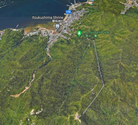
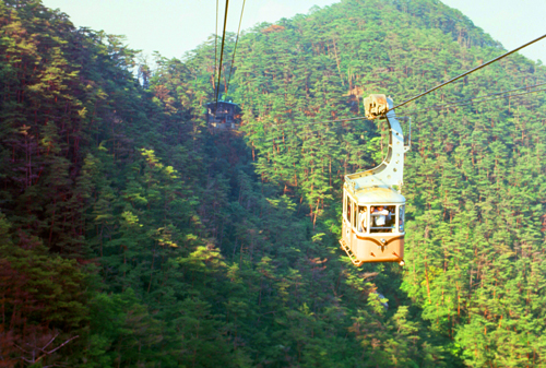
The Trip to the Top of Mount Misen
|
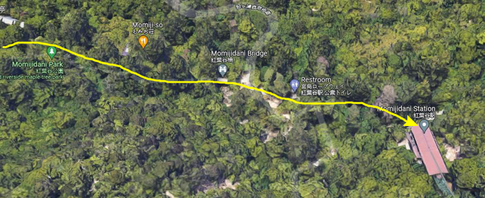
While the guidebook also pointed out that a bus from the center of Miyajima to the base of the aerial ropeway leaves every 20 minutes, it recommended walking through the lovely woods in at least one direction. It said I would pass "streams and waterfalls and a beautiful ryokan". I decided to walk to the station and perhaps take the bus back.
The woods appeared to be mostly maple trees, and the guidebook said that Miyajima's maple trees are renowned throughout Japan and blanket the island in crimson in the autumn.
It went on to say that Momiji manjū, pastries filled with azuki jam or custard, are popular souvenirs and carry maple-leaf emblems. Many other varieties such as chocolate and cheese are also popular with Japanese tourists. Because the island is seen as sacred, trees may not be cut for lumber.
|
|
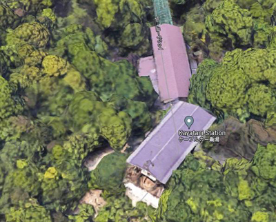
Because of the topography here, running the cable in a straight line to the top of the mountain was impossible, so there is an intermediate station (Kayatani Station). There, one gets off the first cable car, walks a short distance from terminal to terminal, and then gets on the second leg.
The whole process is pretty interesting. The cable cars I rode on my two trips to Japan were the first I had ever been on (not being a skier).
The whole trip to the top took about twenty minutes as the cable cars go pretty slowly.
|
|
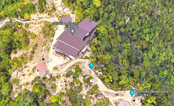
Looking at that aerial view of the station, the actual mountain peak was out of the picture to the left, but you can see the beginning of the trail that led over to it. I thought I would make that my first destination, so I headed off on the trail. I quickly met yet another young Japanese who seemed eager to walk along with me- the the students in Kyoto. This made the 20-minute walk go by pretty quickly.
|
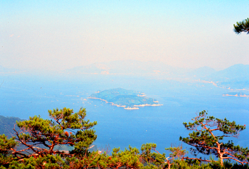
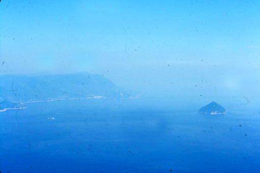
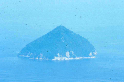
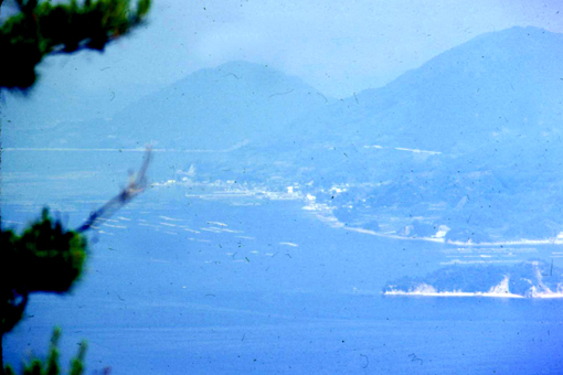
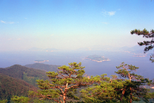
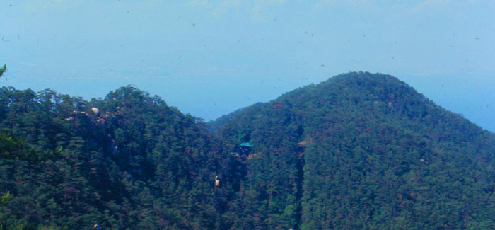
The island of Itsukushima, including the waters around it (part of Seto Inland Sea), lies within Setonaikai National Park. From the top of the peak we had views of dozens of pine-covered islands half shrouded by the mists far below.
I brought my telephoto lens with me, and I tried to use it to get some closer views of the islands around me, but the mists were such that with the extreme telephoto the pictures were, for the most part, a bit blurry and indistinct. But here are some of the pictures that turned out good enough to see:
|
|
|
|
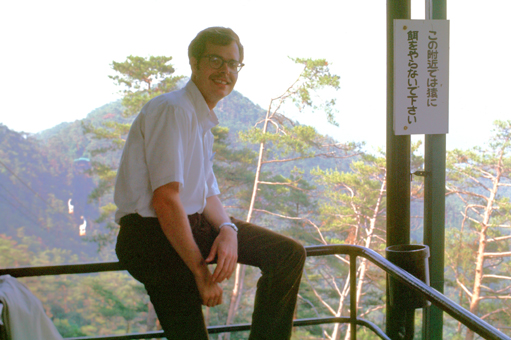
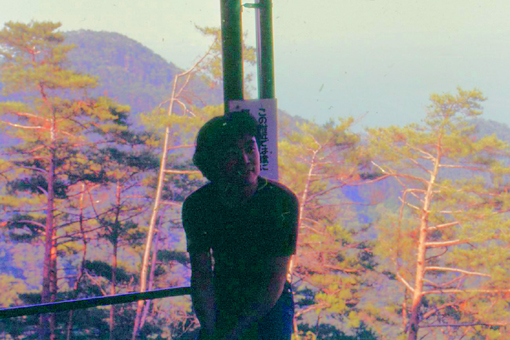
The young man I met on the trail (who I recall was a designer for Toyota) was nice enough to take a picture of me here on the mountaintop, and I also took his picture. Neither one of us was expert enough to know that backlit subjects need a flash:
|
|
If I travel much in the future, I should carry a little notebook where I can write down details of who I meet and what I do. Most of my picture narratives were written months after the pictures were taken. After a while, I returned along the trail to wander around the area by the cable car station.
|
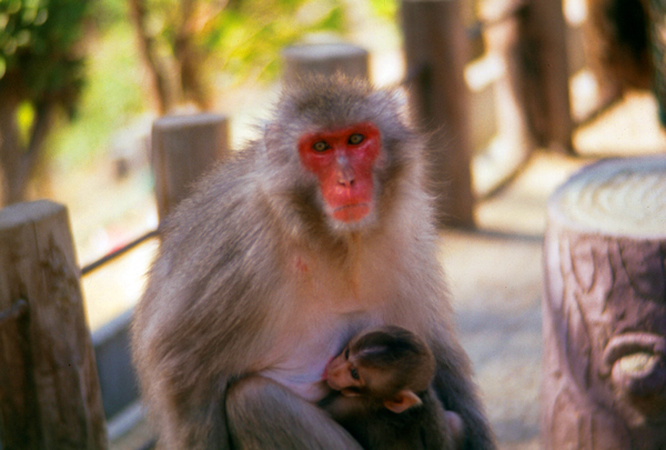
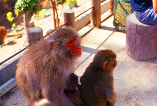
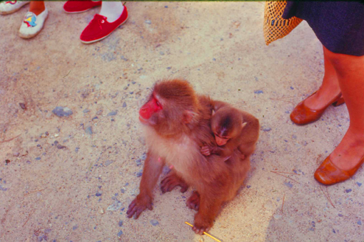
The scores of small monkeys which are being studied under some scientific project of the Institute of Primatology. They're so eager and so smart that when you put 10Y into the slot machine to get them some peanuts, they'll sometimes open the slot and grab the packet before you can.
At left you can see one of the many monkeys, along with a member of the next generation, that are roaming free around the observation area on top of the mountain. You could buy stuff to feed the monkeys and deer and birds, but the monkeys would eat anything.
At one point I bought an ice cream cone for myself, and I had my back to one chimp who took a running start, clambered over my back, and pushed off from my shoulder to grab the cone and be gone with it before I even realized what had happened!
I took quite a few pictures here, and I also prevailed on the young man who I met on the trail to take some of me feeding the animals. The deer were considerably more polite than the monkeys!
|
|
|
|
|
|
|
|
Returning to Hiroshima
|
The cable car arrived presently, and I boarded for the trip back down. It was a smooth ride, and when I got to the bottom I decided to again walk back to the town.
The path brought me back to the shrine area, so I walked along the shore to the port to wait for the next ferry back across to the mainland.
|
As the ferry left Miyajima, I was able to maneuver to a spot on the boat from which I could get a nice picture looking back towards Itsukushima Shrine and its red torii gate sitting out in the water.
Then I settled into my seat and just a few minutes later was getting off the ferry and walking back to the Miyajima-guchi train station. There, it was an easy matter to read the train station signs and find the platform for my train back to Hiroshima Central Station.
About an hour later I was walking from the station back to the Hotel New Hiroshima for my last night here in Japan. I had a good supper at a little Japanese restaurant about a half-mile from the hotel.
Returning to Camp Howze
This had been another amazing trip; about the only thing that would have improved it might have been to have a companion along for it.
You can use the links below to continue to another photo album page.
|
June 16, 1971: Hiroshima, Japan |
|
Return to the Index for the Japan Trip |