|
April 29 - May 7, 2022: A Househunting Trip to Ecuador |
|
December 28, 2021 - January 17, 2022: Our Winter Trip to Florida |
|
Return to the Index for 2022 |
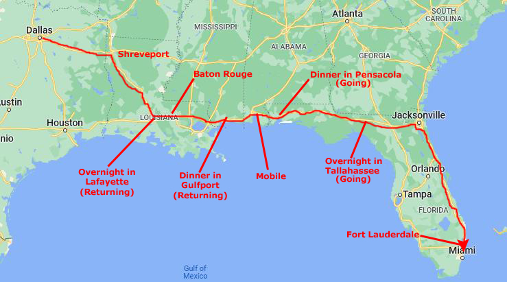
Well, this year is turning out to be uneventful, and there was no event or trip worth an album page between our winter trip to Florida two months ago and the trip we are taking now. As these trips to Florida have become so commonplace, I will again just divide this page by topic, pretty much regardless of when the picture was taken.
Getting to Fort Lauderdale
|
Mississippi and Alabama are an hour each, so we are heading east from Mobile about six-thirty or seven. This puts us north of Pensacola right about dinnertime about eight. After dinner, we have now developed the habit of continuing on to Tallahassee, ariving there about midnight. There is a Red Roof Inn there that is pet-friendly (allows them and doesn't charge extra for them.
We usually get away from the hotel in Tallahassee about nine or so for the 150-mile drive to Jacksonville, which we usually reach about noon. Then we take I-295 around Jacksonville to the south, going through Orange Park. This 14-mile stretch is kind of neat, mostly because of the long bridge that crosses the St. Johns River as it opens out into a large lake southwest of the city. (It narrows as it approaches and flows around downtown Jacksonville to eventually empty into the Atlantic.)
I-295 connects up with I-95 south of the city and we simply take that south for another kind of boring 300 miles down to Fort Lauderdale. Along this streth, which Cole is quite familiar with, he sometimes comes up front to watch the traffic and help navigate. Since there are absolutely no turns to make all the way to Fort Lauderdale, this is no problem for him. We usually get to the condo around 5PM, depending on traffic in Fort Lauderdale on I-95 (which can be horrendous).
We unloaded everything at the condo, got Bob and Cole situated (and fed) and the laptops all set up, and then retired to the dock for a celebratory frozen drink. Then, as is our custom, we headed down to the Floridian Restaurant for dinner. I wish we had transporter technology, but the drive is not a hard one- although sections of it can be boring.
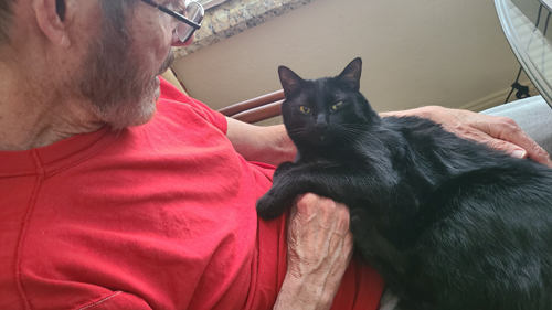
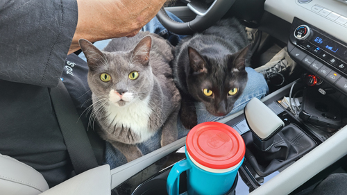
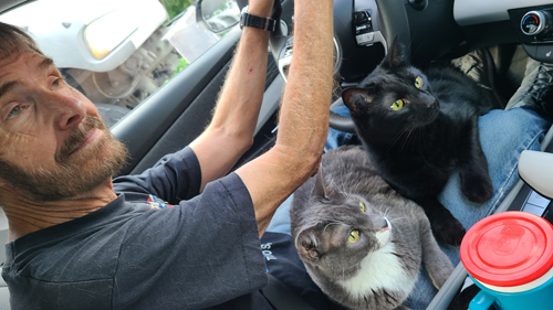
Bob and Cole are young enough that they are still good travelers. Bob, for example, will come out of his carrier every hour or so and walk around the car and sit up front for a while. But then he goes right back in and curls up. Cole stays out of his own carrier more; he usually curls up behind my seat where I usually make a flat space on top of my computer and duffel for him. I like it when they come up front, and it is especially nice when they will stay in one lap or the other for a while. As the driver, I'm OK with that; I just try to ignore them and concentrate on the road.
We have been here to Florida so many times that we have pretty much photographed everything worthwhile anywhere nearby. The pictures we take now are just candid shots around the condo, at the dock or perhaps at an Art Fair or other event that occurs while we are here. So I've begun the practice of just grouping the pictures for these Florida trips by topic.
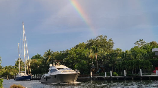
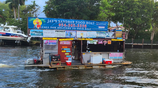
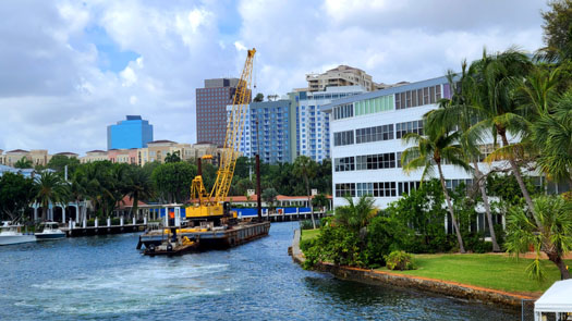
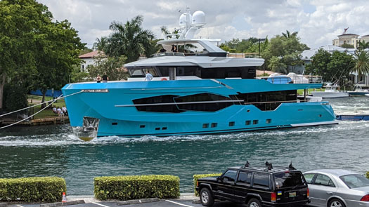
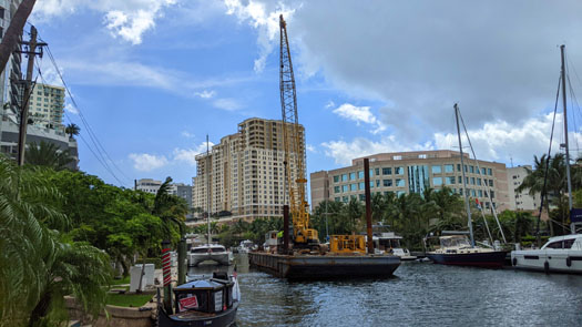
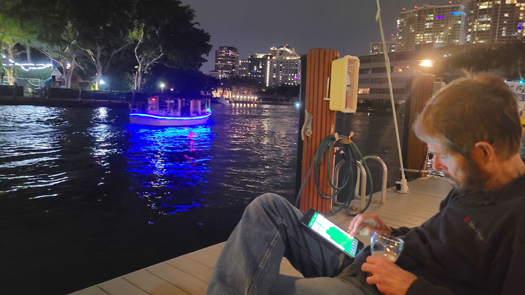
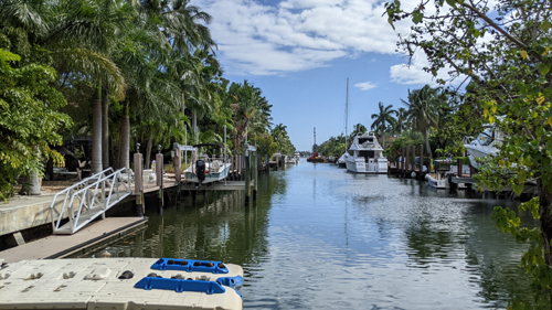
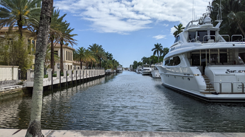
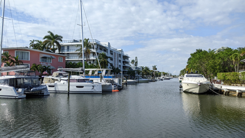
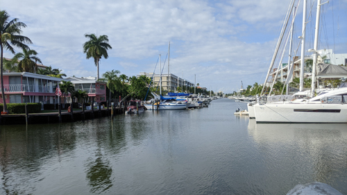
Boat Traffic on the New River (Installment 53)
 |
 |
 |
 |
 |
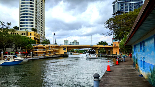 |
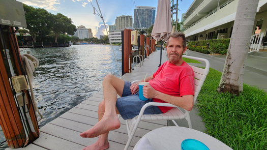
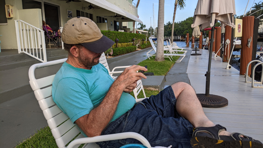
At the Dock
 |
 |
 |
 |
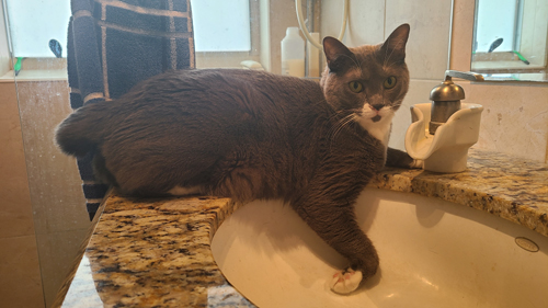
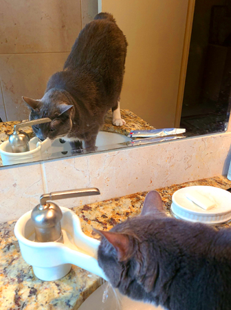
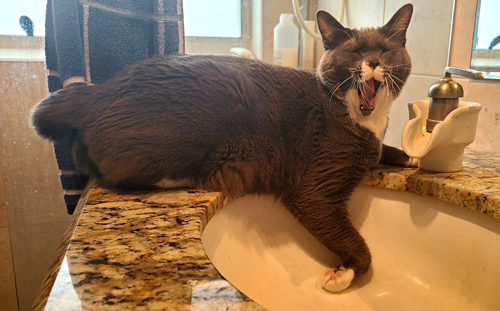
Bob and Cole in Fort Lauderdale
|
|
|
|
Anyway, I don't really think that Bob is always thirsty; I think he just likes the feel of the water as it runs down the little water chute to empty into the sink. Here, unlike at home, he can actually drink from the faucet without getting his paws or himself wet, as he doesn't have to contort himself to get under the faucet.
The New Kinney Tunnel Deck Park
What follows is a section called "Background to the Project". It is a repetition of information on the Deck Park Project- a bit of the history and what the park is to look like that has appeared on any earlier "Florida Trip" pages where we took pictures of the progress of the project. If you have already read this information, please scroll down to the next subsection entitled "Project Update".
Background to the Project
|
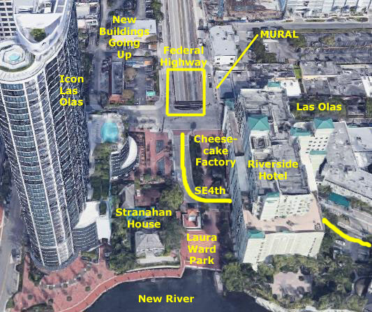
Driving south on Federal Highway from Broward Boulevard, the street descends quickly over two blocks to enter the Henry Kinney Tunnel under the New River. Just as you enter the tunnel, Las Olas is over your head. Up on Las Olas, there has always been an ugly concrete wall on the north side of the street to keep people from accidently (or on purpose) dropping anything onto the roadway below (or falling onto it). South of Las Olas, SE 4th Street curved south and east from Las Olas to go through the Riverside Hotel (actually going under part of the parking garage) and then on eastward to our condo.
Between that street and the Cheesecake Factory, there were some planters and an outside eating area for the restaurant. This is also where the commemorative brick we placed for Ty Ferel and Scott Dole is located. Between 4th Street and the New River is the Laura Ward Plaza- basically an open area with a kind of ugly ventilation shaft from the tunnel below right in the middle of it.
Ever since the Icon Las Olas went up, there has been a movement to try to do something more with this whole area. First, everyone wanted to beautify it; where Las Olas crosses over the tunnel entrance is a particular eyesore. Also, new buildings are going up just west of Federal Highway, and these, as well as the existing buildings, have a particularly unattractive view of Federal Highway's descent into the tunnel.
But to do anything really significant, there had to be more space, and the only way to get it would be to essentially cover over 100 feet or so of the sloping highway. But if just a flat "roof" were put over the roadway, there would not be enough clearance for many trucks that use the tunnel.
|
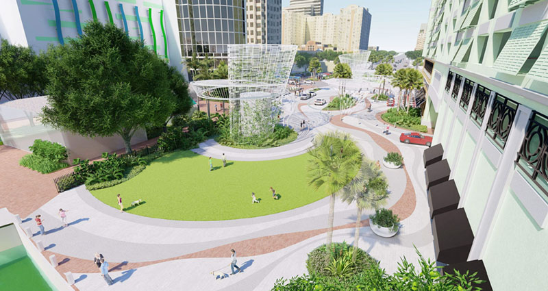
The greenery along the Riverside Hotel about halfway back is where the existing outside eating area for the Cheesecake Factory Restaurant is; I assume that area will return when construction is done. A bit further back, Las Olas crosses through this new park, and then there is the 100-foot section of new deck. This deck, incidentally, slopes up as it extends north, thus increasing the vertical clearance for high vehicles using the Kinney Tunnel. There appears to be more sculpture in the distance, on this new deck, perhaps also concealing another ventilation structure.
This is certainly an ambitious plan, and I will admit I am not at all sure that what we end up with will look like this, but I have to say that almost anything would be an improvement.
Project Update
|
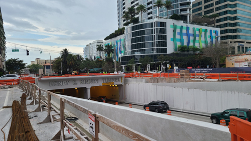
There is no deck yet, but you can see that the side walls of the tunnel approach have been raised, and the wall slopes up to the north. This will be to support the deck which will itself angle upward, so that the minimum clearance for vehicles to go through the tunnel will not be reduced.
Eventually, the roadway that you see will be covered over, and I assume that the lettering for the tunnel will be moved north and placed on the north edge of the new deck, but we will see as construction proceeds.
Incidentally, the building in the background is the Icon Las Olas Condominium complex.
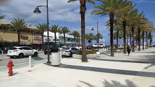
A Bike Ride to the Beach
|
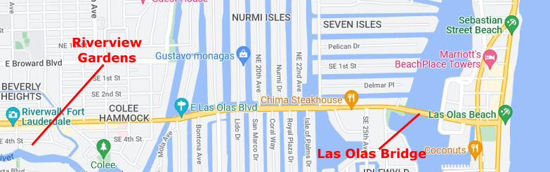
Oddly, the bike lane disappears for a hundred feet or so on the bridge from Colee Hammock out to the artificial finger islands, where the lane picks up again. (The only other place where you lose the dedicated bike lane is when you cross the Las Olas Bridge over the Intracoastal Waterway and out onto the barrier island where the beaches are.)
All these artificial islands are divided into four sections, or neighborhoods. All are pretty exclusive, but those south of Las Olas are really off the charts. The eight Las Olas Isles south of Las Olas are the first group and then you have Idylwyld between them and the actual Intracoastal. North of Las Olas are first the Nurmi Isles, and then an area of seven artificial islands (oddly enough called "Seven Isles") lie between them and the Intracoastal.
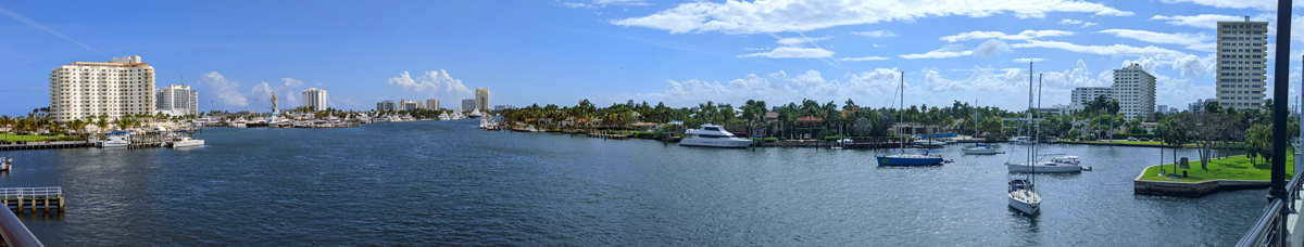
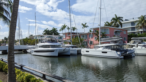
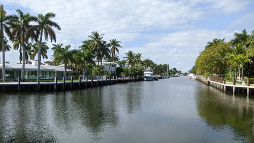
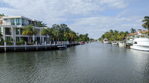
So as I biked towards the beach (in the south-side bike lane along Las Olas) I could look south down the waterways between the various fingers of land, and I thought I would photograph some of them. The closer I got to the Intracoastal itself, the bigger the boats seemed to get:
 |
 |
 |
 |
Once past Las Olas Isles and Idlewyld on my right, I can decide to ride on the sidewalk of the Las Olas Bridge or on the roadway (where there is no bike lane). Since I wanted to take some pictures, I actually got onto the sidewalk and walked my bike up onto the bridge. From here, I have an expansive view to the south. In the panoramic view below, you see the barrier island and Bahia Mar on the left, the Intracoastal Waterway going south in the middle, and then the exclusive residential islands of Idlewyld on the right. It's a beautiful view:
 |
Next, I walked my bike across the top of the bridge, and then coasted down the other side, covering the last few blocks between the Intracoastal and the beach.
|
|
|
|
|
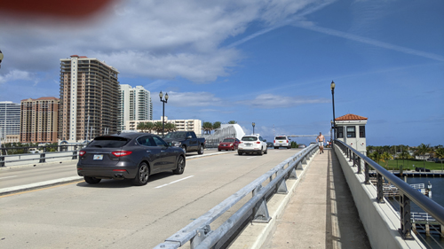
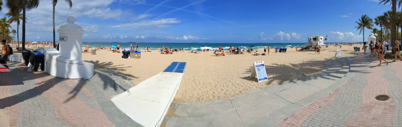
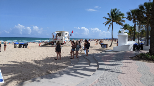
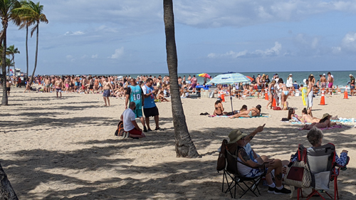
It's a beautiful afternoon, although in the middle of the week, and so the beach is quite busy. Some of these folks are Spring Breakers, but probably only half of them. I had not recalled seeing a ramp here before, but it is apparently for older folks who have walkers or something like that, as a wheelchair would not, of course, be maneuverable in the sand.
Anyway, this is one of the main entry and exit points to and from the beach itself. There is an ornamental wall that divides the oceanside sidewalk from the sand, and every block there is an opening in the wall like this one.
Of course, I took some pictures and movies of the crowd here at the beach this afternoon, and you might want to see at least a couple of them:
 |
 |
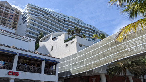
Also, here's a movie of the crowd and one of the new building complexes at the beach:
|
|
|
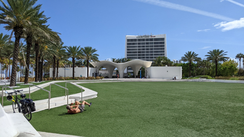
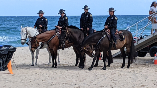
Back down at the entry plaza at Las Olas and A1A, I happened to be standing there when some of Fort Lauderdale's mounted police came onto the beach. So far as I know, they are only used here at the beach.
|
|
|
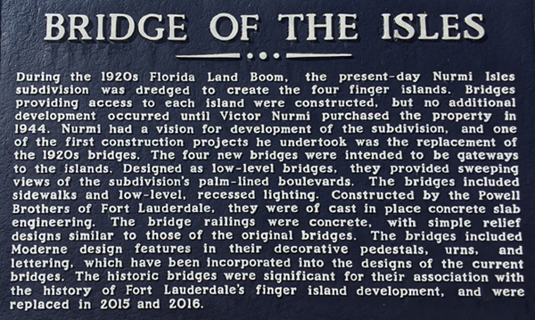
Heading back to the condo, I was on the north side of Las Olas this time, so I could get a good look at the Seven Isles neighborhood and the Nurmi Isles as well. Between the two is this open water basin, which you can see in the map above. As I was taking some pictures of the waterways here in the Nurmi Isles, I came across an historical landmark plaque that I just don't recall having seen before.
|
 |
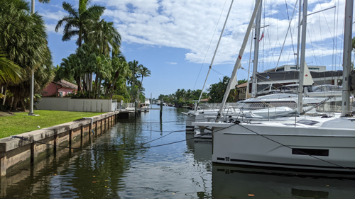
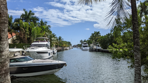
And finally, here are some views of the canals that run through the Nurmi Isles area. When Ty and Scott first moved to Fort Lauderdale from Dallas, they lived on a 50-foot boat that was docked on one of these canals, and it was the experience of staying with them that got Grant enthused about getting a place here.
 |
 |
 |
 |
Around the Neighborhood
|
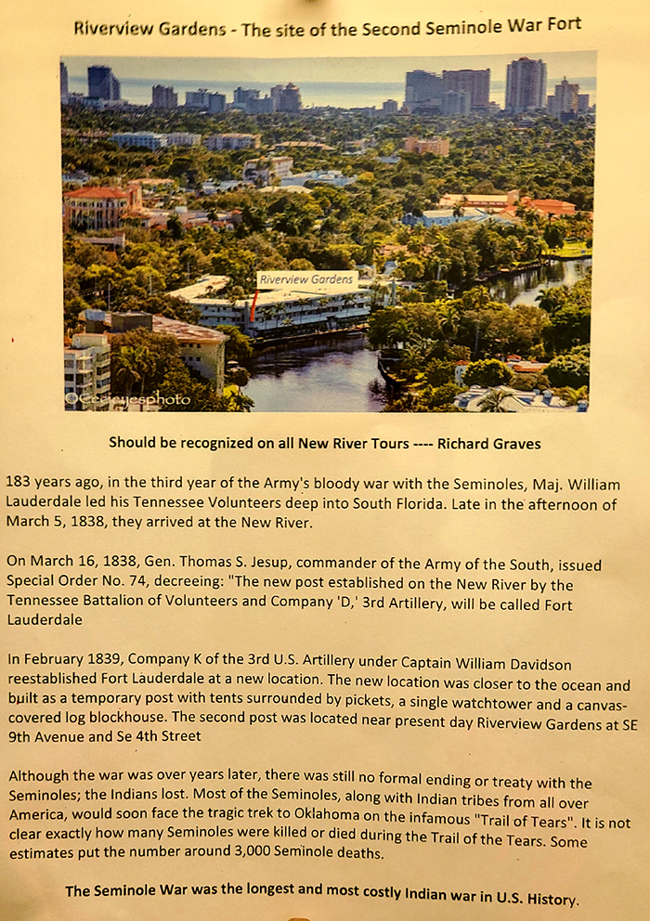
It tells a story that I was almost totally unaware of- the fact that Riverview Gardens actually sits on an historic site along the New River.
I think it should interest you, too, and I have put it in the scrollable window at left.
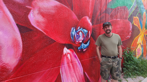
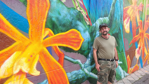
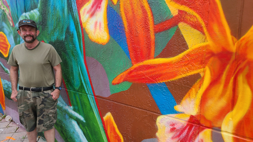
There are some other pictures for this section two. One afternoon, out for a walk, we went by the mural over by the new deck park above Federal Highway, and we got a few closeup pictures of the incredible colors of it:
 |
 |
 |
|
|
The Trip Home
 |
 |
You can use the links below to continue to another photo album page.
|
April 29 - May 7, 2022: A Househunting Trip to Ecuador |
|
December 28, 2021 - January 17, 2022: Our Winter Trip to Florida |
|
Return to the Index for 2022 |