|
October 21, 1970: A Visit to Panmunjom- the JSA and the DMZ |
|
October 10, 1970: Hail and Farewell |
|
Return to the Index for 1970 |
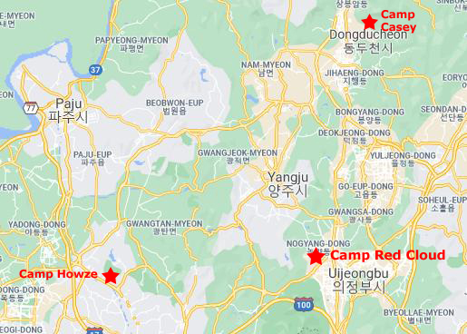
The next morning, the 11th, I rode in General Hannum's helicopter to Camp Casey, where we had a football game with the 7th Division. Camp Casey is lots bigger and has more facilities than Camp Howze, because it is a centralized Division headquarters (the 7th Division is headquartered here), with a large number of individual units all stationed at the same place. In the 2nd Division area, each unit normally has its own compound, so each individual compound is much smaller.
A Bit of Background and Orientation
|
Camp Casey was established, as you might expect, almost at the very beginning of the Korean Conflict (we are told to try not to call it the Korean "War") in the early 1950s. I don't know what it was called originally, but it was actually renamed to Camp Casey in 1952 in honor of Major Hugh Boyd Casey who died in a plane crash here in 1951. The crash site is marked with a white concrete cross and a plaque that details his display of complete heroism and selflessness.
Several battalions and divisions used Camp Casey as a home during the Korean War. Some notable battalions include: the United States 45th Division; the United States 5th and 7th Marines; the 19th Battalion Combat Team from the Philippines; and the Royal Thai Battalion. It was also the home of the 1st Royal Australian Regiment up until the 1953 (later to be relieved by the 2nd Royal Australian Regiment that same year). Camp Casey was also the site for the training and rehabilitation of the 35th Infantry Division, where they remained in the camp and later returned to Hawaii as part of the 25th Infantry Division where they were to remain as reservists during the remainder of 1953.
Beginning in 1953, the United States 7th Infantry Division has been using the camp as its main garrison. The two divisions (the Second and the Seventh) have been working together to monitor the border and train the South Korean forces. Over the years, as the threat of invasion diminished and life north of Seoul became more routine, the need for two division has diminished, and it seems only a matter of time before one division is withdrawn.
|
Goguryeo (37 BC–668 AD) was a Korean kingdom located in the northern and central parts of the Korean Peninsula and the southern and central parts of Manchuria. At its peak of power, Goguryeo controlled most of the Korean peninsula, large parts of Manchuria and parts of eastern Mongolia and Inner Mongolia.
Along with Baekje and Silla, Goguryeo was one of the "Three Kingdoms". It was an active participant in the power struggle for control of the peninsula and was also associated with the foreign affairs of neighboring polities in China and Japan.
Goguryeo was one of the great powers in East Asia until its defeat by a Silla–Tang alliance in 668. After its fall, its territory was divided among the states of Tang, Silla and Balhae. The name Goryeo (alternatively spelled Koryo) was adopted as the official name in the 5th century, and is the origin of the English name "Korea".
After unification of the peninsula, the capital was moved to Seoul, a burgeoning town on the Han River. Through the centuries, the Kingdom survived huge changes, including incursions from China, Russia, and Japan. From the very beginning (earliest references to the town date to 100-200 AD), Dongducheon has been important for the defense of the capital, and it remains so today.
|
NOTE from 2021:
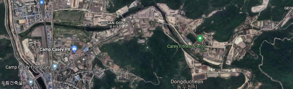
The aerial view at left, of course, is from the present day. My own photographs and recollections of Camp Casey are of a modern, but much smaller installation that what you see here. Marked on the map are numerous facilities which have been built over the years to accommodate not only the increased usage of the camp (as numerous outlying camps were closed over the years) but also the change in the general situation in Korea. In the years after my departure, the relaxation of tensions (but not without intermittent spikes) between North and South has led to a corresponding relaxation of military life in the South. For example, servicemen are now, generally, allowed to bring their families with them on tours in-country. Many do, even though there is little housing available on post. Korea has advanced so much that modern apartments are now not difficult to find, even in small towns like Dongducheon.
|
In fact, in my investigations for the album pages devoted to my time here, I have found very little that even resembles the way things looked when I was here. I would dearly love to find photographs, for example, of what the little town that was just outside the gates of Camp Howze looks like today. I would imagine that since Camp House was returned to Korean control and perhaps a decade or more ago turned into a public park, that enough people now live in the area to justify having such a large park available to them. I can find articles in Korean publications that talk about the handover and closing of Camp Howze, but it would be nice to have actual photographs of the area.
The Trip to Camp Casey Today
|
|
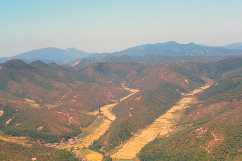
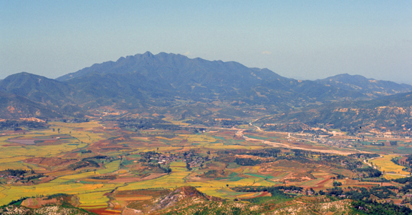
As you can see from the map above, we are flying generally northeast, although that doesn't give me much clue as to exactly where the countryside pictures were taken.
|
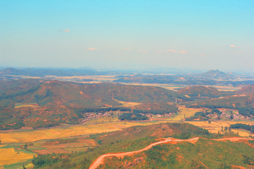
These rice paddies have begun to change color to a wheat-color as the stalks dry out and ripen. At this time of year, you can tell the rice from other crops because of the color change. Even so, it will be a few weeks yet before the rice is ready to be harvested.
Note:
I wrote the above some weeks after the trip over to Casey, because it took some time to get my slides back from Kodak. By now, of course, almost all the harvest is in, but in early October when I went over to Casey the rice is just getting ripe. Incidentally, I have had an opportunity to pluck some of the rice right off the plant just before the harvest to taste it. It tastes something like wild rice that you can buy in the store.
The helicopter trip over to Tongducheon took only about thirty minutes; the distance is about thirty miles. The ride was a great deal of fun; it would be nice to be a General and have one of these machines at one's beck and call.
|
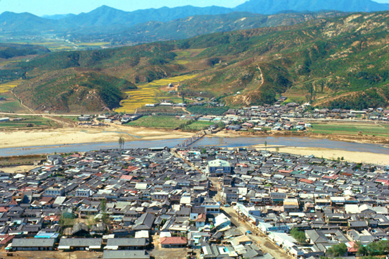
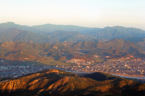
Camp Casey itself is out of this picture to the right; I am looking west at the moment.
I think you'll agree that the Korean countryside is really quite beautiful. I haven't been to Colorado, but this is what I imagine Colorado would look like. Tongducheon is actually quite a large town, which is only partly due to its proximity to one of the largest US Military installations in South Korea.
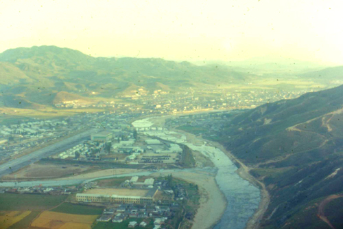
Before I include the pictures I took at the football game itself, you might be interested to see an aerial view (admittedly from the 2020s) of Camp Casey itself. Situated on the north side of Tongducheon, the camp lies along a narrow river that runs up into the hills (which look inviting for hiking). Here is this area seen from above:
|
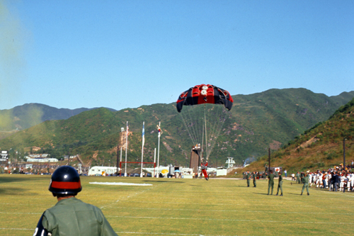
As far as pictures from the game today are concerned, there weren't many of them and they might be of interest only to me, but here they are:
|
|
|
|
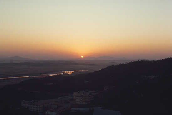
The game was certainly interesting, as was wandering around this large installation for most of the afternoon. But what made it a really neat trip was, of course, the helicopter ride to and from. The ride back began in late afternoon and we got back to Howze just before sunset.
|
|
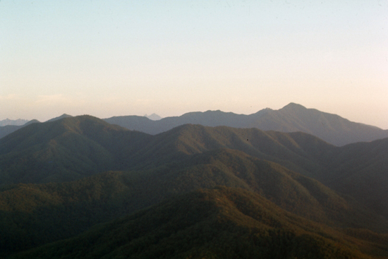
Parts of this section of Korea are rugged and nearly inaccessible, and occasionally shelter North Korean agents from discovery for a short time. But the landscape is still very beautiful, hiding dangers though it might.
|
|
What an interesting day. This next week will be hectic. Before LTC Fuentes leaves, I am going to be making a trip up to the Joint Security Area (JSA) in the DMZ- right on the border with North Korea.
You can use the links below to continue to another photo album page.
|
October 21, 1970: A Visit to Panmunjom- the JSA and the DMZ |
|
October 10, 1970: Hail and Farewell |
|
Return to Index for 1970 |