|
October 23: General Matheson's Departure Ceremony |
|
October 11, 1970: My First Visit to Camp Casey |
|
Return to the Index for 1970 |
Today, one of my payroll agents, a Lieutenant who pays a payroll of Korean direct-hire personnel, had invited me and Pete Cannon, my disbursing officer, to go up with him to the JSA (Joint Security Area) and take a tour while he paid his people. Even though LTC Fuentes won't leave for another two days, he's already handed everything off to me, hence the use of the term "my".
What Are the DMZ and the JSA?
|
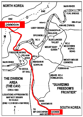
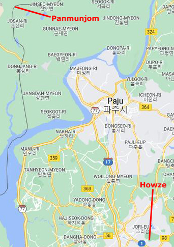
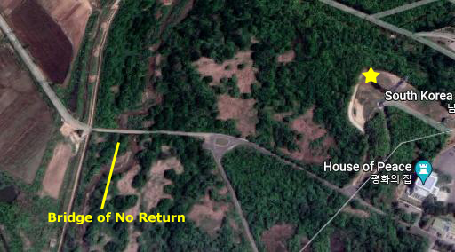
As far as where the JSA is located, that's easy. It is about 20 miles NNE of Camp Howze, and you can see where it is in relation to Howze at left. There are two images. The leftmost shows the various military camps that the US and ROK maintain along the DMZ, and I've marked the route we took to get there. The image on the right is an extract of the current map of South Korea that covers basically the same area. Of course, the camps and bases from 1970 aren't marked on the map; for one reason, not many of them still exist, and for another they don't really belong on a civilian map.
|
It also established a zone of separation between the two Korean states in hopes of avoiding further military confrontation. Within the Korean Demilitarized Zone (DMZ), Panmunjom became the permanent site for the two sides to meet as needed to maintain the fragile peace.
When the two sides signed the armistice in July 1953, the ground contact line bisecting the Korean peninsula near the 38th Parallel became the de facto inter-Korean border. To preclude accidental violations of each side’s territory by the other, a four-kilometer-wide demilitarized zone (DMZ) with the border as its center was created. Signs indicate the acctual border.
|
Within the JSA itself, the Armistice agreement limited each side to five officers and thirty enlisted personnel for security at any one time. In addition, the UNC Military Armistice Commission (UNCMAC) maintained a twenty-four-hour presence within the JSA. The Joint Duty Officer (JDO) worked on “Conference Row,” in one of several buildings that straddled the Military Demarcation Line. The JDO controlled a direct telephone connection to his North Korean counterpart, enabling instant communication in the event of a crisis.
Over the years, the North has provoked numerous incidents within the JSA and across the peninsula. Conditions became so dangerous that, from 1966 to 1969, American soldiers who served anywhere on the Korean DMZ earned the Combat Infantryman’s Badge if they exchanged fire with the North Koreans on five or more separate occasions. For a brief period in 1968 and 1969, combat pay and combat patches were also authorized. Most recently, year before last, communist soldiers infiltrated south of the MDL and ambushed a UNC supply truck. Two U.S. soldiers and two ROK soldiers were killed.
Getting to the JSA
|
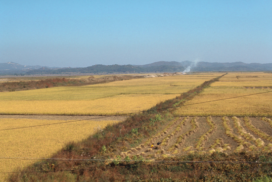
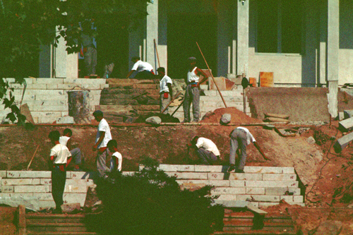
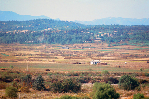
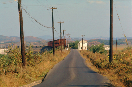
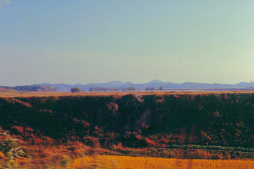
For the harvest, the paddies are allowed to dry out, and this process stimulates the rice plants to ripen and change color. Once the paddies are dry and the rice is ripe, it is harvested manually.
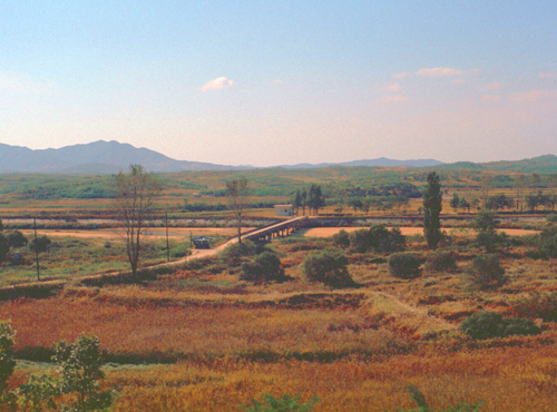
The day was sunny and cool, a beautiful day for pictures. These particular rice fields were above Munsan, a mile or two south of the Imjin River.
Now let me tell you how our visit to the JSA was conducted today. The first thing you should know is that to get to the area north of the Imjin River but south of the DMZ, special permissions are required. There are many South Korean citizens who actually live north of the river, or have land that they farm there. These people all carry identification cards that give them free passage across the river at one of the monitored bridge crossings and the authority to be in that area north of the river. These cards also can be used to distinguish South Korean citizens from NOK infiltrators.
For everyone else, if you want to cross the Imjin River you have to go in an official group. These groups are just like scheduled tours. Visiting tourists can sign up for them in Seoul, but most of the people who do have an interest in the area. They might be visiting military, retired servicemen, or government officials.
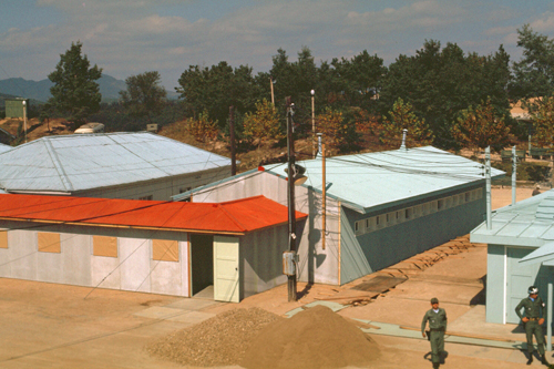
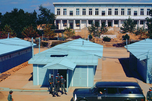
For servicemen currently in country, tours can be arranged through the Special Activities Office. These can be hard to get space in, as almost every soldier who serves in Korea seems to want to get to the JSA- if only to look across the border into North Korea. What our Class B Agent had done was to arranged for us was to go along with a VIP tour for an American Army Colonel. Consequently, there would only six of us along, and it made for a better tour. The tour pulled out all the stops (including lunch), and we were able to sit in on a full-scale daily briefing, something most people don't get. Our tour began at Camp Pelham, and that's where PFC Kim took us this morning.
|
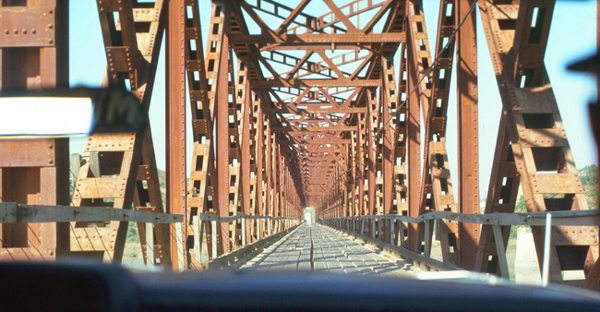
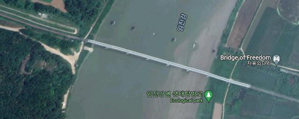
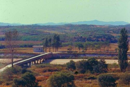
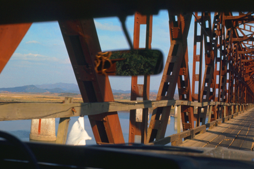
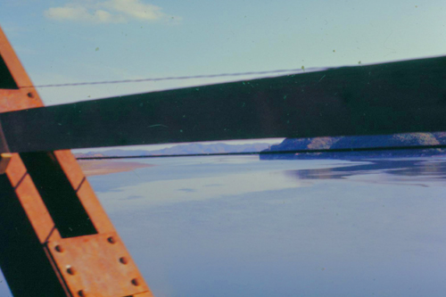
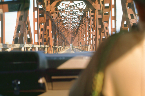
Freedom Bridge has changed a great deal since I crossed it today. At left (top), you can see the bridge, in a picture taken from the back seat of the sedan looking through the windshield. Picture-taking from Freedom Bridge is technically forbidden, but I took these anyway. That is the Imjin River, and the pilings of the old bridge that was demolished during the war. Note the wooden planking. Below my picture is an aerial view circa 2020, and in it you can see that the bridge has been entirely rebuilt.
|
The bridge crosses the Imjin river, and it is a former railroad bridge which was used by repatriated POWs/soldiers returning from the North. It is the more famous of only two bridges that provide access to the Western Sector of the DMZ, the other being Liberty Bridge (which is controlled by the South Korean Army). Freedom Bridge is the only direct link to Camp Greaves, Liberty Bell, and Panmunjom. Once we crossed the bridge, we were in the DMZ.
|
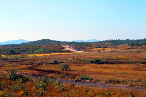
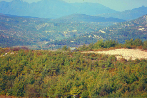
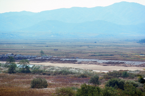
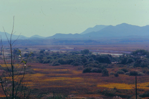
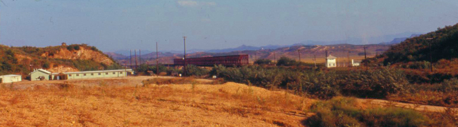
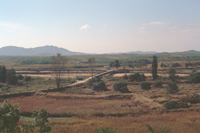
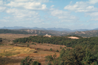
Most of the DMZ is pretty barren, and below is a picture I took looking south across the deserted landscape:
|
The DMZ is actually a strip of land about a mile wide, with the border between North and South Korea running through the middle of it. There is a fence along the boundary itself (the aforementioned MDL, or Military Demarcation Line), and then there are parallel fences a half-mile north and a half-mile south of that boundary. Within the DMZ, there are strict rules about moving about, weaponry, and other things. Generally speaking, no one is allowed in the DMZ without authorization from both sides. Perhaps one day there will be an analogous boundary between North and South Vietnam, but that situation is still in flux- still contested.
In the JSA
|
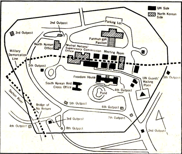
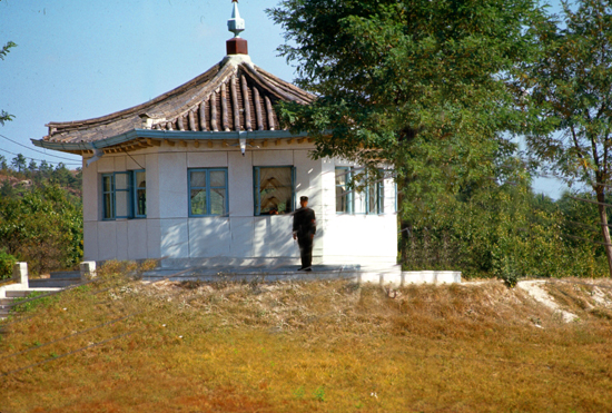
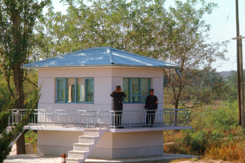
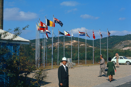
Among the provisions of the Korean Armistice Agreement was the establishment of a Military Armistice Commission (MAC) to supervise implementation of the truce terms. Meetings of MAC representatives and North Koreans/Chinese were held here in the JSA, a roughly circular area, about 2600 feet wide and bisected by the MDL- the boundary between North and South. This is a neutral area, half in North Korea and half in South Korea, where there is supposed to be free movement of both sides. Military Police of both sides provide security for the JSA, and the administrative facilities for both guard forces are located within the JSA.
As you can see from the diagram at left, the actual boundary between North and South runs right through a whole row of buildings. This was done so that when negotiations are ongoing or meetings being held, neither side must actually leave their own territory. (Inside some of the buildings, the "national" boundary actually bisects the main conference table.) While the boundary has remained the same over the years, the buildings themselves have changed. Some have been removed, including all of the KPA checkpoints on the southern half of the JSA. New buildings have been constructed, whilst some existing buildings have been expanded or simply renovated. But the entire area is neutral territory, and there is complete freedom of movement.
We arrived a little ahead of the VIPs, and so we wandered around the area, just to see what we could see, before the beginning of the actual guided tour. At first we thought that we might actually meet up with some North Koreans, but is seems that they stay pretty much on their side of the MDL, aside from the area down by the Bridge of No Return (more on that site later).
|
|
|
|
|
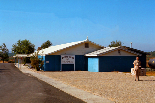
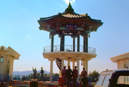
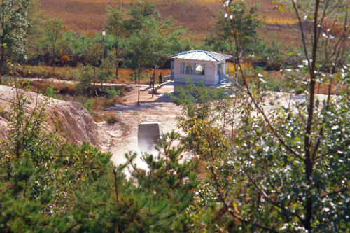
When our VIPs had arrived, we gathered at the Visitor Center (just outside the JSA itself by the road coming into it from the south) and were all introduced to one of the MPs stationed here, who would be the one to take us on a tour. He apologized at the outset, telling us that the MP who normally gives these tours could not do so today, and that he would tell us more about that later. He led us on foot through a checkpoint at the South Korean entrance into the JSA, and we walked over to a viewpoint where we could look out across the DMZ and actually see into North Korea. Here are some of the views that we saw:
|
|
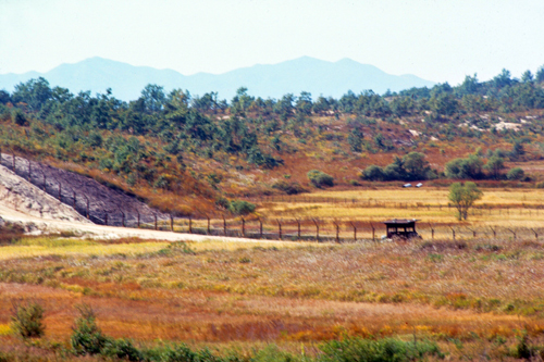
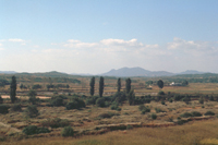
In these pictures of the DMZ at Panmunjom, you can see a fence running through most of them. This is the Southern Boundar fence, marking the beginning of the mined area. It is heavily patrolled, every inch of it is under constant surveillance. From time to time, usually under the cover of darkness, and more often down by the coast, agents do slip through, accounting for the stories that appear in the Korean papers where the ROK Army has captured another infiltrator. Sometimes they get down as far as Seoul, but that is rare.
|
|
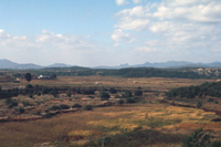
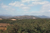
These pictures show more of the terrain of the DMZ at Panmunjom, and in the right-hand picture above you can see teh first checkpoint leading into the Southern part of the DMZ, about 75 yards out. And of course you can see the barrier fence. Within the JSA itself, there isn't usually much activity unless there are some negotiations going on or some incident is being resolved, but today there was some.
|
|
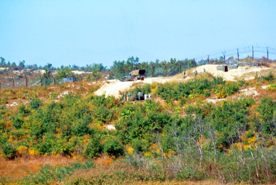
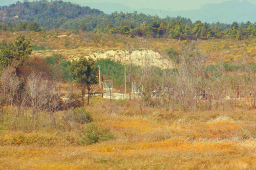
The North Korean headquarters and display building, which, of course, is going to be slightly larger than Freedom House, the corresponding structure on the South Korean side, is almost finished, and these workers are putting the finishing touches on it. All the workers are politically reliable, but are nevertheless closely guarded by North Koreans soldiers. The sun was extremely bright and I had a hard time getting the readings right, so this and a couple of other pictures are dark.
If you refer back to the diagram of the JSA above, it is interesting to note that each of the main buildings, and most of the little outposts sprinkled through the JSA, are controlled by one side or the other. And there are a couple of these buildings that straddle the actual national boundary. If you look at the buildings along the boundary, we were actually able to go inside one of the meeting rooms, this one nominally "North Korean", through which the actual boundary runs.
|
|
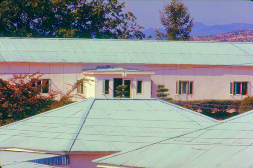
Meetings between North and South are either held in this building or in the more spacious UN Commission Building at the west end of this central line of buildings. These meetings occur whenever there is an "incident", and these happen a few times a year. At other times, the JSA is very low-key and almost deserted.
|
Almost from its creation, the JSA has been the venue for a "competition" of sorts between North and South, as each tried to outdo the other in almost every aspect of their presence here. One of those parameters was the height of the buildings each side constructed. If one side built a two-storey structure, the other had to build a taller one. When this particular competition got out of hand, the Commission intervened and set a maximum height for any structure, and this South Korean structure is exactly at that maximum height.
|
|
I had actually wondered, before learning this, why all the MPs that we saw today seemed to be taller than average, but when I learned the story it made perfect sense. If we had the money to waste, and if there had not been restrictions put in place by the UN Commission, it might be fun to put up some supertall skyscraper here for the North Koreans to try to match. I am sure they would try, though, to the detriment of their citizenry, whose needs are so great. While we don't know a whole lot about what life is like in Pyongyang, as opposed to Seoul, the conventional wisdom is that the North Korean capital is far less modern and with vastly less opportunities for average people to live lives that remotely approach lives in the West.
|
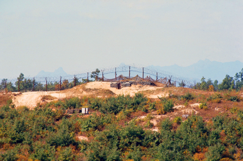
Aside from these outposts, though, soldiers tend to stay on their side of the line, and rarely do the different sides transgress on each others' area. When they do, conflict is likely to result. For example, just a week after I was there, the MP that had given us the tour was injured in a fight with North Korean soldiers that began with another MP wandering onto the wrong side of one of the buildings.
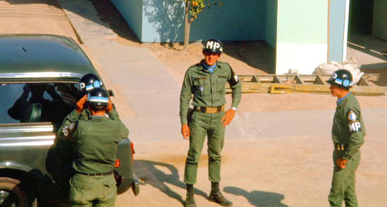
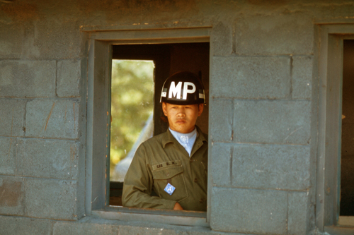
The American MPs and a Swiss officer intervened. The Swiss officer was also injured, as were two other MPs. The first MP suffered a concussion, but I am told ten or more North Koreans had to be carried away. These incidents happen once in a while, and the requirement that all American MPs assigned to the JSA area be over six feet tall stands them in good stead.
From the area near the actual buildings here in the JSA, one can see a great deal of the DMZ itself, and we spent some time just following our guide around and taking pictures.
|
One curious thing about this picture is the existence of the road gate, which you can plainly see in the raised position. The rules of the Armistice and the JSA require that no such structures that could be used to block free passage within the JSA be permitted, and our side adheres to that agreement.
The North Koreans, however, have no compunction against installation of the proscribed structures, this being one of them. At the various meetings held, the UN side repeatedly points to this violation, but the negotiators from the North deny the existence of the violation. They have been shown pictures of them, like this one, and still they deny it.
Our guide said that at one point the UN commissioners wanted to literally drag the negotiators from the North outside to point out the violation (which I could see easily), but that would have caused all hell to break loose. My own opinion is that we ought to amble up and take them down, by force if necessary, but we don't.
Our tour was going to head out into the DMZ itself soon, so I spent some time here in the center of the JSA looking around at the various buildings- some North Korean and some under the control of the South.
|
|
|
|
|
|
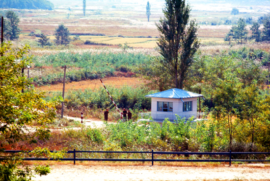
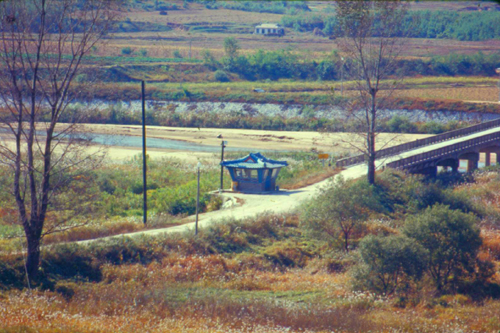
We stayed in the administration area for a while, and then our guide took us on a brisk walk perhaps a quarter mile to the west and out into the DMZ. Our tour, I suspect, had been prepared for, and I assume the North was told ahead of time who we were. This did not stop them from observing us as we walked to Outpost #5 (refer to the diagram near the top of this page) where we got our first expansive view out into the DMZ.
|
|
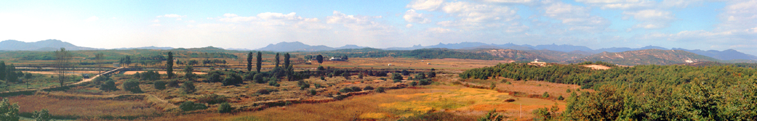
That picture above of the Bridge of No Return was actually the first of a series of five pictures that I took from the same spot as I panned across the entire western view from the JSA into North Korea. These five pictures are below:
 |
 |
 |
 |
 |
Note from the present:
I did not have the ability to do so then, but now I can use computer software to actually stitch these five separate images together into the panoramic view that my camera could not take. That view is below:
|
Because you are looking at almost 180° of panorama, fitting the whole thing on this page meant that I had to make it fairly small. The view was even more impressive than the small view above, so I have put a larger view, which is about 2500 pixels wide, into the scrollable window below. (If the image is small and at the top of the window, please just click on it to expand it to full size.) You can use the horizonal scroll bar to move across the image and see all of the incredible detail:
In looking at this panoramic view, I was struck by the beauty of this part of North Korea. We think of Communist countries as being gray and dismal, but at least as far as the weather and terrain is concerned, they can be as beautiful as anywhere. Although it seems wrong that people who live amid such beauty can't be free.
|
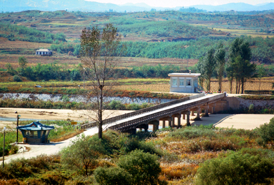
The last time the bridge was used for prisoner exchanges was in 1968, when the crew of USS Pueblo was released and ordered to cross into South Korea via the bridge. The Military Demarcation Line runs through the middle of the bridge. At the end of either side of the bridge are guard houses of the respective countries; ours is in the nearground and the North Korean on the far side. The North Korean building is called KPA#4 while the United Nations Command checkpoint was called CP#3. This outpost, which is surrounded by trees, was only visible from one other UNC site during the winter months, OP#5. The North's Korean People's Army (KPA) has made numerous (unsuccessful) attempts to grab UNC personnel from the CP#3 and drag them across the bridge into North Korean territory.
Because of this proximity to North Korean territory, being surrounded on all access routes by North Korean checkpoints, and repeated attempts to kidnap the UNC personnel working there, CP#3 is often referred to as "The Loneliest Outpost in the World".
|
|
The Communists like to make the point that their people are so contemptuous of the American presence that they have no problem with establishing farms right in the DMZ, while they say that we restrict the mobility of the South Koreans within the DMZ. That's true for us, as far as it goes. But much of the DMZ is actually still mined, and so we discourage Korean civilians from coming into the area. On the other hand, the Communists point to the "voluntary" farming done here by the people, and I guess they think it's good propaganda. I don't know how voluntary it is, as our intelligence shows the houses to be mere shells, like Hollywood sets, and the farmers are brought down by truck each day from further North; no one actually lives in the North Korean portion of the DMZ.
|
|
|
|
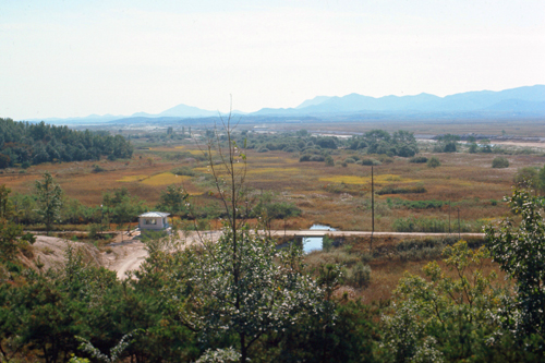
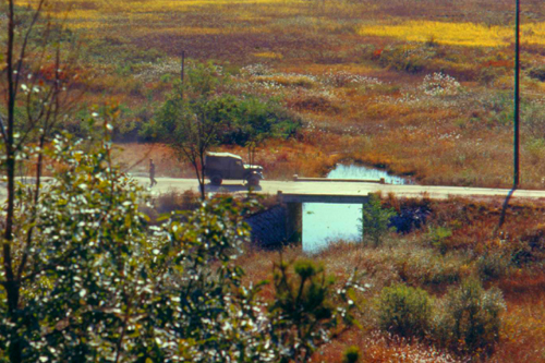
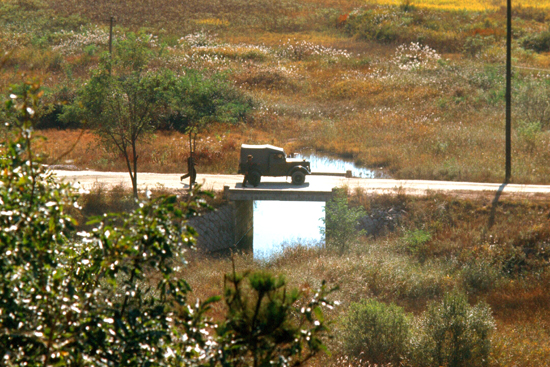
Now for something interesting. Not much has gone on during our visit- no infiltrators, no gunfire, no excitement. But sometimes what seems unexciting can actually be significant. Now we were to be treated (if that's the word) to an actual Armistice violation. It began innocously enough with the truck I had seen earlier.
|
|
Now things got interesting, although our guide had to explain to us just what was going on.
|
But our guide explained that what we were watching was an actual violation of the Korean Armistice agreement right before our eyes. There was no shooting and no excitement, but our guide said that someone would be taking note of what was going on right in front of us and that it would be the subject of discussion at the next meeting of representatives from the two sides.
The explanation was that by the terms of the Armistice that set up the JSA, it is not permitted for either side to obstruct the access of the other to any of its installations, and indeed any area within the JSA. To do so is a violation of the agreement, and therefore a truce violation.
You are looking at a violation in progress, one which was later denied by the North Korean negotiators. The NK vehicle has stopped in the middle of the bridge, effectively blocking the road, and the driver has left the vehicle there. Not satisfied with merely blocking the approach to the bridge, the NK jeep has moved out onto the bridge to block the center, and this is an important picture, for it is rare that one gets a shot of an actual violation in progress, although I am told they happen quite frequently.
After watching an actual treaty violation in progress, we didn't think the afternoon could get any more exciting, and we were right. For the remainder of our time in the JSA, I just took some candid shots around the area.
|
|
|
|
Back at the Visitor Center
|
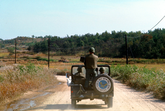
When we came into the DMZ, we had an armed escort, and this is it. We trailed the security escort all the way back to the Visitor Center, and so I had plenty of time to note something interesting about the jeep. If you want to see what it was that caught my eye, just click on the spare tire on the back of the jeep.
I have no idea why the wheel cover on the spare tire on the back of the jeep was upside down, though it made little difference in the reassuring feeling the escort provided.
Driving back along the road, we passed Freedom Village off to the side. It is a town populated by South Koreans who live entirely within the DMZ. They are protected by the South Korean troops, and, while their movement is restricted due to the mining of the area during the war, they have their own government, which is separate from the Seoul one, and they live by themselves. Other than the protection that the national government gives them, the town is pretty much totally independent. The North Koreans have a corresponding village, bigger, of course, that we call Propaganda Village.
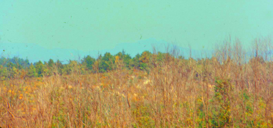
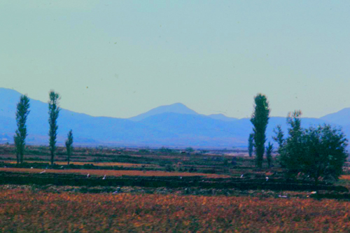
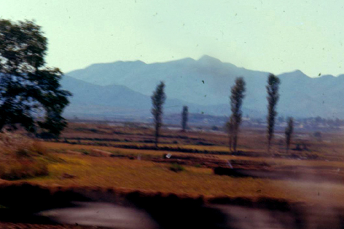
It was hard to take any pictures from the back seat of the sedan, as I happened to be sitting in the middle. But I did get a couple of not-so-good pictures of the countryside along our road:
|
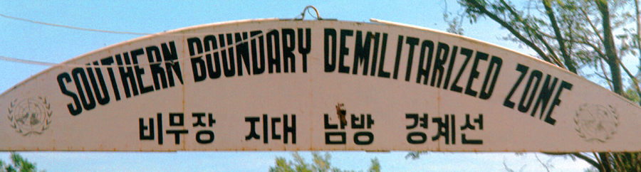
|
Shortly, we left the DMZ and returned to South Korea proper. I can only imagine the feelings of the Pueblo crewmen, and other returnees coming South, when they passed under this sign, knowing that they were finally home:
 |
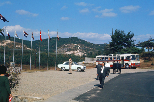
Shortly after leaving the DMZ, the road came around behind the Visitor Center and we pulled back up to the Center itself to find that a tour bus of civilians had just arrived.
|
|
|
I have since learned that South Korean visitors are not normally allowed into the DMZ. I am not sure why, although perhaps they could be in more danger from North Koreans, or perhaps they, themselves, might be spies who could return to the North by being "captured" by North Korean guards. The actual reason is probably more mundane, but I am not sure what it is.
These tourists, in any event, came up to the visitor center, but that was as far as they could go.
I have noticed on my forays into Seoul and into the countryside that Koreans of whatever age seem to have a penchant for getting their pictures taken, and this guy was no exception. In fact, the only people I ever saw who really didn't want their pictures taken were, understandably, the "club girls", as they might worry that their families would somehow find out how they are making their living.
|
The drive back was exceedingly pleasant, as the weather had been perfect and the afternoon sun lent a nice patina to all the countryside around us.
|
|
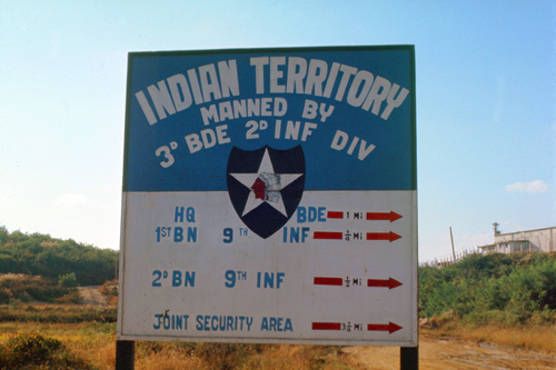
As regards the sign we passed, I can't help but feel that if there were an invasion, this sign would be only too helpful, but then the North Koreans, if they were ever to attack by land, would know all our installations anyhow. It's all public knowledge.
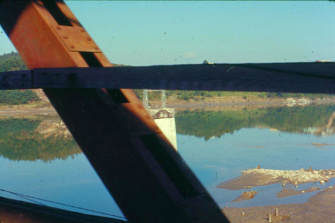
As we returned across Freedom Bridge over the Imjin River, I took some additional pictures, kind of duplicating those I took on the way up. But I am going to include them, as well as a picture of the countryside I took as PFC Kim drove us back to Camp Howze from Camp Pelham, as a conclusion to this page for our visit to the DMZ and the JSA.
|
|
Freedom Bridge and the Imjin River are quite scenic. I like my views of the bridge and the geometry of the girders. I think the pictures turned out well for having been shot from the back seat during an exceptionally bumpy ride.
|
|
The trip up into the DMZ and to the JSA really brought the whole reason for my own tour in-country, not to mention the whole point of the US military presence here, into perspective. It has been scarcely two decades since the end of hostilities, but it is as if the conflict has never ended.
You can use the links below to continue to another photo album page.
|
October 23: General Matheson's Departure Ceremony |
|
October 11, 1970: My First Visit to Camp Casey |
|
Return to Index for 1970 |