|
December 15: Flying with Tony in Boston |
|
October 6-18, 1977: A Business/Pleasure Trip to England |
|
Return to Index for 1977 |
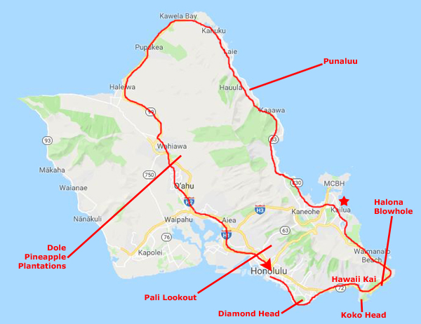
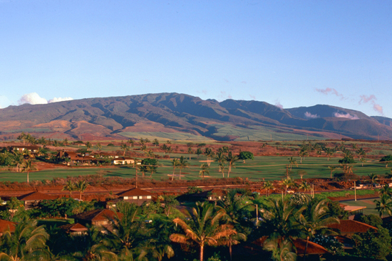
In November, 1977, I returned to Hawaii with Tony Hirsch to do an installation of EEO-REPORTER, the system I developed in San Francisco with Greg Grosh. This was probably the best thing that came out of the whole project, other than my opportunity to get to know San Francisco. The reason that Greg did not go is that he has left Cullinane Corporation and now works for Wells Fargo Bank as the EDP-Auditor. Both Tony and I worked extremely hard, long hours to install the package and make the extensive changes that the Bank of Hawaii wanted. At the end of that time, though, we took a week to ourselves to tour Oahu and some of the other islands on a trip arranged by Steve Goldberg.
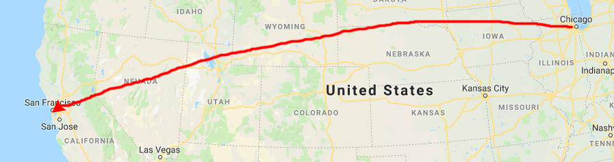
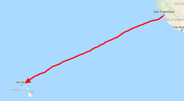
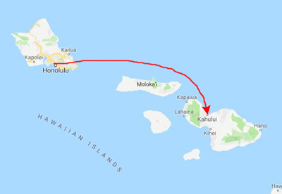
Traveling from Chicago to Honolulu
|
And the flight is on a 747, which typically has a great deal more room than, say, a 707.
But another benefit is that the Hawaiian "ambience" starts in Chicago, as the stewardesses on the flight are dressed in what for Hawaii is normal business attire for women- a brightly-colored muumuu. (That they also stock Mai-Tais is an added plus.)
|
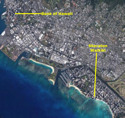 |
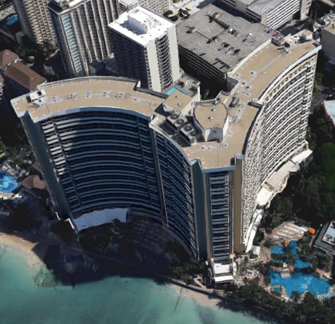
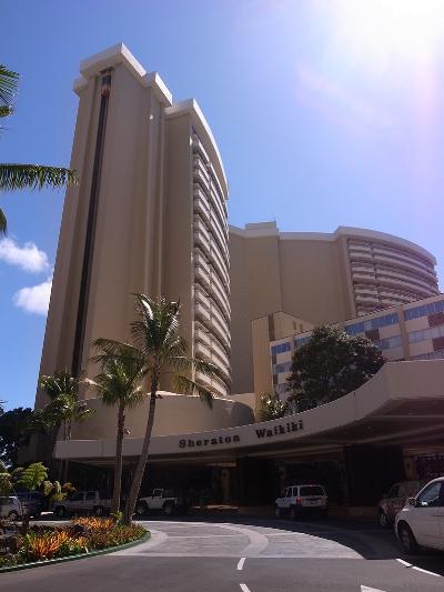
Once again, I suggested to Tony that we stay at the Sheraton Waikiki, a hotel I have stayed at before. It is right on the beach and has a garden annex with nice rooms that are budget-friendly. Cullinane is pretty good about spending client's money as efficiently as possible, whenever possible. Honolulu is a fairly expensive place, but there was no need for us to get rooms in the tower with nice views since we wouldn't be in them a great deal.
|
|
So Tony and I didn't know it wasn't a Sheraton, but I suppose that really didn't matter. It was the same hotel I remembered with the same service level. By the way, the Garden Annex where we stayed was a separate, four-story building to the left of the main entrance off Kalakaua Avenue (shown at left), situated in an actual garden and surrounded by palm trees.
On much more recent trips to Honolulu, I have noticed that the annex has been removed and the lobby and entrance area expanded. There is still a small garden, though.
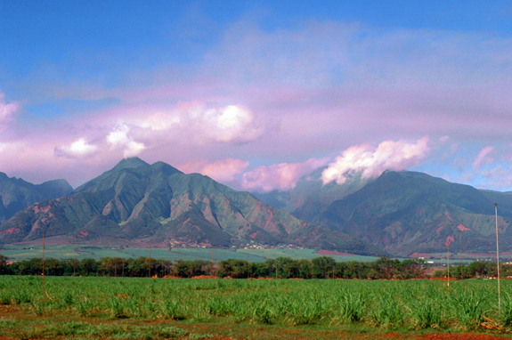
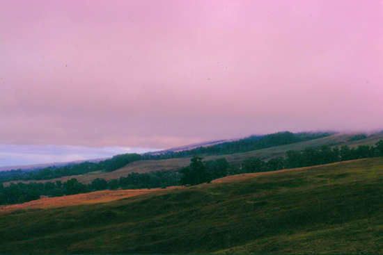
We spent our first week hard at work over at the Bank of Hawaii in downtown Honolulu, about a mile from the Sheraton and away from the beach. The bank wanted a lot of customization made to EEO-REPORTER, and I did most of that while Tony taught the class for CULPRIT (the basis of the EEO-REPORTER package). It was a successful installation, but we looked forward to the following week when we would be on our own to see some of the Islands. We did three main things here in the Islands. First, we took an entire day drive around the Oahu on the perimeter road that just about circles the island by the ocean. Second, we took a trip over to Maui, an island I'd not been to. We were there on my birthday. Finally, we also made a trip to the Big Island of Hawaii, as both of us wanted to see the active volcanoes there. Each of these three mini-trips will have its own section below.
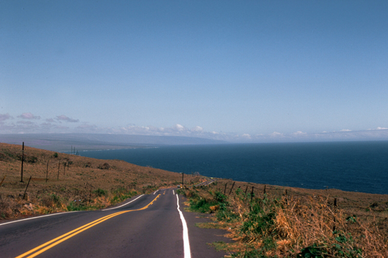
Driving Oahu's Perimeter Road
|
From there, the road heads north along the eastern coast of the island all the way up to the northernmost point- Kawela Bay. From there, the road continues along what is generally called the "North Shore" (famous for its surfing). The road continues around and along the north shore heading west.
Looking at our map before we set out, we could see that while the highway continues to the west along the north shore, it dead ends in the Ka'ena Point State Park. There has never been a passable vehicle road around that point; the entire area is protected. So at Haleiwa, we took Hawaii Highway 83 back south through the center of the island. Pretty quickly, that road turns into Highway 99, and that highway continues down into Pearl City. On the way, it traverses the center of the island, relatively flat relative to the mountains in the east and west.
It is here that most of the island's pineapple plantations are located. Last time I was here, I stopped at a field stand for a taste of pineapple fresh from the fields, and it was pretty amazing. Today, we just took a picture. Then we continued down past Pearl City and stopped at a lookout I know of to get views of the city before we took the expressway back into Honolulu.
I should say that I have been on this route twice before. When I stopped here on my way back from Korea, I did exactly what we did today- rented a car to drive around the island. I also made this drive when I stopped here in Hawaii the last time I had a business trip to Anchorage and used a triangle fare to come to Hawaii as well. So I knew a bit about what to expect. I also might have taken more pictures this time, but I'd taken many pictures the two previous times. But for Tony this was all new, and as you know, one thing that makes doing something over again more interesting is when someone is with you who is doing it for the first time.
|
Princess Bernice Pauahi Bishop (1831 – 1884), born Bernice Pauahi Paki, was an ali'i (noble) of the Royal Family of the Kingdom of Hawaii. At her death, her estate was the largest private landownership in the Hawaiian Islands, comprising approximately 9% of Hawaii's total area. The revenues from these lands are used to operate the Kamehameha Schools, which were established in 1887 according to Pauahi's will. Pauahi was married to businessman and philanthropist Charles Reed Bishop.
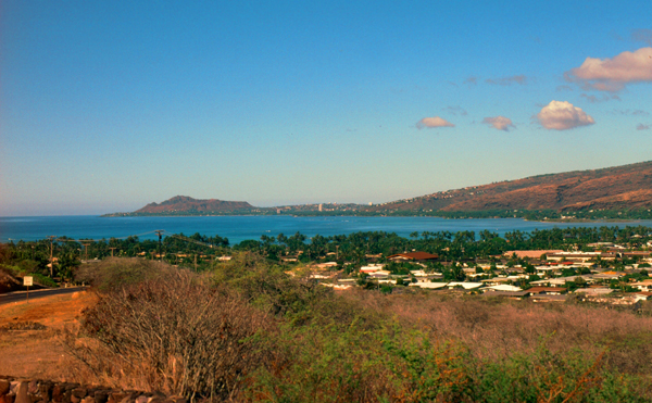
Beginning in 1959, and with the approval of the Bernice Pauahi Bishop Estate, the State of Hawaii began dredging the ancient Maunalua fishpond near Koko Head to form the Hawaii Kai Koko Marina (I am looking across that area in the picture at right). This dredging transformed the shallow coastal inlet and wetlands into a marine embayment and was accompanied by considerable land creation. In 1961, Kaiser-Aetna entered into a lease agreement with the land owner, the Bernice Pauahi Bishop Estate, to develop the 521 acre area into residential tracts with a marina and channels separated by fingers of land and islands upon which house lots and commercial properties would be laid out and developed. Nearly all of the low-lying lands surrounding the marina have since been developed, and neighborhoods now extend back into the several valleys and up the separating ridges. Kaiser was more than just "involved" in this project; he moved to Hawaii to oversee the project, and died in Honolulu as it neared completion.
|
I wish that we could have taken the time to explore this part of Oahu, as there is a great deal to do here. Of course, there is Hawaii Kai itself, with its golf courses and other attractions, but there are also Sandy Beach, Makapu'u Lighthouse and beach, Koko Crater Botanical Garden, the "From Here to Eternity" cove (where the famous scene was filmed), and Hanauma Bay. Sandy Beach, is a picturesque and sandy beach park barely a mile away from Kalama Valley. It is a popular beach for the local crowd, and, due to its quiet location and powerful waves, is a hot spot for body surfing but is rarely overcrowded with tourists. Koko Crater botanical garden encloses beautiful plumeria trees and plants from different regions of the world. There is an easy hike up to Makapu'u lighthouse, which overlooks the beautiful Makapu'u Beach, Sea Life Park and the windward coast. In the winter it serves as a whale watching lookout. As a marine-life sanctuary, Hanauma Bay is idyllic for snorkeling.
But we are going to continue along the incredibly scenic Kalanianaole Highway (State Route 72) which winds around this eastern point just above the waves that are continually crashing on the rocky coast. The Halona Blowhole is a blowhole in the rocky shore, and we stopped at the large pull-out/parking area to have a look. The adjacent Halona Cove is best known as the site of the love scene between Burt Lancaster and Deborah Kerr in the movie From Here to Eternity.
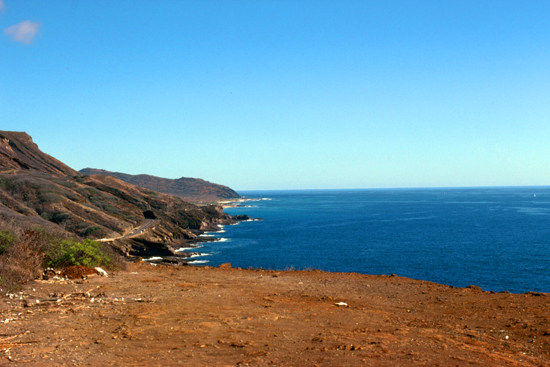 The Eastern Coastline of Oahu |
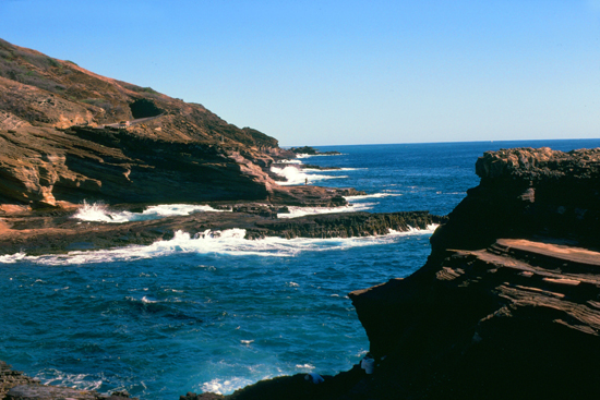 The Halona Blowhole |
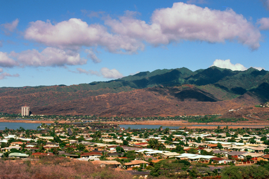
This entire eastern end of Oahu is very scenic and most of the area is part of Koko Head Regional Park, administered by the City & County of Honolulu. We continued up the coast, driving through the cities of Kailua and Kaneohe and then up into the more rugged area of the coast along Highway 83.
|
Bordered by the Ko'olau Range, the East Shore extends from Makapu'u Point and Lighthouse on the southeastern point of the island, all the way to Kahana Bay which adjoins the area known as the North Shore. The Windward East region is perfect for outdoor adventures such as swimming, hiking, kayaking, and snorkeling, with many beautiful beaches such as stunning Lanikai Beach, Waimanalo Bay and Kalama Beach.
Over the next hour or so, we continued our trip northward, finally rounding the northern tip of Oahu between Kahuku and Kawela Bay. From there, the coastline changed from rocky and volcanic to wide sandy beaches with sizeable waves pretty constantly. That's why the North Shore is so fabled in surfing circles.
|
The $7 billion Dole Food Company traces its origin to the 1851 establishment of Castle & Cooke by missionaries Samuel Northrup Castle and Amos Starr Cooke. Castle & Cooke rapidly became one of the largest companies in Hawaii, investing in shipping, railroad construction, sugar production and seafood packing. The other half of Dole's corporate heritage, the Hawaiian Pineapple Company, was founded in 1901 by James Dole, who opened his first pineapple plantation in the central plateau of the Hawaiian island of Oahu. (Dole's cousin was president of the Republic of Hawaii and the territory's first governor.)
(Note: In another odd coincidence, I would, on a visit to Dallas in 1982, make the aquaintance of one Terry Leff. Some years later, after I moved to that city from Chicago, I would become reacquainted with him and his parter, Scott Dole. Scott, as it happens, was a grand-nephew of James Dole, founder of the Hawaiian Pineapple Company. The pair would continue as good friends even after they moved from Dallas to Florida.)
When the United States annexed Hawaii, made selling agricultural products to the mainland much more profitable, since they would never be subject to import tariffs, so both Castle & Cooke and the Hawaiian Pineapple Company benefited. In 1932, Castle & Cooke purchased a 21% interest in the Hawaiian Pineapple Company, and in the 1960s purchased the rest of the company. Chances are that if you have eaten a pineapple, it was grown right here in Oahu's central valley. Tony and I stopped at the plantation roadside stand so he could taste a pineapple right out of the fields. If you have never tasted a field-fresh pineapple before, then you really haven't tasted pineapple. It was only recently that the combined company was renamed to Dole Foods.
(Note: Since you are visiting this page sometime after June, 2019, when it was created, then you may know that by the 1990s, land values and production costs, among other factors, had caused the Hawaii pineapple business to decline, and that today most pineapples consumed in the United States are grown in Central and South America. In fact, the very plantation you are looking at in my picture has turned into a tourist attraction called "Dole Plantation" with all kinds of family activities. There is still a small working plantation, but the pineapples grown here now are almost all consumed right here in Hawaii.)
|
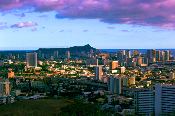
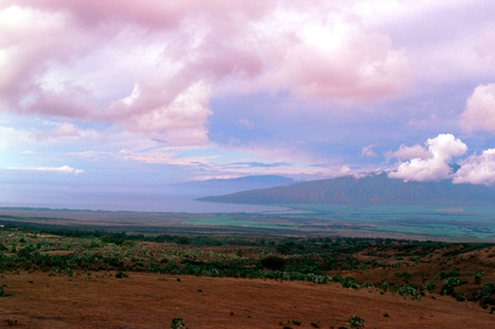
Instead, I drove Tony and myself to a spot known locally as the Pali Lookout where there are incredible views of Honolulu. That's where the picture at left was taken- one of the best pictures in my entire online photo album. In the distance you can see the extinct volcano known as Diamond Head (the volcano and the headland go by the same name), and between us and it the city of Honolulu.
Evidence of the first settlement of Honolulu by the original Polynesian migrants to the archipelago comes from oral histories and artifacts which date to the 11th century. After Kamehameha I conquered Oahu, he moved his capital and royal court to Honolulu in 1804 from the Big Island of Hawaii. Both were located in what is today downtown Honolulu. In 1794, Captain William Brown of Great Britain was the first foreigner to sail into what is now Honolulu Harbor. More foreign ships followed, making the port of Honolulu a focal point for merchant ships traveling between North America and Asia.
In 1845, Kamehameha III moved the permanent capital of the Hawaiian Kingdom from Lahaina on Maui to Honolulu. He and the kings that followed him transformed Honolulu into a modern capital, erecting buildings such as St. Andrew's Cathedral, Iolani Palace, and Aliiolani Hale. At the same time, Honolulu became the center of commerce in the islands, with descendants of American missionaries establishing major businesses in downtown Honolulu.
Despite the turbulent history of the late 19th century and early 20th century, such as the overthrow of the Hawaiian monarchy in 1893, Hawaii's subsequent annexation by the United States in 1898, the great fire of 1900, and the Japanese attack on Pearl Harbor in 1941, Honolulu remained the capital, largest city, and main airport and seaport of the Hawaiian Islands. It is also, of course, one of the most tourist-oriented cities in the United States, hosting some 5 million people a year.
A Trip to Maui
|
 |
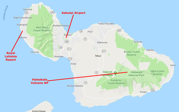
We were going to be staying over by Lahaina, only about fifteen miles from the airport as the crow flies, but as you can see from the map above, left, there's no road that cuts straight across the mountains and through the large forest reserve. Instead, we headed south from Kahului to Maalaea, and then took the west coast up to Lahaina. The Royal Lahaina Resort was another three miles beyond Lahaina itself.
|
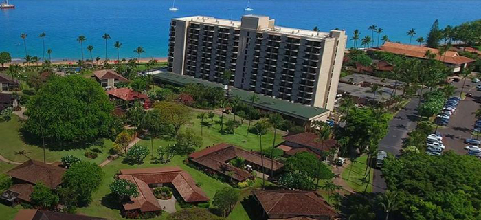
So one thing I didn't photograph was the actual resort, although we wandered all around it during our stay, went to the beach, ate in the restaurant, and so on. In working on this page, I was actually a bit surprised that the resort was still in operation forty years later, but even more surprised that when I visited their website and got the picture at right, the resort looked just as I remembered it. Tony and I stayed in a tower room, but you can see that there are also bungalows that are much more private. You can see what the grounds were like, where the beach was, and so on. Again, the hotel today looks remarkably just like I remember it.
I can say that when Steve made these reservations for us, the Royal Lahaina was just about the nicest resort on the island, but when I looked around as I was creating this page today, I've found that in the years since my visit, numerous other resorts and hotels have been built to cater to the hugely increased number of tourists who visit Maui. All the major high-end chains are represented now, and the Royal Lahaina Resort is now among the smaller properties around. It still has some cachet, though.
|
The bakery was quite busy when we walked in; the counter and display cases were manned, it seemed, by an oriental family- parents and a couple of young kids. Tony saw a chocolate cake in the display case that he wanted, and he asked the only person who wasn't busy, a 10-12 year old girl, to put it in a box so we could take it back to the hotel for after dinner. She seemed reluctant, and as I recall it seemed as if her English wasn't really great. Tony was insistent, and with everyone else in her family busy, she boxed the cake up, we paid for it, and left.
After dinner, we got some utensils from the hotel restaurant and went to our room to cut into the cake for dessert. I seemed very hard to cut, but I thought it was because I was trying to use a regular dinner knife. I finally got the first slice cut, but when I transferred it to a plate, Tony and I were surprised to find that the center of the cake was not brown (it was a chocolate cake after all) but green. My first thought was that the center was made of candied green cherries like in a fruitcake, but we immediately saw that the green was actually mold. Pretty much the entire interior of the cake was moldy, although it had looked fine before we cut into it.
Well, we got the number of the bakery and we called, even though we thought it had probably closed for the day already. Well, one of the adults answered, and as soon as Tony started to explain the situation, they knew exactly who we were, and had been hoping that we would call them. As it turned out, the reason the young girl was reluctant to sell the cake to Tony was that the cakes in the display case are just that- displays. They might bake a cake and put it in the display case and leave it- sometimes for months- just so customers can see what's available. The actual sellable cakes are kept in a large fridge in the back. The adult explained to Tony that their daughter had only been helping them for a couple of weeks, and didn't know how to explain that to Tony. They apologized profusely (as did Tony, for being insistent) and said that if we would drive immediately to the bakery, they would meet us there and switch out the cake. When we met them, they were very nice, we all had a bit of a laugh, and Tony and I left with not only a fresh cake, but also a humorous story to tell.
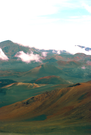
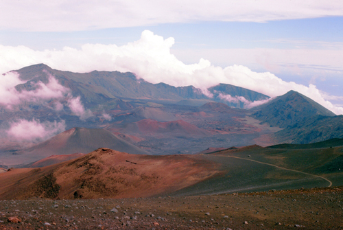
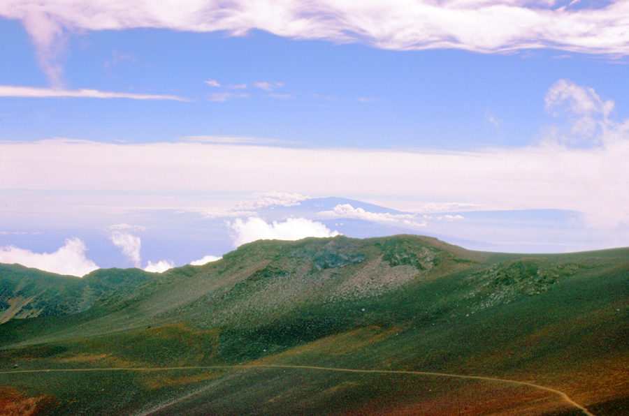
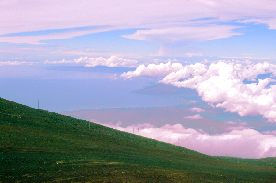
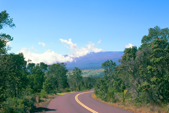
On our full day on Maui, we took a day trip to Haleakala, an extinct volcano on the island. To get there, it is about twenty miles from Lahaina, and then another fifteen up a steeply sloping road to the top. As this sequence shows, one first achieves impressive panoramas of the island, and then, as the ascent continued, we went into the clouds and finally through them.
 Heading Up Volcano Road - 1 |
 Heading Up Volcano Road - 2 |
 Heading Up Volcano Road - 3 |
 Heading Up Volcano Road - 4 |
Haleakala National Park covers an area of 52 square miles, of which about 30 square miles is a wilderness area. We weren't traversing the wilderness, but taking the tourist route up to the observatory from which we could look out over Haleakala Crater.
|
The park features the dormant Haleakala (East Maui) Volcano, which last erupted sometime between 1480 and 1600 AD. The park is divided into two distinct sections: the summit area and the coastal Kipahulu area.
We followed the extremely winding but well-maintained road that leads up the mountain. The summit area includes Haleakala Crater, the summit of the volcano, and the area surrounding the summit. This part of the park is accessed by Hawaii state road 378. There is a visitor center, with parking and restrooms, near the summit. At the summit itself is another parking lot and a simple observatory without facilities.
The main feature of this part of the park is undoubtedly the famous Haleakala Crater. It is huge- 7 miles across, 2 miles wide, and about a half mile deep. The interior of the crater is dotted by numerous volcanic features, including large cinder cones. Two main trails lead into the crater from the summit area: the Halemauu and Sliding Sands trails. Hikers in the crater can stay in one of three cabins (which need to be reserved through the park first).
|
The park is known for its unique volcanic features, its long scenic drive with numerous overlooks, and the unusually clear views of the night sky available. Haleakala is one of the best places in the United States for amateur astronomy, and binoculars and telescopes are available for rent from many local merchants. Nene (Hawaiian geese, Branta sandvicensis) can also be seen in their natural habitat in Haleakala Crater. Although nene died out entirely in the park, in 1946 they were re-introduced with the help of the Boy Scouts, who carried young birds into the crater in their backpacks.
Due to Hawaii's volcanic origin and isolation, all of the native plants and animals on all the islands evolved from pioneers, which arrived carried by the wind, waves or wings of birds. Before the arrival of humans, a new species arrived in Hawaii every 10,000 to 100,000 years and, eventually, each evolved into an endemic species, unique to the islands. More endangered species live in Haleakala National Park than any other national park in the United States. Sadly, once traveling to this part of the island became more frequent, native species were destroyed. One example is the Haleakala Silversword, a small white flower similar to edelweiss, which used to cover Haleakala Mountain to a degree where the mountain looked as if it were covered with snow.
We spent quite a bit of time up here this afternoon; it was cool and relaxing and the views were tremendous. We also took a short hike down one of the trails that led around the crater. I took a few more pictures, and they are below. If you would like to see a larger version of any of them, just click on it.
|
|
|
After we left Haleakala and got back down the mountain, we did a bit of driving along the coast road around the southern part of the island, and then back north towards Lahaina. We got back into Lahaina around dinnertime, so we found a local restaurant before returning to the resort. We hung around there for the rest of the evening and the morning of the next day before heading out on the second leg of our island tour- this time to the Big Island of Hawaii.
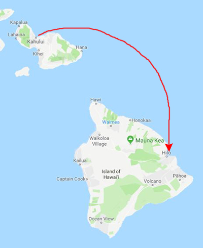
A Visit to Hawaii- "The Big Island"
|
|
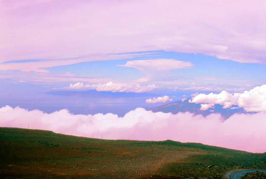
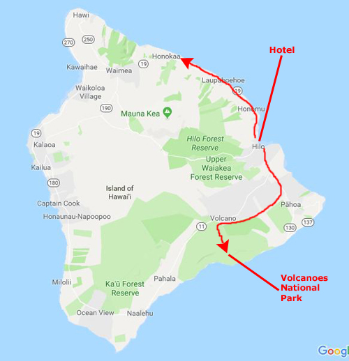
We would also be here on the Big Island for two nights, and we reserved the full day for a trip to Volcanoes National Park, which is south of Hilo. On our first afternoon here, we just drove up the coast, and on our last morning, we drove down south past the park as far as the southern tip of the island.
For some reason, the only pictures I took were on our day trip to the National Park; I assume this was either because I was running out of film or perhaps was deterred by the cost of taking lots and lots of pictures. In any event, it would have been nice to have taken more, but it is what it is.
NOTE:
I might mention that during our whole stay in the Islands, I probably also thought that I didn't need to over-photograph everything as I expected to be back here more times in the future- either on business or for pleasure. Fortunately, that turned out to be the case- except for Maui, to which I have never returned as of 2019. And a number of these trips were after the introduction of digital photography. The best of these trips was one we took in 2005 with two friends of ours, and if you have a particular interest in Hawaii, you might want to visit that page. You can use the link below to do so:
So, my apologies for the relative dearth of pictures from this trip, but there are certainly plenty that you can look at if you visit the pages for our trip in 2005. (It might actually be interesting for you to do that, as you will see photos of the same places taken almost thirty years apart.)
|
In this view, Volcanoes National Park is out of the picture to the left, and in the distance you can see the coast of the island north of Hilo. Hawaii is the largest of the Hawaiian Islands- and the southernmost. At just over 4000 square miles, it makes up 63% of the state's area, and is the largest island in the United States. However, it has only 13% of Hawaii's population. The island of Hawaii is the third largest island in Polynesia, behind the two main islands of New Zealand.
Hawaii is said to have been named after Hawai'iloa, the legendary Polynesian navigator who first discovered it. Other accounts attribute the name to the legendary realm of Hawaiki, a place from which some Polynesian people are said to have originated, the place where they transition to in the afterlife, or the realm of the gods and goddesses. Captain James Cook, the English explorer and navigator who was captain of the first European expedition that discovered the Hawaiian Islands, called them the "Sandwich Islands" after his patron, the Earl of Sandwich. Cook was killed on the Big Island at Kealakekua Bay on 14 February 1779, in a melee which followed the theft of a ship's boat.
Hawaii was the home island of Pai'ea Kamehameha, later known as Kamehameha the Great. Kamehameha united most of the Hawaiian islands under his rule in 1795, after several years of war, and gave the kingdom and the island chain the name of his native island.
Of course, one thing we really wanted to see was a volcano- preferably an active one. Luckily, there are three of them on the Big Island. The Big Island is actully build from five separate shield volcanoes that erupted somewhat sequentially, one overlapping the other. These are (from oldest to youngest):
|
Kohala – extinct Mauna Kea – dormant Hualalai – active Mauna Loa – active, partly within Hawaii Volcanoes National Park Kilauea – active, erupting often, part of Hawaii Volcanoes National Park |
|
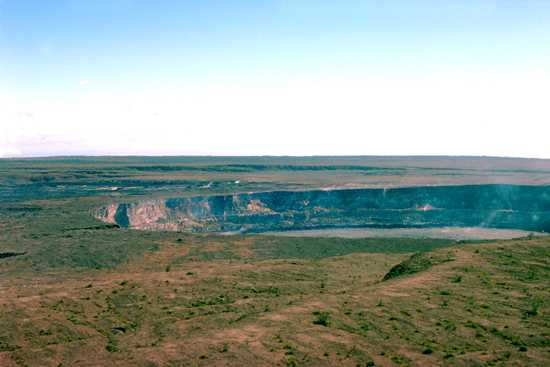
Hawaii Volcanoes National Park, established on August 1, 1916, encompasses two active volcanoes: Kilauea, one of the world's most active volcanoes, and Mauna Loa, the world's most massive shield volcano. The park provides scientists with insight into the birth and development of the Hawaiian Islands, and ongoing studies into the processes of volcanism. For visitors, the park offers dramatic volcanic landscapes, as well as glimpses of rare flora and fauna.
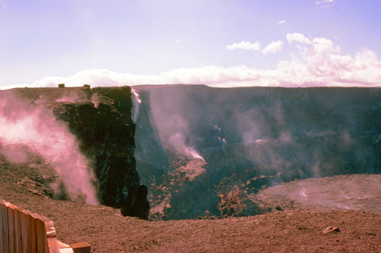
Kilauea and its Halemaumau caldera were traditionally considered the sacred home of the volcano goddess Pele, and Hawaiians visited the crater to offer gifts to the goddess. In 1790, a party of warriors, along with women and children who were in the area, were caught in an unusually violent eruption. Many were killed and others left footprints in the lava that are still visible. The first western visitors to the site, English missionary William Ellis and American Asa Thurston, went to Kilauea in 1823. Ellis wrote of his reaction to the first sight of the erupting volcano:
| "A spectacle, sublime and even appalling, presented itself before us. 'We stopped and trembled.' Astonishment and awe for some moments rendered us mute, and, like statues, we stood fixed to the spot, with our eyes riveted on the abyss below." |
The volcano became a tourist attraction in the 1840s, and local businessmen set up hotels near the rim. Currently, Volcano House is the only hotel or restaurant located within the borders of the national park. Lorrin A. Thurston, one hotel investor, was one of the driving forces behind the establishment of the park- an idea first proposed by William Castle in 1903. Thurston, who then owned The Honolulu Advertiser newspaper, printed editorials in favor of the park idea.
|
After several attempts, legislation introduced by a delegate from the Territory of Hawaii to the US Congress to create the park was finally passed, and was signed by Woodrow Wilson on August 1, 1916. Hawaii Volcanoes National Park became the eleventh national park in the United States, and the first in a territory. As it turned out, this legislation also spurred the Congress to create the National Park Service to run all eleven of the parks. Originally called Hawaii National Park, the park was officially renamed Hawaii Volcanoes National Park after being split from Haleakala National Park in 1961.
In recognition of his contribution, the park's most easily accessible lava tube was named for the Thurston family. This was my second visit to the park, and so I took Tony down to that lava tube, which allows visitors to follow a trail some 1000 feet into the hillside.
|
|
As you may know, the Hawaiian Islands were created, the modern theory holds, through the action of a single hotspot which, following plate tectonics, has been moving very slowly southeast. As it moved, the lava was ejected beneath the sea, and when the eruptions were large enough, or the hotspot paused long enough, the rock would break the surface of the sea, and an island would appear. Thus, the chain was slowly built up, with the oldest islands being at the northwest end of the chain. The Big Island, in the southeast, is the newest, and Kilauea, on its southeastern shore, the youngest volano.
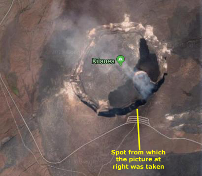
When you see news footage of eruptions at Kilauea, you usually see lava from the eastern side of the volcano being ejected diretly into the ocean, although there have been eruptions higher on the volcano's slope that have flowed down that slope to the ocean. The last time I was here, I actually drove right up to the point where lava had crossed the road and blocked it at a spot near the Thurston Lava Tube, and you may already have seen that picture. Today, there is a small eruption going on, but it is down by the ocean and we can't really get close to it.
We very much enjoyed visiting Hawaii Volcanoes National Park, and it was, of course, the high point of our visit to the Big Island. We stayed another night in Hilo before flying back to Honolulu. We stayed there another night or two, just relaxing, before flying home- me to Chicago and Tony on to Boston.
You can use the links below to continue to another photo album page.
|
December 15: Flying with Tony in Boston |
|
October 6-18, 1977: A Business/Pleasure Trip to England |
|
Return to Index for 1977 |