|
November 7-14, 1986: A Week in California |
|
September 13-19, 1986: A Class at NATO in Oslo, Norway |
|
Return to the Index for 1986 |
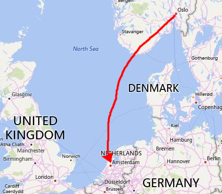
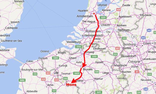
After the one week class in Oslo, the next two weeks assignments were to be at a NATO technical and communications facility southeast of Brussels, Belgium, in a town called Mons. Since there was no way to fly down on Friday afternoon, I decided to fly to Amsterdam on Saturday morning.
My First Week of Classes at NATO in Mons, Belgium
Arrival in Amsterdam
|
At Schipol Airport, Ed Broussard, the European sales representative for MDC, picked me up. The plan was that I would spend a day with him and his wife in Amsterdam, where they live, and then on Sunday he would take me down to Brussels, show me around, and then drive me down to where I would be staying.
Ed thought that it might be difficult for me to get situated at NATO without the help of someone local. NATO had made a hotel reservation for me a few miles north of the city of Mons, Belgium, but Ed knew that it would be hard for me to use any kind of public transportation to get there.
So we spent the afternoon wandering around Amsterdam (this was the second time I had been here; the previous time was some years ago when I did a class for Merck Pharmaceuticals just outside the city), and that night they let me stay with them in their house south of the city.
As I mentioned before, Ed is the European salesman for MDC, and the classes that are conducted in Europe are set up by him and are his responsibility. I had met him a number of times in St. Louis, when he came to the States for sales meetings. Linda used to work for MDC in St. Louis; Ed had met her some time previously and they had married.
I think that all the planning Ed did for the class and for getting me where I needed to be showed a very high level of conscientiousness. It is this attention to detail that has made Ed one of MDC's outstanding sales managers. I enjoyed wandering around Amsterdam with them; we visited a couple of places I'd been to before, but having a "local" show me around was a novelty.
|
|
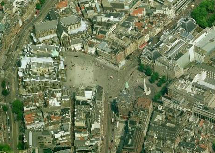
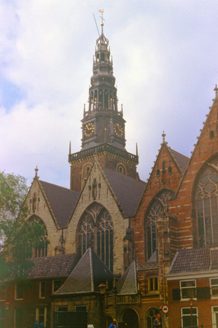
I was happy, too, that Ed and Linda served as guides around town. On this Saturday, lots of people were out strolling around and shopping, although the weather was cool. We not only had a chance to visit some of the iconic buildings and sites of Old Amsterdam, but I got a chance to see some of the more residential areas; a picture of one of them is at left.
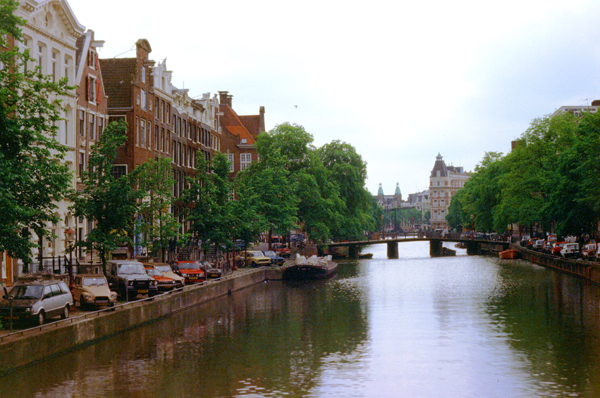
Of course, as everyone probably knows, Amsterdam is a city of canals, and a sizeable percentage of buildings border on one of them. The scene at left is typical. You can see that most of the buildings in the city are five or six stories tall, and there is a limited amount of parking along the canals themselves. The canals, of course, are spanned by bridges every so often, but many residents get around the city on the numerous barge-like craft that ply the canals.
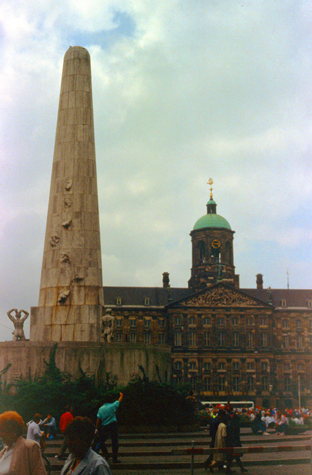 War Memorial and Royal Palace |
(Picture at left) This picture did not turn out as good as I had hoped. We are still in Dam Square.
Here is a view along one of the canals, with most of the buildings being commercial on their ground floors and residential above.
|
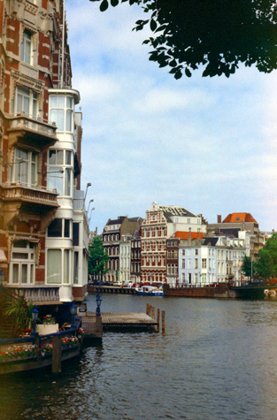 A Typical Canal Scene |
We had a nice dinner at the Broussard's house, and I got a good night's sleep in their little guest room. (Houses in Europe, even, apparently, for upper-class residents, are on average much smaller than those in America. Europeans have learned, however, how to make maximum use of the smaller spaces that they inhabit.)
Getting to My Hotel in Belgium
|
The drive down to Brussels from Amsterdam would have taken a couple of hours in the United States, but with the autobahn-like expressways and consequent speeds, we made the trip in about 90 minutes.
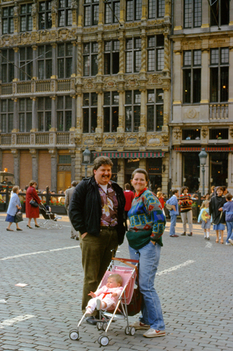
Ed drove right into the center of Brussels, found a place to park, and then we walked around the "centrum" for an hour or so. I found the city of Brussels to be much like Amsterdam; the architecture (and age) of the buildings was similar, the shops and stores looked pretty much the same, and the people walking around seemed also to be similar in economic status (at least so far as I could tell from their dress and their activities). In the entire walk, I did not see any evidence that any significant number of Brussels citizens were poor or even anywhere close to it.
|
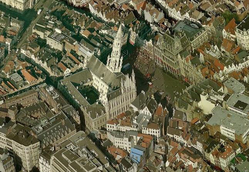
The Grote Markt (Grand Place) is the central square of Brussels. It is surrounded by opulent guildhalls and two larger edifices, the city's Town Hall, and the Breadhouse building containing the Museum of the City of Brussels. The square is the most important tourist destination and most memorable landmark in Brussels. It is about one-third larger than a standard football field (about the size of a typical stadium field plus the sidelines and end zones).
In the 10th century, Charles, Duke of Lower Lorraine constructed a fort on Saint-G�ry Island, the furthest inland point at which the Senne river was still navigable. This was the seed of what would become Brussels. By the end of the 11th century, an open-air marketplace was set up on a dried-up marsh near the fort that was surrounded by sandbanks. The market was called the Nedermerckt, or Lower Market. The market likely developed around the same time as the commercial development of Brussels; there are many references to it in early documents.
At the beginning of the 13th century, three indoor markets were built on the northern edge of the Grand Place; a meat market, a bread market and a cloth market.] These buildings, which belonged to the Duke of Brabant, allowed the wares to be showcased even in bad weather, but also allowed the Dukes to keep track of the storage and sale of goods, in order to collect taxes. Other buildings, made of wood or stone, enclosed the Grand Place.
|
The Brussels City Hall (shown in my picture at left) was built on the south side of the square in stages between 1401 and 1455, and made the Grand Place the seat of municipal power. It is over 300 feet high, and its tower is capped by a 12-ft. statue of Saint Michael slaying a demon or devil. To counter this symbol of municipal power, the Duke of Brabant built a large building across from the city hall as symbol of ducal power. It was built on the site of the first cloth and bread markets, which were no longer in use, and it became known as the King's House, although no king has ever lived there; its Dutch name translates to "Breadhouse" after the market whose place it took. Wealthy merchants and the increasingly powerful guilds of Brussels built houses around the edge of the square.
In 1695, the French began a bombardment of Brussels in an effort to draw the League of Augsburg's forces away from their siege on French-held Namur in what is now southern Belgium. The main target of the shelling was the Town Hall; the shelling of the mostly defenseless city was massive and both cannon and mortar were used. The city was set on fire and a majority of the Grand Place ans surrounding city were demolished. Only the stone shell of the town hall and a few fragments of other buildings remained standing.
The square was rebuilt in the following four years by the city's guilds. Their efforts were regulated by the city councillors and the Governor of Brussels, who required that their plans be submitted to the authorities for their approval. This helped to deliver a remarkably harmonious layout for the rebuilt Grand Place, despite the ostensibly clashing combination of Gothic, Baroque and Louis XIV styles. In the late 18th century, Brabant Revolutionaries sacked the Grand Place, destroying statues of nobility and symbols of Christianity.[2] The guildhalls were seized by the state and sold. The buildings were neglected and left in poor condition, with their fa�ades painted, stuccoed and damaged by pollution. In the late 19th century, mayor Charles Buls had the Grand Place returned to its former splendour, with buildings being reconstructed or restored.
At the start of World War I, as refugees flooded Brussels, the Grand Place was filled with military and civilian casualties. The Town Hall served as a makeshift hospital. On August 20, 1914 the occupying German army arrived at the Grand Place, hoisted a German flag and used the area for field kitchens, but their control was fleeting, and they were ejected from Brussels a year later. The Grand Place continued to serve as a market until 1959, and it is still called the Great Market or Grote Markt in Dutch. Neighboring streets still reflect the area's origins, named after the sellers of butter, cheese, herring, coal and so on. The Grand Place (would be named a UNESCO World Heritage Site in 1998 and voted the most beautiful square in Europe in 2010 by visitors to a Dutch website that conducted the survey.
|
Visitors to NATO over in Mons usually stay at a hotel in that town, but it was booked up for the first week that I was to be there, so the NATO people had to put me up at a small inn out in the country. It was a little tricky to find, as it is much off the beaten path. If you start from the NATO installation, it is fairly easy to find, but coming from Brussels it was a little trickier.
We had to follow some back roads through the countryside, passing through a couple of very small farming towns on the way. The largest of these was Lens, which is the town just south of where the hotel was located. The inn was about thirty miles from Brussels, and about ten miles northwest of Mons. I really enjoyed being able to look at the countryside as Ed drove along.
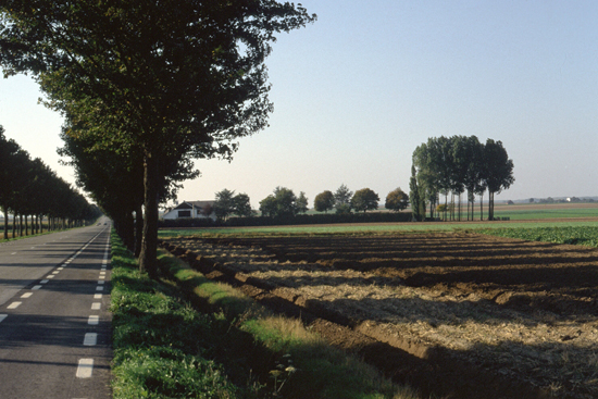
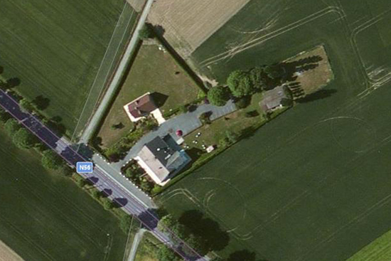
When we passed through Lens heading northwest, the sun started to come out, and as we approached the country inn where I would be staying, the afternoon sunlight made the countryside seem quite beautiful. When Ed told me that the inn was up ahead, I had him stop so I could get a picture of it. The scene is typical of the countryside here; on either side of the road are farms and fields, and trees have been planted along the roadway, I presume for beautification. The picture I took is below, left. For interest, I have also obtained an aerial view of the inn- L'Auberge d'Lens- and I have put it at right, below.
 |
 |
We arrived at the inn, and Ed used his Dutch and French to get me situated there. The innkeeper spoke very little English, but everything had been arranged by NATO and Ed did most of the talking. The inn itself was like a large house, with five or six rooms on the upper floor and a restaurant and bar on the ground floor. Ed had to start back to Brussels, so I was left at this small inn, where little English was spoken, to fend for myself for my first afternoon and evening. My room was much like any other hotel room, but there was no telephone and no television.
My Daily Routine While at NATO
|
On Monday afternoon, the class coordinator took me over the a local rental car agency so that I could get a car using the NATO contract (Ed had brought me down from Brussels and dropped me off at the hotel L'Auberge d'Lens). From that point on I was at least mobile, and could drive out in the evenings, which made staying at the out-of-the-way inn a good deal easier to take.
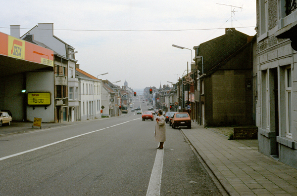
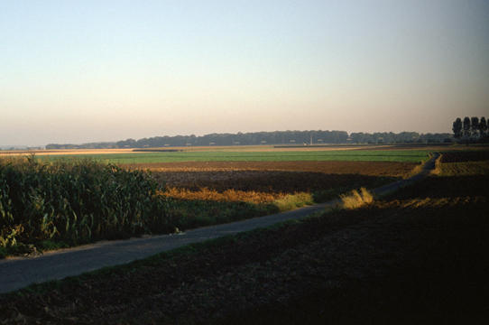
Since I had my own transportation, on Tuesday morning I decided to take my camera to work so I could photograph the countryside along the way from northwest of Lens down to the training facility at Mons. The country inn was just north of the small town of Lens, Belgium, and at left is another view of it that I took this morning.
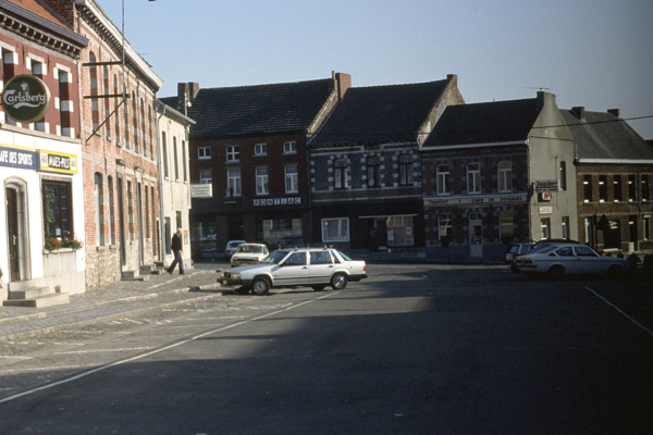
There was never a lot of traffic while I was here, and such traffic as there was moved along at a rapid clip, except when the road went through a small town or populated area. Even going through the towns like Lens, there wasn't much traffic, and even down in Mons, the largest town around, the traffic was light by U.S. standards.
|
As you can see from these pictures, the area of Belgium where I was staying is very rural, and the Inn, out in the middle of farm country, was quite unlike any hotel I have stayed at before. Although I have often stayed at very small hotels in my travels, none have been so isolated as this one. From my pictures, you can see that there are no other businesses around, and no fast-food franchises within eyesight (actually, I found that there weren't any at all out in the country, and I don't recall seeing any in Mons, either. The L'Auberge d'Lens was like an oasis in the farmland.
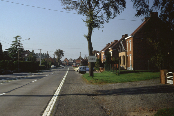
Even though I was isolated at the hotel, I was only there in the evenings. The area was very pretty, and I did take the opportunity to put on my jogging stuff and go out for a run almost every afternoon. I ate at the dining room most nights, although on one occasion I went into Jurbise to a small local restaurant that I had noticed driving through. The weather, cool at the beginning of the week, warmed up towards the end.
|
NATO, of course, is not an entirely military organization; many of its installations are supportive in nature. The member countries may have standing armies and contribute military personnel to the organization, but the two facilities I have been at bore little resemblance to stateside military posts that I have been to.
There were soldiers around, of course, and some of the people in my classes were uniformed officers. But most of the people I dealt with were civilian (or, at least they weren't in uniform). Other than the occasional soldiers, who wore the uniforms of their respective countries, the whole installation looked just like a lot of office buildings clustered together.
My classroom was a small affair on the second floor, and the class attendees were representing some five or six countries. As with all the European classes, the attendees all spoke English well enough to understand what was going on, although the proliferation of accents was often disconcerting. I certainly ran into a much wider variation of names than is usual for the classes that I conduct here in the States.
There was a little cafeteria a couple of buildings over, and that is where the class went for coffee breaks and for lunch. I ate there a couple of times, but was usually content to munch on one of the snacks I bought at a place in Jurbise. Once the class was underway, I couldn't really tell that I was actually in Europe- save for the proliferation of accents, of course.
On my way back to the Inn this afternoon, I took two more pictures worth including here:
 The Countryside Near L'Auberge d'Lens In the late afternoon sunlight the area around the inn is very pretty. Beginning on Monday afternoon, I was able to go out jogging on some of the country roads right around the inn. I also felt better on Monday afternoon because I had been able to call Grant through the NATO telephone network at headquarters. |
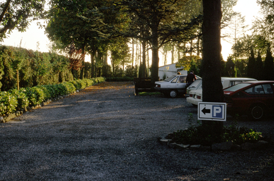 The Parking Area at the Inn My class coordinator was very familiar with the difficulties and expense of trying to call home from a small hotel, and was happy to let me use his office to call home. When I called Grant in the afternoon, he was just getting ready to go to work, but we were able to talk every day or two, and that made me feel much better. |
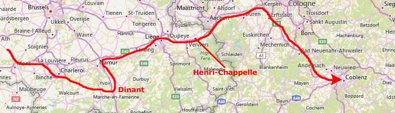
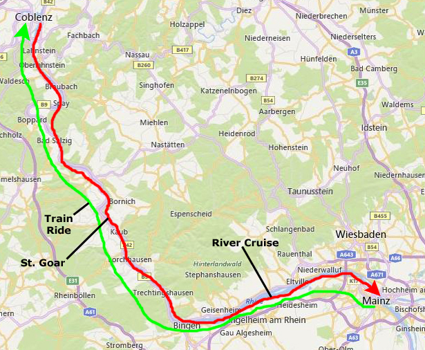
A Weekend in Germany
The Drive from Mons to Coblenz
|
Saturday was overcast most of the way, but the drive was interesting. There was always something to stop and see, but I didn't take as many pictures as I might have due to the weather.
The drive was very pleasant; there wasn't much traffic and the roads in Europe are pretty darn good. The scenery was also amazing, although I wished that the weather had been better. I could imagine how much better my pictures would have looked with sunshine and blue skies.
 The Road Between Mons and Charleroi |
 The Countryside Southeast of Charleroi |
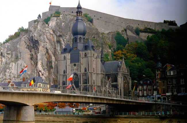
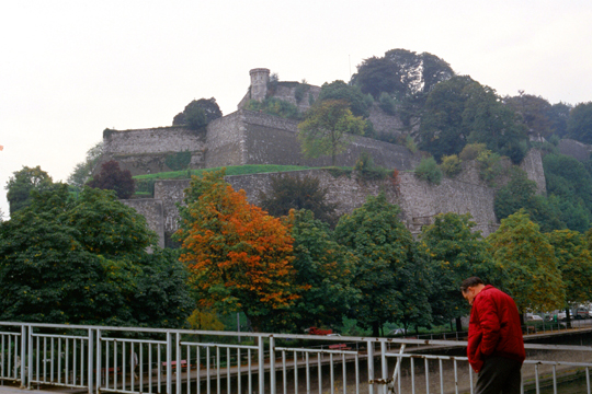
The Citadel at Dinant
|
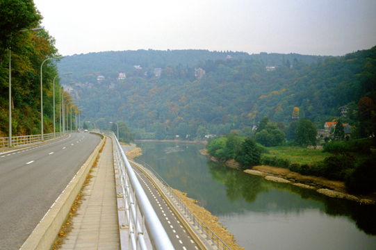
The Citadel of Dinant is a fortress located in Dinant in the Province of Namur, Belgium. The current fort was built in 1815 on a site which was originally fortified in 1051 when the region was ruled by the Prince-Bishopric of Li�ge. The citadel overlooks the city of Dinant and the strategic Meuse river which runs through the town. It is open to the public. Together with the Citadels of Huy and Namur, the Citadel of Dinant forms part of the so-called Meuse Citadels.
In my picture at left, you can also see the Collegiate Church of Our Lady, a 13th-century Gothic cathedral, right on the banks of the Meuse. The collegiate church replaced a 10th-century Romanesque church which collapsed in 1228, leaving only the North door. Its most iconic part is the separate 16th century pear-shaped bell tower.
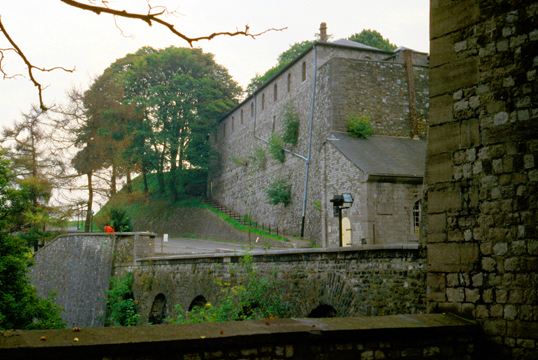
A fortress that watches over the city, the Citadel of Dinant blends with the cliff face on which it sits, complete with a grassy roof, so, from a distance, it's difficult to see. However, once inside, a huge interior courtyard and a museum offer visitors a glimpse back in time. The hike to the top required an ascent of 400 steps, and I was energetic enough to go up that way. For the less adventurous, there is also a cable car.
|
|
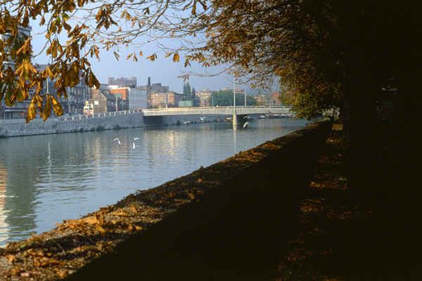
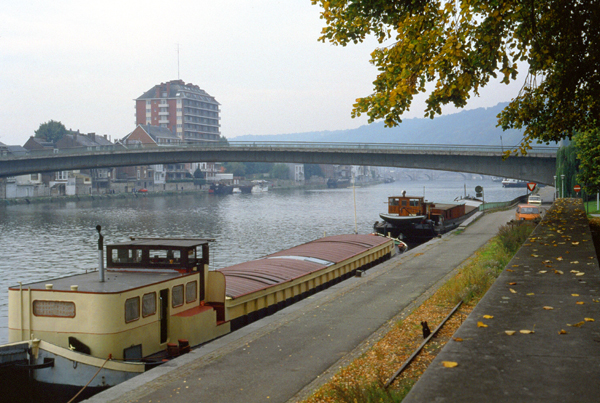
It is interesting how so much of the commerce of Europe takes place along the waterways. This very unlike the United States, where you can find large cities out in the middle of nowhere (like Dallas or Phoenix). In Europe, all the towns seem to have developed only where there was water transportation, and the reasons for this are obvious, given the age of the area.
At the top, you could wander around the fortifications and visit the museum to learn about the fortress' history; there were not only traditional museum exhibits, but also a life-size diorama of defenders in the citadel. The citadel was not crowded today- probably because the weather was not so good.
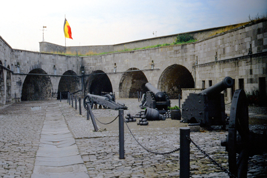 Inside the Citadel of Dinant This particular fortification dates from 1450, with modifications having been made to it as recently as the Second World War. The cannon that you see here have a commanding view of the river, both up and down, as well as the town. The entire fort is made of stone blocks, with heavy wooden doors to armories and living quarters. |
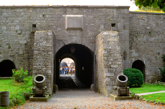 Entrance to the Citadel of Dinant Of course, these fortifications are only for tourists, now, and so some effort has been made to "beautify" them. This is one of the two main entrances; you can see the tourists inside as well as some of the landscaping that has been done outside. I can't imagine that beautification was an issue when the citadel was in use. |
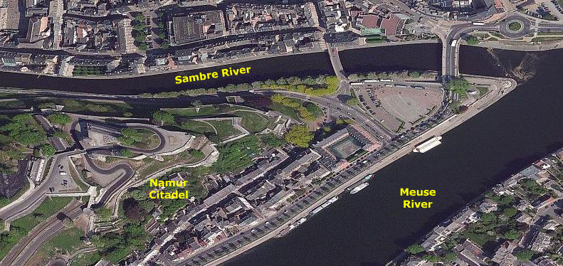
The Citadel at Namur
|
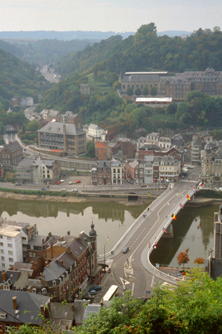
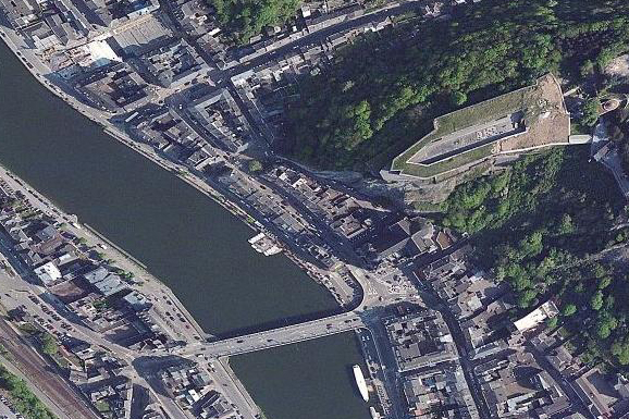
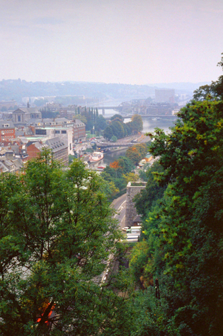
I didn't have any accurate information with me about how to access the fortification here at Namur, but when I got into the city I could see it across the river. I thought the easiest thing to do would be to find a place to park the car and then walk across a bridge over the Sambre River to get to the citadel.
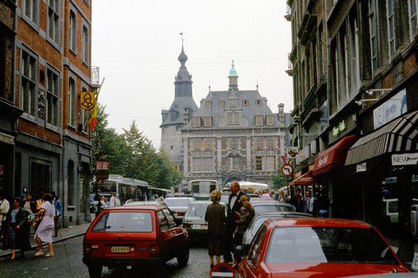
I was able to find a place to park without too much trouble, and then had to walk a ways through town to get to a bridge across the river Sambre. Saturday is market day in most of Europe, and is the busiest shopping day of the week. The downtown area was quite crowded; I had to park some distance away and walk through the center of town. The Namur City Hall is in the distance, and one of the city's largest public squares is in front of it. I found a particularly good pastry shop where I had lunch.
The town was an important trading settlement in Celtic times, straddling east-west and north-south trade routes across the Ardennes. The Romans established a presence after Julius Caesar defeated the local Aduatuci tribe. Namur came to prominence during the early Middle Ages when the Merovingians built a castle or citadel on the rocky spur overlooking the town at the confluence of the two rivers. The town developed somewhat unevenly, as the counts of Namur could only build on the north bank of the Meuse - the south bank was owned by the bishops of Li�ge. In 1262, Namur fell into the hands of the Count of Flanders, and was purchased by Duke Philip the Good of Burgundy in 1421.
|
General Jean-Baptiste Cyrus de Valence's column laid siege to the city on 19 November 1792 during the War of the First Coalition and, after 12 days, the city surrendered on 1 December and its whole garrison of 3,000 men was taken prisoner. France invaded the region again in 1794, annexing Namur and imposing a repressive regime. After the defeat of Napoleon in 1815, the Congress of Vienna incorporated what is now Belgium into the United Kingdom of the Netherlands. Belgium broke away from the Netherlands in 1830 following the Belgian Revolution, and Namur continued to be a major garrison town under the new government. The citadel was rebuilt yet again in 1887.
Namur was a major target of the German invasion of Belgium in 1914, which sought to use the Meuse valley as a route into France. On August 21, 1914, the Germans bombarded the town of Namur without warning. Several people were killed. Despite being billed as virtually impregnable, the citadel fell after only three days' fighting and the town was occupied by the Germans for the rest of the war. Namur fared little better in World War II; it was in the front lines of both the Battle of the Ardennes in 1940 and the Battle of the Bulge in 1944. The town suffered heavy damage in both wars. After the war, peace allowed Namur to develop rapidly, and just earlier this year the city was officially declared the capital of the region of Wallonia.
 The Citadel of Namur The citadel is originally from the Roman era, but has been rebuilt several times. Its current form was designed by Menno van Coehoorn, and improved upon by Vauban after the siege of 1692. It has been classified as a Major Heritage site in Belgium. |
 Inside the Citadel of Namur The original citadel dates to 937, but it achieved its present extent between 1631 and 1675. It was disestablished as a military post in 1891, superseded by a new ring of forts around Namur that were calculated to prevent the city from being attacked with artillery. This ring became the Fortified Position of Namur in the 1930s. |
I enjoyed walking around through the citadel; again, there was a small museum and a number of outdoor exhibits. And, of course, the views from here were quite good.
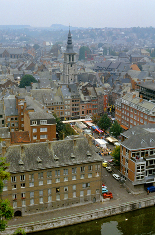 |
(Picture at left) Here is part of the city of Namur as seen from the Citadel. I imagine this area is even more beautiful when the weather is good.
(Picture at right)
|
 |
Li�ge and the Drive to Coblenz
|
The first references to Li�ge are from 558, when it was known as Vicus Leudicus. Around 705, Saint Lambert of Maastricht is credited with completing the Christianization of the region. A few centuries later, the city became the capital of a prince-bishopric, which lasted until 1794. The city became a major intellectual and ecclesiastical centre and maintained its cultural importance during the Middle Ages.
The strategic position of Li�ge has made it a frequent target of armies and insurgencies over the centuries. It was fortified early on with a castle on the steep hill that overlooks the city's western side. In 1345, the citizens of Li�ge rebelled against their ruler and formed a unique political system- the guilds and each person registered in a guild had an equal voice. This democratic spirit in Li�ge survived through the Middle Ages. From 1450 to 1900, the city was ruled by a variety of countries and individuals, including Duke Charles the Bold of Burgundy, France, the Holy Roman Empire, the Habsburgs, Spain, the Bavarian family Wittelsbach, the Duke of Marlborough, the Republic of Li�ge, the United Kingdom of the Netherlands, and, finally, Belgium.
Li�ge's fortifications were a major obstacle to Germany's army in 1914, and to the delay created when the Germans had to spend two unplanned weeks to on the way to France is credited the eventual failure of the German invasion of France. The Germans returned in 1940, this time taking the forts in only three days; it would be 1944 before the city was liberated, although the city was almost destroyed in the process. The city recovered, but in the 1950s began to suffer from a relative decline of its industry, particularly the coal industry, and later the steel industry. Labor strife led to many modifications in city policies; by the 1970s, Li�ge hd become known as a traditionally socialist city.
|
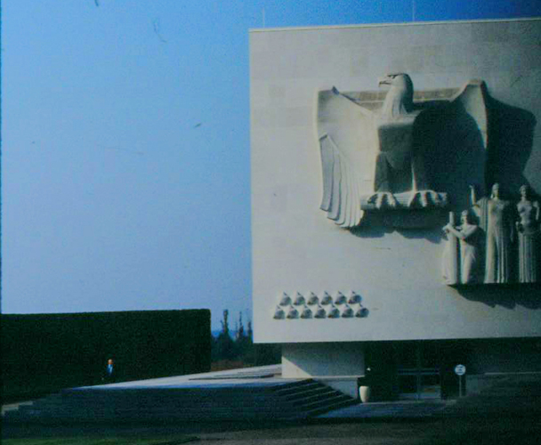
The fifty-seven acre cemetery and memorial was located right off the major highway I was driving to get to the German border at Aachen, about 12 miles away. The cemetery is one of three American war cemeteries in Belgium; the other two are Flanders Field American Cemetery and Memorial (World War I) and Ardennes American Cemetery and Memorial (World War II).
Although I had no relatives who fought in the War, and although I had no particular ties to the area, I thought I would stop to see this cemetery. The entrance to the graves is through this row of well-kept and carefully-manicured trees. At the end of the drive, one comes out into a huge open area with thousands of little crosses stretching off in all directions.
When the cemetery opened out I could see some sort of visitor center or monument, and surrounding it, as far as I could see, were the white crosses marking gravesites.
 |
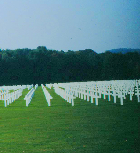 |
Although the surrounding countryside was much different, this cemetery reminded me of nothing so much as the Punchbowl on the hillside above Honolulu.
|
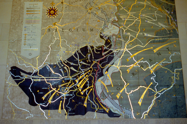
One part of the monument listed the major units that were engaged in this area. (I took more pictures than I have included here, but the same camera malfunction was occurring intermittently, and all but the one at left were spoiled. After I returned to Dallas, I had the camera cleaned and this has seemed to solve the problem.)
Here is a close-up of some of the inscriptions on the actual monument. Again, the similarity to the Punchbowl in Hawaii is strong. Here, the map shows the organization of the troops that fought in this area during the war, and various maps, like this one, show the campaigns and battles that were fought. The rest of the memorial contains similar descriptions of the War as it was conducted in this area and, where it is known, the names of the soldiers who fell and were buried here.
I noted that three Medal of Honor recipients are buried here: Brigadier General Frederick W. Castle (1908�1944), for action as an Army Air Force pilot (the highest-ranking soldier buried here); T/4 Truman C. Kimbro (1919�1944), for action against enemy forces in Belgium; and PFC Francis X. McGraw (1918�1944), for action against enemy forces in Germany. There were two other notable servicemen buried here. One was the film actor James G. Snitzer (1926�1945), and the other was William Harrell Nellis (1916�1944), a USAAF pilot for whom Nellis Air Force Base was named.
|
Although the weather had been fairly nice earlier in the afternoon, it began to deteriorate as I drove along. By the time I got out of the car to take this picture, it had gotten distinctly chilly, and I was happy that I had brought my light jacket with me. The sky became totally overcast, which lent a melancholy aspect to the few pictures I took along my drive.
The highways in Belgium were pretty good, but at the German border, the highway became even better, and I could increase my speed- even though I was not traveling on one of the famous "Autobahns." The highways seemed open and well-maintained, and the vehicles routinely traveled between 70 and 90 miles an hour.
I stopped a few times along the way just to look at the scenery, as it was so much different than Dallas. For one thing, there seemed to be rivers and streams everywhere, and most of them had a fair amount of river traffic.
|
Some distance west of Cologne, I followed my map and changed highways to head southeast towards Coblenz. One interesting thing about European highways is that most of them go right into the center of towns; this avoids the problem we have in the States where a major highway will bypass the town center and cause development to move out of the town itself and out to where the highway (and the potential customers) are. When this happens, town centers atrophy. Having the highways go right into the towns here in Europe seems to keep them vibrant and alive.
One other thing I noticed was that even when a major highway did seem to go around a city, there were signs directing traffic to the center of the town being bypassed; these were the frequently-seen signs that said, simply, "Centrum". The highway I was on actually went around the west side of Cologne, and at many "exits" there were "Centrum" signs directing traffic right into Cologne. I, however, continued southeast, and it was along this road that I stopped to take the picture at left of this part stream and part canal.
The weather did get a bit better as I drove southeast towards Coblenz; the highway nice and I enjoyed the drive. As I neared Coblenz, I followed one of those "Centrum" signs and found myself on a major highway that led right into town and to a bridge across the Rhine River.
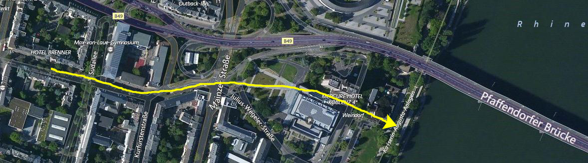 |
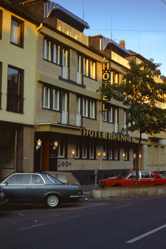
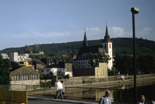
I reached Coblenz late in the afternoon of Saturday the 27th. By the time I reached the city, it had gotten quite overcast again, and a bit more chilly. It was too late to take any kind of trip out on the river, so I resolved just to just find the hotel my class members had recommended and then perhaps take a Rhine River cruise on Sunday.
|
The Hotel Brenner was in an old building, but well kept (actually, it seems that most everything in Europe is in an old building). My room, on the third floor, was small but neat and clean. There was a large feather bed that dominated the room, all done in white with a very pretty comforter. There was a small television, a radio, a telephone, a closet and a small bath.
I took the time to take a long soak in the tub before I went out to get some dinner. My experience with European hotels, both in Oslo and here has been that the older ones are more like large houses; there are very rarely long halls with identical rooms off either side. More often, the rooms more haphazardly arranged and decorated differently. This hotel was quite reasonable and certainly comfortable enough.
On my way to dinner, I walked down to the bank of the Rhine to take a look at the river and to get some information about the river cruises. The cruise kiosk was still open, so I purchased a ticket for the next day.
I had an excellent meal at a local restaurant just down the street from The Brenner (German food, naturally). Although it was very grey and somewhat chilly, I walked around town for a while, going back down to walk along the river a ways, and then I went back to the hotel for one of the most comfortable nights I have ever spent; I opened the room's window and snuggled under the down comforter that was on the bed.
NOTES from 2017:
Looking at the Brenner's website today, I can see that the hotel has been changed a good deal, although the outside is unchanged from the picture you see above. As far as my walk around the city is concerned (and indeed my whole trip over here from L'Auberge d'Lens) I can't help but wish that digital photography had been available to me this year; I certainly would have taken a great many more pictures than I did. Eliminating the cost of film and film developing has meant that all of us feel free to snap photos all the time, and I certainly would have had had more pictures of the citadels, of the Henri-Chappelle Cemetery, and of my walk around Coblenz. And certainly, I would have taken many, many more pictures during tomorrow's river cruise. I also would not have had the problem that spoiled quite a few of the pictures I did take tomorrow. If you have not already seen some of the photo album pages from 2004 or later (when I got my first digital camera), then you don't know how digital photography revolutionized my picture-taking.
A Cruise on the Rhine River
|
At Mainz, I will get off the boat and find my way to the train station and catch a train back to Coblenz. The train schedule says that the return trip will be just about 90 minutes; the cruise itself will take almost seven hours.
I may be using the wrong word when I call this a river "cruise". The boat I will be on is actually more of a commuter craft; it will make a good many stops on its way down to Mainz, taking on passengers and letting them off. I guess I think of it as a cruise because the boat had open areas like cruise ship decks with chairs and lounges on them. There were also inside areas, including a bar and a small cafe that served a limited menu. But so far as I knew at the beginning, there were no staterooms or such. I came to find out that this was incorrect; there actually were a few private rooms that passengers going long distances could book. But for my day cruise, I spent all my time wandering around the boat and looking at the scenery as we passed.
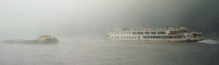
I wish that the weather had been better for my visit to Coblenz and my trip on the Rhine River. The morning started out even more overcast and foggy than it was the night before, and for the first few hours, that is the way it remained. I was fortunate, I guess, that along about noontime the fog and clouds lifted and for the last few hours of the cruise (as well as my entire train ride back), the weather was actually pretty good.
|
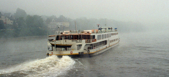
This picture, taken shortly after we left, is another boat on the river- going in the same direction that we are. The boats are run by different companies, and I understand that they do not all stop at the same places. It is kind of like the New York subways; the line you take depends on where you want to go, although all the trains use basically the same set of tunnels.
I could not see the banks of the river at all most of the time, as the fog was very thick. I suppose that is what happens when a spell of warm weather is followed by much colder temperatures.
 A Shore Scene South of Coblenz This appears to be a private home, but with land along the river being at a premium, it's entirely possible this is some sort of small hotel or maybe a B&B. I would think that land on the river would be too expensive for private owners, or would have been pre-empted by the government to protect the navigability of the river and access to it. |
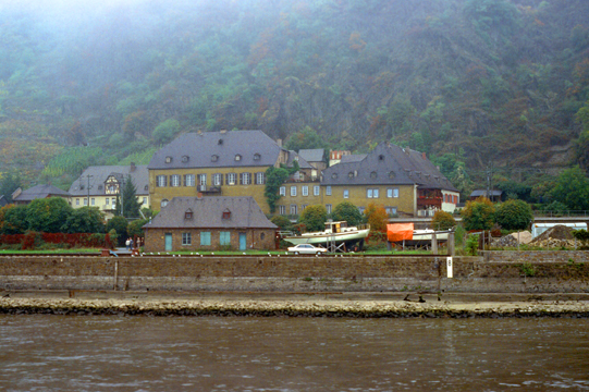 Along the Rhine South of Coblenz As we continued to move up the river, there were a number of different scenes. This is probably even more likely to be some kind of hotel or other commercial structure; it appears to be far too big for a single house. Note how the mountains slope up steeply from the banks of the river. |
At times, it seemed as if the sky was brighter, and I thought the fog might start to lift, but then five minutes later it would be heavy again.
|
We got underway again a few minutes later, and it was about this time that the weather started to improve.
|
As the morning progressed, the fog started to lift, and the sun started to shine through the clouds in places. This offered better opportunities for picture-taking. I saw this church and small cluster of buildings on the west side of the river while I was inside, and by the time I got up on deck to get the picture, we were past the town, so this shot looks backwards. The buildings were typical of those we saw along the river.
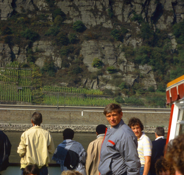
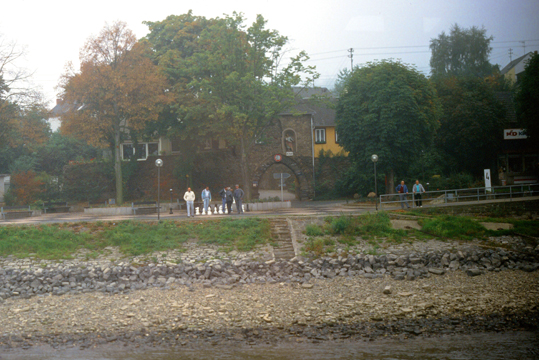
While I was inside for a while, I ran into a group of young people from the United States who were traveling around Europe for a month. Most of them were in their mid-20s, and so they were fifteen years younger than I. They were fun to talk to, and with the boat as small as it was, I tended to run across one or more of them fairly frequently.
|
|
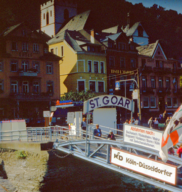
Although the weather seemed to be slowly getting better, the fog seemed to come and go sometimes, particularly when the riverbanks were steeper and the sun was having a harder time burning it off. Here are two pictures that I took just before we got to St. Goar:
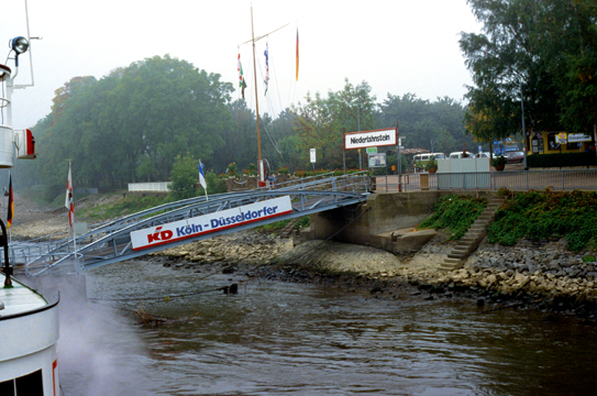 The line I was on was the "Koln-Dusseldorf" line, Dusseldorf being another city on the Rhine south of Mainz. Each line has its own stopping points (although some of them are common). People will know the schedule of the boats and come down to the embankment point in time to catch it. I suppose that we stopped four or five times during the trip at small stops like this one. |
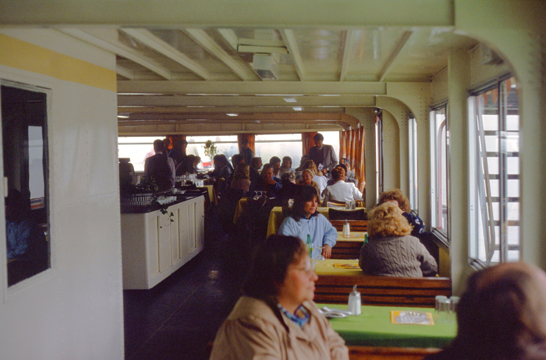 Our boat had three levels, with an inside and outside at each level. The boat served a breakfast and lunch, as well as drinks and snacks throughout the trip. I think about half the riders were tourists; the rest were locals using the boat for everyday transportation. I was told that the clientele is mostly local during the week. |
|
|
Among the people the impression arose that the castles spied on themselves like cat and mouse. So both bastions got their nicknames, under which they are known until today. Mouse Castle opens its gates for visitors. Inside is a wealth of antique furniture and interesting collections.
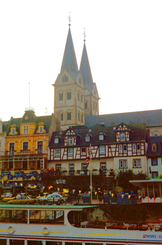
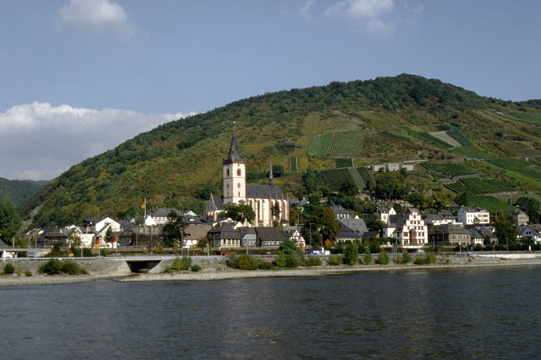
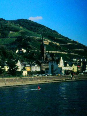
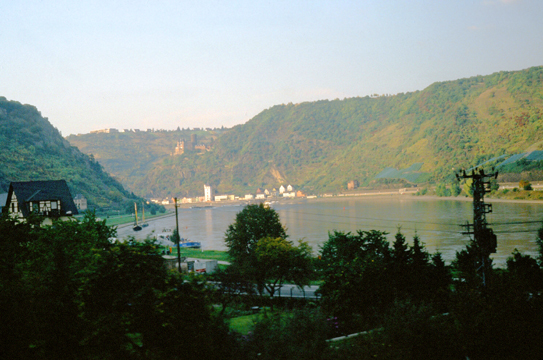
Here is our stop at St. Goar, a town about halfway between Coblenz and Mainz. This was another picture I had to crop to get rid of the black border that's been happening.
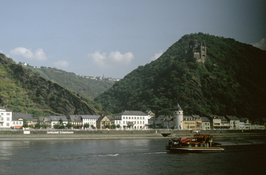
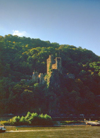
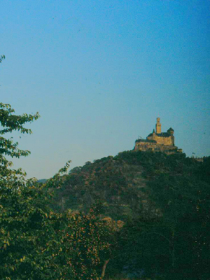
Now that the sun has come out, the pictures I took turned out much better and, as a bonus, few of them showed the imperfection that had plagued me this trip. With the sun out, the next small town and Katz Castle provided excellent views.
|
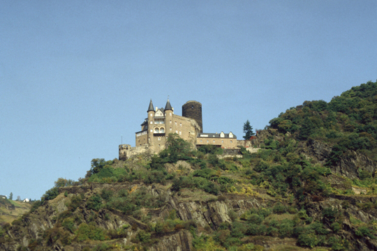
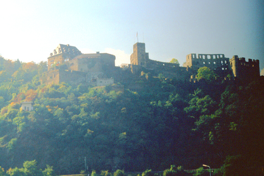
The interesting thing about this picture is the castle high up on the hillside above the riverside town. It it called Katz Castle, and it has an interesting history.
This castle is actually a reconstruction, although it is supposed to look like the original; like many of the castles along the Rhine, there was a reason for building it high on a hill and as sturdy as possible.
|
After the invention of firearms, Katz Castle had to be substantially reinforced. It was also upgraded as bastion against Maus Castle in the Electorate of Trier. At the same time the donjon of Katz Castle was raised to approximately 200 feet to ensure eye contact with Reichenstein Castle which is approx 1.9 miles away. In 1479 the family line of the Counts of Katzenelnbogen died out.
In a succession of long-lasting disputes on heritage, Katz Castle and Rheinfels Castle were besieged, demolished, rebuilt and extended several times. Even though repairs had been made in 1800, Napoleon blew up Katz Castle in 1806.
In 1896 District Administrator Berg acquired Katz Castle, to reconstruct it as close as possible to the original design. From 1946 till 1951 Katz Castle served as local High School "Institut Hofmann" including board. At the time I passed by here, the castle, like many of those along the river, offered tours as a way of bringing in maintenance funds.
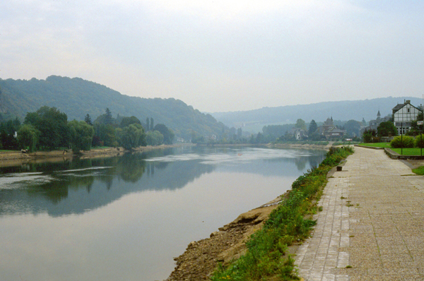
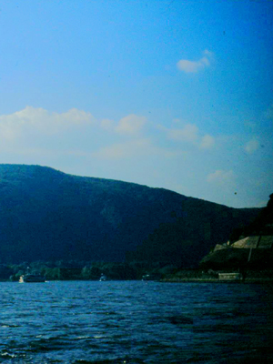
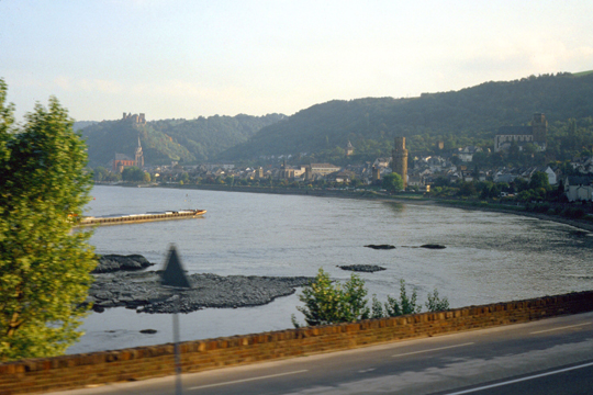
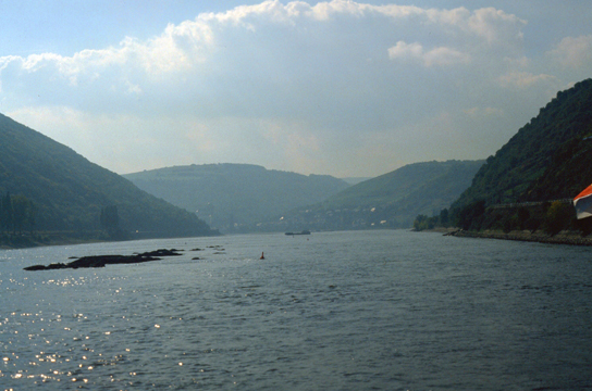 Here's a beautiful view of the Rhine River. Now that the fog has lifted, we can see the width and scope of this waterway- one of the planet's major maritime thorofares. The Rhine is bordered on both sides by high hills (mountains, further south), and seems to flow quite quickly. The headwaters of the Rhine, of course, are in the Alps, about 200 miles away, I think. |
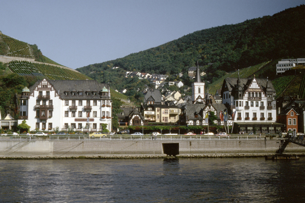
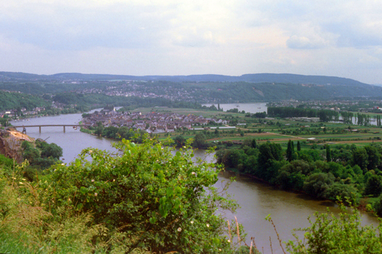
 This is a picturesque town on the banks of the Rhine near Mainz. This is about as good a shot as I have of the picturesque scenery along the river. I can only assume that the small towns like these are farming communities, for there is no obvious industry present. It must be very different to live in a place like this rather than a big city like Dallas. |
I imagine that life in these small towns along the river runs at a slow pace, but the area is certainly amazing. I couldn't quite tell all the time from the boat, but there are roads along both sides of the river along much of its length, so perhaps these areas aren't as isolated as they might look. I found myself wishing that this were more like a cruise with someone knowledgeable aboard who could point out natural and man-made features, and to whom questions might be directed. But then, buses, trains and ferries don't have tour guides either.
|
|
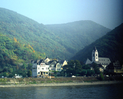
The cruise was a lot more interesting and a lot more pleasant once the overcast, threatening weather cleared out, which happened shortly after we left St. Goar. From then on, the scenery was simply amazing. The cruise continued southward until the Rhine made an abrupt turn to the east towards Mainz. After that turn, the banks of the river flattened out and the entire area became more urban, but before that turn, the mountains and little towns seemed iconically picturesque.
|
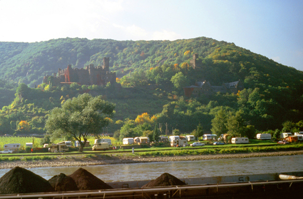
Assmannshausen is, since the incorporation in 1977, a section of R�desheim am Rhein in the Rheingau, located on the Rhine in the state of Hesse, Germany. The village has a lithium spring, spa and a Kurhaus, and is famed for its red wine made from Pinot Noir; it resembles a red Burgundy wine, and it is extremely popular in southern Germany. The wine is made in the village by a winery called "Hessische Staatsweing�ter Kloster Eberbach"; you can see some of the vineyards in my picture, rising up in stairsteps behind the town. As an interesting sidelight, the Assmanshausen Winery in Queensland, Australia, one of the locations on Australia's Register of Historic Places, was named after this region.
From Assmannshausen a chairlift ascends the Jagdschloss Niederwald where a 30-minute hike leads to the Niederwalddenkmal- a monument located in the Niederwald landscape park, near R�desheim am Rhein. The monument was constructed to commemorate the foundation of the German Empire after the end of the Franco-Prussian War.
The first stone was laid in 1871 by Kaiser Wilhelm I. The sculptor was Johannes Schilling, and the architect was Karl Weisbach. The total cost of the work is estimated at one million gold marks. The 125-foot tall monument, representing the union of all Germans, was inaugurated in 1883.
I took a few more pictures on our way down the river that are worth including here. They are typical of the scenery that we saw. I have put these pictures below:
 |
 |
 |
 |
|
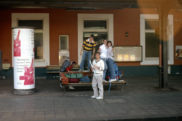
I didn't learn a lot about them; we spent most of our time standing together on the deck, looking at the scenery and talking. By this time, the boat had arrived in Mainz (actually, just north of the city itself), and most of us have disembarked.
I could have gone further, but then I would have not been able to get back to Coblenz in time to drive back to NATO for the next class on Monday morning, this being Sunday afternoon. These students were continuing onward, but all of us were going by train, so we walked the short distance from the boat landing to the train station where this picture was taken.
I have never taken an actual cruise before- neither on an ocean-going ship or a boat like this one on a river. I think I might like to do that sometime, as it is neat that you can see so much while someone else does the driving. I know there are river cruises on the major rivers in Europe that use vessels much more luxurious than this one, and of course ocean-going cruises all bill themselves as luxury resorts that move from place to place.
|
As I have commented before, trains are the preferred way of travel (next to the automobile) in Europe, and are much preferred for trips of over a hundred miles or so. The stations are easily accessible and the trains run frequently. I know that everyone says that we should have trains too, but our situation is much different.
I think the biggest difference is the size of the area the trains would have to cover. When all you have to go is a couple of hundred miles or so, the four-hour trip by train is not that bad compared to three hours of driving or two hours by plane (counting getting to the airport, waiting, and then getting to the center of town on the other end).
But in the US, no one would seriously suggest that business people should routinely take all day to get from Chicago to New York, for example. In the Northeast, say between Boston and New York, the situation is much more comparable, and in this corridor you find trains much more heavily-utilized.
This will be my first train trip in Europe over a distance of more than a few miles; I have taken trains around the London area, but this will be the first trip of any distance. I was able to get some good pictures from the train, including different views of some of the same locales that I photographed while on the boat. These pictures are below:
 Up behind the station, which is quite close to the Rhine itself, are these commercial and residential structures. Again we see the recurring pattern of whitewashed buildings the verdant green hillsides. The train arrived on time, and we started out for Coblenz. |
 Just west of Mainz, the river makes its turn to the north, and so does the highway along it and the train track along that. The train was neat, clean and spacious. There were plenty of seats and I could move around to try to get good pictures. |
 We are on the track along the Rhine, heading north towards Coblenz. This shot offers a different perspective on the river. |
 Another view of the Rhine as we head north to Coblenz; very scenic as we ride through the Rhine River Valley. |
I enjoyed the train ride immensely. As a tourist, it offered a great way to see the landscape up close. But I did notice that there were a good many people on the train who were nonchalant about it all; they looked like local residents just trying to get somewhere. They live here, and have "seen it all before". The trip back to Coblenz took a little over an hour.
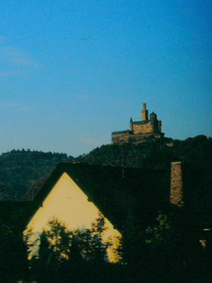
 One of the old fortresses along the Rhine; most of these date to the 1500s or 1600s, and some seem to be in disrepair. This is my last spoiled picture; both the camera malfunction and the movement of the train conspired against me. |
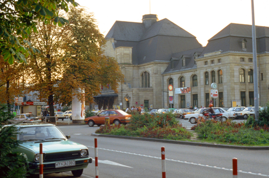 We made a couple of stops and arrived back in Coblenz in late afternoon, and I began to walk back to The Brenner where I had left my luggage and the car. This is the train station in Coblenz. |
I collected my bag and began my drive back to Mons. The drive would be much shorter, as I won't be stopping to see stuff, and about half the drive was at night. This evening, I checked into a different hotel just outside the NATO installation, this hotel being a good deal larger and more used to Americans (foreigners) than L'Auberge d'Lens.
|
I returned the car after I returned from my weekend trip, and on Friday, Ed Broussard drove back down to Mons to collect me and take me to Schipol airport near Amsterdam. I stayed with him again in Brussels on Friday night, and on Saturday morning he dropped me off at the airport.
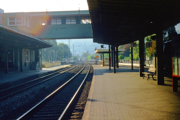
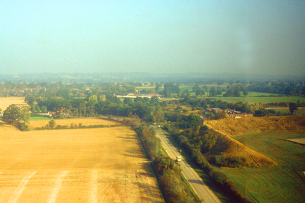
My last picture of this trip was taken as my plane took off from Schipol Airport outside Amsterdam. Schipol is a very busy airport, but it is built way out in the middle of nowhere, so as soon as you take off you are over open countryside.
I flew for eight hours directly to Dallas/Ft. Worth. Grant picked me up at the airport and I was home by dinnertime on Saturday.
This trip to Europe was fun, in that I got to see some of the scenery rather than just be cooped up in a room teaching, but I really didn't like being away from home and from Grant for that long. Grant didn't like it either, but that's the way it goes. Grant was pleased with the piece of Delft china that I bought for him in Amsterdam when Ed and Linda and I went shopping.
You can use the links below to continue to another photo album page.
|
November 7-14, 1986: A Week in California |
|
September 13-19, 1986: A Class at NATO in Oslo, Norway |
|
Return to the Index for 1986 |