|
October 26, 1992: Arches NP and Natural Bridges NM |
|
Return to the Index for Our Western Trip |
I am not used to sleeping on air mattresses, and so even though I don't have any trouble getting to sleep, I tend to sleep in short snatches, and wake up fairly early. When we arose about nine, we took the tent down, packed everything up, stopped at the park headquarters to use the facilities, and then decided to take another circle around the loop road to see the other natural bridges in the Park.
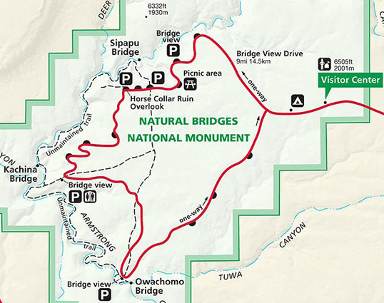
In Natural Bridges National Monument
|
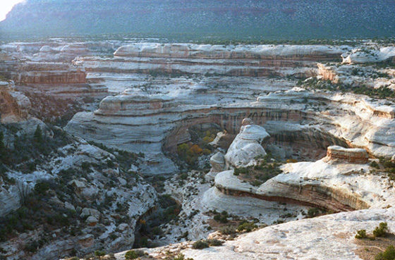 |
I think this picture is interesting because it shows all the various ways that the action of water has cut into the rock to produce the curved, stratified effects. You can pick out various directions that the water must once have followed if the rocks were to be shaped like they are. That is not snow on the rocks, but rather a fine white sand. Also, much of the rock face is pure limestone. Due to the cap rock in some places, there are also some interesting mesa-like formations, although the ones in Monument Valley are much larger.
|
You can see clearly that there is very little water present now, and it must also be true that there is not a lot of water at any time because of the tree growth you can see. I can't imagine that these trees would be washed away every season and have to grow back, but maybe the spring floods don't get that deep.
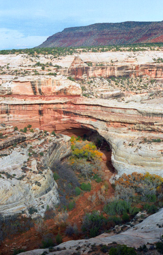
Kachina is "the middle bridge". Spanning the canyon equidistant from both Owachomo and Sipapu bridges, it is larger than Owachomo but smaller than Sipapu. Proving that canyons are dynamic rather than static, approximately 4,000 tons of sandstone fell from the inside of the Kachina bridge opening just a few months ago, enlarging the opening as it has doubtless been enlarged time and time again.
Government surveyor William Douglas dubbed the bridge Kachina when he found petroglyphs and pictographs depicting dancing figures carved on the base of the bridge. Douglas assumed that the ancestral Puebloan people who left the ancient rock art were related to the present day Hopi people, and that the painted and carved figures represented Kachina dancers. Before Douglas, local cowboy Jim Scorup named the bridge "Caroline" in honor of his mother. Before that, Cass Hite had named it "Senator".
We got out of the car here for a bit and walked a ways down the short trail that descends from the parking area along the rim drive to the base of Kachina bridge. We did not go all the way to the bottom of the trail, preferring to spend some time at the third bridge down the road. But we did get a nice photograph (see left) of Kachina Natural Bridge.
In 1883, prospector Cass Hite wandered up White Canyon from his base camp along the Colorado River in search of gold. What he found instead were three magnificent bridges water had sculpted from stone. In 1904, National Geographic Magazine publicized the bridges, and in 1908 President Theodore Roosevelt established Natural Bridges National Monument, creating Utah's first National Park Service area. We continued down the park road to its southernmost point and the trail to Owachomo Natural Bridge.
|
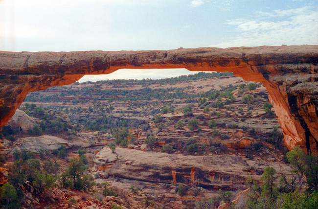
Owachomo means "rock mound" in Hopi and is named after the rock formation on top of the east end of the bridge. Before William Douglas gave it this name in 1908, it was called "Edwin" or "Little" bridge. Prior to that, it was referred to as "Congressman" by miner and explorer Cass Hite.
This is my iconic photograph of Owachomo Natural Bridge, taken from the end of the short trail that led along the top of the mesa from the parking area. I wanted to get the thinnest part of the arch framed against the background of sky to emphasize how thin it actually was. We were told at the ranger station that about two years previously a huge chunk of the right-hand support for the arch had fallen away; the piece weighed many tons, we are told. You can see the raw rock face that has not had sufficient time to weather to the same degree as the surrounding rock. I find myself wondering how long this formation will last, and whether it will collapse in my lifetime.
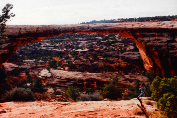
This was an amazing natural bridge. All the others I have seen have had at least some arch to them, but this one seemed to have been engineered, it was so flat. You aren't allowed out onto it, of course, but even if you were, seeing what's underneath (or not underneath) it, I wouldn't dare go out onto it.
|
You might wonder what Fred was doing while I was scrambling down the edge of the mesa to get some sky behind the natural bridge; he was further up on the mesa taking his own picture. He caught me in the process of taking my own picture (look for me in the lower right).
It is amazing to me that this formation could have been created by water; it seems much too high, way above any possible course that the river might take or have taken. But, being the oldest bridge here, some 5000 years, maybe there was time for the watercourse to sink that low under the bridge it created. Owachomo is a very graceful formation; at its thinnest, it is only about four feet thick, making it one of the thinnest known.
As you have guessed, the three major bridges have each had three names. They were first named "President," "Senator" and "Congressman" by Cass Hite, but later explorer groups renamed them "Augusta," "Caroline" and "Edwin". As the park was expanded to protect nearby Puebloan structures, the General Land Office assigned the Hopi names "Sipapu," "Kachina" and "Owachomo" in 1909. Sipapu means "the place of emergence," an entryway by which the Hopi believe their ancestors came into this world. Kachina is named for rock art on the bridge that resembles symbols commonly used on kachina dolls. Owachomo means "rock mound," a feature atop the bridge's east abutment.
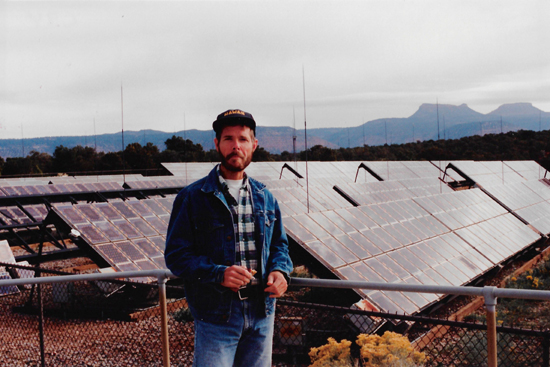
On the way out of the park, we noticed a big solar installation just south of the visitor center, and we stopped to have a look at it. I had not seen one this size before, and I was interested in reading the signs about it.
|
While only 10 percent of the sun's energy striking the PV cell is converted to electricity, the many cells that comprise the PV array produce up to 50 kilowatts of power. That is more than enough electricity to supply the needs of the small community of National Park Service personnel, their families, and we, the visitors. The array here covers a single acre, and a short path from the Visitor Center led to a viewing platform.
Natural Bridges National Monument was chosen as a demonstration site for the use of solar energy only a ten years ago; prior to the installation of the PV system, the monument relied on diesel generators for all its electricity needs. The generators operated continuously. The noise and pollution produced by burning nonrenewable fossil fuel was incompatible with Natural Bridges' pristine desert setting. (Most heating and cooking needs, which would otherwise consume large amounts of electricity, continue to be met by liquefied petroleum gas.
Mokee Dugway
|
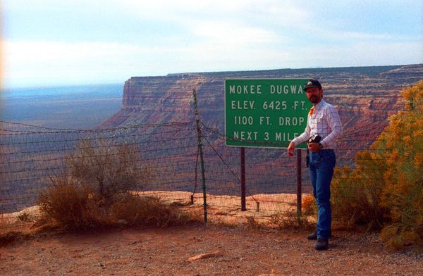 |
It took some investigation to discover what the term "Mokee Dugway" actually meant. At first, I thought that the feature, just northwest of Monument Valley (the Valley of the Gods), had something in common with Dugway Proving Ground, and perhaps it does. The term "moki" is derived from the Spanish word "moqui", a general term used by explorers in this region to describe Pueblo Indians they encountered as well as the vanished Ancestral Puebloan culture. "Dugway" is a term used to describe a roadway carved from a hillside.
|
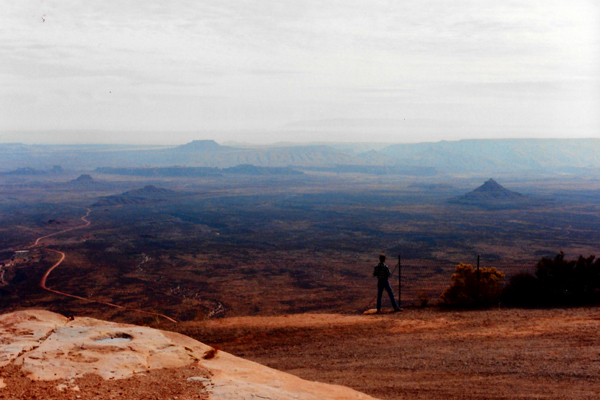
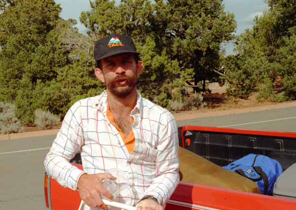
That's me, at left, looking out and down towards Monument Valley and Mexican Hat from the Mokee Dugway. Fred has climbed up above the roadway to try to get as much of the vista in his picture as he could. I am there for perspective. I am standing some 1500 feet above the valley floor, although the road you can see at the left is three miles or so away.
The Moki Dugway is a staggering, graded dirt switchback road carved into the face of the cliff edge of Cedar Mesa. It consists of 3 miles of steep, unpaved, but well-graded switchbacks (11% grade), which wind 1,200 feet from Cedar Mesa to the valley floor near Valley of the Gods. This route provides breathtaking views of some of Utah�s most beautiful sites. Scenic views of Valey of the Gods and distant Monument valley open at every turn of the dugway.
The Moki Dugway was constructed in the 1950s provide a way to haul ore from the Happy Jack Mine on Cedar Mesa to the mill in Halchita, near Mexican Hat. There were signs galore at the top of the unpaved road; Utah recommends that only vehicles less than 28 feet and 10,000 pounds attempt to negotiate the dugway. We are actually stopped at a place called Muley Point, where fantastic vistas stretched away in front of and below us. Sadly, the day was quite hazy, and so the pictures really don't to the scene justice.
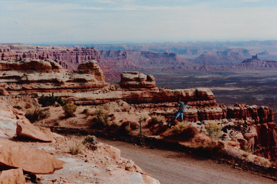 Looking East from Muley Point Fred asked me to strike some humorous pose, so I tried to look as if I was falling off the edge of the mesa. From here to the bottom, the road is unpaved; I guess that with all the rock slides and such, trying to maintain a good paved road is too difficult. A large RV passed us here and headed down; it took up the whole road, and I would not have wanted to be riding in it. |
 The Edge of Cedar Mesa at Muley Point Cedar Mesa is huge, not the small rocky thing you might imagine. The mesa is a vast upland area, which just happens to drop off very abruptly to a lower one. As I said, I thought that "Mokee Dugway" was the geologic feature, but instead it refers to the road. This is one of many pictures that shows very well the stark but beautiful nature of this area of the country. |
 |
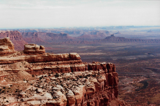
(Picture at left) Here you can see the road down from the upland area at Mokee Dugway, and the nature of the switchbacks that the road will take as is descends towards Mexican Hat and Monument Valley. The straight road at the right is the one we will eventually be on once we have descended.
(Picture at right)
|
 |
We got back in the truck and headed down the winding road, still on Utah Highway 261, reaching the bottom of the descent about thirty minutes later. Then we set off for Mexican Hat, Arizona. We filled up with gas there and got some more ice for the cooler, and then headed south through Monument Valley.
Monument Valley
We could have left the highway and gone a bit east to the Navajo Tribal Park to see some of the more iconic buttes and spires, but the ones right along the path of the highway were certainly spectacular enough.
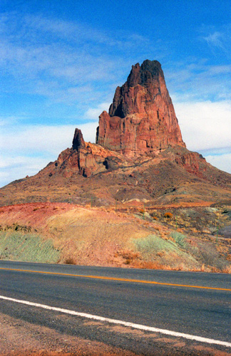
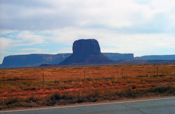
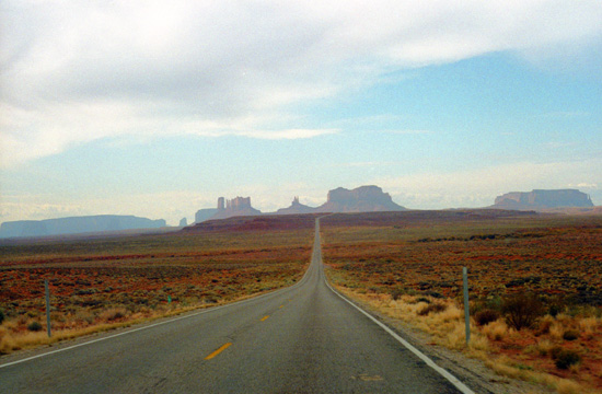 Leaving Mokee Dugway behind, we are heading southwest on US Highway 163 and are going a bit to the west of the center of Monument Valley, but you can see that the spires and buttes here are certainly impressive. This shot is one of the Valley's iconic views. |
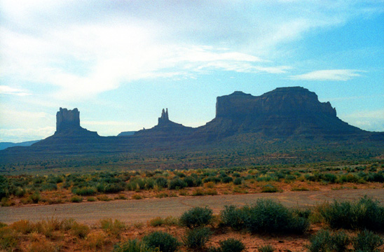 Some of the mesa and butte formations in Monument Valley. These are the same formations as in the picture at left, but now the road is passing close by them. They do look like monuments that one might see in a capital city. The landscape is barren, but beautiful. |
The area is part of the Colorado Plateau. The elevation of the valley floor ranges from 5,000 to 6,000 feet. The floor is largely siltstone of the Cutler Group, or sand derived from it, deposited by the meandering rivers that carved the valley. The valley's vivid red color comes from iron oxide exposed in the weathered siltstone. The darker, blue-gray rocks in the valley get their color from manganese oxide.
|
|
The buttes are clearly stratified, with three principal layers. The lowest layer is the Organ Rock Shale, the middle is de Chelly Sandstone, and the top layer is the Moenkopi Formation capped by Shinarump Conglomerate. The valley includes large stone structures including the famed "Eye of the Sun".
Between 1945 and 1967, the southern extent of the Monument Upwarp was mined for uranium, which occurs in scattered areas of the Shinarump Conglomerate; vanadium and copper are associated with uranium in some deposits.
Passing through Monument Valley, we picked up US 160 at Kayenta and ten or so miles later were turning off to visit Navajo National Monument.
Navajo National Monument
|
The Anasazi who lived in this area were a sedentary group that largely based their subsistence on agriculture. Their primary crop at the sites within Navajo National Monument was maize, with beans and cucurbits also being incorporated into their diet. While the people of the Tsegi Canyon system relied heavily on agriculture for their food, they also hunted wild game that was indigenous to the area.
It is thought that these Anasazi people lived in these cave dwellings to optimize the amount of sustainable land to produce crops. By living in these caves, and not on the mesas or the canyon floors, they were able to use this land towards agricultural production to ensure their success in this high elevation, desert environment. Within the ruins that make up Navajo National Monument were a large number of rooms used for storage, suggesting that at some point their crop production was successful enough to dedicate a significant amount of their living area towards storage purposes.
The site of Keet Seel (Broken Pottery House) was discovered in 1895 by the Wetherill Brothers- and was the first of the three sites to be found. Originally part of a ranching family from Colorado, the Wetherill's keen interest in the Ancient Anasazi led them to pursue numerous expeditions into the heart of the Kayenta region, uncovering a number of previously unknown sites. Richard Wetherill is credited for selecting the term Anasazi, which refers to the ancient people that inhabited this region and means "Enemy Ancestors" in Navajo.
|
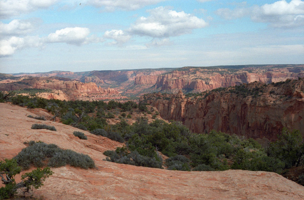
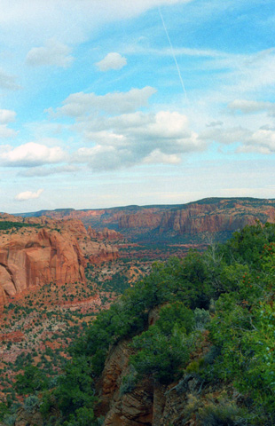
The Park is a small affair, with a small visitor center and some exhibits. We spent some time there looking at them, and then took a rim trail down to a vantage point from which the cliff dwellings can be seen. All of them are in the cliffs above the valley that you can see at right. While there are free, ranger-guided tours in the summer, at this time of year you are pretty much on your own (although we could have waited a while for one of the two such tours offered each day of Keet Seel and Betatakin. The third ruin, Inscription House, is further west and did require a ranger guide. (As I write this 25 years later, that site has been closed to public access.)
The structures contained within this cave site were constructed mainly of sandstone blocks plastered together with mud and mortar. In marked contrast to earlier constructions and villages on top of the mesas, the cliff dwelling of Navajo National Monument reflected a region-wide trend towards the aggregation of growing regional populations into close, highly defensible quarters during the mid to late 13th century.
While much of the construction in this site remains similar to common ancestral Pueblo architectural forms, including such features as kivas, a circular tower (at Keet Seel), and pit-houses, the limited space that this site presented created a much more densely populated living area. At its peak, Keet Seel had more than 150 rooms and 6 kivas, while Betatakin had about 120 rooms and only one kiva.
We took the time to walk the Sandal Trail- a self-guided walk that provided views of the spectacular canyonlands and rugged topography near the visitor center. Interpretive signs provided information on local flora and other topics. The 1-mile round-trip trail ended at an overlook of the Betatakin ruins across the 560-foot-deep Betatakin Canyon.
|
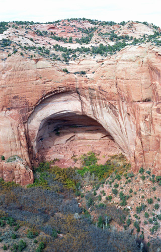
Betatakin only has one kiva, whereas Kiet Siel has several. Betatakin was built in an enormous alcove measuring 452 feet high and 370 feet across between 1267 and 1286. The first excavations occurred in 1917 under Neil Judd, and continued into the 1950s and 1960s under archaeologists like Jeffery Dean. During its two-decade heyday Dean estimated a maximum population of about 125 people.
These cliff dwellings are the reason for the Park's existence. You cannot get down to the dwellings themselves unless you register ahead of time and take one of the infrequent guided tours that are offered. These are overnighters; it takes a goodly while to get to the other side of the canyon and then down to the dwellings. If you have trouble finding the dwelling buildings in the picture, a hint is that the overhang is much, much larger than the dwellings themselves. Look for something smaller than you might expect.
"Jacal" walls were found to be used at this site. Jacal walls were made from a screen of upright wooden poles plastered together with mud. The dry conditions and protection from the elements at Betatakin allowed for some of the most notable preservation of these architectural characteristics in all of the Southwest.
In addition to the cliff dwellings, there were also a number of structures believed to be built at the base of the cliff as well. But due to this area not being protected by the over-hanging cliff wall, its exposure to the elements led to its destruction by erosion. At Keet Seel, archaeological excavations have revealed that there were 25 room clusters beneath the overhanging wall, each that included one common living room, with anywhere from one to four storage rooms surrounding a small courtyard. The layout of these dwellings greatly mirrored that of the Pueblo III structures at Mesa Verde, whereas Betatakin had about 20 room clusters.
|
We got back to the truck and Fred unloaded the lunch fixings at the picnic area and we had something to eat. While we were eating our sandwiches, we read more about the mysterious disappearance of the Anasazi.
There is evidence later in the record to suggest the beginning of an episode of deep arroyo cutting, that would have damaged what was left of the usable agricultural land. Increased deposition of sediment onto agricultural lands caused the lowering of the water table, thus making the land inadequate for farming. Regardless of their reasoning, near the end of the thirteenth century it's evident that the Anasazi people migrated towards places with more stable and abundant water sources, suggesting that the agricultural land in this area had become unsuitable to sustain the population levels that once inhabited this spectacular cave site.
Hopi legends tell a different tale. According to oral tradition, the area known as Wunuqa (modern day Tsegi Canyon) was abandoned as part of a spiritual quest. In particular, the Snake Clan inhabited the Navajo National Monument ruins, along with the Horn Clan. The Horn Clan forced the Snake Clan out, due to the children of the Snake Clan biting other children and causing death. This may be an allegory for some historical occurrence, in which one group forced another out for a perceived fault or slight.
Navajo National Monument was very interesting, and I was glad we stopped here. When we were done with lunch, we headed back to US Highway 160 south, heading for the last major stop on our trip- the Grand Canyon.
The Grand Canyon
|
Grand Canyon National Park is the United States' 15th oldest national park. Named a UNESCO World Heritage Site in 1979, the park takes up a sizeable chunk of northwestern Arizona. The park's central feature is, of course, the Grand Canyon, a gorge of the Colorado River, which is often considered one of the Seven Natural Wonders of the World. The park covers almost 2,000 square miles of unincorporated area in Coconino and Mohave counties.
If you don't count the National Parks that are located in Alaska (heck, almost the whole state seems to be a National Park), then Grand Canyon National Park is the 4th largest- surpassed only by Death Valley (#5), Yellowstone (#8) and The Everglades (#10); Grand Canyon National Park is 11th in size overall.
Grand Canyon was officially designated a national park in 1919, though the landmark had been well known to Americans for many years. President Theodore Roosevelt visited the site in 1903 and said:
| "The Grand Canyon fills me with awe. It is beyond comparison�beyond description; absolutely unparalleled throughout the wide world... Let this great wonder of nature remain as it now is. Do nothing to mar its grandeur, sublimity and loveliness. You cannot improve on it. But what you can do is to keep it for your children, your children's children, and all who come after you, as the one great sight which every American should see." |
It actually took 37 years for the Grand Canyon to be designated a National Park- from the first bill introduced in Congress by Senator Benjamin Harrison in 1882 to President Wilson's signing of the Grand Canyon National Park Act in 1919. The creation of the park was an early success of the conservation movement, and its national park status may have helped thwart proposals to dam the Colorado River within its boundaries. In 1975, the former Marble Canyon National Monument, which followed the Colorado River northeast from the Grand Canyon to Lee's Ferry, was made part of Grand Canyon National Park, and in 1979, UNESCO declared the park a World Heritage Site.
|
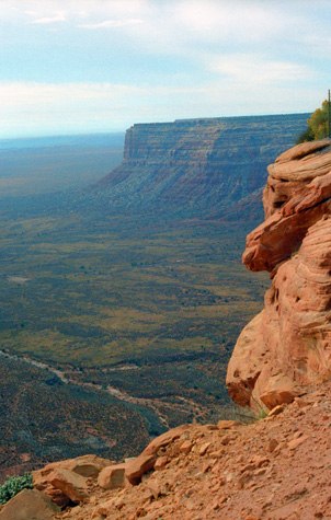
Our visit this afternoon will be to the South Rim- probably the most visited part of the canyon as it is much more easily accessible than the North Rim. But the North Rim is where the hiking is, and so I hope I get the chance to visit it soon. Only the Navajo Bridge near Page, Arizona, connects the rims by road in Arizona; getting there from here takes 5 hours, although you can easily see the North Rim from the South Rim. (You can also get to the North Rim via Hoover Dam, but that trip takes even longer.
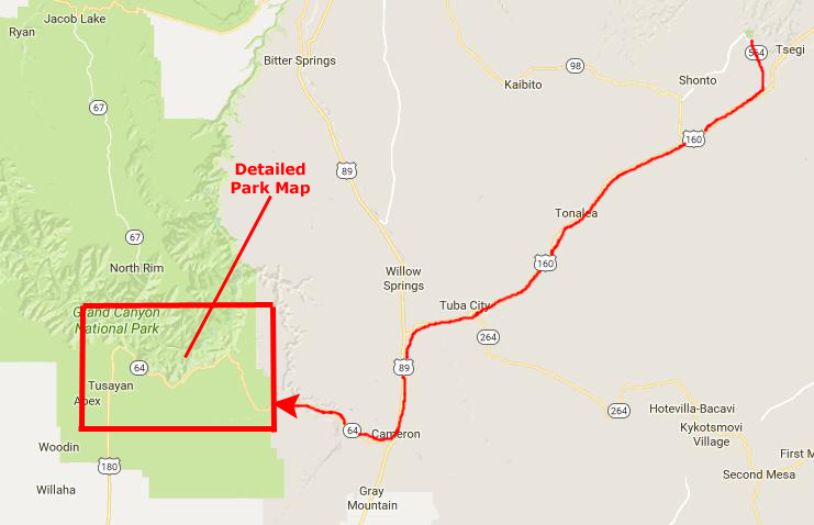
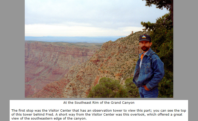
From the moment we entered the Park at the southeast entrance near the Desert View Visitor Center, we made one stop after another as we drove westward for over 30 miles along the Rim Road.
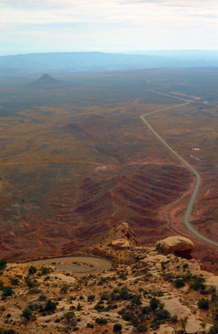
Although it's no way to understand the grandeur of this "Crown Jewel" of the National Park System, I thought I might include an aerial view here to supplement the Park Map above, right. It may give you some idea of the terrain we would cover; you can certainly contrast the fairly level portion of the Colorado Plateau with the amazing series of deep canyons that the Colorado River has patiently cut over the eons:
 |
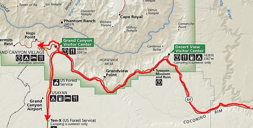
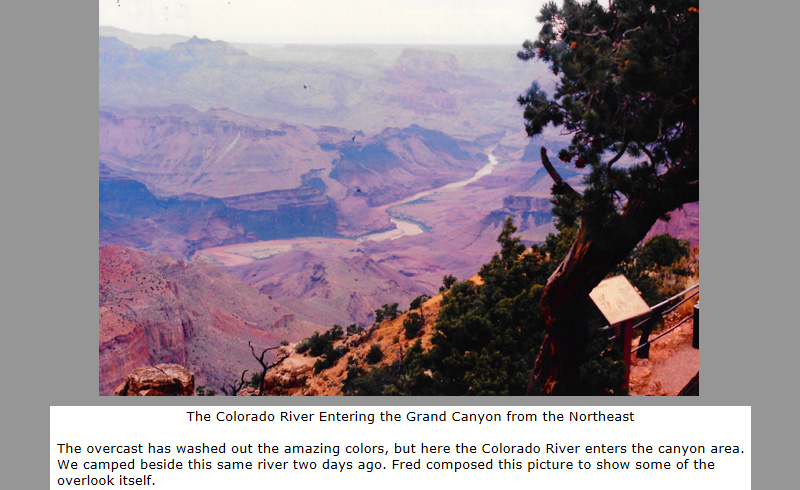
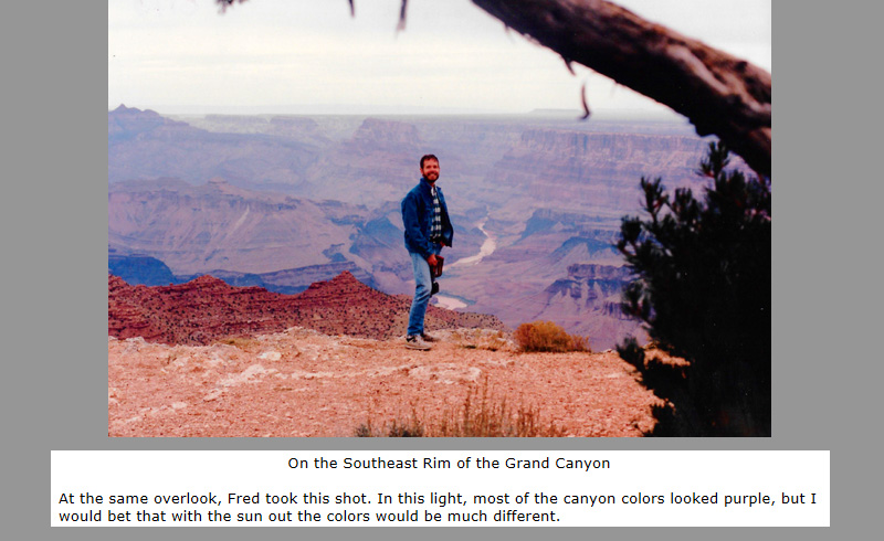
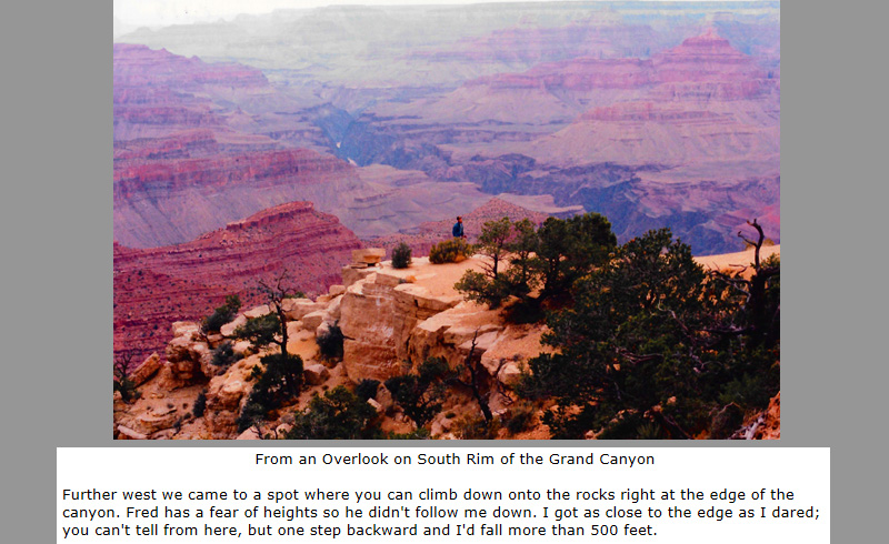
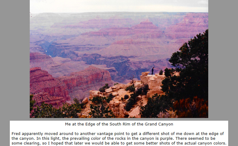
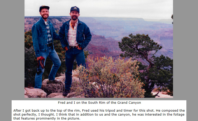
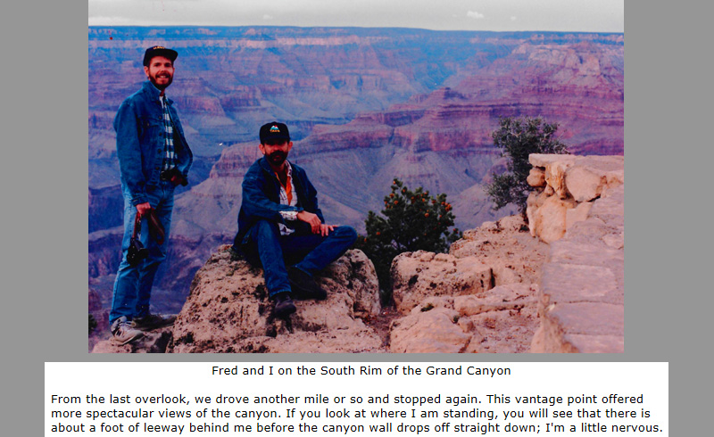
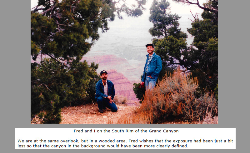
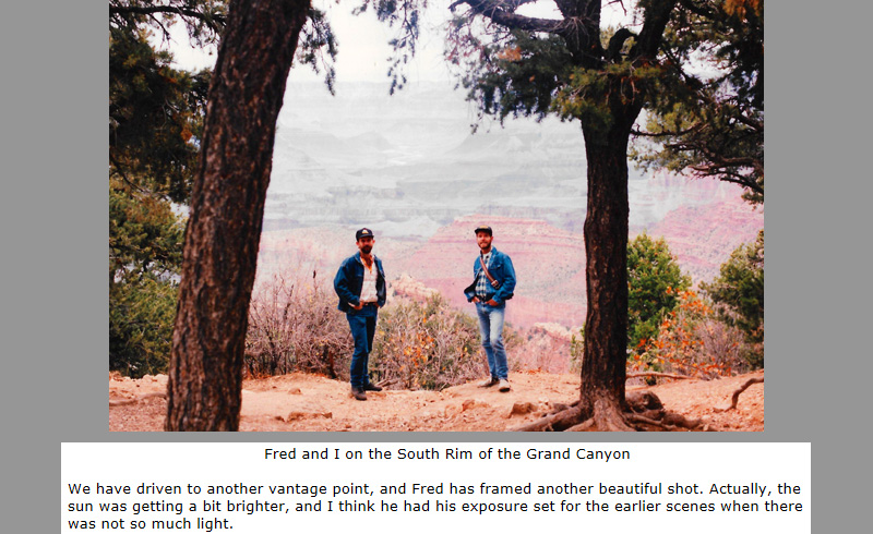
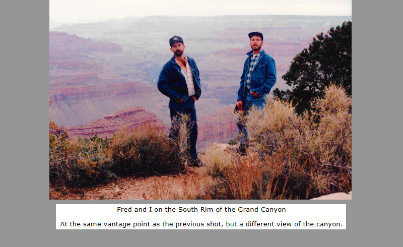
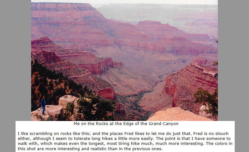
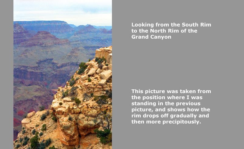
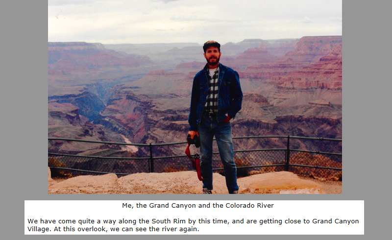
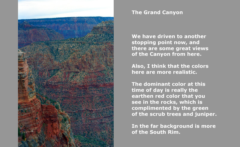
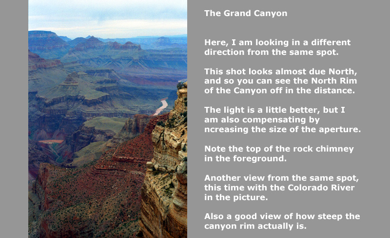
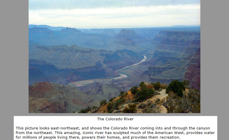
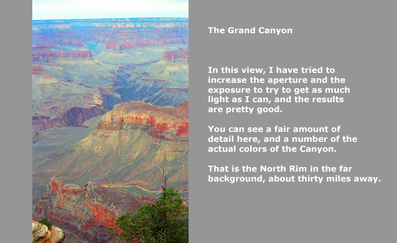
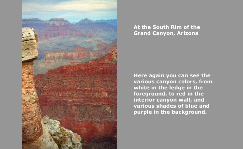
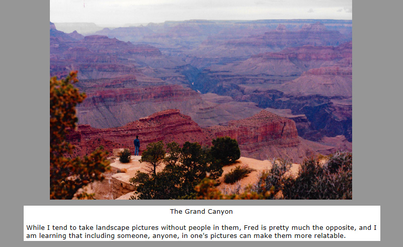
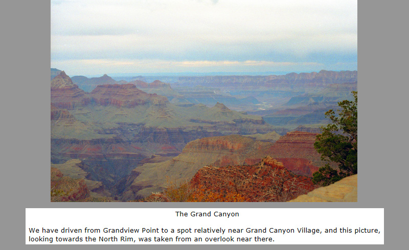
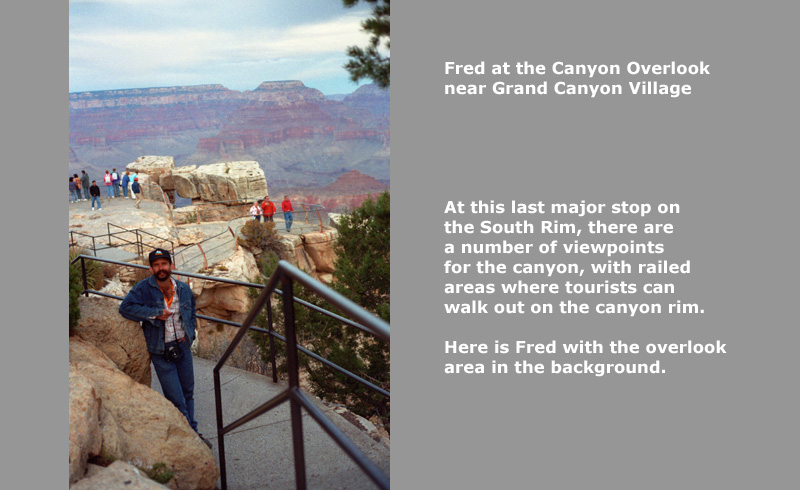
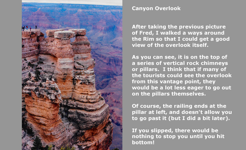
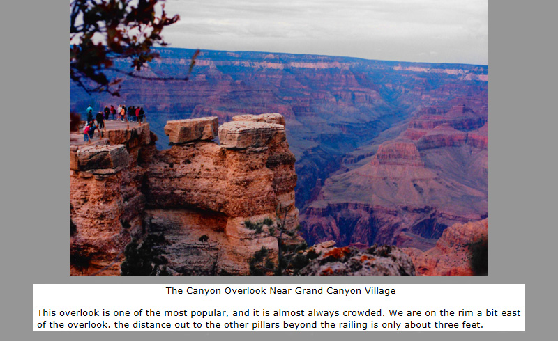
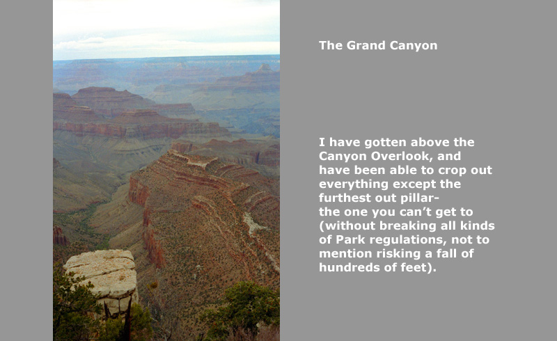
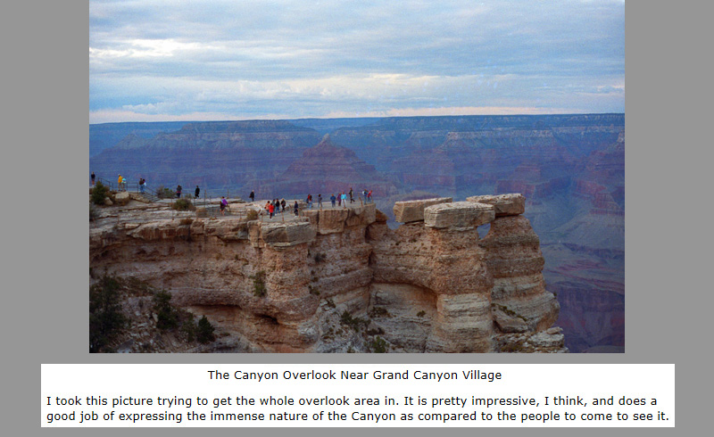
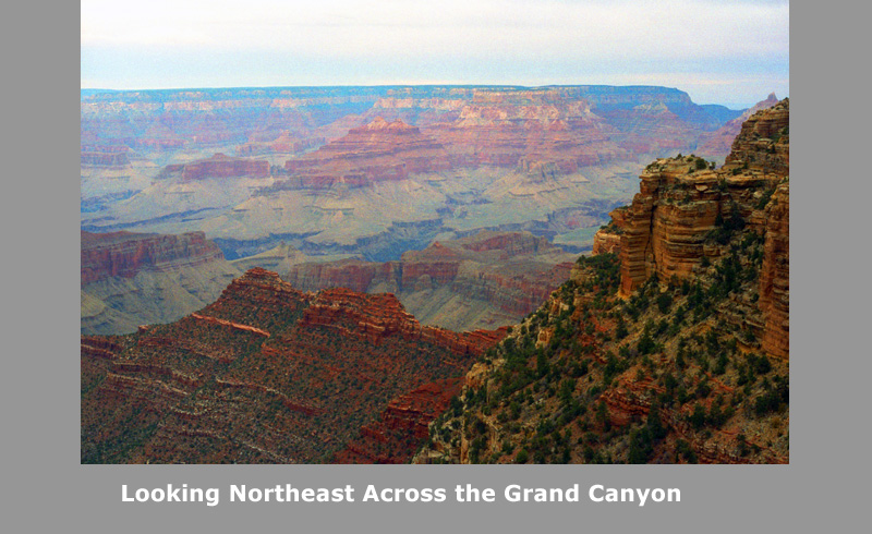
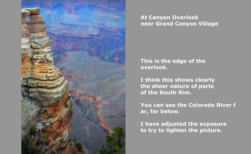
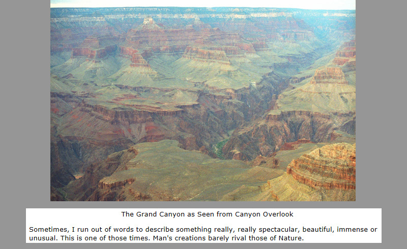
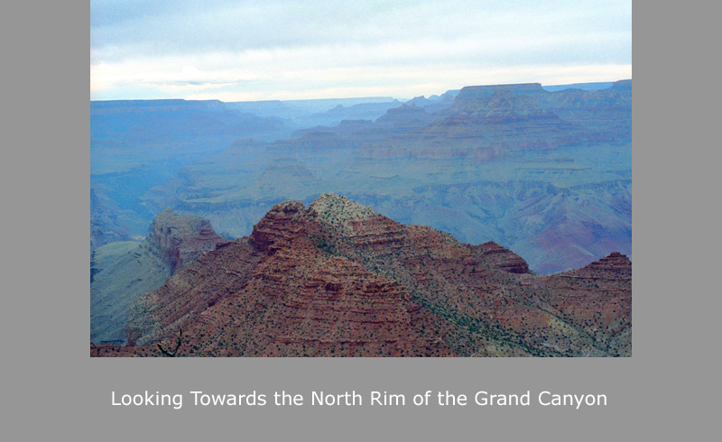
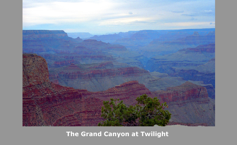
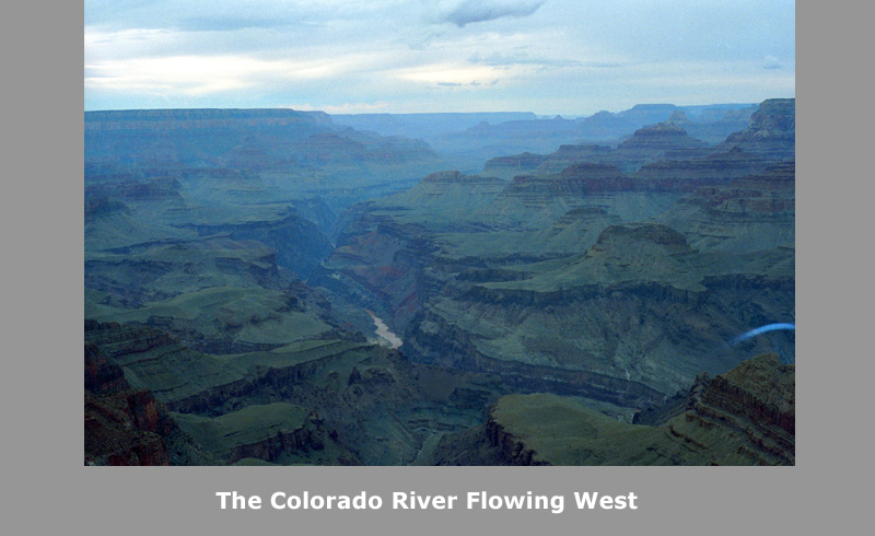
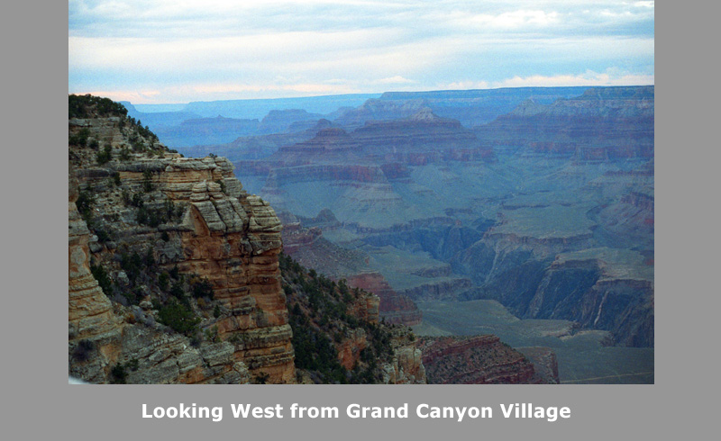
As I said, our visit today will be a drive along the South Rim. We stopped at almost every overlook, and took picture after picture of this amazing natural wonder. I thought about how to display those pictures on this page, and I have concluded that a slideshow would be best. It will take up a lot less space (with a lot less scrolling for you) and it will allow you to move from picture to picture at your own pace. In addition to a picture, each "slide" will also have the accompanying narrative that I wrote to go along with each picture back in 1993, when I was putting the physical pictures into a physical album. Those descriptions will be basically unedited, although I might expand on a couple of them from my vantage point 25 years later. If this is the first slideshow you've seen in this album, all I need tell you is that to move from picture to picture you just click on the little "forward" and "backward" symbols in the bottom corners of each slide. The numbers in the upper left will tell you where you are in the slideshow. I hope you enjoy visiting the Grand Canyon with us!
The Trip Home
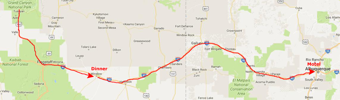 |
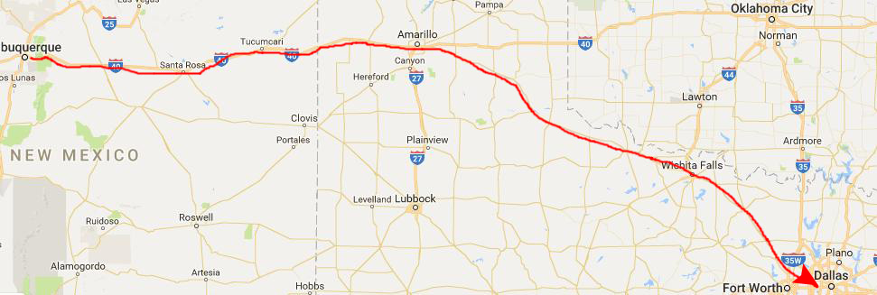
We stopped in the Village because I thought there was supposed to be a Baskin-Robbins there. There was, at one time, but it had closed some time ago. We filled up with gas in the town of Grand Canyon, and then headed South on Arizona Highway 64 and then US 180 to Flagstaff. Darkness fell on the way. We reached Flagstaff about eight in the evening, and then headed East on Interstate 40. We stopped in Winslow and had dinner at a small Mexican restaurant, and then got back on the highway to Albuquerque. We reached Albuquerque early in the morning (about twelve-thirty), and got a room at the Quality Inn there.
|
That highway took us through Wichita Fallas and then through a series of small towns to get back to the Metroplex northwest of Fort Worth. Then we cut across through Grapevine to my house on Texas Highway 114. We reached home in the early evening of October 28th.
Fred had to be back at work the next day, but he spent the night, as he usually does, and left early in the morning for work.
This trip, like our first major one to Guadalupe, was extremely enjoyable. Although I'm not the biggest fan of camping, having spent all my travel career in upscale hotels, I am getting to like it. It will be some time before I'll be comfortable camping more than a couple of nights in a row, but I can see that time coming- if Fred and I continue to take trips together.
Fred is absolutely a great traveling companion, not for the least reason that he knows what he's doing and plans things out ahead of time. Fred takes great pleasure in all the accompanying activities- cooking a meal, setting up the tent, going to ranger talks and generally being outdoors. He is more of an outdoor person than I am, but I don't dislike it at all.
We had a great time.
You can use the links below to continue to another photo album page for our Western Trip or return to the Index to continue through the photo album.
|
October 26, 1992: Arches NP and Natural Bridges NM |
|
Return to the Index for Our Western Trip |