|
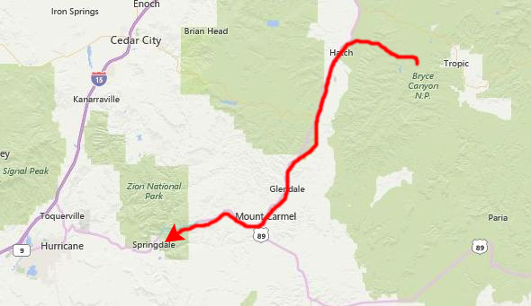
June 25, 1993: Zion National Park |
|
June 22-23, 1993: The Trip from Dallas to Mesa Verde |
|
Return to the Western Trip Index |
This morning begins our second visit to Mesa Verde; we were here in October last year, but decided to stop again both because the park was on our way to Bryce Canyon and because last time we were here, we were not able to see one of the park's most famous cliff dwellings- Balcony House.
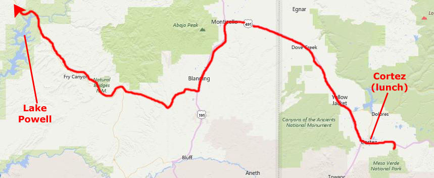
We have a lot to do today, here at Mesa Verde and on down the road in Utah, so we were up early and heading off from the campground to see more of the cliff dwellings for which Mesa Verde is so well-known. We plan on staying here at Mesa Verde into the early afternoon, and then heading west, going around the north end of Lake Powell, through Capitol Reef National Park and then south an into Bryce Canyon National Park. We hope to camp there this evening, but we will be getting there so late that finding a campsite might be difficult. But that is a worry for much later on today.
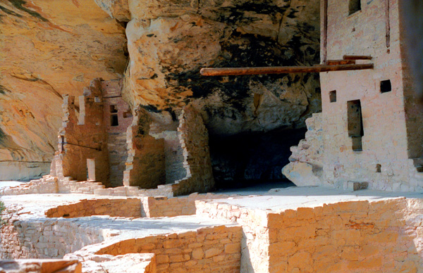
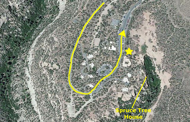
Mesa Verde National Park: Balcony Tree House
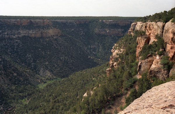
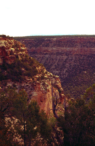
On that map, you can find the campground and the road south into the park. I've marked the route we took first to the Museum to pick up our tour ticket and then down to Balcony House- as well as the two overlooks at which the first two of today's pictures were taken.
|
Mesa Verde National Park is not only a National Park but also a World Heritage Site; it protects some of the best preserved Ancestral Puebloan archeological sites in the United States. The park was created by President Theodore Roosevelt in 1906. It occupies 52,485 acres, and with more than 4,300 sites, including 600 cliff dwellings, it is the largest archeological preserve in the United States. Mesa Verde (Spanish for "green table") is best known for structures such as Cliff Palace, thought to be the largest cliff dwelling in North America.
Starting around 7500 BC, Mesa Verde was seasonally inhabited by a group of nomadic Paleo-Indians known as the Foothills Mountain Complex. The variety of projectile points found in the region indicates they were influenced by surrounding areas, including the Great Basin, the San Juan Basin, and the Rio Grande Valley. Later, Archaic people established semi-permanent rockshelters in and around the mesa. By 1000 BC, the Basketmaker culture emerged from the local Archaic population, and by 750 AD the Ancestral Puebloans had developed from the Basketmaker culture.
The Mesa Verdeans survived using a combination of hunting, gathering, and subsistence farming of crops such as corn, beans, and squash. They built the mesa's first pueblos sometime after 650 AD, and by the end of the 12th century they began to construct the massive cliff dwellings for which the park is best known. By 1285, following a period of social and environmental instability driven by a series of severe and prolonged droughts, they abandoned the area and moved south to locations in Arizona and New Mexico, including Rio Chama, Pajarito Plateau, and Santa Fe.
|
 |
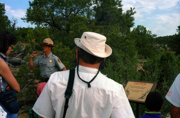
While we were waiting for the ranger to arrive, we chatted with a couple of the other tourists. They were from all over the country, but all of them shared an interest in seeing and experiencing the ancient American West, and many of them had been to other sites that they told us about. We got a wealth of information and many suggestions of other sites we should visit- if not on this trip then on upcoming onces.
|
The cliff dwelling was first discovered in 1888, when two local ranchers chanced upon it while searching for stray cattle. To them it looked from below as if it were the balcony of a large music hall, and so they referred to it that way when describing it to others. The name stuck.
Dr. Jesse Walter Fewkes of the Smithsonian Institution opened Mesa Verde Balcony House for visitation following excavation in 1908. Dr. Fewkes removed the debris of fallen walls and roofs and stabilized the remaining walls. Due to the protection of the overhanging cliff, Balcony House had deteriorated very little through the years and has required little supportive maintenance.
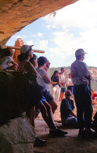
Fred and I had heard or read most of the background about the Anasazi/Puebloan people before, but still the ranger had some interesting things to say. Much of what he had to say was to caution us to stick together, and he also indicated that people who couldn't climb ladders and squeeze through tight spaces shouldn't attempt the tour. It was supposed to be a bit more strenuous that the other self-guided tours that people take.
(The ranger also gave us to understand that, in the future, it was his opinion that more and more of the dwellings would require limited-access tickets and/or rangers to guide visitors, as the increased visitorship has resulted in some deterioration of the ruins. Happy to have a knowledgeable guide, we all headed off.
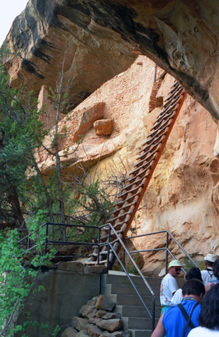 The Entrance to Balcony House |
(Picture at left) The tour began with a short hike down the canyon wall to a point about 200 feet below the starting point. There, the ranger stopped and gave us some more history of the cliff dwellings in general, while everybody gathered around (and the stragglers caught up). There was some interesting flora on the way down, and I pestered Fred to tell me what everything was.
(Picture at right)
|
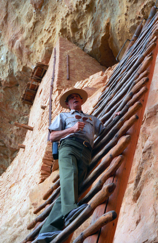 Looking Up Into Balcony House |
Balcony House was built during the "Pueblo III Period" (1150 to 1300). A severe southwest drought (1130 to 1180) led to rapid depopulation in many parts of the San Juan Basin, particularly at Chaco Canyon. As the extensive Chacoan system collapsed, people increasingly migrated to Mesa Verde, causing major population growth in the area. This led to much larger settlements of six to eight hundred people, which reduced mobility for Mesa Verdeans, who had in the past frequently relocated their dwellings and fields as part of their agriculture strategy. In order to sustain these larger populations, they dedicated more and more of their labor to farming.
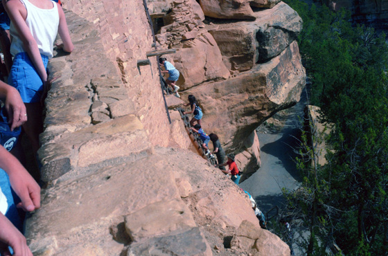
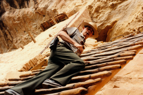 The Ranger on the Entry Ladder Fred took this picture of the ranger up above us on the entry ladder, from a different vantage point than the picture above that I took. (Years after our visit, a different entrance path was created, one that did not involve ladders.) |
 Some of Our Tour Group Climbing the Ladder I was third up the ladder after the ranger, and I thought that it would be interesting to show the steepness of the climb. This is one of the reasons why the ranger encouraged people who couldn't deal with such things to remain behind. |
The Chacoan system brought large quantities of imported goods to Mesa Verde during the late 11th and early 12th centuries, including pottery, shells, and turquoise, but by the late 12th century, as the system collapsed, the amount of goods imported by the mesa quickly declined, and Mesa Verde became isolated from the surrounding region. For approximately six hundred years, most Mesa Verdean farmers had lived in small, mesa-top homesteads of one or two families. They were typically located near their fields and walking distance to sources of water. This practice continued into the mid- to late 12th century, but by the start of the 13th century they began living in canyon locations that were close to water sources and within walking distance of their fields.
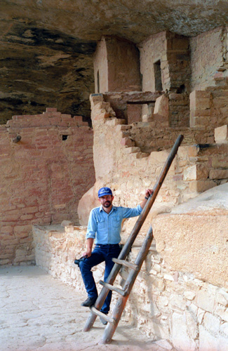
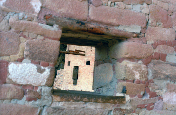 A Room With a View at Balcony House Up in the first part of the ruins, we have a chance to walk around and look at it all. Having been to cliff dwellings before, we knew what to expect, but these ruins were somewhat different. The way the bricks were formed and put together seemed to be different, and the use of wood different too. |
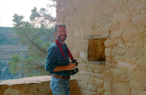 Me at Balcony House I had just taken the previous shot when Fred snapped this picture of me. I am thoroughly enjoying myself. |
Mesa Verdean villages thrived during the mid-Pueblo III Era, when architects constructed massive, multi-story buildings, and artisans adorned pottery with increasingly elaborate designs. Structures built during this period have been described as "among the world's greatest archaeological treasures". Pueblo III masonry buildings were typically occupied for approximately fifty years, more than double the usable lifespan of earlier structures, although some were continuously inhabited for hundreds of years. Architectural innovations such as towers and multi-walled structures also appeared during the Pueblo III Era.
|
|
Mesa Verde's population remained fairly stable during the 12th century drought. At the start of the 13th century, approximately 22,000 people lived in the area. There were moderate population increases during the following decades, and dramatic ones from 1225 to 1260. Most of the people in the region lived in the plains west of the mesa at locations such as Yellow Jacket Pueblo, near Cortez, Colorado. Others colonized canyon rims and slopes in multi-family structures that grew to unprecedented size as populations swelled. By 1260, the majority of Mesa Verdeans lived in large pueblos that housed several families and more than one hundred people.
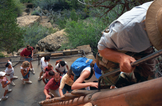
 A Following Tour Group Climbing the Entry Ladder We were getting a bit behind, and as we moved into another section of the ruins, we could see the next group of people entering the ruins from below. The front section of each area of the ruins, nearest the canyon, always has a low wall, which the ranger explained was probably to keep children from simply falling off the ledge. |
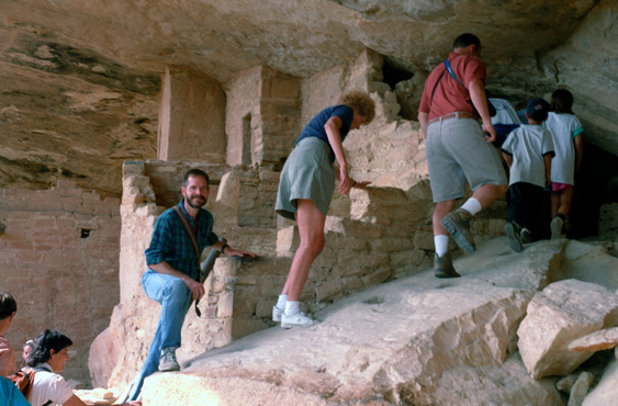 Moving to the Next Area of Balcony House We followed a passageway that leads behind some of the walls, and entered a third section of the ruins. I was surprised that we had not been told not to put our hands on the ruins (not doing so would have been difficult). All were were told was that we should not climb on the walls or take anything away. |
The 13th century saw 69 years of below average rainfall in the Mesa Verde region, and after 1270 the area suffered from especially cold temperatures. Dendrochronology indicates that the last tree felled for construction on the mesa was cut in 1281. There was a major decline in ceramic imports to the region during this time, but local production remained steady. Despite challenging conditions, the Puebloans continued to farm the area until a severely dry period from 1276 to 1299 ended seven hundred years of continuous human occupation at Mesa Verde. Archeologists refer to this period as the "Great Drought"; the last inhabitants of the mesa left the area around 1285.
 Fred at Balcony House |
(Picture at left) I'm impressed by how "cozy" the overhang makes the dwellings look.
(Picture at right)
|
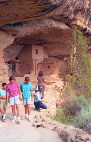
 Entryway to the Last Ruins Section |
The structures contained within these alcoves were mostly blocks of hard sandstone, held together and plastered with adobe mortar. Specific constructions had many similarities but were generally unique in form due to the individual topography of different alcoves along the canyon walls. In marked contrast to earlier constructions and villages on top of the mesas, the cliff dwellings of Mesa Verde reflected a region-wide trend towards the aggregation of growing regional populations into close, highly defensible quarters during the 13th century.
|
|
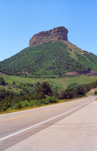
Incidentally, the man behind him is carrying his little boy in a carrier on his back. The parking area is on top of that brownish rock outcropping in the background.
Balcony House was immensely interesting, and I was glad that we had a ranger guide to provide a lot of background information about the ruin. There is lots to do here in Mesa Verde, and between our trip last year and the stop today, we have done quite a bit of what's here to do. But there is still more, so perhaps we will visit a third time at some point.
|
| "In 1765, Don Juan Maria de Rivera led what was possibly the first expedition of white men northwest from New Mexico and, although they did not identify Mesa Verde, mentioned in their journals the ancient "ruins" they found. The first European known to climb onto the mesa, was geologist Dr. John S. Newberry, a member of the 1859 San Juan Exploring Expedition. Although he didn�t record finding any archeological sites, the expedition was the first to officially use the name Mesa Verde. Fifteen years later, pioneer photographer William Henry Jackson was introduced to rancher and explorer John Moss, who led him into Mancos Canyon, where Jackson entered Two Story House, and took the first photographs of a cliff dwelling in the Mesa Verde region. Two years later, Sixteen Window House was discovered and named. Prospector S. E. Osborn spent the winter of 1883-84 in the canyons of Mesa Verde and later wrote about many of the sites he saw. Many believe he is the first documented visitor to enter Balcony House; his name and the date March 20, 1884, were carved in a nearby dwelling in lower Soda Canyon. The first known suggestion that the area be set aside as a national park appeared in an editorial in the Denver Tribune Republican on December 12, 1886. The editor was concerned that "vandals of modern civilization" were destroying the sites and that the area needed Federal or State protection. Local rancher Richard Wetherill and his brothers made several trips into Mesa Verde (1888-1892), primarily for collecting archeological material. The Wetherill parties discovered Cliff Palace, Spruce Tree House and Square Tower House, entering and exploring all three. The Wetherill brothers explored the Mesa Verde "ruins" and reported having entered 182 cliff dwellings, and the elder Wetherill wrote to the Smithsonian Institute multiple times, proposing that the entire area be set aside as a National Park in order to preserve the cliff dwellings; he feared that if this was not done "the tourists, will destroy them." |
| In 1891, Baron Gustaf E. A. Nordenski�ld, of the Academy of Sciences in Sweden and the first scientist to visit Mesa Verde, used painstaking field methods for his time to excavate, sketch, and photograph numerous sites. He collected about 600 items which now reside in the National Museum in Helsinki, Finland. His book, The Cliff Dwellers of the Mesa Verde, was the first extensive examination and photographic record of Mesa Verde�s cliff dwellings. The Colorado Cliff Dwellings Association was formed in 1900, with its sole purpose to preserve the cliff dwellings of the Mesa Verde area. They promoted their campaign to make Mesa Verde a national park through letter writing, fund raising, and even tours of Mesa Verde for the press. In February, 1901, the first bill was introduced before Congress to create "Colorado Cliff Dwellings National Park," but it did not pass. At least four more bills were introduced during the following years, but all failed. Finally, in 1905, a bill for the creation of Mesa Verde National Park was introduced in the 59th Congress and subsequently passed and signed by President Theodore Roosevelt. The Park was officially created on June 29, 1906. Earlier that same month the "1906 Antiquities Act" was passed, making it a federal crime to collect or destroy any historic or prehistoric object or building on federally owned land. Excavation and repair of major sites began in 1908 so visitors could see and enjoy the park. Most of the early work was done by Jesse Walter Fewkes, an archeologist from the Smithsonian Institution. The New Deal, launched in 1933, brought the Civilian Conservation Corps (CCC) to Mesa Verde. The CCC and other depression era efforts employed young men and women to build trails and roads, operate switchboards, help in archaeological excavations, fight fires, build park buildings, and create museum exhibits. Much of their work is still in use today." |
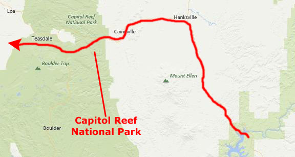
The Drive to Capitol Reef National Park
|
Heading west across this part of Utah, we were traveling through desert terrain. The landscape was starkly beautiful. It was very hot this afternoon, with a temperature that I would estimate exceeded 100 degrees.
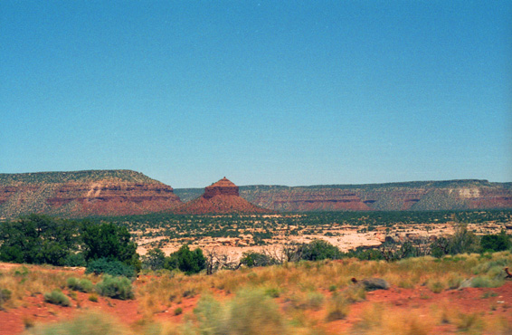 The Landscape Along Utah Highway 95 I thought that the reddish peak that you see in the center of the picture was very interesting. |
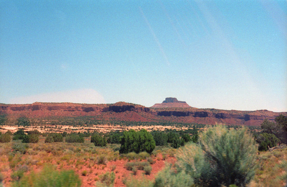 The Landscape Along Utah Highway 95 This scenery was typical of this part of the trip. |
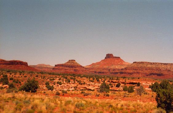
 Along Utah Highway 95 in Southeastern Utah The line of mesas on either side may at one time have been the edge of a land shelf along the shore of an inland sea. Note how colors change abruptly; probably the result of different sediments laid down. The sunlight was incredibly brilliant. |
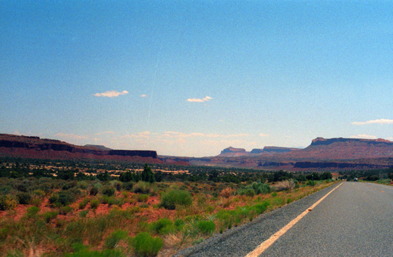
 Roadside Scenery as We Approach Lake Powell We are closer now to some of the formations in the picture at left, especially that mountain in the background with the striking color change. I wouldn't like to be walking out there on a day light today. |
After about an hour's drive along Highway 95, Lake Powell came into view. Lake Powell is a reservoir on the Colorado River, straddling the border between Utah and Arizona but with most of it in Utah. It is the second largest man-made reservoir by maximum water capacity in the United States behind Lake Mead (storing almost a trillion cubic feet). Lake Powell was created by the flooding of Glen Canyon by the Glen Canyon Dam, and the lake is named for explorer John Wesley Powell, a one-armed American Civil War veteran who explored the river in wooden boats in 1869.
|
In just the past two years, Fred and I have done quite a lot along the Colorado River. Of course, this crossing will be one thing, but last year, we camped alongside the Colorado some 70 miles north of here. In addition, we have been to the Grand Canyon, which is many miles south of here in Arizona. I have, of course, been to Hoover Dam outside Las Vegas; that dam is well below Glen Canyon Dam and well north of the Grand Canyon.
It seems as if there is an incredible amount of impressive scenery, and many, many things to see and do along this single river. Our campsite a year ago was in a wooded area beside a turbulent, rocky Colorado River. The Grand Canyon, of course, is thousands of feet deep, and the Colorado River at the bottom is deep and fast and cutting the canyon ever deeper. The area from Hoover Dam north, past Glen Canyon and all the way to this bridge, is yet another type of area; it is mostly desert and barren rock, with little other than water-based recreation. Just looking ahead at the barren landscape ahead, with the lack of vegetation, it is hard to believe that you are just out of sight of one of the largest lakes in the country. The sunlight was even brighter than it looks.
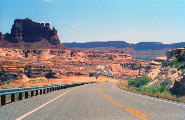
Of course, we just had to stop before crossing the bridge so we could get some pictures.
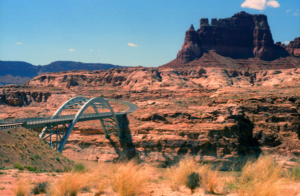
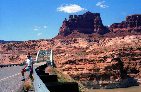 Me at the Approach to the Hite Crossing Bridge We have parked by the bridge, and are wandering around taking pictures. Fred took this one of me with the bridge in the background. You can also see the Colorado entering the lake below the bridge to the right. I assume that Lake Powell is as high as it is going to get, but I won't know that until we cross Glen Canyon Dam, which we plan to do after visiting Bryce Canyon and Zion. |
 Fred and Lake Powell from the Hite Crossing Bridge I thought I had compensated for the extremely bright sunshine when I took this picture, but apparently I had overcompensated. It looks from here as if the lake could rise quite a bit without endangering the bridge. The dark red formation in the background is spectacular. This view looks southwest across the upper end of Lake Powell. |
This area was so starkly beautiful that we wandered around for quite a while taking our pictures. At one point, I wanted a better picture of the bridge itself, and I had to walk a ways away from the road to the north to show the span to best advantage.
|
The settlement which formed at the crossing location took the name of its founder, and so Hite, Utah Territory, was established. In 1946, a settler named Arthur Chaffin constructed an automobile ferry using an old car engine and a thick steel cable to hold it in place. The ferry operated for 20 years, before the rising waters of Lake Powell inundated the settlement of Hite, Utah.
This bridge was completed as part of the realignment of Utah State Route 95, which was approved in 1962 due to the construction of Glen Canyon Dam and Lake Powell's subsequent flooding of the original roadway alignment and the original river crossing in Hite. The bridge was designed by David Sargent and was advertised for bids on June 29, 1963. The winning bid was $3 million, and construction began in 1964. The bridge was dedicated on June 3, 1966.
In that picture above right, you can see the way the Hite Crossing Bridge is constructed. The curved span presses against the canyon walls, creating enough tension to hold up the roadway. As long as the canyon wall stays stable, the bridge will last. After this shot, we got back in the car and headed further West and much higher.
|
Sadly, when that agreement was reached, Brower had not actually been to Glen Canyon. When he later saw the canyon on a river trip, (before the dam was constructed) he discovered that it had the kind of scenic, cultural, and wilderness qualities often associated with America's national parks. Over 80 side canyons in the colorful Navajo Sandstone contained clear streams, abundant wildlife, arches, natural bridges, and numerous Native American archeological sites. By then, however, it was too late to stop the Bureau from building Glen Canyon Dam. Brower would forever after consider the loss of Glen Canyon his life's ultimate disappointment.
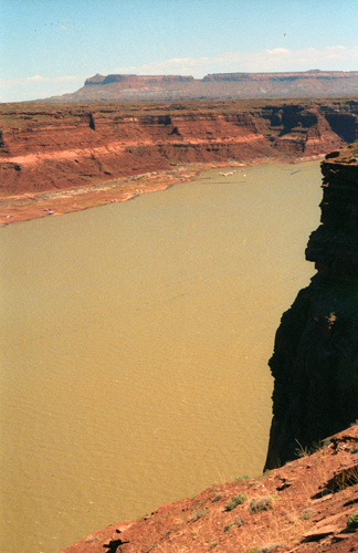
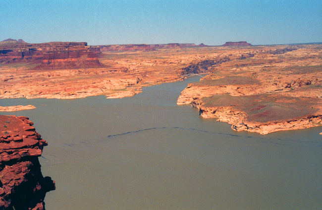
The water is a dirty light green color, due to all the sediment that is washing into Lake Powell from the Colorado up at this end. I read on the sign here that Lake Powell is over 175 miles long, so I imagine that by the time the water slowly flows down to the area near the dam, most of that sediment will settle out. I'll test that theory when we cross Glen Canyon Dam the day after tomorrow.
You can see a marina in the distance; I found this to be an unusual sight because we are so far from any town of any size at all. But I suppose that vacationers bring their boats to any place on the huge lake and put them in, and then traverse the lake at will, sometimes stopping at this marina, but not staying here all the time. There were some RVs down there by the marina, so I guess this is a good place to get away from it all for a time.
Lake Ray Hubbard pales in comparison to the size of this Lake. Although the width at this narrow point is about the same, Lake Ray Hubbard is only five miles long, and even so provides an entire day of sailing without a lot of retracing of one's route. (It made me wonder, standing here, what Grant would have done with 180 miles worth of lake!)
|
Lake Powell began to fill in 1963; it took 17 years for the lake to rise to the high-water mark. Since then, the lake level has fluctuated considerably depending on the seasonal snow runoff from the mountains. However, up through the time of this visit, the lake has been generally full or fairly close to it. (Beginning a few years from now, though, river flow would become much more erratic. The lake has had its ups and downs, but by 2014, the lake was critically low and for the first time the Bureau of Reclamation had to reduce the annual release from Lake Powell to Lake Mead. This has resulted in Lake Mead itself declining to its lowest level since the 1930s.)
I think the barren nature of the land around here is striking. We normally think of the area around lakes to be lush and green, but here there is none of that. The water you see here doesn't fall here as rain; the water you are looking at comes from a hundred miles north of here and is mostly snowmelt from the Rockies. Add that to the fact that the soil here is still little more than rock and you can see why there is little greenery.
This must be what the world was like before the action of wind and water had a chance to grind down the rock into soil, and add the nutrients that plants would need. Perhaps in the far future, when rainfall patterns change and nutrient-rich soil is created, there may be forest or grassland here. (Note the line of floating debris in the water; it consisted of tree branches, some logs, leaves, and a lot of other stuff washed down here in the river.)
Capitol Reef National Park
|
Capitol Reef National Park is about 60 miles long but only about three miles on either side of Highway 24. The park was established in 1971 to preserve 400 square miles of desert landscape. Originally called "Wayne Wonderland" in the 1920s by local Wayne County boosters, Capitol Reef National Park was initially designated a National Monument in 1937 by President Franklin D. Roosevelt in order to protect the area's colorful canyons, ridges, buttes, and monoliths. It was not until 1950 that the area officially opened to the public and another 12 years before getting here became easy after the construction of State Route 24 through the Fremont River Canyon.
The majority of the nearly 100 mile long upthrust formation called the Waterpocket Fold� a rocky spine extending from Thousand Lake Mountain to Lake Powell� is preserved within the park. Capitol Reef is the name of an especially rugged and spectacular segment of the Waterpocket Fold alongside the Fremont River. The park was named for a line of cliffs of white Navajo Sandstone with dome formations� similar to the white domes often placed on capitol buildings� that run from the Fremont River to Pleasant Creek on the Waterpocket Fold. The local word "reef" refers to any rocky barrier to land travel.
|
The road was well-maintained, and the drive into the park was a pleasure. Fred, I believe, napped pretty much the whole way from the Colorado River to where I woke him up to take in the changed scenery. Note the clearly-defined layers of sediment in the rocks on the left side of the road.
While not where its name comes from, at one time this whole area was underneath the inland sea; many fossils of an aquatic origin are to be found even very high in the mountains here. This area was also home to a number of prehistoric peoples, who left rock pictographs behind for us to see. As I have mentioned before, Fred has a great interest in rock and cave art, and we wanted to hike at least some short distances to see some of them.
Fremont culture Native Americans lived near the perennial Fremont River in the northern part of the Capitol Reef Waterpocket Fold around 1000 AD. They irrigated crops of lentils, maize, and squash and stored their grain in stone granaries (in part made from the numerous black basalt boulders that litter the area). In the 13th century, all of the Native American cultures in this area underwent sudden change, likely due to a long drought. The Fremont settlements and fields were abandoned.
President Roosevelt created Capitol Reef National Monument in 1937; it was administrated from Zion National Park by a volunteer custodian. It was not until 1950 the the first full-time superintendent- Charles Kelly- took up residence. In 1958 a second Park Ranger transferred from Zion; in that year 56,000 people visited Capitol Reef. A visitor center was opened in 1966 as visitation spiked upward- tripling in ten years.
The Monument was vastly enlarged in 1968; this and diversification of the scenic resources soon raised another issue: whether Capitol Reef should be a national park, rather than a monument. A number of bills were introduced in Congress, but none gained significant support and most languished. After much negotiation, a House and Senate bill finally reached the Conference Committee stage. A final bill was approved in 1971, and "An Act to Establish The Capitol Reef National Park in the State of Utah" was signed into law by President Nixon.
|
Anthropomorphic (human-like) figures usually have trapezoidal shaped bodies with arms, legs and fingers. The figures are often elaborately decorated with headdresses, ear bobs, necklaces, clothing items and facial expressions. A wide variety of zoomorphic (animal-like) figures include bighorn sheep, deer, dogs, birds, snakes and lizards. Abstract designs, geometric shapes and handprints are also common. Designs may have recorded religious or mythological events, migrations, hunting trips, resource locations, travel routes, celestial information and other important knowledge.
At right you can see some of these pictographs; there were others along the cliff face, but these were the best that we saw, and Fred took this excellent shot of them. We were standing maybe fifty feet in front of them and about twenty feet below them.
An interesting and amusing incident happened while we were here at the pictograph site and if you want to find out about it (and you have a password for the diary-portion of this photo album) just click here.
|
The area including the park was once the edge of an ancient shallow sea that invaded the land in the Permian, creating the Cutler Formation. Only the sandstone of the youngest member of the Cutler Formation, the White Rim, is exposed in the park. The deepening sea left Carbonate deposits, forming the limestone of the Kaibab Limestone, the same formation that rims the Grand Canyon to the southwest. During the Triassic, streams deposited reddish-brown silt, which later became the siltstone of the Moenkopi Formation. Uplift and erosion followed. Conglomerate, itself followed by logs, sand, mud, and wind-transported volcanic ash, then formed the uranium-containing Chinle Formation.
During the middle to late Triassic, other layers formed, including Wingate Sandstone (sand dunes from the shore of the ancient sea), the Kayenta Formation (thin-bedded layers of sand deposited by slow-moving streams in channels and across low plains) and Navajo Sandstone (huge fossilized sand dunes from a massive Sahara-like desert). In the Jurassic, layers included the yellow Carmel Formation carbonate, Entrada Sandstone (from barrier islands and sand bars), the Curtis Formation (conglomerate, sandstone, and shale) and the Summerville Formation (reddish-brown mud and white sand deposited in tidal flats). After that, streams laid down mud and sand in their channels, on lakebeds, and in swampy plains, creating the Morrison Formation. Early in the Cretaceous, similar nonmarine sediments were laid down and became the Dakota Sandstone. Eventually, the Cretaceous Seaway covered the Dakota, depositing the Mancos Shale.
Near the end of the Cretaceous period, a mountain-building event called the Laramide orogeny started to compact and uplift the region, forming the Rocky Mountains and creating monoclines such as the Waterpocket Fold in the park. Ten to fifteen million years ago, the entire region was uplifted much further by the creation of the Colorado Plateaus. Erosion (water and wind) has made many of these layers visible.
|
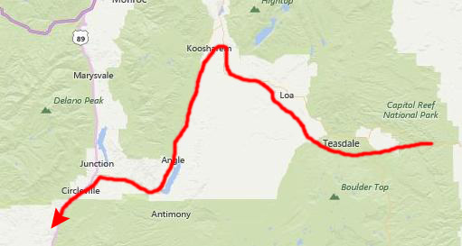
As we drove, we passed through some very fertile valleys, where every available inch of space was given over to crops or animals. Fred and I were talking about what we imagined to be the productive Mormon inhabitants of the valley. After about an hour, we reached the end of the valley and the intersection with US Highway 89, where we turned south.
We continued for about 50 miles to and through the town of Panguitch until we found the turnoff on Utah Highway 12 to Bryce Canyon National Park. In the darkening evening, we passed through Red Canyon State Park with some impressive reddish rock formations and a couple of campgrounds (all without facilities, according to the map), and then arrived at Bryce Canyon at dusk.
There were a couple of motels just outside the park, but we wanted to camp, so we drove on in. The entry station was unmanned this late in the day, but we hadn't got very far inside the park when we saw the sign that said all the campgrounds were full. We stopped at a couple of them anyway, and asked one of the campsite coordinators (people who stay at the campsites all during the day and the evening to make sure that any questions are answered or problems resolved) if there were any tent spaces left, but there were not. We were both disappointed, but there wasn't much we could do.
|
I might say, in retrospect, that our decision was a good one. Had we stayed, even if we could have gotten a campsite for the next night, it turns out that a single day is not nearly enough to spend in Bryce Canyon. If we'd stayed, we would have had to skip Zion; there just wasn't time to do both. I know all this because when we finally did return to Bryce Canyon a few years hence, we stayed two full days, and still didn't do all we could have.
In any event, after the enjoyable talk, we stopped outside Bryce, back on Highway 89 to have dinner (a local Mexican place), and then drove down to Zion. We arrived in Springdale about one in the morning and had no trouble finding a motel room right near the east entrance road into Zion.
You can use the links below to continue to another page for our western trip or to return to the trip index so you can continue though the photo album.
|
June 25, 1993: Zion National Park |
|
June 22-23, 1993: The Trip from Dallas to Mesa Verde |
|
Return to the Western Trip Index |