|
June 26, 1993: Zion and Petrified Forest NP/The Trip Home |
|
June 24, 1993: Mesa Verde/Lake Powell/Capitol Reef |
|
Return to the Western Trip Index |
After spending the night outside Zion National Park in Mount Carmel Junction, we got up early and headed into the park. We intended to get to the campgrounds by the time that the previous night's campers who would not be staying on were packing up their sites; our first order of business would be to secure a site.
The Campground and Visitor Center
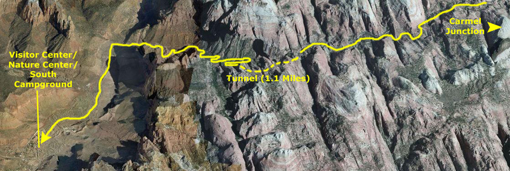 |
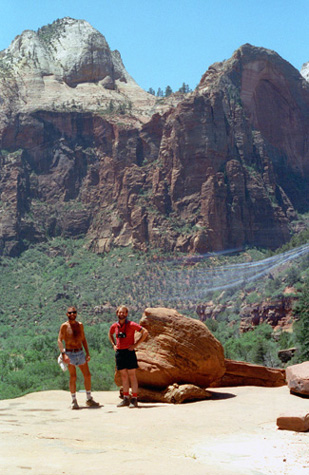
As you can see on the aerial view above, there is a natural pass that leads through the mountains that form the eastern rim of the Zion Canyon, but eventually, we came to a point where simply laying asphalt wouldn't work.
|
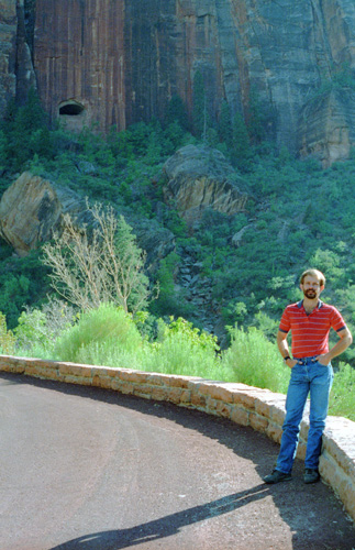
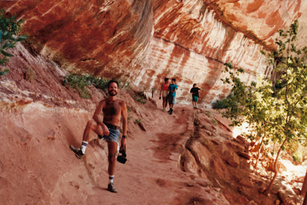
What you are seeing behind him would seem to be the tunnel entry, but if you look closely you won't see a road going into it. That's because the "window" in the cliff face a half-mile behind Fred is actually just that- a "window" about halfway through the tunnel along Utah Route 15 that not only helps with ventilation but also provides a brief but spectacular view back the way one has come. (As it turned out, there were a couple of these "windows".)
When you enter Zion from the East, the entry is through this tunnel, which is about a mile long, that was built in the 1930s as a WPA project. It is a fine tunnel, but unfortunately it was built for the cars of the day, not for the RVs that we have now. Consequently, when an RV is going through it, it is often restricted to one-way traffic. So when we got to the tunnel, we had to wait at the flagman, and sure enough, pretty soon a line of cars came the other way, and among them were a few RVs. The flagpeople carry portable radios, to tell each other when the traffic must be restricted to one direction only. This picture was taken as the road from Carmel Junction curves around to cross a bridge and enter the tunnel.
A little later on in the day, when we stopped in at the Visitor Center, we happened to see an exhibit about the tunnel, and it was there that we learned that while the "windows" to provide ventilation and a view, that's not actually why they were created. In truth, they were cut into the rock face as a method of getting rid of the debris that was created as the tunnel was built. It was only after the tunnel was completed, that they served as air vents into it. Even so, modern standards came in to play years ago, adn the tunnel now boasts its own ventilation system. There are still piles of rocky rubble below each of these openings testifying to their use during the construction of the tunnel.
Once through the tunnel, the road begins a long series of switchbacks as it descends into the Zion Canyon Valley; these switchbacks were not difficult to drive, but I had to restrain myself from looking at the wonderful views and let Fred be the one to take them in. Once on the valley floor, we turned southwest towards the Visitor Center/Campground complex.
|
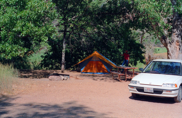
We picked the South Campground because as Fred was reading our brochure on the drive in, he discovered that there are few RV sites in that campground, as opposed to the Watchman Campground a bit further south which is primarily RV and group camping. We thought the South Campground would be quieter- and it was. This campground is located � mile from the South Entrance (we are coming in the East Entrance) and about a quarter mile north of the Visitor Center. There is an amphitheatre at each campground, and ranger talks at each of these on weekends. There were over a hundred campsites here at $10 night (today, the cost is twice that), and when we arrived about nine in the morning we found quite a few campers were leaving (but had not yet vacated their sites). We were quite lucky to find a tree-shaded site at the back of the campground (away from the noise of the road, the Nature Center and the Visitor Center, and just a short walk from the nearest "facilities". Its occupants, we found, were indeed leaving today, and so we settled on securing that site. That night, we discovered an added bonus to the site- we could hear the Virgin River all night long.
|
So we spent a bit of time in the nature center, and then drove back into the campground 30 minutes later. By then, the occupants of our space were actually leaving. There were a lot of people leaving, as it turned out, and we could literally take our pick of sites. We did notice one down at the end of a loop, even more secluded that the one we'd spotted earlier, and we thought we might take it instead. We were about to take it instead, and indeed had gotten tent pad out of the car, but when we went to spread it out on the ground, we found that there were a lot of ants all over the campsite area.
So we returned to the site we'd found earlier. The woman and her two daughters occupying the site were almost packed up, and I asked them if we could set up our stuff while they got ready to leave- which was fine with them. We started getting stuff out of the car, and had just begun to set up the tent when the three girls left.
This turned out to be a great spot, if a little windy, but then the wind was affecting all of the campsites equally. There was a nice large tree for shade and the site was more secluded than most, and it was within an easy two-minute walk of the amphitheater where the ranger talk would be that night. So we set up the tent, had a bit of breakfast, and went off to explore Zion National Park.
|
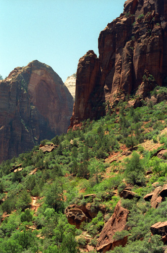
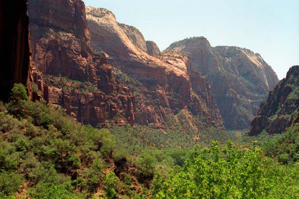
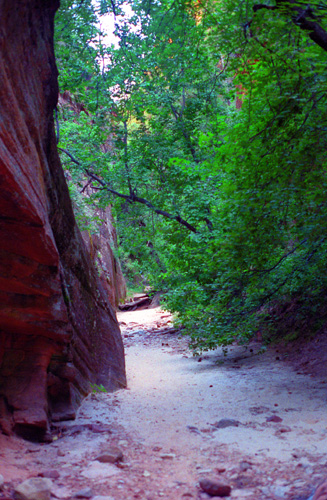
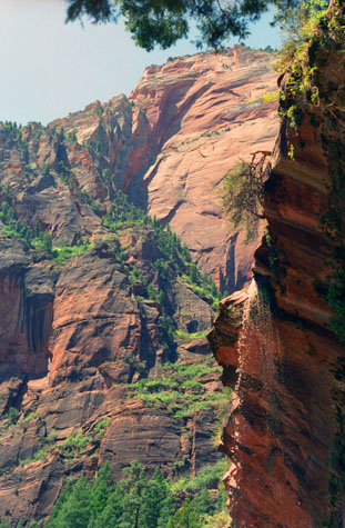
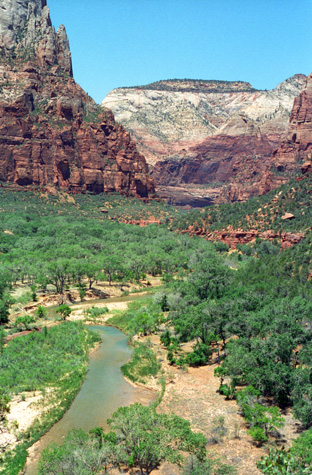
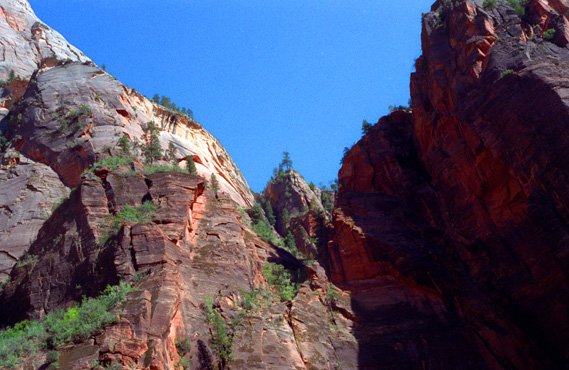
The most prominent feature of the 229-square-mile Zion National Park is Zion Canyon- 15 miles long and up to half a mile deep- that cuts through the reddish and tan-colored Navajo Sandstone by the North Fork of the Virgin River. The lowest elevation is 3,666 ft at Coalpits Wash and the highest elevation is 8,726 ft at Horse Ranch Mountain. Located at the junction of the Colorado Plateau, Great Basin, and Mojave Desert regions, the park's unique geography and variety of life zones allow for unusual plant and animal diversity. Numerous plant species as well as 289 species of birds, 75 mammals (including 19 species of bat), and 32 reptiles inhabit the park's four life zones: desert, riparian, woodland, and coniferous forest. Zion National Park includes mountains, canyons, buttes, mesas, monoliths, rivers, slot canyons, and natural arches.
Human habitation of the area started about 8,000 years ago, and continued with aboriginals, the Anasazi, the Parowan Fremont and other Southern Paiute subtribes up through the 1850s. Mormons came into the area and settled here in the early 1860s. In 1909, the area was designated the Mukuntuweap National Monument in order to protect the canyon. In 1918, the name was changed to Zion, which played to the bias of the time against Spanish and Indian names, and late that year the Monument was elevated to National Park status. The adjacent Kolob section, formerly its own Monument, was incorporated into the park in 1956.
The geology of the Zion and Kolob canyons area includes nine formations that together represent 150 million years of mostly Mesozoic-aged sedimentation. At various periods in that time warm, shallow seas, streams, ponds and lakes, vast deserts, and dry near-shore environments covered the area. Starting 13 million years ago, uplift associated with the creation of the Colorado Plateaus lifted the region 10,000 feet, forming the mountains we see today.
We only had a full day here in Zion, and there were one or two places that Fred really wanted to go, so we inquired about the other hikes that we could fit into that schedule. We decided to tackle the Emerald Pools, Weeping Rock, and Lost Canyon trails, and also to do a river walk (more about that later).
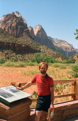
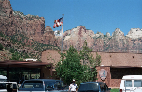 The Zion National Park Visitor Center (West View) The Visitor Center had a library, films, lectures and demonstrations. We could easily have spent a day here, but settled for mailing postcards home. Zion is surrounded on all sides by rock cliffs like those in the background; the only natural entry is the Virgin River. |
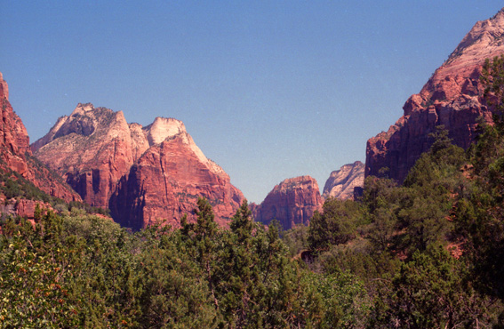 A View of the South Rim from the Visitor Center In the valley of Zion, there is much vegetation and many tall trees. As you move up the slopes, however, this vegetation declines and then disappears entirely. The one exception was Lost Canyon. |
|
|
I have obtained a map of Zion Canyon, courtesy of the National Park Service's website for Zion National Park. I've sized and cropped it so that it concentrates on the area we covered during our visit. I have put it in the window at left and I've added a vertical scroll bar so you can move up and down the canyon.
The map will be oriented to the top when you arrive on this page, but the entry highway, our campground and the Visitor Center are towards the bottom. So, you might begin by scrolling the window down until you can see the Visitor Center and campground where we began our day.
The legend for the map is a little further down still, and you are welcome to scroll all the way to the bottom as necessary.
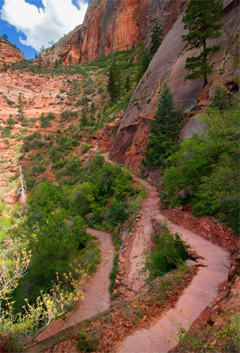
After leaving the visitor center, we drove North through the canyon on the main park road. At the bottom of the canyon, running all the way from North to South, is the Virgin River, and the road through the canyon parallels that river. After a slow drive of about four miles, we came to the parking area for the Emerald Pools trail.
The Emerald Pools Trail
|
The trail has two sections, and we did both of them. Here is a diagram of the Lower and Upper Emerald Pools trails:
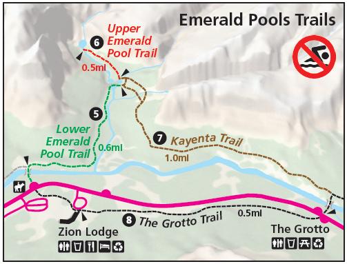 |
This was billed as being a crowded trail, and there were a number of people on it, but not so many as to clutter up all of the pictures we tried to take. We started off on the trail just on the other side of the footbridge.
|
The first photo on the trail, seen at right, was taken at the overhang for the Lower Emerald Pool. The current trail diagram does not show it, but at the time we did this hike in 1993, the Emerald Pools trail was a circular one; you can go up a different way than you come down. My guess is that having two trail routes was somehow damaging the site, and so the out and back trails were combined.
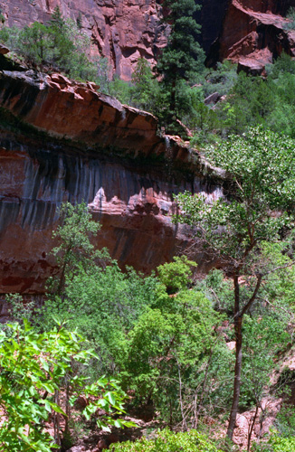
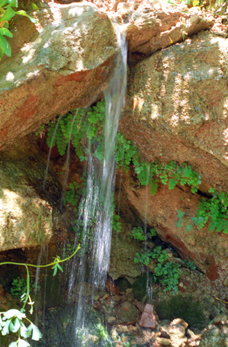
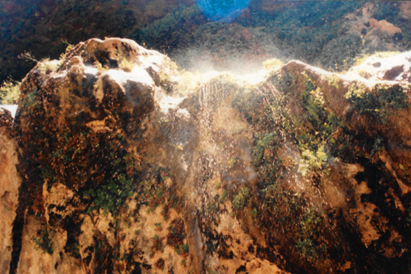
We came to the Lower Emerald Pool after hiking upwards for only a half mile or so. There is a large rock overhang, over which a small rivulet of water is pouring. The water is not enough to form an actual waterfall, but more a spray of water that is moved around by the wind.
This is one of Fred's shots, and is of the overhang itself, taken just before the trail actually came underneath it. You can just barely detect the spray of water coming off the top of the overhang. We got this view as we rounded a curve in the trail, and we could from this distance see the entire overhang.
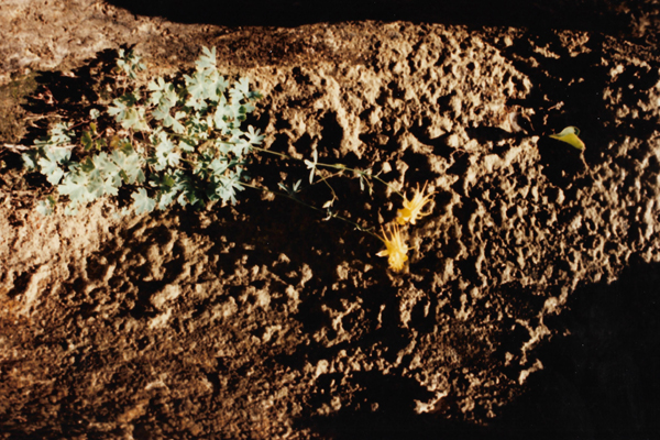
The trail itself curved around behind the tops of the trees that you see at left. The small amount of water is coming over the top of the overhang, and spraying the trail below in random patterns that are affected by whatever breeze is blowing. The overhang either was not commodious enough for a cliff dwelling to be built, or no humans inhabited the Zion Valley; there is no evidence of any habitation here.
|
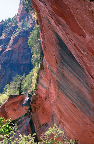
The rock here at Zion is composed of nine known geologic formations called the Grand Staircase. Together, these formations represent about 150 million years of mostly Mesozoic-aged sedimentation in this part of North America, as ancient shallow seas advanced and retreated. After the sediments were laid down, uplift affected the entire Colorado Plateau, by slowly raising these formations more than 10,000 feet higher than where they were deposited. This steepened the stream gradient of the ancestral Virgin and other rivers on the plateau.
The faster-moving streams took advantage of uplift-created joints in the rocks. Eventually, all Cenozoic-aged formations were removed and gorges were cut into the plateaus. Zion Canyon was cut by the North Fork of the Virgin River in this way.
High water volume in wet seasons does most of the downcutting in the main canyon. These flood events are responsible for transporting most of the 3 million tons of rock and sediment that the Virgin River transports yearly. The Virgin cuts away its canyon faster than its tributaries can cut away their own streambeds, so tributaries end in waterfalls from hanging valleys where they meet the Virgin. The Emerald Pools and their overhanging rock formations are examples of this process.
 Lower Emerald Pool Falls |
(Picture at left) This view, taken from a little further along the trail under the rock cliff, looks up at the mountain that forms the rim of Zion at this point, and you can see now clearly the water flowing over the edge of the overhanging rock. The stains on the rock are not caused by the water, but are the result of various lichens that grow on it; different lichens produce different colors. I think it is interesting how the trees adapt to any available space on the mountain in the background.
(Picture at right) |
 Lower Emerald Pool Overhang |
This was a really neat place, nice and cool and shady, and the views looking out and up from underneath the semi-circular rock ledge were simply amazing. And for some reason, there weren't many people on the trail today.
|
The United States Congress established Zion National Park in 1919; travel to the area before it was a national park was rare due to its remote location, lack of accommodations, and the absence of real roads in southern Utah. Old wagon roads were upgraded to the first automobile roads starting about 1910, and the road into Zion Canyon was built in 1917 leading to the Grotto, short of the present road that now ends at the Temple of Sinawava.
Touring cars could reach Zion Canyon by the summer of 1917, and the first visitor lodging- Wylie Camp- was built that same year. The Union Pacific Railroad acquired Wylie Camp in 1923, and offered ten-day rail/bus tours to Zion, nearby Bryce Canyon, Kaibab, and the North Rim of the Grand Canyon. The Zion Lodge complex was built in 1925; architect Gilbert Stanley Underwood designed the Zion Lodge in the "Rustic Style" and the Utah Parks Company funded the construction.
Work on the Zion � Mount Carmel Highway started in 1927 to enable reliable access between Springdale and the east side of the park. The road opened in 1930 and park visitation and travel in the area greatly increased. The most famous feature of the Zion - Mount Carmel Highway is the 1.1-mile Zion - Mt. Carmel Tunnel, with its six large windows cut through the massive sandstone cliff.
As far as the trails were concerned, the first was an improvment of an old Native American footpath up Echo Canyon made in 1896 by local rancher John Winder; this became the East Rim Trail. In 1906, a one-mile trail was constructed from the Temple of Sinawava, to the start of the Narrows. Angel's Landing Trail was constructed in 1926 and two suspension bridges were built over the Virgin River. Most of the rest of the trails were constructed by the Civilian Conservation Corps during the 1930s.
|
|
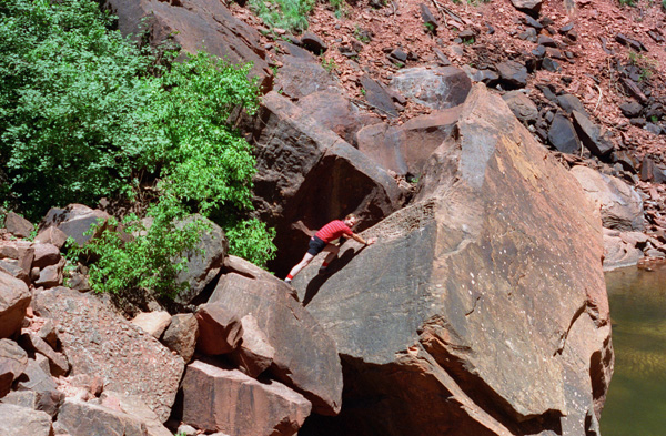
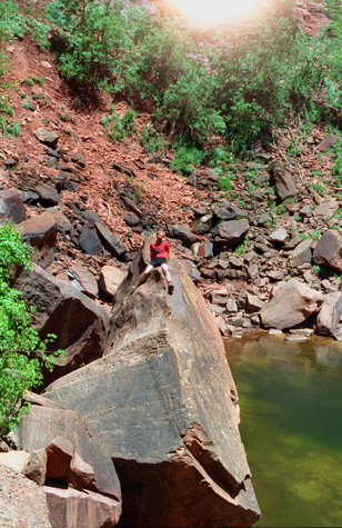
We passed some people on their way down, and they were following all sorts of different pathways. The final stretch is a hot and sandy quarter mile, but it is well worth the effort to get to the final pool at the base of the 300-foot cliffs above. Once at the upper pool, it is like a small pond, fed by some springs and water flowing from the rocks above. There is a small beach, and on this end of the pool a huge pile of rocks, some of them very large, like this one, that have fallen down the slope to this point.
We clambered around on the rocks for a while, and I asked Fred to go over there and make like he was going to climb up that big one. I didn't think he would, since he is moderately afraid of heights, but it turned out that he did. You can see the picture that I took above, right. The upper pool area is a great area to find a shaded boulder to relax. Most of the time, you can see a faint waterfall coming from the mouth of Heaps Canyon far above.
 Fred at the Upper Emerald Pools |
(Picture at left) As you can see, Fred did indeed get on top of the rock. He looked a bit uncomfortable, so I took the picture hurriedly. That's why there is a glare from the sun at the top of the picture. I had been using my hand as a lens hood, but I didn't take the time to do a good job of it here. Now you can see some of the pool itself; with the greenish water which is full of algae and other plants. There is not enough water movement here to keep the algae from growing; this is not a pool that is fed by a large spring, but rather by seepage out of the rocks. The water evaporates out of the pool before the pool fills enough to allow it to flow out and down the slope to the lower pool. So, until there is significant rain or snowfall, the water is basically stagnant.
(Picture at right) |
 Me on the Upper Emerald Pool Rocks |
While climbing around the far side of the pool, I came across some large boulders that had fallen in a way such that a small cave had been formed. You could go into the cave only a few feet, but then the ceiling opened up (more like a crevasse than a cave). I like to explore places like this, so I went inside as far as I could.
|
|
About five feet behind me, there is a drop off of about a hundred feet or so. Again, I am just feet from a sheer drop, but I was OK as long as I didn't bend over to look down. I think Fred composed this picture very well, getting the scope of the mountains and cliffs in the background. It is amazing to me that so much spectacle can exist in such a small area such as Zion.
When Fred was taking my picture, I was looking about for someone I could ask to get a picture of both of us, and I picked out a likely candidate. Were this any other place except the scenic West, I might think twice about handing a stranger my camera, but in this neck of the woods one is pretty safe. After all, people with larceny on their minds don't travel all the way to Zion and then hike an hour up a mountain just on the off chance that they might be able to get away with a camera.
 Above the Lower Emerald Pool |
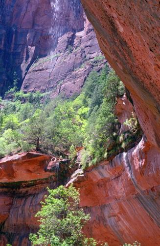
(Picture at left) Behind us, across the valley, are some of the cliffs and mountains that form the rim of the Zion canyon. Just a few feet behind us is the drop off of the overhang. I must admit that I have no idea what the wispy white streamers are in the picture; I don't think it is water, and I can only assume that it is some sort of glare from the sun. After milling around up at the top of the trail, we started down along the other part of the circle route.
(Picture at right) |
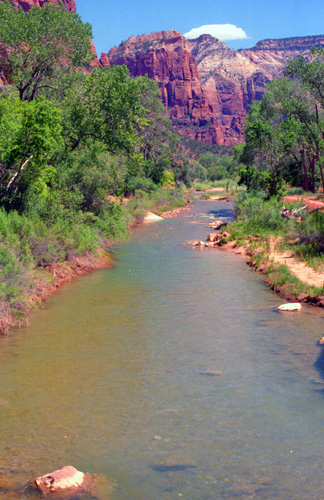
 The Virgin River |
As we descended, the winds got very brisk, and there was a lot of blowing sand. At times it was uncomfortable trying to keep the sand out of our eyes, but that didn't last long. The trail down was easy and the views were spectacular.
|
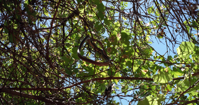
Look carefully at the picture at left, and you will see the reason for the commotion: a predator with its prey. The snake is only a bit more than an arm' length away, but I could not quite reach it. As the tree snake with the bird in its mouth slithered away through the branches, I was able to get this shot.
Most people, including most of my friends, are quite averse to snakes; if I know that it is not a poisonous one, though, I don't mind them at all, and in fact enjoy handling them. You have to be careful in the wild, though, particularly if you are a city slicker like me, but I don't recall an indigenous poisonous tree snake in North America.
In any event, I couldn't get close enough to touch it, and it continued to swallow the bird as we watched it get away down out of the tree and through the underbrush alongside the trail.
|
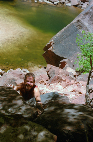
When we got back to the car, both of us were sweaty and dusty. Before I had something to drink, however, I got a washcloth and went down to the river itself to wash my face. I don't think I can recall cold water feeling any better than it did right then. I must have stayed at the riverbank for ten minutes just scooping up water and splashing it on my face. Then I returned to the car and joined Fred in a soda.
Consulting our park brochure, we continued on up the valley to our next stop- Weeping Rock.
The Weeping Rock Trail
|
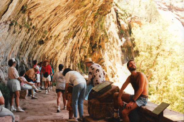
The walk up here took only fifteen minutes or so, and we found ourselves standing under the beautiful alcove with the wonderful water sprinkling from above. In the picture at left you can see me sitting on the rock wall looking up at the water coming down, and you can see most of the overhang as well.
There is not enough water here to form a continuous waterfall as it is forced our of the rock, though, hence the name. Most of the water drips on the trail or along the ledge where I am sitting, or it blows around dampening everybody. Some of it runs along the back wall of the overhang, and collects in small pools on the ground, only to seep right back into the sand. Fred took this picture from one end of the small area under the overhang.
|
|
The trail continued along the cliff in my direction for about a hundred feet or so, and there were a number of smaller springs dripping water down the rock face. The sun was very bright and it was quite warm.
We hung around here for a little while just looking at all the little places where water was seeping out of the edge of the cliff face. Understanding how the "springs" were created didn't make them any less interesting.
|
|
It looks like it might be very inviting to drink the water that you find here, but there are signs that caution against it. We think of spring water as being very pure, but the sign says that, in addition to the possible contamination by tourists themselves, various animals in the area might also contaminate it.
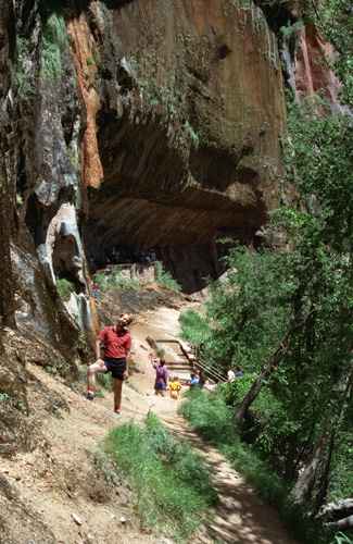
We went back down the trail to the overhang, and then took the flight of steps down to the trail that led back to the parking area. Once there, we looked for the signs directing us to the trailhead for the Hidden Canyon Trail.
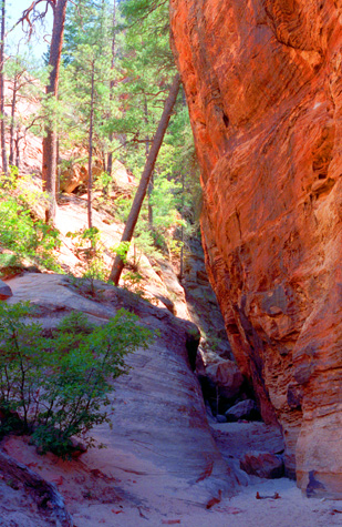
The Hidden Canyon Trail
|
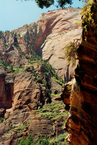
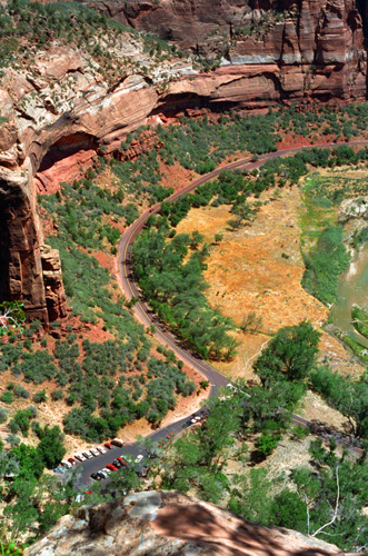
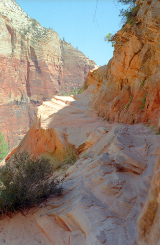
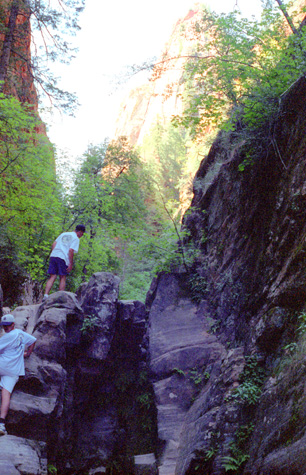
The views got better and better, but after about 45 minutes, the trail really opened up and we got a wonderful view back down into Zion Canyon and the trailhead parking area. If you look very closely, you can see the white Honda in the row of cars in the middle of the lot that has the black one at the end. The Honda is the third car in the row, counting from the black one. The trail to Weeping Rock is out of the picture at the bottom.
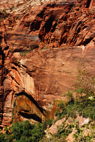
You can see the course of the Virgin River, and road that continues up the Canyon. You can also see two other rock overhangs along the cliff face. At one time, the water must have been right along the face of the cliff, carving a canyon deeper and deeper, but obviously the water has not been at that level or in that location for quite a long time. The trail we are on is not a hard one, but it is rising at a very quick pace, and so walking up it is an effort.
This picture was actually not taken from the trail; a little ways past the junction of this and another trail there was an unofficial viewpoint with a short trail out to it. The brochure cautioned that the area was very exposed, and that hikers should stay well back from the edge. I got as close as I dared.
Both the rangers and our little park brochure cautioned us to take our time on this trail. It pointed out that if one wasn't acclimated to uphill hiking, this would be quite strenuous. This trail portion was common to two different trails, and, soon enough, we came to the junction of the Hidden Canyon Trail, and it was now time to choose the path less traveled!
|
|
| "The trail then follows the canyon wall and with the help of a few chains, it descends into a little shaded valley- Hidden Canyon. A tall set of stone steps take us to the final section of trail: a short exposed ledge section that was chiseled out of the sandstone walls. While not technically difficult, this section could be quite intimidating to those with a fear of heights. Take it slow and hold onto the chains!" |
I must say though, that when we got to this part of the trail, Fred became distinctly uncomfortable. As I have mentioned before, Fred has something of a fear of heights, and along this part of the trail there is little to separate you from oblivion. The tipoff that Fred was getting a little nervous was when he simply refused to go any farther!
I would certainly never attempt someone with acrophobia to do anything they weren't quite comfortable with. A fear of heights is something you can't control, and I thought that if I pushed him further, he (or I) might be so nervous that we'd make a mistake- and along this trail a mistake could be terminal. So I didn't blame Fred at all, nor did I think less of him for not wanting to push his limits.
But since we had come so far, I asked him if he would mind waiting for me to go on along the trail to see where it led. I promised that I wouldn't be gone more than an hour or so. I think that what sealed the deal is that we had just passed a man and woman who were also sitting by the trail having something to eat. We went back down to where they were and discovered that they, too, had decided they didn't want to go any further and did the same thing I was requesting of Fred- allowed the other members of their group to go on to Hidden Valley itself.
So with Fred's approval, I left him there in the shade with his own snack and water and then turned back around to continue up the trail that is in the picture above. Just around the curve in that picture the chains started, and they lasted for perhaps 150 feet. I will freely admit that if the chains had not been there, I might have myself decided that discretion would have been the better part of valor. I could see ahead of me, though, that there was just one place where if you fell you would fall more than fifty feet or so before finding something to grab onto.
|
|
I can't say that the trail didn't have an unnerving effect on me, too, but as long as I didn't just lean over the edge and look down, I was OK. This view looks back across to the cliff face along which the previous part of the trail had ascended. Fred is waiting a hundred feet down and to my left with those other folks (whose party members I encountered in Hidden Canyon itself).
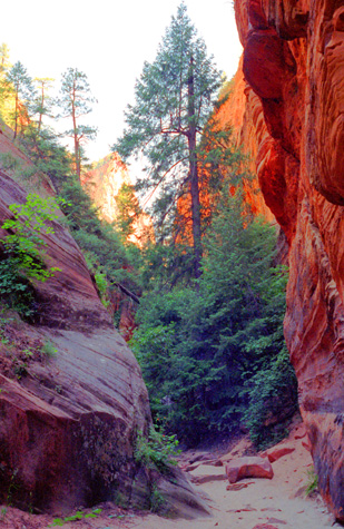
You can see that the trail has been carved so that it tilts towards the cliffside, minimizing the chance that someone might stumble and roll over the edge. I was happy for that. Once you get around the ledge trail then the trail continues on back into the hills, rather than along the cliff face any further. It was just fifty feet further on where the ledge trail ended and it turned into Hidden Canyon itself. Now I started taking pictures as I made my was east through the canyon, which was a different from the cliff face as night from day. For one thing, trees reappeared.
 Hidden Canyon Begins |
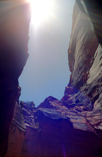
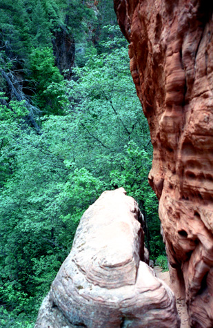
(Picture at left) Actually, Hidden Canyon is just that; it is a crevasse between two mountains that make up the East Rim of Zion, and the crevasse appears to go all the way through to the other side of the row of mountains that form the valley wall. You can see how narrow the crevice is at spots. The trail goes right along the sandy walkway between the two rock outcroppings.
(Picture at right) |
 The Sandy Floor of Hidden Canyon |
Once I got into the Canyon, the "trail" as such kind of disappeared. The canyon was very narrow in many places- almost like a slot canyon- and no place was it so wide so as to allow you to get lost. About the only way was forward, and so it was a fun walk through the shady crevasse.
|
|
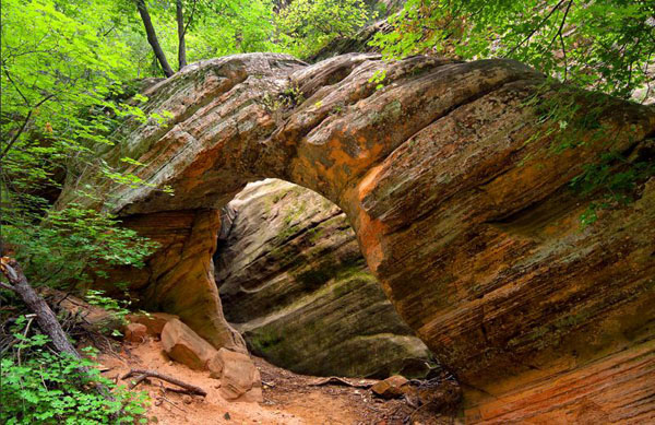
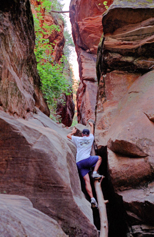
On a very small scale, this arch reminded me of those that Fred and I saw in Arches National Park last October. The form was essentially the same, but my guess would be that this arch is less than a tenth the size of some of those that we saw in that park. But the neat thing here is that you get right up to the arch, go under it and even climb on it if you wished- there were no admonitions either by signage or in the trail guide not to do so. It was very, very beautiful.
The walk through the canyon was shady and relatively cool, although there were a great many flies for some reason. I was reaching the halfway point of the time I told Fred I would be back, so I knew I wouldn't be able to go much farther, but up ahead I heard voices so I continued on.
 Another Hiker on the Trail |
(Picture at left) After going for a ways through the canyon, I began to hear voices up ahead, and soon I caught up with these two guys also hiking the trail. As it turned out, they were from Fayetteville, North Carolina, and it was their parents who were waiting for them back at the same place where Fred was resting. That was about all I found out about them, as we were too busy trying to find our way through the canyon.
(Picture at right) |
 A Hiker Climbs the Rocks |
I supposed I hiked between a quarter mile and a half mile through this narrow canyon. At some places, the trail, and the canyon, were very narrow, but at other times it widened out. After hiking for a good ways, and climbing up a particularly steep part of the trail, I reached this point where it looked as if the trail ended.
 Towards the End of My Hike |
(Picture at left) After climbing up one rock, I was above the tops of the trees and couldn't find an easy way back down to continue forward. That knob of rock is about ten feet below me and about as far in front of me. Possibly the trail goes down between it and the cliff face, but as I said I had gone about as far as I had time to go, so I turned around to head back to Fred.
(Picture at right) |
 Coming Out of Hidden Canyon |
I thought that the short hike through Hidden Canyon was really interesting, with the trees, tree ladders, rocks to climb on, the "slot" nature of the canyon in spots and of course the natural arch. I was glad I'd come on up here and only sorry that the trail up to the entrance of the canyon was so nerve-wracking.
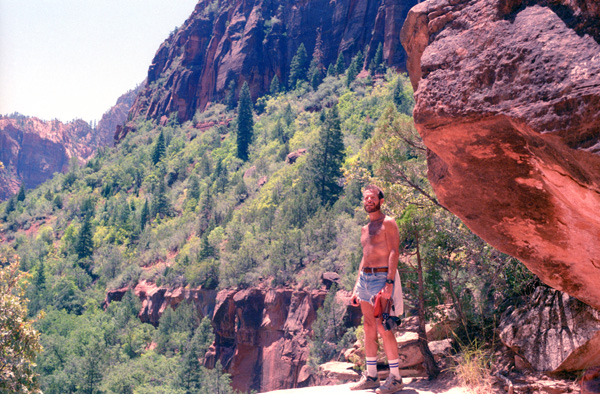
 Mountain Peaks at the Entrance to Hidden Canyon When I got back out to the entrance to the canyon, I took this picture of some of the peaks just inside the entrance to the canyon. The actual Zion valley is directly behind me and about a thousand feet below. I returned along the trail I had come up, collected Fred, apologized for being gone a bit longer than I said, and together we started on back down the trail to the parking area. Going down was a lot easier than going up, and we made pretty good time. |
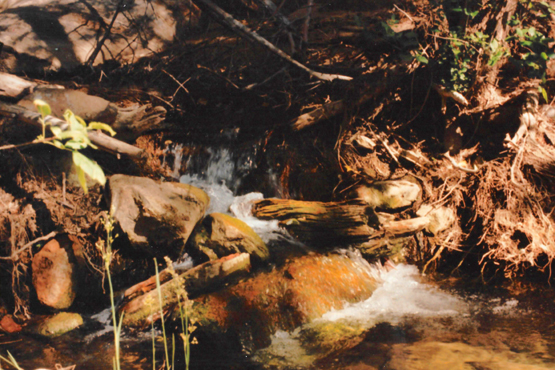 Weeping Rock Creek Near the Hidden Canyon Trailhead Once back at the beginning of the trail, we took an opportunity to refresh ourselves by using some water from the small creek formed by the Weeping Rock springs. As we were doing so, Fred obtained this close-up of the course of the creek. Once again, the water was immensely refreshing (although we heeded the warnings posted in the campground not to drink the water). |
Once we had rested for a few minutes, we got back in the car and continued to the end of the accessible portion of the Virgin River valley to the point where the Virgin River actually enters the valley proper.
Walking the Virgin River
|
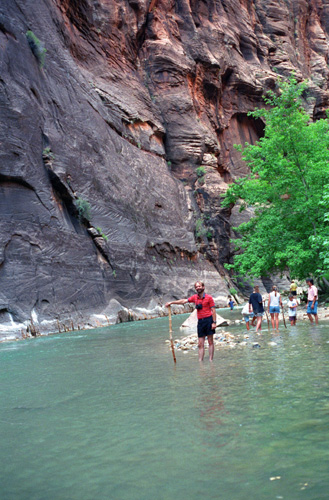
From the car, we walked along a paved walkway to the point where the Virgin River enters the valley itself, and the valley begins to spread out. This hike is about a half-mile or so. Once there, the thing to do is to continue hiking up the river, but by walking in the river itself. There is a seating area at this point for you to change into river shoes or some other shoe you can get wet and also some steps that lead down into the river. There is also a large bucket full of walking sticks which you are welcome to borrow.
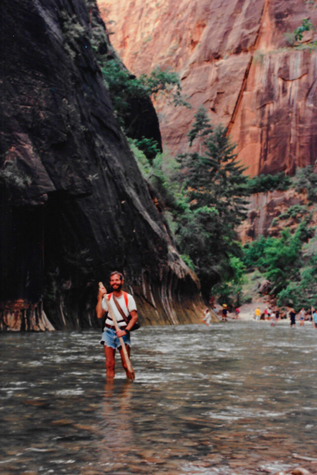
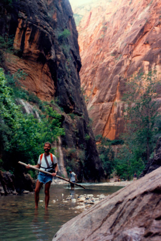
Walking stick in hand, then, you just walk down into the river, which is, at most places, only a foot or two deep, and hike right up the riverbed. The guidebook says that you can hike some ten miles or so up river before it gets difficult, but we had no intention of going that far. Fred had heard about this hike before, but had not done it, so it was something new for him also. We were wearing sneakers (Fred had planned ahead and we had both brought two pairs of tennis shoes for the trip.) At left is Fred a short distance from the starting point, standing in the Virgin River with his walking stick.
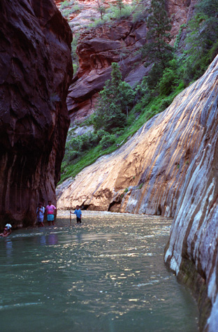
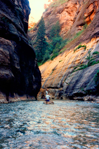
The North Fork of the Virgin River (aka "The Zion Narrows") is probably one of the most legendary canyons to hike in all of Zion National Park. The Zion Narrows is the section of the Virgin River just upstream from the Temple of Sinawava and here the majestic walls of the main canyon close in to form a tall and narrow crevasse with beautiful dark corners and the Virgin River flowing around you. With beautiful flowing water and barely any direct sunlight reaching the bottom, this is the slot canyon that all other slot canyons are compared to. Careful not to drop our cameras or get them wet, here are some of the pictures we took as we walked up the Virgin River:
 Hikers in the Virgin River |
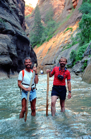
(Picture at left) Using the walking sticks for support (which came in quite handy many times), we walked slowly up the river from the starting point. As you can see, there is no more valley- just the bare river canyon. You can also see that the river is very, very shallow at some points, although in spots it was four and five feet deep. We ran across hikers of all ages on this popular hike. At some places, the canyon walls entirely blocked out the sunlight, and this made picture-taking somewhat difficult. The river flows quite quickly here, and you really need the hiking sticks to keep your balance.
(Picture at right) |
 Me in the Virgin River |
 Walking Through the Virgin River |
(Picture at left) Here I am standing in a very shallow area of the river. The deep areas are usually at the outside.
(Picture at right) |
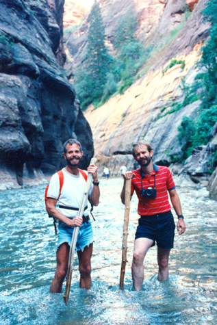 Fred and I in the Virgin River |
After we hiked a goodly way up the River, we reached a point where the only way to go further was to get up to your chest in the water. We were not prepared for this, not having worn bathing suits, and so we decided that because it was getting later in the day, we would turn around and head on back. Also, the light was beginning to fade, and it was getting harder and harder to keep pictures in focus.
 Fred and I in the Virgin River |
(Picture at left) On the way back down the river, an obliging tourist took my camera and took this picture of both Fred and I standing in the river. We continued our return hike down river, eventually reaching the staging area where we left the walking sticks and tried to dry off our shoes somewhat.
(Picture at right) |
 A River Walker |
When we left the staging area for the river walk, we began our short walk back to the parking area. Taking the opportunity for this "must do" activity here in Zion was a good choice; it is one hike that lots of people can do and so it is very popular.
|
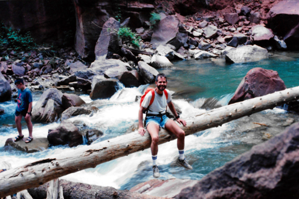
Fred asked me to go out on the large log that was wedged into the riverbank and suspended over the rapids so he could take a picture of me sitting on it. I did that, and the picture turned out pretty well.
It was getting late in the day, and was cooling off somewhat. We walked around the area for just a while, and then got back in the car and drove back down the valley to the South entrance to the Park. We went outside the park to the town of Springdale to get some fruit and some more ice for the cooler. The town was very quaint, with lots of motels and restaurants for the people not camping in the park itself. We located a place where there were showers if we wanted them. Then we drove back to the campsite.
Once there, we found that the high winds during the day had blown the tent down. It hadn't blown anything away, but the tent had collapsed. The winds were still high, and we didn't think that just trying to put the tent up again would help, so we just left it down while we had some dinner. After dinner, the winds started to die down, and we were able to get the tent back up.
Once it got dark, we walked a short distance to the amphitheater for the ranger talk. In most National Parks, there is at least one ranger talk each evening. We had heard about raptors in Mesa Verde, and about the National Park System at Bryce Canyon. The lecture this evening in Zion was about stars and constellations. We gathered in the amphitheater and as it got darker the ranger pointed out many of the stars, planets and constellations. It was quite interesting.
After that, we went back to the tent for a very restful sleep.
You can use the links below to continue to another page for our Western trip or to return to the trip index so you can continue though the photo album.
|
June 26, 1993: Zion and Petrified Forest NP/The Trip Home |
|
June 24, 1993: Mesa Verde/Lake Powell/Capitol Reef |
|
Return to the Western Trip Index |