|
June 25, 1993: A Day in Zion National Park |
|
Return to the Western Trip Index |
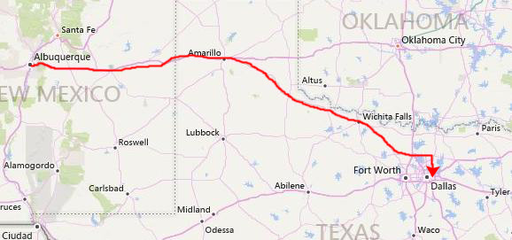
Today will be a full day. We plan on doing a hike out by the east entrance to Zion that is supposed to offer beautiful views of the valley. Then we will begin driving back towards Dallas via Glen Canyon Dam near Page, Arizona. We'll continue south towards Flagstaff and then head east along I-40 towards Albuquerque and Amarillo. We plan on making our final stop the Petrified Forest National park east of Flagstaff.
Leaving Our Campsite
|
Usually, that gives us time to use the available facilities to wash up; if showers are available we can do that too, but National Parks rarely have them and Zion was no exception. Though we'd scoped out Springdale the evening before to locate private shower facilities, we decided to eschew that for today; tonight we will be in a motel somewhere anyway.
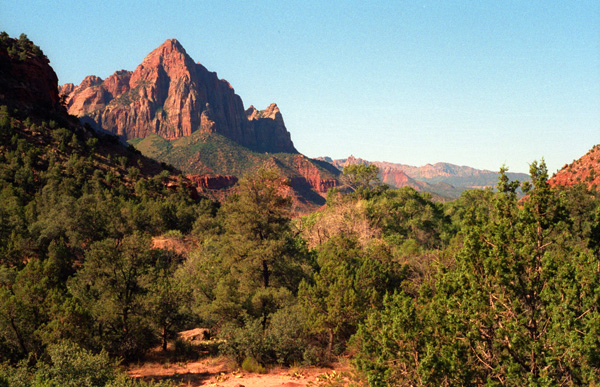
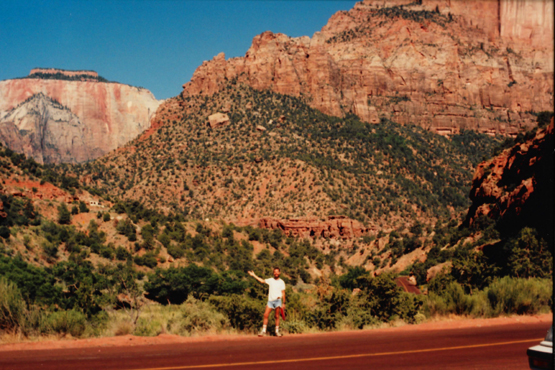
As we were taking down the tent and packing everything up, I walked a ways away from the actual campsite to get this picture of the South entrance to Zion in the early morning light. This view of the sun hitting the mountains early in the morning looks southwest.
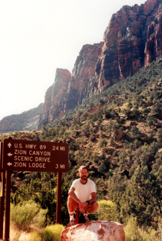
We went by the visitor center so we could mail some postcards and so Fred could by a video that he had seen the day before, and then we set out for the east entrance to the Park, the one we had come through yesterday morning.
Getting to the Canyon Overlook Trail at Zion's East Entrance
|
|
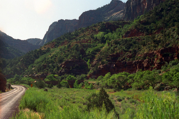
Right after we turned onto Highway 15 I took this picture of the road ahead out of the park. We are still on the valley floor at the moment, but here you can see a good view of the East Rim from inside the park. You can also make out the cuts where the road follows a series of switch backs as it climbs to the tunnel out of the park.
As we headed east, the switchbacks appeared and we started climbing. The views got better and better and at a couple of points we stopped to take a picture; I did a landscape and Fred found something plant-related:
 The Zion Valley from Route 15 I thought this view was interesting because of the rock and tree formations that seem to outline the head and neck of a horse on the cliff face opposite. To me, it looked as if my sister had gotten up on the cliff face and carved or drawn one of her horse head pictures. |
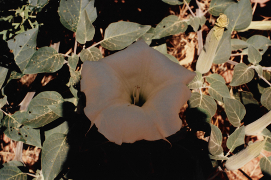 Some Jimson Weed Along Highway 15 At the same stopping point, Fred found this interesting flowering plant; he also took some seeds from one of the open pods so he could see if he could get them to germinate once he returned home to his new greenhouse. |
We made some other stops when there were interesting views to photograph:
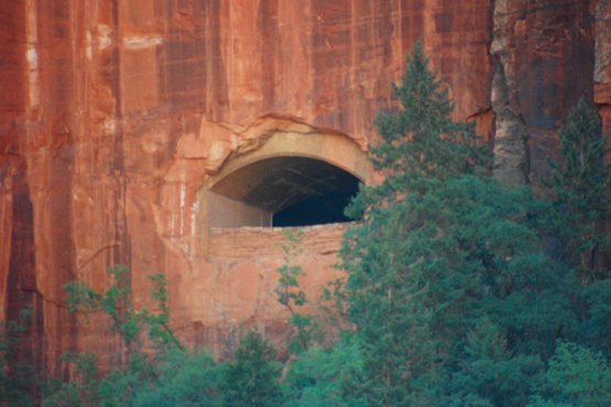 A Window in the Route 15 Tunnel A little further on, you could get a good view of one of the openings in the rock face that was cut when the tunnel into Zion was built. This picture was taken with Fred's telephoto lens, and I think it is amazing just how sheer the cliff face was at this particular point. |
 A Zion National Park Vista As we climbed further along the highway, the views of the park changed, and we stopped to get this picture of the South end of the Zion valley, and the same horse formation we had seen before. |
Just before the road began to climb the final series of switch backs to the tunnel entrance, there is a stone bridge over a streambed. There wasn't much water in it at the moment, but it was still picturesque, so we got out of the car to tramp around below the highway for a bit.
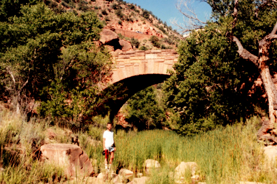 Walking Underneath the Highway 15 Bridge Here I am in the small stream bed in the eastern Zion valley. Fred wanted to get out and look along the stream bed for interesting plants, so we wandered around on the rocks for a while. |
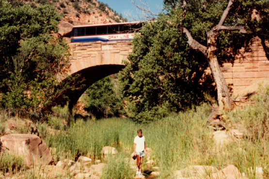 I Didn't Know There Was a Second Picture There was not much water in the stream itself, although there was some, it was more swampy than a stream. In the background is the highway bridge. You can see some of the stream at my feet. |
From the little stream, it was up the switchbacks in earnest as we climbed a thousand feet pretty quickly, we had just turned the last curve heading for the tunnel when we had to stop.
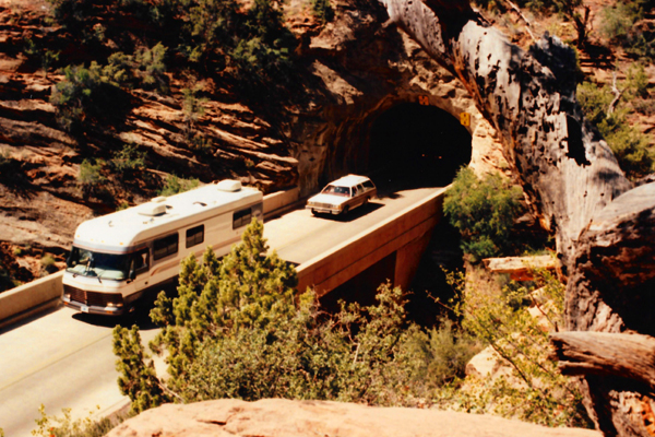
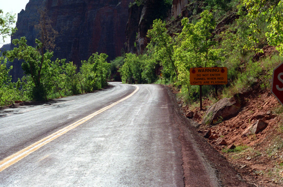 The Entrance to the Highway 15 Tunnel Heading East At this particular time of the morning, the tunnel was being restricted to one way traffic because a number of recreational vehicles were going through in both directions. So we had to stop and wait in line for the vehicles already in the tunnel could come on through. The entrance to the tunnel is at the far end of the roadway in this picture. |
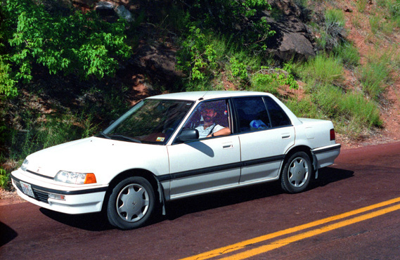 Fred Driving the Honda at the Zion Tunnel Unfortunately, I didn't expose the picture enough so that you could see Fred very clearly, but he was taking his turn behind the wheel this morning. The car was doing very well on the trip. It had been driven almost three thousand miles in the preceding six days or so. |
Once the Westbound traffic had cleared, we were able to drive through the tunnel. Just on the eastern end of the tunnel are two parking areas; we picked the second, on the north side of the highway, and set out on the Canyon Overlook Trail.
Hiking the Canyon Overlook Trail at Zion's East Entrance
|
Parents with children were cautioned, though, to keep an eye on them, since as with all the Zion hikes, there are always points where someone could get carless and fall- a short way or a long one.
So we started off on the first very short hike to a viewpoint, looking forward to what the trail guide said would be a shady alcove (as the day was warming up steadily, as you can tell because I shed my shirt soon after we started out).
|
|
The ground in here was slightly damp all around, and there were many ferns growing at the point where the water was seeping out of the rocks. It was also nice and cool under the rock face.
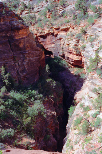
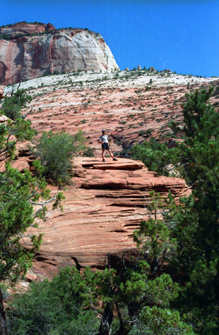
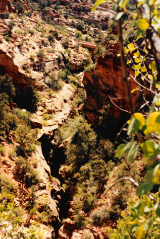
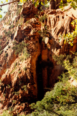
I don't know if some of the side canyons we saw were cut by water, or whether they were just natural crevices formed as two rock masses moved apart. I couldn't see any evidence of water at the bottom, so I assume it was wind or something else. As we walked along to the end of this short trail, we looked off to our right and saw some people on rocks in the distance; I thought they were actually over on the East Rim Trail, but as it turned out, they were actually on the longer Canyon Overlook Trail portion that we will head to shortly. And we were to discover that just beyond them is a sheer drop off into the Zion valley proper. I am again impressed by the stark beauty of this part of the country.
|
|
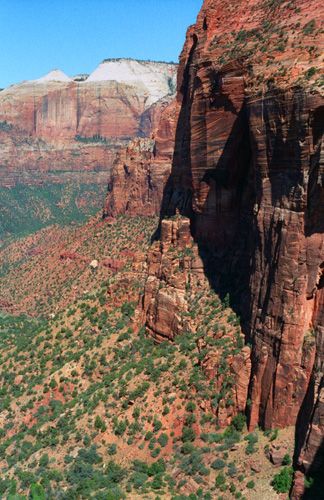
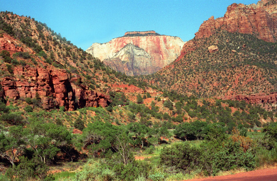
Then we stepped up onto the end of this short trail and, as advertised, there was an amazing view of the Zion Canyon valley opened up and we were open-jawed at the beauty. The best picture I took is the one at left.
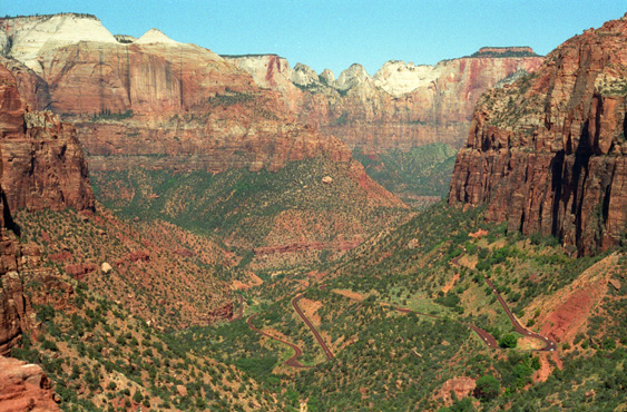
Once at the viewpoint, we found an old metal plaque that pointed out many prominent landmarks, such as the Highway 15 switchbacks down below, Bridge Mountain (the highest peak on the left side of the canyon), the East Temple (the impressive rock formation above the viewpoint to the right), and the Pine Creek stream far below. Also you can look closely at the canyon walls to find several of the tunnel "windows".
The views from here were just amazing, and here are a couple more of them:
 |
 |
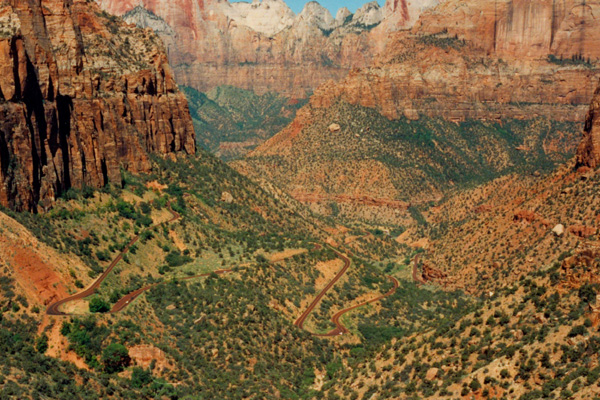
In one of the shots above, I am on a rock ledge just below Fred; both views are incredibly beautiful. Just beyond me the cliffs drop off pretty steeply. You can pick out the Virgin River; the visitor center and campgrounds are in the valley off to the left.
From this overlook, we walked back down the path towards the parking area, and then took the other trail section to get in some more hiking in this starkly beautiful area. We discovered later that this part of the trail was actually a portion of the East Rim Trail which continues all the way north along the east rim of the Zion Canyon. It is one of the many overnight backpacking trails in the Park. Along the way to the overlook at the end of this trail branch we took a number of pictures.
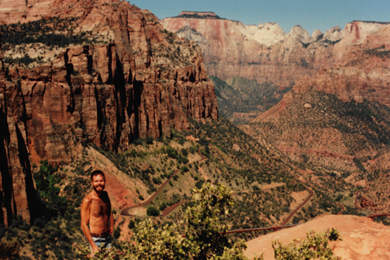
 Me and the South Rim Cliffs |
(Picture at left) This part of the East Rim Trail leads to a promontory point that extends out into the valley, leaving this crevasse that you see between the point and the South rim. One can walk all the way out onto that point that you can see, but here even I drew the line. This shot looks directly South, and you can see the morning sun glinting off the cliff face. The tunnel into Zion National Park is in that cliff face directly in front of you.
(Picture at right) |
 Fred at the East Rim Trail Overlook |
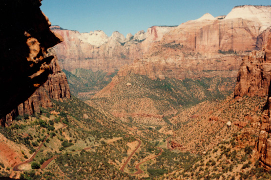
When we got to the next overlook, we found ourselves on a level area with some neat rock formations and, of course, another beautiful overlook out over the Zion Valley:
 The Southern Portion of Zion National Park As it turned out, the views from this overlook were about the same as the easier trek, but the walk out here was still worth it. |
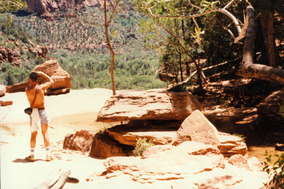 Me Photographing Rock Formations I was actually trying to set up a shot for when Fred would join me and we could use the tripod for a couple of pictures. |
And here are the two pictures that we took after I set up the shots and set up Fred's tripod:
 Fred and I at the East Rim Trail Overlook I didn't quite know what the best exposure would be, so I thought the best thing to do was just to put the camera on automatic and the shot turned out rather well. |
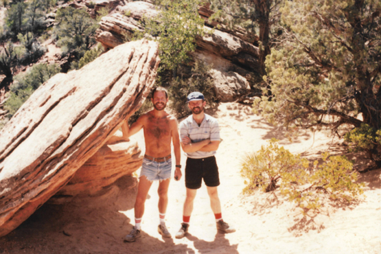
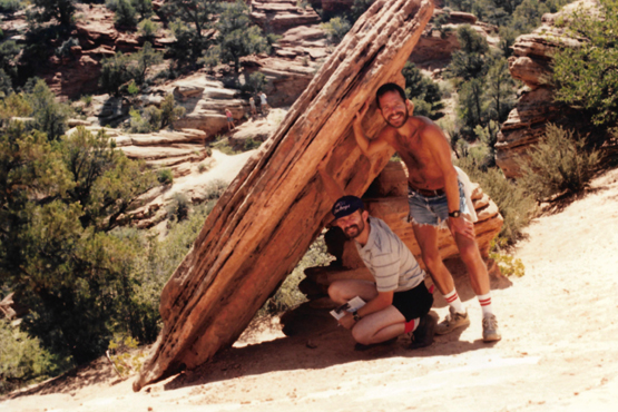 Holding Up Our End Then we tried a timed exposure with Fred's camera, setting up the tripod again to do so. I had tried to be a bit humorous here, to make it look like we were holding up the rock, but we look too calm and collected for that. A good picture of the two of us, though. |
I like these trips with Fred; he has an easygoing nature that appeals to me; he is compulsive about some things (like not allowing anyone to visit him if his house isn't all straightened up), but they don't make him hard to get along with. All the trips we have taken, and all the weekends that we have spent together have been very enjoyable. I enjoy the friends he has, and he certainly likes getting together with mine. From the overlook we did some more walking around as we made our way back to the trailhead.
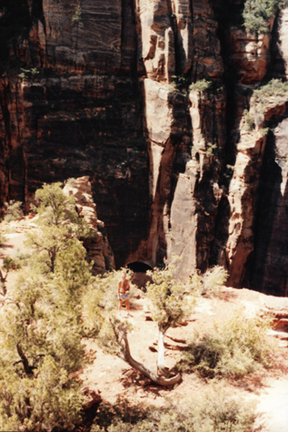
 The East Rim Trail Looking East |
(Picture at left) As we started back to the parking area, Fred took this picture of the course of the small canyon along which the East rim trail goes. The trail itself is following the rocky face to the left, and you can see the overhang we were in earlier which is that shadowed area at the left. In the far center of the picture, you can see the short bridge that leads from the East rim of the canyon across the small ravine into the tunnel which goes through a portion of the South rim to emerge in the canyon proper.
(Picture at right) |
 Along the East Rim Trail |
We took a couple more pictures when we got back near the trailhead:
|
|
Because the traffic heading west had been halted for this eastbound traffic, I was able to get the picture at far left by standing at the head of the line of about ten vehicles waiting to go west through the tunnel.
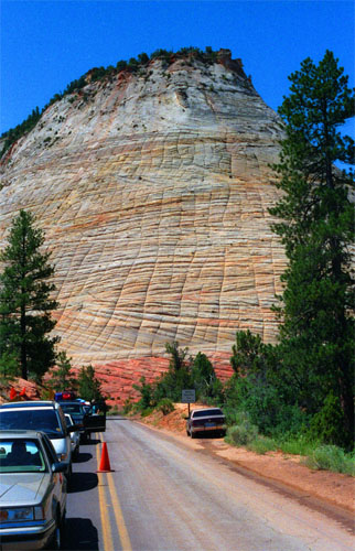
As far as those striations in the rock east of us were concerned, we discovered how they were made. First, small amounts of water in the rock freeze and then thaw, opening up small fractures in the soft rock. Then the action of wind enlarges and smoothes those fractures until the whole surface of the rock looks like a huge pineapple. There were a number of rock faces with this same pattern that we saw on the way to Mt. Carmel Junction and Highway 89.
Lake Powell and Glen Canyon Dam
|
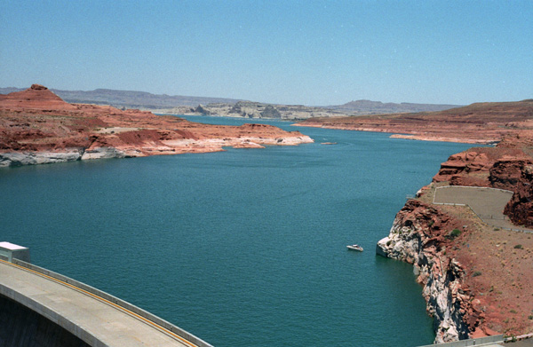
We reached Glen Canyon about two in the afternoon, after our 125-mile trip from Zion. When Lake Powell first came into view, Fred could see that the difference between the lake here and the same lake whose upper reaches we crossed day before yesterday, was like the difference between night and day. That muddy brown water was now, at the end of a 200-mile settling process, sparkling blue as it backed up behind Glen Canyon Dam.
|
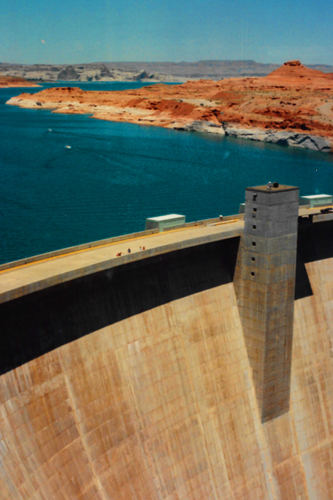
It turns out that the answer is about 7 cubic miles of water! Put it in any terms you might want; that is a heck of a lot of water to be held back by a single structure.
You remember that two days ago we crossed the upper end of this same lake on a small bridge, and at that time the water was a muddy brown. My guess that all that stuff would settle out sometime during the 200-mile length of the lake was correct. Down here at the dam the water is as blue as you might wish.
We stopped outside the visitor center first and had a picnic lunch on the small lawn there (along with a few other people who had the same idea). Then we started walking around the immediate area and also found out about the self-guiding tour of the dam itself.
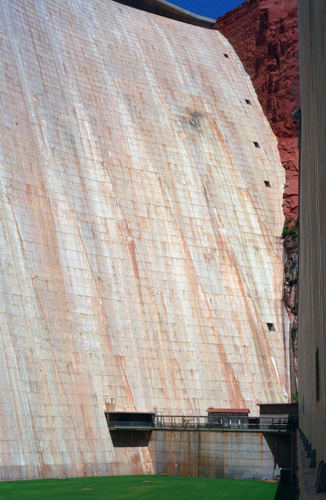
I think that the contrast in this picture, between the arid red rock hills and mountains and the pure blue water is a very interesting one. For the land to grow vegetation, it is not apparently enough that there be water nearby; first the land must get rain and second it must be fertile. I don't think that the former happens often here, and I don't think that the latter is true either. So consequently you get this stark contrast without any vegetation to soften the picture. That is the dam in the lower left.
We did sign up for a tour of the dam, which we took, and we spent a good deal of time taking pictures from the dam, both from the top and from the base (during our tour), and also from vantage points above and adjacent to the dam. Let's take a look at some of these pictures.
|
|
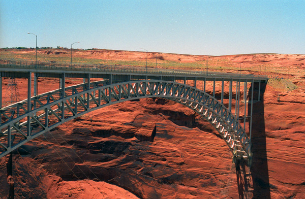
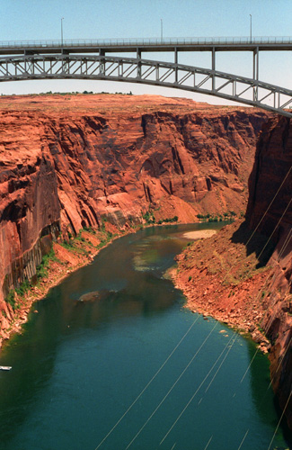
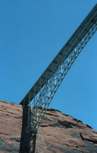
The bridge spans one of the steepest, narrowest gorges that I have ever seen. I think the bridge is amazingly graceful. What holds it up is simply the pressure of the curved span pressing against the rock wall of the gorge on both sides. It seems to me a remarkably little amount of steel and support for a roadway that carries so much heavy traffic.
As I said, we took a tour of the dam, and the next series of pictures was taken while we were on that tour (which is the only way to get down to the bottom of the canyon below the dam).
|
|
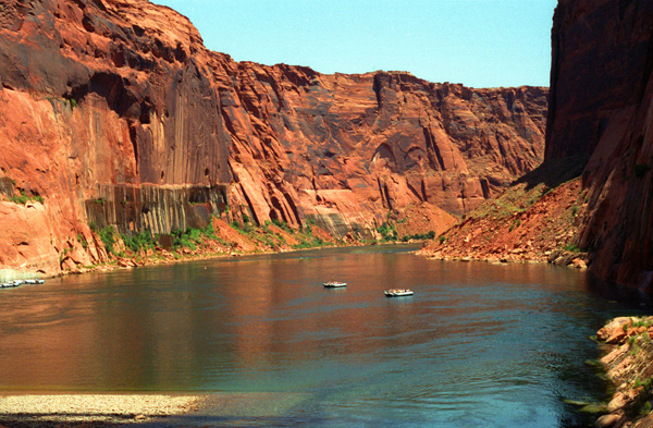
Both in the past and, as it turns out, in the future, Fred and I will see and experience much of the length of this amazing waterway. Some years from now, we'll travel along the river as it parallels Interstate 70 in central Colorado. Last year, we camped beside the river near Arches National Park. Day before yesterday, we crossed it as it entered Lake Powell, and today we've seen it flow south from Glen Canyon Dam. Some years from now, we will visit the Grand Canyon and we will admire the work it has done over the millenia carving that amazing geological feature. And in future years, we will happen to cross the upper part of Lake Mead- the reservoir that was created by Hoover Dam outside Las Vegas. Finally, we will also tour that dam and also take a river rafting trip down the Colorado River below it. It will figure prominently in many of our trips.
The tour of Glen Canyon Dam was interesting, and we got a chance to go inside it (although there was only one picture worth taking, and we got a chance to come out at its base, where the view was more spectacular.
|
Construction of the dam started in 1956 and was not finished until 1966. When the reservoir filled, the dam began to deliver a regulated flow of water downstream and a supply of electricity to the region. By suppressing floods and other factors that once characterized the Colorado, the dam has led to major physical and ecological changes in the lower river. Controversy continues, however, over the dam's effects both positive and negative.
Glen Canyon's overall design was based on that of Hoover Dam near Las Vegas to be a massive concrete arch-gravity structure anchored in solid bedrock. However, the nature of the canyon rock here- porous and relatively weak Navajo sandstone- forced the engineers to build a thicker dam with stronger abutments to transmit more of the holding force to bedrock further down. Two sites were considered; this one was chosen for two reasons. First, the land was easier to acquire and second, the canyon wall rock was stronger.
As a road link was obviously needed for transport across the canyon from one end of the dam site to the other, the Glen Canyon Bridge had to be built first; construction began in 1956 and was completed a year later. The bridge was in itself a marvel of engineering. By 1959, the bridge itself was a major tourist attraction and it was said that "motorists [were] driving miles out of their way just to be thrilled by its dizzying height".[26] Workers flooded into the dam site beginning in the mid-late 1950s, and at first encountered difficulties just finding places to live. As a result, the second major infrastructure element was built- the town of Page, Arizona, named for former Reclamation commissioner John C. Page. By 1959, Page had a host of temporary buildings, electricity, and a small school serving the workers' children. As the city grew, it gathered additional features, including numerous stores and a hospital, even a jeweler.
In 1956, work began on the two diversion tunnels that would carry the Colorado River around the dam site during construction. Each of the tunnels was 2,700 feet long and 41 feet in diameter, and had a combined capacity of 200,000 cubic feet per second. Numerous rock fractures were discovered during construction, necessitation reinforcement. The material excavated out of the tunnels was used to build the two cofferdams that would keep the damsite dry during construction of the dam itself. The tunnels were finished in 1959 and the cofferdams early in 1960.
|
At the beginning of 1963, the dam was high enough to begin impounding water; huge steel gates were closed over the diversion tunnels on January 2, and Lake Powell began to rise. Construction continued and on September 13, 1963, the dam was topped out. Work on the power plant and spillways began directly after the dam wall was complete. The spillway tunnels were excavated and eventually the upper ends of the diversion tunnels were then sealed with solid concrete. The first electricity was generated on September 4, 1964.
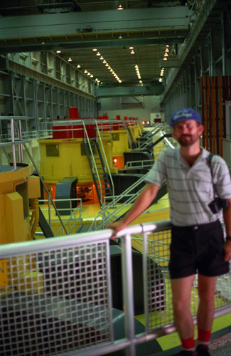
At right you can see Fred inside the turbine room at Glen Canyon Dam. The principle of this dam is the same as for most hydroelectric dams- the rushing water going through the tunnels at the base of the dam (forced through by the pressure of all the water behind the dam) spins the turbine blades which are housed in the red and yellow structures, through a magnetic field, thus creating electricity. It has been a long time since I studied this stuff, and I don't pretend to remember all the details.
From the turbine room, the tour went out a set of doors to put us on the downriver side of the dam at its base- just above the level of the water coming out of the spillways.
|
|
While Fred was occupied back in the Visitor Center, I called ahead to a La Quinta motel in Albuquerque and made reservations for that night. I remembered that the last time we came through Albuquerque late we couldn't find a place to stay, and I didn't want the same thing to happen again. Then we left Glen Canyon and continued down Highway 89 through the Painted Desert to Flagstaff.
At right is an interesting view of the road ahead on Highway 89, descending out of the high mountains towards the desert. I just thought that this would be an interesting picture as we descended towards the desert floor. We continued South on Highway 89, passing the turn off where we had previously gone to the Grand Canyon, and continued on to Flagstaff.
Petrified Forest National Park
|
So at Holbrook, Arizona, we took Route 160 South to the entrance to the Park. You can enter the park on the South, travel North through it, and connect up again with Interstate 40, all without retracing your route.
Just before we entered the Park, we stopped at one of the stores selling rocks, minerals and petrified wood and bought some things. You can't take petrified wood out of the park, but the wood sold here was collected on private land outside the park itself (or so they say).
Averaging about 5,400 feet in elevation, the park has a dry windy climate with temperatures that vary from summer highs of about 100 �F to winter lows well below freezing. More than 400 species of plants, dominated by grasses such as bunchgrass, blue grama, and sacaton, are found in the park. Fauna include larger animals such as pronghorns, coyotes, and bobcats, many smaller animals, such as deer mice, snakes, lizards, seven kinds of amphibians, and more than 200 species of birds, some of which are permanent residents and many of which are migratory. About half of the park is designated wilderness.
|
|
The Petrified Forest is known for its fossils, especially fallen trees that lived in the Late Triassic Period, about 225 million years ago. The sediments containing the fossil logs are part of the widespread and colorful Chinle Formation, from which the Painted Desert gets its name. Beginning about 60 million years ago, the Colorado Plateau, of which the park is part, was pushed upward by tectonic forces and exposed to increased erosion. All of the park's rock layers above the Chinle, except geologically recent ones found in parts of the park, have been removed by wind and water.
In addition to petrified logs, fossils found in the park have included Late Triassic ferns, cycads, ginkgoes, and many other plants as well as fauna including giant reptiles called phytosaurs, large amphibians, and early dinosaurs. Paleontologists have been unearthing and studying the park's fossils since the early 20th century.
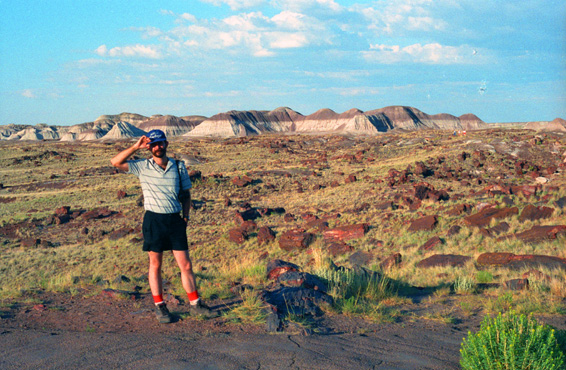
After we came through the entrance station and paid our fee, we stopped first in an area near the Rainbow Forest Museum where many of the larger petrified logs can be found.
|
I assume that there is more of the petrified wood below my feet. You are allowed to wander anywhere you want, but you are not allowed to take any of the petrified wood with you, and in fact are asked not to disturb it at all.
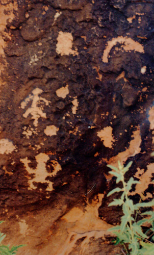
The park's earliest human inhabitants arrived at least 8,000 years ago. By about 2,000 years ago, they were growing corn in the area and shortly thereafter building pit houses in what would later become the park. Subsequent inhabitants built above-ground dwellings called pueblos. Although a changing climate caused the last of the park's pueblos to be abandoned by about 1400, more than 600 archeological sites, including petroglyphs, have been discovered in the park.
In the 16th century, Spanish explorers visited the area, and by the mid-19th century a U.S. team had surveyed an east�west route through the area where the park is now located and noted the petrified wood. Later, roads and a railway followed similar routes and gave rise to tourism and, before the park was protected, to large-scale removal of fossils. Theft of petrified wood remains a problem in the 21st century.
Petrified Forest National Park is known for its fossils, especially, of course, the fallen trees that lived in the Late Triassic period of the Mesozoic era, about 225 million years ago. During this period, the region that is now the park was near the equator on the southwestern edge of the supercontinent Pangaea, and its climate was humid and sub-tropical. What later became northeastern Arizona was a low plain flanked by mountains to the south and southeast and a sea to the west.
Streams flowing across the plain from the highlands deposited inorganic sediment and organic matter, including trees as well as other plants and animals that had entered or fallen into the water. Although most organic matter decays rapidly or is eaten by other organisms, some is buried so quickly that it remains intact and may become fossilized. Within the park, the sediments containing the fossil logs for which the park is named are part of the Chinle Formation.
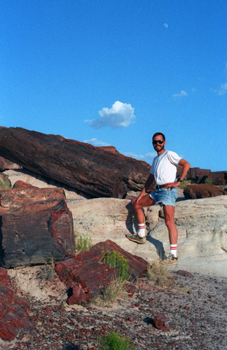
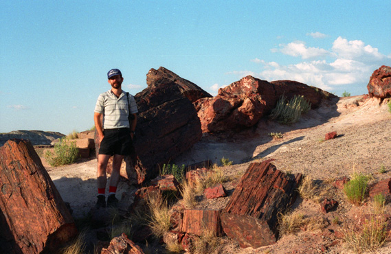 Fred and Some of the Petrified Wood Logs It was a beautiful afternoon, just right for wandering out over these low rolling hills. Much of the petrified wood is within a couple of hundred feet of the parking areas, and you can see much of it as you drive along. |
 Fred and the Chinle Formation Hills in the Background This gives you a good indication of what the area looks like with the pieces of petrified wood scattered around. But I thought that the layered hills in the background were also interesting. |
The colorful Chinle, which appears on the surface in many parts of the southwestern United States and from which the Painted Desert gets its name, is up to 800 feet thick in the park. It consists of a variety of sedimentary rocks including beds of soft, fine-grained mudstone, siltstone, and claystone�much of which is bentonite�as well as harder sandstone and conglomerate, and limestone. Exposed to wind and water, the Chinle usually erodes differentially into badlands made up of cliffs, gullies, mesas, buttes, and rounded hills. Its bentonite clay, which swells when wet and shrinks while drying, causes surface movement and cracking that discourages plant growth, and so the area weathers even faster.
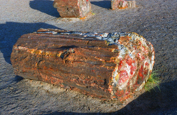 A Petrified Log You know, it almost looks as if this petrified wood has been faked, the outside of it looks so realistic, and it is lying in a setting almost devoid of other vegetation. The inside is mostly white quartz, with red and brown rock making up the remainder. |
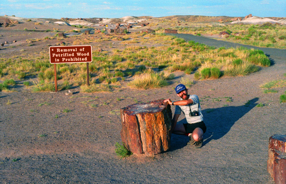 "Gee, I Wonder If I Could Carry This..." Of course we knew that you just couldn't up and take a piece of petrified wood from the park, but it certainly would have been amazing to have such a piece of history. No danger of theft here; the piece was way too heavy for even both of us to carry; you would have needed a block and tackle just to move it. |
We got back in the car and headed north through the park. Eagle-eye Fred spotted some park residents before I did. Some of the larger animals roaming the grasslands include pronghorns, black-tailed jackrabbits, Gunnison's prairie dogs, coyotes, bobcats and foxes. Pronghorns, the fastest land animals in North America, are capable of 60-mile-per-hour sprints. The blood vessels in the huge, thin-walled ears of the jackrabbits act as heat exchangers. These hares are known for their bursts of speed, long leaps, and zigzag routes, all of which protect them from being eaten by golden eagles and other predators. The prairie dogs live in large colonies or "towns", near which many other species find food and shelter. Coyotes dine largely on rodents but also eat fruits, reptiles, insects, small mammals, birds, and carrion.
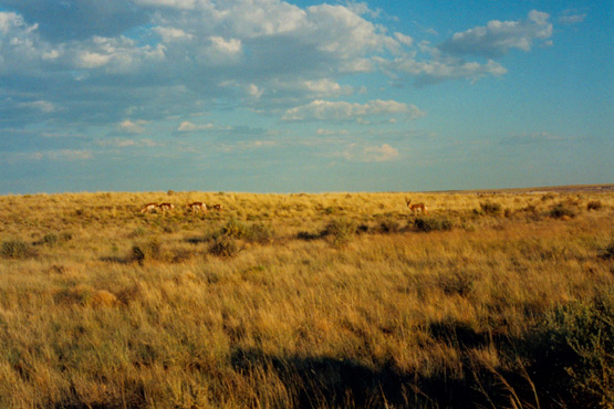
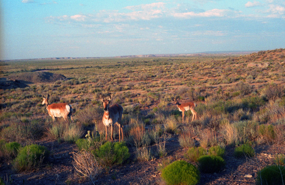 Some Deer in Petrified Forest NP These deer were fairly close to the road, so we pulled over to take a couple of pictures. |
 More Deer Away from the Road The area around Petrified Forest National Park is quite flat, at least compared to the mountains we left this morning. |
We continued to drive north until we approached Puerco Pueblo. During the Pueblo I Era (circa 900-1200), most occupied sites were single-family homes, but as soils became exhausted many sites were abandoned by 1250 in favor of very large multi-room pueblos close to more dependable sources of water. The Pueblo Builders constructed two of these large pueblos, one called Stone Axe, about 0.5 miles (0.8 km) east of the park, and the other at Puerco Pueblo, which overlooks the Puerco River near the middle of the park.
There they built about 100 one-story rooms around an open plaza. The rooms had no windows or doors but each could be entered by climbing a ladder and descending through a hole in the roof. At its peak, perhaps 200 people lived in this pueblo. Over time, however, a persistently dry climate led to out-migration, and the last residents abandoned Puerco Pueblo in about 1380 CE.
|
|
When you click on the image at right, the slideshow will open in a new window. In the lower corners of each picture you will find little arrows that allow you to move from one picture to the next. You can see which picture you are on by referring to the sequence numbers in the upper left.put small thumbnails for them below. If you want to see any full-size picture, just click on its thumbnail, closing the popup window when you are done looking at the picture. Enjoy!
By the time we crossed I-40 and entered the Painted Desert, it was quite late, and our light had faded considerably. We did stop at Chinde Point to look out across the desert, which was still quite pretty in the faded light.
|
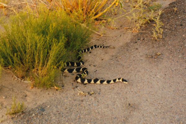
More than 16 kinds of lizards and snakes live in various habitats in the park and consume large quantities of insects, spiders, scorpions, other reptiles, and small mammals. The collared lizard, which occurs in every habitat, is the largest and most often seen.
Plateau striped whiptails, a species consisting entirely of females, prefer grasslands and developed areas. Side-blotched lizards live in rocky areas of the park but are seldom seen. Gopher snakes, which sometimes imitate rattlesnakes when disturbed, are among the most common snakes in the park. The Western rattlesnake, the only venomous snake found in the park, prefers grasslands and shrub areas.
It would have been nice to stay here longer, and perhaps do a hike or two, but we have a long way to go to get back to Dallas tomorrow, so we had to head off.
|
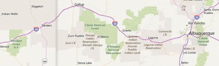
We took our last picture of the day as we were descending into Gallup, New Mexico. We stopped there for dinner. We found a Mexican restaurant; although the food was very, very good, the place was a good deal more upscale than we are used to. No problem, though, the dinner was wonderful at the end of a long day.
We drove on to Albuquerque, reaching the motel about twelve-thirty. We spent the night at the La Quinta, ate breakfast at Denny's, and set out for home.
|
At Henrietta, we angled off straight East on US 82 which took us right to Sherman, and then South to Van Alstyne. We stopped in Sherman to pick up some things for dinner- not wanting to eat out yet again.
The cats were fine when we returned, although happy to see us, and the first order of business was to take care of them. We cooked dinner after that and just relaxed and unpacked.
I spent the night and then headed home with the cats when Fred went to work the next morning. Like all of the trips we have been on, this one was very enjoyable. And also like most of the trips we have been on, this one involved a lot of driving. But if you want to see the West, and you live in Dallas-Fort Worth, that is pretty much what you have to do.
You can use the links below to continue to another page for our Western trip or to return to the trip index so you can continue though the photo album.
|
June 25, 1993: A Day in Zion National Park |
|
Return to the Western Trip Index |