|
July 4, 1994: A Day in Las Vegas |
|
July 2, 1994: Bryce Canyon National Park |
|
Return to the Index for Our Western Trip |
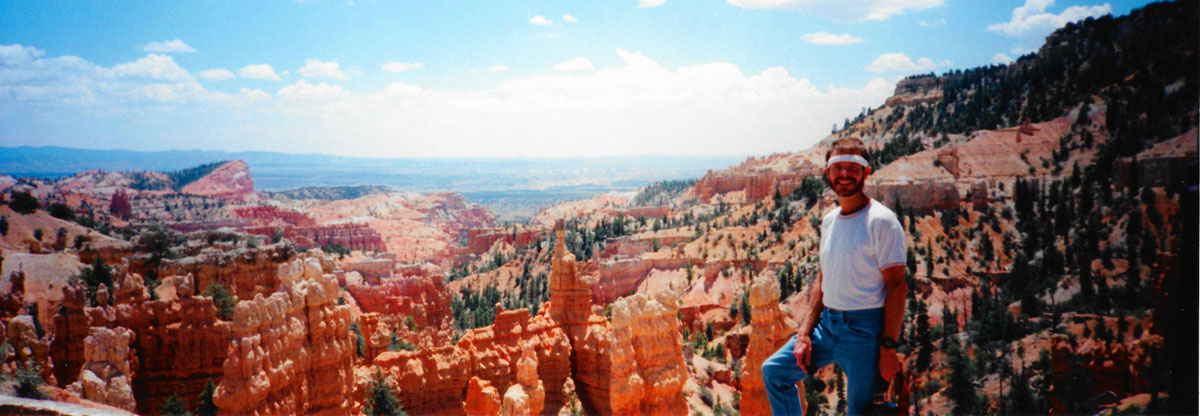
We got up early the this morning, July 3, struck the tent and went over to the lodge to get cleaned up and have breakfast. We ate in the dining room again- a treat from just donuts or something out of the cooler. While we ate, we mapped out the day's hiking. We planned to do the Navajo Loop and the Queen's Garden trails, one moderate and one easy hike totalling about four miles (compared to yesterday's strenuous hike of eight miles plus).
Hiking in Bryce Canyon NP: The Navajo Loop Trail
|
We got all our camera stuff together- including Fred's panoramic camera, made sure we had some water, and set off to the trailhead for the descent on the Navajo Loop trail.
|
|
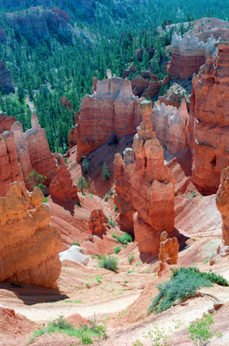
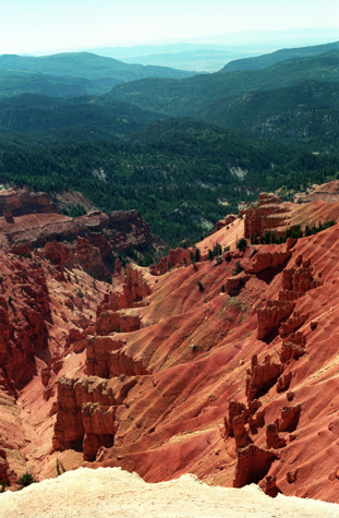
Going down was not very strenuous, since you have gravity to do most of the work for you, but we'll have to balance the account when we come back up the other side of the loop. The colors of the rock were simply amazing (though I hadn't seen anything yet). It may look as if I have "pumped up" the color, but the photograph is unretouched.
Even up at Sunset Point, where the trail started, the colors were spectacular. You saw some of the pictures that we took from that overlook on yesterday's page. But this morning, the hoodoos and rocks were a deep orange or red- colors that look almost too magical to be real. Here are two amazing pictures we took on the switchbacks heading down; click on the little thumbnails to see the full-size picture:
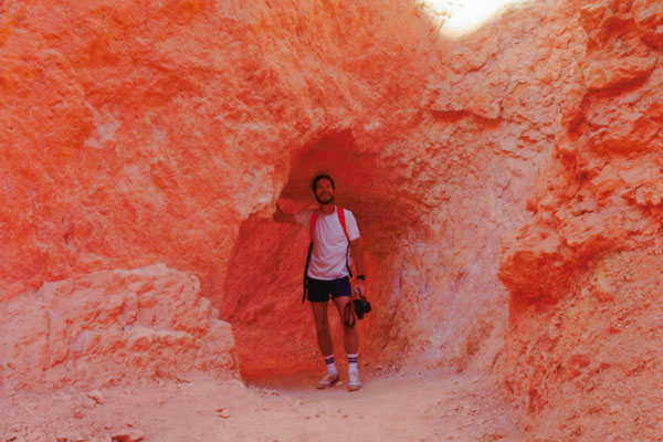
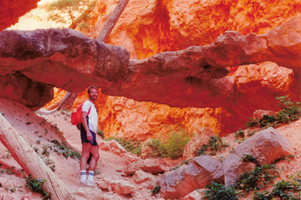
This picture shows Fred and some of the continuing switchbacks along the middle portion of the Navajo loop trail at Bryce Canyon. After we came through the tunnel from the uphill side of the fin formation, the colors changed dramatically, perhaps because the morning sun is not shining directly on the rocks, but is being reflected down. Here you can see Fred, two switchbacks below me, and you can see the continuing trail that leads all the way into the dark area below. I didn't know what to expect when we got down there, but it certainly looked interesting from up here. |
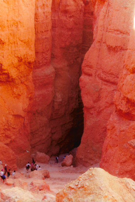
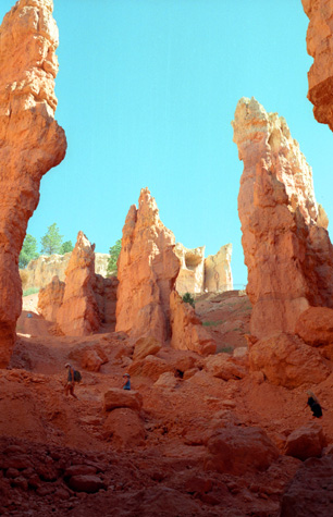
Here you can see some of the hikers on the lowest set of switchbacks and the entrance to Wall Street. The length of each switchback trail segment got less and less as we moved downward, as if we were being funneled into a small opening, which, of course, we were. Here, the dark shadows and the reflected light combine to set off the iron deposits in the sediments to make rock that was, in places, very red- kind of like lava. I don't think I have seen such colors before. They make the spectacular colors of the Grand Canyon look muted by contrast. At first, I thought Wall Street would refer to a formation of hoodoos that would look like the buildings of Wall Street, but now I can see that the reference is to the narrow street between two sheer walls of rock. From this angle, since you can't see the sky, it looks as if you are about to descend into the very bowels of the earth. |
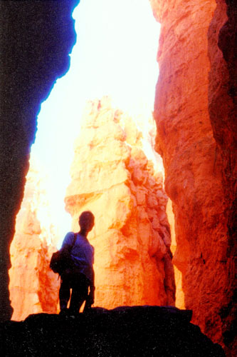
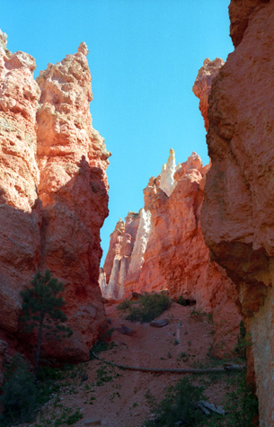
After taking the last couple of pictures, I caught up with Fred on the switchbacks and we continued down, going back and forth, until we came to a point where the vertical walls on either side of us were only about forty feet apart. I stopped just before entering the crevasse proper so I could take a picture looking further down the trail.
|
|
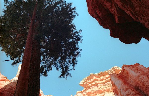
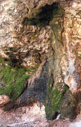
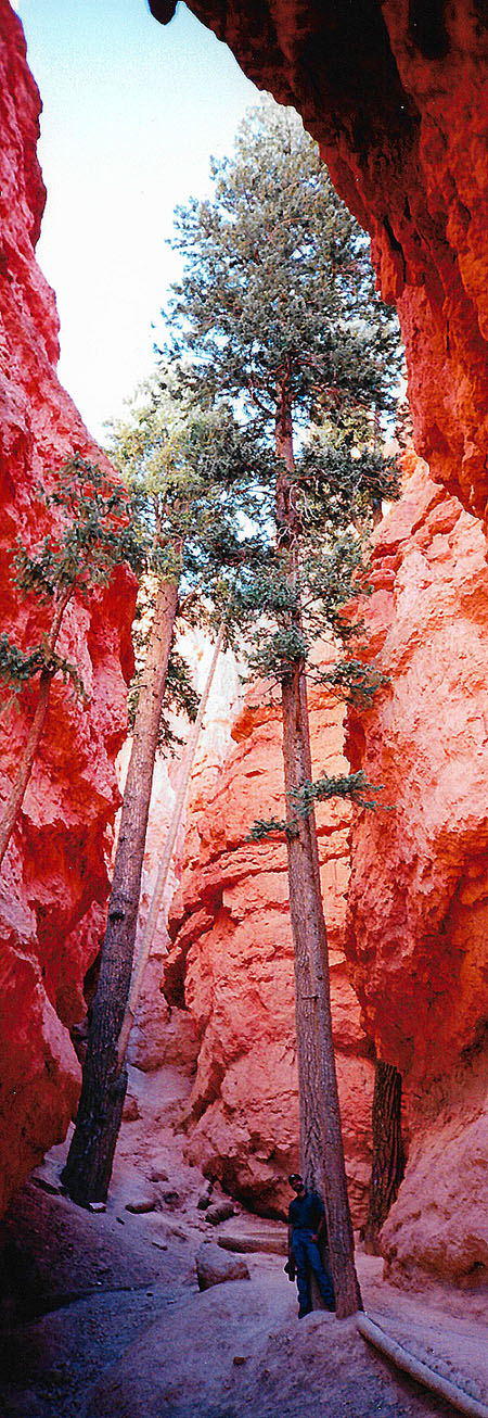
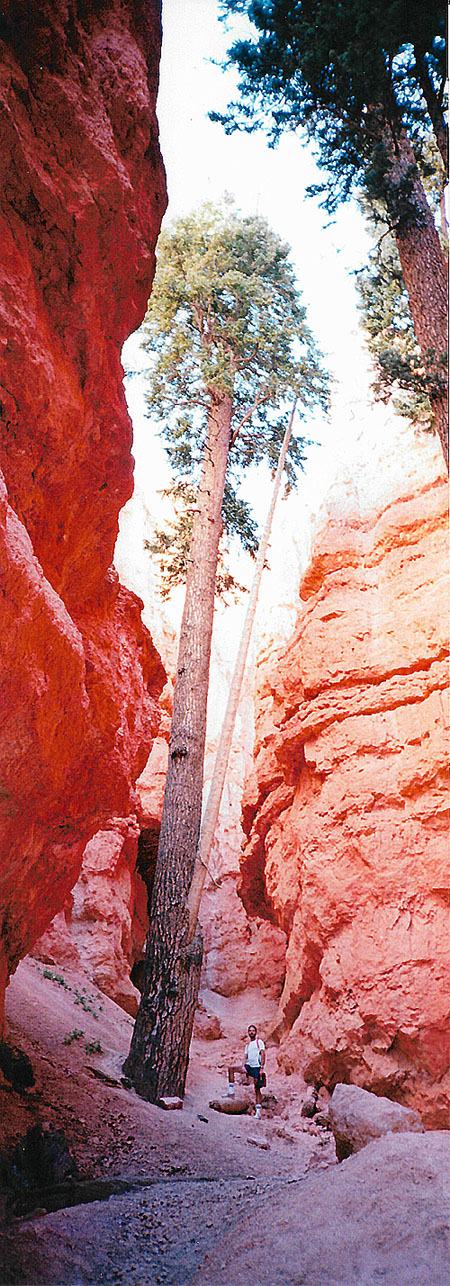
First, it was absolutely straight. It looked for all the world like an overgrown telephone pole that had been placed here. It was both regular and straight up. I guess that was because the only appreciable sunlight came from directly above it, and heliotropism might be enough to cause it to grow straight up to the light.
The other odd thing was that the tree had absolutely no branches and no leaves on 90% of its lower height. The only foliage was right at the very top, like a stalk of broccoli. I tried to get the whole tree in a picture, but couldn't get far enough away to do so, so I settled for this shot, which I took looking straight up at the tree and the sky. My guess would be that the tree is 200-300 feet high.
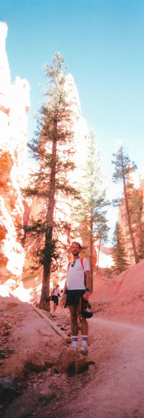
Years from now, taking panoramic pictures with a digital camera will be routine, but now, the only way to do it is to have a dedicated panoramic camera. Fortunately, they aren't expensive and Fred had his with him. So each of us took a panoramic picture of these trees. Since they are so tall, I have put them in the scrollable windows below; scroll down to the bottom of each picture to see one of us:
 |
 |
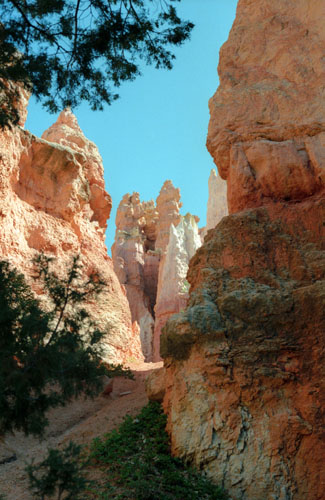
After going through Wall Street, the trail evens out somewhat and wound through the tall red rock formations. We found more of the trees that we'd seen coming through Wall Street, and they provided an interesting perspective.
|
Unlike our hike yesterday along the Fairyland Loop, this hike has so far been through narrow, shaded canyons at the base of huge rock pillars or fins, and so it is a much different experience. And then we came to a really, really neat formation:
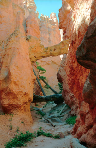 A Natural Bridge on the Navajo Loop |
(Picture at left) At the bottom of the trail, there is a short side trail that leads to this rock bridge across a small side canyon. Here you can see that there are some trees that have apparently lost their support, and have toppled over against one of the canyon walls. Some other tree trunks lie on the bottom of the small canyon.
(Picture at right)
|
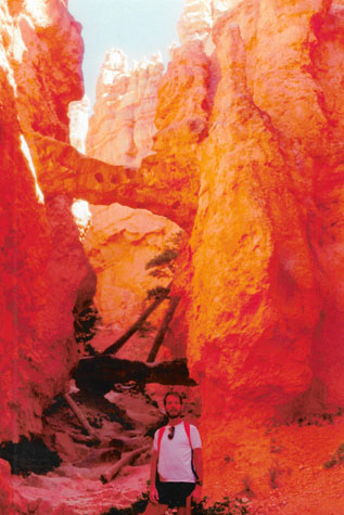 A Natural Bridge on the Navajo Loop |
As I said earlier, we have walked up a side canyon off the main Navajo Loop trail to see this natural bridge, and we took a couple more photos up here by the bridge among the red, red rocks.
|
|
Secondly, you can see that the rock is actually in the shape of a "Y", as it forks in the middle and there are two separate supports pressing against the canyon wall to the right of the picture. Looking underneath the bridge, I could see some deep cracks in it, and I imagined that it would choose that particular time to give way and injure me severely, but it didn't.
I am again impressed when I look at this and other pictures, how the rocks seem to glow like coals in a fire, heated from the inside and glowing with that heat. It's almost as if Hollywood wanted to simulate a lava flow.
|
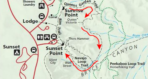
I went back down through the canyon to rejoin Fred, and together we walked down to the southernmost point on the Navajo Loop trail (you can refer to the trail map near the top of this page to see about where we are. Here, where the Navajo Loop and Queen's Garden trails intersect, we had a decision to make.
These two trails are kind of like a figure eight, with both of them using the same ascent trail to get back to the canyon rim. We could have continued ahead onto the Queen's Garden trail and returned to the Rim that way, but we wanted to both go to the west of Thor's Hammer to get pictures of it looking out across the valley, and we wanted to go back up the Navajo Loop through Wall Street for a different perspective.
The best solution was to continue on the Navajo Loop trail back up to the Rim, passing west of Thor's Hammer. Then we could go to Sunrise Point to the trailhead for the Queen's Garden trail and descend back into the Amphitheatre, eventually reaching this point again. Then, we continue back the way we have just come, returning to the Rim once more via Wall Street.
This plan would repeat only one section of trail- exactly the section we wanted to repeat, so we followed our plan and began to ascend the Navajo Loop trail back to the Rim. As we rose, there were good views of the Amphitheatre, but we already had quite a few of them. It wasn't until we reached Thor's Hammer and the final switchbacks to the Rim that we took some more pictures.
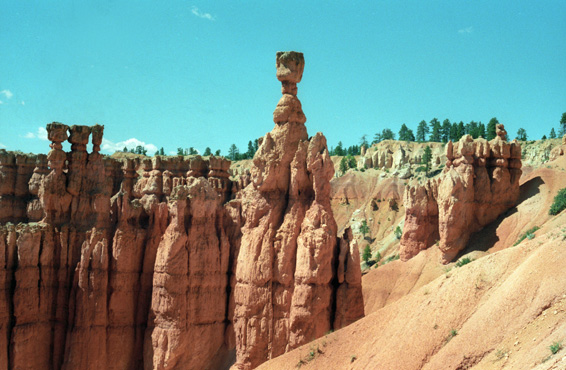
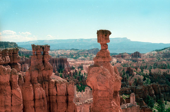 Thor's Hammer and the Sentinel As the trail goes up, the views of the formations change, and I decided to record this with a series of pictures as we ascended. Of course, it was also true that every time I took what I thought was a great picture, there was another one even greater waiting around the bend. From my memory, the colors in this shot are about as close to the actuals as I can imagine. |
 Thor's Hammer and the Paria Valley With the dramatic hammer formation right in the center, and the contrast of the red rocks of Bryce Canyon and the verdant green of the Paria River valley and Paunsaugunt plateau in the background, you see all the best of the scenery at Bryce Canyon (I am a bit jealous that Fred took it). I think that Bryce Canyon is quite possibly the most beautiful place I have ever been. |
From almost the top of the Navajo Loop trail's return switchbacks, two more vistas beckoned:
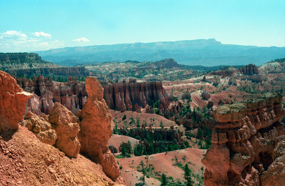 The Queen's Garden Trail from the Navajo Loop Trail From almost the top of the Navajo Loop trail, this is the trail that we would hike next. In the distance, across the Paria River valley, you can see the Paunsaugunt plateau and the Pink Cliffs. Of course, with the sunlight coming from the east, the cliffs are not lit up like they will be later in the day. Look carefully along the canyon floor, and you can see the unmistakable markings of a trail. |
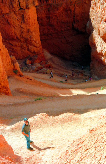
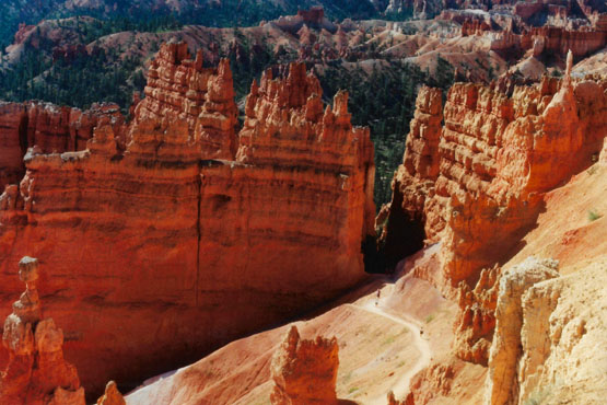 The Descent Portion of the Navajo Loop Trail I think it is dramatic how the trail disappears into the darkness of the lower portion of the Navajo loop. We went down on a trail that is out of the picture to the right, two or three fins away from the trail you can see here. This also gives you an idea of how steep the trail is, that we have come up so much from such a short distance away. The formations remind me of Parliament or Westminster Abbey. |
A short distance further on brought us back to the canyon rim.
Hiking in Bryce Canyon NP: The Queen's Garden Trail
|
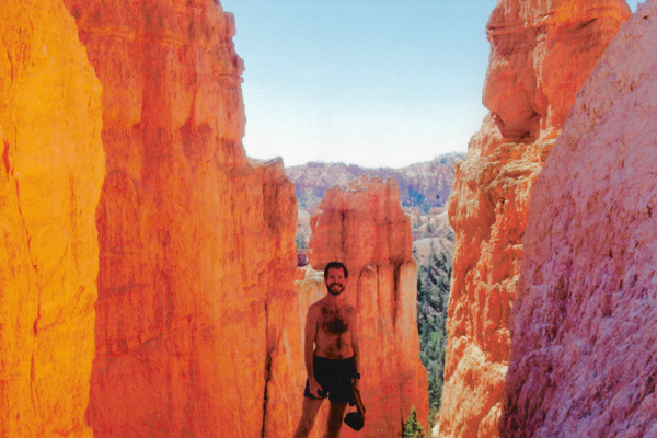
Before we began our descent on the Queen's Garden trail, Fred got out his panoramic camera and took this panoramic shot of me looking out across the Amphitheatre; you can see Thor's Hammer behind me:
 |
There were some switchbacks as we descended 320 feet into the Amphitheatre on the Queen's Garden trail, but they were not so steep as on the Navajo Loop. The trail was fun to walk, with excellent scenery, and we soon came to one of the unusual features on the trail-a tunnel.
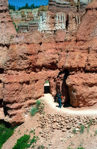 |
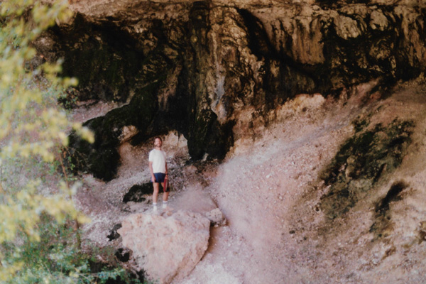
(Picture at left) Fred, about to enter one of the many short tunnels on the Queen's Garden trail at Bryce Canyon. This last trail that we hiked was the easiest of them all, and indeed we passed many more people on this one than on many of the others. Supposedly, there are formations that look like Queen Victoria, but I didn't see any.
(Picture at right)
|
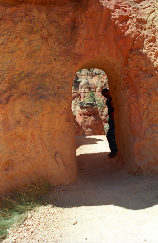 |
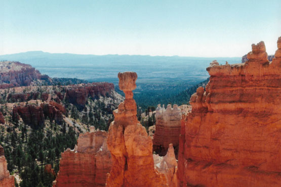
There were actually two or three tunnels on this enjoyable, easy hike, and when we came through the last of them we were treated to an iconic view of Thor's Hammer:
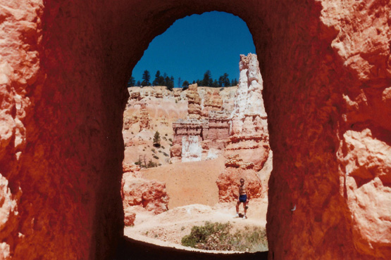 Me on the Queen's Garden Trail Behind me are some of the hoodoo formations along this particular trail. As you can see, this portion of the trail is not very far below the canyon rim, making it more accessible for everyone. If you decide to take the connecting trail back to the Navajo loop, as we were going to do, then you go down a considerably greater distance, making the ascent at that end more difficult. |
 Thor's Hammer and The Sentinel Here is an excellent view of Thor's Hammer, this time looking from the Amphitheatre towards the Rim. Thor's Hammer is one of the most recognized formations at Bryce Canyon. You can see again in the morning light how the rocks look more reddish than they do late in the day, which is the opposite of what you might expect. |
As I said earlier, when we got back to the intersection with the Navajo Loop trail, we found a few people (not all from the United States) trying to decide which way to go. They had arrived at that point from various routes, and were trying to decide how to continue. Since we had by this time gone along all three routes, we were much in demand as tour guides trying to tell people what was in store along each particular path. We had to tell people over and over again that what we found interesting they might not, so we just restricted our explanations to the facts about how steep the trails were, what we thought of the scenery, and so on. For ourselves, we had already decided to get back to the rim by going again through Wall Street- looking for a different perspective on that canyon.
 A Side Canyon off Wall Street |
(Picture at left) After playing tour guide, we decided ourselves to go back to the top through Wall Street. On the way to the base of that trail, where the tall tree was, we passed this side canyon. I had taken a picture of another canyon much like it earlier in the morning.
(Picture at right)
|
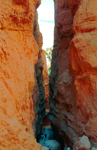
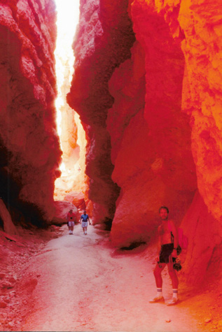 Wall Street |
And now for the last two pictures we took in Bryce Canyon proper:
|
|
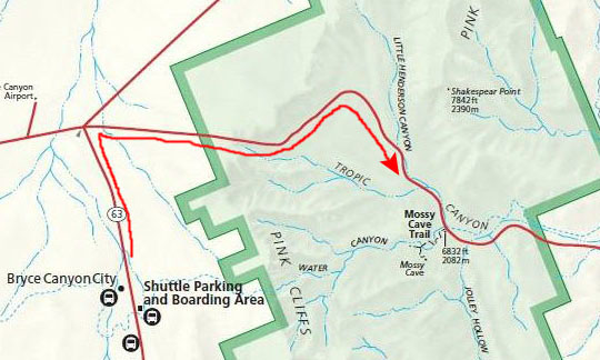
We returned to the car, and decided that our next stop would be Mossy Cave and Water Canyon, these attractions being northeast of the Amphitheatre along the road to Tropic, Utah. They don't get nearly the visitation that the Amphitheatre area gets. Before heading out there, we returned to the same picnic area that we had been at the day before, and had our last meal in Bryce Canyon. Bryce Canyon is another of those places that you really can't do justice to in a single trip; there were many trails we would like to have taken, but there wasn't time. I suspect that we will return there at some time in the future, and hike some of those trails. (NOTE: As of 2015, we haven't done that yet, there have been so many other new places to visit!)
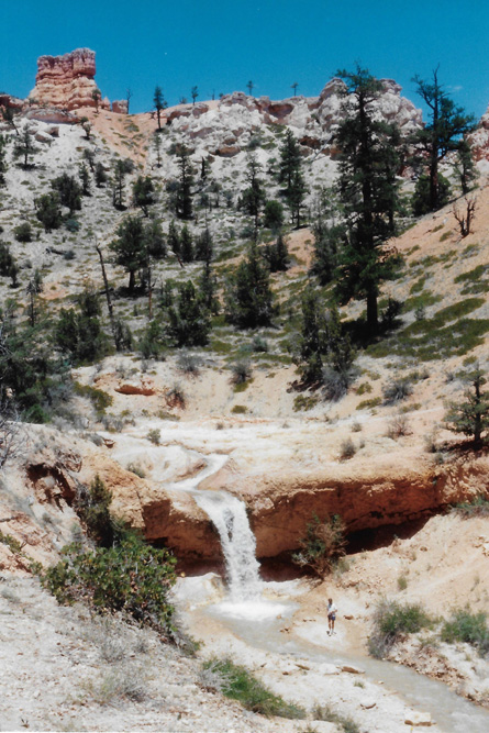
Mossy Cave in Water Canyon
 |
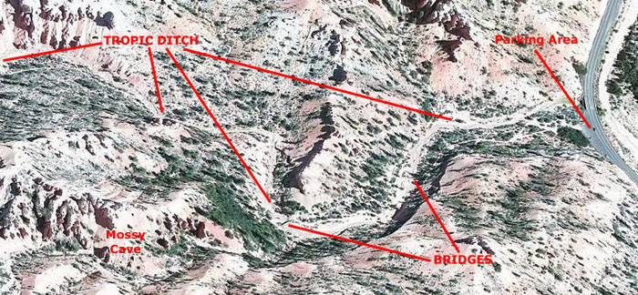 |
Above I have put a small map to show you where Mossy Cave is in relation to Bryce Canyon, and to the right of it I have put an aerial view of the portion of the Tropic Ditch that lies west of Highway 12. (It actually extends to the east boundary of the amphitheatre area, but that is a good ways out of the aerial view to the left.)
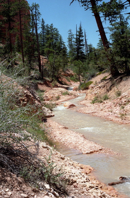
From the parking area, we hiked along the path that led along Tropic Ditch and then up the hillside from the watercourse to the cave. The little creek doesn't really have a name other than Tropic Ditch, because it is an artificial stream, created when irrigation water was brought to the Paria Valley from the East Fork of the Sevier River, some fifteen miles away to the northwest.
|
|
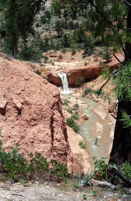
The cave was a bit of a disappointment; we had no idea what to expect and naturally thought we might even find a cave that we could go into. But the walk along the water was certainly pleasant enough, and shortly after we left the cave which was up on the hillside, we walked further west along the watercourse and then eventually back to the car. Along the way, we took some interesting pictures, and I have put many of them here in the album. To look at any of them, just click on the little thumbnail:
|
|
|
|
|
|
|
|
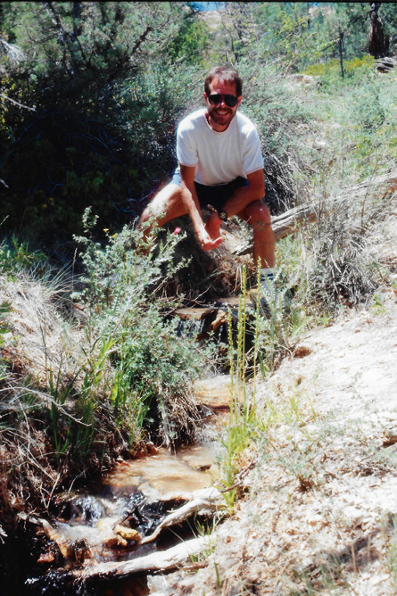
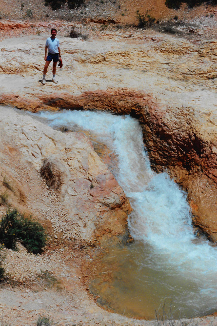
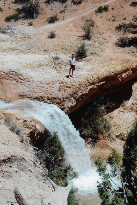
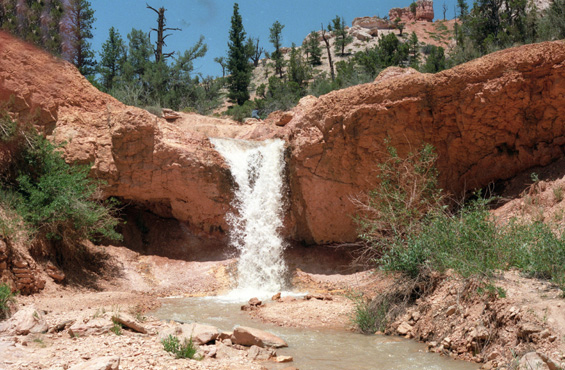 The Falls in Water Canyon This shot had originally been spoiled by my finger in front of my lens; it angled across the picture at the upper left. I didn't have the ability to fix it then, but I do now. |
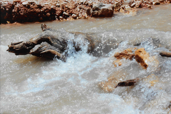 The Watercourse in Water Canyon Meanwhile, Fred went to the other side of the bridge and got this close-up shot of the water flowing in the river. We both wondered how that tree trunk got into the river. (Either it grew here and fell, which was unlikely, or it was washed down from upstream, which would have meant a lot more water than we are seeing today.) |
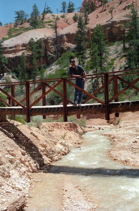
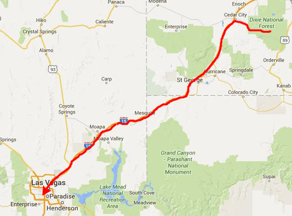
We hiked back to the car, had a drink, and then set off back along Utah 12 to US 89, where we headed south, heading for Interstate 15- the route to Las Vegas.
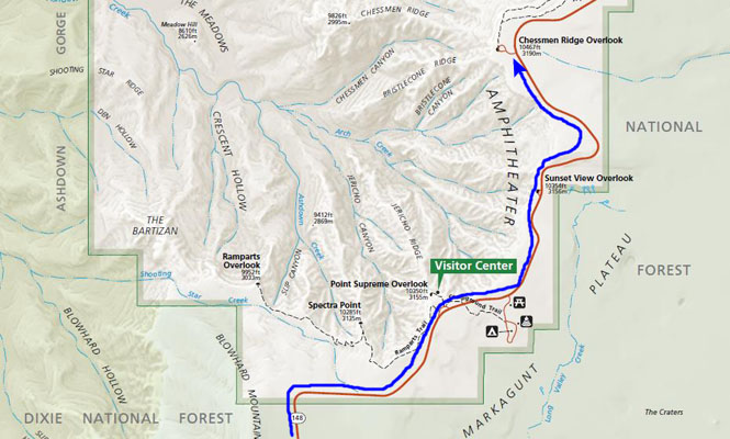
Cedar Breaks National Monument
|
The drive along Utah 14 was extremely scenic, and when we reached Utah Highway 148, the turn off for Cedar Breaks National Monument, we decided to go on up and see what it was like.
The road up to the park climbed continuously, and when we got to the visitor center to pay the admission, we found that we were over 10,000 feet high, easily as high as the two of us have been on any trip.
|
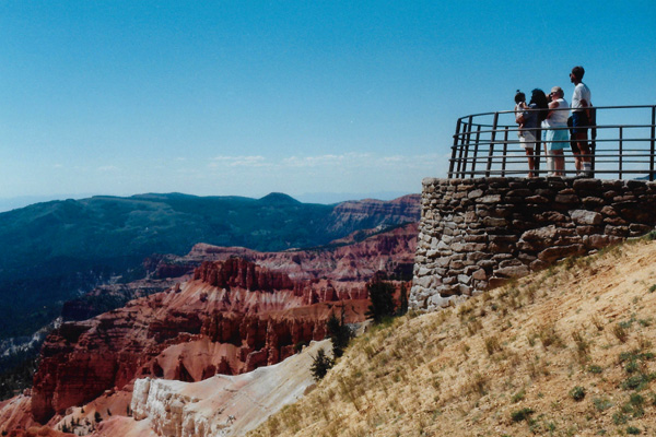
From the Visitor Center, we took a short walk out to the Point Supreme Overlook, and the picture at left is the view from that overlook. Cedar Breaks has formations much like Bryce Canyon, but the ones at Bryce are more numerous and more spectacular. What sets Cedar Breaks apart is the altitude and the views from the park. Early Indians called the area "The Circle of Painted Cliffs." Many years later, early southern Utah settlers renamed the amphitheater "Cedar Breaks": "cedar" for the cedar, or juniper, trees that grew nearby, and "breaks," which is another word for "badlands." In 1933, Cedar Breaks National Monument was established, calling nationwide attention to the spectacular amphitheater.
There is nothing subtle about the great natural rock amphitheater of Cedar Breaks. It is a spectacle of gigantic dimensions full of extraordinary forms wrapped in bold and brilliant colors. Once you see it, you may agree with the observer who said, "If Cedar Breaks were anywhere but in this region, it would be picked as one of the world's greatest scenic wonders."
|
The amphitheater, located near the west end of the Colorado Plateau, covers the west side of the Markagunt Plateau, the same plateau that forms parts of Zion National Park. Uplift and erosion formed the canyon over millions of years, raising and then wearing away the shale, limestone, and sandstone that was deposited at the bottom of an ancient 70 by 250 mile lake, known as Lake Claron about 60 million years ago. It continues to erode at a pace of about 2 inches every 5 years. Atop the plateau, volcanic rock known as rhyolitic tuff covers much of the area, formed during cataclysmic eruptions around 28 million years ago.
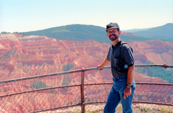
From the Point Supreme Overlook, we drove up Highway 148 to the Chessman Ridge Overlook, where we found terrain more like what we had seen over in Bryce Canyon.
 A View from Chessman Ridge |
(Picture at left) Although the rocks look the same, the scenery here is much different than Bryce Canyon, since you have the heavily-wooded mountains as a backdrop, rather than the drop to the Paria River valley. Also, the formations are in a well-defined area, almost as if this is an artist's work in progress. Exhibited like statues inside this natural gallery are stone spires, columns, arches and canyons of intricate design and seemingly infinite variety.
(Picture at right)
|
 A View from Chessman Ridge |
In this sanctuary of clean, cool air, abundant rainfall, full sunlight, and fertile soil, nature exhibits its full irrepressible potential. In late June through mid-August, the fields are ablaze with wildflowers, such as bluebell, spring beauty, fleabane, beardtongue, larkspur, lupine, penstemon, columbine, Indian paintbrush and many others. In contrast to the flowers is the bristlecone pine. This native of the Cedar Breaks high country is the Methuselah of trees; we saw one at Spectra Point that is over 1600 years old. That the bristlecone pine lives at all is something of a miracle, since it grows only in spots where water is scarce, soil is thin, and winds blow unchecked. You really don't know what natural beauty is until you see places like Cedar Breaks.
|
The rocks of the eroded canyon contain iron and manganese in various combinations, providing brilliant colors that led Indians to call it "the Circle of Painted Cliffs". Iron oxides provide the reds, oranges and yellows, while manganese oxides provide shades of purple. The color of rock is soft and subtle compared to the hoodoos at Bryce Canyon.
The area is a form of badlands—canyons, spires, walls, and cliffs so steep and confusing that the lands, while of great aesthetic value, are of little utilitarian worth. Early settlers called them badlands or breaks and created its current name by combining breaks with cedar for the many juniper trees (often incorrectly called cedars) that grow in the area.
Cedar Breaks National Monument was established in 1933. A small lodge, designed by Gilbert Stanley Underwood and built and operated by the Utah Parks Company once existed near the south end of the monument, but it was razed in 1972. The Cedar Breaks Lodge was the smallest of the park lodges in the Southwest. It was deemed "uneconomical to operate" by the Park Service, but protests associated with its demolition caused the Park Service to re-examine its policies concerning lodges in other parks, contributing to their preservation.
|
When we reached there after driving down off the Colorado Plateau, we headed south on I-15 to St. George, Utah. In St. George, I found a new Baskin-Robbins store when we stopped for gas, and then we continued to Las Vegas. We arrived there about six o'clock, and checked into the La Quinta. (I would show you an aerial view of the La Quinta, but it is no longer there, the MGM Grand having expanded into the space for a new convention center around 2005.) We had thought it would be out in the sticks somewhere, but it turned out to be right across the street from the new MGM Grand Hotel and Casino, and right next to everything else.
We had a swim in the pool, and then went off to see the sights. It was too late for pictures, so we just wandered through the MGM Grand, and then had dinner at the Excalibur. We went by the Luxor to watch the evening laser display, and wandered through that hotel too. Right in the lobby they have a water ride that circles the inside, and it is just like something at Six Flags Over Texas.
We had had a long day, but saw many amazing things- Bryce Canyon, Mossy Cave and Cedar Breaks- all natural wonders. Tomorrow, before we head back to Phoenix, we'll see some other amazing sights- but these will be man-made.
You can use the links below to continue to another photo album page.
|
July 4, 1994: A Day in Las Vegas |
|
July 2, 1994: Bryce Canyon National Park |
|
Return to the Index for Our Western Trip |