|
July 3, 1994: Bryce Canyon National Park/Cedar Breaks National Monument |
|
July 1, 1994: Wupatki NM and the North Rim of the Grand Canyon |
|
Return to the Index for Our Western Trip |
We got an early start from Kanab this morning, July 2, and drove north on US 89 to Utah 12, and then to the entrance of Bryce Canyon. On the way, along US 89, we stopped at a private cave. Fred wanted to see what it was like. It was a short cave, without any formations, but Fred said he had been curious about it since the first time his family drove by it years ago. Inside, there were lots of things collected by the man who discovered and had owned the cave, most notably a collection of fluorescent rocks and minerals. Then we continued on up US 89, passing the turnoff to Zion National Park, and we arrived at Bryce Canyon late in the morning.
|
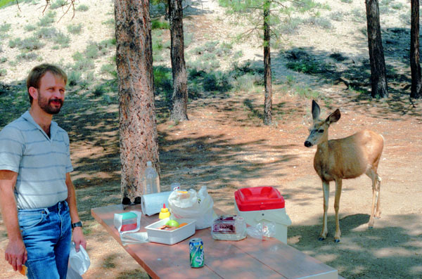
Before getting started, Fred wanted some lunch, so we stopped at a picnic area and spread one out. Pretty soon, we were joined by one of the local fauna. Other people were feeding the deer, but we knew that was not a good idea, so it just watched for a while and then wandered off to other picnickers.
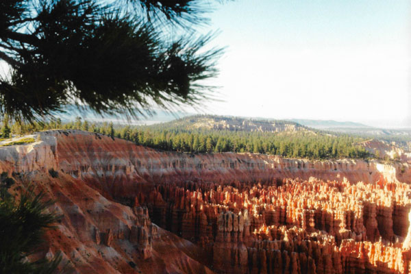
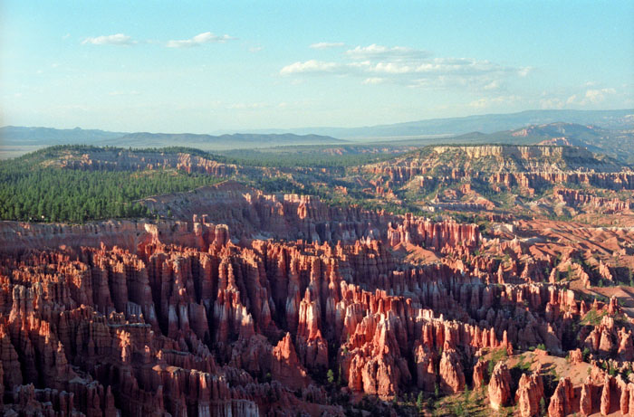
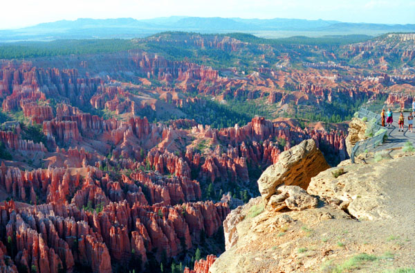
Bryce Canyon National Park, here in southwestern Utah, has, as its major feature, Bryce Canyon, which despite its name, is not a canyon, but a collection of giant natural amphitheaters along the eastern side of the Paunsaugunt Plateau. Bryce is distinctive due to geological structures called hoodoos, formed by frost weathering and stream erosion of the river and lake bed sedimentary rocks. The red, orange, and white colors of the rocks provide spectacular views for park visitors. Bryce sits at a much higher elevation than nearby Zion National Park. The rim at Bryce varies from 8,000 to 9,000 feet.
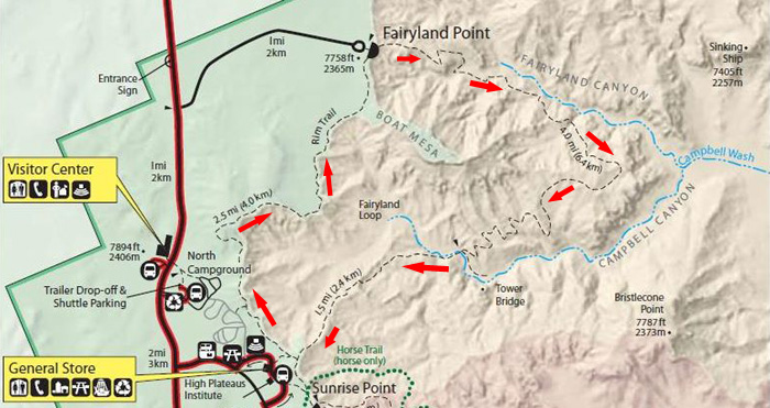
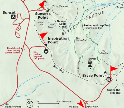
Bryce Canyon National Park is considered one of the National Park System's "crown jewels", and that's one reason why we wanted to spend more than just a day here. The park is actually quite large, north to south, but we will do most of our hiking in an area known as The Amphitheatre. In case you are interested, though, there is a full park map in the scrollable window below:
There were a number of excellent hiking trails here, and we had investigated some of them before leaving Dallas. We decided to make the Fairyland Loop Trail our first hiking experience at Bryce Canyon.
The Fairyland Loop Trail
|
The Fairyland Loop hike is not as crowded as other trails in Bryce Canyon National Park, which adds to its appeal. The route is 8 miles long and takes the average hiker about 4 hours to complete. If I recall, we took about that much time as we were stopping frequently to photograph and admire the scenery. Also, we took the short side trail to Tower Bridge, which added a bit to our time.
The trail is extremely well maintained and signed. This trail loses 950 feet of elevation as it drops to its low point and than climbs 950 feet as it returns to the rim. Bryce Canyon is very hot in mid-summer, but we are just a bit early for the highest temperatures. Still and all, it was very warm, and I think that probably September and October would be the ideal time for this and other hikes down in the Amphitheatre. Much later than that, and the hiker might encounter snow!
We parked the car and gathered up our cameras, checked our shoelaces, put some water in the pack and got ready for our first hike.
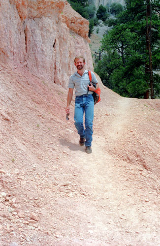
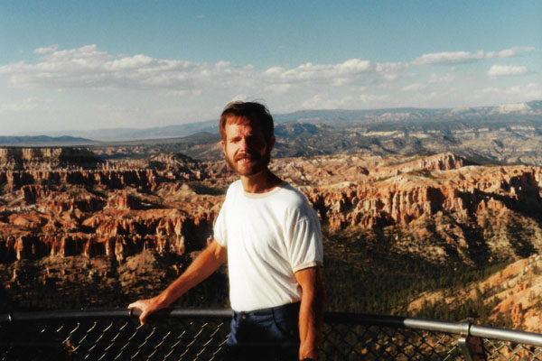
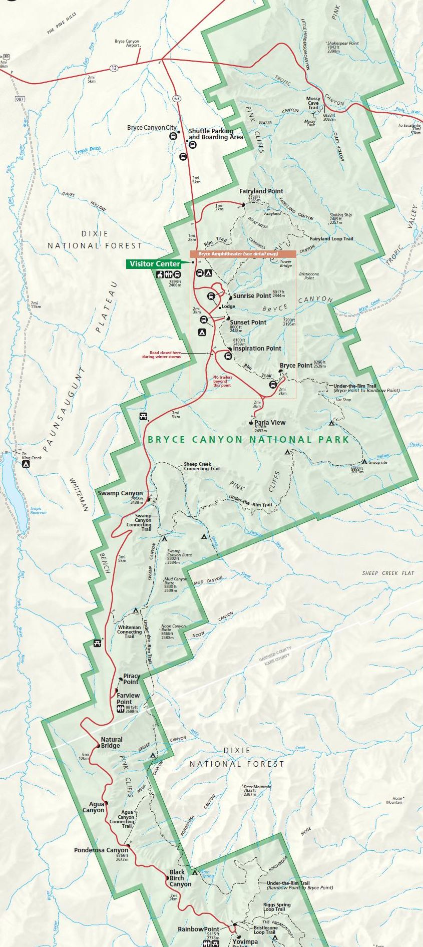
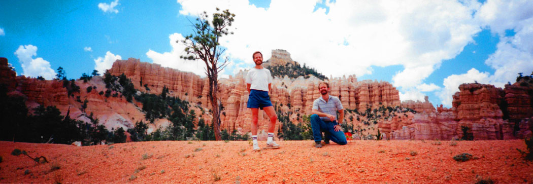
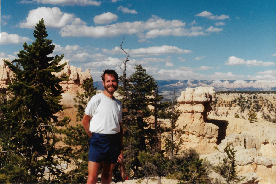
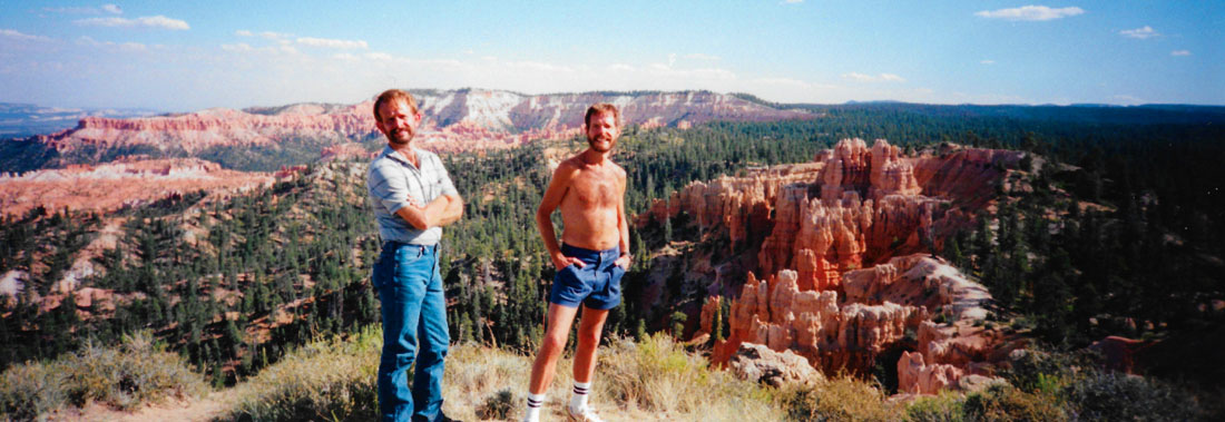
At the overlook at the top of the trail, we paused to check the trail diagram, and Fred used the opportunity to use his panoramic camera to take a picture of me checking that diagram:
 |
That panoramic camera does a very good job, but it would be nice if a single camera could take both normal and panoramic pictures. (As it turned out, we'd have to wait about fifteen years before a camera with that capability became commercially available and reasonably priced.)
|
We had actually thought a lot about which hikes to do and in which order to do them. We wanted to do as much as we could, and since we were starting out early in the day, we decided to try the longest of the hikes- and that's the Fairyland Loop trail. Although the Loop is over eight miles long, we had all day to do it, and the weather was wonderful.
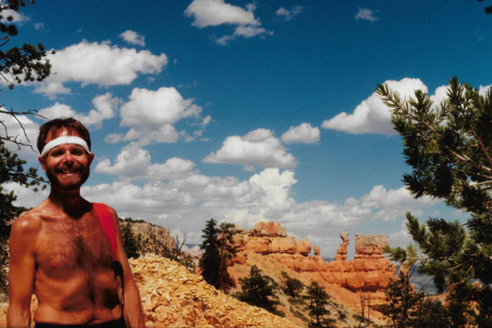
Actually, though, as I often do, I dress for a hike before starting out, often forgetting that as soon as exertion begins, what was comfortable at the beginning might be uncomfortable later on. On this hike, we'd gone about 200 feet before I realized that I was going to be very overdressed in jeans and all, so I asked Fred to wait on the trail while I ran back up to the car to to change into some shorts and a lighter shirt (although I ended up taking the shirt off, too). Then I went back to where Fred was waiting.
This view was taken from the point where I'd left Fred waiting. I will say at the outset that many of the pictures you will see today and tomorrow may seem repetitive; after all, one hoodoo looks much like another. But this scenery was simply so spectacular that I don't consider even one picture to have been wasted. Problem was, though, that it often seemed that only minutes after I took one picture another even better one came along. I wish film and developing were free; I wouldn't have taken just tens of pictures but hundreds!
NOTE:
That last remark, taken from the notes I wrote up for our pictures after we had gotten back to Dallas, turned out to be prophetic. I didn't realize it at the time, but digital photography was well on its way to the mass market; the first digital cameras would appear in another five years. When they did, and the cost of film and developing went essentially to zero, we began taking a hundred pictures for every one we'd taken before. I looked it up in 2014: in 1994, approximately 60 billion photos were taken worldwide. In 2014, that total was three trillion!
|
The National Park lies within the Colorado Plateau geographic province of North America and straddles the southeastern edge of the Paunsaugunt Plateau west of the Paunsaugunt Fault (Paunsaugunt is Paiute for "home of the beaver"). Park visitors arrive from the plateau part of the park and look over the plateau's edge toward a valley containing the fault and the Paria River just beyond it (Paria is Paiute for "muddy water"). The edge of the Kaiparowits Plateau bounds the opposite side of the valley.
Bryce Canyon National park is about a thousand feet higher than Zion National Park, and so it is a bit cooler here. Bryce also gets more rain- a total of 15 to 18 inches per year. Yearly temperatures vary; the record low was -29°F in December, 1972, and 98°F in July, 2002. Today, near as I can estimate, it is in the high 80s or perhaps 90.
|
|
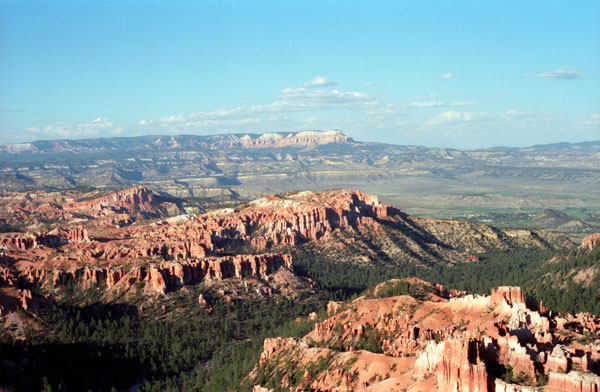
Bryce Canyon was not formed from erosion initiated from a central stream, meaning it technically is not a canyon. Instead headward erosion has excavated large amphitheater-shaped features in the Cenozoic-aged rocks of the Paunsaugunt Plateau. This erosion exposed these delicate and colorful pinnacles that are up to 200 feet high. A series of amphitheaters extends more than 20 miles north-to-south within the park. The largest is Bryce Amphitheater, which is 12 miles long, 3 miles wide and 800 feet deep. That's where we are now. A nearby example of amphitheaters with hoodoos in the same formation but at a higher elevation, is in Cedar Breaks National Monument, which is 25 miles west on the Markagunt Plateau, and which we plan on visiting tomorrow afternoon.
|
|
The denizens of the park and the rangers as well like to say that, surrounded by the beauty of southern Utah, these hoodoos cast their spell on all who visit. The Paria River and its many tributaries continue to carve the plateau edges. Rushing waters carrying dirt and gravel gully the edges and steep slopes of the Paunsaugunt Plateau on which Bryce Canyon National Park lies. With time, tall thin ridges called "fins" emerge. Fins further erode into pinnacles and spires- the "hoodoos." These in turn weaken and fall, adding their bright colors to the hills below.
Little is known about early human habitation in the Bryce Canyon area. Archaeological surveys of Bryce Canyon National Park and the Paunsaugunt Plateau show that people have been in the area for at least 10,000 years. Basketmaker Anasazi artifacts several thousand years old have been found south of the park, and other artifacts from the Pueblo-period Anasazi and the Fremont culture (up to the mid-12th century) have also been found.
|
|
The Paiute Indians moved into the valleys and plateaus in the area around Bryce Canyon at about the same time that the other cultures left. These Native Americans hunted and gathered for most of their food, but also supplemented their diet with some cultivated products.
The Paiute in the area developed a mythology surrounding the hoodoos (pinnacles) in Bryce Canyon. They believed that hoodoos were the Legend People whom the trickster Coyote had turned to stone. At least one older Paiute said his culture called the hoodoos Anka-ku-was-a-wits, which is Paiute for "red painted faces".
 The Upper Valley of the Paria River Below Bryce Canyon The Paiutes were living throughout the area when Captain Clarence E. Dutton explored here with John Wesley Powell in the 1870s. Many of today's place names come from this time. Dutton used "Pink Cliffs" for the Claron Formation, and other names- "Paunsaugunt" (place or home of the beavers), "Paria" (muddy water), "Panguitch" (water or fish) (Panguitch is a town near Bryce Canyon on US 89), and "Yovimpa" (point of pines)- were derived from the Paiute language. |
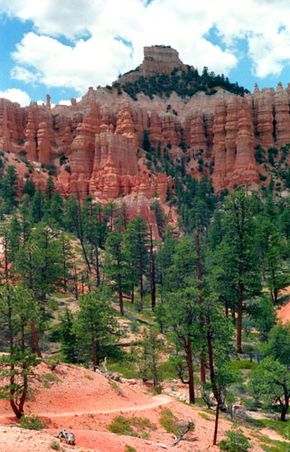
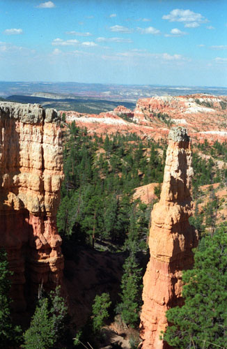
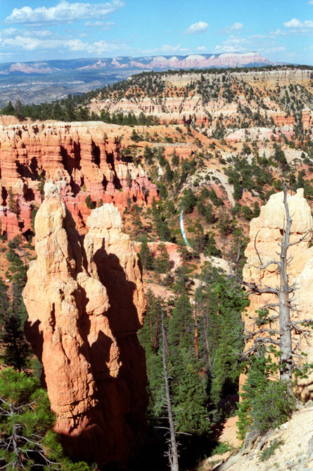
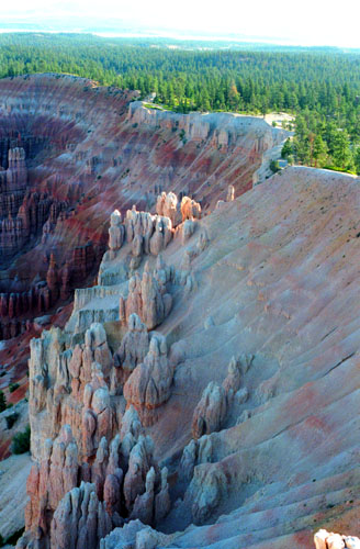
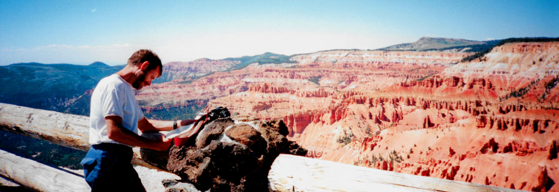
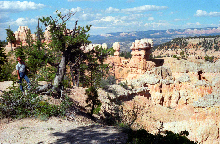
 Boat Mesa from the Fairyland Loop trail We are a bit higher than we were when I took that earlier picture of Boat Mesa, and you can see now that it is really an outcropping of the canyon rim, rather than a mountain on the Paunsaugunt plateau. You can also see more of the amazingly regular hoodoo formations. |
The Paiutes were displaced by emissaries of the LDS Church who developed the many small communities throughout Utah. Ebenezer Bryce aided in the settlement of southwestern Utah and northern Arizona. In 1875, he came to the Paria Valley to live and harvest timber from the plateau. Neighbors called the canyon behind his home "Bryce's Canyon." Today it remains the name not only of one canyon but also of a national park.
|
|
For 60 million years, a great seaway extended northwestward into this area, depositing sediments of varying thickness and composition as it repeatedly invaded, retreated, then re-invaded the region. Retreating to the southeast, it left sediments thousands of fee thick. Their remnants form the oldest, lowest, gray-brown rocks at Bryce Canyon. In the Tertiary Period, between 63 and 40 million years ago, rivers and streams flowing from surrounding highlands deposited iron-rich, limy sediments into an ancient freshwater lake system. The sediments became the reddish-pink rocks that represent the Claron Formation from which the hoodoos are carved and for which the Pink Cliffs are named.
Shortly after 1900, visitors were coming to see the colorful geologic sights, and the first accommodations were built along the Paunsaugunt Plateau rim above Bryce's Canyon. By 1920, efforts were started to set aside these scenic wonders. In 1923, President Warren G. Harding proclaimed part of the area as Bryce Canyon National Monument under the Powell (not Dixie) National Forest. In 1924, legislation was passed to establish the area as Utah National Park, but the provisions of this legislation were not met until 1928. Legislation was passed that year to change the name of the new park to Bryce Canyon National Park.
|
|
Elsewhere in the park, older Cretaceous layers rested side by side with younger Tertiary layers across fault lines. Streams began to remove sediments deposited by their ancestors. Working on the weakened edges of the upthrown blocks, water gradually removed the uppermost Tertiary layers and exposed Cretaceous rocks once again. Now these drab marine sediments lay on the surface of the land side by side with the brightly colored deposits of freshwater lakes and streams- the Claron Formation.
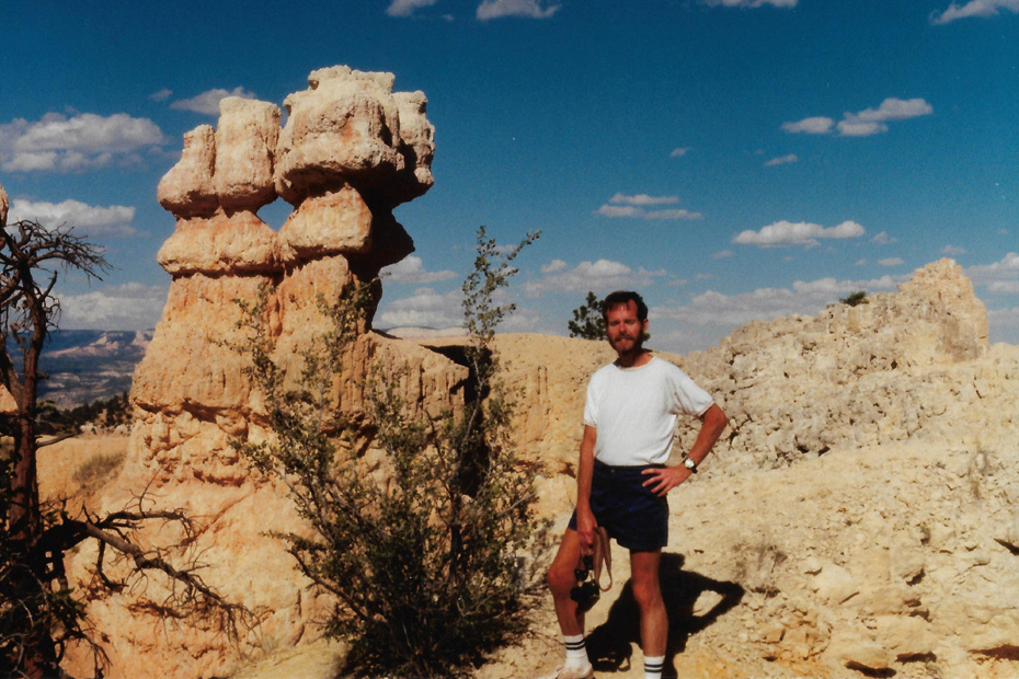
A bit further on along the trail, we stopped so Fred could set up the tripod and take another of his panoramic pictures. Here it is:
 |
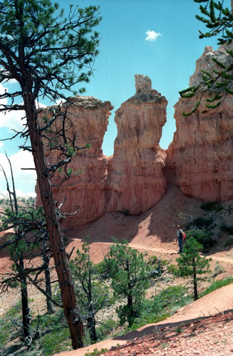
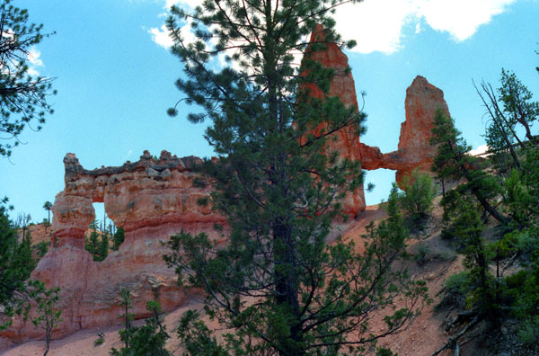
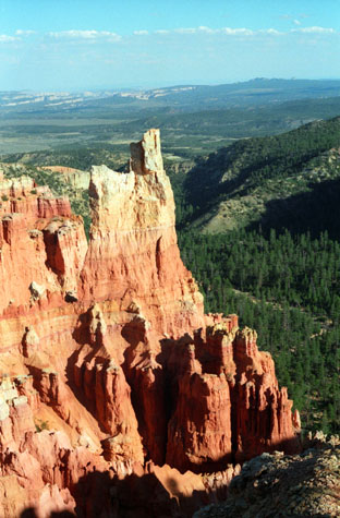
If you wish, refer back to the trail diagram above. We have come all the way across the north part of the trail and have now been angling to the southwest. We have now come to one of the highlights of this particular trail- the Tower Bridge formation.
|
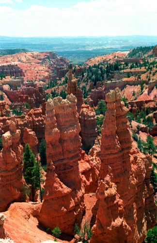
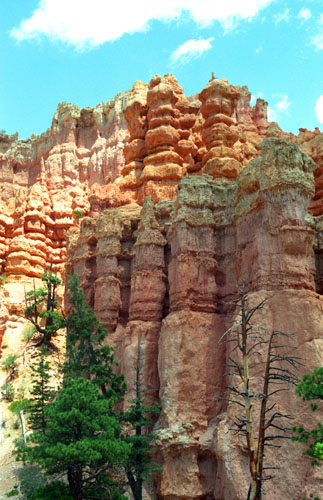
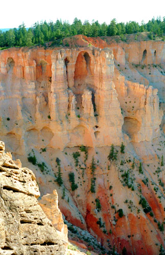
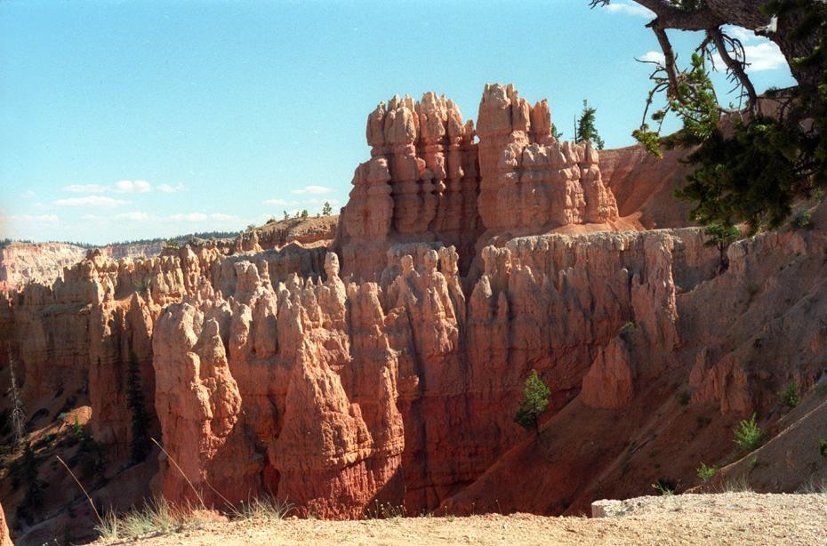
How, and when, were these fanciful formations created? They were created as the result of an uplift some sixteen million years ago, when the Colorado Plateau was uplifted and then segmented into different sections, each separated from its neighbors by faults and each having its own uplift rate. This uplift created vertical joints, which over time were preferentially eroded. The easily eroded Pink Cliffs of the Claron Formation responded by forming freestanding pinnacles. But differences in rock density and erosion patterns allowed the formation of other structures as well- including arches, natural bridges, walls, and windows. The vertical formations are composed of soft sedimentary rock topped by a piece of harder, less easily eroded stone that protects the column from the elements.
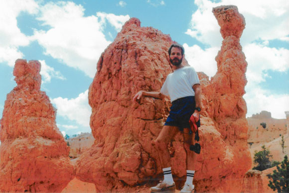
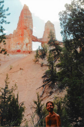
The Tower Bridge formation is composed of almost all of these types of formations. At the left end is a pinnacle, of course, and you can see that the caprock has not been eroded and so the top of the pinnacle is still connected to the curtain wall structure. A window, however, has opened up, as wind and the elements have worn away some of the softer sedimentary rock. At the right end of the wall are two taller pinnacles, and these are connected by a natural bridge (with another window, of course). We condtinued along the Fairyland Loop to get closer to this amazing structure.
|
|
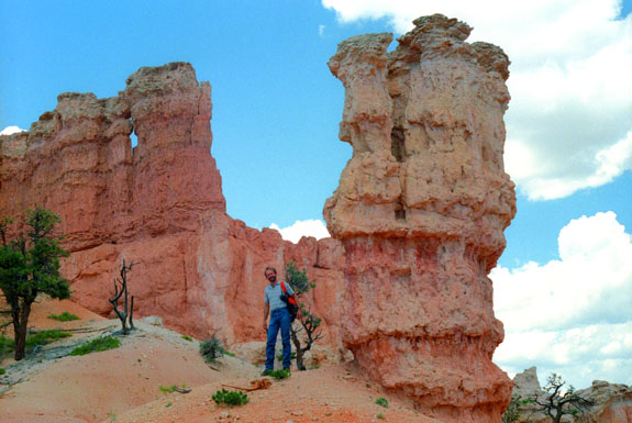
In this view, you can see more clearly how these formations come to be, as the caprock that protects the underlying layers from erosion is clearly visible along the length of the bridge. The hoodoos at the end may be made of slightly different rock, but probably the edge of an upthrust fault came along here at some point, with the rocks to the left of the tree being much lower that the rocks that used to be to the right, most of which, since the layer they were a part of was not protected or was more easily eroded, have disappeared, except for the two hoodoos that are left.
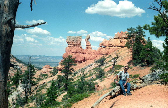
We have come about two thirds of the way along the part of the trail that winds about the canyon floor; from the trail diagram above you can see that we are a little less than halfway through our 8-mile trek. It has been a little under two hours thus far, and both of us are getting thirsty and hungry (although we did bring water). We returned to the main trail from the spur and continued on to the southwest.
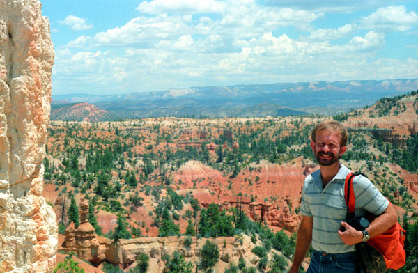
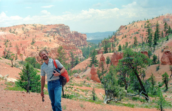
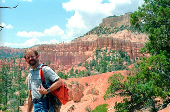
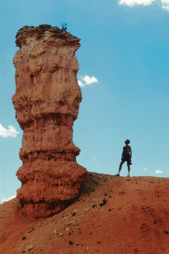
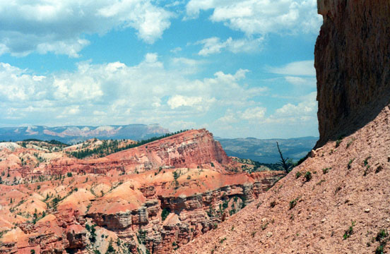
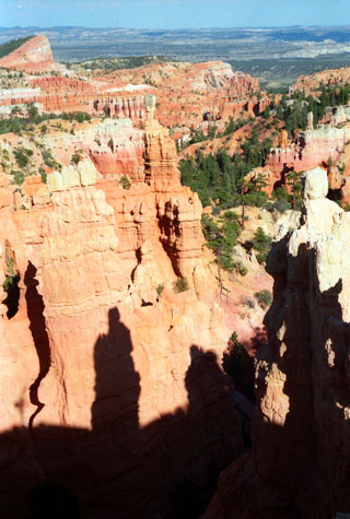
 Formations Along the Fairyland Loop Trail (and Me) Note the wide range of spectacular formations that exist throughout Bryce Canyon; it is almost more than the mind can take in. There is not just one lovely formation, or even a hundred, but thousands. Look at the way that rock in the distance is balanced on top of the hoodoo; we saw many just like it. The weather is really great, but warm enough that I have had to lose the shirt for a while. |
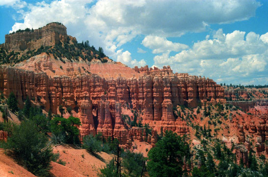
 Fred on the Fairyland Loop Trail in Bryce Canyon Here are more of these amazing formations in the background behind Fred, who is resting along the trail. You can see more of the canyon floor and the Paria River valley in the distance. Again, this picture brings together all the elements that make Bryce Canyon National Park such a wonder. |
We continued hiking for another hour or so when the trail began to rise to get back to the rim of the canyon. There were some switchbacks, and we were puffing by the time we got to the top and the end of the sixth mile. When we came up on the rim, we were near the Lodge and, more importantly, the park's General Store. There, we stopped and had a welcome soda and some frozen yogurt, and then just sat on the verandah and just watched the people for a while.
|
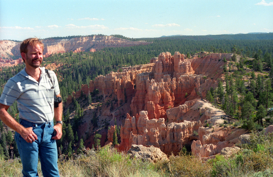
We took a number of great pictures of the Amphitheatre, and if you will click on the little thumbnails below, the full-size picture will pop up in a new window:
 |
Fred and some of the scenery along the rim trail between the lodge and the Fairyland parking area at Bryce Canyon. This view looks pretty much due east, past some of the formations in the Fairyland trail area and out to the Paria River valley. This is very typical of the scenery at Bryce Canyon; they say "typical" but I say "spectacular"! | |
 |
Me along the rim trail at Bryce Canyon. If you look at the right of the picture, which would be pretty much straight east from here, you can see the formations known as the Pink Cliffs. | |
 |
Me on the Rim Trail with hoodoos. It looks like I could just walk over to the formations, but the edge of the rim is just beyond me, and if I were to move ten feet back I would disappear (never to be heard from again, presumably). At this point on the Rim we are actually lower than the tops of the hoodoos. It is mid-afternoon, now, and you can tell from the shadows that we are looking east. |
Hiking the Fairyland Loop down in the Amphitheatre was just amazing, but so were all the views to which we were treated on our way back to the parking area, and if you've been clicking on the thumbnails and looking at the pictures, I am sure you will agree.
Click on the thumbnail images below to see more of the simply stunning views from the Rim Trail as we walked north:
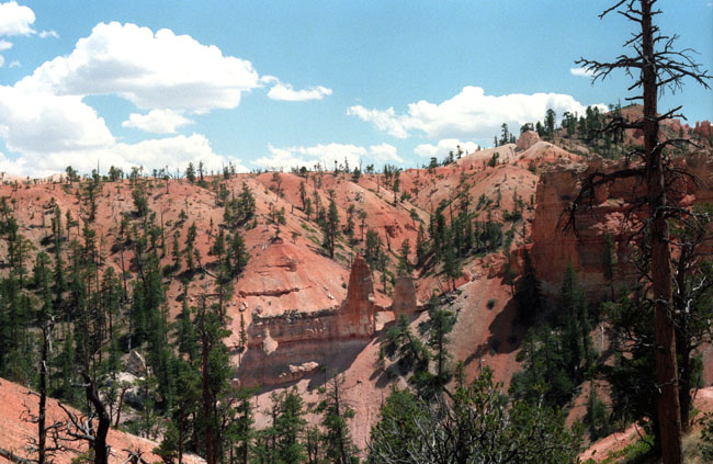
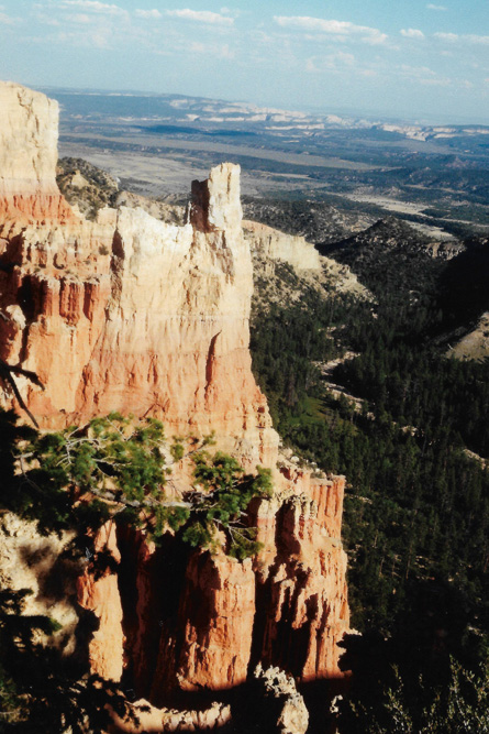
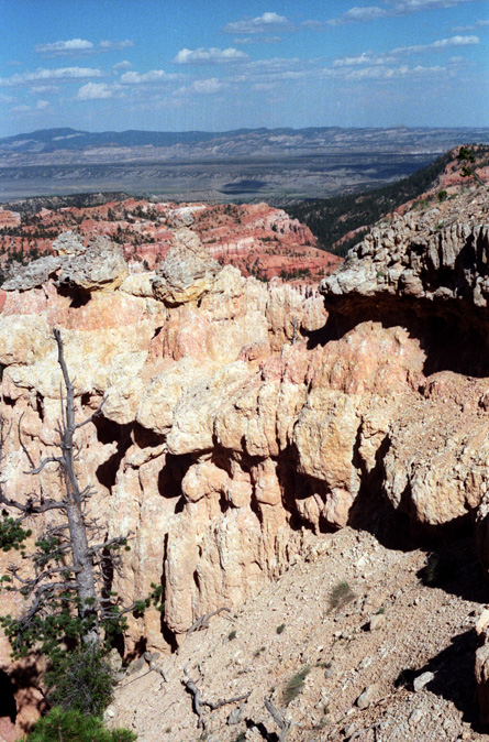
As the rim trail winds around heading north, the view changes so that you are looking somewhat south out into the Paria River valley. Down there is the small town of Tropic, Utah. Throughout the Amphitheatre, we saw what looked to be dry stream beds, like the one you can see here. There was no water in any of them now, but I suppose that on the days that it rains here, there would be. Actually, we haven't seen any flowing water since we crossed the Colorado River yesterday. This is a good picture for you to see some of the sedimentary layers in the rock. Fred took this picture while I was out on the short trail to the hoodoo formations. |
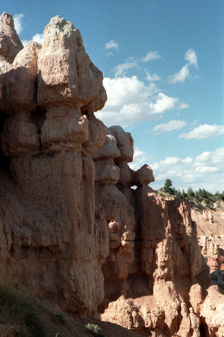
This picture shows more of the hoodoo formations along the rim of Bryce Canyon. When I got out to the end of the short trail, I could look back at the actual rim of the canyon, and see it up close. Of course, you can see the rim when you get down to the floor of the canyon on the Fairyland trail, but this view gives a much better idea of what the main rim of the canyon looks like. The canyon is so steep, that very quickly after noon the entire cliff face is in shadow, as it is here. |
||
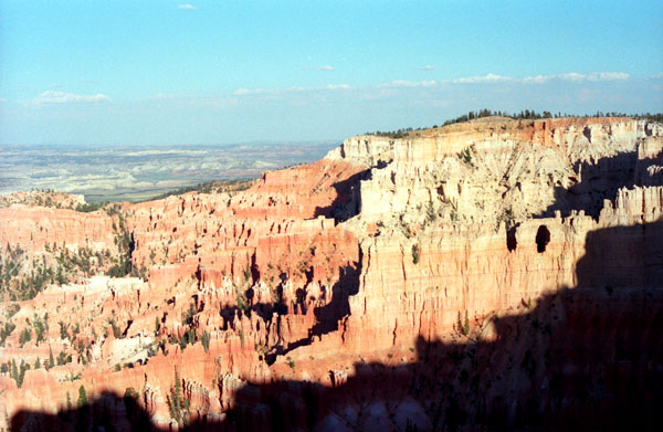
This view looks east from the rim trail, past the Paria River valley to the Pink Cliffs. The Pink Cliffs are at the edge of the Aquarius plateau, which is higher than the one we are on by about two thousand feet. If you look closely here, you can pick out bits of the Fairyland trail that we started out on four or five hours ago. |
These are some hoodoo formations that are now beginning to weather away. From further along the Rim Trail, you can see some of what were once tall hoodoo formations beginning their slow decomposition. The caprock that protects the tall formations has been lost in places, and now the softer layers are exposed to the elements. I suppose it will be a long time, but eventually those formations below the gray caprock that you can see here will weather away and, if nothing disturbs the caprock, there will be some free-standing formations here then. I know I won't be around to see it, but then neither will anyone else I know. In the background, again, is the huge Paria River valley. |
We have less than a mile to go before we are back at the parking area. Before we finish the Fairyland Loop trail, though, there are a few more pictures to show you.
|
To see the last two pictures we took here on the Fairyland Trail, just click on the thumbnail images below:
 |
 |
It is kind of odd, but the entrance to the Fairyland Loop trail parking area is actually outside the park entrance, so people can actually come hike for nothing. But that would be just locals, I'd think, for tourists would want to drive to the overlooks, see the Lodge and perhaps camp. We still had a good deal of daylight, it only being about four or five o'clock, so we decided to drive down to the other view points and
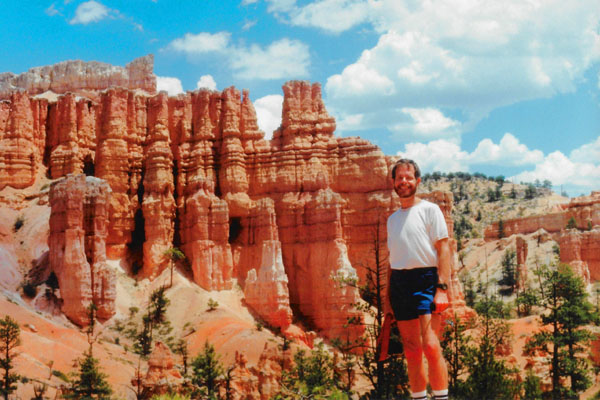
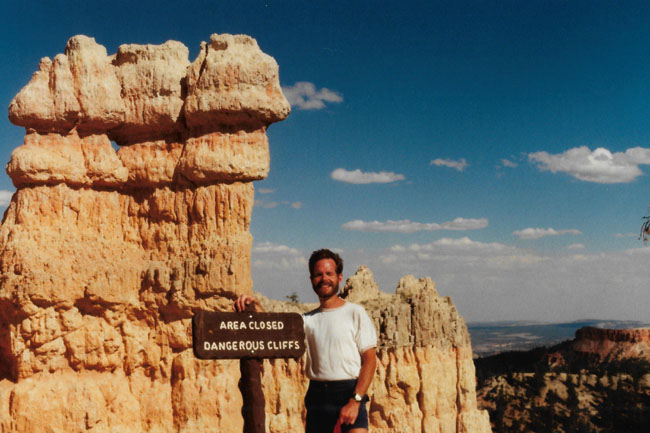
When we got back to the top of the Fairyland Loop trail, Fred got out his tripod and set it up with his panoramic camera to take this picture of the two of us:
 |
We left here, stopped by the lodge to make reservations for dinner and then headed on down to Paria View.
The Scenic Drive South Through Bryce Canyon National Park
|
Since it wasn't yet sunset, we bypassed Sunset Point to go down to the furthest overlook on the northern part of the Park drive- Paria View. Little did we know that some of the best sunset pictures are taken from the first stop we made.
Photographers seeking sunset pictures are often disappointed by the fact that most of the cliffs and hoodoos of Bryce Canyon do not face the setting sun. Paria View is one exception. Here one prominent and photogenic castle-like hoodoo rises high above the canyon floor to absorb the last rays of the setting sun. Paria is a Paiute word meaning "water with elk" or "water with mud". The translation varies depending on context and season.
Without that tidbit of information, we thought it best to go to the farthest point and work our way back. That way, if we couldn't see everything at the various points, the ones left would be closer to the campground and we might do them tomorrow.
At Paria View
|
As you look down and to the southeast you are gazing into the Paria River watershed. This region is famous for its slot canyons. These slot canyons were carved by rapid rates of runoff during spring thaws in the Ice Age. Even in today's drier climate some erosion continues to occur during flash floods. As a result, hikers are urged to stay out of the Paria Canyons during thunderstorms. This river's watershed is so immense that even a moderate rain can create catastrophic flooding downstream. The bottom of a slot canyon is the last place you want to be when a 30-foot wall of water comes roaring downstream at 50 mph.
Paria View is a good place to watch for Peregrine Falcons. Perhaps they prefer the comparative quietness this overlook offers. In the meadows back down the road from Paria View, Mule Deer and occasionally, Elk can be seen. Keeping to the forest during the day, these animals make their subtle appearance during the twilight hours. In late spring you might also spy the Pronghorn Antelope in these forest meadows. Pronghorn leave the sagebrush prairies north of the park to give birth to their young in the seclusion of the forest.
At Bryce Point
|
From some information displays we learned a bit about the canyon's namesake, Ebenezer Bryce, who settled in the valley just below the canyon in 1870. Bryce was a shipbuilder who journeyed west with Brigham Young and the Mormon pioneers to assist in the construction of buildings essential to community life throughout the new land.
Bryce lived here for only five years, but in that time, the canyon became known as Bryce's canyon to the people who knew him. Ebenezer Bryce was a pragmatic man, constructing roads to facilitate lumber transport and surveying the route for a 10-mile irrigation ditch from the top of the plateau to the valley that would later lead to larger, more permanent settlements.
If Bryce had romantic ideas concerning the land on which he struggled to survive, they are lost in history. All he is known to have said concerning this striking scene behind his home is, "It's a hell of a place to lose a cow."
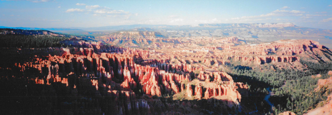
Here at Bryce Point, Fred got out his panoramic camera and took another nice shot of the Amphitheatre:
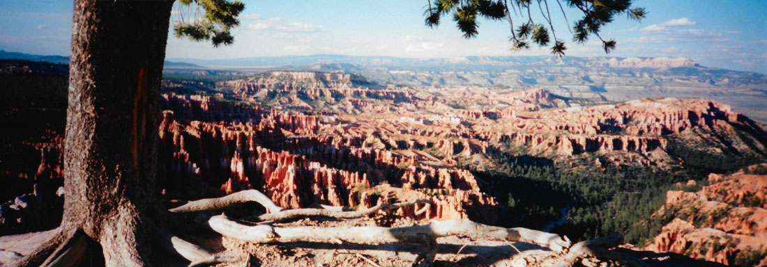 |
Geologic features visible from Bryce Point illustrate pieces of the natural history of the area. Visitors stand on the conglomerate at Boat Mesa that caps the Claron Formation along the rim from Bryce Point to Inspiration Point, a remainder from a time when nearby areas were being uplifted by volcanic activity and eroded by streams. These streams flowed through the area we now know as Bryce Canyon and deposited this gray to brown conglomerate. The grottos, also visible from Bryce Point, are the result of erosion of softer pockets of the upper White Member of the Claron Formation. Many of these formations can be seen in the beautiful views from Bryce Point:
 Hoodoo Formations at Bryce Point |
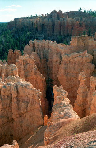
(Picture at left) These formations, golden in the afternoon sun, wear away, imperceptibly, year after year. So this view is different, each and every year, although you'd need a time machine to notice. One reason for taking this picture was the tree in the center of this group of formations. There are trees along the rim, of course, but down in the canyons they are scarce, mostly because the continual erosion doesn't allow them to get a foothold for very long before the ground erodes away and they topple over.
(Picture at right)
|
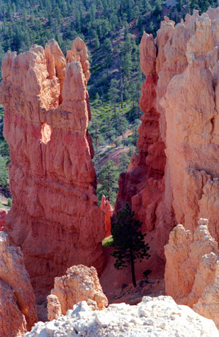 Formations Viewed from Bryce Point |
Bryce Point is a popular hangout for Golden-mantled Ground Squirrels, and Uinta Chipmunks; we saw a couple of the former. Here, as at many overlooks in the park, these rodents have become dangerously bold, and people make the mistake of feeding them. Signs cautioned against this, for, when fed, they lose the ability to survive on their own, and become susceptible to diseases- some of which can be passed on to humans.
 Hoodoos and the Paria River Valley |
(Picture at left) Looking out across the valley, there are a number of interesting formations here. They probably all have names, but I don't know what they area. In the upper left is a formation that reminds me of an adult (possibly a teacher) with a group of children grouped behind, as if they are looking out at the natural wonders here just as I am. Across the canyon are some more hoodoos that look like they could be part of the same tableau. Beyond is the river valley and some of the White Cliffs.
(Picture at right)
|
 The Paria River Valley and Tropic |
At Inspiration Point
|
It would seem to be impossible to count all the individual formations that you can see from here, but, surprisingly, some of them have individual names. Someone took the time to look at them all carefully and, where some group of hoodoos resembled and animal or structure, it was given a name. Much like constellations, I guess, or clouds.
The Claron Formation consists of two members, the lower Pink Member, a "dirty" limestone that contains sand, silt, and iron that lends the rock its reddish color, and the upper White Member, a purer freshwater limestone. This upper White Member of the Claron Formation is visible below Inspiration Point, although few hoodoos form in this softer rock.
There were a couple of benches here at the overlook and, even though it was getting late in the day, we couldn't resist sitting down and just taking in the incredible views. I had the thought that sitting here looking at the Silent City was more inspirational than being in the world's most beautiful cathedral.
|
|
Inspiration Point is an overlook that is very aptly named; there is one in Yosemite that I have been to, and one in Yellowstone that perhaps we will get to one year, and perhaps others. We should make a collection of pictures someday.
At Sunset Point
|
Directly below the point and to the south, the Silent City rises from the canyon floor, a maze of hoodoos and fins packed in tight formation. Just below the overlook on the northern edge, Thor's Hammer stands alone. Striking in form due to its isolation from other hoodoos, Thor's Hammer is a favorite among visitors, and we plan on getting much closer to it tomorrow.
Nowhere are the colors of Bryce Canyon's rock better displayed than from Sunset Point. Called the Claron Formation, this unique rock is primarily composed of limestone deposited approximately 50 million years ago in a large freshwater lake, known to geologists as Lake Claron. Iron oxide minerals supply the vibrant red, oranges, and yellows of the lower half of the cliffs which geologists call the Pink Member.
As its geologic names suggest, here too patches of pink and purple caused by manganese oxides add to the rainbow of color. The change from orange to white marks the beginning of the Upper Member. This section of limestone is purer; its lack of color is caused by the absence of mineral impurities.
|
|
Simply amazing.
Here at Sunset point, Fred did another of his panoramic pictures:
 |
We went back to the campsite for a little while, and then went over to the lodge for dinner. The campgrounds here don't have showers, but the lodge had a large restroom where it was possible to get pretty much refreshed. Dinner in the dining room was very good. I had barbecued chicken and Fred had some pork tenderloin. Both dinners were superb, and not just because they were a change from sandwiches.
After dinner, we went to the evening ranger presentation, which talked about the role that fire plays in the maintenance of Bryce Canyon National Park, and others as well. We learned a lot about natural and artificial burns, and how they keep the park in good condition. There was some quite pretty music playing as background for the slides, and Fred asked the ranger what it was. She said it was the Yellowstone Suite by the new age group Fresh Aire, and Fred noted that so he could find the CD of it sometime. By the time we got back to the campsite, we were pretty much exhausted, and got a great night's sleep as a result.
You can use the links below to continue to another photo album page.
|
July 3, 1994: Bryce Canyon National Park/Cedar Breaks National Monument |
|
July 1, 1994: Wupatki NM and the North Rim of the Grand Canyon |
|
Return to the Index for Our Western Trip |