|
July 2, 1994: Bryce Canyon National Park |
|
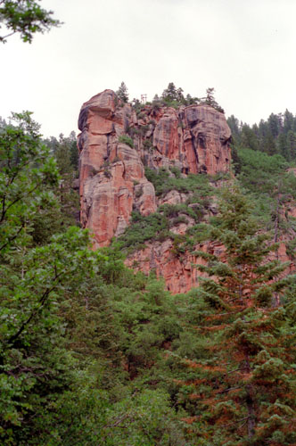
June 30, 1994: Lava River Cave and Sedona, AZ |
|
Return to the Index for Our Western Trip |
After a good night's sleep, we awoke early on Friday, the first of July, struck the tent, had a bit of breakfast, and headed off to explore Sunset Crater Volcano and Wupatki National Monuments.
Sunset Crater Volcano National Monument: The Bonito Lava Flow
|
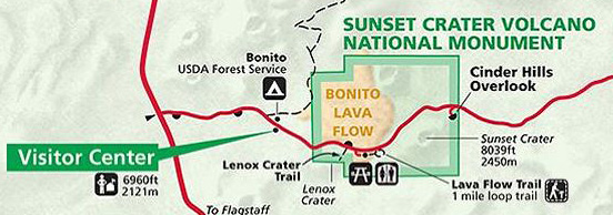 |
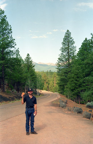
We had actually stopped for a little while at the Visitor Center before heading out; and we'd gotten some advice from a ranger as to some of the hikes we could do. Fred is munching on one of the donuts we got yesterday.
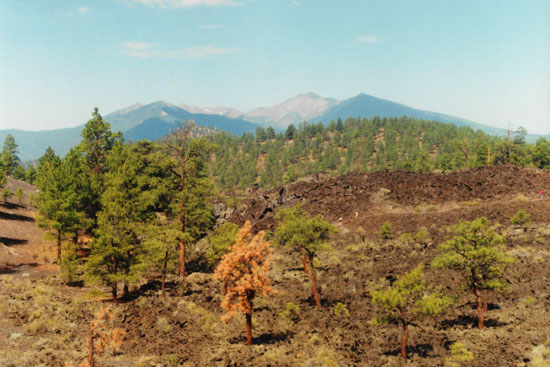
The cones and lava flows of the San Francisco volcanic field, which covers about 2,000 square miles of the southwestern Colorado Plateau result from several million years of volcanic activity. These powerful underground forces changed the landscape dramatically beginning in the winter of 1064-65. We have stopped at an overlook where we are able to look out over the ancient lava flows, on which not much grows, although the surrounding land not covered by lava supports a wide variety of plant and animal life.
Our first stop was at the Bonito Lava Flow, and we walked a relatively short interpretive trail through the flow. The flow is actually lava that broke out the side of a cinder cone and then formed structurally complex flows some nearly two miles in length composed of basalt. On the lava flow trail there were two types of lava visible, Aa and pahoehoe.
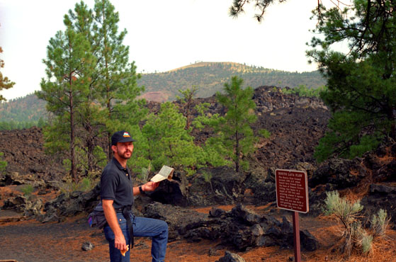 Fred at the Bonito Lava Flow Trailhead You can walk out on the lava flows, as they are just rock, but you can't climb the cinder cones (except for Lenox Crater) as they are very fragile. The lava flows were formed after the original explosions that created the fissures through which the lava could emerge. It was these original explosions that created the cones. |
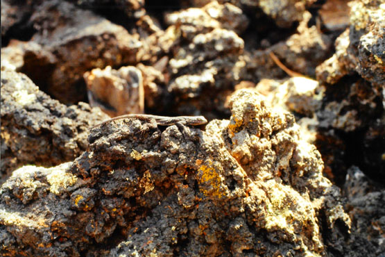 About the Only Fauna Along the Trail We really didn't see much wildlife in the National Monument, probably because there is little grass or other edibles. We did see a great many lizards, and here is one that Fred captured on film. This close-up is also typical of the terrain around the lava flow- just barren rock. |
The craters and cones themselves formed when molten rock sprayed out of fissures high into the air, solidified, then fell to earth as large bombs or smaller cinders. As periodic eruptions continued over 200 years, the heavier debris accumulated around the vent creating the cones, while the lightest, smallest particles blew the farthest, dusting 800 square miles of northern Arizona with ash. Perhaps as spectacular as the original pyrotechnics were the Kana-A flow (1064) and the Bonito flow (1180). They destroyed all things in their paths.
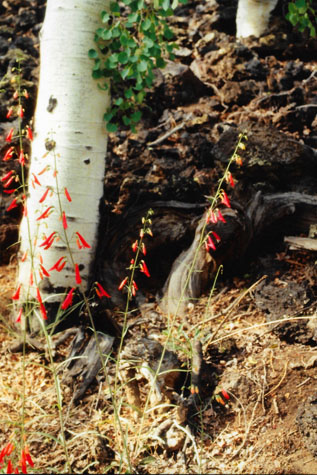 Bonito Lava Flow Flora |
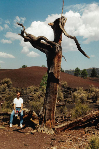
(Picture at left) In this part of the state, there are many Aspen trees, which have bark that resembles that of the Birch tree. Fred wanted to capture these desert flowers on film. The trees are growing right at the edge of the lava flow where there is just enough loose soil to hold them in place.
(Picture at right)
|
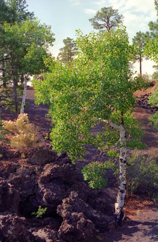 Aspen trees at the Edge of the Bonito Lava Flow |
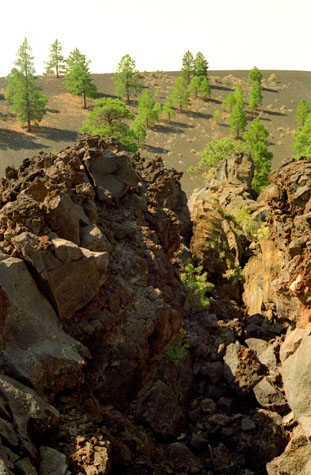
Flows typically start as pahoehoe, thin and runny, forming a smooth ropy texture when cooled. As the lava cools and becomes thicker it changes into an Aa flow. Aa flows are characterized by their jagged, blocky texture. The majority of the lava here at the lava flow trail is Aa lava.
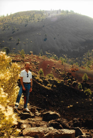
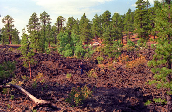 Fred Standing on the Bonito Lava Flow As you can see, not much is growing here, even a thousand years later. Where ash blew into aggregations, soil had a chance to form, at least enough to support a wide variety of pine trees. But there is little in the way of grass or other vegetation. |
 Me on the Bonito Lava Flow I clambered out a good ways onto the lava flow, examining the lava and having a generally great time wandering around. Fred was paying more attention to the few flowers that he could find, and trying to ascertain the differences between the flora here and that with which he is familiar. When I got back near the entrance to the trail, Fred took this picture of me. |
We had a really neat time clambering around on the lava flows along the one-mile self-guided loop trail (particularly since we'd picked up a small hiking guide for the trail when we were at the Visitor Center.
Sunset Crater Volcano National Monument: The Lenox and Sunset Craters
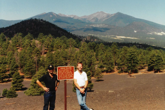
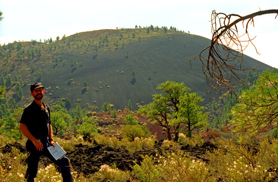 Fred on top of Lenox Crater/Sunset Crater Backdrop Sunset Crater wass closed to climbing fifteen years ago to halt the damage to the cinder cone. Although it has been many years now, and some restoration work has been done, you can still see the path that was worn to the top. We were able to climb to the top of Lenox Crater, which has enough vegetation on it that the cinders aren't disturbed much by hikers. |
 Fred and I on Top of Lenox Crater All of these mountainous and cone-like formations, reddish from the oxidized iron particles, are mounds of solidified volcanic debris that skid down from the summits of the early craters. The hike up was a mildly strenuous twenty minutes. It was hot in the sunlight, but there were a good many pine trees to provide shade. |
In a final burst of activity, around 1250, lava containing iron and sulfur shot out of the vent at Sunset Crater. The red and yellow oxidized particles fell back onto the rim as a permanent "sunset" so bright that the cone appears still to glow from intense volcanic heat.
 Me Atop Lenox Crater |
(Picture at left) The processes that created Sunset Crater also created a sculpture garden of extraordinary forms at its base. As new gas vents opened suddenly, spatter cones sprouted from the ground like miniatures of the cone itself. Most of these craters were formed by explosive eruptions. Magma, a mixture of molten rock and highly compressed gases, rises upward from its underground source. As the magma ascends, the extreme pressure drops and gases are released. The relatively thick magma and the high gas percentage causes an explosion out of the central vent. Solidified rock pieces, of various sizes, fall back down around the vent, creating a mound.
(Picture at right)
|
 Lava Flows at the Sunset Crater |
We climbed back down from the top of Lenox Crater (the trip down being much easier than the trip up), and got back in the car to continue around the loop road. The next stop was the self-guiding nature walk around the base of Sunset Crater. There was a long (1 mile) trail and a short (1/4 mile) trail, and we intended to just take the short one, but made a wrong turn and ended up going for the whole enchilada. There was a nature booklet that we carried around with us, and Fred read the descriptions of each stop.
|
|
In these middle elevations, we see some ponderosa pine, pinyon pine, one-seed juniper, and various grasses, although there is not much of the latter. Off in the distance, in the higher elevations, about all you will see are ponderosa pine. It is also usual to see aspens at this elevation.
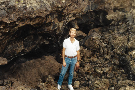
We continued around the loop trail, looking at a lot of interesting formations, including a cave. I guess I really wasn't supposed to go in, but I did, and I was amazed how cold it was, even just five or ten feet into the lava flow.
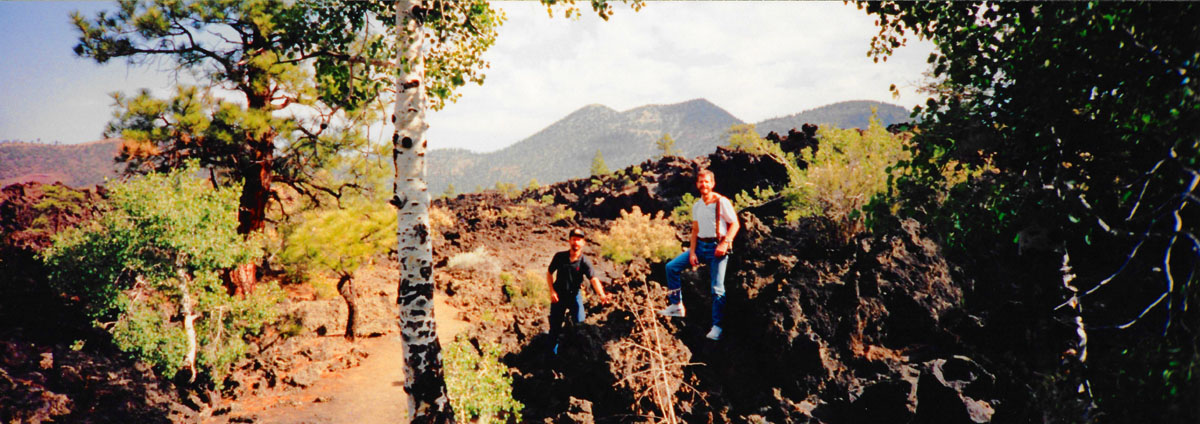
Here is a panoramic view towards the end of the trail:
|
We completed the nature walk, and then continued around the loop road, leaving Sunset Crater National Monument and going about ten miles further to the Wupatki National Monument.
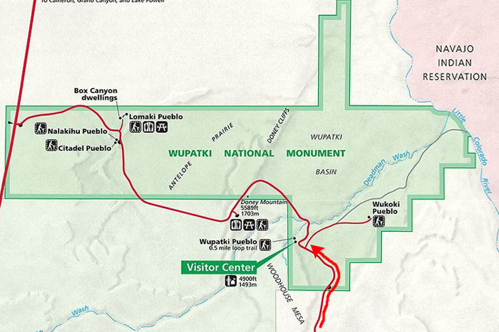
The Wupatki National Monument
|
A major population influx began between 1040 and 1100; ash from the eruptions to the south blanketed the area with volcanic ash- improving agricultural productivity and the soil's ability to retain water. Based on a careful survey of archaeological sites conducted in the 1980s, an estimated 2000 immigrants moved into the area during the following century and, without irrigation, raised maize and squash.
Three major dwellings were built in the area- Wupatki, Wukoki and The Citadel. Today the Wupatki area appears empty and abandoned, but it is remembered and cared for. Though it is no longer physically occupied, Hopi believe the people who lived and died here remain as spiritual guardians. Stories of Wupatki are passed on among Hopi, Navajo, Zuni, and perhaps other tribes. Members of the Hopi Bear, Katsina, Lizard, Rattlesnake, Sand, Snow, and Water Clans return periodically to enrich their personal understanding of their clan history.
Amidst what would seem a generally inhospitable area due to the lack of food and water sources, several artifacts have been located at the site from distant locations, implying that Wupatki was involved in trade. Items from as far as the Pacific and the Gulf Coast have been located at the site, such as many different varieties of pottery, during numerous excavations stretching back to the site's exploration in the mid-1800s.
This National Monument was established by President Calvin Coolidge in 1924, and occupies 56 square miles of dry, rugged land on the southwestern Colorado Plateau directly west of the Little Colorado River.
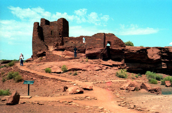
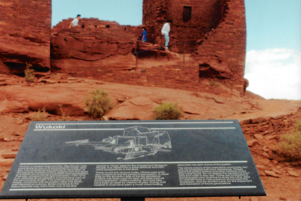
The Wupatki National Monument: The Wukoki Ruin
|
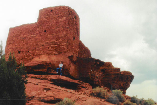
An architect today might have won an award for designing Wukoki Pueblo. The corners, angles, and lines of masonry are meticulous. From its base, the eye is drawn skyward to a height that inspires awe of this ancient craftsmanship. The architecture blends so well with the environment that the building seems to grow out of the rock, disguising where nature�s work ends and handcrafted walls begin. Today these walls stand as a silent tribute to prehistoric people.
Because the people of Wukoki left no written records of their life here, architecture and artifacts are important sources of information. Using the pottery types found here, archeologists can date the occupation of Wukoki from approximately 1120 through 1210. The inhabitants were most likely a cultural group known today as Ancestral Puebloans.
A partial excavation done by archeologist Jesse Walter Fewkes in 1896 revealed not only superb architecture but also the work of skilled artisans. He recovered beautifully designed pottery, a bracelet of shells, and ear pendants of stone with turquoise mosaic inlay. These artifacts have provided clues to who lived here and when.
|
In addition to Sitgreaves, John Wesley Powell also explored this area, and in 1869 became the first in historical times to navigate his way down the Colorado River through the Grand Canyon. In 1885, as head of the U.S. Geological Survey, Powell explored the San Francisco volcanic field. One bright-rimmed cone impressed him. "The contrast in colors is so great," he wrote in his journal, "that on viewing the mountain from a distance the red cinders seem to be on fire. From this circumstance, the cone has been named Sunset Peak," hence the name of the National Monument we just left.
In 1891 and 1893, Fewkes visited Walpi pueblo on the present-day Hopi reservation. On one of his visits he heard the origin of the Snake Clan. According to legend, the clan migrated from Tokonave near Navajo Mountain to the great house Wukoki before moving on to Walpi. Wukoki was said to have been located 50 miles west of Walpi by the Little Colorado River, but its exact location was uncertain.
Fewkes did locate dwellings, within what is now Wupatki National Monument, that he believed to be the Wukoki of the Snake Clan legend. Initially he referred to the entire area as Wukoki. As he grew more familiar with the individual pueblos, Fewkes specifically applied the name Wukoki to the largest pueblo, since "Wukoki" means �Big House� in Hopi.
|
Over time, the pueblo Fewkes called Wukoki became widely known as Wupatki instead. This also became the name of the national monument established in 1924. The name Wukoki was assigned to the nearby pueblo that was this, the first one we stopped at.
The original grandeur of Wukoki is still evident. There were three stories in what seems to be a tower. A total of six or seven rooms may have been home for two or three families. The open area adjacent to the tower was a plaza used for daily activities, pottery making, basket weaving, and other chores. The plaza was enclosed by a semicircular parapet wall.
We were able to walk all around the ruin. The sign down by the start of the paved walkway did advise the visitors should not climb on or sit on the rock walls, take anything away or otherwise compromise the structure itself. But that left us free to follow the little paths into and through some of the rooms.
|
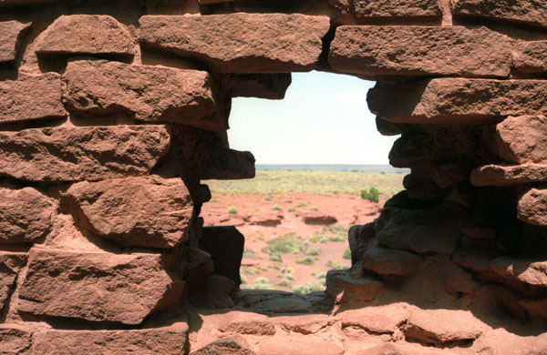
In a couple of rooms, there were what looked like windows, but which may have been openings created when stones collapsed. At right is a view out one of these "windows". One of the little signs seemed to indicate that this opening actually had been a constructed window, although if that were true, then the opening's borders would have to have been marred by natural or human forces.
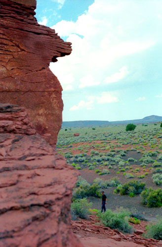
But the opening offered a very interesting picture of the landscape around the ruin itself. It is hard for me to understand why the pueblo was built in this particular spot. Although it is the highest land around, it is not very high at all, and I don't think that the pueblo would have been particularly defensible. Perhaps there was no need for that, as this may have been a period of relative peace for the peoples of the area.
Mud was used to plaster the surface of the walls inside and out. This insulated and waterproofed the pueblo, but made invisible the beauty of the stonework we marvel at today. Because of the nature of these materials, they must have required seasonal upkeep.
|
|
As the era of exploration drew to a close and the era of scientific advancement took hold, both Sunset Crater and Wupatki enjoyed scrutiny by a number of interested people. Around the turn of the century, archeologist Jesse W. Fewkes carefully mapped and photographed the Wupatki area, using appropriate Hopi terms to label geographical and cultural phenomena. But no one offered substantial evidence that Wupatki might be in any way connected with Powell's "Sunset Peak" until archeologist began excavations.
Twentieth century scientists did not have to guess the age of the artifacts they unearthed; modern techniques allowed them to accurately place their material findings within the time frame of the Southwest. A major breakthrough for archeologists and geologists alike came in the 1930s with the refinement of dendrochronology, or tree-ring dating. This process matches the pattern of growth rings from a tree of an unknown date with patterns from a cross-section of a tree of the same species whose age has been established. Because new rings are produced annually, this method can date timbers to the year they were cut.
|
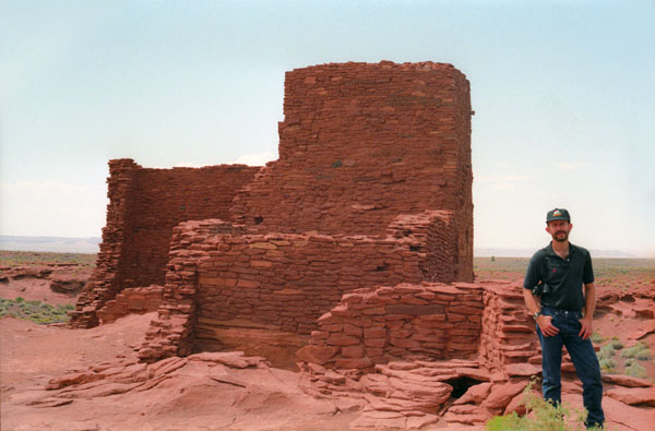
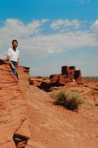
As we were leaving Wukoki ruin, I climbed up on a rock outcrop so Fred could get a good shot of me with the Wukoki Pueblo in the background.
Fewkes described Wukoki as �...visible for many miles, and from a distance resembles an old castle as it looms...above the plain.� The tower is nearly 20 feet high and with the rock base measures over 30 feet. The encompassing view may have been the motive for building on the sandstone outcrop. We don�t know exactly why they chose to build where they did, but the height and location of Wukoki are extraordinary.
Wukoki is one of the best preserved prehistoric structures within Wupatki National Monument, but it has not been reconstructed. The National Park Service partially reinforced the pueblo in 1941 by installing wood braces, props, and wedges. Cement and mud mortars were used to further stabilize the walls. Later a stabilization survey was conducted and the walls again remortared with mud. Test trenches were dug in two of the rooms. This is the only modern excavation of the site.
By 1954 more extensive stabilization was required. Workers used Portland cement covered with clay mortar made from local soils. They also braced the walls internally, using half-inch reinforcing steel, flat steel bars and concrete. Hidden within the masonry, these reinforcements help ensure the stability of this 800-year-old home.
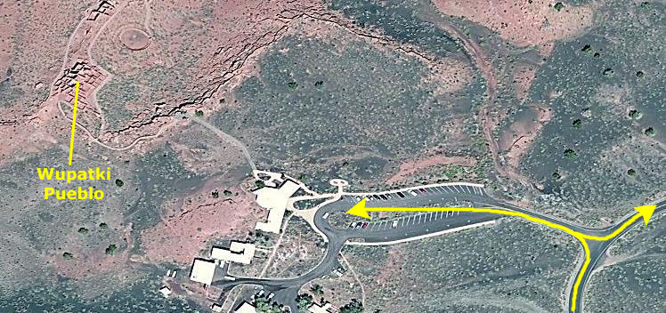
An archeological site survey completed in 1987 answered some questions about Wukoki but raised many more. We know, for example, that the prehistoric people left the area permanently within 200 years of the eruption of Sunset Crater, but why did they leave? Perhaps it was because of drought, disease, overpopulation, or a combination of all these things. Perhaps it was something entirely different. And where did they go? With all these questions still unanswered, we left the Wukoki ruin, drove back to the loop road, and continued a short distance to the Wupatki Pueblo, the largest of the ruins in the National Monument.
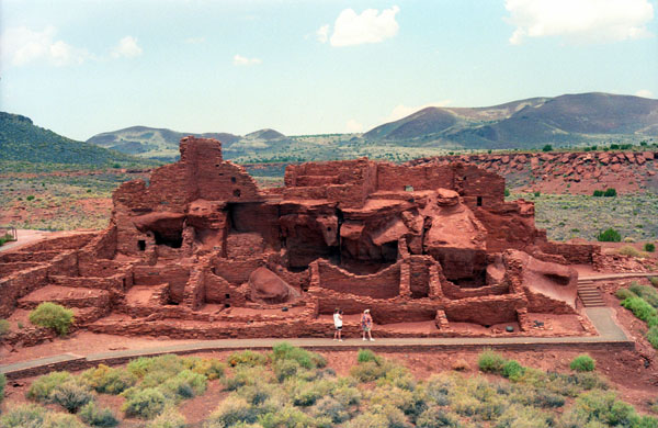
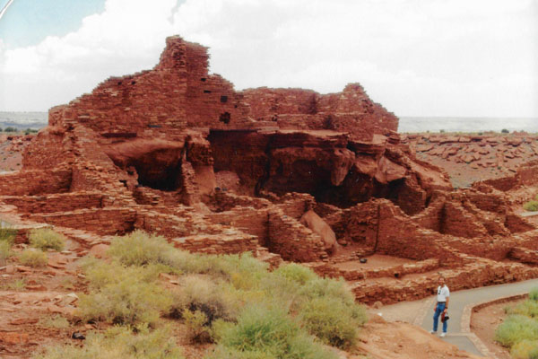
The Wupatki National Monument: The Wupatki Pueblo
 |
Wupatki, which means "Tall House" in the Hopi language, is a multistory Sinagua pueblo dwelling comprising over 100 rooms and a community room and ball court, making it the largest building for nearly 50 miles.
|
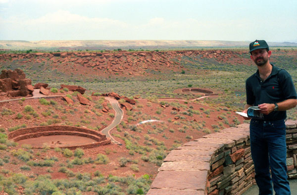
Nearby secondary structures have also been uncovered, including two kiva-like structures. By 1182, approximately 85 to 100 people lived at Wupatki Pueblo but by 1225, the site was permanently abandoned.
The dwelling's walls were constructed from thin, flat blocks of the local Moenkopi sandstone giving the pueblos their distinct red color. Held together with mortar, many of the walls still stand. Each settlement was constructed as a single building, sometimes with scores of rooms. The largest settlement on monument territory is this Wupatki Ruin, built around a natural rock outcropping. With over 100 rooms, this ruin is believed to be the area's tallest and largest structure for its time period.
The monument also contains ruins identified as a ball court, similar to those found in Mesoamerica and in the Hohokam ruins of southern Arizona; this is the northernmost example of this kind of structure. This site also contains a geological blowhole.
|
The many settlement sites scattered throughout the monument were built by the Ancient Pueblo People, more specifically the Cohonina, Kayenta Anasazi, and Sinagua. Wupatki was first inhabited around 500 AD. A major population influx began soon after the eruption of Sunset Crater in the 11th century (between 1040 and 1100), which blanketed the area with volcanic ash; this improved agricultural productivity and the soil's ability to retain water. Based on a careful survey of archaeological sites conducted in the 1980s, an estimated 2000 immigrants moved into the area during the century following the eruption. Agriculture was based mainly on maize and squash raised from the arid land without irrigation. In the Wupatki site, the residents harvested rainwater due to the rarity of springs.
Today Wupatki appears empty and abandoned, but it is remembered and cared for. Though it is no longer physically occupied, Hopi believe the people who lived and died here remain as spiritual guardians. Stories of Wupatki are passed on among Hopi, Navajo, Zuni, and perhaps other tribes. Members of the Hopi Bear, Katsina, Lizard, Rattlesnake, Sand, Snow, and Water Clans return periodically to enrich their personal understanding of their clan history.
|
The youngest rock layer, the reddish Moenkopi sandstone which provided the principal building material for the pueblo, is visible in several spots. Near the ball court is a good example of a blowhole, an opening in the Kaibab limestone layer that "inhales" and "exhales" air moving through interconnected underground cavities. Earthquake activity created fissures in the limestone called earth cracks, which can be found in the western half of the monument. Spatter cones rise like small pyramids throughout the San Francisco volcanic field.
Amidst what would seem a generally inhospitable area due to the lack of food and water sources, several artifacts have been located at the site from distant locations, implying that Wupatki was involved in trade. Items from as far as the Pacific and the Gulf Coast have been located at the site, such as many different varieties of pottery, during numerous excavations stretching back to the site' exploration in the mid-1800s.
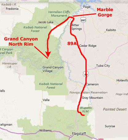
From Wupatki National Monument, we began our drive northwest towards the Grand Canyon- our next stop.
Marble Canyon National Monument (R.I.P.)
|
Outgoing presidents long have made a practice on January 20, their last day in office, of leaving parting gifts. For Lyndon Johnson, his gift to the nation 25 years ago was a national monument that served to protect the Grand Canyon from further dam building. In the flurry of papers he signed before heading back to Texas and retirement in 1969, was one that created the Marble Canyon National Monument. Some 26,000 acres in size, this monument ran from Lee's Ferry, about ten miles downriver from Page, Arizona and near the mouth of the Grand Canyon, down to Marble Canyon, which really is where Colorado River floaters first get the feeling that they're entering a canyon of significant size.
At the time the idea was to designate the monument so as to protect the landscape from any more thoughts of building dams in the canyon. (Before he turned his back on the Oval Office that day, he also taked on 215,000 acres to Capitol Reef National Monument up north in Utah, and 49,000 acres to Arches National Monument, also in Utah. Of course, those two monuments two years later were redesignated as national parks.
Marble Canyon National Monument had a long (I am being facetious) history; actually, six years later, in 1975, it and the then Grand Canyon National Monument were added to their larger neighbor, Grand Canyon National Park.
As I said, our objective was the North Rim of the Grand Canyon; to get there was a lot easier for us than it was many years ago, even though we had to cross the Colorado River- which is in a deep canyon (including the Grand Canyon) all the way through Arizona.
|
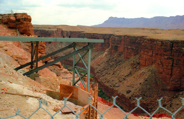
To get to the bridge, we angled off northwest from US 89 on US&89A; this took us north into the former Marble Canyon National Monument. There, about ten miles south of the town of Lee's Ferry (more about that in a moment) US 89A crosses the Navajo Bridge.
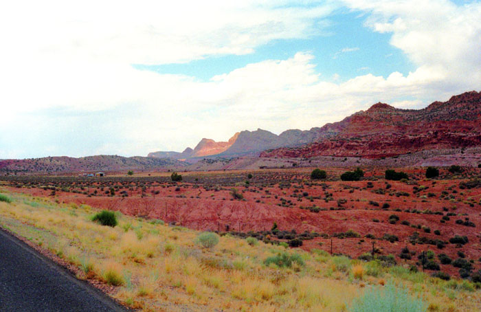
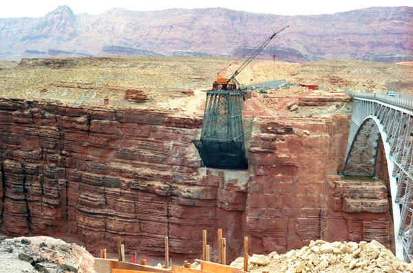
US 89A is very scenic, traveling through and along more reddish mountains; you can see some of that scenery at left (the picture taken about midway between the turnoff from US Highway 89 and the bridge). There was little along the miles of roadway before the canyon to tell us that we were approaching the Colorado River. The gorge that has been cut by the river at this point is very steep and very deep, but it is not very wide, and you can't even see it until you are almost on top of it. The only thing that gave it away from a couple of miles back were the cranes that the Navajo tribe companies are using to build a new highway bridge.
The Navajo Bridge crosses the Colorado River's Marble Canyon and carries U.S. Route 89A. Spanning Marble Canyon, the bridge carries northbound travelers to southern Utah and to the Arizona Strip, the otherwise inaccessible portion of Arizona north of the Colorado River, which includes the North Rim of Grand Canyon National Park. Prior to the construction of the first Navajo Bridge, the only river crossing from Arizona to Utah was at nearby Lee's Ferry, where the canyon walls are low and getting vehicles onto the water was relatively convenient. The ferry offered only unreliable service, however, as adverse weather and flooding regularly prevented its operation.
Construction of the original Navajo Bridge began in 1927, and the bridge opened to traffic in 1929. It was paid for by the nascent Arizona State Highway Commission (now the Arizona Department of Transportation) in cooperation with the United States Department of the Interior's Bureau of Indian Affairs, as the eastern landing is on the Navajo Nation. The steel spandrel bridge design was constructed by the Kansas City Structural Steel Company. One worker died during its construction when he fell 500 feet to the river below; supervisors had rejected the idea of rigging safety netting, believing that it would catch on fire from falling hot rivets.
|
I didn't take a good picture of the Navajo Bridge; why, I'm not sure. But when we got there, we found that there was another bridge under construction right beside the one we crossed. In 1990, it was decided that the traffic flow was too great for the original bridge, and that a new solution was needed. The sharp corners in the roadway on each side of the bridge's approach had become a safety hazard due to low visibility, and the deficiency in the original design's width and load capacity specifications were becoming problematic. The bridge had also become part of U.S. Route 89A.
Deciding on a solution was difficult, due to the many local interests. Issues included preservation of sacred Navajo land, endangered plant species in Marble Canyon, and the possibility of construction pollution entering the river. The original proposal called for merely widening and fortifying the bridge, but this was ultimately rejected since this could not possibly bring it up to current federal highway standards. Replacement was then the only option, and it was eventually decided to entirely discontinue automobile use of the original bridge. A new bridge would be built immediately next to the original and have a considerably similar visual appearance, but would conform to modern highway codes.
We drove across the old bridge where there was a turnout where we could stop. First, I took the picture above of the construction of the beginning of the eastern span; it's a neat picture and shows a lot about the method of construction of the bridge. I find engineering fascinating, and am continually impressed that we as an animal species have the wherewithal to conceive of such structures and the knowledge to invent the technology to build them.
|
I am writing this narrative years after our visit, as you know, so I can report that the new bridge would be completed in September of 1995, at a cost of approximately $15 million.
The original Navajo Bridge, the one we drove across today, is still open to pedestrian and equestrian use, and an interpretive center has been constructed nearby to showcase the historical nature of the bridge and early crossing of the Colorado River. Bungee jumpers are frequently seen using the span. The original bridge has been designated as a Historic Civil Engineering Landmark. The bridge was placed on the National Register of Historic Places on August 13, 1981.
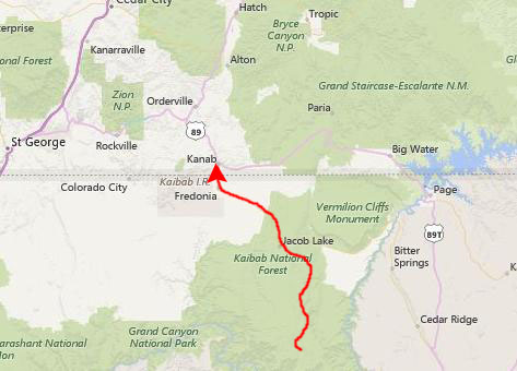
After stopping here, we headed on west to Jacob Lake, which is at the intersection of US Highway 89A and Arizona Highway 67; that road heads south to the entrance to the North Rim of the Grand Canyon. We stopped in Jacob Lake at a picnic area and had lunch, then headed on down to the park. As we approached the North Rim, the weather turned very cloudy, and it looked as if it would rain some. We entered the park and drove directly the Grand Canyon Lodge and Bright Angel Point- the main overlook for the North Rim.
The North Rim of the Grand Canyon
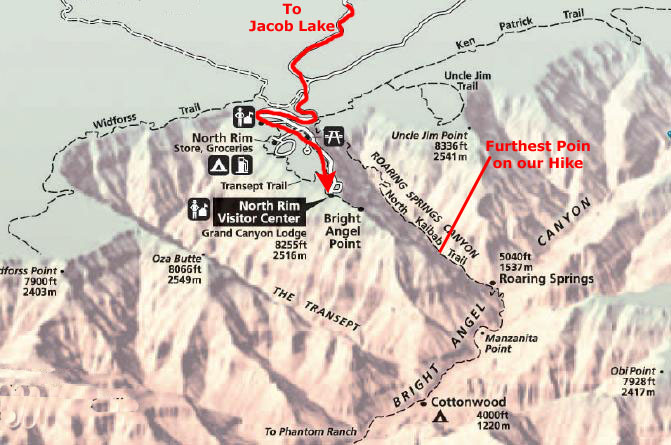
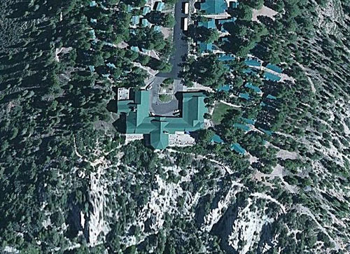
 Topography of the North Rim Area |
 Grand Canyon Lodge on the North Rim |
The Grand Canyon was officially designated a National Park in 1919, though the landmark had been well known to Americans for over thirty years. In 1903, President Theodore Roosevelt visited the site and said:
| "The Grand Canyon fills me with awe. It is beyond comparison � beyond description; absolutely unparalleled throughout the wide world... Let this great wonder of nature remain as it now is. Do nothing to mar its grandeur, sublimity and loveliness. You cannot improve on it. But what you can do is to keep it for your children, your children's children, and all who come after you, as the one great sight which every American should see." |
Despite Roosevelt's enthusiasm and his strong interest in preserving land for public use, the Grand Canyon was not immediately designated as a National Park.
|
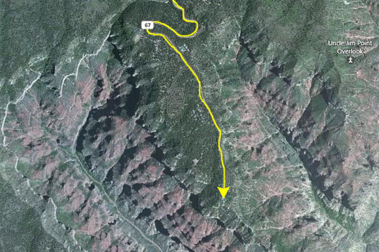
Today, we will be visiting the North Rim, following our visit to the South Rim last year. At left is an extract of the Grand Canyon National Park map showing the area where we will be and some of the points of interest we saw. Of course, we spent some time walking through the Lodge- one of the nicest in the National Park System. We also walked out to Bright Angel Point. But our main activity for the day was our hike down the North Kaibab Trail- about seven miles round-trip.
The creation of the park was an early success of the conservation movement. Its national park status may have helped thwart proposals to dam the Colorado River within its boundaries. (Later, the Glen Canyon Dam would be built upriver.) In 1975, the former Marble Canyon National Monument, which followed the Colorado River northeast from the Grand Canyon to Lee's Ferry, was made part of Grand Canyon National Park. In 1979, UNESCO declared the park a World Heritage Site.
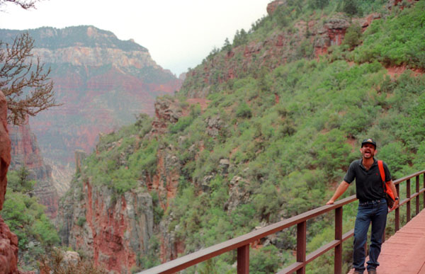
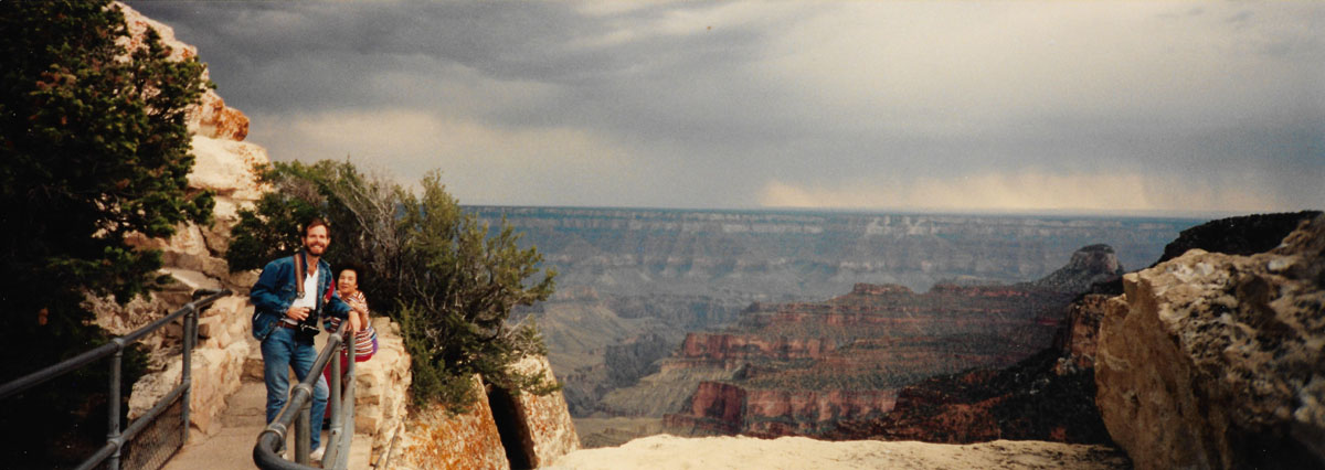
We were anxious to begin walking, so we parked and headed right over to the Bright Angel Point Trail, which begins on the south side of the Grand Canyon Lodge complex. This was not really a trail but a 3/4-mile paved walkway that followed the ridge line at the end of the Bright Angel Peninsula to Bright Angel Point. There, we were treated to a panoramic view of the canyon from its north side.
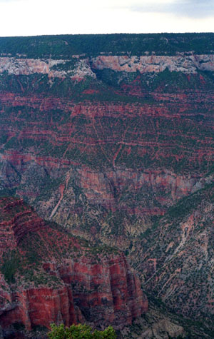
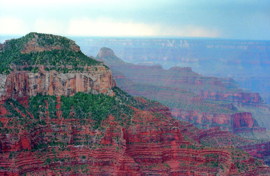 The Grand Canyon from Bright Angel Point As soon as we got out on the point that juts out into the canyon here, I was struck by the similarity in the views today and those from our trip a year ago to the South Rim. On that occasion, too, it was in the afternoon and the weather was threatening, so the same muted colors come through in the pictures. But, in any weather, the Grand Canyon is still spectacular. |
 Me at Bright Angel Point on the North Rim You can see, in this picture, that there is a good deal of haze out over the canyon itself, but a lot of that was actually rain that we could see from the overlook. |
Out over the canyon, we could see one or two thunderstorms, and there was some lightning and thunder, but it looked as if the rain might miss us. We were lucky, as it turned out, that it did.
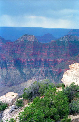 Looking SE from Bright Angel Point |
(Picture at left) There were a lot of people on the North Rim this afternoon, people speaking all languages and from all over the world. I would imagine that the Grand Canyon is one of those natural wonders that are not just nationally famous, but famous the world over. Fred and I might think that the Guadalupe Mountains in West Texas are famous, since everyone in Texas knows about them, but their fame ends there. But the Grand Canyon is one of those features that literally everyone knows about. No wonder it attracts so many people.
(Picture at right)
|
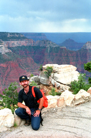 Fred at Bright Angel Point |
Being out here at the point was really incredible. As you can see from the aerial view above, it is a promontory with steep dropoffs on both sides (and indeed there were a number of signs about children and other pets). Here are some more views:
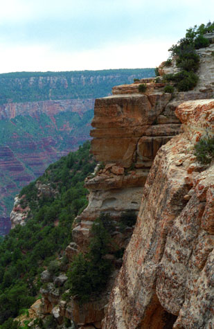
 A View Towards the South Rim from Bright Angel Point |
(Picture at left) Although this view is spectacular, it is very typical of the views one gets by looking in any direction from the North Rim. Actually, this view looks directly at some of the observation areas along the South Rim, which is only ten miles away at this point. Of course, that is as the crow flies. To get to the other side of the canyon, that you can plainly see here, you would have to drive 250 miles by the shortest route.
(Picture at right)
|
 A View Along the Side of Bright Angel Point |
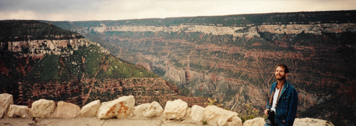
Before we left Bright Angel Point, the sun came out and I had to take a final shot of Fred, which turned out well. Then we went back up the short trail to have a look at the lodge.
 Fred at Bright Angel Point I thought that the gnarled tree and the clouds made an excellent backdrop for a picture of Fred in his element- out in nature and away from most of civilization. |
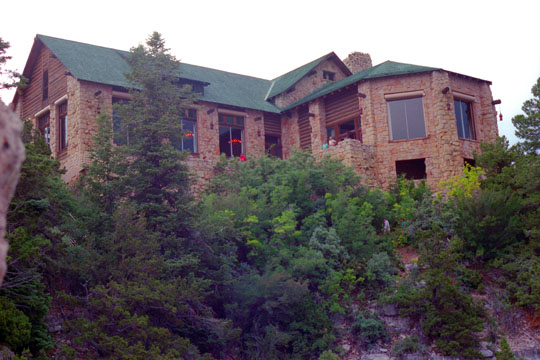 Grand Canyon Lodge on the North Rim I had given some though to staying at the Lodge, but we had really already planned to stay in Kanab, Utah, so that we could be assured of getting to Bryce Canyon early enough to get a good camping spot (since we missed out last year). |
At the other side of the lodge there is another trail and some stairs down to another overlook, and I left Fred in the lodge while I went down to check it out. (It was from this overlook that I got the view of the Lodge above.) Actually, the rooms are all in separate buildings, and the only thing in the building you see here are the dining rooms and public areas. We thought about staying for dinner at the lodge, but we wanted to get in some hiking and still make it to Kanab, so we decided to try again some other time.
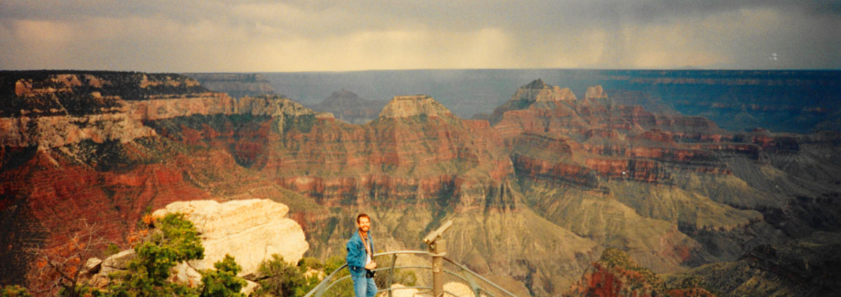
As we came back by the lodge on our way back to where we had parked, we walked down to the patio overlook, where Fred took this panoramic picture:
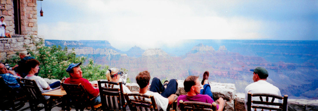 |
We knew that by the time we returned from the North Kaibab Trail, we would probably be losing our light, so we took this opportunity to wander around the observation areas and take some panoramic pictures. Here are three of them:
 |
 |
 |
Hiking Down the North Kaibab Trail
|
The first thirty minutes of the trail (it was real easy since we were going down) brought us down through a ravine and then out below a rock chimney, and that's the picture you see at left. The trailhead is above and to the right of the chimney, out of the photograph.
The trail itself, we read, is over 14 miles long; being so long, very few hikers actually do the entire trail, down and back up, in a single day. In fact, there is a fair amount of camping along the trail- at Cottonwood Camp (mile 7) Bright Angel Camp (mile 14). There is also Phantom Ranch at the very bottom of the trail; this is a reservation-only ranch-like affair with more amenities than a typical campsite. Again, because the trail is so long, treated drinking water is available seasonally at the Supai Tunnel, Roaring Springs, the Caretaker's Dwelling, and Cottonwood Campground; and year-round at Bright Angel Campground and Phantom Ranch. Features along trail include Roaring Springs, Ribbon Falls (140 ft), The Box (a slot canyon), and Phantom Ranch.
It was pretty obvious to us from the beginning that it would be next to impossible for us to do the whole trail. We'd read that the few experienced hikers that do start out before dawn, or as soon as there is enough light to see. And, even keeping up a good pace, they rarely return before dusk. As we walked along, we came to the conclusion that we would just hike until we thought it was time to turn around.
We have done lots of hikes where we were not sure how long the hike would take, but most of these have been hiking to the top of something. In those cases, you can be pretty sure that it will take you less time to get back down than it did to get up, and so we were comfortable taking a little over half the allotted time for the ascent, figuring that even if we spent some time at the top, getting down would be a lot quicker. This trail, of course, was different in that we were hiking down to something, and so we knew that if we spent, say, three hours hiking down, that we'd better count on at least four hours to hike back up. So, basically, that's what we did. We worked backward from the time we knew we'd need to leave the North Rim to get to Bryce Canyon at a decent hour (about 7PM). Since it was about noon now, we knew we'd need to start thinking about turning around by 3PM or so. This, as it turned out, would get us four miles down the 14-mile trail.
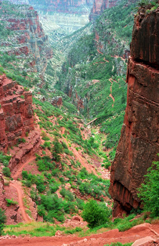
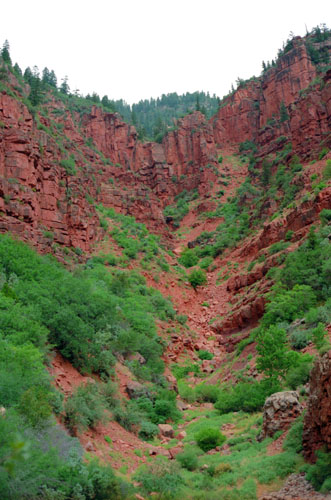
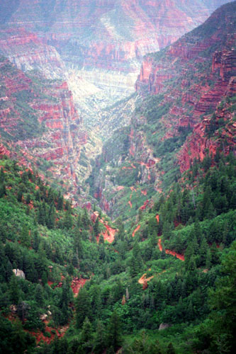 A View Down the North Kaibab Trail |
(Picture at left) Roaring Springs, which, from its name, we wanted to see, was five miles down the trail, and so we made that our objective. After more than an hour of hiking, this vista opened up and we could see where the trail was going. You can pick out the trail in this picture winding its way down the canyon walls.
(Picture at right)
|
 Looking down the North Kaibab Trail |
We were having a great time, hiking and talking. There were some light showers, and for a few minutes we thought that it would be getting worse, turning the trail into something muddy and treacherous (both going down and going up). But the showers stopped and the sky lightened, and there were even some blue patches, so we went on.
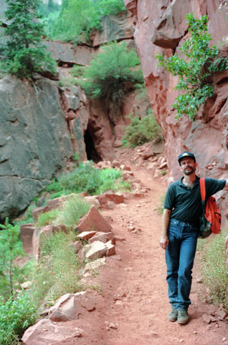 Fred at the Supai Tunnel |
(Picture at left) It was quite warm as we were descending, but as we were not expending great amounts of energy, it didn't seem too bad. I was mentally recording how far we had come, and not relishing the trip back up. There is the tunnel that the trail goes through as it switches from one side canyon to another. You can see how well the trail is maintained.
(Picture at right)
|
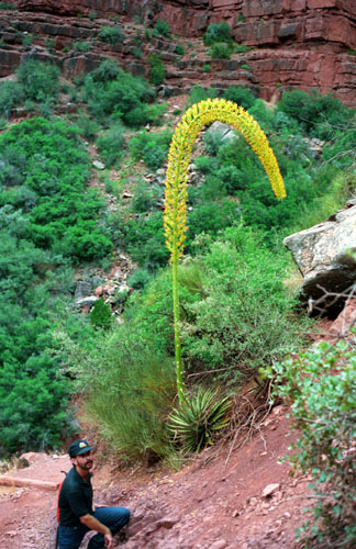 Fred and a Yucca along the North Kaibab Trail |
On the downtrail side of the tunnel were some tie bars for mules; it is possible to ride a mule all the way down to Phantom Ranch, but I can't imagine that would be as fun as hiking (except, perhaps, going up).
|
But we kept on hiking down, and the hike was really enjoyable (even though the trip back up was in the backs of our minds all the time). A little after three-thirty we arrived at our next objective- the footbridge that we first saw a couple of hours ago from about a thousand feet higher.
Here is Fred on the bridge with the continuation of Roaring Springs Canyon to his right.
Well, now that we have made it here, we face the decision of whether or not to continue on. While we were deciding, we rested on the bridge, looking around at the scenery. The trail continues to the right in this picture, and presumably goes around that hill and then continues down.
We assumed that Roaring Springs was down at the river level (an incorrect assumption as it turned out, but one that didn't matter), and as you can see that seems to be a good deal further down. We estimated that we had come about two-thirds of the way down the canyon, which was true, but had no idea how far the rest of the trail was. As it turned out, the end of this canyon was not at the river but, as you can see from the diagram above, at the intersection with Bright Angel Canyon- and it that canyon that goes down to the river.
Both of us wanted to get to the end, if only to say we'd done it, but we had to be realistic. If it got dark while we were on the trail, it would be very difficult to get back up. Since we didn't want to spend the whole hike worrying about that, we decided to turn back at this point. This will not be the last time we come to the Grand Canyon, and perhaps we can do this trip again sometime, and this time make it all the way to the bottom. Perhaps we might even overnight at Phantom Ranch. Anyway, it gives us something to look forward to.
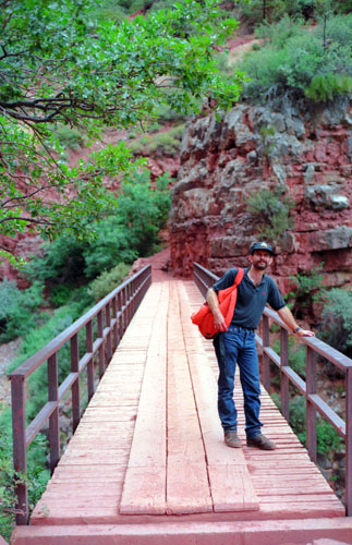 Fred on the North Kaibab Trail Bridge |
(Picture at left) This is a very good picture, both of Fred and of the bridge. There was no water below us, just a small canyon, but I imagine that when it rains there is water here. I suppose there was no convenient place to continue the trail on the canyon side where we were. Somebody put a lot of effort into trying to make the hike better by building this bridge.
(Picture at right)
|
 Roaring Springs Canyon |
As we suspected, the hike back up was much, much more strenuous than the hike down, and we had to take it more slowly. But we made good progress and we were less than a quarter of a mile from the trailhead when it began to get really dark, so we timed it just about right. It was a neat hike, and we hope to complete it sometime.
The Trip to Kanab, Utah
|
We thought of waiting until we got to Kanab and the motel, but we didn't want to risk getting there and having everything closed. Kanab was another fifty miles, and we reached there a little after ten; surprisingly, there was quite a lot still open.
The hike on the North Kaibab Trail has been the highlight of the trip so far, with the only regret being that we didn't get all the way down to the river. Later investigation, though, told us that if one plans to hike the whole trail, there is little alternative to camping for the night in the canyon or staying at the Phantom Ranch. I would like to do the latter, sometime, as we are not backpackers and wouldn't want to carry our tent and everything else on our backs. Anyway, it's something to look forward to.
I'd made reservations at the Best Western there, so we checked in, relaxed for a while, and then got to bed after an exhausting day.
You can use the links below to continue to another photo album page.
|
July 2, 1994: Bryce Canyon National Park |
|
June 30, 1994: Lava River Cave and Sedona, AZ |
|
Return to the Index for Our Western Trip |