|
October 28, 1994: Carlsbad Caverns National Park |
|
Return to the Index for Our Western Trip |
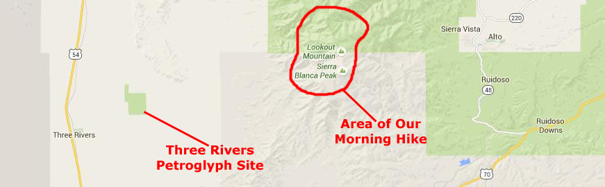
Today, we plan two major activities. The first will be some hiking up above the Ski Apache ski area to the peak of Sierra Blanca. The second will be a visit to the Three Rivers Petroglyph site, which is actually down in the valley below Sierra Blanca.
 |
The first thing we did this morning was to strike the tent and went off hiking up the hillside behind the campground. The campground was actually at the edge of a high meadow, and we just walked up into the trees and part way up the mountain behind camp. There were logging trails there, and we just followed them for a while, returning to the campsite after about an hour. We said good-bye to our friends from Europe, and drove off to our major morning hike.
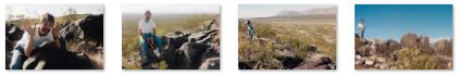
Hiking the Trails at Sierra Blanca
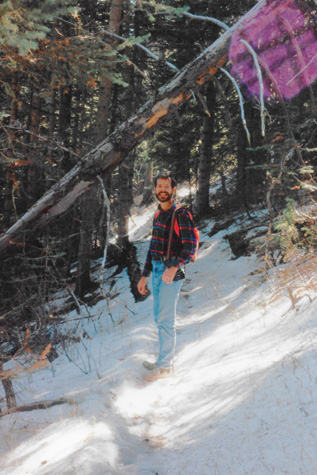
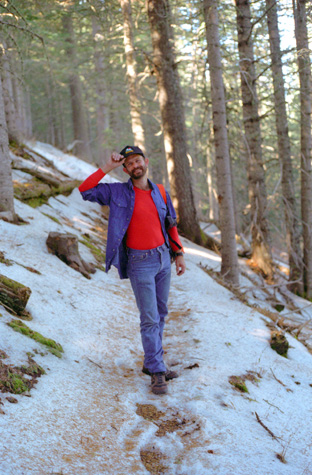 Fred on the Sierra Blanca Trail |
(Picture at left) There are lots of neat trails that lead up into the mountains and which follow the chain of mountains of which Sierra Blanca is the highest. As we got higher, we began seeing quite a bit of snow, as this picture indicates. In places, the footing was a bit treacherous, but neither Fred nor I had any mishap.
(Picture at right)
|
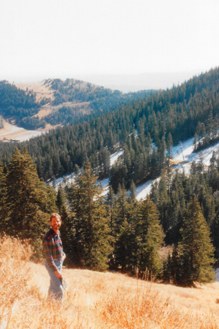 In a Grassy Meadow Along the Trail |
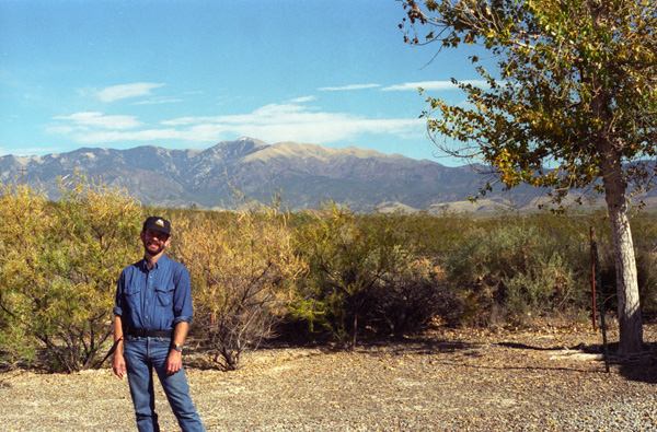
Sierra Blanca (also called the White Mountains) is a range of volcanic mountains in Lincoln and Otero counties of south-central New Mexico. It has the highest mountain in Southern New Mexico and the seventh highest peak in the state. The range is about 40 miles from north to south and 20 miles wide, and is dominated by Sierra Blanca Peak (White Peak), whose highest point is at 11,981 feet. The peak is located on the Mescalero Apache Indian Reservation, 10 miles west-northwest of Ruidoso and 30 miles north-northeast of Alamogordo.
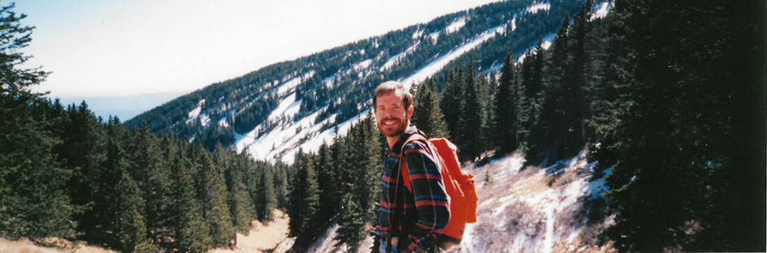
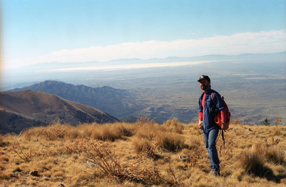 Fred On the Crest of the Trail This view looks generally west from the crest of the White Mountains. The weather is quite cool, although in the times the wind wasn't blowing, the sunlight was warm. Behind Fred, and way down in the Tularosa Valley, is the Three Rivers Petroglyph site that we will be visiting later today. |
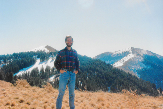 At the Crest of the White Mountains Trail That is Sierra Blanca in the far background, and in the near ground the peaks that form the Ski Apache ski area. Although you can't see it in this picture, there are ski runs on that snow-covered area to the left of me. |
The majority of the Sierra Blanca range is within the Lincoln National Forest, and part of this is protected as the White Mountain Wilderness Area. However, much of the southern half of the range, including the summit of Sierra Blanca Peak, is part of the Mescalero Apache Indian Reservation. To the south, across the valley of the Rio Tularosa, lie the Sacramento Mountains. Sierra Blanca peak can be seen for many miles, particularly within the Tularosa Basin, and is visible from as far away as Sandia Crest near Albuquerque and is the highest point in southern New Mexico, and is one of the southernmost points at which alpine ecosystems occur in the United States.
Fred brought his panoramic camera with him on our hike, so while we were up towards the crest of the trail, he took a few pictures with it- setting up the tripod to get shots of the two of us. Here are the pictures that he took:
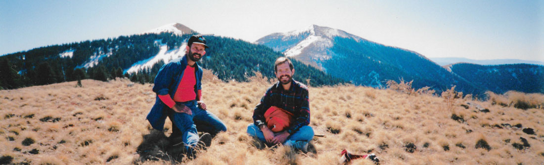 |
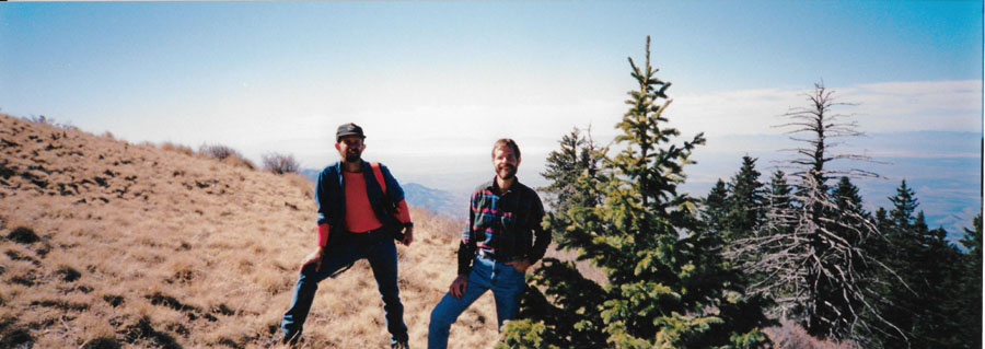 |
 |
It was simply beautiful up here on the trail, with the incredible views of the mountains in one direction and the Tularosa Valley in the other. Up here in the meadows, the sun was warm and the day inviting. Sadly, we couldn't spend all day up here just wandering the maze of trails that criss-cross the area (nor could we hike to the top of Sierra Blanca, as that requires a permit issued by the Mescalero Apache Indian Reservation- something we did not obtain in advance).
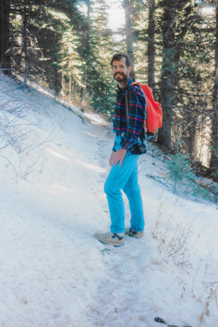 On the Trail Down from the Crest |
(Picture at left) This is what the snow looked like in the shade of the trees. It wasn't powder or anything, since the temperature was well above freezing. In fact, it was slushy and a bit muddy.
(Picture at right)
|
 Hiking Through the Snowy Forest |
The eastern foothills of the Sierra Blanca range include the town of Ruidoso, and the area has a number of popular hiking and camping destinations. Sierra Blanca Peak is the towering backdrop and snow-maker for Ski Apache- the southernmost major ski resort in North America. The peak of Sierra Blanca is located on the Mescalero Apache Indian Reservation. Ski Apache, on the other hand - is located mostly on land within the Lincoln National Forest and is operated by the Mescalero Apache Tribe's Inn of the Mountain Gods.
|
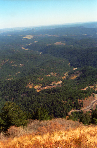
We returned to the car and had a bite of lunch, and then set off back down the mountain. Along the way, this excellent view (see picture at left) looking east appeared. You will remember that I said this morning we took a hike up from where we had pitched our tent? The area where we camped is right near that arc-shaped area, which is really a gravel turnaround at the bottom of the hill at Bonito Campground. The trees we hiked up into are the ones just below that cleared area where the campground is. To the right you can see the road down the mountain, which goes right by the entrance to the campground.
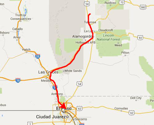
We went back through Ruidoso and down to US Highway 70 which we took southwest down into the Tularosa Valley.
The Three Rivers Petroglyph Site
|
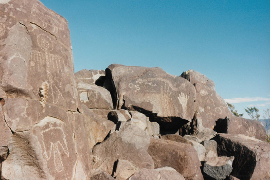
The Three Rivers Petroglyph Site is one of the few locations in the Southwest set aside solely because of its rock art. It is also one of the few sites giving visitors such direct access to petroglyphs. The number and concentration of petroglyphs here make it one of the largest and most interesting petroglyphs sites in the Southwest. As you may know, "petroglyphs" are created when the surface of a rock or other object is picked away; "pictographs" are created when another substance is added to a rock or other surface.
More than 21,000 glyphs of birds, humans, animals, fish, insects and plants, as well as numerous geometric and abstract designs are scattered over 50 acres of New Mexico's northern Chihuahuan Desert. The petroglyphs at Three Rivers, dating back to between about 900 and 1400 AD, were created by Jornada Mogollon people who used stone tools to remove the dark patina on the exterior of the rock. A small pueblo ruin is nearby and Sierra Blanca towers above to the east.
We picked up a trail guide at the parking area, and set off on the rugged, half-mile trail to the petroglyphs. A short while later, we found ourselves on the low rock ridge that angled through the desert. Perched on top of and along the sides of this ridge were the petroglyph-covered rocks.
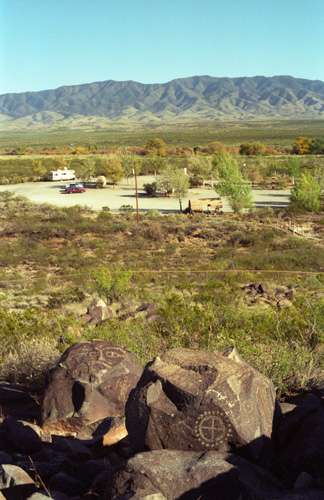
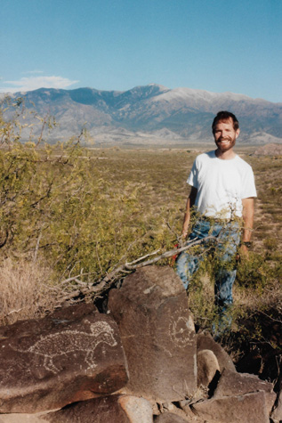
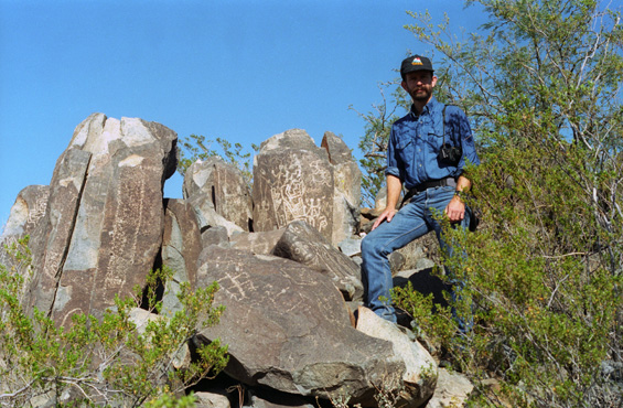 Here are the first of the petroglyphs we came across as we walked out onto the crest of a very low hill piled with rock outcroppings. The Three Rivers Petroglyph Site is an outstanding example of prehistoric Native American Indian rock art. A low ridge rising above the Three Rivers Valley contains extensive carvings of masks, sunbursts, wildlife, hand prints, and geometric designs. |
 If you look carefully, you can see many, many carvings all over the rocks around me. The rock carvings at this site were made with stone tools by a people archaeologists call the Jornada branch of the Mogollon culture. Many of the designs present are similar to the Mimbres style which is found in the southwestern part of New Mexico. |
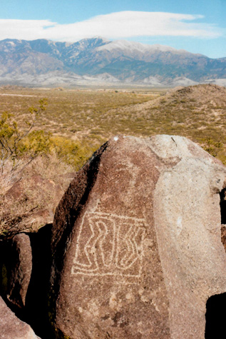 |
(Picture at left) Some of the carvings at the Three Rivers Petroglyph Site, at Three Rivers, New Mexico, with Sierra Blanca and the Guadalupe Mountains in the background. Archaeologists are not sure what all these symbols mean. Some are thought to have religious meanings or to be records of important events. Others show the type of game that once lived in the area.
(Picture at right)
|
 |
The petroglyphs at Three Rivers were recorded during a six-year project by the Archaeological Society of New Mexico's Rock Art Recording Field Schools. Photographs and records are on file at the Bureau of Land Management's District Office in Las Cruces.
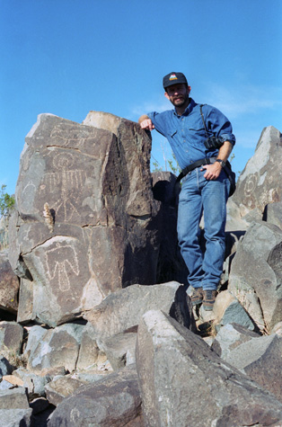
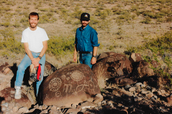
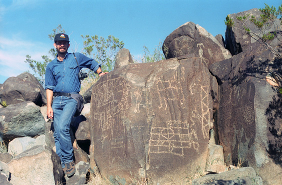 Fred and the Petroglyphs |
 On the Ridgeline |
The Jornada Mogollon people were descended from the nomadic tribesmen who had inhabited south-central New Mexico from approximately 5,000 B.C. By A.D. 900, they had established several villages in the Three Rivers drainage. Like earlier cultures, these people subsisted primarily by hunting wild game and by gathering the edible portions of such desert plants as yucca, prickly pear, and mesquite. In addition, they developed an elaborate system of agriculture and established trade routes with other Indian groups to the north, south, and west. The year-round supply of water in the valley provided a sure source of game and enabled villagers to grow corn, beans, and squash. Near the end of the thirteenth century, a severe drought is believed to have caused this site to decline in population. By 1400, the Jornada Mogollon people had abandoned the area.
 Petroglyphs at Three Rivers |
(Picture at left) Early inhabitants of the village below us lived in structures which were made by digging a pit and then roofing it with mud, branches, and grasses. Structures of a later age were either masonry houses or of the adobe style and often had several rooms. Most rooms had an opening to let smoke escape and to provide cross ventilation. Doorways normally faced to the south and southeast. Activities, such as stone tool making, tanning hides, pottery manufacture, and much of the cooking, were done outdoors in the areas between the houses.
(Picture at right)
|
 Fred and the Petroglyphs |
Although the Jornada Mogollon people lived throughout the Tularosa Valley, the symbols on this ridge were probably inscribed by the inhabitants of the partially excavated Indian village lying a couple of hundred yards to the south. This village was occupied for over 400 years and several types of Jornada Mogollon architecture have been found here.
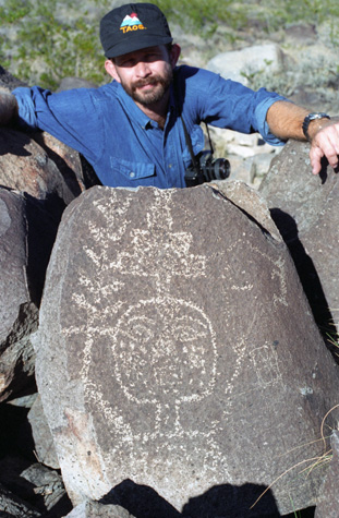
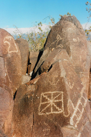
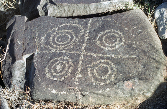 One of the Three Rivers Petroglyphs It's hard to imagine what some of these geometric figures might represent. If all four quadrants held a different carving, that might mean one thing, but the fact that two of the quadrants are identical (or as identical as hand carving could be) might mean something entirely different, whatever that might be. |
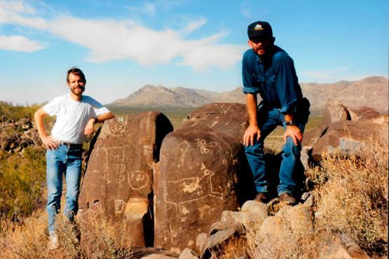 Fred and I at the Three Rivers Petroglyph Site Here, you can see a fair representation of the different kinds of petroglyphs that there are here. This view looks mostly north. The reason that Fred is crouching down is that he figured if he didn't, he wouldn't get me, the rock, and himself all in the picture without cutting something off! And I think he was exactly right. |
The Three Rivers Petroglyph Site was arranged along a ridgeline in the valley floor, and the area was made all the more beautiful with the backdrop of the White Mountains where we had been earlier. We made our way all the way to the far end of the ridge from the parking area; as advertised, there were many thousands of petroglyphs, and I am certain we saw only a fraction of them. The ridgeline was actually not that high, so I doubt the village was built nearby for any kind of security.
|
As I said, we saw and photographed a great many petroglyphs; I suppose the pictures can get repetitive. So I have taken some of them and put little thumbnail images below for them. In one picture, the carving on the shaded rock certainly looked like a lizard or perhaps a scorpion. In other pictures, it seemed as if some rocks only contained one kind of carving, such as geometric figures or animals, but then that wasn't always true. And in one picture, I'm trying to be funny, imitating the pose of the human figure carved into the rock below me (although I just ended up looking silly).
If you would like to see any of the full-size pictures, just click on its little thumbnail and it will open in a popup window. Close that window to look at another image or to continue down the page.
|
|
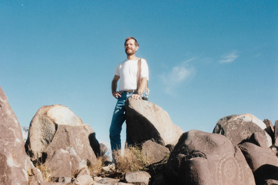
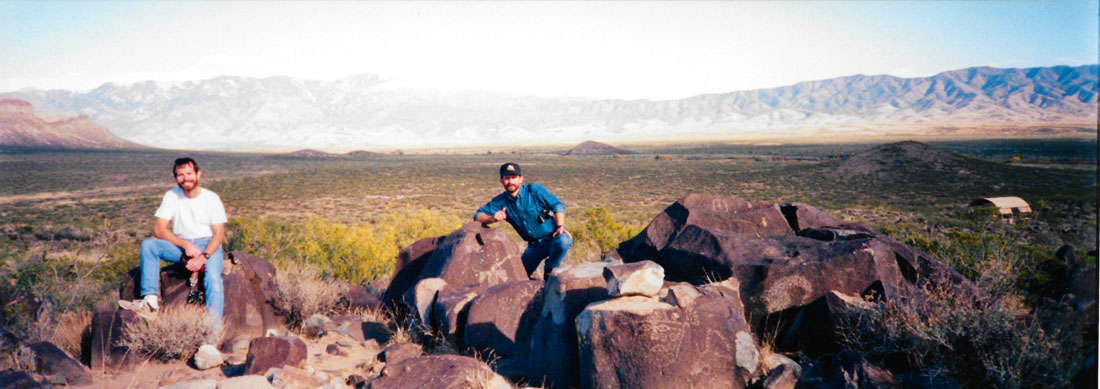
At one point, Fred got out his panoramic camera to take one picture of us on the ridgeline here at Three Rivers Petroglyph Site, and the resulting picture turned out well:
 |
Finally, here are some more of the pictures we took this afternoon at the petroglyph site:
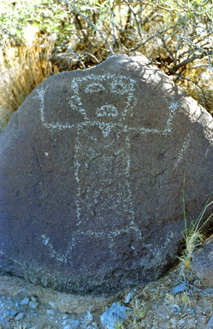 A Recognizable Image |
(Picture at left) Everything we've seen in all the petroglyphs that we've viewed was stylized, like this carving of a person. Whether that was because the way the carving was done did not allow for close work and a lot of realism, or whether the artist was just not skilled enough to be more realistic, or whether the stylization actually carried a meaning (I am reminded of the same stylized carvings in ancient Egypt, where we know that artists could do much more realistic pictures but chose not to) we just don't know.
(Picture at right)
|
 Me at the Petroglyphs |
In the left-hand picture below, that figure in the upper left is very interesting because of the circle around the head. Some have thought this to be a helmet of some kind, and they think these are carvings of alien visitors. But maybe the circle is actually a halo, which would mean that the carving is something quite different, and which would also open up an entire avenue of speculation. That's all it can ever be, as there is no one left to tell us why the carvings were made or what they represent.
 A Collection of Petroglyphs Here again, you can pick out geometric shapes, animals, a typical hand print, and a carving that I personally find interesting on the rock face at the upper left. It looks like a person with arms outstretched, and something, perhaps the folds of a robe, hanging from the arms. |
 Myself and Fred at the Three Rivers Petroglyph Site I know it's impossible, but the carving on the rock looks almost as if someone was trying to carve "E=MC2" in the rock. I like this picture; I think it is good of the two of us. |
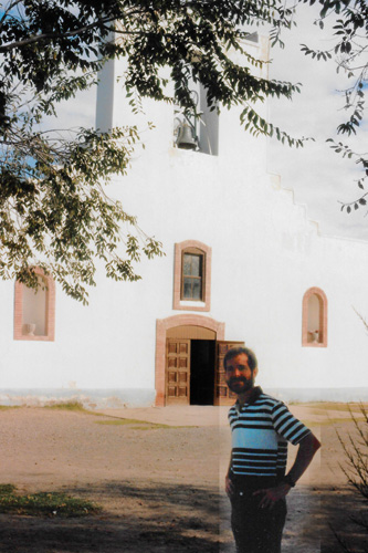
Back at the parking area, there was another short trail began on the east side of the picnic area and led to the remains of the Mogollon village, partially excavated in 1976. At the village site, there were some ruined foundations. There is also the ruin of a more modern small pueblo nearby and just up the road is Three Rivers Campground and an entry point into the Lincoln National Forest. The entire Three Rivers Petroglyph site was simply amazing, I was very happy that Fred had planned a stop here.
The Trip Home (10/29-10/30)
|
We stopped for a little while at a small town just outside Las Cruces, La Mesilla, and walked around the authentic Spanish square in the center of town. There wasn't much open, so we decided to head on down to El Paso and have dinner there.
We continued south on I-10, and reached El Paso just after dark. We checked into a La Quinta, and went out for Mexican food at a restaurant we picked out of the phone book. It turned out to be quite good, and we were relatively stuffed. A bit later, we went out to one of the local bars and had a few drinks and I played a game or two of pool.
We were pretty tired, and had a long drive ahead, so we returned to the La Quinta and bed.
|
We then drove a bit back north to pick up I 10 and head east.
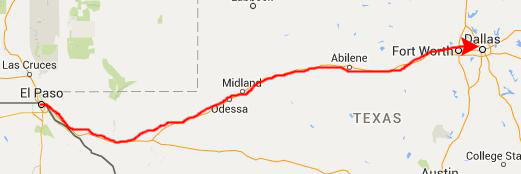 |
We drove all day from El Paso to Dallas, branching north on I-20 were it splits off from I-10. We arrived back home about 11:00 in the evening, after stopping for dinner at Don Pablos over near Fort Worth. As he usually does, Fred stayed the night and then headed off for work the next morning.
We packed quite a bit into this relatively short trip, and it was extremely enjoyable. I look forward to the time when we both might have more free time to take longer sojourns, so that such a large percentage of our time isn't taken up by driving.
You can use the links below to continue to another photo album page.
|
October 28, 1994: Carlsbad Caverns National Park |
|
Return to the Index for Our Western Trip |