|
July 2, 1995: Pueblo del Arroyo and the Chaco Mesa |
|
Return to the Index for Our Western Trip |
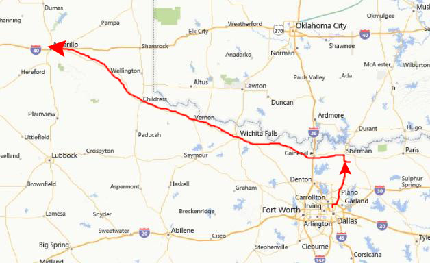
Our Western Trip is actually going to be 4 full days, with our trip from Dallas as far as Amarillo occurring on June 30th, and our trip home from Albuquerque happening on July 5th.
Getting to Chaco Canyon (June 30th and July 1st)
|
There, I had made reservations at the Holiday Inn, since the last time we came through we had a devil of a time trying to find a room. When we got to the inn, about two in the morning, the room they had held for us was a handicapped access room. I didn't think much about that, until I found that this meant no tub or shower, but rather an area of the bathroom closed off with a drain that was supposed to allow you to take a shower without flooding the whole room. It didn't quite work that way. I was a little peeved that this was the room that a guaranteed reservation held. We did get a good night's sleep, although we decided to get up fairly early for the long drive to New Mexico.
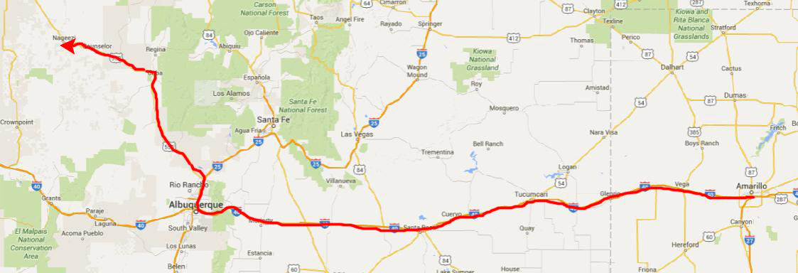
In the morning, when I checked out, I made a point of telling the desk clerk that I was upset that a guaranteed reservation only held a room like this one, and as a result, the rate for the room was cut in half. Fred got some muffins and apples out for breakfast, we gassed up the truck, and then headed west on Interstate Highway 40 towards Albuquerque.
|
|
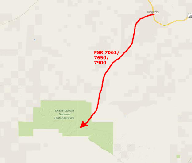
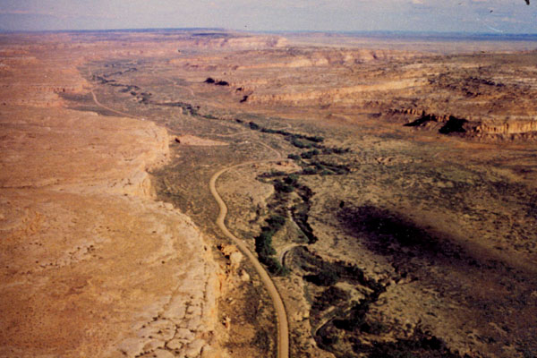
When we reached the town of Nageezi, New Mexico, we had to look for a Forest Service Road off to our left. The guide and maps were in some disagreement as to exactly what number the Forest Service Roads were supposed to be, but it was fortunate that there was a sign directing us down the correct road, and so we turned southwest. The pavement ended just a few hundred feet from the highway.
Fortunately, it had not rained for quite a while before our arrival and so, other than the roughness of the road (which was much like a washboard in most places) we made the thirty mile trip in a bit over an hour.
We got to the canyon proper about four in the afternoon, and had been worried that we wouldn't be able to find a campsite, this being a holiday weekend and all. So we went right to the visitor center, paid our park entry fee, and then went right to the camping area.
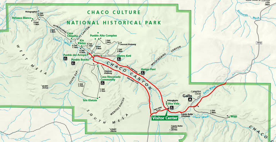
This is probably a good time to orient you to Chaco Canyon by showing you a map of what is properly termed the Chaco Culture National Historical Park.
|
As luck would have it, we found that there were quite a few campsites still available, and we were able to get a good one on the outside of the camping area, where Fred likes to be.
We decided to try setting up the tent before we went to see some of the ruins, but the wind was incredible, and every time we tried to get it set up, the wind would either blow it down or blow it away. The weather was also a bit threatening, and we were thinking that if it turned bad, we'd have to go back out to the highway to find a place to stay.
So we did what lots of campers do- we just put our cooler on the picnic table to reserve the campsite, and went off and look at some of the ruins, hoping that when we returned the wind would have died down and we could set up the tent. We didn't want to pay for the campsite ahead of time, in case we couldn't stay, so we postponed doing that. The cooler would be enough to reserve the site for the rest of the afternoon.
We went off to the visitor center to get some information on the various ruins in the canyon, and decided to take in Chetro Ketl and Pueblo Bonito this afternoon, leaving Pueblo del Arroyo and a hike up onto the mesa for tomorrow.
|
Chaco Canyon is known for its large-scale, multi-storied masonry buildings that were planned and constructed over a thousand years ago by people archaeologists refer to as "Anasazi." However, these "great houses" were not the first structures to be built at Chaco Canyon.
Long before they were begun, hunters and gatherers lived in the canyon area. They used temporary campsites as they moved to seasonal food source areas. With the exception of stone tools, the bones of game animals, and head-cracked rock from their fires, very little remains at these Paleo-Indian and Archaic sites.
By 1000 B.C., these people were cultivating varieties of beans, corn and squash which were used along with wild plant foods. This transition brought an increase in the size of the population as people adopted these more dependable food sources. A growing population and increased agricultural production led to a more sedentary way of life in small villages.
At that time, the people lived in circular subterranean pithouses with above-ground storage rooms, often clustered in small villages. People continued to live in this way for several centuries, but by A.D. 700, a transition to the above-ground, multi-story buildings occurred.
|
(Mouseover Image if Video Controls Not Visible) |
We will learn more about the "Sun Dagger" petroglyph tomorrow, but before we begin visiting the ruins here at Chaco Canyon, I'd like you to watch a short clip from Carl Sagan's "Cosmos" series, first shown in the 1970s. In the clip, he is talking about the knowledge of astronomy developed by many ancient peoples, but I would like you to watch it because he filmed the segment here in Chaco Canyon- primarily at a location known as Casa Rinconada, another site here that we will see tomorrow. Use the movie player at right to watch this clip.
The Chaco region was unique because the structures being built were immense, some covering up to three acres. Roomblocks were more extensive and multi-storied. A distinctive core-and-veneer masonry was developed that added to the immensity and stability of the structures, and roadways, stairways, and ramps were connecting sites together within the canyon and beyond it. The public or communal structures that were built in Chaco from about A.D. 850 through 1100 are referred to as great houses. They are easily identified from other prehistoric architecture by the excellent masonry, massive scale, pre-planned design, and geometry they exhibit.
Nearly half of the precipitation in Chaco occurs in the summer months and comes in the form of intense and sudden showers. These heavy summer rains produce a flash runoff of water from the slick rock areas of the canyon walls. The runoff is particularly abundant in the small side canyons along the north side of the canyon. The Chacoans took advantage of these brief floods by capturing the runoff in a system of stone-lined irrigation ditches that channeled it to their fields on the canyon floor.
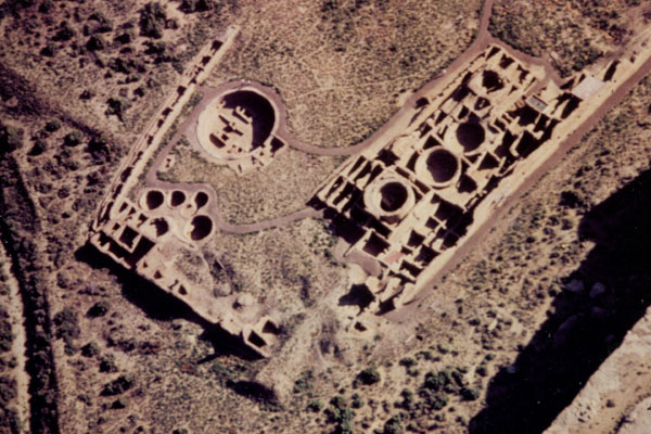
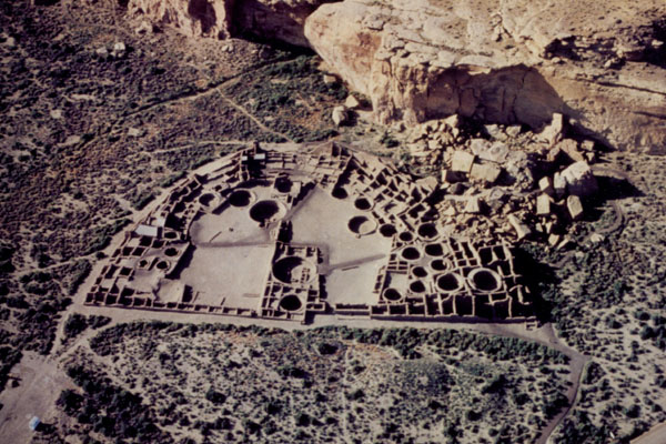
As we look at the various ruins today and tomorrow, I am going to include here some pictures that I did not take- aerial views of the major sites that we visited. At the visitor, I bought a set of these aerial views, and I have scanned some of them for inclusion here.
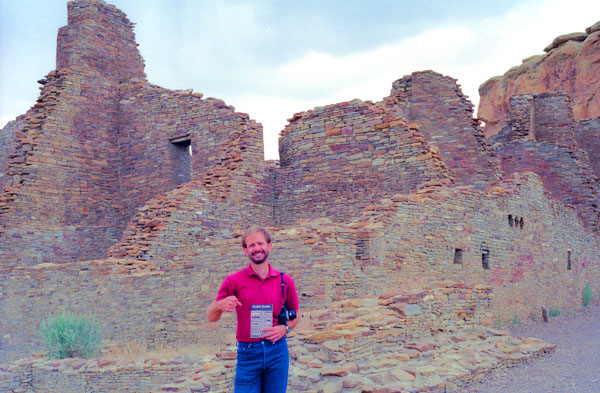
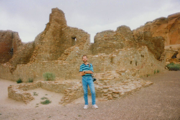
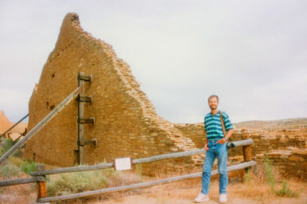
Chetro Ketl
|
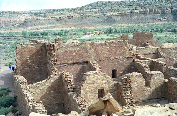
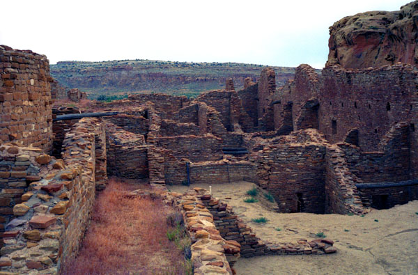
Along the top portion of the walls of this kiva, and of the plaza walls above them in the picture, a protective capping of modern masonry is evident by the lighter colored stones. Because the prehistoric masonry is extremely fragile, a course of capping stones has been added to all of the exposed walls in the canyon ruins. The unexcavated section of the ruin in the top center forms the west wing of Chetro Ketl. The overall ground plan is a D-shape, with the front wall of the plaza forming the arc of the D. There are between 200 and 225 ground-floor rooms, and an estimated 500 rooms for all stories.
The site covers almost three acres, with nearly half of that area taken up by the enclosed plaza. The plaza of Chetro Ketl is unique in that it was intentionally elevated above its natural level by the original builders.
The great house was rediscovered in 1823 by the Mexican governor of New Mexico, Jos� Antonio Vizcarra, and in 1849 Lieutenant James Simpson of the United States Army Corps of Engineers documented the major ruins in Chaco Canyon. Edgar L. Hewett, the director of the first archeological field school in the canyon, conducted excavations of Chetro Ketl during 1920 and 1921, and again between 1929 and 1935.
Chaco scholars estimate that it required more than 500,000 man-hours, 26,000 trees, and 50 million sandstone blocks to erect Chetro Ketl. The east wall of the D-shaped structure is 280 feet long, and the north wall is more than 450 feet. The perimeter of the structure exceeds 1500 feet, and the diameter of the great kiva is 62 ft. Chetro Ketl contained approximately 400 rooms and was the largest great house by area in Chaco Canyon. Chetro Ketl is a half-mile from Pueblo Bonito, and is in an area that archeologists call "downtown Chaco". They theorize that the area may be an ancestral sacred zone. Chetro Ketl contains architectural elements, such as a colonnade and tower kiva, that appear to reflect a Mesoamerican influence.
|
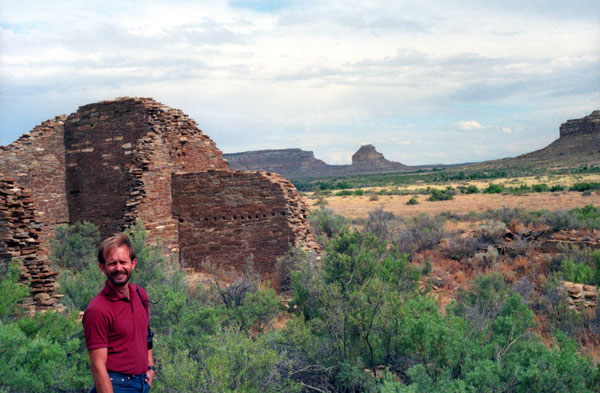
Chetro Ketl is a Chacoan great house, and as with most of the other great houses in the canyon, original construction was modest. Beginning with a single-story roomblock around A.D. 1010, it became a monumental structure that covered almost three acres by the early 1100s.
The trail through Chetro Ketl is six-tenths of a mile long. The origin and meaning of the name "Chetro Ketl" are not known. There are at least two Navajo names for this ruin, "tsebida't'ini'ani," or "covered hole," referring to the sealed concavities that were fund in the cliff behind the pueblo; and "nastl'a'kin," or "house in the corner," referring to the location of the ruin near a small rincon (box canyon). William Henry Jackson, a photographer and explorer who came through Chaco in 1877, translated Chetro Ketl as "Rain Pueblo," but did not identify his source.
Chetro Ketl's purpose is widely debated but many archeologists believe the building was a place of large-scale ceremony that held an important position within the larger Chacoan system. It may have been occupied primarily by groups of priests and, during times of ritual, pilgrims from outlying communities. Archeologist Stephen H. Lekson believes Chetro Ketl was a palace inhabited by Chacoan royalty, and the scale of its construction was motivated by what architects call "massing": building imposing structures with the intent to impress onlookers. The building has deteriorated significantly since its rediscovery in the early 19th century, and its usefulness as a source of information about Chacoan culture is slowly diminishing.
|
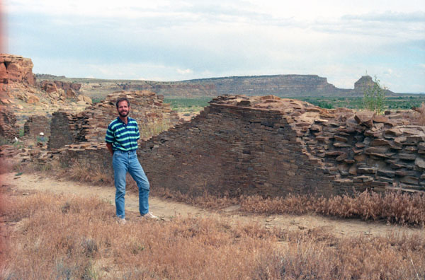
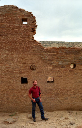
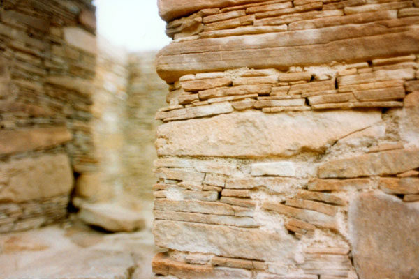
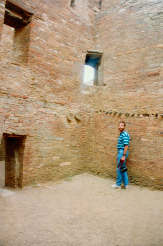
Looking at the cross section of broken wall behind Fred, you can see how the walls were constructed. Chacoan walls are commonly referred to as core-and-veneer. The core consists of roughly-shaped stones or rubble laid flat in adobe mortar. The core was then faced with carefully selected shaped stones to make a veneer on both sides. But these were more than decorative overlays; they were structural elements.
In this section, you can also see that the lower story wall is wider than those in the upper stories. Very wide walls in the first story created a strong and stable base on which to build. The decrease in wall width in each additional story lightened the load of the upper stories on the massive base. Decreasing wall widths also demonstrated that the second and third stories were planned before the first story was built.
Some early archaeologists suggested that influences from Mexico were primarily responsible for the architectural developments in Chaco. Supporting evidence for this theory includes what remains of a colonnade at this particular ruin. The colonnade was originally built as a row of square masonry pillars that formed the plaza-facing wall of a long narrow room. When the original builders renovated the room, the spaces between the columns were filled and the long narrow room was divided into several smaller rooms. Archaeologists think that the colonnade may have been built around 1100- at least 50 years after the main portion of Chetro Ketl was designed and built. If the colonnade itself was inspired through contact with Mexico, it was long after the original design and construction of this great house had been completed.
|
The two parallel walls were finished on all four faces and a well-plastered floor was laid between them. The plastered floor and a wall vent suggest the structure was roofed. No evidence of cross walls were found in the section that was excavated. When it was first constructed, the walls were probably free-standing, but as the plaza filled with soil and rubble from construction, the moat became a retaining wall.
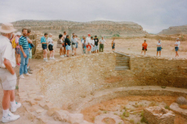
On the way to this spot, we passed a number of excavated kivas, like the ones we have seen at other locations throughout the Southwest. The last time we were in this area, at Bandolier National Monument, there were a number of good pictures of the kind of structure the kiva is.
Kivas, great and small, are found in ruins throughout the Southwest; it was a classic element of great house construction, with a set of highly formalized features. Among these would be an entryway and antechamber on the plaza level, a low masonry bench encircling the base of the room, a raised masonry fire box and deflector, four seating pits (for roof supports), and raised floor vaults between the seating pits. Located in the four quadrants of the circle, the seating pits are circular well-like depressions in the kiva floor. These pits were elaborately constructed and formed the foundation for the large upright roof beams; they were highly ceremonial. When the pit in one kiva was excavated, four sandstone discs were found beneath the floor- each separated from the next by a layer of adobe. Beneath the fourth one, two alternating layers of lignite and adobe were found, and below all of that, exactly in the center, was a sueded leather bag containing powdered turquoise.
Kivas were built, razed, remodeled, and replaced over time, and in one area of Chetro Ketl- the "Kiva G Complex"- the remodeling created a maze of curved and straight walls. This maze provides an excellent illustration of reuse and renovation of a site through time. Some of the rooms that were created were dead space; while others provided a form of structural buttressing.
Some kivas were elevated, and built into above-ground rectangular rooms. Most elevated kivas were single-story structures, but some, referred to as "tower kivas", were multi-storied. The numerous stones projecting from the exterior walls of these elevated kivas may have been used as steps or scaffolding during construction, or they might have tied the kiva wall into the "fill" between the kiva and the walls of the encolsing room (thus providing additional support).
|
In cross-section, the construction details of a floor consist of the vigas, then the willow rods laid perpendicularly on top of them, followed by sequential layers of juniper bark and mud plaster. You can see one of the original logs still in its position just above Fred's head. In the construction and maintenance of Chetro Ketl, and estimated 26,000 trees from forests dozens of miles away were used. Before being used, they were carefully trimmed and peeled, and the ends were cut flush and sanded with stone tools. Several thousand of the vigas used in great house construction have been dated by the science of tree-ring dating (dendrochronology).
Early accounts of Chetro Ketl mention balconies along the second and third story of the back wall. Although the third story sections of the wall have collapsed, evidence of the lower floor balcony can still be seen. Looking up along the second story floor level, there is a narrow ledge or groove extending along the length of the wall. This groove seated the closing material (upper layer) of the balcony floor. Beneath the groove there are sockets from which the primary beams (vigas) would have extended. Above the groove are doorways that would have led out to the balcony. According to historical chronicles, at least portions of the balconies were still intact in 1901. Within two decades, they were gone because the wood from which they were built had been scavenged for campfires and other purposes.
Looking at the long and elegant back wall of Chetro Ketl, we can well imagine how it may have looked when it was occupied. The archaeological record and historical chronicles provide us with a great deal of information about the architecture. We know the back wall was at least three stories high, with balconies extending from the upper stories; we know there were multi-storied structures along the canyon wall that would have extended towards Chetro Ketl creating a small architectural complex behind it; we know the plaza was artificially elevated and enclosed by a moat; and we know there was a small pouch of turquoise placed far beneath the floor of the northeast seating pit in the great kiva. We even know that it took an estimated 50 million pieces of sandstone to build this great house.
Tomorrow, we will be climbing the mesa behind these ruins to get the view from up there, but as we walked along the long back wall of Chetro Ketl and looked over at the canyon wall, we could see distinct circular depressions of various sizes carved into it. These were beam supports for the roofs and floors of the smaller structures that were built here. The canyon wall served as a back wall for numerous structures and along with Chetro Ketl, these structures would have created an architectural complex.
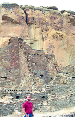 Fred and Some Chetro Ketl Rooms |
(Picture at left) You can see even more clearly here the nature of room construction in these multi-storied great houses. Some of the original beams are still sticking out from their anchors in the walls, although for the most part only the holes once occupied by these beams are still visible.
(Picture at right)
|
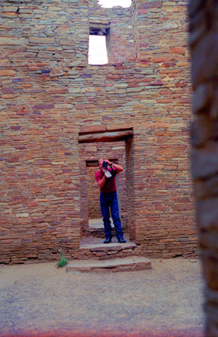 Fred Inside Chetro Ketl |
There is a separate portion to this ruin, called the Talus Unit, named after its location at the foot of the talus slope at the base of the canyon wall. The site consists of two distinct blocks. The western block contained 30 to 35 ground-floor rooms. It was multi-storied, and the plaza includes a large kiva. The later eastern block included eight ground floor rooms and two kivas. The east and west blocks were joined by two rooms.
|
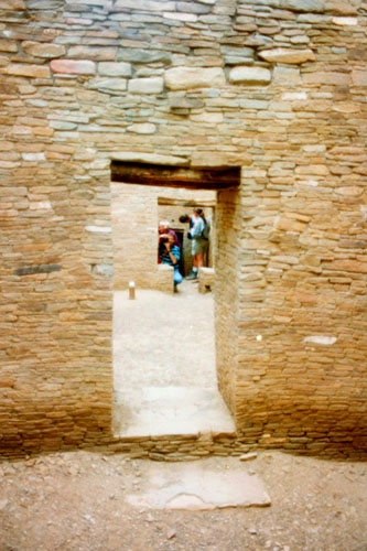
The visitor trail through this ruin led around to the left in the picture at left, and then up through a series of rooms to this vantage point where I could see much of this end of the ruin. You can see very plainly in this view how the upper stories of the great house were constructed. Across the wall in the middle of the picture you can see the remnants of the flooring material for the third story (the roof of the first story is seen in the lower right). You can see the holes that held the secondary beams that held up this story, and you get an idea of how the thickness of the walls decreased as the wall grew taller.
We know a great deal about the architecture in Chaco, but there is much more that we don't know, and may never know, because the archaeological record and historical accounts cannot furnish that knowledge. The celebrations, rituals and ceremonies, and socio-political make-up of this ancient culture cannot be determined by gathering data. This knowledge lies with the ancient people of the canyon, and will always be a magnificent mystery to us, luring us back to the canyon time and again.
Pueblo Bonito
|
Traces of Mexican cacao from at least 1,200 miles away have been found at Pueblo Bonito, and cylindrical pottery jars, common in Central America, have also been found there- 111 in Pueblo Bonito's 800 or so rooms. According to the National Park Service, "Pueblo Bonito is the most thoroughly investigated and celebrated cultural site in Chaco Canyon. Planned and constructed in stages between AD 850 to AD 1150 by ancestral Puebloan peoples, this was the center of the Chacoan world." According to the anthropologist Brian Fagan, "Pueblo Bonito is an archeological icon, as famous as England's Stonehenge, Mexico's Teotihuacan, or Peru's Machu Picchu."
Carravahal, a guide from San Juan Pueblo, provided Lt. James Simpson with the name during a military expedition that came through Chaco in 1849. Following the expedition, Simpson published the first detailed description of the ruins in Chaco Canyon. Anasazi, a Navajo word which translates as "Ancient Ones" or "Ancient Enemies," is the term archeologists use to refer to the culture that began about 2,500 years ago and was centered in the Four Corners region. The Anasazi Indians were the builders of the large pueblos that were constructed in Chaco Canyon from approximately A.D. 850 through 1150.
|
This is the oldest section of Pueblo Bonito, dating from about A.D. 850 to the late 900s. This early construction consisted of about one hundred ground-floor and upper-story rooms, including some sections that were three stories high. Three to five kivas were built in front of the multi-storied, crescent-shaped block of rooms, completing this stage of construction. As with most great houses, this early section was incorporated into the bulk of the structure during subsequent stages of construction. Several different masonry styles are represented in these walls including the earliest type that was used in great house construction. Identified as Type I, it is distinguished by thin rectangular-shaped pieces of sandstone laid in mud mortar. Type I walls required more maintenance than later types because the mud mortar joints were larger. When exposed to the elements, it would have been necessary to regularly repair mortar damage to maintain the wall.
The open area of Pueblo Bonito is well defined by multi-storied roomblocks to the north, east, and west, and by a single-story row of rooms to the south. It is referred to as the plaza, which is a term borrowed from later pueblo architecture used for a similar feature. Along the front of the roomblocks, large firepits were dug, and several kivas were constructed in the plaza. The archeological record provides few clues to the specific use of the plaza area, but based upon modern day use, a great deal of activity took place here. Today, plazas provide a place for people in the community to gather for informal activities as well as ceremonial events.
|
At the extreme right in the picture at left you can see some of the enormous blocks of sandstone that remain from Threatening Rock. There was a large mound close to the cliff that concealed another great house, and in the mounds between Pueblo Bonito and Chetro Ketl, there may be portions of a masonry wall that would have connected these two structures during their occupation.
The plaza of Pueblo Bonito is divided into eastern and western halves by a central dividing wall that is aligned with true north. There was only one entryway into the plaza, which is located in the southeast corner of the western half of the plaza. (The present opening in the eastern section resulted when a room collapsed.) When the original entrance was first constructed, it was over seven feet wide. During a later construction phase it was remodeled and reduced to a door less than three feet wide, and even this small door was subsequently blocked. One of the original excavators interpreted this as a defensive measure, suggesting there was a pressing need for this deliberate and progressive closing in of the pueblo.
The east and west wings of Pueblo Bonito were constructed between 1075 and 1115. This was the most extensive building phase in the canyon and one of the last. There are several methods for dating and identifying building phases including the science of tree-ring dating known as "dendrochronology," and the analysis of masonry styles and ground plans. The way walls meet or abut is another method for identifying construction sequences. Abutted walls do not interconnect at corners but instead are flush with each other. Walls that abut one another were constructed at different times, while walls with stones that interconnect at the corners were typically built at the same time.
|
Before wall building began, the layout of the structure was determined by constructing foundations. If additions to the original plan were made during construction, foundations were added, while deletions from the plan left unused foundations. Beneath the floors of Pueblo Bonito and extending to the east, a maze of unused wall foundations have been located during excavations. They consist of trenches that are about eighteen inches wide and deep, filled with stone rubble set in clay mortar. Foundations would have prevented uneven settling of the walls and added durability.
As we walked through the rooms, we could see the remains of the original vigas (roof beams) and latillas (secondary flooring supports) in the well preserved ceilings. The upper-story floors and exterior roofs of great houses consisted of large vigas, latillas, split shakes, and layers of mortar and sand known as "closing material." In 1991, cores and samples were taken from these beams for tree-ring dating. Sampled areas are visible as freshly sawed sites and circular depressions in the vigas and latillas. When these beams were sampled, the latest cutting dates were around A.D. 1082, indicating roof construction sometime after that date.
|
Chacoan walls are referred to as "core and veneer" masonry, and are a hallmark of great house construction. You are looking here at the facing stones of the wall (the veneer). The core consists of roughly shaped pieces of sandstone laid in mud mortar, which is faced with carefully selected shaped stones to create the veneer.
There were several types of veneers used in great house construction, and they changed over time. Today these pattern variations in veneer provide archeologists with a tool for dating site construction. After the walls were built and roofed, a plaster coating was applied over most of the walls that concealed this fine stonework. This helped protect the mud mortar from rain. It also decreased maintenance because it is easier to reapply mud plaster than to repair the mortar joints of the walls.
Richard Wetherill, who was a rancher and an archeologist, and George Pepper, from the American Museum of Natural History, were the first to excavate at Pueblo Bonito. After they completed their excavations in 1899, Wetherill remained in the canyon, homesteading and operating a trading post until his death in 1910. Wetherill and Pepper began their excavations in Pueblo Bonito in 1896, and by the time they were finished, they had excavated 190 rooms. They located, photographed, and mapped all of the major structures in the canyon. In addition, they recorded Anasazi irrigation systems, stairways, roads and water catchment areas, and sponsored other researchers including a physical anthropologist and a geologist. Overall, they contributed immensely to the early archeology of Chaco Canyon.
|
This broken cross section of wall displays its massiveness and how well it was designed. The height of the first story determined the width of the wall. Wall width decreased with each additional story, lightening the load on the massive base. This type of wall construction ensured strong and stable walls at heights of four or five stories. Decreasing wall widths also demonstrate advance planning on the part of the builders. Second and third stories were planned before the first story was built.
Great houses were built more substantially than other Anasazi structures in the San Juan Basin, but it is not certain for what purpose. Substantial walls were necessary for multi-storied design, but the overall massiveness of the structures may have served other functions. Pueblo Bonito, along with the other great houses found here, may have been used primarily for religious or political functions, rather than serving individual family needs. The massive scale and attention to detail in construction also reduced building maintenance, which would have been particularly important if the resident population was small or seasonal. Whatever the reason, substantial portions of the great houses in the canyon are still intact eight hundred years later because they were so well constructed.
It is possible that Pueblo Bonito was actually neither a village nor city. While its size has the capacity for a significant population, the environment may not have been ideal for so many; excavations at the site have not revealed significant trash middens or other indicators of a sizeable population. A common suggestion is that Pueblo Bonito was a ritual center. This is not only evident in the existence of the kivas (which are more often than not attributed to ritual function) but also in the construction of the site and its relation to other Chaco Canyon sites. Although there were many occupants, only 50-60 burials were found here.
|
Kivas are characteristic of great house construction and include a set of highly standardized architectural features, including a low masonry bench around the base of the room, raised floor vaults, a raised firebox and deflector, pits for seating four wooden posts or masonry pillars used to support the roof, and an antechamber and entryway at the plaza level of the subterranean structure.
The size, standardization in construction, and investment of labor exhibited in great kivas indicates they may have served a highly specialized public function that met community-wide needs. In the plaza of Pueblo Bonito, there were at least three great kivas. An additional feature that is frequently found in Chacoan great kivas is a set of wall crypts or niches. Wall niches may have functioned as depositories for offerings and ceremonial paraphernalia, or possibly served as open shelves for the display of ceremonial objects. Supporting evidence for these interpretations is the recovery of beads, pendants, and ornaments from the niches in one of the great kivas at Chetro Ketl. When these niches at Pueblo Bonito were exposed during the excavation of this great kiva, they were empty.
The tour through Pueblo Bonito was immensely interesting- better than the one at Chetro Ketl.
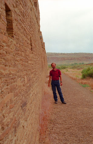 Standing by the Back Wall of Pueblo Bonito |
(Picture at left) This back wall was built during the second construction phase at Pueblo Bonito; the earlier rooms did not have exterior doorways, so access to the new arc of rooms was not possible. There were interior doorways between all the new rooms and several doorways in the new exterior back wall. Many of these rooms had platforms across the short axis of the room, midway between the floor and ceiling, about four feet wide. Given the limited access to these rooms, some have thought them to be sleeping platforms, although there is no conclusive evidence regarding their use.
(Picture at right)
|
 Observing one of the Lesser Kivas at Pueblo Bonito |
Our tour also took us inside the complex, and we got to see the structure and arrangement of the interior rooms. I thought the construction was surprisingly modern-looking.
|
In this room, there are remnants of original plaster as well as primary and secondary roofing beams known in Spanish as "vigas" or "latillas." Vigas are the primary beams and carry the weight of the roof. Latillas are secondary supports and were laid perpendicular to the primary beams. Split shakes of juniper wood, bark, and matting were then laid over the secondaries. A layer of clay mortar or packed adobe was applied over this, and the surface was completed with a final layer of sand.
The size of this room is characteristic of the rooms built in Chacoan great houses between A.D. 900 and 1150, with large floor areas and very high ceilings. The present surface is elevated above the actual floor level due to the protective fill.
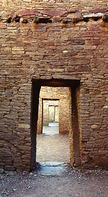
Some rooms have doorways that were later filled with masonry. These can be seen throughout the great houses in the canyon and are usually the result of architectural modifications completed by the Anasazi builders. Closing rooms off could have been done to conserve heat, or it may have indicated a change in the use of the room, such as from domestic use to storage.
Although most doors from room to room are in the center of a wall, there are some corner doorways. This is an unusual type of door opening used in great house construction. Only seven are known in Pueblo Bonito, and all of them were built during later construction sequences in the eastern part of the pueblo. One particular doorway appears to function as an astronomical marker. When the sun rises on the morning of the winter solstice, rays of sunlight pass through this opening and strike the opposite corner of the room behind it. Throughout the canyon, there are other architectural features, as well as modified land forms, that correspond with astronomical events. This knowledge of astronomy seems to have been an integral part of the construction plan at Chaco.
|
|
The function or use of a room is often difficult to determine in prehistoric buildings. One of the ways archeologists try to determine room function is through architectural features found at the time of excavation. These may include sandstone slabs used to grind corn or grains, mealing bins, or firepits. Another is through examining the artifacts that are recovered, and studying their placement upon excavation.
The large rooms in this section of the pueblo would have been inadequate as domestic dwellings. Because of their size, they would've been difficult to heat, an they would have been dark because they are interior rooms. When these rooms were excavated, most of them lacked domestic features. The lack of room features, such as mealing bins or hearths, and the lack of artifacts suggest they may have functioned as storage rooms.
The earthen mounds that we passed as we left Pueblo Bonito were originally identified as trash deposits, known as "middens." Although they contain trash, they also include sand and construction debris. These rectangular mounds are enclosed by masonry walls raised about ten feet above the surrounding ground level. The tops of the mounds were leveled, and they wee accessible via stairs. This combination of features strongly suggests the mounds are planned architectural features. Some archeologists believe these earthen mounds tie in with the series of Anasazi roads and are part of the great house landscaping. Similar mounds are found in association with roads and formalized entrances to other great houses, such as Pueblo Alto, Penasco Blanco, and Kin Ya'a.
After taking the Pueblo Bonito tour, we returned to the campground to see if we could set up the tent. Fortunately, the wind had died down, and we were able to set up the tent with no particular problem. After doing that, Fred cooked dinner- stew, chips, and cobbler for dessert. After we cleaned up from dinner, we went down to the end of the campground for the ranger talk. The topic was the history of the Chaco Canyon area.
Back at the campsite, I went to get something from the truck and then, in the dark, started to walk to the picnic table. I forgot that there was a large boulder between the two. I went sprawling, and for about two weeks after couldn't run or jog as both my knees hurt.
You can use the links below to continue to another photo album page.
|
July 2, 1995: Pueblo del Arroyo and the Chaco Mesa |
|
Return to the Index for Our Western Trip |