|
July 3, 1995: Riding the Durango-Silverton Excursion Train |
|
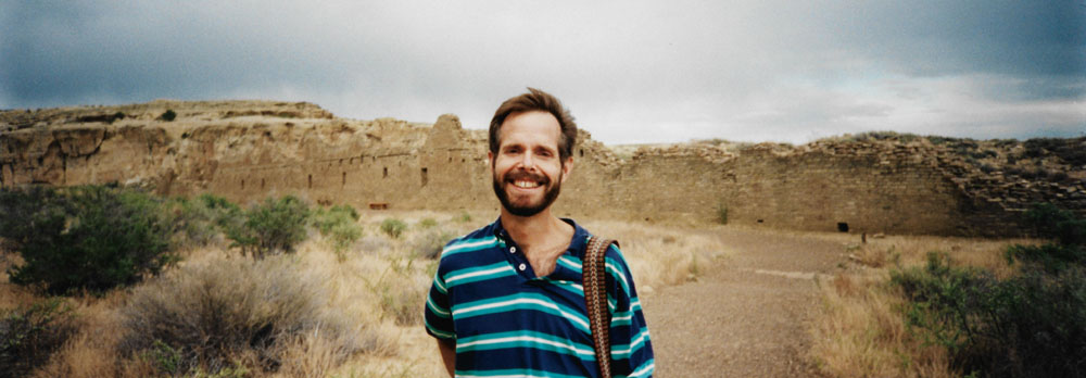
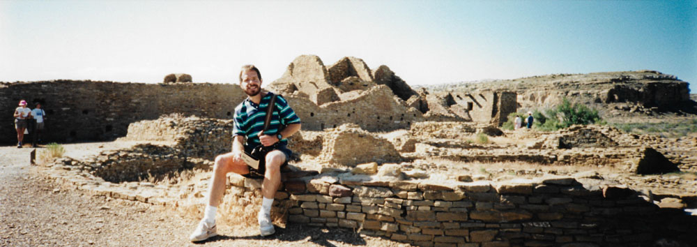
June 30 - July 1, 1995: Chaco Canyon: Chetrol Ketl and Pueblo Bonito |
|
Return to the Index for Our Western Trip |
The second day of our western trip will be spent mostly here in Chaco Canyon, where we tour through Pueblo del Arroyo and then take a hike up out of Chaco Canyon and out to Pueblo Alto. When we leave here, we will drive to Durango, Colorado to stay for the night.
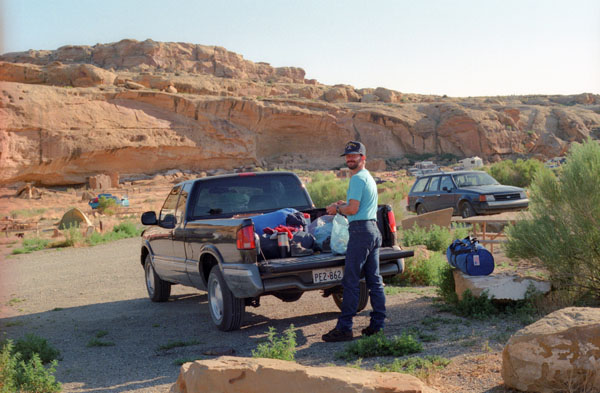
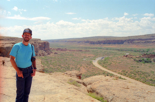
Our Chaco Canyon Campsite
|
The previous afternoon had been threatening weather, but this morning dawned bright and clear, and we were looking forward to the day's hikes.
The campsite we ended up with was a good one, on the outside of the campground circle where things are quieter.
Chaco Canyon is famous not only for the ancestral great houses that are located here, or for the heritage of the Anasazi Peoples and the mystery surrounding their sudden departure, but also for the mythology surrounding their apparent knowledge of the motion of the earth, the sun and the stars. The entire Chaco site is an amazing display of alignments, and it appears that the Anasazi were as sophisticated in their knowledge of celestial mechanics as were any ancient people. For example, at least twelve of the fourteen principal Chacoan complexes were sited and aligned in coordination, and that each was oriented along axes that mirrored the passing of the Sun and Moon at visually pivotal times. For example, at Casa Rinconada, the twinned "T"-shaped portals of its great kiva were north-south collinear, and axes joining opposing windows passed within 4 inches of its center.
|
Two shared-latitude but diametrically opposed complexes located some 15 mi from the core buildings of the central canyon, Pueblo Pintado and Kin Bineola, each lie on a path from the central canyon that is collinear with the passage and setting of the full mid-winter "minimum moon", which recurs every 18.6 years. Two other complexes less distant from Pueblo Bonito, Una Vida and Pe˝asco Blanco, share an axis collinear with the passage of the full "maximum moon".
But one of the most amazing sites at Chaco is Fajada Butte. Here, there is an astronomical clock so famous that it has been featured on numerous television shows dealing with the subject.
Near the top of the butte (access to which is not allowed save by special permit), two whorl-shaped etchings compose what is called the "Sun Dagger" petroglyph, itself tucked behind the eponymous rock panels of the "Three-Slab Site". They are symbolically focal.
|
(Mouseover Image if Video Controls Not Visible) |
The Sun Dagger petroglyph consists of two spirals: one principal and one ancillary. The latter left-hand spiral captured both spring and fall equinoxes; its artifice was revealed by a descending spear of light, itself filtered through the slabs, that shined upon it and split it in two. The former and larger whorl to its right was lit by the titular "sun dagger", which bisected it through another interplay of slab and sun. It struck it, brilliantly, as the summer sun attains its solstice midday peak. The Chacoans were said to be marking, as artist, "Sun Dagger" discoverer, and leading proponent Anna Sofaer puts it, "the middle of time".
Each turn of the 9.25-turn large spiral was found to mark one year in the 18.6-year "lunar excursion cycle" of the rising mid-winter full moon. This record is kept by a slab-cast lunar shadow whose edge strikes in succession each ring. As the full "minimum moon" closest to the winter solstice rises, the shadow's edge precisely strikes the center of the larger spiral; it steps outward year by year, ring by ring, until it strikes the outermost edge of it during the full "maximum moon", again in mid-winter.
Fajada Butte bears five other petroglyphsŚ including a carving of a "rattlesnake", other spirals, and a rectangleŚ that are conspicuously lit by contrasts between sunbeams and shadows during equinoxes or solstices. Public access to the butte was curtailed when, in 1989, erosion from modern foot traffic was found to be responsible for one of the three screening slabs at the "Sun Dagger" site shifting out of its ancient position; the assemblage of stones has thus lost some of its former spatial and temporal precision as a solar and lunar calendar. In 1990 the screens were stabilized and placed under observation, but the wayward slab was not moved back into its original orientation. We could not access the Butte, but you can see what some of these petroglyphs look like here.
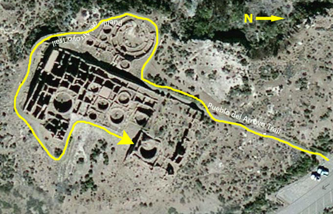
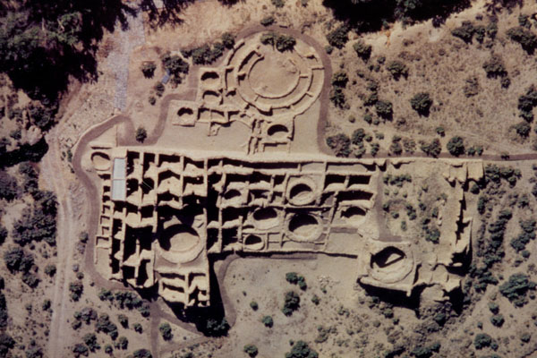
Pueblo del Arroyo
|
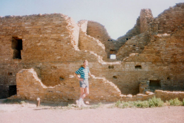
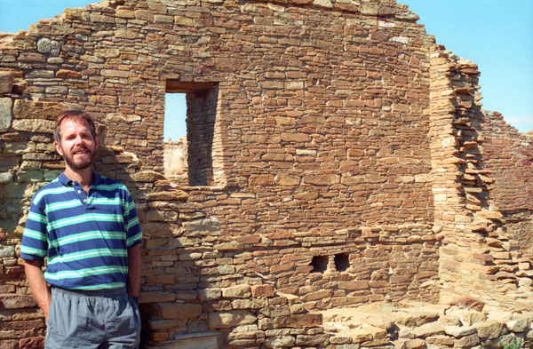
The construction of Pueblo del Arroyo, located a few hundred yeards from Pueblo Bonito near Chaco Wash, began around AD 1060 and continued continued for approximately thirty years. With three hundred rooms, it is the fourth largest great house in Chaco Canyon. Whereas the other great houses in the canyon are located near the north wall and face south, Pueblo del Arroyo was built in the middle of the canyon facing east. The structure is located opposite South Gap.
American archaeologist Neil Judd excavated Pueblo del Arroyo from 1923 to 1926, uncovering approximately half the structure. In his opinion, it was built by a group from Pueblo Bonito who moved there due to overcrowding. There are fourteen kivas at Pueblo del Arroyo, but no great kiva has been found at the site.
Pueblo del Arroyo is a Spanish name that means "Town of the Gully." The Navajo name for this structure translates as "home Beside Water's Edge."
|
The large-scale, multi-storied masonry pueblos that are found in Chaco were not the first structures to be built in the canyon. The beginning of human occupation in the Chaco Canyon area began around 8,000 years ago. At that time, people lived in temporary campsites that they moved to seasonal food producing areas. These sites are identified by the characteristic artifacts found at them including stone tools, the bones of game animals, and heat-cracked rock from fires.
People secured better control over their food supply when domesticated crops were introduced around 1000 B.C. and by A.D. 400, corn, beans, and squash were staples of the prehistoric diet. Increase in agricultural production allowed the population to grow and led to a more settled way of life in small villages. At that time, dwellings consisted of circular subterranean pithouses with above-ground storage pits often clustered in small groups. People continued to live in this way for several centuries, but by A.D. 1000 another transition occurred.
Pithouse villages were replaced with small stone masonry pueblos built on the ground surface. Circular subterranean chambers, the kivas, evolved in place of pithouses. These basic developments occurred throughout the Colorado Plateau.
An immense quantity of stone was required for the construction of a Chacoan great house. Stone was quarried from the sandstone cliffs that form the canyon, and two general types were used. The first, a hard gray-brown, thinly bedded sandstone is found along the upper level of the canyon cliff. The second, a softer, tan colored sandstone forms the lower walls of the canyon. The prehistoric builders appear to have preferred the larder, tabular stone. It was used more frequently, particularly in the earlier styles of masonry construction, (from about A.D. 900 to 1100). The blockier, tan colored sandstone was used in construction after 1100. This use of two types of sandstone during different eras provides archaeologist with a tool for identifying and dating construction.
|
Archaeologists are unsure how this tri-wall structure was used. However, the formal design, mass, size, and placement of this building indicate it had ritual significance. Among the multi-walled structures that have been excavated, most have enclosed kivas. When the central room of this tri-wall was excavated in 1926, researchers did not find any features typical of kivas such as wall niches or a fire hearth, but they did discover that the floor was partially paved with sandstone slabs.
Three bird skeletons, identified as macaws and native to Mexico and areas further south, were excavated from one long room at Pueblo del Arroyo. Macaws were highly prized for their feathers, which may have been used in ceremonial costuming or for other ritual purposes. This and other discoveries have led archaeologists have looked for parallels between the architectural forms of the Anasazi and the ancestral cultures of Mexico and Meso-America but have not found them. However, we do know that the Chacoans traded for objects from these cultures. Aside from macaws, they traded for items made of shell and copper, such as trumpets and bells. CloisonnÚ decorated sandstone, pottery stamps, and turquoise mosaics have also been found here; ideas and objects which originated in areas far to the south.
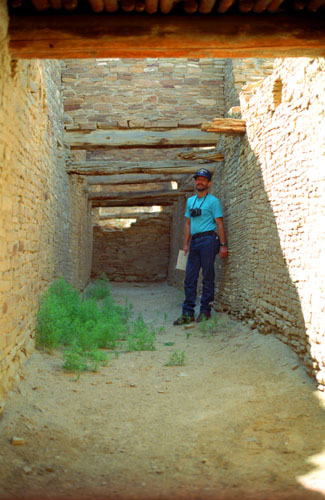
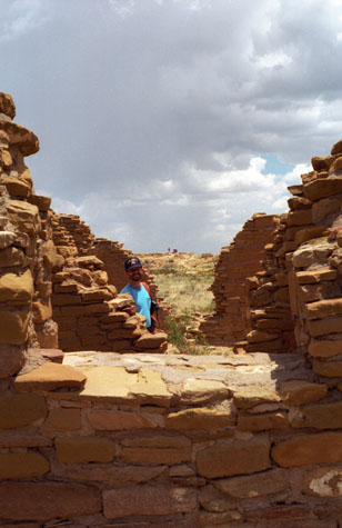
Here at Pueblo del Arroyo, we had an opportunity to look inside some of the exterior rooms, and also to descend some stairs into one long rectangular room where there was a lot of information about how these rooms were constructed.
|
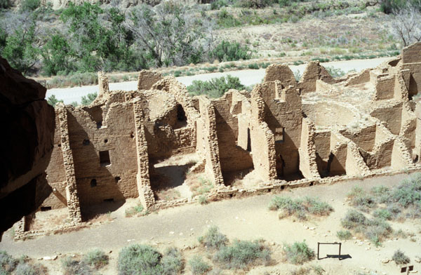
One wonders how the lower level rooms were reached during prehistoric times. Ladders, carved from logs, connected upper and lower story rooms, and also provided access to lower rooftops. Since the time the Chacoans left the canyon, these ladders have disappeared. Unaware of the consequences, archaeologist and explorers who came through Chaco at the turn of the century used ladders and other building timbers for firewood. The few that remain are preserved in museums.
Most of the other perishable materials that were used in construction have also disappeared, although remnants remain. As we looked down into these lower story rooms, we could see portions of the original roof or upper story floor. Roof construction began with a layer of peeled ponderosa pine or fir beams ("vigas"). The second layer consisted of lighter, peeled poles ("latillas") followed by a layer of brush or twigs archaeologists call "closing material." A layer of clay mortar or packed adobe was laid next, and this top layer was smoothed to create the finished surface.
Inside these ground floor rooms are remnants of original plaster approximately one thousand years old. Examining the small beams across the top of the door (door lintels), you can see small plugs where core samples have been removed. The cores are sent to the Laboratory of Tree Ring Research at the University of Arizona where they are dated and the wood species are identified. At one room on our tour, we were directed to look very carefully at one of the door lintels; there, we saw a core labeled "6195." Sophisticated testing and technology has allowed archaeologists to pinpoint the date the Douglas fir used for that lintel was cut to A.D. 1103, so it is highly probable that the room was built after that date.
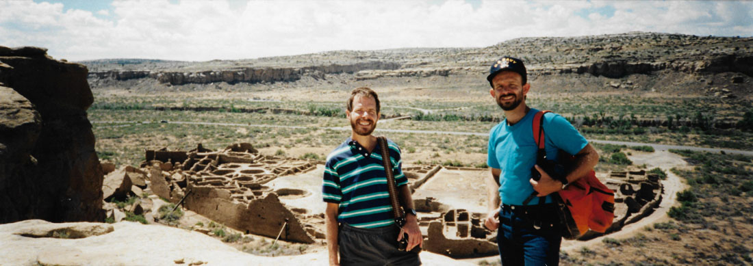
Fred took a couple of panoramic shots while we were here at Pueblo del Arroyo. The first shows me on the path that led around the back of the pueblo:
 |
As we followed the path around the west side of Pueblo del Arroyo, we circled around what appeared to be a kiva, but the sign indicated that archaeologists think that the area was actually just a circular arrangement of one-story rooms- actually a fairly odd arrangement for a Chacoan great house. One reason that experts have concluded that this is not a kiva is that there are no remants of a kiva's roof. Kiva roofs were complicated affairs, with interior benches supporting masonry boxes, on top of which were laid logs from box to box. Additional tiers of logs made circles of ever-decreasing size until the desired height was reached, creating a dome-shaped ceiling. None of the wood needed remains, although it is possible that early explorers used it for other purposes.
|
According to tree-ring studies (dendrochronology), and studies of prehistoric pollen and plants, there has been very little change in climatic conditions here since prehistoric times. Yet there have been dramatic changes in the landscape around us. Beginning in the 1880s, sheep and cattle grazed throughout the canyon area. Grazing depleted the native plant population and favored non-native species, like Russian thistle (tumbleweed). Over-grazing also diminished overall ground cover, increasing both the intensity and amount of erosion. The wash is a product of that process. Some large round stones have been placed in the wash for erosion control, to prevent further cutting of the arroyo banks, protecting the ruin from additional damage.
The orientation of Pueblo del Arroyo differs from most other great houses because it faces east rather than south, and it is one of the few in the canyon set out in the open flood plain away from the cliffs. This unusual orientation may relate to the overall placement of buildings within the central portion of the canyon, reflecting a carefully conceived master plan. Pueblo del Arroyo is similar to other great houses in that the plaza area is well defined by multistoried blocks of rooms to the north, south, and west. The plaza-facing rooms were one-story and led up to three-story sections along the west (rear) wall, and along the back walls of the northern and southern roomblocks.
The second of Fred's panoramic shots here at Pueblo del Arroyo has me sitting on a low rock wall around the front of the pueblo:
 |
A little over half of Pueblo del Arroyo, including the tri-wall structure, was excavated under the direction of Archaeologist Neil Judd from 1923 through 1926 as part of a National Geographic Society expedition. Gordon Vivian and Leland Abel of the National Park Service Stabilization Unit re-excavated and stabilized the tri-wall in 1950, and Vivian also partially excavated and stabilized a kiva in the north wing.
|
Wall cross-sections also show the amount of mortar it took to build these structures. Mixing this mortar required a considerable quantity of water. Getting enough water for construction must have been a serious problem for the builders. During occupation, rain water was diverted by a series of irrigation systems, and stored in pots. Other probably sources of water were seeps, pools in the slick rock, and hand-dug wells in Chaco Wash. Most of the primary and secondary beams used in construction were ponderosa pine. Although there may have been small stands of pine in the wetter areas of the canyon, there were no extensive local forests. It has been estimated that it took about 300 years and over 200,000 trees to build the great houses in the canyon. This timber had to be brought in from forests as far away as 40 miles and was moved without draft animals or wheeled vehicles.
Along with the corresponding wing of rooms on the north side of the plaza, this section was built during the second construction phase at Pueblo del Arroyo, between 1095 and 1105. When completed, it was four stories high. The original exterior was which is to the right of the existing exterior wall began to tilt outward after, or during, construction. To compensate for this, the builders constructed supporting buttress walls along this long exterior wall. This is just one type of structural buttressing that was designed by the great house architects.
This was an unusually long and narrow room that originally extended for over 100 feet but was later divided into three rooms. The dividing walls of this room were built upon vigas, which is an unusual building design. This design may have been used because it provided additional support to the outward tilting wall. The large square holes were used for ventilation and allowed sunlight to enter.
|
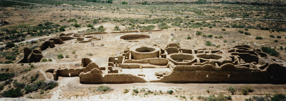
Across the top is the actual wash from which much of the mortar material for this and other great houses came. At the top center is the tri-wall section that I walked through earlier. You can see two kivas built into square enclosures, a characteristic feature of late kiva construction in Chaco. The enclosing square of masonry elevated the kiva to the second story, and created four empty triangular corners. These corner areas were sometimes filled with trash, rubble, or soil and then made flat with the roof of the kiva, or they were used for storage.
The kiva at the center right, shaped like a keyhole, is more typical of regions north of Chaco such as Mesa Verde and was added sometime after A.D. 1100. The larger kiva on the left, is more typical of the type of kivas found at Chaco.
The roomblock to the left (south) is the oldest section of the ruin, dating to about A.D. 1078. Three of these rooms were excavated and floor features were found in two. These features included firepits and a storage bin, indicating domestic use. The north wing of this ruin remains unexcavated except for the kiva, allowing for future research.
For example, before the technique of dating by means of tree-rings was developed in the 1920s, prehistoric wood was frequently tossed aside or used for fuel. Charred dirt was thrown out with the back dirt until the 1950s. After that time, carbon-14 dating was developed, and charcoal became a valuable resource for dating. In the 1960s, another breakthrough made it possible to determine the approximate date the clay liner of a firepit was first burned. Before then, many such features had been exposed to weather or destroyed.
When we were finished at Pueblo del Arroyo, we returned to the truck to consider what we might do next here in the canyon.
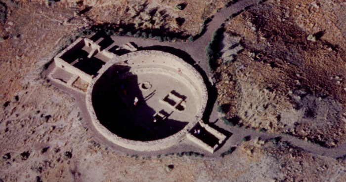
Casa Rinconada
|
Today, we tend to think of architecture in terms of practical use. Each room of a building has a specific purpose, such as a dining room or living room. Many of the rooms in these structures may not have been built to accommodate the practical needs of occupants, but were constructed to support other architectural features, or were built to create a structure pleasing to the eye.
Enclosing the kiva in a square room to elevate it is one example of a structural design that supports the overall architectural style. Here, the two rectangular rooms at either side of the kiva make the overall structure more pleasing, although they may also have had a practical use.
The Hike on the Mesa to Pueblo Alto
|
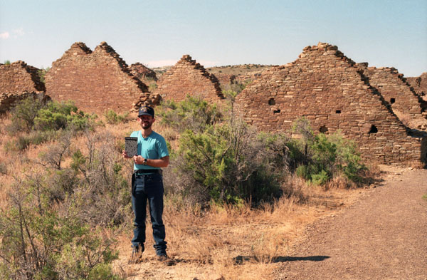
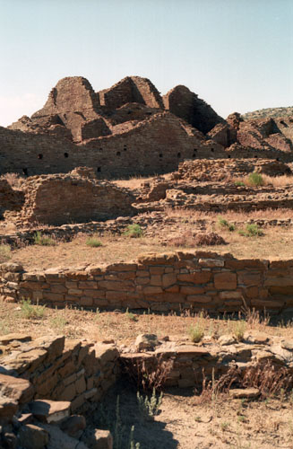
From its masonry work, rectangular shape and design Kletso is identified as Pueblo III architecture by prominent Chaco archaeologists Stephen H. Lekson and Tom Windes. They also argue that this great house was only occupied by one or two households. Fagen writes that Kletso contained around 55 rooms, four ground-floor kivas, and a two-story cylindrical tower that may have functioned as a kiva or religious center. Evidence of an obsidian production industry were discovered here. The house was erected between 1125 and 1130.
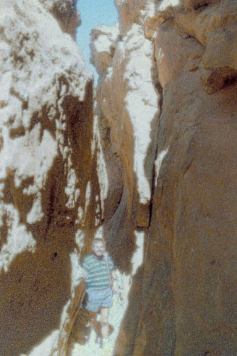
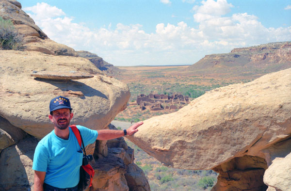
When you go behind the pueblo, there is another rock that has cracked off the mesa must has only tilted out a short way, thus providing a way up to the mesa through the crack (which I suspect has been partially filled in to make it easier to negotiate). In the far future, when that rock finally separates, not only will the trail to the top of the mesa be gone, but a sizable portion of the pueblo will be crushed as well. Maybe there are unseen efforts to keep that from happening.
Anyway, the trail up to the crack between the rocks was neat- just tough enough to negotiate to make it interesting. Just before you enter the crack between the rocks, you can get this excellent view of the pueblo. You can see many of the characteristics we have seen before- the kiva, the multi-story nature of the pueblo, the walls that are thicker at the bottom than at the top, and so on.
|
|
Also, there is a large rock at the northeastern end of the ruin that has fallen from the mesa, although that occurred many years ago. How small it all seems from up here.
Negotiating the rock crevice to get to the top of the mesa wasn't difficult, but it was a lot of fun. We weren't free-climbing, or anything like that; there was a definite trail up to the top that led through this crevice, and although we were the only two folks I could see up on top when we first ascended, I seem to recall that there were a few more up here when we returned from Pueblo Alto.
|
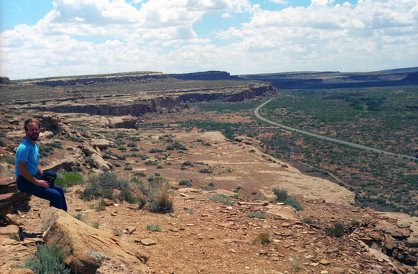
You can see the road through the canyon (we are looking towards the visitor center and the campsite), and you can see Pueblo del Arroyo at the right of the picture. Just at the base of the cliffs in the background is Pueblo Bonito.
There is a trail that leads all along the cliff back to the visitor center and even the campground. The trail also branches off to the interior of the mesa and reaches Pueblo Alto.
We have planned to hike all along the trail, which is marked only by small cairns (piles of stones) so as not to disturb the natural beauty of the high mesa.
The beginning of the trail led across the bare rock near the edge of the cliffs against which some of the great houses of Chaco are built, so we had excellent views all along the way.
|
Walking along the mesa was very, very interesting. There were unusual rock formations, fossils, odd plants, and places where water accumulates when it rains. At this point on the mesa, the water has formed a small waterfall (visible only when it rains) where the water falls off the mesa and down into the canyon.
I scrambled out to the very edge to look over Pueblo Bonito which is below. Above my head, these two rocks almost formed a natural bridge. Perhaps they did at some point in the past.
Just below Fred's feet is the first of the waterfalls, and then there is a short ledge, and then the long fall to the canyon floor. The cliff face is not sheer, and a rock climber could probably negotiate it easily.
Look at the flat rock right above Fred's head. It's hard to imagine that a formation like that could occur naturally.
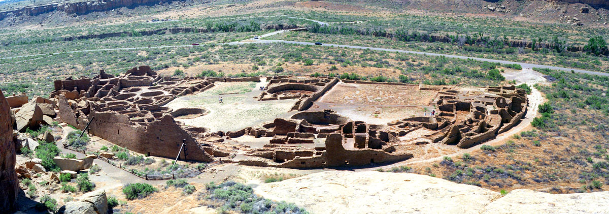
We walked another quarter mile or so along the bare rock cliff until we found ourselves above Pueblo Bonito. I thought that the vista of this great house from above was really neat, but we were so close to it that I could not get it all in one picture, so I took two. At the time, I did not have a way to combine the two pictures, but now I have software that does exactly that. So here is a panoramic view of Pueblo Bonito constructed from my two pictures:
 |
As a side note, Fred had, a few minutes before, taken a picture with Pueblo Bonito down below us, using his panoramic camera and a tripod. I think it is interesting to compare my "composite panoramic" with the one he took with a single exposure:
 |
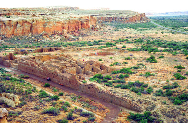
Here you can see very clearly how the back of the great house was much higher than the front or the plaza area in the interior. You can see the various kivas through the plaza area, and even some of the second-story, elevated kivas. At the extreme left, you can see where Threatening Rock fell and crushed part of the ruin. Note the supports that have been added to keep portions of the back wall from collapsing. Across the bridge, where the park road becomes one-way, is Pueblo del Arroyo. You can see the far side of the canyon in the distance.
|
Notice all the kivas here, some of which are elevated. My own opinion, given that the population of one of the great houses was many hundreds of people, is that each kiva belonged to one particular clan or family, with the larger of them having the larger kivas. I think this makes the most sense; if the kiva was owned communally, it would be much bigger to allow the entire population of the pueblo to meet, or worship, or whatever.
I suppose that it is also possible that each different kiva was used by a particular section of the great house, without regard to exactly who was living in that section.
One of the most amazing things about these ruins is the fact that they were apparently planned almost entirely before construction began. In this Pueblo particularly, most of the walls meet at interleaved joints, indicating that they were all built at approximately the same time and according to a plan. So most everything was laid out ahead of time, rather than expanding haphazardly as time went on (as even we do with our homes today).
The arroyo along which Pueblo del Arroyo can be found is that line of water-indicating trees across the center of the picture.
I wasn't sure when our trail would start heading out across the mesa to Pueblo Alto, but we were certainly enjoying all the spectacular views out across the canyon from the top of the mesa.
|
|
While we up here on the top of the mesa, there were a couple of sun showers, one of them quite heavy, but they only lasted a matter of two or three minutes, and for the heaviest of them we were able to find a ledge of rock to get under.
We continued walking along the edge of the mesa, and eventually we came to a point where we could look out over a third great house. This made me think that the park brochure should emphasize this is true for this trail, and encourage people to make the trip up here, but then on the other hand, hikers need to be careful and not get too close to the edge of the cliff. So I suppose this would not be a good trail for kids to be on.
|
Notice that one kiva is out in the plaza area by itself, while others are elevated within the house. You can also see the low wall that formed the original boundary of the plaza, and which has been called a "moat" because of its similarity to that type of structure.
Much of this great house has not been excavated, as the back wall extends way beyond the rooms that have been unearthed. Most of the ruin at this end, however, has deteriorated to the point where individual rooms would be hard to discern.
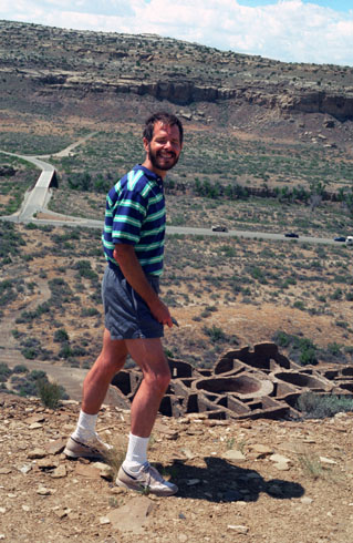
This picture provides and excellent view of the way the cliffs wind around the ruins. We continued around the top of the mesa until we lost the trail. I wanted to cut cross-country to Pueblo Alto, but Fred thought it would be better to go back to Chetro Ketl, and take the more well-marked trail that we saw branching out at that point, so that's what we did.
But while we were down closer to the far end of Chetro Ketl, Fred took a picture of the far end of the ruin that you can see in the picture above, left. Here is Fred's panoramic view:
 |
When we got back to the point where the marked trail turned out into the middle of the mesa, we followed it and began hiking over to Pueblo Alto. We hadn't gotten far when another of those rain showers came along. I happened to be right by a little cave-like rock formation, so even though the shower looked as if it would be over very quickly, I got under it. The shower did end quickly, but before I got out from my little shelter, Fred got a picture of me in the niche.
|
The complex, comprising 89 rooms in a single-story layout, is located about a mile from Pueblo Bonito; it was constructed between AD 1020 and 1050. Its location made the community visible to most of the inhabitants of the San Juan Basin; indeed, it was only 2.3 miles north of Tsin Kletsin, on the opposite side of the canyon. The community was the center of a bead- and turquoise-processing industry that influenced the development of all villages in the canyon; chert tool production was also common.
It shares its mesa with another great house, Nuevo Alto, both of which are now protected within the borders of Chaco Culture National Historical Park. Storerooms at Pueblo Alto opened to the outside rather than into the interior rooms and there was a huge midden of pottery. This and chert found in the midden came mostly from the Chuska area 43 miles to the west.
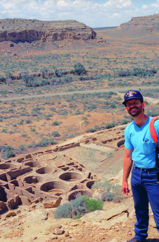
Pueblo Alto was not nearly as extensive as the ruins down in the canyon, and Nuevo Alto was even smaller. We could see Nuevo Alto a few hundred yards away, and we will head over there soon. Pueblo Alto is the more extensively excavated of the two.
The stonework is different here; most of the stones are of the same size, rather than alternating wide and narrow as they are in the valley. There are in fact five different types of stonework that have been found within the Chaco area.
Pueblo Alto was one of the focal points of the extensive road network that connected the Anasazi ruins throughout the Southwest, and you can barely see the remains of these roads today. The prehistoric road network radiating out from the great houses in Chaco Canyon extends for miles throughout the San Juan Basin. These roads were carefully engineered. The roadbeds are often below ground surface, particularly in areas of uneven topography. Although the width of the roads can vary, they can be as wide as thirty feet. The roads are sometimes flanked by mounds of dirt called berms, or by low masonry walls.
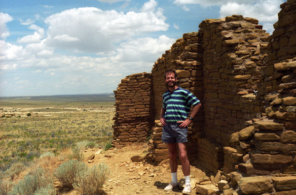
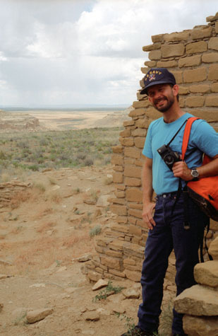 Fred at Pueblo Alto |
(Picture at left) Off in the distance are the Pueblos at Mesa Verde, and other pueblos in northern New Mexico that were connected to the Chaco Canyon site via the road network. This pueblo certainly has a commanding view of the entire countryside. You can see a roof line about a foot above ground level, indicating that there is at least one level of rooms below where I am standing that has not been excavated. Perhaps there are no plans to do so.
(Picture at right)
|
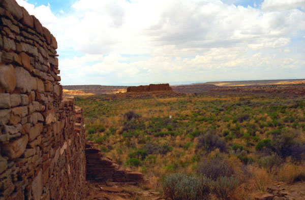
 The Rooms at Pueblo Alto |
What we know about the roads is similar to what we know about the architecture, quantifiable and measurable facts. Combining what is known about the architecture and the roads has led some archaeologists to conclude that Chaco Canyon was the ceremonial center and hub of a vast regional network. Looking at the imposing architecture that remains, it is easy to believe that it was.
|
Fred and I spent maybe an hour our here at these two ruins; they seemed more "personal", more like the places where only a few people would have lived.
When we were done at both ruins, we hiked back to the canyon proper, retracing our walk back along the cliff face to Kin Kletso, and then back down the stone stairway to the valley floor.
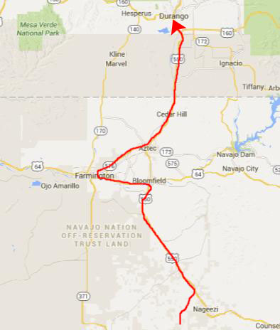
We returned to the truck and had some lunch, and then left Chaco Canyon, heading back out to Highway 550.
Going back along the unpaved road seemed longer, but we took a different fork in the road since we wanted to continue north on US Highway 550 to Bloomfield, New Mexico.
|
It was a nice drive up to Durango, a city we've been through before; the scenery in this part of Colorado and Northern New Mexico is very pretty, and the late afternoon sunshine made it that much prettier.
|
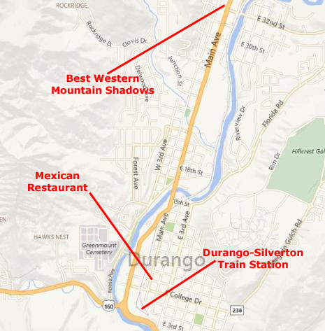
After getting the tickets, we drove to the Best Western, checked in, and then went for a swim in their heated pool. The hotel was very nice, but a bit more expensive than the places we usually stay on our trips.
We drove back down into Durango to have dinner, choosing a Mexican restaurant that we had not eaten at before. The dinner was excellent.
Our train would depart at 8AM in the morning, and so we had to be at the station at 730AM. So we made an early evening of it, looking forward to the train ride tomorrow.
You can use the links below to continue to another photo album page.
|
July 3, 1995: Riding the Durango-Silverton Excursion Train |
|
June 30 - July 1, 1995: Chaco Canyon: Chetrol Ketl and Pueblo Bonito |
|
Return to the Index for Our Western Trip |