|
July 18, 1997: Mammoth Hot Springs and the Grand Canyon of the Yellowstone |
|
July 16, 1997: Hiking in the Grand Tetons |
|
Return to the Index for Our Yellowstone Trip |
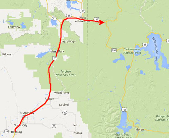
Today, we are going to take a drive down US Highway 191 through Yellowstone National Park. This highway enters the Park from Montana through the West Portal, and is the main Park road running north-south through the park. It leaves Yellowstone and continues south through Grand Teton National Park into Jackson, Wyoming.
|
Yellowstone National Park is located primarily in Wyoming, although it also extends into Montana and Idaho. It was established as a national park in 1872. By almost all measures, Yellowstone was the world's first true national park, and it is widely known for its wildlife and its many geothermal features, especially Old Faithful Geyser, one of the most popular features in the park. It has many types of ecosystems, but most of it is subalpine forest is most abundant.
Native Americans have lived in the Yellowstone region for at least 11,000 years. Organized exploration did not begin until the late 1860s, and the U.S. Army was commissioned to oversee the park on its establishment. In 1917, administration of the park was transferred to the National Park Service, which had been created the previous year. The park contains many historic buildings and more than 1,000 archaeological sites.
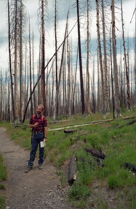
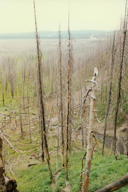
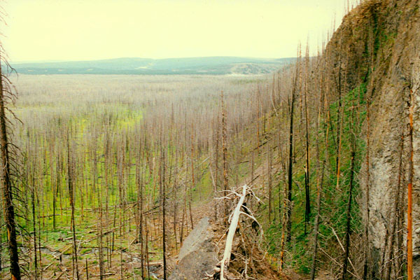
Hundreds of species of mammals, birds, fish and reptiles have been documented, including several that are either endangered or threatened. The vast forests and grasslands also include unique species of plants. Yellowstone Park is the largest and most famous megafauna location in the Continental United States. Grizzly bears, wolves, and free-ranging herds of bison and elk live in the park. The Yellowstone Park bison herd is the oldest and largest public bison herd in the United States. Forest fires occur in the park each year; in the large forest fires of 1988, nearly one third of the park was burnt (and on our visit this summer, we would still see large areas that had not yet begun to recover from those fires).
Yellowstone has numerous recreational opportunities, including hiking, camping, boating, fishing and sightseeing. We will spend more than two days here, traversing many of the paved roads provide close access to the major geothermal areas as well as some of the lakes and waterfalls.
|
The caldera is considered an active volcano, and it has erupted with tremendous force several times in the last two million years. Half of the world's geothermal features are in Yellowstone, fueled by this ongoing volcanism, and it is precisely these geothermal features that we plan to spend the day investigating.
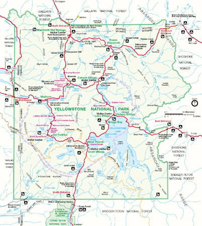
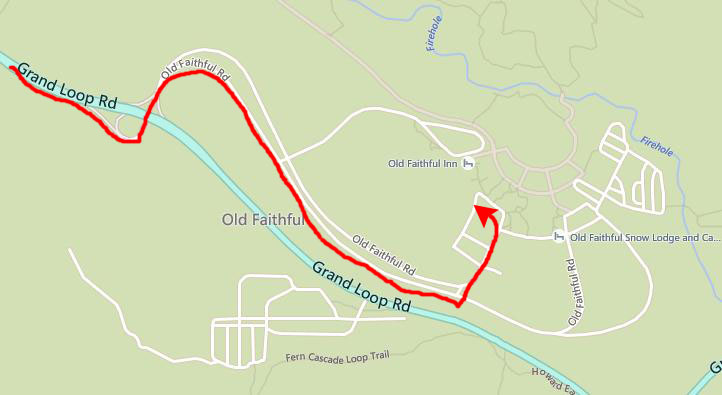
At left is a Yellowstone National Park Map, and to the right of it is a more detailed map showing the area that we'll be covering today as we investigate the geothermal features of the park.
For our first day in the park, we decided to see as much as we could between the West Entrance and Old Faithful. Coming into the park from the West Portal, we found that there was a good deal of road construction going on, and pretty heavy traffic. There were places where we moved only very slowly, but we finally made it to Madison and the visitor station. At this junction is the Firehole Lake Drive and the Fountain Paint Pot area- our first stop.
The Fountain Paint Pot Trail
|
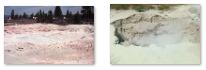
Silex Spring is a common feature, one of those that has lots of water (geysers are another example). Other features have a limited amount of water (paint pots and mud volcanoes) and some have steam only (fumaroles and steam vents). Deep in the earth, molten rock transmits heat upward through solid rock to ground water that has penetrated to that depth. The extremely hot water that results forces its way upward through fissures and fractures, warming rocks and water as it goes. Where the hot water can escape at the ground surface, a hot spring is formed.
Hot water is a better solvent than cooler water; it dissolves large amounts of silica, the major element of these volcanic rocks. Silica, in the form of sinter, lines the bottom of Silex spring. It forms terraces along the runoff channels and gives the spring its name: Silex is Latin for silica.
Silex Spring overflows most of the year. This overflow creates a hot environment where thermophiles thrive. Thermophiles become food for several kinds of flies that live in and on the hot water. The flies then become food for mites, spiders, various insects and birds.
|
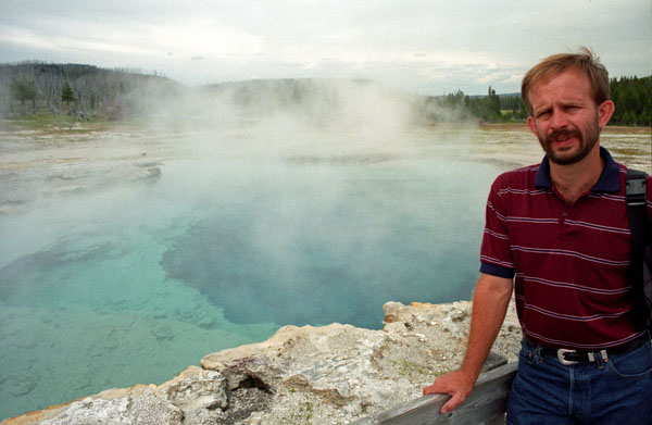
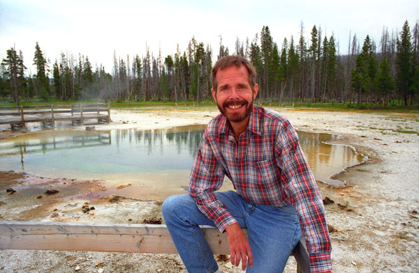
Extremely hot water has properties important in the development of a hot spring’s plumbing system. First of all, its lower density allows it to rise more easily through small channels. Secondly, it is a much better solvent than cooler water; it dissolves astounding amounts of silica, a common component of volcanic rocks. In this way some small channels are enlarged while others are clogged with new deposits. Celestine Pool usually overflows throughout the year; the overflow provides a restricted hot environment for mats of various types of bacteria.
Bacteria and other thermophiles (heat-loving microorganisms) usually form the ribbons of color around these geothermal features. The green, brown, and orange mats are cyanobacteria, which can live in waters as hot as 167°F. At this temperature they are usually yellow-green. They become orange, rust, or brown as the water cools. In cooler water other thermophiles may appear that will modify the colors even more. Color may also change due to stress, such as the intense sunlight of mid summer.
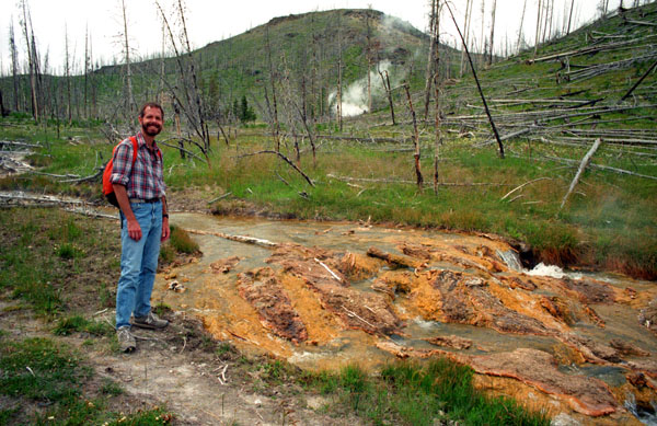
The next stop on the trail was one of the largest mudpots found in the park. In early summer the mudpots are thin and watery from abundant rain and snow. By late summer they are quite thick. The mud is composed of clay minerals and fine particles of silica. In this area the rock is rhyolite, which is composed primarily of quartz and feldspar. Acids in the steam and water break down the feldspar into a clay mineral called kaolinite.
|
As you can see, there seems to be no overflow out of the mudpot, so the mud is trapped in the paint pot, ever-increasing in quantity until the next time of abundant rain when the diluted mud solution may flow out of the pot. If you will click on the thumbnail images below, you can see some additional views of the Fountain Paint Pot:
 |
We continued on along the trail, which was boardwalk in places and on the ground in others. We passed a number of hissing and roaring fumaroles; the noise, of course, comes from gases - steam, carbon dioxide, and a little hydrogen sulfide - rushing from the earth through the vent. Its channel system reaches down into the hot rock masses, but it contains very little water. When water contacts the hot rock, it flashes into steam. Its volume increases 1,500 times and drives the gases from the vent.
|
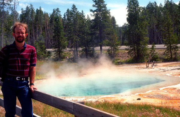
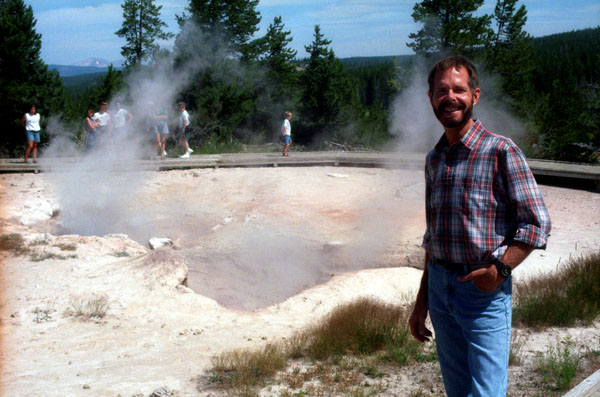
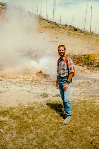
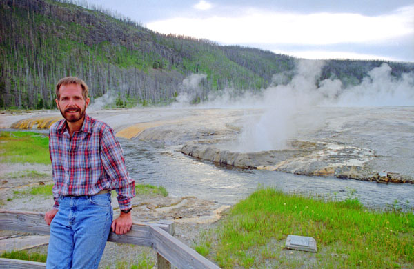
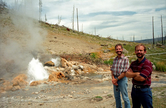
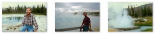
At right is a picture of Fred with two other geysers- Fountain Geyser and Morning Geyser- behind him, and there were others to the left out of the picture. The essentials for geysers are combined in Yellowstone. Snow and rain provide water. Fractures in the bedrock serve as avenues through which the water seeps downward. A source of heat deep in the earth warms the rock and water above it. The fractured volcanic bedrock allows the hot water to rise.
Fountain Geyser looks like a placid blue pool as its water slowly rises. This geyser gives little warning of its pending eruption, but when it does blow, it is one of the most beautiful geysers in the park. It erupts 10-50 feet for 20 minutes or more.
I learned later that the geysers behind Fred did not include Morning geyser. Morning Geyser seldom erupts, but when it does it is one of the park's largest geysers. It erupts in bursts 150-200 feet high and 60-100 feet wide.
Below these geyers we could see the vast amount of sinter that has deposited in this area. Sinter was first deposited in the Firehole Valley as glacier ice melted. It continues to accumulate at different rates depending on the chemistry of the water in each spring and the rate at which erosion removes it. The sinter mound beneath these geysers has been building for thousands of years. We finished the Fountain Paint Pot Trail and returned to driver further along Firehole Lake Drive.
|
The behavior of all the geysers in the basin was profoundly affected by the 1959 Hebgen Lake earthquake (magnitude 7.5). This geyser is one of the most beautiful in the park, although not the most famous. It now erupts almost continually, on average a hundred feet or so, but sometimes higher. The bursts alternate with calm periods over a 45-60 minute duration. Once finished, the interval to the next eruption typically lasts 8-12 hours. During this time the crater slowly fills with water, then begins to overflow about an hour before the expected eruption. This was an average display.
As I said, we had continued south along the park road and then turned off on the one-way Firehole Lake Drive road, doing the Paint Pot Trail and then stopping at some of the other attractions along this one-mile drive. In addition to Fountain Geyser, there was White Dome Geyser and Pink Cone Geyser, neither of which was more than a bubbling cone when we stopped. At one point, we stopped to look at this hot lake by the roadside. There are a number of these hot lakes, which are simply springs out of which bubbles extremely hot water.
The Fairy Falls Trail
|
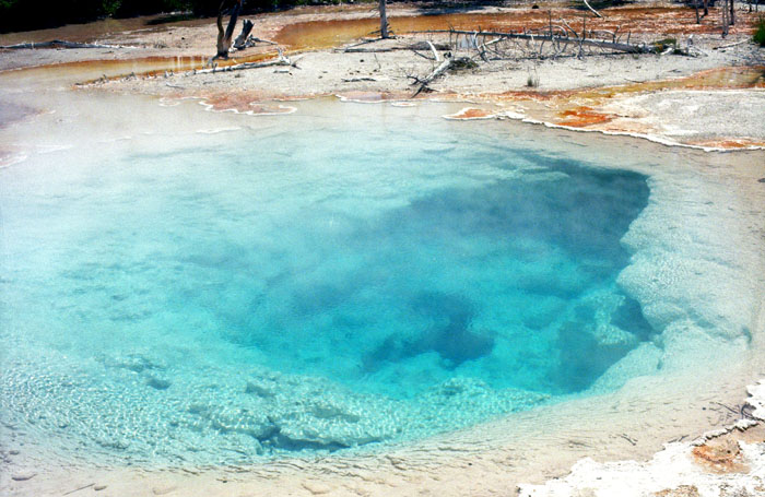
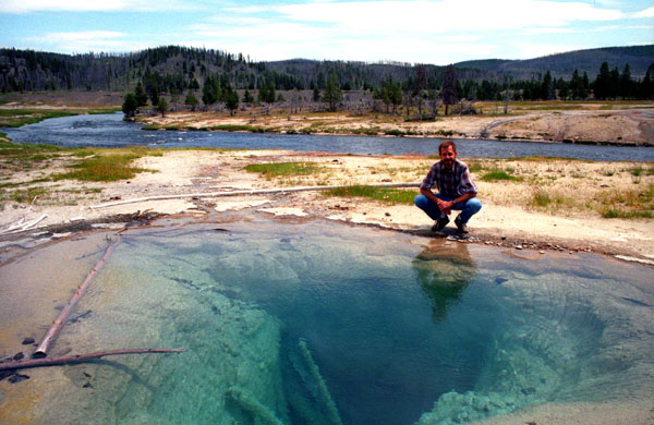
Here, you can see even more clearly how deep and clear the water is. If I were to step into the pool only a foot in front of where I am, I would sink straight down- the sides are that steep. That’s the Firehole River in the background, flowing down from the north. Presumably, the logs might have been swept into the pool at some point, although the Firehole River is about a hundred feet away. This is not a lake in any traditional sense, but rather a filled fissure through which the hot water rises.
Fairly close to the large, deep pool is this smaller, shallower one. All around the edge are encrusted mineral deposits. Touching the water revealed that it was just a little cooler than typical hot water from a faucet. I suspect that at the bottom of the pool the water is warmer still, but the pool was too deep to find out.
|
|
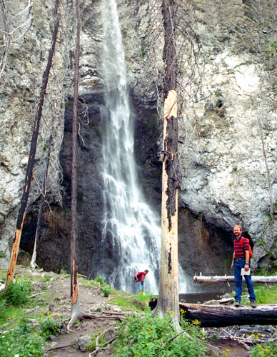
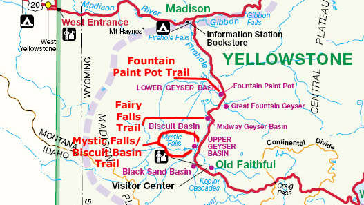
I had actually left the trail and clambered a ways up the hillside to get that second picture, and if you look closely, you can see the pool below Fairy Falls, and if you follow it to the left, just past the broken white pine trunk, you can see the log across the creek where some of our upcoming pictures were taken.
We learned that the fire had started naturally, and that Yellowstone management decided to allow it to take its natural course. They underestimated its severity, and by the time they realized that it was going to burn much more than a small area, it was too late to do anything about it. The result was that the beautiful lodgepole pine forest has been decimated, and it will be many years before new trees can grow to begin to take the place of those that died in the fire. It made for a desolate scene, not only here but elsewhere in the park.
|
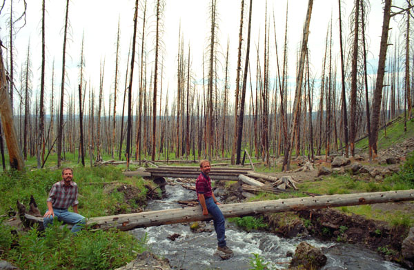 |
As falls and mountain streams go, this was a nice setting. The falls were high enough to be dramatic, but not so spectacular as to seem unreal. Of course we had to set up the tripod to take a photo of ourselves on one of the natural log bridges (although the one behind us in the picture above is actually man-made. Here, you can see more vividly than in just about any other picture, the devastation left by the fires of two years ago. Yellowstone will not look as it did just three years ago for at least a generation. I can remember it from my trip across country in the 1970s, but Fred will never, I guess, see it as it once was. This view looks north.
|
|
As it turns out, we are in a cul-de-sac of the Continental Divide. The Divide is east, south and west of us- but not north. So rain falling here, or water flowing here, can only (eventually) flow north and then east. So, even though we seem to be northwest of the Divide, we are actually on the eastern side of it. So, oddly enough, we are standing less than a quarter-mile from one of the earliest tributaries of what eventually becomes the Missouri River. So, again oddly enough, the water flowing through this picture will eventually reach New Orleans and the Gulf of Mexico- even though the Columbia River and the Pacific are much, much closer.
The sign near me in the second picture above points both to the falls behind me and also to the Imperial Geyser, which will be our next stop, as we have elected to add another three-quarters of a mile onto our hike.
|
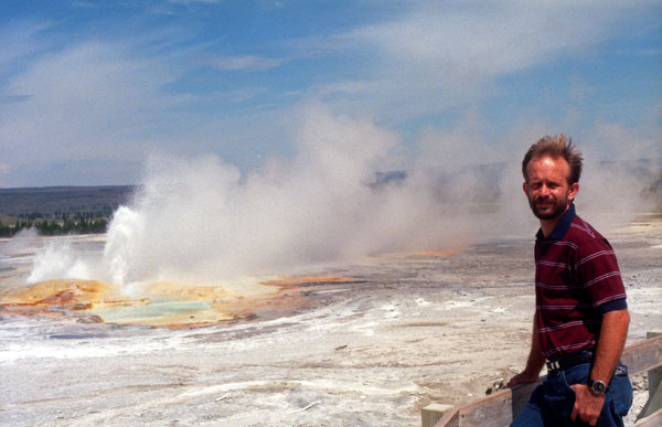
The other side of the caldera, which is most of the way to the eastern boundary of the park, is about the same distance beyond that. Way off in the distance, you can see some of the geothermal activity along Firehole Lake Drive.
If you look closely, you can see the pool below Fairy Falls, and if you follow it to the left, just past the broken white pine trunk, you can see the log across the creek where the earlier shots were taken. You can also get a better idea of how high I am by looking at the cliff face in the lower left.
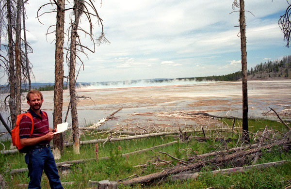
Having taken all the pictures we wanted to, we set off for the Imperial Geyser, about three-quarters of a mile further along the trail. The Fairy Falls trail wound a bit further west, leaving the forest canopy (or, what would have been the forest canopy had it not been burned) and entering an open area with a lot of geothermal activity. That’s one reason why the trees are more scarce here- the activity of the geysers and hot springs kills any small trees and vegetation that tries to get a foothold in the immediate area.
|
 |
To get the above picture, we waited around for an eruption (such as they are) to start, and this seemed to be one, so we took the picture. The water is only about two or three feet high, and there is not a great deal of it. But there is enough to be the beginning of a small creek (not marked on the park map) that flows north, paralleling Fairy Creek, to join the Firehole River.
|
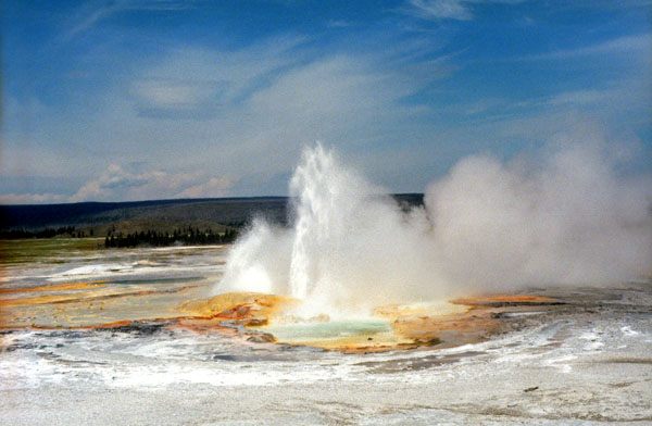
We took other pictures of the fairly constant eruption; interesting but not much compared to some of the other geysers in the park. This geyser was neat because you could walk all the way around it and get as close to it as you cared/dared to. To take my pictures, I got as close as I could. The eruption seemed to get steadily higher; this must not be a geyser like some of the others that reach their maximum height after just a few seconds. It seems to have a much more gradual pressure build-up, and thus a more gradual release.
A few minutes later, the eruption reached its maximum, so I took another picture of the Imperial Geyser. After that, the eruption subsided, but there was still a lot of steam everywhere. We also examined the little standing pools, which were interesting for the colors left by the various minerals dissolved in the water. No aquatic life that I could see, though. Below are clickable thumbnails for the other pictures we took here at the Imperial Geyser:
 |
We had come to the end of the Fairy Falls trail, so we lingered here for a bit before retracing our path along the trail back to the parking area. When we got there, we picked out our next destination- Mystic Falls. To get there, we headed south along the park road about two miles leave the Lower Geyser Basin and enter the Upper Geyser Basin.
|
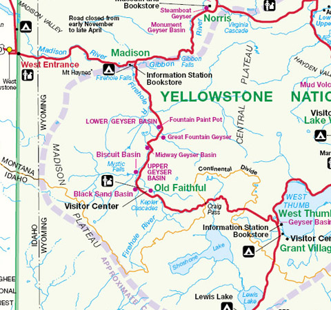
Here is the part of the Park Map covering our hikes this afternoon:
 |
A short ways from Sapphire Pool we came to a pair of trails that we decided to do.
The Mystic Falls Trail and the Biscuit Basin Overlook
|
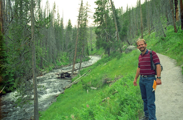
The trail began at the west end of the Biscuit Basin boardwalk near Avoca Spring, which was itself reached by crossing the bridge over the Firehole River and then continuing along the boardwalk west toward the treeline. Mystic Falls is actually on the Little Firehole River, which flows into the Firehole River from the west, and the trail to the Falls goes along the north side of the Little Firehole River, seen at left in my picture of Fred on the trail. We are actually nearing the edge of the area that was so completely burned a few years earlier, and there are some trees here that survived that cataclysmic event.
On the 3-mile loop to Mystic Falls and Biscuit Basin Overlook we encountered varied river, forest and plateau scenery, and the trail had a moderate elevation change of 550 feet. The trail paralleled, but did not cross, the Little Firehole River for about a mile, and this made the hike very enjoyable- the sound of rushing water is always soothing.
|
The trail climbs steeply to an overlook of the falls, which are 70 feet (21 m). To make a loop hike, which is 0.2 miles (0.3 km) farther with elevation gain/loss of 500 feet (152 m), continue on the trail above the switchbacks until it meets the Little Firehole Meadows Trail. Turn right, descend to an overlook of Old Faithful, and continue downhill to rejoin the Mystic Falls Trail.
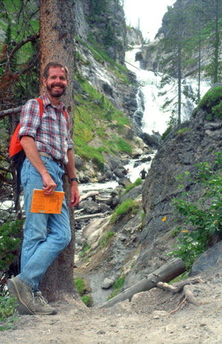
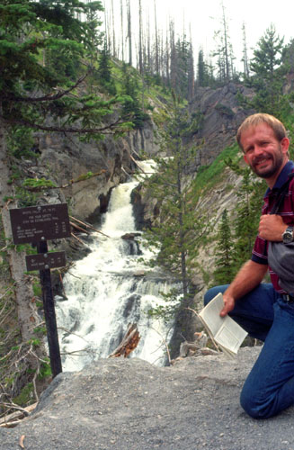
After about a mile, we reached Mystic Falls- as advertised an excellent place to take pictures such as the ones at right. The point where both these pictures were taken was actually the bend in the trail that turn away from the falls and climb up onto the Madison Plateau. In case you are curious, the sign Fred is near points points the way to some of the local trails and natural features:
| Mystic Falls Height 70ft. |
| For your safety, stay on establish trails |
| Biscuit Basin Loop 1.4 miles |
| Little Firehole Meadow 4.0 miles |
| Imperial Geyser 9.1 miles |
| Biscuit Basin .5 miles |
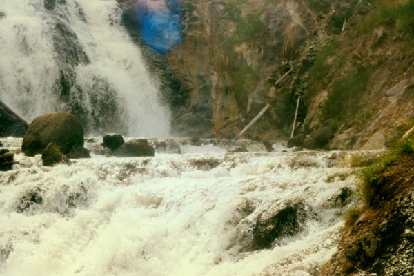
Mystic Falls was really neat. It is located along the Little Firehole River which begins high on the Madison Plateau near the western edge of the park, and at this point it drops, as the sign says, 70 feet as it rushes through a narrow slot near the top of the falls, which becomes significantly wider at its base.
|
Both Fred and I really like waterfalls, and a large percentage of the hikes we've taken in previous years (and an even larger percentage of those we will take in the years upcoming) have been up or down from our starting point to waterfalls of various sizes and various types. While Mystic Falls wasn't the largest or highest, it, like most waterfalls, had its own special ambience. We too, more pictures here at the falls, and you can click on the thumbnail images below to see some of them:
 |
This whole little canyon, up and away from where most tourists are, was peaceful and quiet. The hike, instead of being strenuous, was oddly restful as we saw very few other people at all.
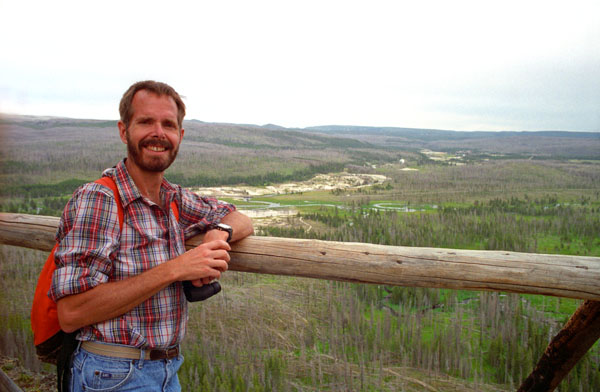
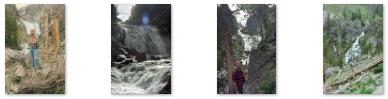
The falls were really great, but we had to push on. From the falls, the trail ascended rather steeply as it climbed up onto the Madison Plateau. Here, we are some 200 feet higher than we were at the falls. It was about a mile to the crest. One of the virtues of doing the hike in this direction was that the overlook eventually came on us suddenly, making the vista all that much more spectacular.
|
After Fred took my picture, I took one of him nearby at the overlook, and you can see that picture here. The hike up to here was interesting and the views well worth it. We had excellent views of the gradient between one of the boundary plateaus and the valley of the Yellowstone. This is also the edge of the ancient caldera from which the geothermal features of Yellowstone evolved. Click on the thumbnail images below for some other views from the Biscuit Basin Overlook:
 |
After we finished the Biscuit Basin Loop Trail, we got back in the car and headed a bit further south to Black Sand Basin, our last stop before Old Faithful.
Black Sand Basin
|
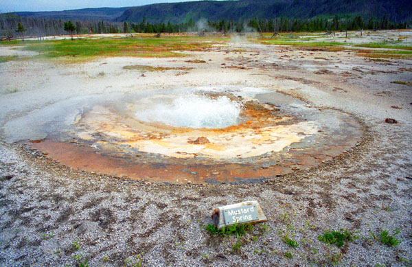
We parked and got out of the car to go walk out on the extensive boardwalk system. You can see some of these boardwalks and geothermal features in the picture I took of Fred here at Black Sand Basin. The hill in the far background is the point where the Biscuit Basin Overlook can be found.
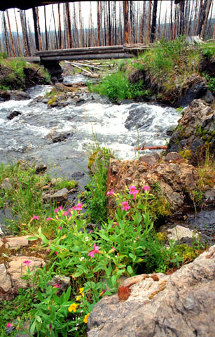
The whole area of Black Sand Basin lies right along the Little Firehole River, and that's one thing that made the area so interesting. Here were geysers and other features right on the banks of the river.
|
We took some other pictures here at Black Sand Basin that I want to include here, and you can click on the thumbnail images below to have a look at them:
 |
The afternoon is getting overcast and dark, and pictures were getting hard to take. I did get one of the Cliff Geyser erupting, but the ambient light wass so low that I had difficulty with the shot. Fred took one other of the steaming river and geysers, but again the light down here below the tree line was so low that the picture has a surreal quality (and two rainbows due to the lens filter he is using). You can see that picture here.
|
You really can't see the deep color of this pool in the picture; the water was very, very green- at least out in middle. The deep green shade resulted from the activity of cyanobacteria in the water forming a coating on all the underwater surfaces. This coating became a perfect surface for a type of algae that can exist in the very hot water (just over 150°). This particular pool is over thirty feet deep, and it is unusual in that the geyser located at the bottom does not explode, so there is no overflow of water by the edges and this does not wash away the coating or the algae.
This particular pool was discovered in 1872, and there have been a number of attempts to name it for its discoverer (which was in fact the case for some years). But there is an unwritten tendency in National Parks to avoid naming individual geologic features for individuals. Sometimes this is unavoidable or there is some overwhelming reason to do so, but usually such names are changed. So this isn't Belcher's Pool but rather Emerald Pool.
We spotted a small herd of deer walking along the far side of the area of geothermal activity, maybe 200 feet from where we were standing. I borrowed Fred’s telephoto lens to try to get a good picture, but with the low light I had to use a slow shutter setting, and I couldn’t steady the camera enough to get a good picture. But you can see the one I did get here.
Old Faithful
|
We found a space easily enough, right below the main steps to the Old Faithful Inn.
On the afternoon of September 18, 1870, the members of the Washburn-Langford-Doane Expedition traveled down the Firehole River from the Kepler Cascades and entered the Upper Geyser Basin. The first geyser they saw was Old Faithful. In his 1871 Scribner's account of the expedition, Nathaniel P. Langford wrote:
| "Judge, then, what must have been our astonishment, as we entered the basin at mid-afternoon of our second day's travel, to see in the clear sunlight, at no great distance, an immense volume of clear, sparkling water projected into the air to the height of one hundred and twenty-five feet. "Geysers! geysers!" exclaimed one of our company, and, spurring our jaded horses, we soon gathered around this wonderful phenomenon. It was indeed a perfect geyser. The aperture through which the jet was projected was an irregular oval, three feet by seven in diameter. The margin of sinter was curiously piled up, and the exterior crust was filled with little hollows full of water, in which were small globules of sediment, some having gathered around bits of wood and other nuclei. This geyser is elevated thirty feet above the level of the surrounding plain, and the crater rises five or six feet above the mound. It spouted at regular intervals nine times during our stay, the columns of boiling water being thrown from ninety to one hundred and twenty-five feet at each discharge, which lasted from fifteen to twenty minutes. We gave it the name of "Old Faithful." |
|
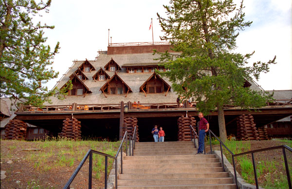
Initial construction was carried out over the winter of 1903-1904, largely using locally obtained materials including lodgepole pine and rhyolite stone. When the Old Faithful Inn first opened in the spring of 1904, it boasted electric lights and steam heat.
The structure is the largest log hotel in the world; possibly even the largest log building in the world. In 2007 the American Institute of Architects conducted a survey to determine the 150 favorite buildings in America; the Old Faithful Inn ranked 36. The Inn, which was designated a National Historic Landmark in 1987, is itself part of the Old Faithful Historic District. Old Faithful Inn is a member of Historic Hotels of America, the official program of the National Trust for Historic Preservation.
When we arrived, we found that there would be more than half an hour before the next eruption, so we decided to visit the Lodge and the gift shop inside. I suppose it would be fun to stay at one of these park lodges sometime, but they are awfully expensive. We did find a number of interesting items in the gift shop. I found some buffalo stoneware that was particularly nice, and I got it to set aside for either Fred’s birthday or Christmas. Then we went out the other side of the Inn to the geyser itself.
|
When the eruption finally came, it turned out that I had misjudged the shutter setting, and consequently there is almost no contrast between the tower of water and steam and the gray sky behind it. Had this been a bright day with blue sky, the picture would have been close to ideal.
More than 137,000 eruptions have been recorded. Harry Woodward first described a mathematical relationship between the duration and intervals of the eruptions in 1938. Old Faithful is not the tallest or largest geyser in the park; those titles belong to the less predictable Steamboat Geyser.
Over the years, the length of the interval has increased, which may be the result of earthquakes affecting subterranean water levels. These disruptions have made the earlier mathematical relationship inaccurate, but have in fact made Old Faithful more predictable. With a margin of error of 10 minutes, Old Faithful will erupt 65 minutes after an eruption lasting less than 2.5 minutes or 91 minutes after an eruption lasting more than 2.5 minutes. The reliability of Old Faithful can be attributed to the fact that it is not connected to any other thermal features of the Upper Geyser Basin.
The next day was nicer, and from a photographic standpoint, perhaps we should have stopped by again, but there was too much to do. Leaving Yellowstone this evening, we drove through Jackson, Wyoming, and made reservations at the Flat Creek Junction Motel just south of Grand Teton National Park for tomorrow (Friday) and Saturday nights- so we wouldn’t have to drive back and forth to Rexburg continually. We stopped in Jackson and walked around the scenic downtown area for a while, and stopped in a small local restaurant for dinner. It was a good meal. We then drove the sixty miles back to Rexburg.
You can use the links below to continue to another photo album page for our Yellowstone Trip, or return to the index and go from there to other photo album pages.
|
July 18, 1997: Mammoth Hot Springs and the Grand Canyon of the Yellowstone |
|
July 16, 1997: Hiking in the Grand Tetons |
|
Return to the Index for Our Yellowstone Trip |