|
July 17, 1997: Touring the Geothermal Features in Yellowstone National Park |
|
July 15, 1997: Traveling from Dallas to Rexburg, Idaho |
|
Return to the Index for Our Yellowstone Trip |
We have not planned every stop and every activity here in Yellowstone. I have been through here before, but never spent much time in the area, and of course, this will be Fred's first time. There is so much to see and do that we thought just driving from one point of interest to another would be a good plan. We look forward to seeing all of Yellowstone, and also Grand Teton National Park just south of it.
From Rexburg to the Grand Tetons
|
Highway 33 was pretty nondescript, running as it did across a high plateau. There were always mountains in the distance, but it was mostly farmland and small towns.
Thirty-five miles or so brought us to Tetonia, where the highway turned south. The terrain got progressively more mountainous, and at one point we stopped where the highway crossed Fox Creek, which turned out to be a very small, very high tributary of the Snake River. Another twenty miles brought us higher into the mountains and we passed through the town of Victor.
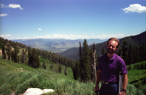
Just past Victor, we crossed the state line into Wyoming, and the highway changed to become Wyoming Highway 22. We started climbing to a crest of the Grand Teton Range. We climbed quite a ways on the highway, with the views getting better and better. When we saw the sign for a vista point at the crest of the pass, we stopped to have a look.
|
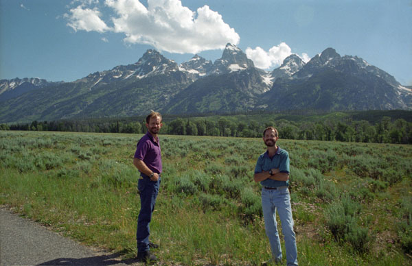
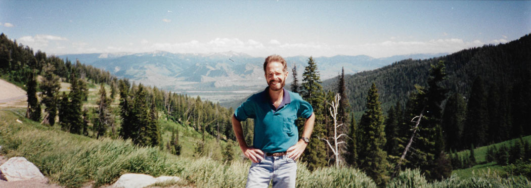
Teton Pass, the crest of the highway, is 8400 feet high. We are in the Teton Range of the Rocky Mountains, and the view beyond Fred looks many miles across the valley to the Gros Ventre Range. I’d been to this area before, the time Tony Hirsch and I drove across country, but this was Fred’s first time. I took another nice picture from another vantage point here on the crest, and you can click on the thumbnail below to have a look at it:
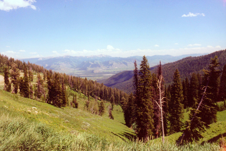 |
While we were here at this overlook, Fred got out his panoramic camera and took this shot:
 |
From Teton Pass, we continued a short way east on Wyoming Highway 22, passing through Jackson, and then headed north on US Highway 191 towards Grand Teton National Park.
Arriving at Grand Teton National Park
|
Efforts to preserve the region as a national park commenced in the late 19th century, and in 1929 Grand Teton National Park was established, protecting the major peaks of the Teton Range. The valley of Jackson Hole remained in private ownership until the 1930s, when conservationists led by John D. Rockefeller, Jr. began purchasing land in Jackson Hole to be added to the existing national park. Against public opinion and with repeated Congressional efforts to repeal the measures, much of Jackson Hole was set aside for protection as Jackson Hole National Monument in 1943. The monument was abolished in 1950 and most of the monument land was added to Grand Teton National Park.
Grand Teton National Park is named for Grand Teton, the tallest mountain in the Teton Range. The naming of the mountains is attributed to early 19th-century French-speaking trappers who referred to them as "les trois tétons" (the three teats); this was later anglicized and shortened to "Tetons". At 13,775 feet, Grand Teton rises abruptly more than 7,000 feet above Jackson Hole; it is about 900 feet higher than Mount Owen, the second-highest summit in the range.
The park has numerous lakes, including 15-mile-long Jackson Lake as well as streams of varying length and the upper main stem of the Snake River. Though in a state of recession, a dozen small glaciers persist at the higher elevations near the highest peaks in the range. Some of the rocks in the park are the oldest found in any U.S. National Park and have been dated at nearly 2.7 billion years.
|
Grand Teton National Park is an almost pristine ecosystem and the same species of flora and fauna that have existed since prehistoric times can still be found there. More than 1,000 species of vascular plants, dozens of species of mammals, 300 species of birds, more than a dozen fish species and a few species of reptiles and amphibians exist. Due to various changes in the ecosystem, some of them human-induced, efforts have been made to provide enhanced protection to some species of native fish and the increasingly threatened whitebark pine.
Grand Teton National Park is a popular destination for mountaineering, hiking, fishing and other forms of recreation. There were some 200 campsites when we visited, but since then, the number and extent of visitor facilities has exploded to a thousand sites, several National Park Service-run visitor centers, and privately operated concessions for motels, lodges, gas stations and marinas.
|
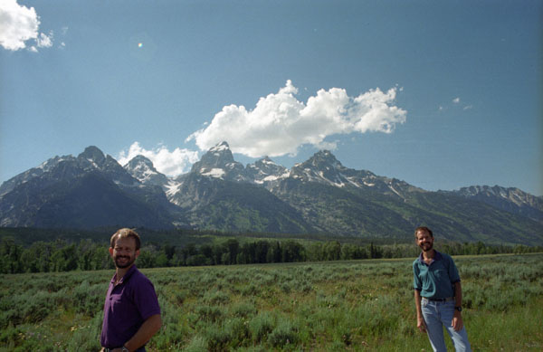
We got back in the car and drove up towards the trailhead for the Taggart Lake Trail. At that parking area, I got a good picture of Fred with Grand Teton and Mount Owen in the background.
We were going to do one long hike this afternoon, but before we started our, Fred took a great picture of Grand Teton Peak with with his telephoto lens. It looks as if there are clouds at the top of Grand Teton, and indeed there are. But there is also a large glacier quite near the peak of the mountain. Actually, there are a number of glaciers here. Just to the right of Grand Teton, down in the valley, is Teton Glacier, one of the largest in the park.
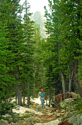
We parked and investigated the trail map signs, finally deciding that we would begin on the Taggart Lake Trail to that feature, and then hike further on to Surprise Lake.
The Taggart Lake Trail and Surprise Lake
|
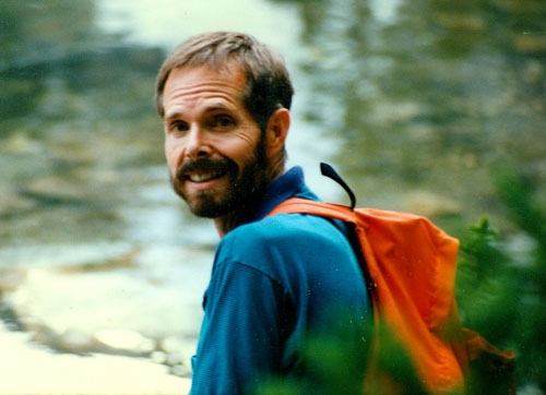
As you can see, I’m carrying Fred’s old orange backpack- an item that has accompanied us on trips and hikes for the last seven years:
 |
About a half mile in, we crossed the first of three footbridges over Taggart Creek, and soon after that, the trail began climbing a moderate grade towards Taggart Lake. This section of trail more or less follows along Taggart Creek, while traveling through a mixed forest of spruce, fir and lodgepole pine. We also passed through some long stretches of aspen groves.
|
This picture would have been better had there been much sunlight, but you take what you can get.
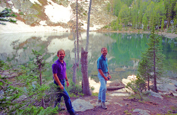
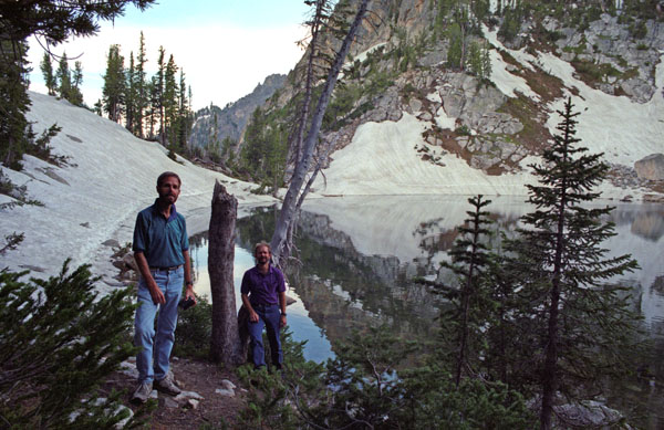
When Tony and I were here, there was no snow left, as our trip cross-country was in September. I had hoped we could get to the other side of the lake so I could take Fred up to some scenic spots in the rocky hillsides in the background, but there was just too much snow to make this advisable. So we had to settle for pictures on this side of the lake.
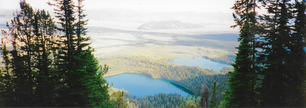
Fred had brought his panoramic camera along on the hike, and he used it here at Surprise Lake to take a couple of vertical panoramas. You can use the scrollable windows below to have a look at them:
|
|
|
We stayed at Surprise Lake for an hour or so, and then started back down the trail, and I have four more pictures to include here.
|
Below is another picture of the two of us at Surprise Lake:
 |
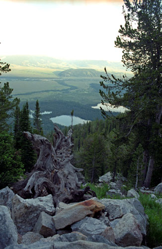
The hike down was uneventful, if you don’t count the bear sighting. On the way down, Fred took a panoramic picture of a view that we'd missed on the way up:
 |
We reached the car late in the afternoon, and just drove around some of the other scenic spots along the park road. Before we left the park, Fred got out the panoramic camera again for this view of the Tetons:
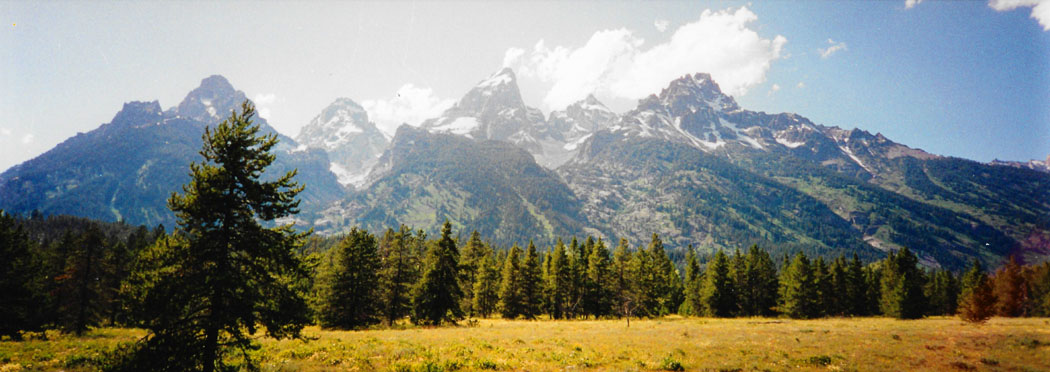 |
One thing we decided was to move to a lodge nearer to Yellowstone- and we found one north of Jackson- the Flat Creek Junction Lodge. We made reservations for the next two nights, and then went into Jackson, had dinner, and headed back west to Rexburg and the hotel.
You can use the links below to continue to another photo album page.
|
July 17, 1997: Touring the Geothermal Features in Yellowstone National Park |
|
July 15, 1997: Traveling from Dallas to Rexburg, Idaho |
|
Return to the Index for Our Yellowstone Trip |