|
September 19, 1998: Jeffie and Her Horse |
|
August 22, 1998: Prudence's Birthday Party |
|
Return to the Index for 1998 |
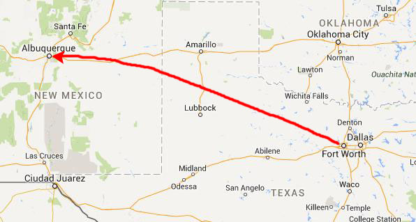
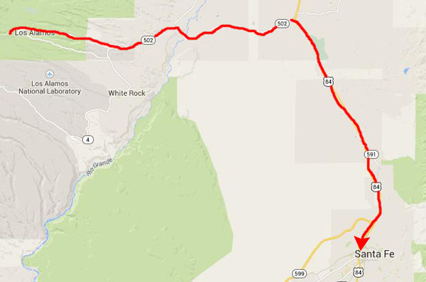
For Labor Day weekend, Fred and I have planned a trip to Santa Fe with Prudence and Ron. We plan to show them some of the places we've seen between Albuquerque and Santa Fe, including Bandelier National Monument. Prudence wants to see the sights in Santa Fe, and stay at a bed and breakfast she has read about there.
The Trip to Albuquerque (9/4)
|
We were lucky to find a nice restaurant that was still open, since we hadn't had time to eat before we left Dallas.
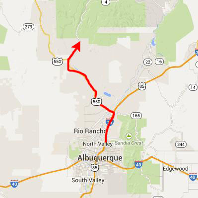
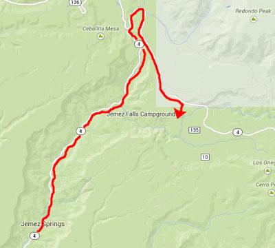
In the morning, we had some breakfast and talked about the route today. Fred and I wanted to take Prudence and Ron northwest from Albuquerque towards Jemez Falls on New Mexico Highway 4, and then take that around and over to Santa Fe where we would stay the night. There is a lot to see along the mountain route, and we thought they would enjoy it.
The Ponderosa Winery (9/5)
|
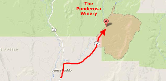
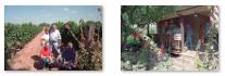
We'd only gone about five miles up that highway when Prudence saw a sign for the Ponderosa Winery. Prudence likes wine (as does Fred and Ron as well) so we decided to pay it a visit. We turned off New Mexico 4 onto County Road 290, and about three miles later found ourselves at the winery.
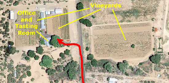
Although the winery was located on relatively flat land, it is nestled in the scenic Ponderosa Valley on the southern slopes of the beautiful Jemez Mountains. The winery is the largest Riesling vineyard in New Mexico; their slogan is "If it isn't an award-winning wine, we don't serve it."
The vineyards and winery are situated at well over a mile above sea level, on deep, well drained volcanic ash deposits, which, along with long hot days and cool nights, are said to provide the ideal conditions to develop a unique wine character.
|
I think that if Prudence thought she could easily get some bottles of this wine home, she would have bought a few. If I recall correctly, though, she did buy a sampler case and had it shipped home.
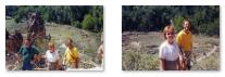
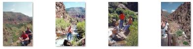
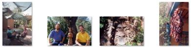
Outside the rustic tasting room, we were right in the middle of the vineyards. There was a vintage truck parked outside (not a working truck, I don't think) and we used that, the tasting room and the vineyards as backdrops for a series of candid photographs. You can click on the thumbnail images below to have a look at them:
|
After visiting the winery, we went back out to Highway 4 and continued north towards the Jemez Mountains.
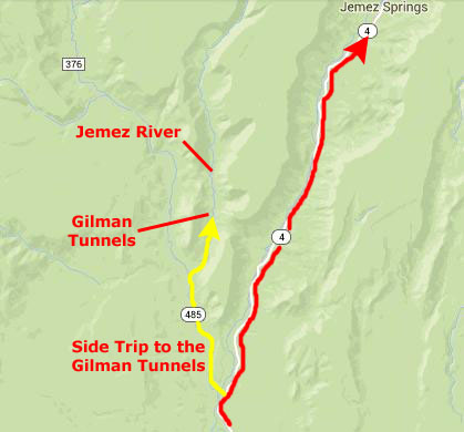
The Gilman Tunnels (9/5)
|
We discovered later that the stream paralleling us was not actually the Jemez River. Unbeknownst to us, the main river had continued along Highway 4 to the north; we were actually following a stream called the Rio Guadalupe.
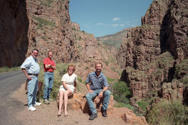
We continued about three miles up this road, with the river constantly on our right, until we came to the first of the Gilman Tunnels. The Gilman tunnels were originally blasted out of rock in the 1920s for a narrow-gauge logging railroad that used to haul timber out of the Jemez. There was a sawmill near the town of Gilman but it came much later (around 1948). At some point they enlarged the tunnels so that logging trucks would fit. Perhaps this coincided with the building of the sawmill in Gilman. (There is no record of when the railroad tracks were dismantled, but many tracks in the west were torn up during WWII). Railroading and logging artifacts can be found throughout this area, even up towards Cuba, New Mexico.
All around us were hills made of some of the oldest rocks in the Jemez Mountains. The Jemez mountains themselves are the remnant of a series of major volcanic eruptions that occurred about one million years ago.
|
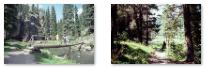
The stream beside us was quite pretty, and Fred and I took a number of pictures of it. You can click on the thumbnail images below to see some of them:
 |
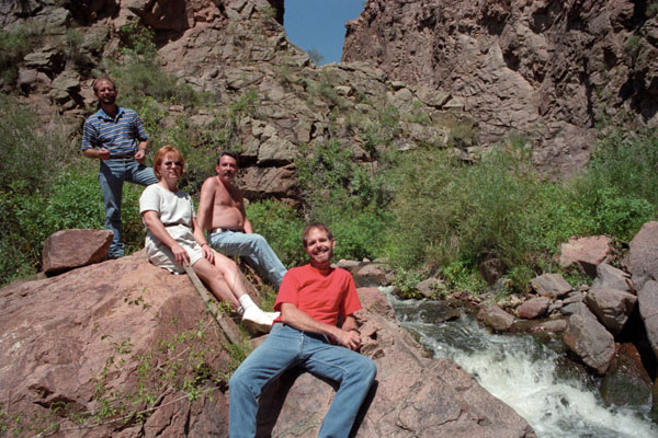
All along the narrow road, and particularly at the tunnels, there were numerous turnouts where you could park to get out of the traffic and do some sightseeing or rock scrambling, get down to the Rio Guadalupe, or just take pictures.
|
Past the tunnels, highway 485 ends, turns to dirt, and becomes Forest Service Road 376. At Porter crossing (where the Forest Service Road crosses the Rio Guadalupe), you can continue on FR 376 to Fenton Lake and Jemez Springs, or turn left to Cuba- although this road is reportedly fairly rough. That's why we went back to Highway 4.
We did scramble down to the river at a couple of places, and took a number of photographs; you can click on the thumbnail images below to see them:
 |
When we got back to Highway 4, we once again continued north towards Jemez Springs, where we stopped for lunch in a little local place.
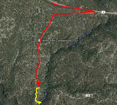
Jemez Falls (9/5)
|
This is an easy hike to a beautiful waterfall. It is just a dirt trail when it starts out from the parking area, and the first part of the half-mile trail down to the falls is a fairly level walk through tall pine trees that provided plenty of shade. The trail descends about 200 feet over that half mile, but it is a fairly easy walk.
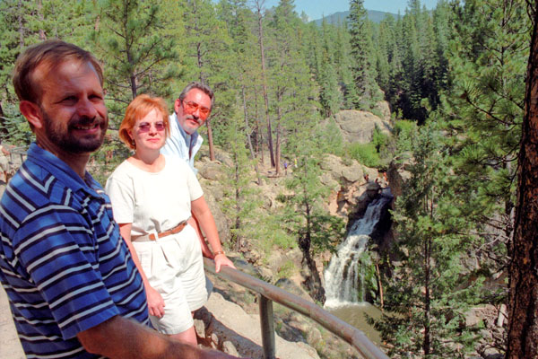
Near the end of the trail (at least at the end of the fairly level dirt portion of it) was a scenic overlook for the falls; it provided a full view of the falls, and was a great place for a picture.
|
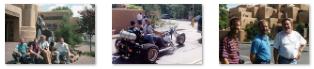
Unknown to me as I started off, Ron Ruckman thought he would go as well, and he started to follow me. I was jumping from rock to rock as I like to do, and I hadn't gone twenty feet down the path with rocks sticking up in it when I heard a terrific clatter behind me and turned to find that Ron had taken a misstep and had experienced a bad fall. He had gashed his ear and was bleeding from his temple. I jumped up to help and called Fred and Prudence over to help him. I could tell we'd need somthing for him to press against his ear, a portion of which was hanging loose, so while Fred and Prudence stayed with him, I ran back up to the car to get that and some water to wash the wound.
On the way back down to the overlook, I met the three of them coming up. One of the people at the overlook had just happened to be a nurse. She had quickly looked at the ear and given Ron a towel to stanch the bleeding. She said we should have the ear looked at immediately, so we skipped the rest of our Saturday plans (which were to have included two more short hikes) and headed off to Los Alamos and the hospital emergency room.
Los Alamos Medical Center (9/5)
|
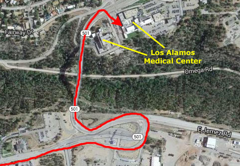 |
We were there about two hours as the tallest doctor I have ever seen stitched up Ron's ear- it took seven stitches, we were told. Ron also got some antibiotics and various dressings for his scrapes, cuts and bruises. The worst was over, except that his ear looked like he'd been mauled in a bar fight or something (or been in the ring with Mike Tyson). He was a real trooper, and we didn't hear any complaining or anything the entire rest of the trip.
|
Finding the B&B that Prudence had reserved was pretty easy, and it turned out to be as nice as she had hoped. We checked in and then went out for a nice supper before returning so Ron could get some rest.
The Inn at Pueblo Bonito (9/6)
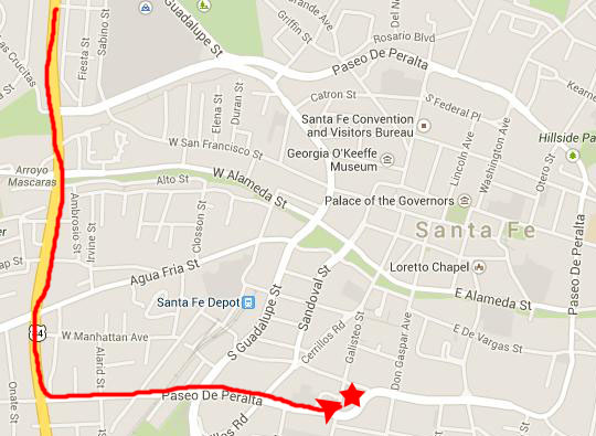 The Location of Pueblo Bonito |
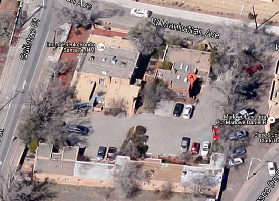 |
In the early 1930s, Al Kempineck purchased the highly sought after pueblo-style estate from U.S Federal Court Judge John McFie. Judge McFie served the U.S. Court system from early 1860 to well into the 1900s, assigned to the Southwest Texas Territory (which included West Texas and all of New Mexico) prior to New Mexico becoming a state in 1912. (It was during his tenure that outlaws like Billy the Kid and Pancho Villa were active.) After the purchase, Kempineck converted the estate and farm buildings into apartments and gave them the name they have today.
|
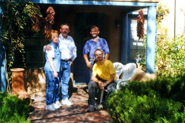
In 1986, a young couple from Dallas, Herb (28) and Amy (24) Behm, bought the property and turned it into the Inn at Pueblo Bonito, and it began its life as a bed and breakfast. Together, the Behms worked side-by-side learning the business of B&B innkeeping. With no other employees but themselves (for the first year) and 12 rooms to take care of, they were busy- particularly when you find out that they served breakfast in the rooms (unlike when we stayed, where there was a communal dining room).
Prudence was extremely interested, I thought, in how the B&B operated, and both she and Ron talked with Herb and Amy for quite some time. It was almost as if the two of them were getting ideas on doing the same thing somewhere. Little did I know.
|
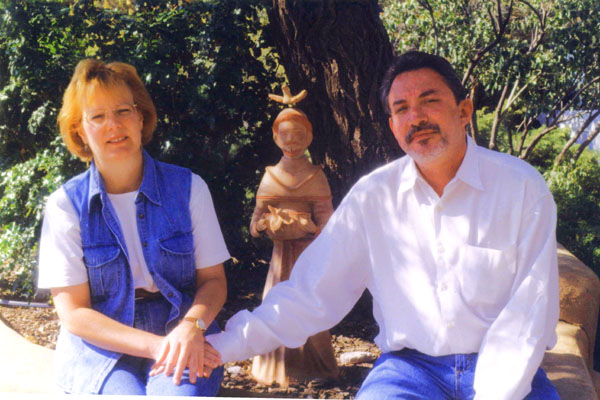
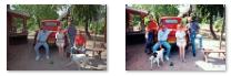
We thoroughly enjoyed our stay, and took some other pictures I want to include here. Click on the thumbnail images below to have a look at them:
 |
Using Pueblo Bonito as our base, we went off to explore Santa Fe.
Nedra Matteucci Galleries (9/6)
|
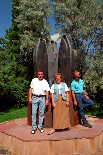
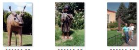
Nedra Matteucci is not the sculptor or artist; she just happens to own the gallery and garden. The sculptures are created by famous contemporary sculptors such as Doug Hyde, Glenna Goodacre, Dan Ostermiller, Fritz White and George Lundeen.
Click on the thumbnail images below to see some additional pictures of the various sculptures:
 |
After visiting the gallery, we walked back by the Pueblo Bonito and on into the historic area of downtown Santa Fe.
Walking Through Santa Fe (9/6)
|
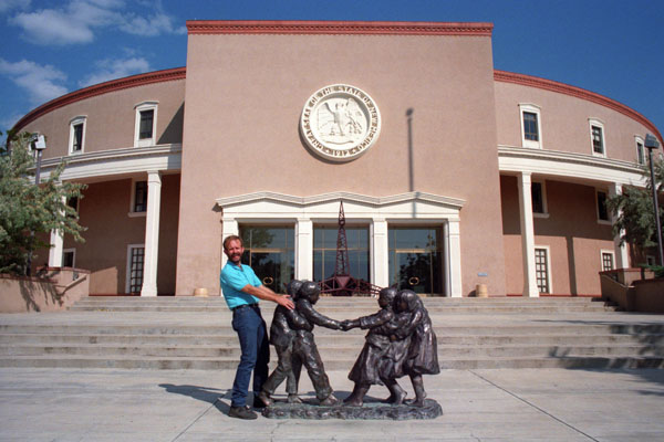
The New Mexico State Capitol (2)
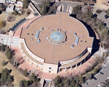 |
The building was designed to resemble the Zia Sun Symbol when viewed from above, with four entrance wings that protrude from the main cylindrical volume. Architecturally, the Capitol is a blend of New Mexico Territorial Revival style and neoclassical influences. Above each entrance is a stone carving of the State Seal of New Mexico. The building has four levels, one of which is below ground.
|
We did not get to inside the building (since this was Sunday), but it sounds as if it is very interesting. The central Rotunda is 50 feet in diameter and 60 feet high- spanning the second, third, and fourth floors. It is finished with Travertine marble native to New Mexico and inlaid with a turquoise and brass mosaic of the Great Seal of New Mexico. The ceiling skylight is designed to resemble an Indian basket weave, with blue and pale pink stained glass representing the sky and the earth, respectively. The flags of New Mexico�s 33 counties are on permanent display on the fourth floor balcony.
Not all of the beauty of this rather small state capitol is on the inside of the building, or even involved with its decorative exterior. Few state capitols sit in the middle of what is, in effect, a sculpture garden.
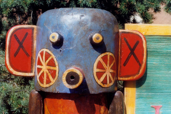
The Grounds of the New Mexico State Capitol (3)
|
Surrounding the capitol is a lush 6.5-acre garden boasting more than 100 varieties of plants, including roses, plums, almonds, nectarines, Russian olive trees, and sequoias. Statues of native Pueblo peoples carrying pottery and hunting dot the property. We took pictures of a few of them; you can click on the thumbnail images below to see some pictures we took on the grounds:
 |
The capitol was very interesting outside; I was sorry that we did not get to see the interior.
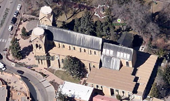
Mission San Miguel (4)
|
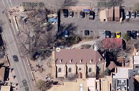
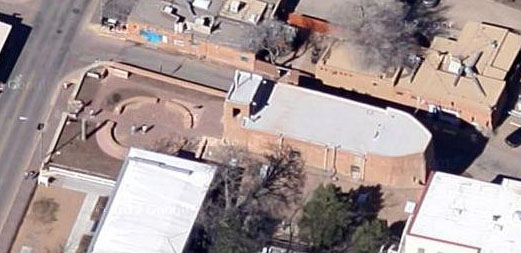 An Aerial View of Mission San Miguel |
The church was damaged during the Pueblo Revolt of 1680 but was rebuilt in 1710 following the Spanish reconquest and served for a time as a chapel for the Spanish soldiers. The wooden reredos (an altarpiece, or a screen or decoration behind the altar in a church, usually depicting religious iconography or images, which can be made of stone, wood, metal, ivory, or a combination of materials) includes a wooden statue of Saint Michael dating back to at least 1709. The reredos itself seems to have been added in 1798.
Though the church has been repaired and rebuilt numerous times over the years, its original adobe walls are still largely intact despite having been hidden by later additions. The church is a contributing property in the Barrio De Analco Historic District, which is a U.S. National Historic Landmark. Sunday mass is still held at the chapel.
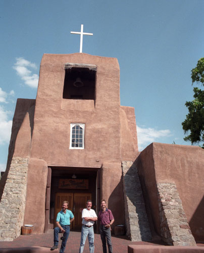
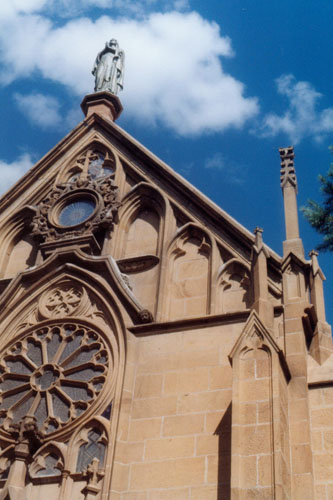
The Loretto Chapel (5)
|
It has been the subject of legend and rumor, and the circumstances surrounding its construction and its builder are considered miraculous by the Sisters of Loretto and many visitors. I would include more information here about the stair, but for some reason we did not go inside the chapel to have a look. Perhaps Fred and I can return here sometime and take a tour.
Basically all we did was to take a photograph of the chapel from the garden just outside and northwest of it. You can see that picture here.
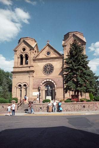
The Cathedral Basilica of St. Francis of Assisi (6)
|
 |
Influenced by the French-born Archbishop Lamy and in dramatic contrast to the surrounding adobe structures, Saint Francis Cathedral was designed in the Romanesque Revival style. As such, the cathedral features characteristic round arches separated by Corinthian columns and truncated square towers.
The large rose window in front and those of the Twelve Apostles in the lateral nave windows were imported from Clermont-Ferrand in France. The towers were originally planned to be topped with dramatic 160-foot steeples, but due to lack of funds, these were never built. The left tower is a single row of bricks taller than the right tower.
The cathedral was built from yellow limestone blocks quarried near the present site of Lamy. A 2005 addition to the upper facade of the cathedral is a small, round window featuring a dove, the symbol of the Holy Spirit. It is a stained glass replica of the translucent alabaster window designed in the 17th-century by the Italian artist Bernini for St. Peter's Basilica in Vatican City.
The Cathedral of Saint Francis of Assisi was actually not a basilica when we visited this year; it was only officially elevated to a basilica by Pope Benedict XVI on October 4, 2005, when it was named the Cathedral Basilica of Saint Francis of Assisi.
Other Stops on Our Santa Fe Walk
|
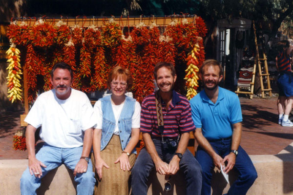
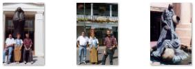
We took a few candid pictures around town, and you can click on the thumbnail images below to have a look at them:
|
Eventually, we returned to Pueblo Bonito to take advantage of their afternoon tea and margaritas. We spent a very pleasant last evening here in Santa Fe; tomorrow we will head off to do some of what we missed doing yesterday when Ron sliced his ear.
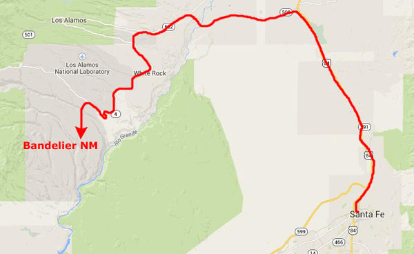
Bandelier National Monument (9/7)
|
 |
But instead of going back through the city of Los Alamos, we took the turnoff for New Mexico Highway 4, about fourteen miles from US 84. At this point, Highway 4 leads south past an archaeological area called White Rock (which Fred and I put on our list of places to come back and visit sometime) and up into the high country south of Los Alamos. Some ten miles down the road we found the entrance to Bandelier NM.
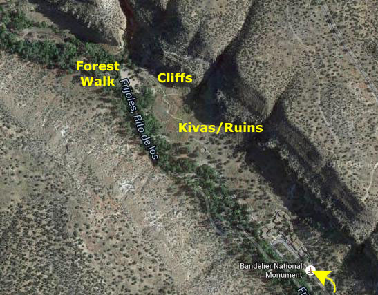
|
The hikes and walks are mostly northwest of the Visitor Center. On the valley floor are the ruins of numerous ancient buildings, including a large apartment block and two or three kivas. Another trail leads up along the cliff face so you can see the actual cliff dwellings. And there is also a very nice walk that leads along the Frijoles River off to the northwest. We plan on doing all these things.
Bandelier's human history extends back more than 10,000 years when nomadic hunter-gatherers followed migrating wildlife across the mesas and canyons. By 1150 AD Ancestral Pueblo people began to build more permanent settlements here and in other similar place, but by the 1500s, most had moved from their homes here to pueblos along the Rio Grande.
In the mid-1700s Spanish settlers with Spanish land grants made their homes in Frijoles Canyon. In 1880 Jose Montoya of Cochiti Pueblo offered to show his ancestral homelands to Adolph Bandelier, who he brought here for the purpose. Bandelier was impressed, and thought the sites ought to be preserved, and he began campaigning to set the area aside as a park. His efforts bore fruit when, in 1916, legislation to create Bandelier National Monument was signed by President Woodrow Wilson.
Between 1934 and 1941 workers from the Civilian Conservation Corps (CCC) worked from a camp constructed in Frijoles Canyon. Among their accomplishments is the road into Frijoles Canyon, the current visitor center, a new lodge, and miles of trails. For several years during World War II the park was closed to the public and the Bandelier lodge was used to house Manhattan Project scientists and military personnel. Today, Bandelier National Monument protects over 33,000 acres of rugged but beautiful canyon and mesa country. Petroglyphs, dwellings carved into the soft rock cliffs, and standing masonry walls pay tribute to the early days of a culture that still survives in the surrounding communities.
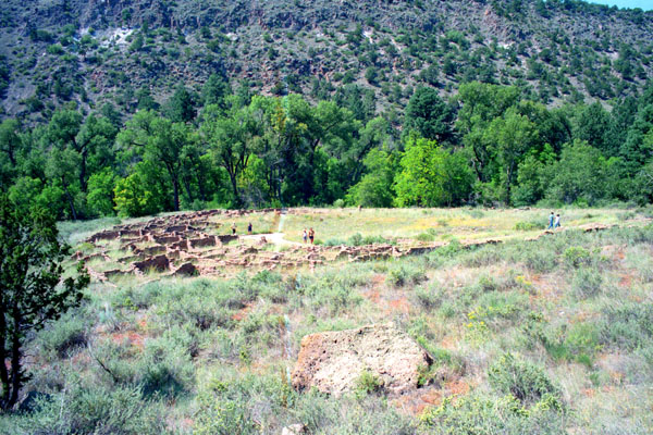
The Valley Floor: Ruins and Kivas
|
A kiva is a room used by Puebloans for religious rituals, many of them associated with the kachina belief system. Among the modern Hopi and most other Pueblo peoples, kivas are square-walled and underground, and are used for spiritual ceremonies. The tradition in ancient times was for kivas to be circular, and while some were totally underground, others were only partially so, and had wood/earthen roofs. Since these ceremonies often included building fires, most kivas also had ventilation systems to carry smoke out of the structure.
Kivas are found at many of the ruins sites in the American southwest, indicating ritual or use by the ancient peoples of the region including the Ancient Pueblo Peoples, the Mogollon and the Hohokam. Those used by the ancient Pueblos of the Pueblo I Era and following, designated by the Pecos Classification system developed by archaeologists, were usually round, and generally believed to have been used for religious and other communal purposes.
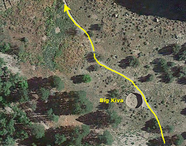
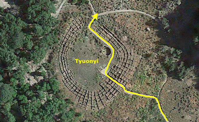
The kiva that we passed first was called the Big Kiva (although it was only somewhat larger than the next one we encountered.
From that kiva, the paved path continued a few hundred feet up to the northwest to the main valley floor ruins.
|
The Tyuonyi site dates from the Pueblo III Era (1150 to 1350) to the Pueblo IV Era (1350 to 1600). The age of the Tyuonyi construction has been fairly well established by the tree-ring method of dating, widely and successfully used by archeologists in the Southwest.
Ceiling-beam fragments recovered from various rooms give dates between 1383 and 1466. This general period seems to have been a time of much building in Frijoles Canyon; a score of tree-ring dates from the Rainbow House ruin, which is down the canyon a half mile, fall in the early and middle 15th century. Perhaps the last construction anywhere in Frijoles Canyon occurred close to 1500, with a peak of population reached near that time or shortly thereafter.
|
Scholars believe that some Ancestral Puebloan groups relocated into the Rio Grande valley, southeast of their former territories, founding Tyuonyi and nearby sites. The pueblo was abandoned by 1600. The inhabitants relocated to pueblos near the Rio Grande such as Cohiti and San Ildefonso, which are still occupied.
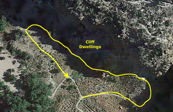
Our path went through the low wall ruins of the pueblo's rooms, into the central plaza, and past a smaller kiva in the northeast corner of the plaza. Then we exited to the north where we found ourselves at the beginning of the circular cliff walk.
The Cliff Walk
|
The community in the Frijoles Canyon on the Pajarito Plateau was settled around 1150 A.D., possibly by refugees from Chaco. Several hundred farmers lived in a pueblo on the valley floor and in dwellings built on the nearby cliffs. By the mid-sixteenth century many of its inhabitants had drifted away, and the San Ildefonso Pueblo claims to be among their descendants.
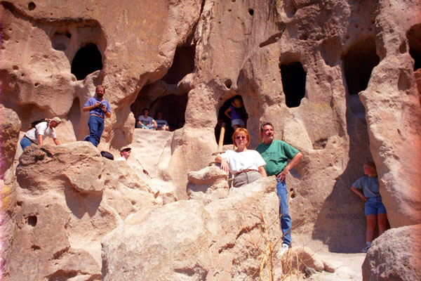
The cliff walk began just north of the Tyuonyi ruins, and led off to the right past the ruins of the Long House; it was once an 800-foot-long multi-story dwelling that Adolph Bandelier once called "the grandest thing I ever saw." The trail turned west and went through a rock crevasse to come out at the base of the cliffs.
How did these primitive peoples hollow out rooms inside bare rock? The answer is as close as the rock beside you. This particular kind of rock is called "tuff"; it is soft volcanic rock that is relatively easy to carve, and in any case the builders began with natural caves and enlarged them to create rooms.
|
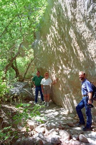
Click on the thumbnail images below to see some nice photos of these cliff dwellings up close:
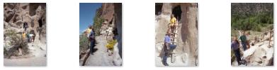 |
These cliff houses are mostly ruined, but many of them are pockmarked with the holes that once held the vigas (beams) that supported their multiple stories.
|
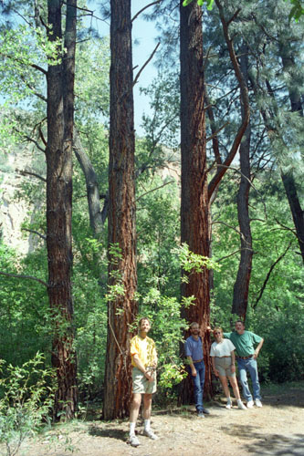
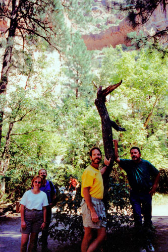
A Forest Walk
 |
The walk through the forest was a shady, relaxing way to end our visit here to Bandelier, and we took a few pictures along the walk. You can see these pictures below:
 |
 |
 |
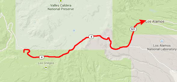
We left Bandelier after a two-hour visit, and continued on west on New Mexico Highway 4.
East Fork Jemez River Hike (9/7)
|
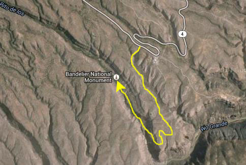
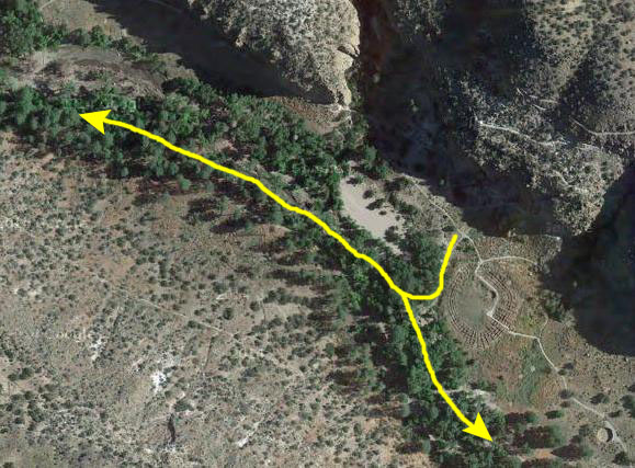
The parking area for the hike was just west of the southwest corner of Valle Grande. So you can follow us on our hike, I have put an aerial view of the short portion of the entire trail that we covered. If you will scroll all the way to the bottom, you will see Highway 4 and the parking area.
The hike along the East Fork of the Jemez River is undoubtedly the most popular hike in the Jemez Mountains; this stroll along the stream is noted for lovely scenery, wildflowers,birds, and small animals. From the trailhead, steps lead down to the stream at the highway culvert. The trail follows the stream, crossing it several times on (sometimes wobbly) rustic bridges.
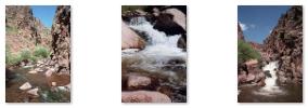
The streamside trail ends where the canyon narrows and the river enters a narrow gorge. We returned the same way, but cross-country hikers can continue forward, eventually ending up at another parking area a couple of miles further along Highway 4. We took two pictures along the hike, and I have marked their locations on the aerial view. Click on the thumbnail images below to have a look at them:
 |
When we returned from the hike, we headed off for our non-stop trip back to the Albuquerque airport.
The Trip Home (9/7)
Returning the car was an endless hassle, and back in the terminal I had to run for the gate. I thought I'd make it, but I was only a minute or so late. I watched the flight back away from the gate and take off for Dallas. No other airline could get me home that same eening. American booked me on a flight at 5:40 the next morning, and in a burst of generosity at my plight, put me up at the airport hotel for free. I called Prudence's house and left a message.
Fred had not noticed that I put my keys in his bag, as it turned out, so it was fortunate that I mentioned that in my message on Prudence's machine. He took my car home, and then took his own truck back to Van Alstyne where I talked to him from my hotel. Our friend Lowery was kind enough to pick me up the next morning from DFW and give me a lift home. I was a bit late for work on Tuesday, but that was of little consequence.
The trip was enjoyable, save for the hassle right at the end.
You can use the links below to continue to another photo album page.
|
September 19, 1998: Jeffie and Her Horse |
|
August 22, 1998: Prudence's Birthday Party |
|
Return to the Index for 1998 |