|
June 4-11, 2000: A Trip to Orlando and Tampa |
|
Return to the Index for 2000 |
Since Fred gets two vacation weeks a year, we used to use them to do a Spring trip somewhere and a Fall trip somewhere else. But recently, Fred has gotten the OK to use his accumulated sick days as extra vacation, so that gives him 14 days or so. This has enabled us to add on a trip or so each year down to Florida as well. Sometimes it isn't a whole week, but by working his vacations into holiday weeks, he can shave another day or so to give him three vacations. This year, in addition to our Spring and Fall trips (to North Carolina and Oklahoma, respectively), we are doing an early trip to Florida, timed to get Fred back to the greenhouses in time for the Easter lily season and all the work that entails.
This year, we've flown down to Florida on a Friday evening, and we will be flying back on the Sunday a week later. The flight was uneventful, and we got to the condo late Friday night. Then we had a late dinner at the Floridian Restaurant, just down the street from Riverview Gardens, something that has become something of a tradition on our arrival here.
For this trip, I'm going to organize the page into three sections- stuff we did near the condo, a trip to Key West with Lowery and Ron (who came over from Tampa for the purpose), the Riverwalk and out visits to the Fort Lauderdale Beach.
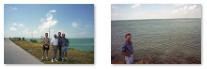
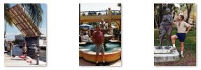
Around the Riverview Gardens Condo
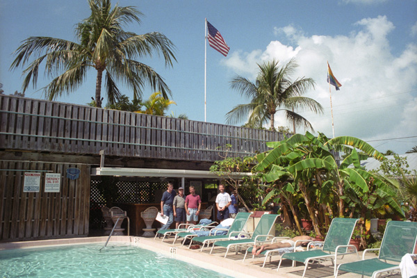
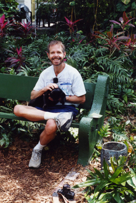
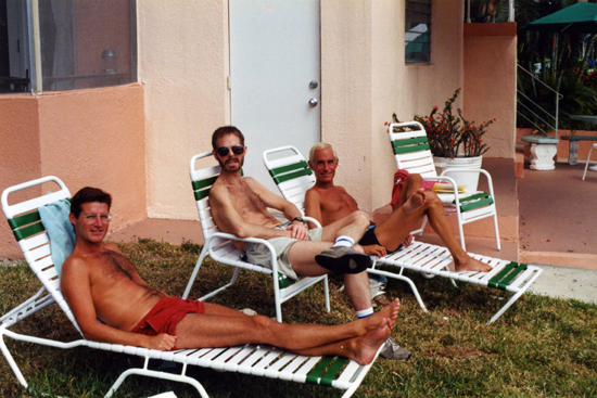 Scott, Myself and Ty at Riverview Gardens |
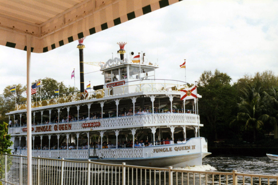 The Jungle Queen Passes Four Times a Day |
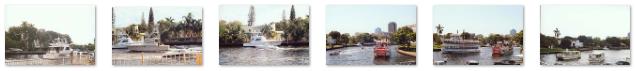
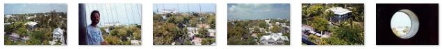
When you are sitting at the dock, it's not just for the sun, but to watch the boat traffic that goes up and down the river. There are all kinds and sizes of boats. A great many people live upriver and have smaller boats that they have to take downriver to get out to the Intracoastal Waterway, so there's a lot of that kind of traffic. But there are also four or five major boatyards and dealers upriver, that sell and service boats up to 200 feet long or so, so we often get to see mega-yachts go by (some of them so big that they have to be towed, with tow boats front and back, to avoid accidentally hitting other boats that are moored on both sides of the river). And, of course, the dinner cruises all leave from upriver landings, and the Jungle Queen and water taxis go by many times each day. So there are almost always boats to watch. Below are clickable thumbnails for some of the pictures we took of this boat traffic as seen from our dock:
 |
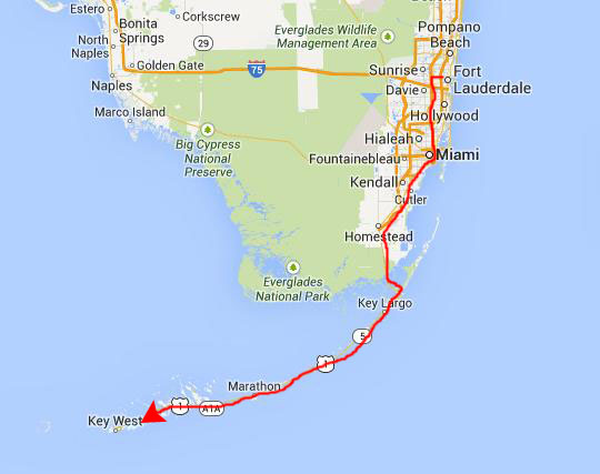
A Trip to Key West
Getting to Key West
|
We haven't driven down there in a number of years, so it may be that by now the road onto the Keys has been improved so that the drive is faster until you actually get onto the Keys- which occurs when you drive onto Key Largo.
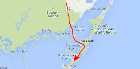 |
Key Largo is the northernmost (and largest) of all the keys in the chain of islands that curves around to the southwest from the southern tip of Florida. Traveling south on Key Largo is pretty, but because it is so close to Miami, and such a boating and beach day-trip destination, it is very much built-up. Even though you can usually see the Atlantic out one window or the Gulf of Mexico out the other, the dual-lane road is still pretty much like any built-up suburban road anywhere in the country.
Once you cross the bridge from the south end of Key Largo onto Tavernier Key, the scenery changes dramatically, and for the next 80 miles or so you will agree that the drive is among the most scenic you have taken. The keys get smaller, the bridges get longer and more frequent, and most times you can see open water on both sides. Take a look at the map below of the drive along US 1 through the Keys south of Key Largo and you'll see what I mean.
 |
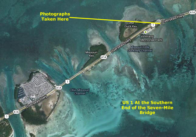
Part of what makes the drive so scenic is that you leave most commercial buildings behind on Key Largo. Oh, sure, there are small communities, which might be a half mile long with some gas stations, a restaurant or two and some other commercial outlets, but for the most part it is resorts, houses up on stilts, scenic turnouts and bridges, bridges, bridges. One of the bridges is the legendary "Seven Mile Bridge," which is, indeed, seven miles long and located south of Marathon, Florida.
|
In the aerial view at left, you can see that the water is pretty shallow; even from a great height, the bottom shows up clearly. You can also click on the thumbnails below to see two pictures that we took when we stopped just after leaving the south end of the Seven Mile Bridge:
 |
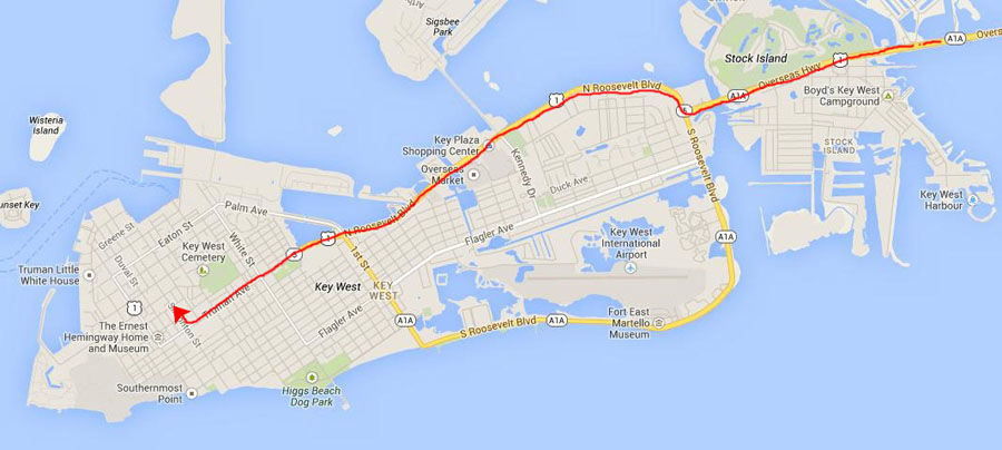
Once you arrive on Big Pine Key, there is more land again, with relatively short bridges from key to key, and more and more homes and commercial buildings as you approach Key West.
|
(You may wonder why it is "Stock Island" rather than "Stock Key (or Cay)." I wondered, too, but learned that there is precious little difference between a "key" and an "island." "Island" is the more general term, and refers of course to any bit of land entirely surrounded by water. A "key" is an island that has been built up on a coral base. My suspicion is that the residents of Stock Island simply thought that Stock Island sounded better than Stock Key (get it? "stocky"). All of the Florida Keys are at least partially founded on coral reef remains.
To get to our guest house (a gay, clothing optional compound located just off US 1 on Windsor Street), we just followed US 1 south across Key West and turned right onto Windsor.
|
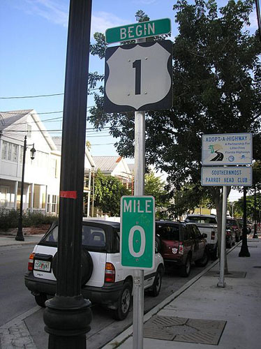
US 1 is generally the easternmost of the main north�south U.S. Highways; when the road system was laid out in the 1920s, it was mostly assigned to the existing Atlantic Highway, which followed the Fall Line between the Piedmont and the Atlantic Coastal Plain north of Augusta, Georgia. At the time, the highways farther east were of lower quality and did not serve the major population centers. (At the time of its construction, Route 99 was its equivalent along the western coast of the United States, before being succeeded by Route 101.)
Here in Florida, US 1 travels along the east coast of Florida, beginning a few blocks south of our guest house 490 Whitehead St. There is a sign there (see picture at left) that marks the beginning (or ending) of this iconic highway. It continues north through the keys, and is the route we took to get down here. When you get to the beginning of I-95, US 1 stays east of the Interstate, passing through Miami, Fort Lauderdale, West Palm Beach, Fort Pierce, Melbourne, Titusville, Daytona Beach, Palm Coast, St. Augustine, and Jacksonville.
The southernmost piece through the Florida Keys, about 100 miles long, is the two-lane Overseas Highway, originally built in the 1930s after the Florida East Coast Railway's Overseas Railroad was ruined by the Labor Day Hurricane of 1935. The rest of US 1 in Florida is generally a four-lane divided highway, despite the existence of the newer I-95 not far away. State Road A1A is a continuous beachfront alternate to US 1, cut only by assorted unbridged inlets and the Kennedy Space Center. North of Jacksonville, US 1 turns northwest towards Augusta, Georgia; US 17 becomes the coastal route into Virginia, where US 13 takes over. In Florida until the 1990s, US 1 used high-contrast markers (white text on a red background).
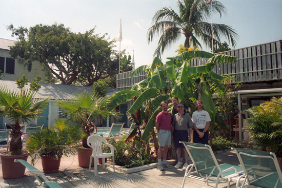
We got to the Sea Isle Guest House about three in the afternoon to check in.
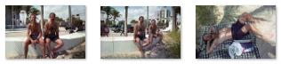
At the Sea Isle Guest House
The Sea Isle Resort is a pretty nice complex, with a pool and lounging area completely enclosed by room wings on three sides and the office and entry on the front, where access is blocked by a wall, foliage and a gate. So the interior is completely private, which is why it is "clothing optional." (We saw little of the "optional" while we were here.) There's a grill and bar in this center courtyard, although neither are staffed; they are for guests to use. We got rooms in different wings, stowed our stuff, and then took a tour around the property.
|
Another respondent followed that post with the following:
| I can tell you that the new owners and the manager were AWFUL people! For those who remember the place, we held Fantasy Fest there in 2004, taking over the "new", non-clothing-optional version for the festival. We got into a closet and pulled out all the FABULOUSNESS they were going to throw away- the vintage posters, the AIDS Quilt panel from the lobby, Miss Judy Garland statue- and they all came out for one last blast. I went and bought a gay flag and raised it on the flag pole over the resort (dare the manager to touch it and take it down with a full house of gay men). It was a GREAT party and the place went out on a high note. They bulldozed it a couple months later. |
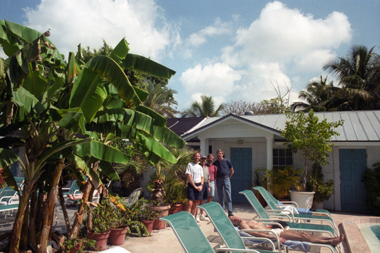
But when we were there, it was a nice place, and we enjoyed the stay. We took a couple more pictures in the courtyard, and you can have a look at them below:
 |
 |
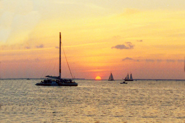
Key West Sunset
|
As you can see from the map above, the pier area was not very far from the guesthouse where we stayed. It was a nice walk through the narrow streets and past all the old houses to get down to the center of Key West, which generally runs along Williamson and Duval Streets and the streets that connect them.
|
None of the buildings in Key West are very tall; I think that four or five stories was the max, and we passed what I believe was the tallest building in town (not counting church steeples and lighthouses) as we walked along Williamson.
|
Apparently, this goes on most nights, and the crowds are certainly sizeable. In fact, I had to crop out of both of these sunset pictures (above and right) the dark heads of the people in front of me.
We went ahead and had dinner at a nice local restaurant downtown before heading back to the Sea Isles Guesthouse.
|
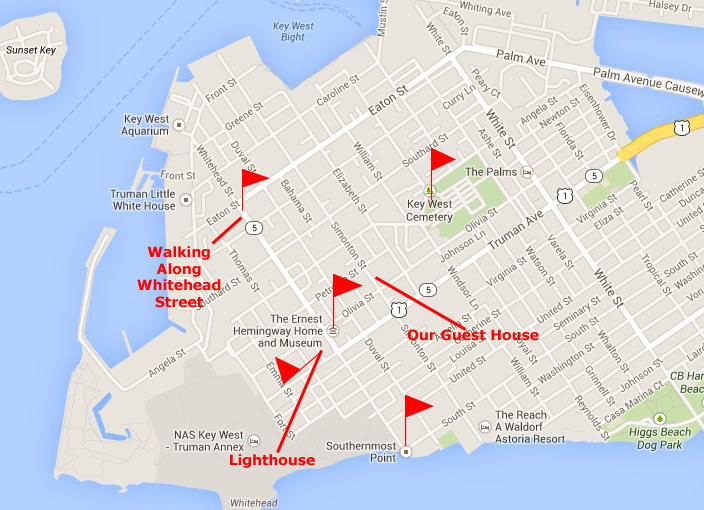
The map at right will give you an idea of where these sights were located in relation to the Sea Isles Guesthouse. Although we did hit these locations in a certain order, that order isn't particularly important, so I've not superimposed a route on the map.
In the sections below, we'll just make stops at these interesting places.
We'll begin with a visit to the Key West Cemetery.
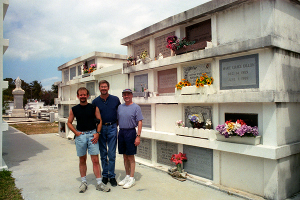
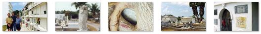
The Key West Cemetery
|
The cemetery was established at its current location in 1847, after an 1846 hurricane washed dead bodies from the earlier cemetery out of the coastal sand dunes on Whitehead Point near the West Martello Towers. An Jamaican Memorial Cemetery was dedicated beside the West Martello Tower in 2009. Slaves, ill from the sea voyage to slavery in "The New World," were buried there prior to the US Civil War. In 2005, this cemetery was among those profiled in the PBS documentary A Cemetery Special.
|
One interesting thing we learned was that some newer graves are being put in above-ground vaults, similar to the cemeteries in New Orleans, since the space for below-ground burials has become increasingly limited. Sadly, while many older graves date back to the mid-1800s, their markers were weathered, broken and/or illegible. Even so, wandering around the cemetery was immensely interesting. There are clickable thumbnails below for some of the other pictures we took here in the cemetery:
 |
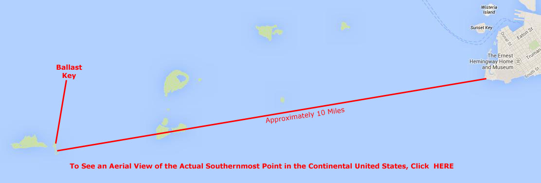
Southernmost Point of the Continental United States
|
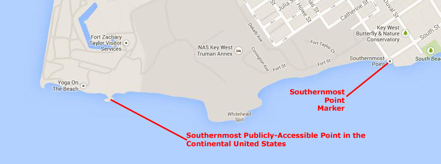
First of all, you can easily see that land on the Truman Annex property just west-southwest of the buoy extends further south than this southernmost point, and the true southernmost point on the island, approximately 900 feet farther south. It has no marker, though, mostly because it is on U.S. Navy property and cannot be visited by civilian tourists. What good would a marker do, local boosters thought, if no one but a few Navy personnel can see it? So this inconvenient fact was simply ignored.
Even restricting the definition to exclude U.S. Government property, there is another problem. The southernmost part of Key West Island accessible to civilians is actually the beach area of Fort Zachary Taylor Historic State Park (west of the "southernmost point"), and it is about 500 feet farther south than the marker. That location, however, is hard to get to, and few tourists would take the time to go around the Truman Annex and walk all the way through the state park (there is no vehicle road) to get to the marker. Again, this wouldn't help tourism much.
|
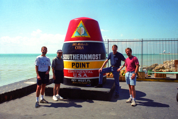
The Southernmost point was originally just marked with a sign, but it was often stolen. In response to this, the city of Key West erected this now famous concrete buoy in 1983. (The concrete buoy is actually an old sewer junction that was dug up in the area and found too heavy and large to move, so it was painted up to look like a buoy.) Today, the "Southernmost Buoy" is one of the most visited and photographed attractions in Key West, even though it is not a buoy and it is far from the southernmost point in the continental United States.
Actually, even before I did some recent investigation, we could all easily see that the wording on the buoy was not accurate, although you might not be able to tell by looking at the picture at left. Just to the left of the tourist who I prevailed upon to take the picture, all four of us could see a house sitting on a plot of land that seemed to extend further south than where we were standing. We eventually went around the corner to stand in front of the Southernmost House in the United States ("continental," I assume, being assumed). Now a tourist with a poor sense of direction might think that the house was actually north of the buoy, but in fact it was almost directly east, and so as you can see on the map above, its back yard dips to a point south of the buoy. Before we leave the "southernmost house," I'd like to show you another view of it here, and also a look through the gate here.
Actually, the misrepresentations didn't end there. As you can see, the buoy is claimed to be "90 miles to Cuba" (see the topmost wording on the buoy). This, too, is incorrect, although it might be considered nitpicking to point out that Cuba, at its closest point, is 94 miles (almost) due south of Key West.
So we can summarize that the buoy is actually "the southernmost point in the continental United States that is on easily-accessible public property." You can see that getting all that on the buoy would not only be crowding the inscription but also making the eyes of visiting tourists glaze over.
|
Florida's (and the continental U.S.'s) official southernmost point is Ballast Key, a privately owned island south and west of Key West. Signs on that island strictly prohibit unauthorized visitors; one gets there only by boat and only by the invitation of one of the island's residents. Even so, you'd have to trek to the back yard of the island's southernmost residence to get to that point.
You can see that Key on the larger map below (and if you want to see the southernmost point from the air, just click where indicated):
 |
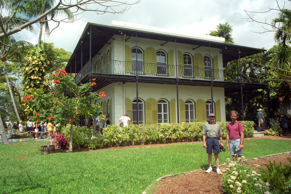
Ernest Hemingway's Key West Home
|
Asa Tift had approximately 14 slaves and it is assumed that was his labor force performing construction; the stone was all excavated from and hand-cut on the site. Electricity was added around 1899 and plumbing around 1944, the use of cisterns being obviated when water was piped in from Florida City that year.
Ernest Hemingway visited Key West for the first time in 1928. The home was at that time abandoned due to the Tift family�s struggle to stake claims on the estate. But, even so, the boarded home caught Ernest and his wife Pauline�s eye, and Hemingway purchased the property in 1931 for $8,000 in back taxes from the City of Key West. Ernest Hemingway, Pauline and their 2-sons, Patrick and Gregory, lived together on the estate from 1931-1940.
In 1940, Hemingway left Key West for Cuba, while Pauline stayed in the home with her sons until her death in 1951. While Hemingway continued to own the home until his death in Ketchum, Idaho, in 1961, he never moved back to Key West, only using the house as a way station on his trips between Cuba and Idaho.
When the sons agreed to sell the estate, local jewelry store owner Bernice Dixon bought it for $80,000 and resided in the main house until 1964. Then she moved into the smaller guest quarters in the rear and opened the main home as a museum and a memorial to the life and times of Ernest Hemingway. In 1968 Bernice moved to a home in the lower keys and the Hemingway guest quarters then became the Bookstore it is now. When Bernice died in the late 1980s, her heirs decided to continue to operate it as a museum. The estate remains the single largest residential property on the island of Key West.
|
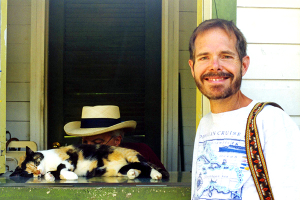
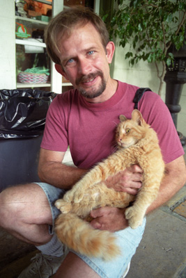
While the tour of the house was interesting, wandering around the grounds was just as interesting, particularly because we were never far from one or more of the 40-50 polydactyl (six-toed) cats that roam around the property and through the house.
|
Cats normally have five front toes and four back toes. About half of the cats at the museum have the physical polydactyl trait but they all carry the polydactyl gene, which means that any of the cats can have polydactyl kittens. Most of the polydactyl cats have extra toes just on their front paws, although about a third have that trait on all four paws. Sometimes it looks as if polyddactyl cats are wearing mittens because they appear to have a thumb on their paw.
|
The polydactyl cats are not a particular breed. The trait can appear in any breed and in cats of any color- Calicos, Tabbies, Tortoise Shell. White, Black, etc. They vary in shapes, sizes, colors and personalities. Key West is a small island and it is probable that most of the cats on the island are related.
The museum engages a local veterinarian to make house calls for routine procedures, annual vaccinations, and routine animal health maintenance. Hemingway named all of his cats after famous people and the museum follows that same tradition today. Cats are capable of learning and responding to their names, particularly if they have an affectionate relationship with the person who calls them.
Below are three more pictures of us with the polydactyl cats at the Hemingway House:
 |
 |
 |
Most of the cats we encountered seemed to be quite used to strangers, and quite willing to be picked up, petted and looked at. Perhaps they know they are special.
|
The historic Hemingway home was very interesting and I enjoyed learning something of the history of the house from our guide.
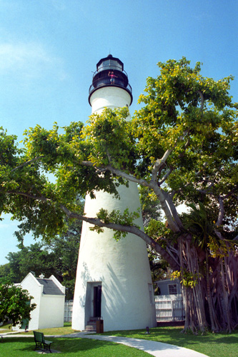
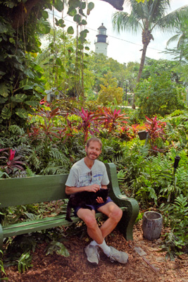
The Key West Lighthouse
|
As both lighthouses serving Key West had been destroyed in the 1846 hurricane, a ship, the Honey, was acquired and outfitted as a lightship to serve as the Sand Key Light until new lighthouses could be built. Due to efforts to reorganize the Lighthouse Board, Congress was slow to appropriate funds for the new lighthouses. The new tower for the Key West Light was completed in 1848. It was 50 feet tall with 13 lamps in 21-inch reflectors, and stood on ground about 15 feet above sea level. In 1858 the light received a third order Fresnel lens. In 1873 the lantern was replaced (it had been damaged by a hurricane in 1866), adding three feet to the height of the tower. The growth of trees and taller buildings in Key West began to obscure the light, and in 1894 the tower was raised twenty feet, placing the light about 100 feet above sea level.
Of course we paid the small admission fee to climb to the top of the lighthouse. From there, there were great views all over Key West in all directions. Immediately below us, across Whitehead Street and beyond the corner of it and US 1 we could see the Newman United Methodist Church which, by actual observation, would seem to be the southernmost church in the continental United States. There were, of course, other great views as well. Click on the thumbnails below to see some of the views from the top of the lighthouse:
 |
After the Coast Guard decommissioned the Key West Light in 1969, it was turned over to Monroe County, which in turn leased it to the Key West Arts and Historical Society. The society operates the lighthouse and its associated buildings as the Key West Light House and Keeper's Quarters Museum. On display at the museum is the first order Fresnel lens from the Sombrero Key lighthouse.
|
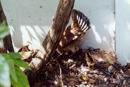
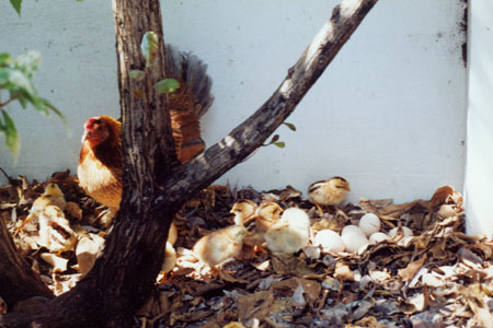
One last thing. When we were having lunch on our second day here, we were eating at a restaurant downtown that had some outdoor seating on a small deck. While we were waiting for our food, we noticed a couple of chickens wandering around below the deck. Then we took a look and found an entire family. The waitress told us that these wild chickens are something of a fixture on the island, and that there are a large number of them all over the place. Anyway, here are the two pictures we took:
 |
 |
The lighthouse was the last of the major things we saw while we were here in Key West, and the next day we headed back to Fort Lauderdale. It was a nice visit, and we were glad that Ron and Lowery came over from Tampa to make the visit with us.
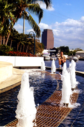
On the Fort Lauderdale Riverwalk
|
On this particular day, we walked to the Andrews Street Bridge (which, like the 3rd Avenue bridge, is decorated with a mosaic mural) and then crossed the river to have lunch at Shirttail Charlie's; we like it because you can sit at tables right on the river and watch the boats go by. When we were done with lunch and crossed back to the other side of the river, I got a picture of Fred with Shirttail Charlie's in the background across the river; you can see that picture here. Just up from where I took that picture, the Riverwalk curves around to cross the tracks of the Florida East Coast Railway, right by Rivercenter, and at that point there is a decorative portico through which people strolling the Riverwalk can pass, or, if a train is going by, wait to cross the tracks.
Click on the thumbnails below to see some other pictures that we took along the Riverwalk today:
 |
We had beautiful weather all through this particular trip, as you can see in our pictures from the Riverwalk.
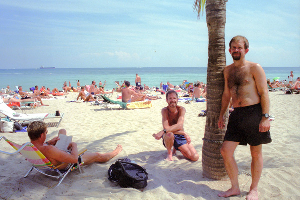
At Fort Lauderdale Beach
|
 |
One of the days we stopped by the beach on our bikes, the weather seemed threatening looking out over the ocean, but there were quite a few people at the beach nevertheless. Other days, the beach was more crowded, like the day we took the picture at left. You can see another version of that picture here. And on some days it is quite windy, which makes the palm trees all that more interesting.
|
Flora
To view the slideshow, just click on the image at right and I will open the slideshow in a new window. In the slideshow, you can use the little arrows in the lower corners of each image to move from one to the next, and the index numbers in the upper left of each image will tell you where you are in the series. When you are finished looking at the pictures, just close the popup window.
Our visit this month was all too short, but we both have to ration our vacations, so after eight days, we packed up, closed the condo up, and headed back to the airport for our flight back to Dallas.
You can use the links below to continue to another photo album page.
|
June 4-11, 2000: A Trip to Orlando and Tampa |
|
Return to the Index for 2000 |