|
July 4, 2000: North Carolina Trip- Day 5 |
|
July 2, 2000: North Carolina Trip- Day 3 |
|
Return to the Master Index for the North Carolina Trip |
Yesterday was waterfalls; today would be a nice drive along the Blue Ridge Parkway and some other attraction near Asheville- perhaps the Biltmore Estate.
Richland Balsam
|
We have come up from the south on US 23/74, and got on the Parkway headed east at Balsam Gap.
The Parkway runs east-west at this point, although when we turned east, the signs actually said "Parkway North," for the scenic road makes a turn to the north after it crests a few miles east of Balsam Gap.
|
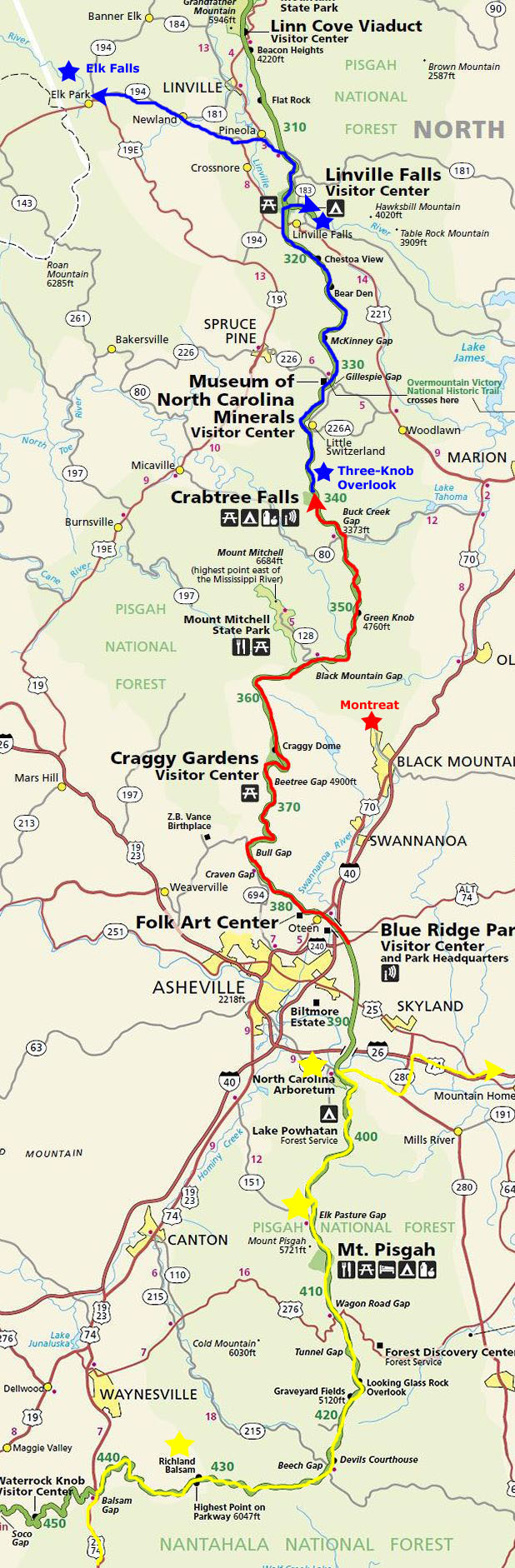
Richland Balsam is a mountain in the Great Balsam Mountains, rising to 6,410 feet; it is among the 20 highest summits in the Appalachian range. The Blue Ridge Parkway reaches an elevation of 6,053 feet as it passes over Richland Balsam's southwestern slope.
Richland Balsam's upper elevations (above approximately 5,500 feet) support part of one of just ten stands of Southern Appalachian spruce-fir forest. This forest type consists of two dominant tree types— the red spruce and the Fraser fir— commonly called the "he-balsam" and "she-balsam" respectively, although the latter has been decimated in recent decades by the balsam woolly adelgid infestation. Spruce-fir forests are found in the highest elevations of Southern Appalachia due their ability to survive in climates that are too cold and harsh for the hardwood forests which dominate lower elevations. Southern spruce-fir ecosystems resemble ecosystems more commonly found in the northern United States and Canada than in the Southeastern United States.
The eastern half of Richland Balsam is part of the Pisgah National Forest, and most of the western half is part of the Nantahala National Forest (the exception being the Blue Ridge Parkway corridor, which is maintained by the National Park Service). There is a parking lot and overlook atop Richland Balsam marking the parkway's highest point.
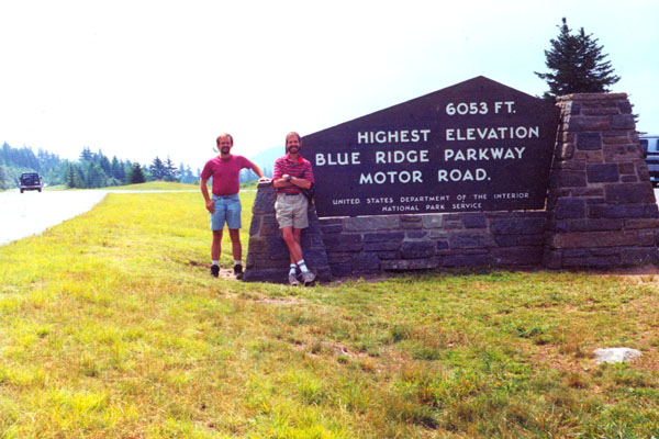
Devil's Courthouse
|
The mostly paved trail started at the overlook and took us on a half-mile route to the summit; along the way were rare plants like the Rock Gnome Lichen and the Spreading Avens. Some of these alpine species may be remnants from the last glacial period. The panoramic view from the summit includes four states: North Carolina, South Carolina, Georgia, and Tennessee. Below are clickable thumbnails for some of the pictures we took along the trail:
 |
The hike up to the top was really neat and very enjoyable. At spots, the trail was almost overgrown with rhododendrons and other plants. I understand that in the years since we were there, the rusting metal railings that you could see in some of the pictures have been replaced with nice stonework walls.
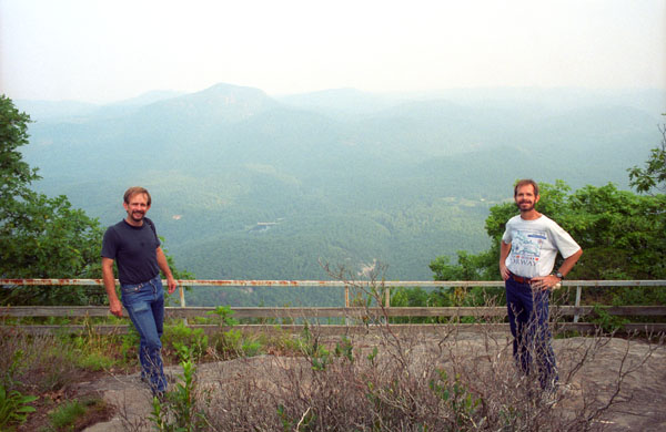
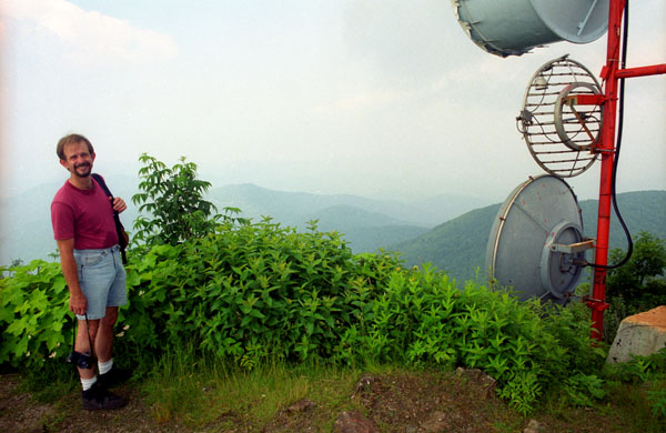
Mt. Pisgah
|
The prominent tower, on what is known as Pisgah Ledge, is a 339-foot-tall television broadcast tower owned by Chesapeake Television and used to transmit two TV stations (Asheville's WLOS and WUNF) and two radio stations- WKSF FM and a National Weather Service station. It is the highest television antenna east of the Mississippi River; its top is at 6,023 feet above sea level. From this location, the stations cover the western Carolinas media market- although due to the terrain, the stations actually cover much more of South Carolina than they do North Carolina.
|
We spent a half hour or so at the peak, where Fred took another picture of me on the peak. Leading up the mountain from the valley floor, is a still-operating cable car that is used to ferry broadcasting equipment to the building. The cable car also ferries engineers during bad weather, for mandatory transmitter work. Also at the Mt. Pisgah Parking area was the Buck Spring trailhead, which was a short walk down a trail to the foundation stone remains of the George Vanderbilt Hunting lodge.
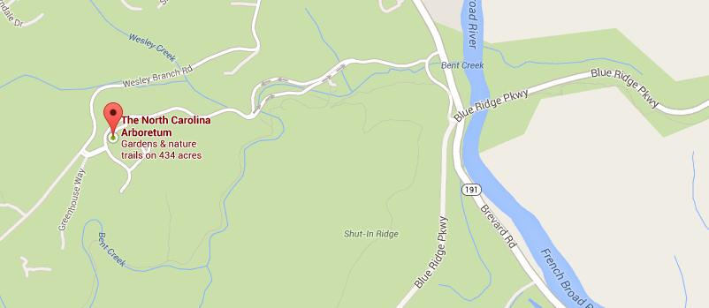
A Visit to the North Carolina Arboretum
|
Over the course of the next few years, funding was obtain from the State of North Carolina, and the non-profit Arboretum Association was set up. Ground was broken for the first of the gardens and support buildings in 1990, and major construction continued for the next five years, with the gardens taking on their present form by 1995. Development of new gardens, garden programs and other activities continues today.
We left our car in the parking area and headed for the entrance. There was no entrance fee, but there was a parking fee, which seemed to me to amount to the same thing. Except that the more people you have in your car, the less the "admission" is per person. A brochure mentioned that this was intentional, to encourage visitors to carpool when possible- just another facet of the Arboretum's emphasis on sustainability.
|
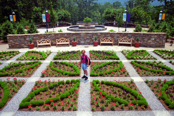
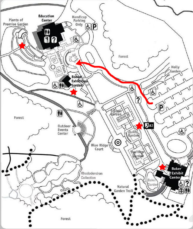
The first stop we made was at the Quilt Garden. This garden is a unique interpretation of traditional quilt block patterns with plants, representing the close ties between heritage crafts and gardening and the contemporary art and craft of quilting in the Southern Appalachian region.
Designs in the quilt garden change seasonally ~ each quilt pattern appears in several iterations. The garden consists of 24 in-ground beds divided by gravel and slate foot path walkways. We enjoyed walking around the beds; the garden seemed somewhat similar to the test gardens at the Dallas Arboretum. You can also walk up to an observation balcony that overlooks the Quilt Garden and looks toward exploring the Blue Ridge Court and its fountain. It was from this balcony that the picture at left was taken.
The Arboretum was an interesting place, and if we lived in Asheville, we would probably visit as often as we do the Dallas gardens. Unlike the Dallas Arboretum, however, the NC Arboretum encompasses a great deal of acreage that is not given over to cultivated gardens.
|

|
We stayed at the gardens until late afternoon before heading off to find lodging for the night. We plan on going to Chimney Rock tomorrow, so the most convenient place to stay will be in Henderson, North Carolina, and we found a nice motel just off I-26 at US 64- the highway over to Chimney Rock.
You can use the links below to continue to another photo album page.
|
July 4, 2000: North Carolina Trip- Day 5 |
|
July 2, 2000: North Carolina Trip- Day 3 |
|
Return to the Master Index for the North Carolina Trip |