|
July 3, 2000: North Carolina Trip- Day 4 |
|
July 1, 2000: North Carolina Trip- Day 2 |
|
Return to the Master Index for the North Carolina Trip |
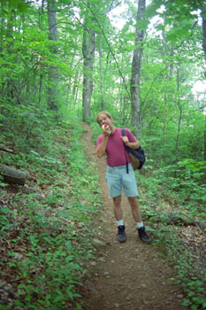
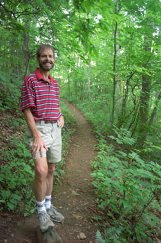
At the Standing Indian Campground
|
The campground is surrounded by 5,000-foot peaks and crossed by several natural trout streams. It is the focal point of numerous hiking trails and has easy access to the Appalachain Trail. If we'd wanted to camp a third night in a row, we probably would have just stayed put here; there was certainly a lot to do relatively nearby.
Situated in a scenic and historic section of the Nantahala National Forest and only a 20-minute drive from Franklin, the campground had five loops, with sites available by reservation or on a first come, first serve basis. Each site had a fire ring, a grill, a lantern post and a picnic table, and the camground also had drinking water, flush toilets and showers.
On our way out of the campground, we parked at the access point for the Appalachian Trail and spent an hour hiking about a mile up the trail and back. That's where the pictures at the left were taken.
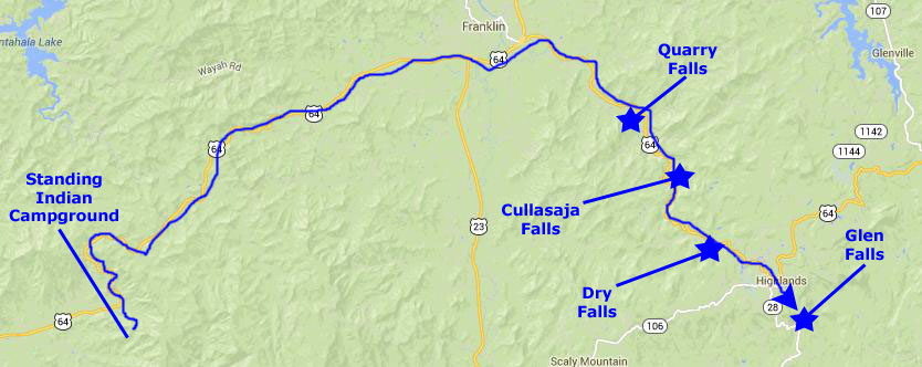
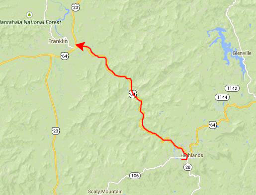
Back in the car, we headed off east on US 64 to see some of the many waterfalls that were mentioned in Judy's book.
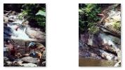
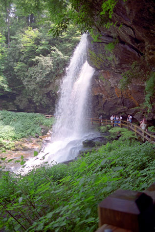
Quarry Falls
|
Each of the waterfalls we stopped at was interesting in its own way (and there were a couple of falls that we just saw from the road as well). Again, in this time before digital, cost-free photography, we took way fewer pictures than we might have taken today (which, again, is mid-2014).
|
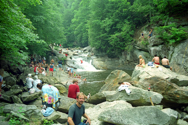
This popular swimming and sliding area just off the highway is also known as "Bust Yer Butt Falls," for there are a number of places on the falls where sliding is often done. For added excitement, there is a "jump off" rock for diving into the chilly waters. The sign at the trailhead noted that in winter, the falls collect snow to make a serene winter setting. The sign also pointed out the telltale quarry drill marks on some of the larger boulders downstream of the falls.
|
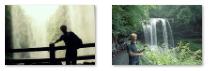
Although the falls were very pretty, it was kind of hard to appreciate them, as there were so many raucous people around swimming, sliding and jumping in the warm afternoon. You can see another view of the activity at the falls here.
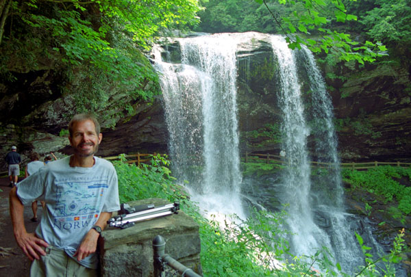
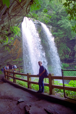
Cullasaja Falls
|
|
The height of the falls was given as 200 ft in the book Judy had (Kevin Adams' book, North Carolina Waterfalls), but my research on the Internet found varying heights up to 250 feet. A third entry in the height sweepstakes was from Google Earth; it said that the falls were 137 feet high (based on the elevation of the water at the top of the falls and the elevation of the plunge pool at the bottom of the falls).
Regardless of how high they actually were, they were a lot of fun to visit- one of the two best stops we made today. Though difficult to reach, some use the falls as a place for leisure activities such as swimming (in the pool below the falls) or rappelling.
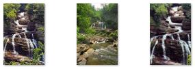
Dry Falls
|
Located roadside on US 64, everyone can enjoy the view from a fully accessible observation area adjacent to the parking area, but it's only a short walk down the trail lined by native mountain plants and flowers to reach the falls.
While the view is nice from the new observation deck, the real treat is getting a closer look by climbing down the stairs and short path. The path is often wet after a rainy period. There are many great vantage points along the way for photos. You can often see a rainbow if you and the sun are in the right position. A little sign advises that the spray from the falls may get you wet when you walk behind it, and so to have somewhere to hide your camera or anything you don't want to get wet. But it�s usually just a little mist, as it was on the day we were here.
Dry Falls flows on the Cullasaja River through the Nantahala National Forest. It is part of a series of waterfalls on a 8.7-mile stretch of that river. The Cullasaja Gorge presents one with the impression that it was cleaved in a moment of anger. Narrow and deep, the Cullasaja River rushes and drops in a series of cascades and waterfalls to the Tennessee River near Franklin.
|
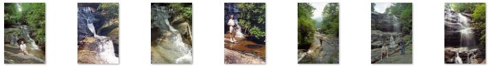
Below are clickable thumbnails for the two other pictures we took here at Dry Falls:
 |
The U.S. Forest Service has designated this to be a National Scenic Byway because of the river and its numerous waterfalls. The highway clings to the north bank of the Cullasaja River as though it knew what would happen if it let go.
Though the road is narrow and the curves are frequent and sharp, it was a fun and beautiful drive. There were many places to pull off, get out and enjoy the views of the river.
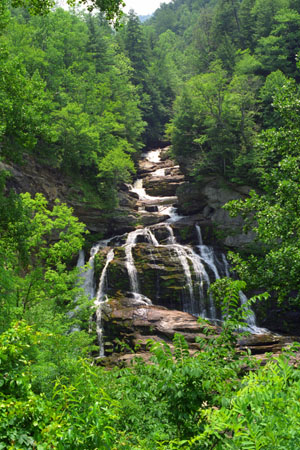
Glen Falls
|
We began the trail behind the sign board at the parking area. We saw a marker for a trail leading up Chinquapin Mountain immediately to our right. We stayed straight on the Glen Falls trail, which begins level and wide. We came upon a nice overlook off the escarpment on the left. The view is of the Blue Valley, and the foothills and beyond to the South Carolina Piedmont region (Highlands is only a few miles from the NC-SC border). The trail turned right here, and began a moderately steep downhill through a mixed forest of medium-aged trees, some of them quite large. There was plenty of rhododendron and mountain laurel along the way.
On its way down, the trail has many steps built in, but there were also lots of roots, small puddles and some erosion, so we had to be careful. We began to hear the creek beside us; there seemed to be some rough side trails over to it. But eventually the trail veered away from the creek again.
The hike was downhill from the parking lot (I always prefer to climb to a site so that I can look forward to an easy return, sigh); it was a 400-foot elevation change. Shortly after, we passed over the top of the falls, and there was a beautiful view from the top of Glen Falls.
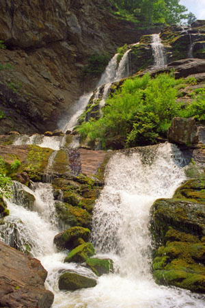
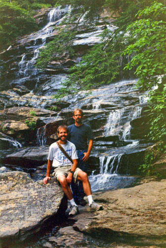
The trail left the creek again, went around the nose of the ridge, and then switched back and forth a couple of times to bring us to the bottom of the upper falls. The water comes down in two distinct falls; the right side had more water. Be careful if you decide to venture very near the falls - the bank is steep and slippery, and the rocks are slippery as well. There was a large flat area great for safe viewing, but one didn't want to venture too close to the top of the second set of falls.
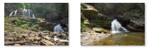
We continued on down the trail that went alongside the rocky creek bottom until we eventually came out at the base of the second set of falls. This was the most picturesque area, and it is where we took most of our pictures. There was plenty of room to relax on the rocks at the base of the falls, and to take pictures. Below are clickable thumbnails for some of the pictures we took on and around Glen Falls:
 |
We ventured down the trail a bit more, to a third section that drops about 15 feet. But some logs were stuck in the waterfall, so it wasn't much to look at. When we were finished at Glen Falls, we retraced our path back to parking area and the car.
We Stay in Franklin, NC
|
We drove from Highlands back along Highway 64 to Franklin, intending to go back up to the Parkway tomorrow morning. We found a small local motel, checked in, got cleaned up, and had dinner at a local Bonanza-type restaurant.
It was a great day with lots of waterfalls- a success in our book!
You can use the links below to continue to another photo album page.
|
July 3, 2000: North Carolina Trip- Day 4 |
|
July 1, 2000: North Carolina Trip- Day 2 |
|
Return to the Master Index for the North Carolina Trip |