|
July 2, 2000: North Carolina Trip- Day 3 |
|
June 30, 2000: North Carolina Trip- Day 1 |
|
Return to the Master Index for the North Carolina Trip |
Today, we're going to visit some more waterfalls north of Crabtree Campground, and then retrace our path back down the Parkway, this time heading south of Asheville to a campground that will position us to a whole slew of waterfalls tomorrow.
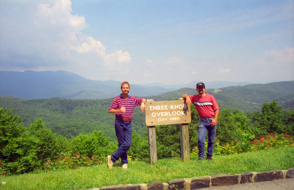
The Three Knob Overlook on the Blue Ridge Parkway
|
The view from this overlook is sensational. The Seven Mile Ridge seems to stretch forever with slopes and ridges filling the foreground. The impressive Black Mountains loom high above Seven Mile Ridge in the background. Early mountain roads would follow a ridge instead of a river valley that could end abruptly. One of these old sled roads still extends across the Seven Mile Ridge. Some parts of the road are still used by farmers in the area.
We got back in the car and continued north another 20 miles to a point where a spur of the Parkway heads over to Linville Falls.
Linville Falls
|
Linville Falls is near the Wilson Creek Wilderness area and at mile marker 316, the road to the falls heads off to the east, deadending after a mile and a half at the falls visitor center. There was quite a lot to do and see here in the Linville Falls Recreation area, and so we were here until well after lunchtime.
|
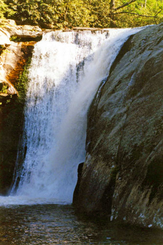
The falls were donated to the National Park Service in 1952 by John D. Rockefeller, Jr. He provided about $100,000 for purchase of the land, including a 1,100-acre area surrounding the falls and a part of Linville Gorge, from a local owner who had purchased it about 1900. According to a legend told by the personnel at Linville Falls, the falls were used by local Native Americans to execute prisoners. No one is known to have survived a fall over the final plunge. (As it turned out, that record was broken in 2010 when a well-prepared, skilled kayaker survived the drop in 2010.)
At one time, the upper section of the main plunge was the same height as the lower section; however, flooding caused the upper section to collapse on top of the lower falls, making the lower falls a considerably longer plunge. The National Park Service operates the visitor center and several miles of trails with 4 overlooks for the falls. The half-mile Upper Falls Trail leads to the top of the falls, where visitors can see the small twin upper falls and the water spiraling through a small canyon on its way to the main falls.
There are 3 main trails to follow, and we all three of them. The Erwin's View Trail is by far the most popular. It was one and a half miles round trip and moderate in difficulty. The trail began at the visitors center, then crossed the Linville River. The first viewing area is at a half mile and offers a view of the small double falls above the main falls. Below this, the river narrows and snakes through a small gorge before plunging over the main drop. The second overlook offers a view of both the main falls and the Linville River above them, including the small upper falls. You can see that view here.
The third overlook is called Chimney View, and features a stone balcony off the trail that offers a great view of the main falls. The last overlook offers the most iconic view of Linville Falls; it is called Erwin's View.
Again beginning at the parking area, the half-mile Plunge Basin Trail leads to the Plunge Basin Overlook, which provides a view of the falls from the other side of the river, and we did that short hike after completing the Erwin's View Trail.
|
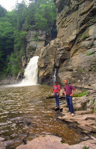
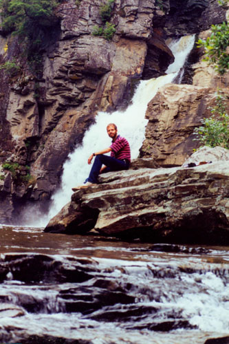
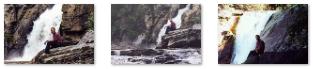
Swimming is prohibited at all areas of Linville Falls, as many deaths have occurred, but this didn't keep us from wandering around at the base of the falls, and getting up on the rock walls at the base. We took a number of pictures down here, and I have put clickable thumbnails for them below:
|
We had some lunch in the parking area for Linville Falls before getting back in the car and heading off to another set of falls we'd learned about from Judy's book.
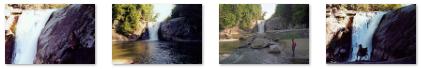
Elk Falls
|
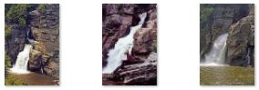
Elk Falls is beautiful 50' high waterfall, and is also a very popular swimming hole in the summer months and a popular place for people who for some reason feel the need to jump off of a waterfall. Not usually a good idea, as a number of injuries and deaths have occurred here over the years. There is a nice area of flat rock near the top that allows you to safely venture out without being too close to the top. There's also a big rock at the top you can get on for a better view. Signage admonishes visitors not to swim in the river above the falls, as the current has taken people over the falls before. There was also a trail down to the base of the falls that we followed, and from there we took a number of nice pictures of Elk Falls; there are clickable thumbnails for some of these pictures below:
 |
The trail to the base was a little steeper, but we were careful. We passed the area where people hang out and even set up chairs, and then arrived at the safe area at the base of the falls where people also swim. Elk Falls was very picturesque, but we now had something of a drive to get down south of Asheville to the campground where we would spend the night.
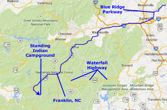
Getting to the Standing Indian Campground
|
At Franklin, we took US 64 west about 15 miles until we found the turnoff for the campground- which is in a National Forest. After another five miles on a gravel road, we found the campground itself and got a very nice site. We set up the tent and then decided to drive back into Franklin to have supper, rather than do sandwiches again.
We returned to the quiet campground and spent a very restful night.
You can use the links below to continue to another photo album page.
|
July 2, 2000: North Carolina Trip- Day 3 |
|
June 30, 2000: North Carolina Trip- Day 1 |
|
Return to the Master Index for the North Carolina Trip |