|
November 2-3, 2002: Arizona Trip Days 8-9 |
|
October 31, 2002: Arizona Trip Day 6 |
|
Return to the Index for Our Arizona Trip |
Today we're going to spend in the Superstition Mountains east of Phoenix.
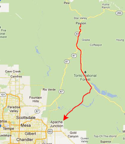
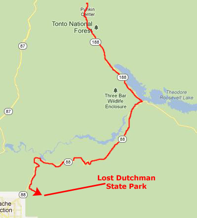
Getting to the Superstition Mountains
|
|
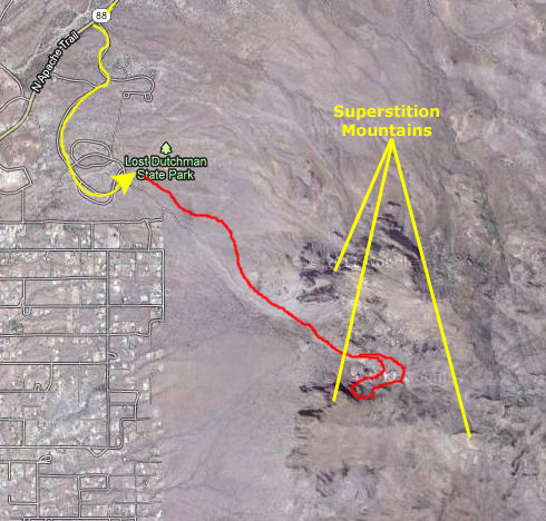
Lost Dutchman State Park is a natural area that has a campground and visitor Center, as well as a number of both interpretive and hiking trails that lead up into the Superstition Mountains. The Superstition Mountains, popularly referred to as "The Superstitions", are a range of mountains in located to the east of the Phoenix metropolitan area. They are anchored by Superstition Mountain, a large mountain that is a popular recreation destination for area hikers.
|
As with most of the terrain surrounding the Phoenix metropolitan area, the Superstition Mountains have a desert climate, with high summer temperatures and a handful of perennial sources of water. The altitude in the more remote, eastern portion of the wilderness is higher than the western portion, which lowers temperatures slightly. Numerous hiking trails cross the mountains from multiple access points, including the Peralta Trailhead, the most popular. The Lost Dutchman State Park, located on the west side of Superstition Mountain, includes several short walking trails.
|
We are going to be hiking the Siphon Draw Trail. It is a very scenic hike, about 4 miles round trip, and winds up into the canyon known as Siphon Draw. It is possible to hike up to one of the mountain peaks, the Flatiron, although it is not a designated, maintained trail all the way. What we'll do is follow the Siphon Draw Trail to its farthest point, and then just hike left or right to whatever features seem interesting.
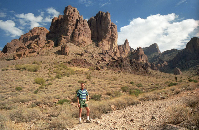
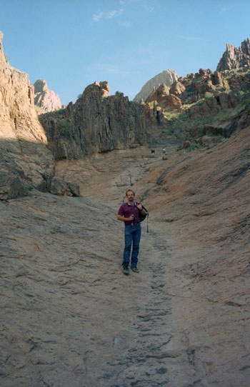
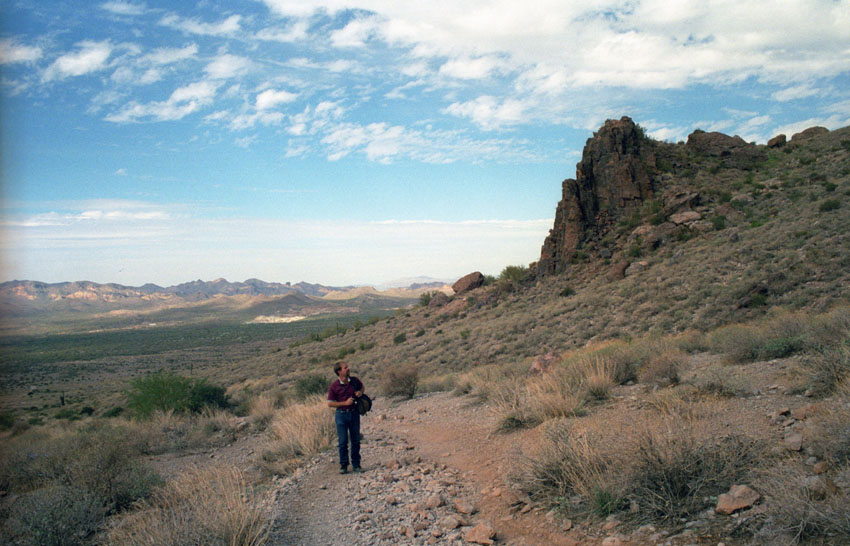
So once we'd selected our campsite and filled out the paperwork to hold it, we gathered our cameras and stuff together and went over to the Siphon Draw Trailhead to begin the hike that should take us the rest of the day. The Siphon Draw Trail begins with a half-mile stretch over fairly open land, sloping up gradually with The Superstitions always ahead of us.
About halfway along this stretch, we cross the boundary of the Tonto National Forest, which takes us from state-owned to federally-owned land. There are different rules and regulations on the two sides, but they won't have any impact on us as hikers.
Fred made a movie as we were starting out on the trail, and you can watch it with the player below:
|
|
After making the movie, we continued up the Siphon Draw Trail.
|
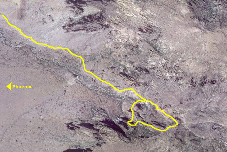
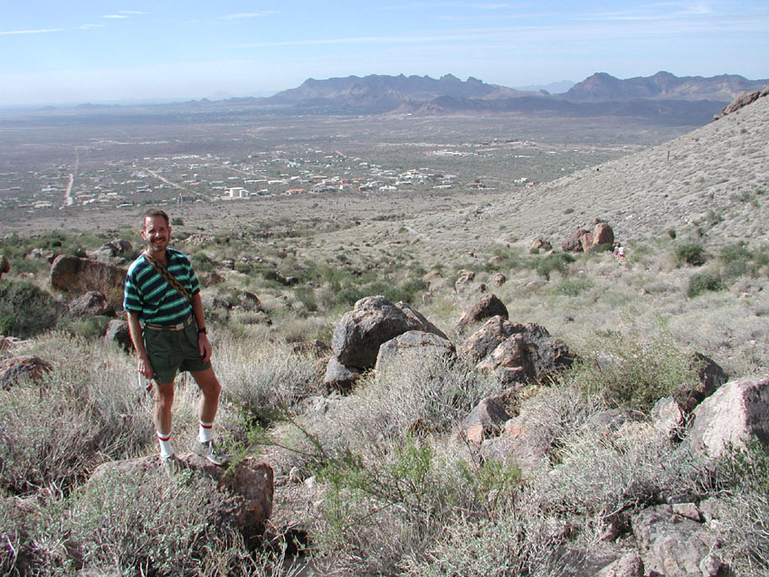
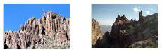
As we came around the western slope of the mountains and climbed higher, vistas to the west began to open up and although we couldn't quite see downtown Phoenix, we could see the buildings and streets that appear above in the aerial view of the area (you can even pick out some of the same buildings in the aerial view that you can see in the two pictures below (click on the thumbnails to view the full-size pictures):
|
We continued hiking slowly up to Siphon Draw through the mid-day sunlight. It was a really nice walk and we were enjoying it immensely.
|
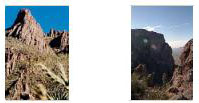
Once we reached the draw, the hiking and climbing got more interesting. As you can see here, we have left the relatively flat, improved trail behind and are now climbing, most times on bare rock, up the steeper slopes of The Superstitions. We climbed this way for a while, zig-zagging through the draw, until we reached a point about halfway up the draw where we got a really beautiful view of the eastern part of the Valley of the Sun where Phoenix is located. The afternoon was nice and warm and the views were tremendous.
Next, we reached a section of bare rock that we had to negotiate.
|
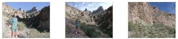
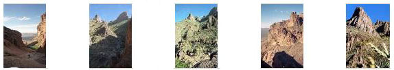
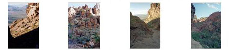
We carefully climbed up this section of the trail, sometimes standing up and other times on our hands and knees; a slide of any distance could hurt! The views got better and better as we climbed until we reached the area of vegetation that you can see up the mountain ahead of us. There, it was easier to stand and look around, and we took quite a few pictures. Click on the thumbnails below and you can see some of them:
|
|
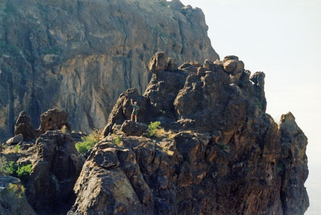
At the top of the bare rock portion of the draw, we followed the trail for another couple of hundred feet upward and arrived at the end of the well-marked trail. Both of us climbed around that area for a while together, and then we separated for a while so we could hike around to different parts of the mountain group. We were never very far from each other, and almost always within shouting distance.
I went around to the right (south and southwest) to climb one of the smaller of the peaks to the south of us.
|
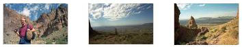
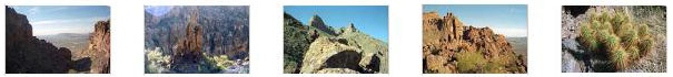
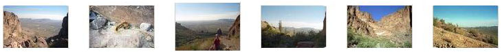
I took some good pictures from my vantage point, and if you will click on the thumbnails below you can have a look at some of them:
|
I climbed around for a while up where I was, and Fred wandered around where he was until I climbed down and rejoined him and together we explored around here at the top of the trail for a while. Click on the thumbnails below to see some of the pictures we took from this farthest point on the Siphon Draw Trail:
|
Fred made a movie while we were here at the top of the trail, and you can watch it with the player below:
|
|
Then we started down the trail back to the campsite. We took it slowly, enjoying the afternoon, admiring the views, taking pictures and just reveling in the beauty all around us. If you will click on the thumbnail images below, from left to right, you can see some of the pictures we took on our way down the trail:
|
This was a great hike this afternoon, and we got back to the trailhead in late afternoon, but being November there was still plenty of light. We went to the campsite and set up the tent. We were going to do another of Fred's campfire meals, but since we were so close to civilization, we decided to drive into east Phoenix and eat out instead. We did that and then happened to drive by a large theatre complex and thought we might just as well watch a movie, and so we got tickets for a movie we'd seen the previews for- "The Ring."
Afterwards, we drove back to Lost Dutchman State Park in the dark, and hit the sack inside the tent.
You can use the links below to continue to another photo album page.
|
November 2-3, 2002: Arizona Trip Days 8-9 |
|
October 31, 2002: Arizona Trip Day 6 |
|
Return to the Index for Our Arizona Trip |