|
November 1, 2002: Arizona Trip Day 7 |
|
October 30, 2002: Arizona Trip Day 5 |
|
Return to the Index for Our Arizona Trip |
|
The White Tank Campground Climbing Squaw Peak Tonto Natural Bridge |
Today we are going to make a hike right in the middle of Phoenix up Squaw Peak. Then we'll head north to visit Tonto Natural Bridge State Park. We'll probably end up staying up in that area somewhere.
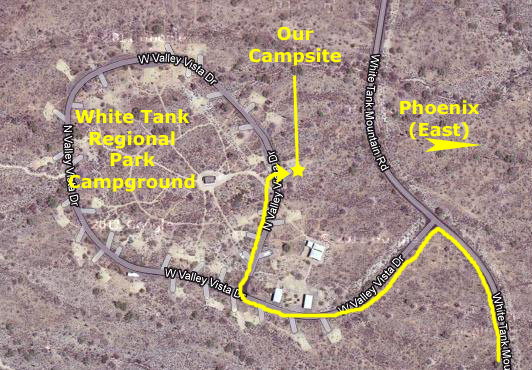
Camping in White Tank Regional Park
|
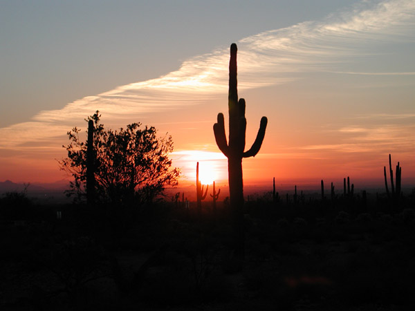
The light from the rising sun waked us early, which was good because it was a beautiful sunrise.
|
|
With the sun up only slightly, we walked a hundred feet east of our actual campsite to look back at the White Tank Mountains. And when the sun had risen a bit more, and everything was a little brighter, we walked closer to the car so we could get a better look at our campsite.
|
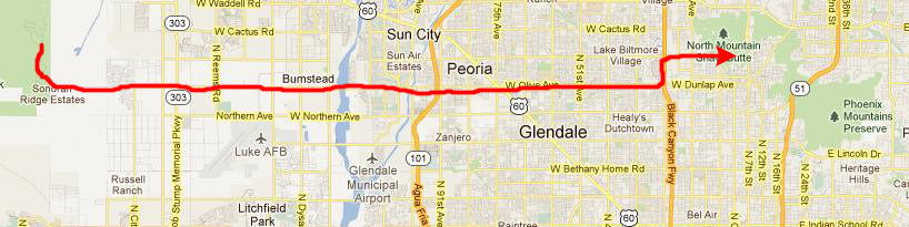
We headed out of the White Tank Regional Park off to our first hike that would be right in the middle of Phoenix.
You can return to today's index
or continue with the next section below.
Climbing Squaw Peak in Phoenix
Getting to Squaw Peak
|
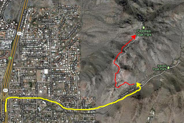
It took us about an hour to get across the city in the morning rush hour, but we eventually reached the parking area off Lincoln Drive.
|
Now, looking at the aerial view taken from Google in 2012, you may wonder about why I am calling it Squaw Peak, rather than Piestewa Peak. Well, that is something of a story.
Squaw Peak or Piestewa Peak?
|
The state board, absent its director, approved the name change to Piestewa Peak on April 17, 2003, less than a month after Piestewa's death. The U.S. Board on Geographic Names, however, refused to accept a similar petition at the time, citing their own five year waiting rule. Five years later the board agreed to review the request as the waiting period had passed. The board also considered other potential alternatives, including Swilling Peak for area pioneer Jack Swilling. During the discussions, board members indicated that there was considerable opposition to the name change but also indicated that the state's pre-emptive decision had complicated the process. Ultimately, the national board voted to approve the name change to Piestewa Peak, while indicating that the original name of Squaw Peak might still be used in publications as a secondary reference.
So now you know.
Hiking up Squaw Peak
|
As a landform, Piestewa Peak is relatively young, formed roughly 14 million years ago. However, it is composed of much older rock, primarily schist. Flora in this area is typical of the lower Sonoran Desert and includes almost all varieties of Arizona cactus such as saguaro, barrel, hedgehog, pincushion, jumping cholla and prickly pear. Trees and colorful shrubbery include palo verde, mesquite, ironwood trees, creosote (dominate), ocotillo, brittle bush, desert lavender and giant sage shrubs.
Wildflowers are abundant in the early spring and include Mexican gold poppies (deep yellow), brittlebush (yellow), lupine (purples), desert globemallow (orange) and scorpionweed (purple). Fiddleneck and bladderpod also are blooming in some areas. These are in addition to the many varieties of flowering cacti. Reptiles and wildlife that thrive in the preserve are gila monster, horned lizard and chuckwalla. Hikers also can encounter rattlesnakes. The mammal population includes coyote, jackrabbit, cottontail rabbit, ground squirrel and kit fox. There are more than 54 species of birds from the turkey vulture to mockingbirds, cactus wrens, gamble�s quail and several species of owls and hawks.
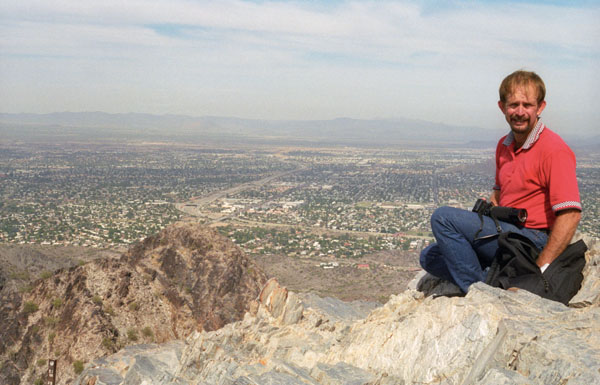
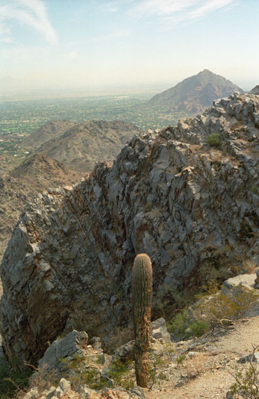
We learned later that quite a few hikers do not actually reach the top due to the fact that this trail is more difficult than it looks, especially in the summer when temperatures are well over 100 �F. No water is available on the trail and dehydration is a common and serious problem with hikers who come unprepared. Views from the summit include, in clear weather, Pinnacle Peak, the McDowell Mountains, Four Peaks, the Superstition Mountains, Tabletop Mountain, the Sierra Estrella, Woolsey Peak, the White Tank Mountains, the Harquahala Mountains, the Papago Mountains and the Bradshaw Mountains. Although the hike can be done in a half-hour each way in cool weather, we took our time and spent an hour going up and about 45 minutes coming down.
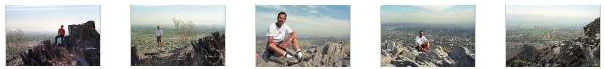
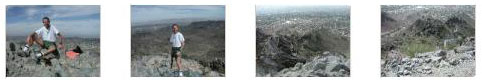
The hike was very enjoyable, and we took lots of pictures. Click on the thumbnails below to have a look at some of them:
|
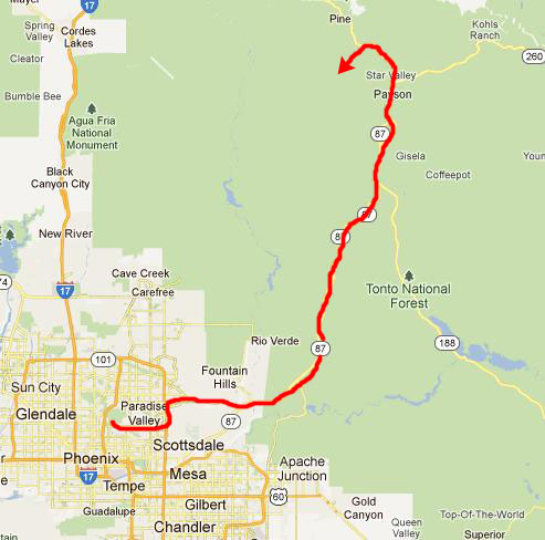
We were pretty parched and hungry when we got back from the hike, so we made some lunch there at the trailhead before consulting our maps as to the best route north to Tonto Natural Bridge State Park.
You can return to today's index
or continue with the next section below.
Tonto Natural Bridge State Park
|
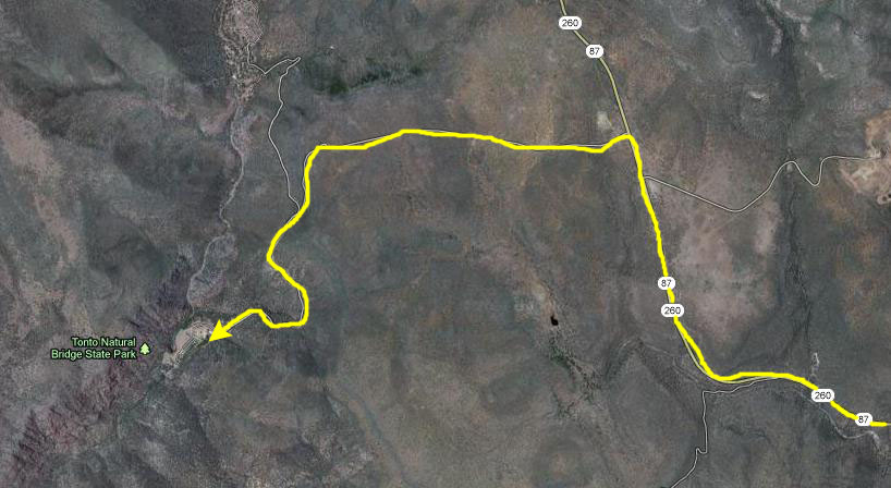
The turnoff is located about halfway between Payson and the town of Pine, Arizona, another five miles north.
|
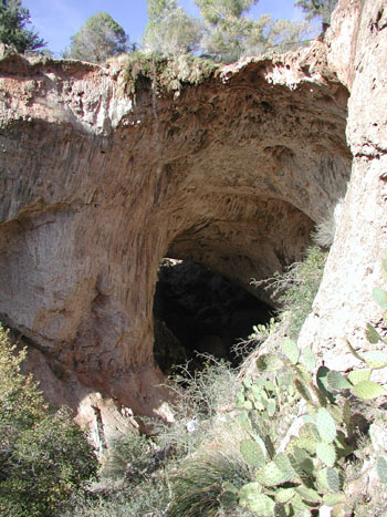
Tonto Natural Bridge State Park is tucked away in a tiny valley surrounded by a forest of pine trees, and the features of the canyon and the natural bridge have been in the making for thousands of years.
|
In 1898 he persuaded his nephew, David Gowan Goodfellow, to bring his family over from Scotland and settle the land permanently. After a week of difficult travel from Flagstaff, the Goodfellows arrived at the edge of the mountain and lowered their possessions down the 500 foot slopes into the valley by ropes and burros. David Goodfellow, with the help of his wife and sons, built a road, converted the rocky travertine-covered acres into fertile farm land, and built a comfortable home to accommodate the family and the few curious who were daring enough to venture into this rugged semi-wilderness to see this amazing natural wonder lying at their doorstep. The Goodfellows continued to enterprisingly improve the site, by constructing six small guest cabins, then building a 10-room lodge with running water and improving access to the caves beneath the Bridge.
The Goodfellows owned the Bridge until 1948 when Glen L. Randall purchased it from them. Mr. Randall�s grandfather first entered the area in 1879 and was one of the first residents to greet the Goodfellows when they moved over from Scotland. The Randalls were the owners and operators of the bridge when an effort began to make the area an Arizona State Park. Since its creation in 1957, the State Parks Board made acquisition of the Tonto Natural Bridge a priority project. In 1968, an Act of the Arizona Legislature authorized the Park and appropriated $250,000 for the acquisition of the Tonto Natural Bridge.
The Randalls were enthusiastic about the prospect of its acquisition as a State Park, either through legislative action, or through The Nature Conservancy. After numerous funding options had been explored, Mrs. Randal was offered $125,000, which she rejected. Another appraisal resulted in an offer of $225,000- also rejected. After a confused few years where the ownership of Tonto Natural Bridge became clouded, the courts determined that a family named Wolfswinkle was now the legal owner of the Tonto Natural Bridge. The Wolfswinkles renovated the lodge in 1987 to return it to its original condition, and then indicated to the State that they were still interested in having the site become a state park.
|
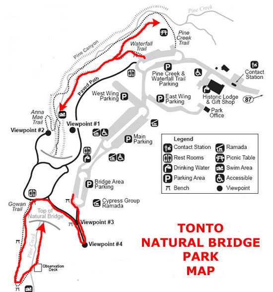
The result was one of Arizona's premier State Parks, and we planned on doing two hikes here. I have marked them on the park map at right. First, of course, we'll follow the improved trails down to the base of the natural bridge and have a look around there. Then we'll come back up, cross the parking areas and take a shorter hike to the Pine Creek Waterfall.
We Hike to the Natural Bridge
Then we followed the trail back across the top of the natural bridge and then down the west side of the canyon. Here the trail descended about two hundred feet to a boardwalk across the creek and back to the east side of the canyon. There, we found an observation deck with excellent views into and underneath the natural bridge. Tonto Natural Bridge is believed to be the largest natural travertine bridge in the world. The bridge stands 183 feet high over a 400-foot long tunnel that measures 150 feet at its widest point.
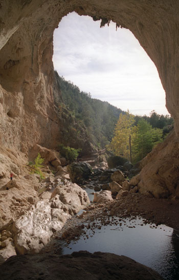
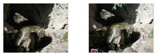
From the observation deck there were impressive views of the entire Natural Bridge, but it was also possible to go beyond the deck and climb right into and underneath the bridge.
|
|
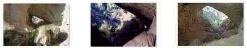
We spent a good deal of time down here underneath the Natural Bridge; it was really an amazing place. As you saw in some of the pictures, there were some old ladders and stuff up underneath the bridge on the rock ledges; I am not exactly sure how old they were or what they were for.
|
|
When we left the base of the bridge, we walked back across the wooden boardwalk and then up the trail to the top of the bridge and back to the parking area.
The Waterfall Trail
|
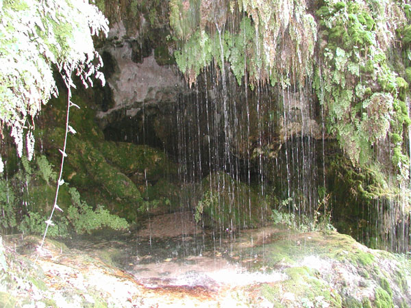
Towards the southern end of the trail, we crossed a boardwalk footbridge that took us to a platform at the end of the trail. Here, you could stop, sit down, and enjoy your surroundings. Fred examined the ferns and I took some pictures of one of the waterfalls.
|
|
It was really neat down here on the trail, but after a while we began to lose our light.
Our next stop was going to be the Superstition Mountains east of Phoenix, but we didn't want to drive down there and get there in the dark, so we drove on through Pine, Arizona and over to Interstate 17, went south a few exits, and got a room for the night.
You can return to today's index
or use the links below to continue to another photo album page.
|
November 1, 2002: Arizona Trip Day 7 |
|
October 30, 2002: Arizona Trip Day 5 |
|
Return to the Index for Our Arizona Trip |