|
June 22, 2003: Western Trip, Day 2 |
|
Return to the Index for Our Western Trip |
Our Western trip began on Saturday morning, June 21st. I came up to Fred's house last night, and this morning we packed the rest of our gear, including our camping stuff, into my little Elantra, and we were ready to head off about nine-thirty.
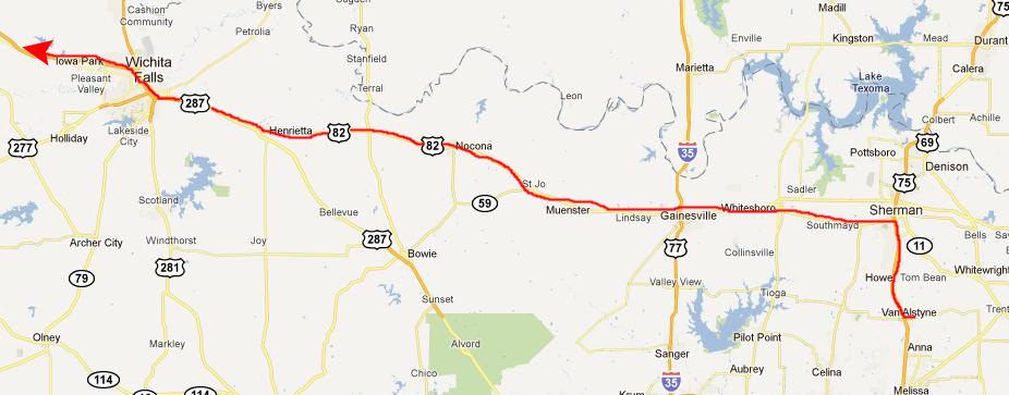
As we have done so often, we took a northwest route towards Albuquerque. The route begins by a drive up to Sherman on US 75, and then US 82 and US 287 west/northwest to Wichita Falls. Here is the first part of the route:
|
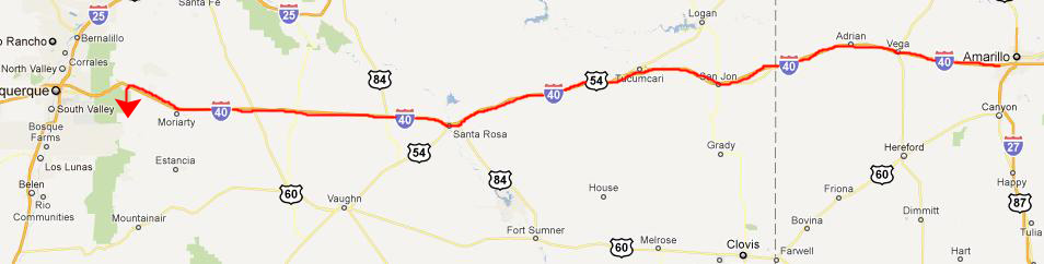
From wichita Falls, we continue to angle up northwest to Amarillo and I-40 West:
|
The driving is a bit quicker as we head west from Amarillo; although US 287 us usually a divided highway, it narrows down to a four-lane road as it goes through the various small towns along its route, and they seem to happen every twenty miles or so. And in each of these towns, the speed limit decreases, usually to 35. This makes it a great deal slower than an interstate highway.
|
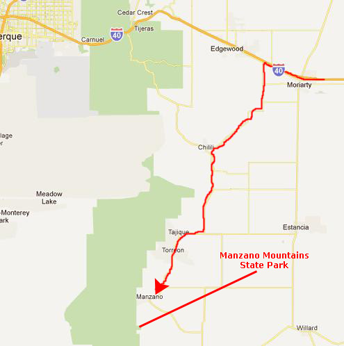
We stopped just west of Amarillo for some lunch, and then got back on the road for the 300-mile run over towards Albuquerque. But we weren't going all the way in to Albuquerque; we plan to camp this first night in a state park southeast of the city. So when we got close, we turned off to the south.
|
When 337 deadends into NM 55, we head west and then south through the town of Tajique and on south to Manzano. There, we follow the signs to County Road 8062 that takes us right down into the entrance to the park.
|
Nestled in the wooded foothills of the Manzano (the Spanish word for apple tree) Mountains, Manzano Mountains State Park is an excellent place for fishing, bird watching, photography, hiking and cross-country skiing. The park is also steward of numerous species of trees. The dominant tree of the area is the ponderosa pine, however alligator juniper dot the landscape. The Alligator juniper is named for the checkered pattern on the bark of older trees, which resembles an alligator's hide. The Manzano Mountains play an important role as a raptor flyway. Some birds may fly 200 miles in a day and several thousand miles in a season. The park has a field checklist available to visitors who enjoy bird watching.
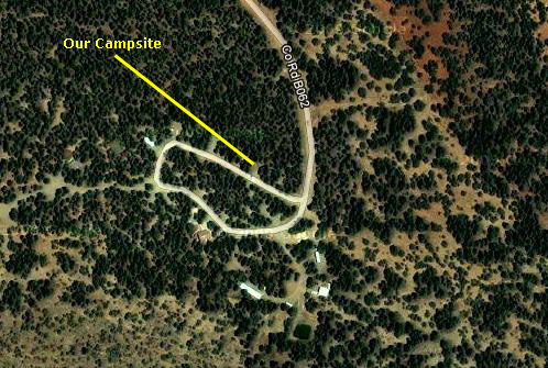
The developed area of the park is a square about a half-mile on a side; all the rest of the park is the Manzano Mountains wilderness, cut only by some US Forest Service roads. It is a refuge for city folk who want a nearby camping experience that is away from the more heavily-used campgrounds north of the city up towards Santa Fe. We spent a relaxing evening here, cooking our dinner and just walking around the small loop road and looking at some of the exhibits at the Ranger Station. Sadly, we didn't think to take any pictures of our campsite; although when we were here years ago, we did.
We had a good night's sleep, listening to the sounds of nature.
You can use the links below to continue to the album page for different day.
|
June 22, 2003: Western Trip, Day 2 |
|
Return to the Index for Our Western Trip |